doglike lopers
The concrete devastations, in today’s post.
– photo by Mitch Waxman
As I’ve mentioned several times recently, an effort is under way to revisit a number of spots which I’ve not set foot in for a while. When I first began wandering around Newtown Creek and the neighborhoods surrounding it, a point was made to visit every single block, but in recent months and years, temporal exigency has caused one to travel along “efficient” routes to get from Point A (A as in Astoria) to Points B, C, and so on.
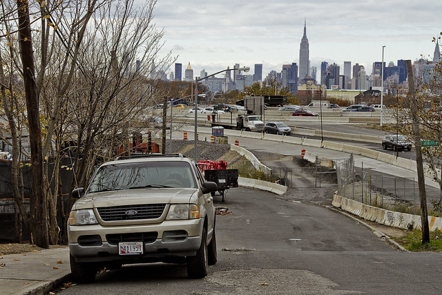
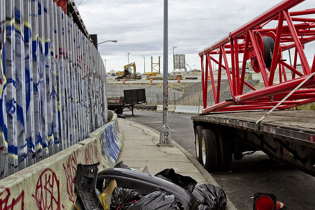
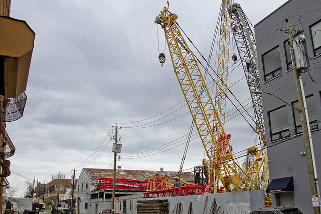
Accordingly, since I seem to have all the time in the world at the moment, I’m taking the road less travelled and revisiting a few locales which have been off my radar for a bit. To wit, pictured above is the view from 53rd avenue at the angle between Sunnyside and West Maspeth, looking west towards the BQE/LIE interchange.
– photo by Mitch Waxman
Prior to the installation of the two highways, roughly 75-80 years ago, this was a place where working people still lived. There was a neighborhood here, at the western border of Newtown’s Maspeth section and the eastern border of LIC’s Blissville subdivision. That’s when Robert Moses, with his New Meeker Avenue Bridge (Kosciuszko Bridge), and Brooklyn Queens Connecting highway, and Long Island Expressway came to town. Zoning decisions made in Manhattan during the post WW2 era rendered this area as “M1” – meaning it is designated for heavy manufacturing usage only.
Regardless of how the City people decided this land should be used, residential usage continued and there are still a small number of fairly ancient homes found peppered in amongst the warehouses, factories and construction oriented tower crane storage yards hereabouts.
– photo by Mitch Waxman
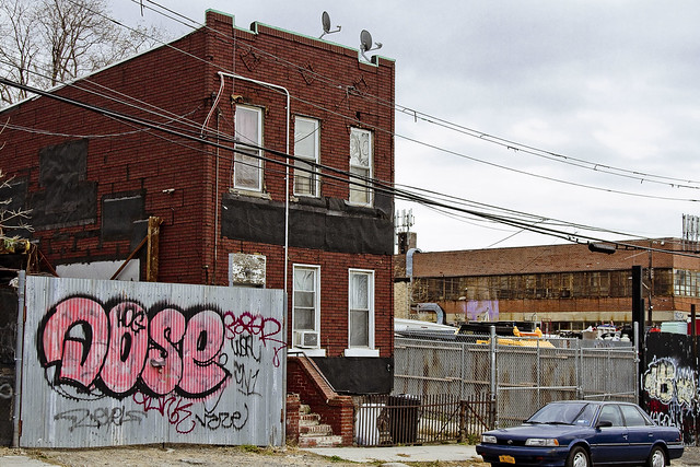
Funny thing is that this neighborhood is – observationally – one of the last places in NYC where you can “leave your front door open.” Saying that, when I use the term “concretized devastations of Western Queens” this section of industrial Maspeth is what I’m usually thinking of.
Most of the surviving homes I see in this neighborhood are typified by what you see above, wood frame row houses which date back to around 1900 or so. There’s a few older houses nearby which are a bit “grander” and speak to an earlier incarnation of this area. A few have disappeared “under my watch,” and have been replaced with bland cinder block warehouse or industrial buildings. Can’t really speak to “who” lives here, amongst the cranes and highways.
– photo by Mitch Waxman
All I can tell you is that they have an amazing view. This POV is on the rising bluff which once led to a prominent hill to the south called Berlin. The next highest prominence to the west would have been Laurel Hill, which Calvary Cemetery was carved into. This section of Maspeth was actually called “Berlin” until the First World War, when it was changed for obvious reasons to West Maspeth. To the east, the land’s declination rises until it meets a ridge which signals the beginning of the terminal moraine of Long Island nearby Mount Olivette and Lutheran Cemeteries. That ridge, which sports the same sort of rocky geology that lends its name to Ridgewood, is “real” land. Everything west of Laurel Hill is elluvial fill deposited by glacial process and sediment delivered by flooding from the Newtown Creek and East River.
Climate change and rising sea level wise, this likely will be the East River coastline someday.
– photo by Mitch Waxman
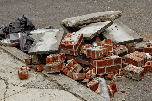
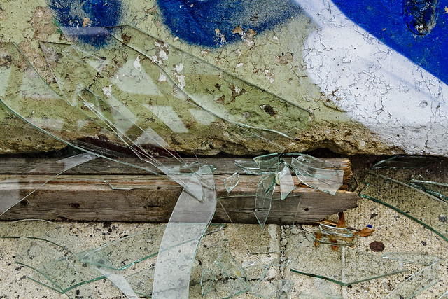
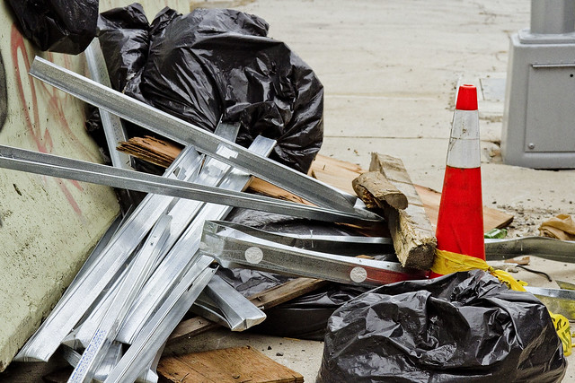
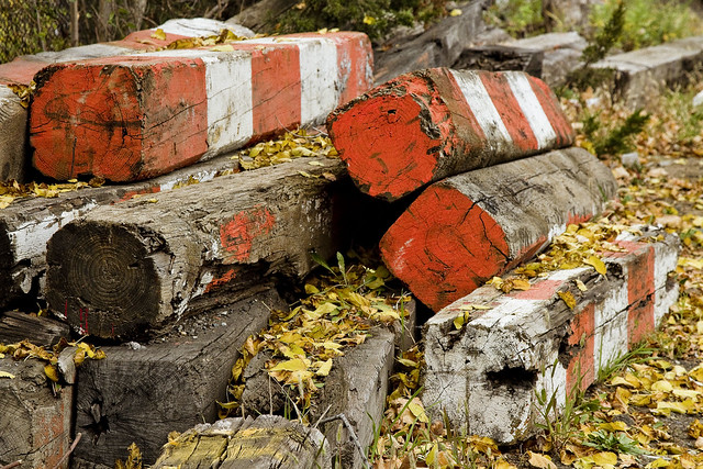
Looping around to the south, as the BQE and LIE interchange cut off egress east/west, an ad hoc art gallery is encountered. Illegal dumping, as I’ve often opined, is the unofficial nativist art form of the Borough of Queens. Combined with long fence lines that are covered in crude graffiti, you’ll encounter several installations along this route which offer intriguing intellectual postulates from the local artistic community.
Everything here is artisanal, incidentally.
– photo by Mitch Waxman
The reality of these installations are that this is simply a convenient place for a low level building contractor to dispose of construction debris without having to pay a dumping fee, but allow me to stay “high brow” in my assessments.
These dumpers really do seem to pay some attention to composition and color, however.
– photo by Mitch Waxman
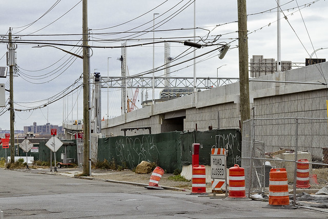
53rd avenue terminates in a parabola which carries it into 43rd street, a colonial era pathway that once connected to Newtown Creek from Bowery Bay in Astoria. The road transected the properties of (amongst several other famous Dutch and English family names from the colonial era) the Riker’s, Skillman’s, and Alsops along its route, and according to the historic record – it was paved with crushed oyster shells. All that changed, of course, when first the Long Island Railroad and later Robert Moses came to town.
43rd street still exists in a fairly unbroken line from Astoria to Northern Blvd. and then crosses the Sunnyside Yards south into Sunnyside where it crosses Queens Blvd. and Greenpoint Avenue. When it crosses under the Long Island Expressway overpass, it resumes its pre municipal consolidation name – Laurel Hill Blvd.
– photo by Mitch Waxman
The “43rd street” you encounter in this section of industrial Maspeth, however, is disconnected from the northern section. The last homes on 43rd street went “bye-bye” just a few years ago, due to a smallish construction project going on in the area. With fewer people watching, and caring, the artisanal illegal dumping in this area has amplified.
– photo by Mitch Waxman
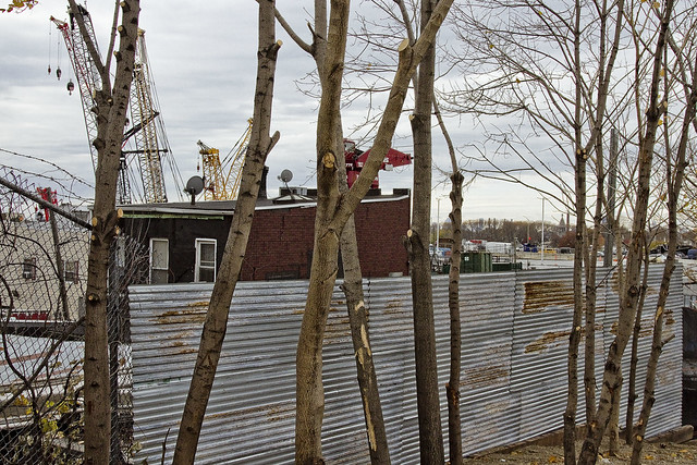
In the shot above, you can discern why I sometimes refer to this section as the “crane district.”
You can also plainly see the sharp rise in altitude hereabouts. This is, as mentioned, largely an industrial zone. There’s a lot of heavy industry going on. Warehouse operations, severely heavy truck traffic, waste transfer stations – Newtown Creek is just a few thousand feet to the south.
– photo by Mitch Waxman
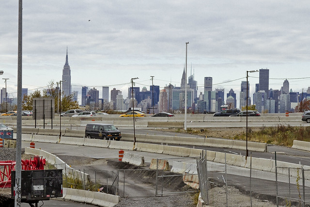
Speaking of Newtown Creek, that smallish construction operation I mentioned earlier is the Kosciuszko Bridge replacement project, which crosses the waterway. If memory serves, that means that something like a half million vehicles a day pass through this pass between Berlin and Laurel Hills. The Kosciuszko Bridge was opened in 1939, and the Queens side approach was built into a shallow valley found between the two landforms, and over a lost tributary of Newtown Creek which was called “Wolf Creek.”
– photo by Mitch Waxman
That’s that, then. See you next week, at this – your Newtown Pentacle.
“follow” me on Twitter- @newtownpentacle


Leave a comment