Archive for August 19th, 2009
Lurking… in fear- or Astoria to Calvary, part 2
Here’s a google map (including part 1 of this walk).

Dwyer Square -photo by Mitch Waxman
Perhaps…
The world knows all that it ought to know of Western Queens, and would remain merry in the satisfied ignorance of modernity- were it not for we Newtownicans who force it to disgorge its centuried secrets to feed the ravenous panopticon. Shudder at revelations of this history, found at our altar of a forgotten cosmos, for its implications may force one to experience monstrous alterations of dream. No rock in this part of the great city can be overturned without portent, or absent the mocking laughter of those who once walked these titan arcades of the Newtown Pentacle.
from the nyc.gov website
Located in the northwestern Queens neighborhood of Astoria, Dwyer Square lies near an old Native American trail (Woodside Avenue) that served as the main road from western Queens to the village of Newtown during the early American Colonial Period. The road ran along a tongue of dry land between the swamps of Long Trains Meadow (towards present day Jackson Heights), Wolf Swamp (towards present day Maspeth), and Burger’s Sluice (along present day Northern Boulevard). Hessians during the American Revolution (1775-1783) garrisoned this strategic point. In 1713 Isaac Bragaw, a descendant of one of the earliest French Huguenots in New Amsterdam, purchased this land. During the early 19th century, William Gosman purchased the farm. (Gosman is also known for having surveyed and laid out the area’s streets around 1875). Also nearby lies Northern Boulevard, an important six mile road connecting Flushing to Hunters Point.
It was originally named Jackson Avenue for Turnpike President John C. Jackson, whose leadership and efforts made the road possible. Costing nearly $40,000 and opening on July 13th, 1860, the highway was originally composed of milestones, a gravel roadbed and a tiny tollhouse and gate where travelers would pay a nine cents fee for passage. Foot traffic, however, was free.
In September 1980, the City of New York rededicated Dwyer Square. The square contains a flagpole with a yardarm that flies the United States, City of New York, and Parks flags; brick and concrete walkways; benches; and five trees, including three Japanese pagoda trees (Sophora japonica), a honey locust (Gleditsia tricanthos), and a green ash tree (Fraxinus pennsylvanica).

48th street between Northern Blvd. and 37th avenue looking west -photo by Mitch Waxman
At the commercialized intersection of 48th street and Northern Blvd. make a right and find the spot where- in 1932 the Madison Square Garden Bowl attracted a degenerate population of gamblers and all those friends and companions of night who accompany the sporting life- and near the spot selected by the US Army in WW2 to locate its titanic mail sorting and postal concentration operation– and close to where Ronzoni’s Pasta Mill stood- is today a shopping mall anchored by discount stores and an ice cream shop.
Gaze west upon the terrible grandeur of the shield wall of Manhattan, lying beyond Newtown across the River of Sound. By the 1970’s, this industrial complex had decayed and fallen prey to the greater malaise which infected New York until just recently. Described to the Newtown Pentacle as abandoned buildings and brick lots, it was home to vermin of all descriptions.
Apocryphal stories passed down by native Astorians speak of queer pock marked and needle scarred characters conducting odd rites in these ruined industrial sites as early as the 1970’s, with the officials in City government only intervening in these midnight gatherings when carelessly lit fires began to plague the area and a jump in the rate of suicide and violent robbery was commented on by many. A whispered Queens patois answers questions put to these lifelong Newtownicans about the place, apocryphally saying that it was where drug fiends and street gangs would hold congress, spending their nights amongst the oddly shaped shadows cast by streetlight streaming through broken windows (typical of similar vacant properties in the greater city, during that degenerate period of shattered and diminished expectations).

LIRR crossing at 48th street and 37th avenue -photo by Mitch Waxman
A side effect of the medications which maintain my frail physique in some semblance of balance- an exotic cocktail representing the highest pinnacle of the chemist’s art- is a vulnerability to an outward bodily manifestation of my subconscious notions- both gross and ridiculous. Without obvious provocation, a series of terrified and hysterical shrieks may emerge from my throat, owed entirely to my nervous and cowardly temperament. These nervous attacks are some surface manifestations of a deeper sensitivity, and suggest the buried neuroses which compel my quixotic and noisome nature. I have learned, when this humiliating condition is approaching, that by changing my course and altering my visual environment, I can often prevail against these terrors by resetting my nervous equilibrium.
It is terrible to have one’s mind couched in such an inferior physical example of the specie, and I have often considered alternatives. Oh, mankind, like a leaf- you.
So, we’re making a left onto a vestigial remnant of an earlier street grid, one that existed before the 800 pound gorilla and the Sunnyside Yard came to town- 37th avenue.

S.E.M./Signals Street Light Yard -photo by Mitch Waxman
On the south side of the street lies the elevated trackbed of the LIRR, and a series of garages which until recently served the nearby Sunnyside Yards. Many businesses in this area, which is defined by the gargantuan rail yard, have had their leases vacated by the MTA and LIRR recently. Sunnyside Yards is about to expand. On the north side of the street are two enormous structures, the first of which is a municipal building- the S.E.M./Signals Street Light Yard. Its yard, which consumes most of its lot, houses stores of street furniture and municipal hardware- and the sturdy employees of the place reveal their kind hearted nature by the carefully cared for colony of cats seen stalking the yard fencelines. Obviously capable hunters, some of the cats carry half eaten things that squeal and scream.

S.E.M./Signals Street Light Yard -photo by Mitch Waxman
I couldn’t find much out about this enigmatic and clearly decaying structure, but I did find a link to the New York City DOT Street design manual. (6.8 meg pdf). Other than that, I can find no proof at the Dept. of Buildings that this structure exists. It is anomalous, but clearly it can be photographed, which confirms it is no phantasmagoria nor an hallucination.

S.E.M./Signals Street Light Yard -photo by Mitch Waxman

“No Photography Allowed” -photo by Mitch Waxman
Across the street from the anomalous facility are a recently emptied series of garage sheds which were utilized by the Sunnyside Yards as some sort of machine shop. Signage disallows photography, but should mention grafiti instead. Such street scrawls, the joy of adolescent boys worldwide, is evidential of the lack of attention paid to security by civil and private authorities to these places that are not visible from their shining towers in Manhattan. Disturbingly, the graffiti writers are provided with both time and opportunity to pursue their art, which adorns every train viaducts and even the offshore Brooklyn Bridge moorings. One wonders who and what else may wander these streets looking for just such an opening, and what esoteric desires they may be seeking to fulfill.
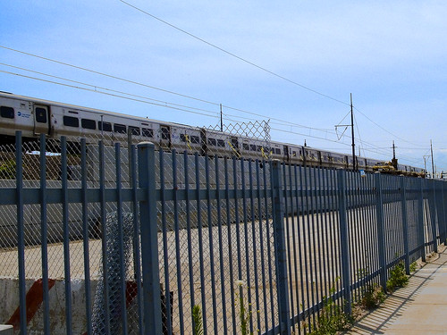
LIRR -photo by Mitch Waxman
Like Jason tied to his mast before the fabled Sirens, my attention was suddenly centered and transfixed. My eyes blurred as the powerful air horn of a LIRR train heading for eastern Long Island passed a construction site- screaming wildly in accordance with federal regulations. Unbalanced by the sudden rush of air and sound, I staggered forward several steps to avoid falling, and became transfixed by the nearby construction site. Such variability and inability to stay focused in the face of visual stimuli is undoubtedly the end product of an undisciplined childhood, an upbringing upon which I insisted on despite the best efforts of my simple parents.

LIRR track work -photo by Mitch Waxman
Up until just a year ago, this was a weed choked dumping ground for area residents and passing building contractors. The engineers of the LIRR have recently reinforced the track bed with structural steel and are in the process of armoring it in a wall of cement tile, as part of the larger East Side Access Project . I am not sorry, for I hated both antique wreckage and hellish vegetation which polluted the artificial ridge and occluded viewpoints of these gleaming trains as they carry their mutitudes back and forth to Manhattan.

New York Presbyterian Church – “stitched panorama” photo by Mitch Waxman
click here to see the ridiculously large original- warning-BIG FILE
Across the street is an enormous Church complex, the New York Presbyterian. It has all the appearance of a fortress, complete with a guardhouse possessed of mirrored windows and a retinue of antennae and cameras, but this would be normal for any structure of this size which abuts one of the largest and most important rail yards in North America. The curious asiatic script found on the church’s signage, and indeed the characteristic wide grin and relaxed countenance of the members of the congregation I have observed show all the hallmarks of origins on the Korean Peninsula. This is an assumption of course, based solely on study of New York’s ever shifting demography.
Here’s what archi-tourist had say:
This massive church is located in a strange area between the suburban, automobile landscape of Northern Boulevard and the planned community of Sunnyside Gardens. The LIRR passes alongside the church and 37th Avenue, adding to the feeling that the church doesn’t really belong to any place, any neighborhood.
The plan is basically split into three areas: a large congregation space fronted by the large wall of translucent panels and the church’s entry, the art-deco front on 37th Avenue now containing classrooms and other small spaces , and a series of metal-clad shells concealing the exit stairs required for the large, 2,500-seat sanctuary. All is surrounded by acres of parking, some at the level of the entry, some one-story below grade on the building’s north side.
It’s the building’s north side and its series of angular, metal scallops that gives the church its most striking feature, even though this facade is the most removed from the entry, the road, and the railway. It’s also ironic that so much effort was expended on a feature that’s rarely used, as these pieces cover the exit stairs from the sanctuary. But perhaps that’s the point; that the design needed some sort of POW or hidden surprise that couldn’t find its way into the art deco piece or the main sanctuary.
They seem like very nice people, despite the forbidding appearance of the structure that houses their church. The adoption of Protestant Christianity by a large segment of the Korean population was facilitated relatively recently, as it turns out.

New York Presbyterian Church – photo by Mitch Waxman
from wikipedia
In 1884, two American missionaries came to Korea: Henry Appenzeller, a Methodist, and Horace Underwood, a Presbyterian.[2] Emphasizing the mass-circulation of the Bible (which had been translated into Korean between 1881 and 1887 by the Reverend John Ross, a Scottish Presbyterian missionary inManchuria), the Protestant pioneers also established the first modern educational institutes in Korea. The Presbyterian Paichai School (배재고등학교) for boys was founded in 1885, and the Methodist Ehwa girls’ school (이화여자고등학교) followed a year later. These, and similar schools established soon afterwards, facilitated the rapid expansion of Protestantism among the common people, and in time enabled the Protestant faith to overtake Catholicism as the leading Christian voice in Korea.
and
Korean Americans in America have historically had a very strong fundamentalist and conservative Christian heritage. Between 70% and 80% identify as Christian; 40% of those consist of immigrants who were not Christians at the time of their arrival in the United States. There are about 2,800 Korean Christian churches in the United States, as compared to only 89 Korean Buddhist temples; the largest such temple, Los Angeles’ Sa Chal Temple, was established in 1974.

Stop, make left on 43rd street -photo by Mitch Waxman
A wall of shadowed brick will greet you as you reach 43rd street, and you must choose as I am forced to- do you return to Northern Blvd. and the greater world beyond- whose every path leads to the great gleaming metropolitan city and its myriad pleasures? Or will you choose to take a left handed path, and plunge deeper- ever deeper- worming your way into the darker heartlands of the Newtown Pentacle?

43rd street and 37th avenue -photo by Mitch Waxman
Steadying myself and resolute to continue, I stopped on the corner to consider 37th avenue and noted the sudden change in environmental conditions after crossing the street. A tenebrous darkness clings to this corner- the smell of mildewed wood and nitre dripping cement- mixed with urine- colors the air a yellowish brown. Somewhere nearby, is something that reeks of degenerate humanity.
note: I’m not kidding about the weird darkness here, check it out in google street view.
Moving south on 43rd street, and passing beneath a steel bridge which is manned by an actual troll… a sort of creature whose name the local Croatians might roughly translate into english as a “Sin-Eater“.

Crossing the angles between spaces -photo by Mitch Waxman
But brave this trollish hazard we will, my ladies and lords of Newtown, for the strange energies which course through the ground in these intermediate zones- which are neither one neighborhood nor another– these places- they are just existential hinterlands which reside in the angles found between them.
And we are on the verge of entering the most progressively designed, rationally proportioned, and ultimately verdant section of the long walk from Astoria to Calvary. Netownicans, we are about to pass under and over and enter into the Sunnyside.


