Posts Tagged ‘Allegheny River’
Burnt ends
Friday

– photo by Mitch Waxman
A few odds and ends shots from a visit to the Millvale River Walk space on the Allegheny River, just east of ‘Pittsburgh proper,’ greet you today. As described, this was a scouting scuttle, wherein I was checking the place out and seeing if there were any interesting compositions to be exploited during intervals when the weather was a bit more photogenic.
I was laughing when shooting this one. The bathroom facility was locked up, and needing to urinate, I walked down a flight of steps meant for fishermen to use and pissed into the river. What was funny about this, to me, was the yiddish expression which my grandmother would often offer – ‘Gain pishen af’n y’am’ – which is offered phonetically as I don’t know how to spell it – which translates to ‘go piss in the ocean.’
I wondered how you’d say river in yiddish during this elimination of bodily waste, which generally cracked me up for some reason.

– photo by Mitch Waxman
That’s the southern shore of the Allegheny pictured above, and I think that the area in frame is called Lawrenceville, but you really shouldn’t take my word for that as I’m still entirely reliant on my phone for navigation here in Pittsburgh. It’s an odd sensation for someone like me – who would throw down in arguments about where Williamsburg and Greenpoint ended and Bushwick began, explain to people that their house was in Astoria but their back yard was in Woodside, and knew where the geographic versus population centers of NYC were.
I love not knowing and the lack of certainty, and ignorance is great. Forces you to learn stuff, if you’re smart.
A storm that was coming in from the southwest would stick around for several days and dump close to four and a half inches of rain on Pittsburgh. The rivers rose, and all of the shoreline trails flooded. It was very exciting.

– photo by Mitch Waxman
It’s warmed up and dried out a bit here since these shots were captured. I’ve been in three of these United States since then, although I just kind of drove into the tippity tip of West Virginia so I don’t know if that counts.
Back next week, with something different at this – your Newtown Pentacle.
“follow” me on Twitter- @newtownpentacle
Buy a book!
“In the Shadows at Newtown Creek,” an 88 page softcover 8.5×11 magazine format photo book by Mitch Waxman, is now on sale at blurb.com for $30.
Millvale, too
Thursday
– photo by Mitch Waxman
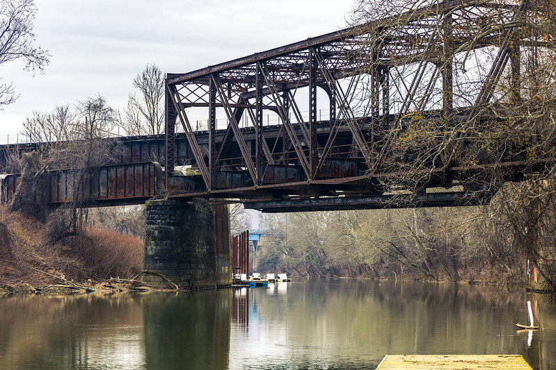
As described yesterday, before a humble narrator found himself getting lost in anecdotes about those bizarre behaviors which the humans display as they’re operating vehicles, a visit was paid to the Millvale Riverfront Park trail, along the Allegheny River. I had a pretty basic camera kit with me, and my goal (beyond getting some exercise) for the day involved scouting out shots which I’d return to during future outings when the scenery isn’t quite as devastated by winter as it currently is.
Y’know, when it’s like… nice out.
By basic, I mean that I had a zoom lens hanging off the front of the camera, and there were a couple of bright prime lenses in my camera bag (just in case) but I had left most of my gear back at HQ. I only ended up using the zoom.
– photo by Mitch Waxman
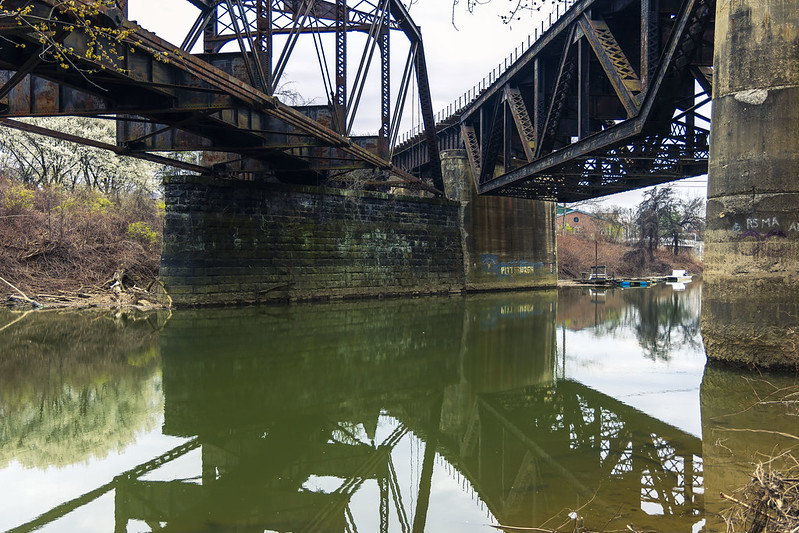
These circumstances here are promising, I think, and especially so when I return with a tripod and filters and work towards capturing some ‘razzmatazz’. Don’t get me wrong, I’m digging the composition on these, but it’ll be a much nicer scene when there are leaves on the trees and the lighting isn’t quite so overcast. I think this will be a ‘morning thing.’
It was a dark afternoon on this visit, however, with a solid ceiling of clouds, and there was meant to be a raining ‘cats and dogs’ event later on that evening.
Millvale, as in the community itself, is entirely unfamiliar to me. First time visiting, and as I was in a waterfront park/trail area it’s not like I interacted with anyone other than the two bicycle assholes mentioned yesterday, or visited any other local institutions, so I cannot say much about the place beyond that there’s a waterfront public park here.
That’s actually good enough for now, but I do wonder what’s just up the hill from here, where the humans infest. Will have to come back sometime in the future and find out.
– photo by Mitch Waxman
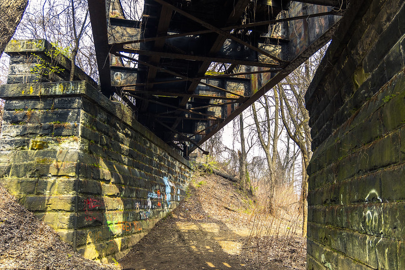
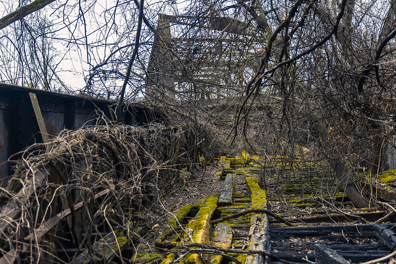
These tracks seem to have once connected to Herr’s Island, which housed stockyards of ruminants which destined for the abattoir, and eventually the shop windows of local Butchers – ‘back in the day.’ The tracks spur off of a right of way which – in modernity – is trafficked by the Norfolk Southern RR peeps.
Back tomorrow, with a few odds and ends.
“follow” me on Twitter- @newtownpentacle
Buy a book!
“In the Shadows at Newtown Creek,” an 88 page softcover 8.5×11 magazine format photo book by Mitch Waxman, is now on sale at blurb.com for $30.
Millvale scuttle
Wednesday

– photo by Mitch Waxman
One piloted the Mobile Oppression Platform over to the community of Millvale recently, to check out a ‘river walk’ trail that I’ve had pegged on my Google maps inventory for a while now. This spot is on the north coast of the Allegheny River and just east of Pittsburgh proper. Active rail moves through here, and there’s also plenty of ruined rail infrastructure to inspect as well.
Funny thing is, this was a particularly annoying afternoon for me but that had little to do with the two or three miles of photowalking which I came here to experience. In general, but specifically on this afternoon, the human infestation just sucks the joy out of everything.
People, amirite?
– photo by Mitch Waxman
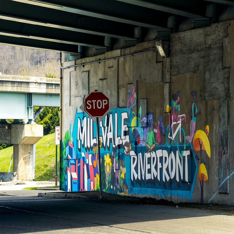
This trail is a part of the Three Rivers Heritage Trail, a combined bike and pedestrian dealie which snakes all around the Pittsburgh Metro area.
There’s a parking lot, which is where I left the car while walking around – as you’d imagine. When it was time for me to leave, I get into the car and pull out of the spot. Where I pulled out, it’s a marked lane indicating travel in the other direction, which means I needed to cross to the other side of the lot where the intended direction is allowed to travel. Thing is, just as I pulled out of the spot and into the lane, I see these two guys on bikes riding towards me, so I immediately come to a complete stop with the intention of waiting for them to pass before I do anything else.
Now, these two guys – they were the ‘Bro Type’ of bikers. You know these sorts of testosterone monkeys – wearing Oakley mirror sunglasses, bike helmets, the biker’s stretchy shorts, and logo laden silky bicycle shirts. The bike is outfitted with multiple water bottles and gadgets. The sort who talk about riding a bicycle with the thousand mile stare of a combat veteran.
One of them (the apparent Dominar who likely self describes himself as an ‘Alpha’ or ‘Sigma’ male) rides up to my drivers side window, while I’m waiting for them to pass rather patiently – with a sneer on his face – to inform me that ‘it’s one way, asshole’ and then gestures at my rear view mirror in a manner that indicated he was planning on knocking it off the door.
Why are ‘the bicycle people’ always such complete and utter dicks?
Four wheels bad, two wheels good, that’s why. Seriously, their two road bikes probably cost as much as my car did. They were drivers too, obviously, as I saw them unloading their bikes from a rack on the back of a Subaru. I’ll bet you anything that they wouldn’t have sat there patiently waiting for me to pass if I was walking past their car.
When the guy mouthed off at me, I let him know what Brooklyn sounded like, and he seemed shocked by both the depths of my profanity and the revelation which he received about his Mother’s sexual proclivities. Specifically shocking to him was Mommy’s passion for lying down with the beasts of the field, while singing Dixie.
– photo by Mitch Waxman
Closer to home and later on in the day, I found myself merging into a turn lane in the center of the City, something which another driver some four to five car lengths behind me displayed great umbrage over.
A tiny person who was driving a gray Volkswagen, this eidelon of assholes started steady honking her horn at me while throwing up both middle fingers, and unintelligibly screaming hostilities out her car window. This series of behavioral tics were observed in my rear view mirror when she was merely two car lengths away, as traffic compressed behind a red light – which also seemed to upset her. The tirade continued for about two to three miles, until she triumphantly passed me by at a traffic light, with one last middle finger salute offered as she passed. Wow.
Road rage is a really, really weird phenomena and I just don’t understand why the angry humans act as they do. It doesn’t make sense, and why do something so high energy if it isn’t going to achieve anything at all? I mean… there’s traffic and a red light. Why would you accelerate your vehicle if you’re coming up to a complete stop?
It… doesn’t… make… sense…
“follow” me on Twitter- @newtownpentacle
Buy a book!
“In the Shadows at Newtown Creek,” an 88 page softcover 8.5×11 magazine format photo book by Mitch Waxman, is now on sale at blurb.com for $30.
Hills/dale
Wednesday
– photo by Mitch Waxman
Constitutional in motivation, I’m nevertheless always carrying a camera kit with me on the long walks that I’m forced to endure – as long time readers will attest. Endure has been a proper adjective in recent years, as a paucity of any remaining youthfulness left in me is draining away, leaving behind only a gray and wrinkled husk. I once was pretty, and not the monster you now see. What I see in the bathroom mirror looks like a dehydrated sweet potato with a gray beard.
Also, in those cheeky years of blessed memory when your narrator was young but already humble, standing up after sitting in a chair wasn’t accompanied by any popping or cracking noises, nor did I often wonder about how I hurt myself while asleep.
Soldier on, and steady, old man…
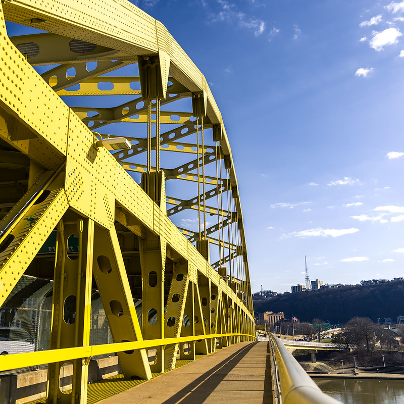
I was crossing the Allegheny River on the Fort Duquesne Bridge, and my short term goal was to get to the neighboring Fort Pitt Bridge so as to cross the Monongahela River.
– photo by Mitch Waxman
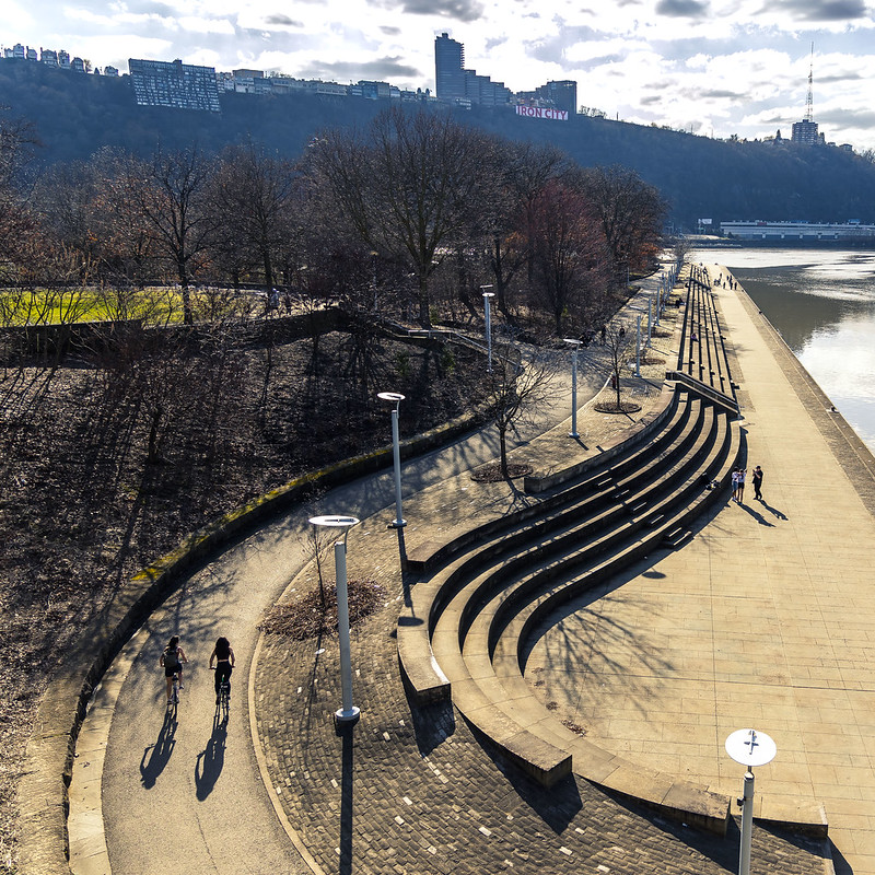
The Fort Duquesne Bridge (the fort thing here dates back to the French and Indian War and George Washington – all that jazz) overflies Point State Park, which is a well used peninsular public space and the titular center of Pittsburgh. At this park, you can pick up the pedestrian/bike path for the Fort Pitt Bridge, which I was heading for next.
Often, I like to ponder about the cloud of epithelial dust that peels off of my withering body while moving about. Pain is my oldest and most loyal friend, after all, but continual decay is still somewhat novel. No matter what happens, pain is always there, and part of the journey. Leaving behind a cloud of skin cells in my wake is just a plus, and novel.
When I had my initial appointment with a new Doctor here in Pittsburgh just last year, I drew a chart of all my physical complaints. The cartoon depicted a humble narrator in a style not unlike the patient from the board game ‘Operation.’ It had call outs to specific maladies, and I used lightning bolt iconography to indicate areas of mystery pain. The Doc was amused, and told me that this was a first for him, in his thirty years of practice. What can I say? I communicate most effectively in graphic narrative.
I’m all ‘effed up.
– photo by Mitch Waxman
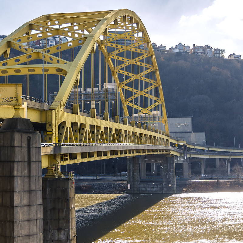
Finally, I surmounted the ramp leading to the Fort Pitt Bridge and began my crossing of the thing, which spans the Monongahela River. This is a fairly muddy river – I’d mention – hence the tan coloration encountered.
Because of the Hudson and Mississippi, I have a mental block and prejudice towards the idea that rivers don’t just run south, but there we iconoclastically are. The ‘Mon’ ends up in Pittsburgh after a long 130 mile northeasterly journey out of West Virginia, and along its run it picks up a lot of soils. This is just about the end of its trip, where it joins with the Allegheny to form the Ohio River.
This whole ‘getting old’ thing is kind of a drag, but I’m enjoying the challenge of not just keeling over and dying so there’s that. Wait, my left ear just fell off, and I’m out of superglue. Dag.
Back tomorrow.
“follow” me on Twitter- @newtownpentacle
Buy a book!
“In the Shadows at Newtown Creek,” an 88 page softcover 8.5×11 magazine format photo book by Mitch Waxman, is now on sale at blurb.com for $30.
Vampire barriers
Tuesday
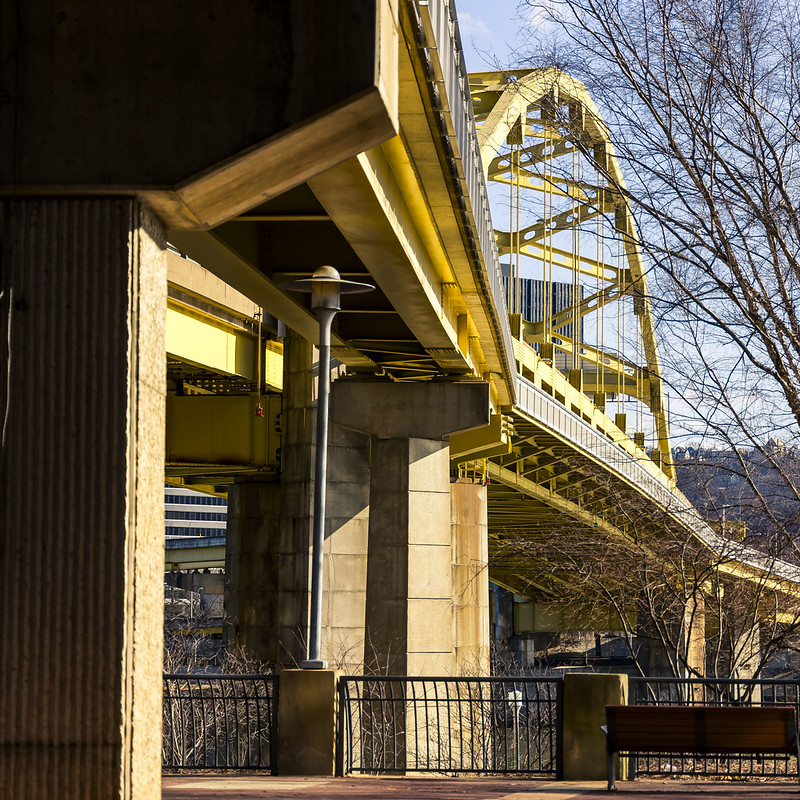
– photo by Mitch Waxman
It must suck to be a Vampire in Pittsburgh because you’ve got all this running water which needs to be navigated around, and all of the bridges that you can’t cross similarly because of ‘running water.’ On the plus side for the Nosferatu-Americans, it’s cloudy or overcast about 2/3 of the year – which occludes the burning thermonuclear eye of god itself’s radiate gaze – so you’d have that going for you. More good news is that the people of Pittsburgh seem pretty well fed, and many of them look like they’re really full of tasty blood.
I was heading towards a pedestrian/bicycle approach to the Fort Duquesne Bridge, which is nearby the sportsball stadium that the Pittsburgh Pirates outfit operate out of. As mentioned yesterday, one of the goals on this warm and sunny afternoon was to get some verticality going on during this walk, and find some steps or ramps to climb onto.
Cardio, yo.

– photo by Mitch Waxman
There don’t seem to be many folktales involving Vampires here in Pittsburgh, but there’s all sorts of ‘hooey’ which involves cults, killers, monsters, unknown beasts which lurk at the edge of the woods, and witches. Lots of witches. There’s a mass of Appalachian ‘Hill Billy’ mythos as well, and while trying to absorb some of that knowledge, I found an amazing YouTube channel called ‘The Appalachian Storyteller,’ which I can heartily recommend.
While looking for these sorts of stories to educate myself on the local psychic firmament, and mythological milieu, one encountered a subgenre of YouTube videos – called Hobo YouTube – which is best represented by a fellow who calls his channel ‘Hobo Shoestring.’ Really, you search for railroad stuff, it inevitably leads to ‘Hobo YouTube.’
There’s a bunch of interesting genres and quite professional creators on that platform these days. Here’s a few examples of – camera YouTube, cooking YouTube, camping YouTube, EDC YouTube, etc. YouTube’s algorithm will see what you’re watching and thereby open up these various genre offerings to you in its suggestions based on ‘clicks.’ It’s really interesting to see how the future works, if you ask me.
Careful what you watch though, as there’s a ‘pimple popping YouTube’ which is downright grotesque. Anyway, back to the Vampires.
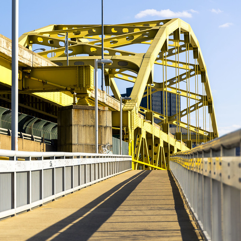
– photo by Mitch Waxman
I’ve never dwelt in the ‘Vampires look like Catherine Deneuve or Frank Langella’ camp. Always have I ascribed to the pre Stokerite descriptions of the undead things: a shambling pile of rotting meat, complete with ‘death stink,’ who is nevertheless quite nimble in its nightly locutions. Horrible ghasts, without the tiniest shred of romantic appeal, that’s a Vampire. Something that takes and takes but never gives, is ignorant of the rule of natural law, and intolerant to all but its own need.
After a brief effort, a humble narrator had surmounted the stairs leading up to the Fort Duquesne Bridge over the Allegheny River and commenced with a southwards lurch forward. I was as secure as I’ll ever be in terms of battling the vampiric – direct sunlight above and running water below. Sun Tzu always spoke of choosing favorable locations for battle, and if the enemy is composed of blood thirsty revenants – this is a great spot for you to reenact the heroism of Horatius Cocles, Spurius Larcius, and Titus Herminius Aquilinus at Rome’s Pons Sublicius, way back in the 6th century B.C.E.
What? I’ve been listening to that History of Rome podcast again.
“follow” me on Twitter- @newtownpentacle
Buy a book!
“In the Shadows at Newtown Creek,” an 88 page softcover 8.5×11 magazine format photo book by Mitch Waxman, is now on sale at blurb.com for $30.


