Posts Tagged ‘Pittsburgh’
Twelve hundred steps program
Monday

– photo by Mitch Waxman
Famously, the City of Pittsburgh offers hundreds of flights of municipal steps for the usage of the citizenry, which aid pedestrians in navigating the challenging terrain of the place. Recent endeavor saw a humble narrator hire a taxi in order to get to the top of one of the more extreme examples of this sort of infrastructure (not the ones pictured above) and then proceed downward along the rises and runs. In my admittedly limited experience, these stairs are generally compound structures composed of concrete and steel that are set into the steep hillsides.
As a note: rises are the vertical dimension of steps, whereas the runs are the flat parts which you step on.
The neighborhood which I started this scuttle in is called ‘Allentown,’ an area that I’ve visited in the past. Allentown is set into a larger residential ‘zone’ called the ‘South Side Slopes’ which cascade about a thousand feet down along the eastern side of Mount Washington, here in Pittsburgh.

– photo by Mitch Waxman
My path carried me past several abandoned homes, which must have been pretty ‘choice’ when they were originally built. The views from this area are pretty spectacular, but it must be a pretty athletic experience living on the edge of a steep slope like this. Imagine carrying your groceries in from the car – there’s a workout, I tell’s ya.
Where I was heading was a set of municipal steps that proceed down the slopes to the South Side Flats while transversing the equivalent horizontal space of no more than a half mile. A passel of municipal density huddles against the southern bank of the Monongahela River down there on flat land along the river – hence ‘Flats.’

– photo by Mitch Waxman
There used to be ‘T’ street car service here, specifically the Brown Line, but budget cuts associated with the first decade of the 21st century ended all that. The tracks and overhead catenary wires are maintained, however. When there’s work on the T happening further to the south, or in the transit tunnel under Mount Washington which T service normally routes through, the streetcars gets rerouted through this area. Essentially, Arlington Avenue is a back-up.
There’s signs along Arlington Avenue warning truckers to switch gears along this road, warning of a 9-10 degree road grade that these heavy vehicle operators will have to contend with. There’s also the ubiquitous ‘Watch Children’ signs, which generally fill me with an existential dread.
What are these Yinzer kids getting up to, that warrants the installation of signage admonishing passerby to watch them?

– photo by Mitch Waxman
This is what you see from up top, looking down on the aforementioned density of the South Side Flats. The bridge is the Birmingham Bridge, which had been mentioned here several times.
The ‘Flats’ area is where I’ve spent more than few hours walking around at this point. There’s trails on both sides of the river, which I’ve also pointed the camera at. Way off in the distance, the Cathedral of Learning can be seen jutting up out of the Oakland area, where the University of Pittsburgh and Carnegie Mellon University rule the roost.
One had examined the desired path using Google maps before committing to the walk, and I was looking out for a certain intersection leading to my desired municipal stairway.

– photo by Mitch Waxman
There it was, and thusly there I went. The path led down, and northwards, which I intuitively find contraindicative. Another one of my NYC born presumptions is that south is both ‘down’ and flat in geologic character, whereas north is up where the terrain gradiates quickly from hilly to mountainous forests, and then to ones which no one has ever visited to the north and left of Albany.
I know… I know.
I’m also of the opinion that rivers flow south rather than north. It’s odd the way that the brain works. Mine, at least, received early training that indicated certain realities – upstate NY started in Mount Vernon or Yonkers, and it was ‘up there.’
Long Island, as in both Nassau and Suffolk, are ‘the country.’ Also; the Atlantic ocean is always on your right hand side whereas the Pacific is on the left, and somehow NYC sets the standard for ‘correct’ weather in the United States (after Los Angeles) – despite the fact that NYC’s atmospheric temperatures annually fluctuate more than a hundred degrees one way or the other and it’s vulnerable to every sort of atmospheric disturbance there is.
Additionally, Chicago is too cold and Florida too hot. Mustard ONLY goes on a hot dog, and whereas I do make an allowance for Sour Kraut, I think that’s a mistake as it ruins the bun with sogginess.

– photo by Mitch Waxman
Walking down steps is pretty low impact and shouldn’t be much of a chore… to continue mentioning things which I believe, without any actual evidence or personal knowledge thereof.
At the end of this scuttle, my legs were absolutely blasted out. The soles of my feet hurt. So did the fronts of my calfs. Globes of inflammation were forming around the knees, and I think I developed a hip problem.
All told, this set of stairs (which are apparently dubbed ‘German Square’) travelled downwards about 1,000 vertical feet before reaching the South Sides Flats area. Holy Moley.
Back tomorrow with more.
“follow” me on Twitter- @newtownpentacle
Buy a book!
“In the Shadows at Newtown Creek,” an 88 page softcover 8.5×11 magazine format photo book by Mitch Waxman, is now on sale at blurb.com for $30.
Interruptus
Monday
– photo by Mitch Waxman
A humble narrator is feeling a bit off today, under the weather, all that sort of stuff. Thereby a single image greets you, but hopefully regular programming will resume shortly when the physical plant returns to a predictable homeostasis.
“follow” me on Twitter- @newtownpentacle
Buy a book!
“In the Shadows at Newtown Creek,” an 88 page softcover 8.5×11 magazine format photo book by Mitch Waxman, is now on sale at blurb.com for $30.
Millvale, too
Thursday
– photo by Mitch Waxman
As described yesterday, before a humble narrator found himself getting lost in anecdotes about those bizarre behaviors which the humans display as they’re operating vehicles, a visit was paid to the Millvale Riverfront Park trail, along the Allegheny River. I had a pretty basic camera kit with me, and my goal (beyond getting some exercise) for the day involved scouting out shots which I’d return to during future outings when the scenery isn’t quite as devastated by winter as it currently is.
Y’know, when it’s like… nice out.
By basic, I mean that I had a zoom lens hanging off the front of the camera, and there were a couple of bright prime lenses in my camera bag (just in case) but I had left most of my gear back at HQ. I only ended up using the zoom.
– photo by Mitch Waxman
These circumstances here are promising, I think, and especially so when I return with a tripod and filters and work towards capturing some ‘razzmatazz’. Don’t get me wrong, I’m digging the composition on these, but it’ll be a much nicer scene when there are leaves on the trees and the lighting isn’t quite so overcast. I think this will be a ‘morning thing.’
It was a dark afternoon on this visit, however, with a solid ceiling of clouds, and there was meant to be a raining ‘cats and dogs’ event later on that evening.
Millvale, as in the community itself, is entirely unfamiliar to me. First time visiting, and as I was in a waterfront park/trail area it’s not like I interacted with anyone other than the two bicycle assholes mentioned yesterday, or visited any other local institutions, so I cannot say much about the place beyond that there’s a waterfront public park here.
That’s actually good enough for now, but I do wonder what’s just up the hill from here, where the humans infest. Will have to come back sometime in the future and find out.
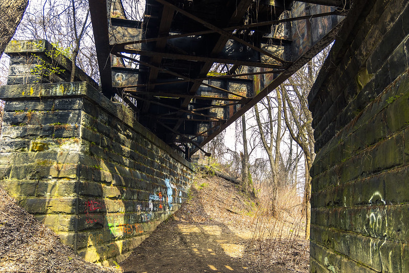
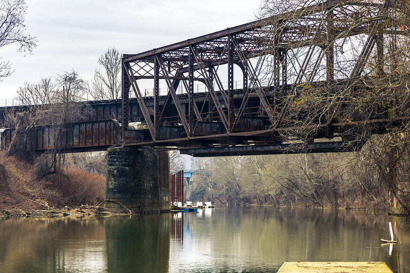
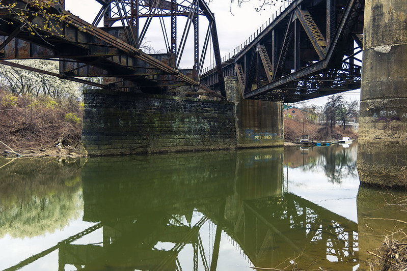
– photo by Mitch Waxman
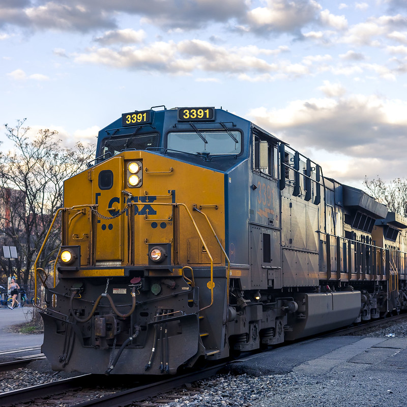
These tracks seem to have once connected to Herr’s Island, which housed stockyards of ruminants which destined for the abattoir, and eventually the shop windows of local Butchers – ‘back in the day.’ The tracks spur off of a right of way which – in modernity – is trafficked by the Norfolk Southern RR peeps.
Back tomorrow, with a few odds and ends.
“follow” me on Twitter- @newtownpentacle
Buy a book!
“In the Shadows at Newtown Creek,” an 88 page softcover 8.5×11 magazine format photo book by Mitch Waxman, is now on sale at blurb.com for $30.
A Schenley Scuttle
Monday

– photo by Mitch Waxman
After entering Schenley Park via a southern entrance (as described last week), your humble narrator walked along the Junction Hollow Trail. Paved with asphalt, this is a pretty easy walk through a series of sports fields and open meadows of grass. On either side of the urban corridor it moves through, here in Pittsburgh, steep hillsides sprinkled with urbanized residential areas were observed.
Pictured above (I think) is the Charles Anderson Memorial Bridge, which is currently undergoing emergency repairs that were undertaken after the nearby Fern Hollow Bridge collapsed suddenly back in 2022.

– photo by Mitch Waxman
There are rail tracks here (Junction Hollow!), which I’m told were once used as a main line right of way for the B&O Railroad. The rails seem to be polished and shiny, which suggests there’s at least occasional rail traffic here, but I didn’t see any while walking through.
One wasn’t here for rail shots, but I definitely wouldn’t have complained if serendipity struck. Frankly, a bit of serendipity would have been nice at this moment.

– photo by Mitch Waxman
This is where I was heading to, anyway, Panther Hollow and Panther Hollow lake. Manmade, a significant amount of upland storm water drainage is directed towards this body. It, in turn, drains via another water way called Four Mile Run into the Monongahela River.
There were birds and critters, and a bunch of those icehole Canada Geese milling about and despoiling the shoreline with incessant pooping.

– photo by Mitch Waxman
High above, spanning the hollow, is the 1896 vintage Panther Hollow Bridge. This was my turnaround point on the walk, which is nearly always pre-decided upon on during this sort of outing.
I had to backtrack to the car, and reverse the steps which I’d already taken. The park itself was beginning to get populated with college students who were bounding about, jogging, doing yoga stretches – that sort of thing. People… yuck.

– photo by Mitch Waxman
A conversation was started up with some random fella, who was walking his dog, and it turned out that his brother lived in Brooklyn’s Greenpoint so we found some random commonality between us. The guy, and his dog, lived here in the Run and he described the neighborhood’s charms in an effusive fashion.
I bid him adieu, and continued scuttling along back to the car.

– photo by Mitch Waxman
It was late afternoon and time to head back to ‘my neck of the woods’ for… sigh… more on that tomorrow.
I said I wasn’t going to ever do that again… over and over, I said it…
“follow” me on Twitter- @newtownpentacle
Buy a book!
“In the Shadows at Newtown Creek,” an 88 page softcover 8.5×11 magazine format photo book by Mitch Waxman, is now on sale at blurb.com for $30.
Run, rabbit, run
Thursday

– photo by Mitch Waxman
Recent endeavor found your humble narrator driving over to a section of Pittsburgh called ‘The Run’ which adjoins Schenley Park. I wasn’t visiting or exploring the community, rather passing through and I was following a trail map which led through the park.
At the nearby end of the Eliza Furnace Trail is found a parking lot, where the Mobile Oppression Platform had been berthed. I should have looked more deeply at the trail maps, as I could have parked a bit closer to my destination, but I’m never one to complain about a bit of extra walking.
That’s Pittsburgh’s Second Avenue pictured above, and the large property on the right is called ‘Blair Park,’ but it used to be part of a Steel Mill (or so I’m told). Still learning about this joint, me.

– photo by Mitch Waxman
Second bends onto Saline Street, which then leads into a neighborhood called ‘the Run.’ There’s a great local YouTube channel, produced by a fellow named Dean Bog, that offers a nice short about this area – check it out here.
Bog’s inventory of videos explore the various communities in the Pittsburgh Metro area, and they impart the ‘vibe’ encountered when exploring the habitations of the local human infestation. Here’s one about the part of town where HQ can be found and where a humble narrator dwells – the Borough of Dormont.

– photo by Mitch Waxman
My goal for the afternoon, beyond getting some exercise and seeing a place which was novel and new, was to get to a spot called Panther Hollow in Schenley Park. The ‘front door’ to this park is nearby the campuses of PITT and Carnegie Mellon University, whereas a ‘back door’ is found down here.
Back tomorrow with more.
“follow” me on Twitter- @newtownpentacle
Buy a book!
“In the Shadows at Newtown Creek,” an 88 page softcover 8.5×11 magazine format photo book by Mitch Waxman, is now on sale at blurb.com for $30.


