Posts Tagged ‘the run’
Shadow of the furnaces
Thursday
– photo by Mitch Waxman
As established yesterday, your humble narrator used a rideshare cab to get from Dormont in Pittsburgh’s South Hills region to the Greenfield section, which is found on the central peninsula of the city along the northern shoreline of the Monongahela River.
Well… more accurately, Greenfield is ‘up there’ in the hills, and the relatively flat area that I was dropped into is called ‘The Run.’
Just as I got out of the car, a fire engine came screaming past.
– photo by Mitch Waxman
Walking under those bridge spans would point your toes towards ‘Panther Hollow,’ which is a ravine that leads back to Oakland through a park, and Oakland is where the big universities are found. I’ve taken that walk before. To be truthful, I’ve done the very walk which I was about to take before as well.
Critically, one of the things I try to remind myself of is that every walk DOES NOT need to be a marathon or somehow evoke memories of Odysseus trying to return home after the Trojan War.
I’ve been trying to prove to myself that the busted ankle is ‘A-OK’ even though it never will be again, and honestly – every now and then I need to not feel like I’m about to get killed by speedy vehicle traffic.
– photo by Mitch Waxman
The pathway for this one, thereby, involved a nice safe rail trail which is entirely separated from vehicle flow. Of course, there were guys riding past me at 40 mph on e-bikes, but there we are.
Pictured is a former rail trestle which has been converted over to recreational usage, and it’s dubbed as being the ‘Eliza Furnace Trail.’
– photo by Mitch Waxman
It’s a minor palaver to find the entrance to the facility, and there is indeed a parking lot available.
As often stated, however, I like to leave the car at home on days like this since it becomes an anchor pulling me back to wherever I started the walk. This ‘anchoring’ thing severely limits my options as far as serendipity, discovery, and distance are concerned. The solution, for the ‘inner ring’ of Pittsburgh at least, has been to just get dropped off where I want to start and then scuttle about to where I need to go to get home.
I used to do something similar in NYC – walking from Astoria to Flushing, for example – and then taking the 7 back through LIC. Alternately, riding the G to Smith/9th street and then walking from Red Hook back to Astoria.
I’m all ‘effed up.
– photo by Mitch Waxman
Luckily, I was able to pass under that overpass without bumping my head, given the nearly seven feet between the button on the top of my ball cap and that ‘13 ft 6 in’ signage indicated restriction. Close one.
My plan for the afternoon was fairly simple; walk the Eliza Trail over to the South Tenth Street Bridge, cross the river, drink a beer while photographing trains, make another quick stop where some people I wanted to meet would be holding an event, and then ride home of the Light Rail.
Oh, and take a million photos along the way.
– photo by Mitch Waxman
As far as the Eliza Trail itself, and the elevated pathway which it takes along the Monongahela River, the logo above should signify the origins of this particular path.
Back tomorrow with more.
“follow” me on Twitter- @newtownpentacle
Buy a book!
“In the Shadows at Newtown Creek,” an 88 page softcover 8.5×11 magazine format photo book by Mitch Waxman, is now on sale at blurb.com for $30.
Scuttling Hollow
Friday
– photo by Mitch Waxman
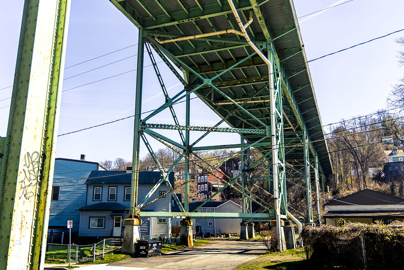
While walking through a Pittsburgh neighborhood called ‘The Run,’ one of the first things I noticed and pointed the camera at was the Swinburne Bridge. It’s a 1915 steel girder affair, which carries Frazier Avenue over the ravine which the Run community is embedded into. Clicking that link above will bring you to a page at historicbridges.org, which will tell you all the nitty gritty about it – when, where, who, and why.
I was heading for an area called Panther Hollow in Schenley Park, and was walking there shortly after having parked the Mobile Oppression Platform in a public lot set up for visitors to the network of trails that snake around Pittsburgh.

– photo by Mitch Waxman
A neighboring span carries I-376 (aka Penn-Lincoln Hwy./US Hwy. 22/Hwy. 30) high over the ravine. The entirety of this high speed roadway is a fairly massive structure, which was built in 1956 as part of the Federal Interstate Highway System build out.
I continued on towards the entrance of Schenley Park, where I was happy to find a Porta Potty waiting for me to ‘dewhizzulate.’ I know that it’s odd to constantly mention when and where I took a piss in these posts, but as a lifelong New Yorker… the idea that such public amenities exist at all are still startling to me.
Imagine it… an acknowledgment of human biology… by a government…
– photo by Mitch Waxman
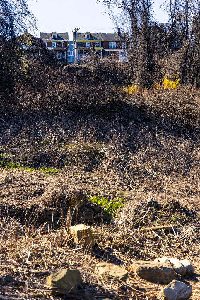
Panther Hollow itself is set into a ravine or valley found between two steep hills which are built out with residential and collegiate buildings. The name of the place comes from the observance of wild Panthers here during the 18th and 19th centuries, critters which are also known as Mountain Lions. Sportsball teams associated with the nearby PITT university use Panthers in their branding, thereby.
Back next week with more from Panther Hollow – at this – your Newtown Pentacle.
“follow” me on Twitter- @newtownpentacle
Buy a book!
“In the Shadows at Newtown Creek,” an 88 page softcover 8.5×11 magazine format photo book by Mitch Waxman, is now on sale at blurb.com for $30.
Run, rabbit, run
Thursday

– photo by Mitch Waxman
Recent endeavor found your humble narrator driving over to a section of Pittsburgh called ‘The Run’ which adjoins Schenley Park. I wasn’t visiting or exploring the community, rather passing through and I was following a trail map which led through the park.
At the nearby end of the Eliza Furnace Trail is found a parking lot, where the Mobile Oppression Platform had been berthed. I should have looked more deeply at the trail maps, as I could have parked a bit closer to my destination, but I’m never one to complain about a bit of extra walking.
That’s Pittsburgh’s Second Avenue pictured above, and the large property on the right is called ‘Blair Park,’ but it used to be part of a Steel Mill (or so I’m told). Still learning about this joint, me.

– photo by Mitch Waxman
Second bends onto Saline Street, which then leads into a neighborhood called ‘the Run.’ There’s a great local YouTube channel, produced by a fellow named Dean Bog, that offers a nice short about this area – check it out here.
Bog’s inventory of videos explore the various communities in the Pittsburgh Metro area, and they impart the ‘vibe’ encountered when exploring the habitations of the local human infestation. Here’s one about the part of town where HQ can be found and where a humble narrator dwells – the Borough of Dormont.

– photo by Mitch Waxman
My goal for the afternoon, beyond getting some exercise and seeing a place which was novel and new, was to get to a spot called Panther Hollow in Schenley Park. The ‘front door’ to this park is nearby the campuses of PITT and Carnegie Mellon University, whereas a ‘back door’ is found down here.
Back tomorrow with more.
“follow” me on Twitter- @newtownpentacle
Buy a book!
“In the Shadows at Newtown Creek,” an 88 page softcover 8.5×11 magazine format photo book by Mitch Waxman, is now on sale at blurb.com for $30.


