Archive for the ‘Greenpoint’ Category
darkly hidden

– photo by Mitch Waxman
As described in the recent posting “Obscure World“, the location of Conrad Wissel’s notorious “Dead Animal and Night Soil Wharf” has been finally nailed down and confirmed by contmeporaneous maps and photographs. A lot of people ask me where I find my information about the oft occluded history of the Newtown Creek, and are surprised when informed about my methodology.
Basically, it all boils down to this- I’ll notice something hidden in plain sight while wandering around, take photos of it, and start researching when back at HQ. There’s a whole list of mysteries in my “to do” pile, and often the answer to what they were is presented while searching for something else entirely. It’s how the whole “missing Lamp Post of the Queensboro bridge thing” got started. Accordingly, whenever accusations of pursuing some political agenda are leveled at this- your Newtown Pentacle- great amusement ensues.
The utterly forgotten headquarters of the General Electric Vehicle Company of Long Island City, which had been staring me in the face for years, revealed itself in this manner. Easy to miss the third largest factory building in Queens, I guess, even if its painted with bright yellow and green stripes.

– photo by Mitch Waxman
As detailed in the posting “uncommented masonry“, one was merely poking around for some information about the “Blissville Banshee“.
A supernatural phenomena, the Banshee was reported on in 1884 by the NY Times (she was described as red haired, blue eyed, and screaming “Oh Ho” like … well… a banshee), and was an obvious jab at the largely Irish and Catholic population of Blissville by Manhattan’s patrician “Nativists”. Racial or ethnic prejudice is commonly encountered in journalism of that era, and quite unsurprising to those familiar with reportage of the period. In the 1880’s, “politically correct” meant not shooting someone on sight.
What emerged about the structure above, however, was that in 1915- a quarter of the 40,000 or so trucks then plying the streets of New York City were electric (and participated in a rail based battery exchange program). Most of them were manufactured in Long Island City within the building pictured above, by the General Electric Vehicle Company.
This is my favorite sort of posting, a product of serendipity and pure discovery.
Which brings me to the Tammany men, and why there very well might be a horse buried in Calvary Cemetery.

– photo by Mitch Waxman
“The Abbot” from January of 2010, described a chance sighting of a curious obelisk in Queens’s Calvary Cemetery.
By the time that I was done with this post, I had found the young J.J. Scannell and Richard Croker sitting out a sentence in Manhattan’s “Tombs”. Quite a propitious meeting- in retrospect, one with far reaching consequence.
These two men would rise to the top of Tammany Hall one day, preside over the consolidation of the City of Greater New York from the shadowed world of the “smoke filled room”, and grow filthy rich on a buttery diet of political corruption.
Think Boss Tweed was something? In that case, you’ve never heard of Scannell and Croker.
All this because I enjoy strolling through Calvary in the afternoon while the Dropkick Murphys are playing on my headphones.
incidentally, something recently discovered (see how it works?) were these portraits of Mr.’s Scannell and Croker- found in Moses King’s “Notable New Yorkers of 1896-1899, courtesy google books


– photo by Mitch Waxman
“from some point in space“, another 2010 posting, showcases a shot of Dutch Kills acquired before a press conference which highly placed members of the Newtown Creek Alliance had asked me to represent them at (literally no one else from Queens was available).
My statement was prepared, thankfully, as I was standing next to and was introduced by Congresswoman Carolyn Maloney. Stage fright and hallucination inducing nervousness ruled my mood during the lead up.
To alleviate the anxiety while waiting for the event to begin… and as I happened to be standing in a south facing room within the Degnon Terminal’s former Loose Wiles building… which overlooks the waters of the Dutch Kills tributary of Newtown Creek- a window was soon roughly thrown open and I shot the image above.
As it happens, while attempting to research a group of heretical Quakers operating in the area just before the Revolutionary War, I came across the following image in another one of those “old and out of copyright” municipal journals which have found their way onto the web.

– Photo from 1921’s ”The Newtown Creek industrial district of New York City By Merchants’ Association of New York. Industrial Bureau”, courtesy google books
Cool, huh?
An August 2011 post, called the “the dark moor“, reversed the point of view and showed the view from infinite Brooklyn into Queens from atop the digester eggs of the Newtown Creek Waste Water Treatment Plant.
Click for details on Mitch Waxman’s
Upcoming walking and boat tours of Newtown Creek, and Staten Island’s Kill Van Kull
June 23rd, 2012- Atlas Obscura Thirteen Steps around Dutch Kills walk (this Saturday)
for June 23rd tickets, click here for the Atlas Obscura ticketing page
June 30th, 2012- Working Harbor Committee Kill Van Kull walk
for June 30th tickets, click here for the Working Harbor Committee ticketing page
July 8th, 2012- Atlas Obscura Walking Tour- The Insalubrious Valley
for July 8th tickets, click here for the Atlas Obscura ticketing page
July 22nd, 2012- Working Harbor Committee Newtown Creek Boat Tour
![]()
Announcement: Newtown Creek Boat Tour- July 22, 2012
 |
Many people know about the environmental issues facing Newtown Creek, but did you know that the Creek was once the busiest waterway in North America, carrying more industrial tonnage than the entire Mississippi River?
You’ll learn much more when Working Harbor Committee’s maritime historians and harbor experts
put it all in context during a Hidden Harbor Tours: Newtown Creek Exploration.
The heart of industrial New York, Newtown Creek was home port to hundreds of tugboats (one of which is the historic WO Decker). It was also an international destination for oceangoing ships and a vast intermodal shipping and manufacturing hub that employed hundreds of thousands of people. Forming the border of Brooklyn and Queens for nearly three miles, five great cities grew rich along the Newtown Creek’s bulkheads — Greenpoint, Willamsburg, Bushwick, Long Island City and Manhattan itself. The waterway is still a vital part of the harbor and the Working Harbor Committee (WHC) is proud to present this tour as part of the celebration of their tenth anniversary year.
Mitch Waxman, a member of WHC’s steering committee and the group’s official photographer, also serves with the Newtown Creek Alliance as its group Historian. In addition to working on WHC’s boat tours of the Creek, Mitch offers a regular lineup of popular walking tours, and presents a series of well-attended slideshows for political, governmental, antiquarian, historical and school groups. His website — newtownpentacle.com — chronicles his adventures along the Newtown Creek and in the greater Working Harbor.
He was recently profiled in the NY Times Metro section, check out the article here.
Upcoming tour: Hidden Harbor Tours: Newtown Creek Exploration.
On July 22nd, Mitch shares his unique point of view and deep understanding of the past, present and future conditions of the Newtown Creek as the narrator and expedition leader for this years Hidden Harbor Tours: Newtown Creek exploration.
Our NY Water Taxi leaves from South Street Seaport at 11 a.m. (sharp) on a three hour tour of the Newtown Creek. From the East River we’ll move into the Newtown Creek where we’ll explore explore vast amounts of maritime infrastructure, see many movable bridges and discover the very heart of the Hidden Harbor.
Limited seating available, get your tickets today.
 |
|||||||||||||||
|
|||||||||||||||

_______________________________________________________________________________
Also:
June 23rd, 2012- Atlas Obscura Thirteen Steps around Dutch Kills walk

– photo by Mitch Waxman
The “Obscura Day” Thirteen Steps around Dutch Kills tour proved that the efficacy and charms of the Newtown Creek’s least known tributary, with its myriad points of interest, could cause a large group to overlook my various inadequacies and failings. The folks at Atlas Obscura, which is a fantastic website worthy of your attentions (btw), have asked me to repeat the tour on the 23rd of June- also a Saturday.
for June 23rd tickets, click here for the Atlas Obscura ticketing page
June 30th, 2012- Working Harbor Committee Kill Van Kull walk

– photo by Mitch Waxman
My various interests out on the sixth borough, NY Harbor, have brought me into association with the Working Harbor Committee. A member of the group’s Steering Committee- I also serve as the “official” group photographer, am chairman and principal narrator of their annual Newtown Creek Boat Tour, and occasionally speak on the microphone during other tours (mainly the Brooklyn one). This year, the group has branched out into terrestrial explorations to compliment the intense and extant schedule of boat tours, and I’m going to be leading a Kill Van Kull walking tour that should be a lot of fun.
The Kill Van Kull, or tugboat alley as its known to we harbor rats, is a tidal strait that defines the border of Staten Island and New Jersey. A busy and highly industrialized waterfront, Working Harbor’s popular “Hidden Harbor – Newark Bay” boat tours provide water access to the Kill, but what is it like on the landward side?
Starting at the St. George Staten Island Ferry terminal, join WHC Steering Committee member Mitch Waxman for a walk up the Kill Van Kull via Staten Islands Richmond Terrace. You’ll encounter unrivaled views of the maritime traffic on the Kill itself, as well as the hidden past of the maritime communities which line it’s shores. Surprising and historic neighborhoods, an abandoned railway, and tales of prohibition era bootleggers await.
The tour will start at 11, sharp, and you must be on (at least) the 10:30 AM Staten Island Ferry to meet the group at St. George. Again, plan for transportation changes and unexpected weirdness to be revealed to you at MTA.info.
for June 30th tickets, click here for the Working Harbor Committee ticketing page
July 8th, 2012- Atlas Obscura Walking Tour- The Insalubrious Valley

– photo by Mitch Waxman
Newtown Creek Alliance historian Mitch Waxman will be leading a walk through the industrial heartlands of New York City, exploring the insalubrious valley of the Newtown Creek.
The currently undefended border of Brooklyn and Queens, and the place where the Industrial Revolution actually happened, provides a dramatic and picturesque setting for this exploration. We’ll be visiting two movable bridges, the still standing remains of an early 19th century highway, and a forgotten tributary of the larger waterway. As we walk along the Newtown Creek and explore the “wrong side of the tracks” – you’ll hear tales of the early chemical industry, “Dead Animal and Night Soil Wharfs”, colonial era heretics and witches and the coming of the railroad. The tour concludes at the famed Clinton Diner in Maspeth- where scenes from the Martin Scorcese movie “Goodfellas” were shot. Lunch at Clinton Diner is included with the ticket.
Details/special instructions.
Meetup at the corner of Grand Street and Morgan Avenue in Brooklyn at 11 a.m. on July 8, 2012. The L train serves a station at Bushwick Avenue and Grand Street, and the Q54 and Q59 bus lines stop nearby as well. Check MTA.info as ongoing weekend construction often causes delays and interruptions. Drivers, it would be wise to leave your vehicle in the vicinity of the Clinton Diner in Maspeth, Queens or near the start of the walk at Grand St. and Morgan Avenue (you can pick up the bus to Brooklyn nearby the Clinton Diner).
Be prepared: We’ll be encountering broken pavement, sometimes heavy truck traffic as we move through a virtual urban desert. Dress and pack appropriately for hiking, closed-toe shoes are highly recommended.
Clinton Diner Menu:
- Cheese burger deluxe
- Grilled chicken over garden salad
- Turkey BLT triple decker sandwich with fries
- Spaghetti with tomato sauce or butter
- Greek salad medium
- Greek Salad wrap with French fries
- Can of soda or 16oz bottle of Poland Spring
for July 8th tickets, click here for the Atlas Obscura ticketing page
elysian realm

– photo by Mitch Waxman
This Saturday, for a change, we’re not going to present a “Project Firebox” posting, and will instead talk a little bit about the holiday weekend. What the British (or most of the rest of the world) might call a “bank holiday”, the truth of what the three day weekend represents is lost within the dross usage and little understood idioms of the modern tongue.
The truth of the term is met by merely sounding it out. This is a secular holiday, a “holi” “day”, or holy day.
From a representative democratic point of view and sensibility, this “holiday” is meant to be like Yom Kippur or Good Friday- serious business.
from a November 2009 posting, “Tales of Calvary 2- Veterans Day“, about the antipode of this seasonal holiday- Veteran’s Day (which discusses the monument in some detail)–
The statues here at Calvary’s Soldiers Monument seem to have been the original castings of a much reproduced statuary design. Placed here in 1866, they predate the identical statues found at Green-Wood Cemetery, and exact issuance of the mold has been confirmed in New England, North Carolina, and all over New York State. As early as 1875, fumes from a nearby Ammonia Factory at Newtown Creek were graving pitted marks into them.

– photo by Mitch Waxman
The original intent of the holiday was to honor the dead of the Civil War… well, all wars, supposedly… but they were really talking about the Civil War in 1868 when Memorial Day (then Decoration Day) appeared on the American Calendar. Someday the eleventh of September will replace Labor Day, as the term “Union” will mean little to future generations, and summer will end “officially” in the second week of the ninth month rather than the last of the eighth. Some politician will have assigned it a name by then- “Never Forget Day” or something, I’d wager.
There are some wounds which will never heal, even in the fullness of time.
from wikipedia
Memorial Day is a federal holiday observed annually in the United States on the last Monday of May. Formerly known as Decoration Day, it originated after the American Civil War to commemorate the fallen Union soldiers of the Civil War. (Southern ladies organizations and southern schoolchildren had decorated Confederate graves in Richmond and other cities during the Civil War, but each region had its own date. Most dates were in May.) By the 20th century Memorial Day had been extended to honor all Americans who have died in all wars. Memorial Day is a day of remembering the men and women who died while serving in the United States Armed Forces. As a marker it typically marks the start of the summer vacation season, while Labor Day marks its end.
– photo by Mitch Waxman
The smell of BBQ will rise above Queens and Brooklyn, as always, and the Manhattan people will order take out Chinese and I really couldn’t tell you what will be happening in the Bronx and Staten Island. There will be parades of Veterans, kids will skin their knees playing ball, and many of their Moms and Dads will get way too drunk. Fatty meats and cold drinks will swell many bellies.
All the kids will get sunburns, and go to bed knowing that the freedom of summertime has finally arrived.
Somewhere far away, however, other American kids with rifles in their hands will nervously stare out into the darkness of the desert, or listen intently for movement at mountain passes, and desperately hope that this will be a quiet night. Their BBQ is back at base, and like freedom- home is infinitely far away.
from usmemorialday.org
Memorial Day was officially proclaimed on 5 May 1868 by General John Logan, national commander of the Grand Army of the Republic, in his General Order No. 11, and was first observed on 30 May 1868, when flowers were placed on the graves of Union and Confederate soldiers at Arlington National Cemetery. The first state to officially recognize the holiday was New York in 1873. By 1890 it was recognized by all of the northern states. The South refused to acknowledge the day, honoring their dead on separate days until after World War I (when the holiday changed from honoring just those who died fighting in the Civil War to honoring Americans who died fighting in any war). It is now celebrated in almost every State on the last Monday in May (passed by Congress with the National Holiday Act of 1971 (P.L. 90 – 363) to ensure a three day weekend for Federal holidays), though several southern states have an additional separate day for honoring the Confederate war dead: January 19 in Texas, April 26 in Alabama, Florida, Georgia, and Mississippi; May 10 in South Carolina; and June 3 (Jefferson Davis’ birthday) in Louisiana and Tennessee.

– photo by Mitch Waxman
The Memorial Day holiday was created by those who would implicitly understand the situation of the latter. They suffered the same sort of dysentery, horror, and mission- and also watched friends get cut down by anonymous artillery fire in some faraway land.
By the end of the Civil War, there were no victors, only survivors. These survivors wanted us to learn from their trials, and set an annual date for us to sit and think- long and hard- about how high a price certain things are worth.
The same can be said of the veterans of every mechanized “modern conflict” fought since the advent and introduction of the war machines in the 1860’s.
from nycgo.com
Memorial Day isn’t just an excuse for springtime sales and a three-day weekend—it is, first and foremost, a time to honor those citizens who’ve served the United States in times of war. NYC honors our fallen heroes with parades all over the City. The Little Neck–Douglaston parade in Queens is reputedly the largest of its kind. You can also attend Brooklyn’s Memorial Day Parade (145 years old!), which begins at Third Avenue and 87th Street. In Manhattan, head uptown for a smaller parade in Inwood that begins at Broadway and Dyckman Street. Check the City’s events calendar for a full list of events and start times.

– photo by Mitch Waxman
Given that this is also “Fleet Week”, might a humble narrator suggest that if you see a Marine or Sailor at the bar- have the bartender anonymously send over a beer on your tab.
Thanks of a grateful nation, and all that.
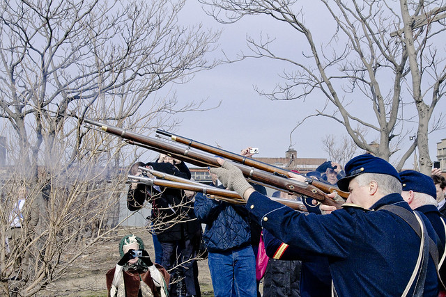
Project Firebox 45

– photo by Mitch Waxman
Appearing suddenly, in the manner of some disemboweled hollywood revenant, this soldier of the realm stands proudly at the border between residential and industrial sectors in eastern Greenpoint, Brooklyn.
certain villagers

– photo by Mitch Waxman
Recent business brought me to the Greenpoint section of infinite Brooklyn, which offered your humble narrator an opportunity to get high.
Pop cultural references aside, what that meant was a trip to the roof of the so called Pencil Factory, and the chance to slide my lens around the unobstructed vista of the alluvial plane which lies between Newtown Creek, the former Bushwick Creek, and the East River.
from wikipedia
An alluvial plain is a largely flat landform created by the deposition of sediment over a long period of time by one or more rivers coming from highland regions, from which alluvial soil forms. A floodplain is part of the process, being the smaller area over which the rivers flood at a particular period of time, whereas the alluvial plain is the larger area representing the region over which the floodplains have shifted over geological time.
As the highlands erode due to weathering and water flow, the sediment from the hills is transported to the lower plain. Various creeks will carry the water further to a river, lake, bay, or ocean. As the sediments are deposited during flood conditions in the floodplain of a creek, the elevation of the floodplain will be raised. As this reduces the channel floodwater capacity, the creek will, over time, seek new, lower paths, forming a meander (a curving sinuous path). The leftover higher locations, typically natural levees at the margins of the flood channel, will themselves be eroded by lateral stream erosion and from local rainfall and possibly wind transport if the climate is arid and does not support soil-holding grasses. These processes, over geologic time, will form the plain, a region with little relief (local changes in elevation), yet with a constant but small slope.

– photo by Mitch Waxman
The pencil factory of the Eberhard Faber company, recently converted to luxury apartments, from above. Often has it occurred to me that this most be how the elites of Manhattan perceive the North Brooklyn and Western Queens communities, as if from above and with the perspective of Olympians.
from nycgovparks.org
The native Keshaechqueren originally inhabited this part of Brooklyn. Dutch mercantilists and farmers, arriving in 1638, rapidly developed it into a hub of seafaring commerce. In the 1850s, the community swelled with new residents, of primarily Irish and English descent, when two ferry lines began regularly scheduled runs from the Greenpoint coastline to Manhattan’s East Side. With the almost simultaneous addition of big businesses like the shipbuilding firm Continental Iron Works and fuel provider Astral Oil Works, Greenpoint began to compete on a national level with older naval foundries in Boston and Norfolk.
From the decades following the Civil War through the 20th century, Greenpoint’s population has steadily grown. In the early 1950s, the community began to suffer strain as several waves of immigration met with limited economic opportunities in the neighborhood.

– photo by Mitch Waxman
The red building in the right of the shot, for instance, houses one of my favorite saloons in this section- also known as the “Pencil Factory”. They serve hard cider in a pint glass with ice during the summer, and that’s what’s known as “local knowledge”. Can’t see that from up here.
Of course, this angle of view precludes one from understanding the truth of these places, the life and cultural norms of the street, and reduces the population housed therein to statistical groups with the status of mere tenants (from a macro historical and sociological point of view) in a “district”. This isn’t a district, this is a neighborhood.
Hmmm, I guess these Eberhard Faber folks must have been a big deal.
from nyc.gov
The company first opened a factory in Manhattan near 42nd Street and the East River in 1861 as the U.S. branch of Germany’s A.W. Faber Company, a pencil manufacturing company dating to the mid-18th century. In 1872, Eberhard Faber, the great grandson of the company’s founder, moved the operation to Brooklyn after the Manhattan plant – the first pencil manufacturer in the United States — was destroyed by fire.

– photo by Mitch Waxman
The shapes on the far horizon in the shot above are all in Queens, and the dark dome of vegetation are those trees fed by the morbid nutritions of Calvary Cemetery. The reason why this part of Greenpoint Avenue is so wide is that it was built to accommodate the street car lines going to and from Calvary, which met the ferry docks not too far from where the so called “transmitter park” is found today.
from “A history of the city of Brooklyn By Henry Reed Stiles” courtesy google books
The Green-point Ferries are from the foot of Green-Point Avenue, Brooklyn, E. D., to the foot of East Tenth and East Twenty-Third streets, New York. The first named route was established in 1852 (lease dated 1850), by the efforts of Mr. Neziah Bliss, of Green-Point; and was soon transferred to Mr. Shepard Knapp, being now held by G. Lee Knapp. The Twenty-Third street route was established in 1857, and held by St. Patrick’s Cathedral, per G. Lee Knapp. Rent of the Tenth street ferry, $1,300, and of the Twenty-Third street, $600 per annum, both expiring in 1874.

– photo by Mitch Waxman
Remains of the Greenpoint Terminal Market, immolated just a few years ago, persist on the riverfront. They await the application of venture capital and the blade of earth moving equipment, and will begin a conversion to towers of steel and glass.
Soon, one will not be able to see the spectacle of the Shining City of Manhattan from Greenpoint, except via regulated and officially decided “sight lines” or “visual corridors” offered by gaps between high rise apartment buildings- or if you happen to live in one of them.
Just like in Long Island City.
from the “DIGEST OF SPECIAL STATUTES By THE CITY OF NEW YORK” courtesy google books
1865: This act incorporates the Green Point and Calvary Railroad Company, and authorizes the construction of a railroad, to be operated by horse power only, from at or near the Green Point and Tenth street ferry, at the foot of Green Point avenue, in the city of Brooklyn, thence along Green Point avenue to Green Point avenue plank road, across the bridge over Newtown creek; thence easterly along said road to the easterly side of Calvary cemetery at or near the point where the, said road intersects the main road leading from Calvary cemetery to Hunter’s Point; thence to Central avenue; thence along Central avenue and Commercial street to Franklin avenue, to Freeman street, to Washington street, to the place of beginning.

– photo by Mitch Waxman
One view which will remain unoccluded for the foreseeable future, of course, is that which is enjoyed by some hideous thing which cannot possibly exist or lurk within the cupola of a Sapphire Megalith in Long Island City.
Such an entity- with its singular and unblinking eye casting about rapaciously, a global army of loyal acolytes and fanatic employees, and a desire to devour all the wealth that there is, was, or ever will be- this hungry and impossible thing which would be “too big to fail”- were it not entirely mythical- what perspectives on the transformations of North Brooklyn could it offer from atop its hildskjalf?
Of course, such paranoid wonderings often occur, when one spends his time getting high in Greenpoint.
from nyc.gov
Greenpoint is generally defined as the district bounded by North 7 Street on the south, the East River on the West, Newton Creek on the north and the Brooklyn-Queens Expressway on the east, corresponding approximately to the area of ward 17 in the 19 century. th
Once also known as Cherry Point, Greenpoint, got its name from the eponymous spit of grassy land that extended into the East River near the foot of what later became Freeman Street. The name came to designate all of the 17 ward when Greenpoint, Bushwick, and Williamsburg were joined to Brooklyn in 1854. At that time, the 17 ward was home to approximately 15,000 inhabitants. A sandy bluff, over one hundred feet high in some parts, overlooked the shoreline between Java and Milton Streets, but it was leveled before the middle of the 19 century for use as building material and landfill both in New York and locally. The original Greenpoint spit disappeared between 1855 and 1868 when the western half of the blocks along the once white sandy shoreline west of West Street were created by landfilling. During this period, the blocks west of Commerce Street between Ash and Eagle Streets were also created or in the process of being filled.


