Posts Tagged ‘Pickman’
coffin shaped
Wednesday

– photo by Mitch Waxman
Back in November, two of my pals from Newtown Creek Alliance – Willis and Gil – got it into their heads to organize a street end cleanup at the Borden Avenue street end in Queens’ Long Island City section. This allowed me to bust their balls by calling the duo “Gillis” for the day, so win. Luckily, the NYC DEP wanted to help and they arranged for a series of dumpsters to be trucked in to support the effort. About 50 people showed up to perform the labor, including a decent number of teenagers. One of those teens dug the creepy baby doll pictured above out of the poison loam surrounding this distaff tributary of the fabulous Newtown Creek.
For the whole set of shots from the effort, wherein you’ll be able to witness the astounding four dumpsters worth of junk that the community gathered during the day, click here.

– photo by Mitch Waxman
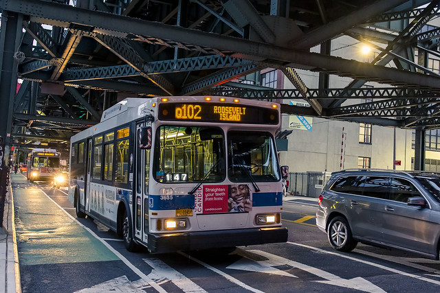
The group’s labor came to an end when a magnificent band of thunderstorms blew through LIC. The high flying Queens Midtown Expressway, whose steel truss roadway hangs some 106 feet over Dutch Kills, provided us with some shelter, but everyone was huddled up against the sides of trucks and wooden fence panels to avoid the horizontal rain. A massive amount of water poured out of the atmosphere, but as is the case with such weather, it was all over in about a half hour.
That’s when we heard a rushing/roaring sound.

– photo by Mitch Waxman
Found alongside the Borden Avenue street end is a storm sewer which empties into Dutch Kills. This particular one drains a couple of large industrial properties as well as a couple of streets and a section of the aforementioned Queens Midtown Expressway section of the Long Island Expressway. Thousands of gallons of storm water were ploughing out of the pipe and discharging into the waterway.
What fun.
“follow” me on Twitter- @newtownpentacle
Buy a book!
“In the Shadows at Newtown Creek,” an 88 page softcover 8.5×11 magazine format photo book by Mitch Waxman, is now on sale at blurb.com for $30.
abnormal ticking
Monday

– photo by Mitch Waxman
Well, Merry Christmas, huh? Actually, Festivus comes first – on the 23rd, then Christmas on the 25th, and Kwanzaa is the 26th. So exciting, ain’t it, the holiday season? Yesterday was December the 19th, and I feel compelled to mention the date as being the anniversary of the opening of the Williamsburg Bridge in 1903, and the USS Constellation fire at the Brooklyn Navy Yard in 1960. This was your calendrical paragraph of the day, lords and ladies.
The shots in today’s post were captured while scuttling home from a visit to Long Island City’s Degnon Terminal area, which adjoins the Dutch Kills Tributary of Newtown Creek. This particular walk (from and to Astoria) is kind of my default destination when I have no particular destination in mind. My feet just point in the right direction and I follow them.

– photo by Mitch Waxman
Over the last decade, a great gnashing of teeth in Western Queens has revolved around a movement for safer streets. The answer to all things safe has revolved around bicycles, bike lanes, and a well organized lobbying campaign which engages in the tried and true methodology of redefining commonly held terms and tropes. Bike lane advocates offer that a car isn’t “parked” along the curb, instead it’s “free car storage.” Automobile owners and operators are described as wheeling around in “two ton murder machines” for instance. I’m actually quite impressed with some of the people and organizations who have led this charge, and less so with several of the quite volatile sock puppets who show up at governmental meetings.
What is always forgotten in these conversations are pedestrians. As a dedicated pedestrian, I spend a good amount of my time these days dodging electrically powered bikes riding at 20 mph on the sidewalks, and crossing the street in several places in Western Queens is now a horror show. You used to just step off the curb when the vehicles passed by, now you’ve got to worry about a secondary line of traffic too, one which doesn’t obey stop sign/red light/yield to pedestrian indications. At least cars have license plates and an insurance company to sue if you get hit by one. Meanwhile, in all the arguing and tumult, basics like street lighting and roadway maintenance are ignored. The corner above hosts a bike lane on the sidewalk, relegating foot traffic to a narrow and dark corridor.
How narrow and dark, you might ask?

– photo by Mitch Waxman
That narrow and dark, I answer. I’ve opined to the “bicycle people,” whose aims I’m generally quite supportive of, that it’s only a matter of time until the political winds blow in a different direction and the City of Greater New York does what it’s historically done regarding every other issue encountered in its long history and legislates that bikes will need to be registered with an bureaucratic agency and be adorned with some sort of license plate. Operator licenses won’t be far behind that, either. This will be a nightmare, using a City version of NYS’s Department of Motor Vehicles as a model. It’ll become a revenue source for the city, with traffic agents handing out tickets for bikes illegally stored on fences and utility poles. Ask a car owner what to expect.
NYC officialdom has told me point blank that bike lanes are easy for them to do, since it’s a low budget improvement they can make. Those little plastic sticks, officially called “flexible delimiters,” are a lot cheaper than actual concrete separation for bike lanes. The ones without the sticks are “just paint.” Now… the paint isn’t paint, it’s a substance called thermoplastic which is applied to the street. When the paint degrades and fades, where does the plastic go? Into the sewers, that’s where, and since NYC has a combined sewer outfall system which discharges directly into the harbor…
We are just doomed. Merry Christmas.
“follow” me on Twitter- @newtownpentacle
Buy a book!
“In the Shadows at Newtown Creek,” an 88 page softcover 8.5×11 magazine format photo book by Mitch Waxman, is now on sale at blurb.com for $30.
oddly corrobative
Tuesday
– photo by Mitch Waxman
The routine one currently ascribes to involves a schedule of “one day out, one day in.” What that means is that if I’m out with the camera on Monday, Tuesday is the day I’m at HQ developing whatever I shot and delivering it to the Internet. One opines that internally lubricated parts like the knee or hip joints require regular flexion lest they lose function. Scuttling, always scuttling, that’s me. As a point of interest, the way that this shakes out this week is that tonight I’ll be out and scuttling.
One appears to be little more than a pile of filthy black fabric caught in a stiff breeze to most passerby, but for some reason I’m catching people’s eyes these days and I don’t like that. Some of the humans want to talk with me, whilst others are suspicious of my presence. Unfortunately, there are also those whom have seemingly developed a taste for human meat during the pandemic, and they gaze at me and my possessions hungrily.

– photo by Mitch Waxman
Things have become odd out there, in this second winter of Covid. A winnowing of patience, the thinning of empathy, an acceptance of “that’s how things are now” has been arrived at. You can feel “the vibe” if you’re the sensitive type. Personally, I miss the illegal fireworks.
I’ve been observing the sort of things which hint at the continuing unraveling of civil order, encountered malign actors on the deserted streets, and have taken to swiveling my head around more than previously. Blame whatever you want to for this, I don’t care what others say, and I’m sure there’s a political narrative you’ll find comfort in. It’s going to be a real shit show when the Cops start doing their jobs again, which I predict as coinciding with the arrival of a new local political regime in January. It’s likely too late for that to have any real meaning, however, as the Djinn has escaped its bottle.

– photo by Mitch Waxman
Pictured above is a frontline of next year’s political bullshit here in Astoria. A mega project offered by the Kaufman Astoria people called “Innovation Queens” is slated to begin paying off local “voices” to sing the song of gentrification. If you want to know what it costs to buy off these voices – it’s about $5,000 a head. You’ll get all the usual characters – the street minister who’s secretly a gangster, the well thought of community leader who’s secretly the secret gangster’s mistress, the odd local business owner who was planning on selling his bar soon anyway. These sort of characters were all in for the LIC rezonings, the BQX, Amazon, etc. – whatever big idea City Hall and the EDC were flacking at the time and writing checks for. That’s why I can tell you what and how much they cost, because that’s what they cost the bosses last time, and the time before that. Five grand isn’t even bagel money for the real estate people.
The Innovation Queens people describe this little industrial zone along Northern Boulevard as “dark, deserted, dangerous.” In actuality, it didn’t used to be, but ever since they started acquiring/emptying/blighting the properties hereabouts…
“follow” me on Twitter- @newtownpentacle
Buy a book!
“In the Shadows at Newtown Creek,” an 88 page softcover 8.5×11 magazine format photo book by Mitch Waxman, is now on sale at blurb.com for $30.
ostentatiously on
Tuesday

– photo by Mitch Waxman
A few odds and ends today, including a shot above accomplished using some of my DIY made at home camera technology. That’s an office setup at one of the many auto dealerships found along Northern Blvd. here in Long Island City, one which I shot through a plate glass window. Reflections were cancelled out using an air conditioner foam insulator collar affixed to one of my lenses. Boo-yah!
I like it when my DIY stuff works.

– photo by Mitch Waxman
A woman lives in that plastic cocoon pictured above. The cocoon is found along Northern Blvd. in LIC nearby another one of the many auto dealerships mentioned above. She’s the one who makes bird sounds, and then laughs in a manner which can only be described as “maniacal” whom I’ve mentioned in the past. What I mean by maniacal is the sort of laugh you’d expect an extra to offer in a “Hammer House of Horror” movie about Bedlam, a laugh which Peter Cushing’s character would ignore.
Before you ask, as I already have, she just wants to be left alone. Doesn’t want socks or “stuff” or access to services, just solitude to deal with whatever’s happening to her. Ok. She’s been here a couple of years, so…

– photo by Mitch Waxman
Coming back into Astoria via Steinway Street, one encounters an automotive repair shop which often offers interesting insights into what could happen on the streets of New York City to an innocent motorist. On this particular evening, no spectacular wrecks were encountered but for some reason this towing truck with a hatchback on its bed caught my eye.
Back tomorrow.
“follow” me on Twitter- @newtownpentacle
Buy a book!
“In the Shadows at Newtown Creek,” an 88 page softcover 8.5×11 magazine format photo book by Mitch Waxman, is now on sale at blurb.com for $30.
bodily visit
Thursday

– photo by Mitch Waxman
One last trio from Dutch Kills for today. What can I say, it’s either been horribly hot or raining for the last week. Gah, do I hate this time of year in NYC. If there was only mist or fog associated with NYC’s summer humidity… but it’s just a blue haze of murky ozone light in late August. If you’re curious, I was flipping through all of the lenses in my kit while at Dutch Kills this particular evening, and the one used for today’s post is the RF 24-105 f4 L.
Every lens seems to have its own color rendition, flaws and strengths, there’s even a difference in exposure in some cases. Science and optics, bro, science and optics.

– photo by Mitch Waxman
Since it was a lifetime ago, and a former variant of the current “me,” I seldom mention to people that I used to draw comic books. Saying that, the training in “storytelling” that revolves around that particular discipline of cartooning continues to come in handy, and informs the way I use the camera. Most photo people come to a scene and do “one and done,” whereas I’m gazing “up, down, all around” before I even click the shutter button, trying to figure out how to tell a story with it.
You need to do “establishing shots” which place the reader in a scene, followed by close ups and other angles, and a wrap up establishing shot. It’s better to have the singular composition which will be your “wow, look at that” photo accompanied by several companion shots from a storytelling point of view. Another concern which I try to shoot for is the unfortunate fact that a lot of my shots are going to end up having type set against them for presentations. That’s something else you learn from drawing comics – leave room for the speech balloons and sound fx. I mention this because today’s images are all establishing shots.

– photo by Mitch Waxman
Another incarnation of mine was the advertising industry production and photo retouching one. The comics never really paid the bills, and a boy has to eat. I’ve done Times Square billboards, specialized in publication specific print ads (there’s a 15 year period during which I had something printed in either the New York Times or Wall Street Journal every day), worked on early internet sites like Jaguar.com, and if you walked into a Footlocker to buy sneakers at the start of this century the big banners and other “POS” stuff hanging in the windows was probably something I had sent to the printer. Again – leave room to set type or a logo on the image but shoot it so that it still could stand on its own as a single image without copy. It was an incredibly dull work life, incidentally, and not remotely like Mad Men.
The current incarnation is the craziest life I’ve ever known, however.
“follow” me on Twitter- @newtownpentacle
Buy a book!
“In the Shadows at Newtown Creek,” an 88 page softcover 8.5×11 magazine format photo book by Mitch Waxman, is now on sale at blurb.com for $30.


