wide scattering
Thursday

– photo by Mitch Waxman
Another night, another walk around Long Island City in the wind and cold. Another shot of the same gas station in the dark. One thing about this pandemic time… it enforces you being in a rut. Same old, same old, nothing matters, nobody cares. Meh.
I want to see waterfalls and mountains. Vast forests, full of critters, and experience the novel, the new, the unexpected. Right now, I’ve got traffic and gasoline tanker trucks though, so I can’t justify the ennui. Better than nothing, or homogeneity and sprawl. As the now classic song by TLC would advise – Don’t go chasing waterfalls.

– photo by Mitch Waxman
One reminds himself that he’s actually grown quite jaded over the years, here in Western Queens. When you’ve got a high school with a fighter jet in its parking lot just a short walk from the house, which you pass by on your way to what used to be the world’s most valuable maritime industrial zone, not finding “something worth taking pictures of” speaks to your own lack of imagination more than anything.
I was going somewhere specific this particular evening, however.

– photo by Mitch Waxman
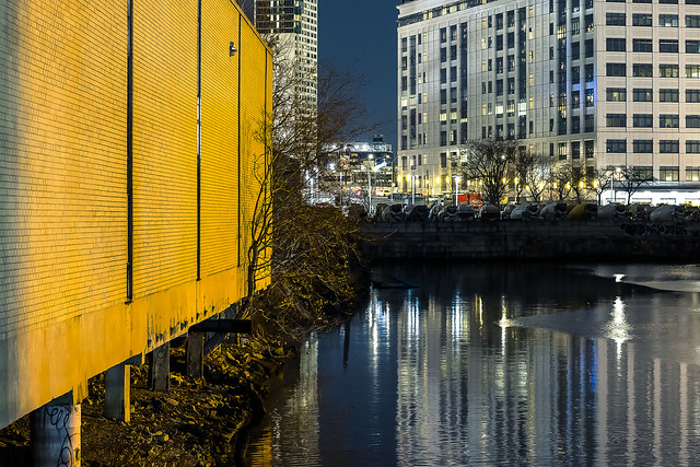
That’s 29th street, between 47th avenue and Hunters Point Avenue, in the Degnon Terminal section of Long Island City. Just beyond the chain link fence in the shot above is found the Dutch Kills tributary of Newtown Creek. Specifically, it’s the “turning basin” of Dutch Kills. If you look at an overhead map, this is the hammer head shaped area.
There’s been a slow moving shoreline collapse happening for about three years now. When the original collapse began, NYC DOT came out and inspected the roadway for signs of instability. They pronounced it safe for travel and traffic, three years ago. Subsequent collapses have not drawn them back out to take another look.

– photo by Mitch Waxman
Thanksgiving weekend of 2021, about 25-30 feet of land collapsed into the water, and just about the second week of 2022 the rest of it gave way. Now, this area was a wetland/swamp just over a hundred years ago and the land was “reclaimed” by a developer named Michael Degnon, hence the dub of “Degnon Terminal.”
The way they used to do this, back in the day, was to build out a network of timber box cells. These timber structure boxes, with piles driven into the water and muck, were then filled with rubble and fill which created dry land that they could build on. It’s that hundred year old timber which is giving way, allowing the contained fill to excavate into the water. Unfortunately, 29th street is sitting on top of this and the street itself has started to sag downwards.
As mentioned – nothing matters, and nobody cares. This, however, matters to me and I’m working on making “them” care.
– photo by Mitch Waxman
Nothing is natural here, it’s all built environment.
This land was once owned by a Governor of New York State – Roscoe P. Flowers. Gov. Flowers passed away in the late 19th century, and Degnon purchased the so called “waste meadows” of Long Island City from his estate shortly before the Pennsylvania Railroad announced that they would be developing the adjoining marsh and swamp land into the Sunnyside Yards.
Degnon was either incredibly lucky or he had the inside scoop, but either way that’s how the Degnon properties came to be and how they were “reclaimed” from the tidal wetlands of Dutch Kills. Dutch Kills was canalized, and at the end of the turning basin there used to be infrastructure that could load rail cars onto barges and vice versa. This connected to a series of tracks known as the Degnon Terminal Railway, which offered connections to the Pennsylvania Railroad tracks at Sunnyside Yards and to the nearby Long Island Railroad Lower Montauk tracks along Newtown Creek. When the PRR and LIRR assets became “nationalized” by Nelson Rockefeller in the late 1960’s and the MTA was created, the properties here in the Degnon Terminal were part of the property portfolio that the agency was thereby born with.

– photo by Mitch Waxman
29th street isn’t a proper NYC street, thereby. It’s a “railroad access road” which the NYC DOT surfaces and sets parking rules on, as well as deciding traffic patterns, and they get to erect signage over it. MTA/LIRR still owns the land below, and the bulkheads which touch the water. Thing is, this NYS land is regulated by another agency – the DEC, and NYC DOT, and the Army Corps, and the Coast Guard, and the EPA because of superfund and…
Calgon, take me away…
“follow” me on Twitter- @newtownpentacle
Buy a book!
“In the Shadows at Newtown Creek,” an 88 page softcover 8.5×11 magazine format photo book by Mitch Waxman, is now on sale at blurb.com for $30.


Brave trees! Thanks for making me look up “Calgon Take Me Away”.
dbarms8878
February 3, 2022 at 4:21 pm
Mitch, enjoyed this one particularly. That is my ancestral mance peeking above the gas station, and Mike Degnon was my father’s cousin. Glad you came back from Pittsburgh, but Im coincidently contemplating a move there myself. You can never go home again, particularly when there is an 80 story skyscraper where your house was.
gregwood4@yahoo.com
February 4, 2022 at 7:27 am