Archive for the ‘Dutch Kills’ Category
strange and brooding apprehensions
CREEK WEEK continues… for the first installment, from the mouth at the East River to the Pulaski Bridge, click here. For more on just the Pulaski Bridge, click here.

– photo by Mitch Waxman (from the Queens Museum of Art’s “Panorama of the City of New York”)
Moving a quarter mile eastward along the Queens bulkheads of the Newtown Creek from the Pulaski Bridge, the first tributary encountered by the intrepid urban explorer and photographer is a canalized horror called the Dutch Kills.
This branch of the Newtown Creek watershed is about an hour’s walk from Newtown Pentacle HQ, and its locale is visited or transited rather regularly by your humble narrator, as I perform the penitential exertions ordered by my physicians as the curative for certain extant health issues. All ‘effed up, my version of such wholesome activity requires the presence of the macabre, and some element of existential danger. Luckily- the Newtown Creek offers, to those who seek it, succor and salvation for a variety of desires.
Detailed postings, in and around the immediate neighborhood of the Dutch Kills waterway, include:
- Dutch Kills, or let the Photos do the Walking
- Long Island City Zen 2 -The Empty Corridor
- Weird Synchronicity
- After the Fire
- affordable housing development on Borden Avenue
- cry fowl, and let slip…
from wikipedia
Dutch Kills is a sub-division of the larger neighborhood of Long Island City in the New York City borough of Queens. It was a hamlet, named for its navigable tributary of Newtown Creek, that occupied what today is centrally Queensboro Plaza. Dutch Kills was an important road hub during the American Revolutionary War, and the site of a British Army garrison from 1776 to 1783. The area supported farms during the 19th Century, and finally consolidated in 1870 with the villages of Astoria, Ravenswood, Hunters Point, Middletown, Sunnyside and Bowery Bay to form Long Island City.

– photo by Mitch Waxman
Leaving the main course of the Newtown Creek, just .8 of a mile beyond its mouth, the first thing one encounters is a somewhat worse for wear railroad swing bridge- called the Long Island Railroad Bridge. Reports from “railfans” and “foamers” (and confirmed by the Coast Guard) state that the bridge hasn’t opened since 2002, which has orphaned the Dutch Kills from its parent waterway and cut the canal off from its intended usage. If my readings of old maps are correct (they often aren’t), these two tracks carry (or at least carried) rail traffic from either the Montauk Cutoff and Montauk Branch tracks, connecting the LIRR to the Sunnyside Yard and Wheelspur Yard with the tracks leading west to Hellsgate and east to Long Island. Notable former sights along this bank of the Newtown Creek would have been the City of New York’s Poultry Yard and the still extant Texas Oil Co.
For an extensive series of historical photos, discussion of the function and design of these tracks, and the industrial centers they once served- trainsarefun.com is the place to go. Special attention is called to this 1860 map of the area– which details the natural flow of the wetlands and shows the Dutch Kills as being a far larger body of water than it is today.
from Queens Borough, New York City, 1910-1920
During 1914 bulkhead lines were established by the United States Government for Dutch Kills Creek, a tributary of Newtown Creek, thus putting this stream under the jurisdiction of the War Department. The bulkhead lines as approved on October 29, 1914, give a width varying from 200 feet at its junction with Newtown Creek to 150 feet at the head of the stream, and include a large basin in the Degnon Terminal where car floats can be docked. The widths of the channel to be dredged under the appropriation of $510,000 mentioned previously, range from 160 feet at Newtown Creek to 75 feet at the turning basin. The Long Island Railroad plans to establish at this point a large wholesale public market, estimated to cost nearly $5,000,000.
Among the larger industrial plants in the Degnon Terminal served by this stream are : Loose Wiles Biscuit Company, American Ever Ready Works, White Motor Company, Sawyer Biscuit Company, Defender Manufacturing Company, Pittsburg Plate Glass Company, Marcus Ward, Brett Lithograph Company, Waldes, Inc., Norma Company of America, Manhattan-Rome Company, American Chicle Co. and The Palmolive Co.

– photo by Mitch Waxman
From Borden avenue, the second rail bridge is observed, which I believe to be the Montauk Cutoff track and a bascule type drawbridge. The canalized Dutch Kills, with its high bulkheads and rail connections, served as a water connection to NY Harbor for several heavy manufacturers in the area including F.A. Hunt, Holdtronics, New York Envelope, and American Chicle. The rail/dock complex, collectively, was known as the Degnon terminal. A short but sweet history of the Degnon Terminal can be accessed at members.trainweb.com. Michael Degnon was a master builder, one of the great men of the early 20th century in Queens, and is buried in Calvary Cemetery. Check out this nytimes.com article which discusses an expansion of his operations at the Dutch Kills in 1922 that brought floor space at his Degnon Terminal up to an astounding three million square feet.
from forgotten-ny.com
Michael Degnon was the contractor for the Steinway Tunnel, the first rail link to connect Manhattan and Queens, and also the contractor for the Sunnyside Yards. He decided to build his own railway, called Degnon Terminal, adjacent to the Sunnyside Yards and constructed large factories and warehouses complete with sidings facing the railroad tracks. This was attractive to his clients, since shipping goods via rail was now more accessible and less expensive for them. Some of the Terminal’s early clients were Sunshine Biscuit Company, Packard Automobile Company, American Ever Ready Company, and American Chicle Company. Of course, the rising cost of doing business in New York forced all of these companies to find other cities in which to manufacture. The sidings haven’t seen rail traffic since 1989, and the tracks are now either paved over or overgrown with weeds (some of which can be seen on FNY’s Disappearing Railroad Blues page). In its heyday, Degnon Terminal employed 16,000 workers.

– photo by Mitch Waxman
The currently “under construction” Borden Avenue Bridge allows vehicle and pedestrian traffic to cross the Dutch Kills. This is the point at which the water quality declines seriously, as the only fresh water entering its stagnant depths are combined sewer outputs (CSO’s) and runoff from the concretized industrial landscape surrounding it (which carry a stream of road salt, engine and exhaust residue, and whatever else might be on the road or sidewalk into the water every time it rains). The bridge recently celebrated its centennial, incidentally.
from the army corps of engineers, discussing precautions for the collecting, handling, and testing of Dutch Kills underwater sediments:
All individuals involved in handling contaminated sediment are required to use protective equipment and to submit to blood and urine tests. The protective equipment consists of:
from nyc.gov
As part of the construction of Borden Avenue in 1868, a wooden bridge was built over Dutch Kills. This bridge was later replaced by an iron swing bridge, which was removed in 1906. The current bridge was opened on March 25, 1908 at a cost of $157,606. The deck’s original design consisted of creosote-treated wood blocks, with two trolley tracks in the roadway. Character-defining features of this bridge include the stucco-clad operator’s house, four pairs of rails, and a rock-faced stone retaining wall. The gable-on-hip roof of the operator’s house retains the original clay tile at the upper part. Although alterations have been made, the bridge is a rare survivor of its type and retains sufficient period integrity to convey its historic design significance.
The Department of Transportation has identified a pocket of contaminated soil which has been classified as “contaminated non-hazardous”. As such, it poses no significant health risk to workers or the surrounding community. However, precautionary measures will be taken and every effort is being made to remove and dispose of the contamination quickly, yet safely, within all New York City and State guidelines. A Corrective Action Plan (CAP) for the removal and disposal of the contamination has been submitted to the NYS Department of Environmental Conservation (NYSDEC) for review and approval.

– photo by Mitch Waxman
Sewer construction projects along Hunters Point Avenue revealed that the swampy nature of western Queens is unchanged. These ground waters, as you might observe by the chalk markings on the pilings, would be some 13 feet beneath the streets. The vertical clearance of the nearby Hunters Point Avenue Bridge (and street grade) is approximately 15 feet over the water, so this would make sense.
Never forget, lords and ladies, that this Long Island City of ours is a swamp which was “reclaimed” by industrial means just within the last 150 years. The “ground” in most of the area is actually a sort of pier or dock, with timber pilings supporting cement clad fill. Just two stories down are the waters of the Newtown Creek and it’s tributaries, and this sort of subterrene terraforming is typical for most of the spongy land directly surrounding the Newtown Creek.
Who can guess, what poisons there are, laying in the mud waiting to hatch out?
from hydroqaul.com
Like a number of other local tributaries to New York Harbor, Newtown Creek is now simply a peripheral canal system fed by tides, CSO and stormwater discharges. None of its original freshwater creeks and extensive wetlands exist anymore, the whole area having been transformed into a series of canals by channelization, land reclamation (filling) and bulkheading. Biological abundance and diversity is impaired by reductions in the amount and variety of physical habitat, and by a vulnerability of the remaining habitat to retention and accumulation of pollutants. Although no scientific studies have been identified prior to 2001, it can be expected that biota of Newtown Creek reflect similar conditions in other highly impacted waterbodies around the harbor. Thus, a fouling community composed of epibenthic invertebrates such as barnacles and sea squirts should be present on pilings and bulkheads; a fairly homogenous community of benthic invertebrates dominated by tolerant forms of polychaete worms should be found in the sediments, and a typical assemblage of regionally indigenous fish such as striped bass, winter flounder, bay anchovy, Atlantic menhaden, snapper bluefish, sea robin and tautog may come and go as water levels and quality permit.

– photo by Mitch Waxman
The Hunter’s Point Avenue Bridge offers spectacular views of the Long Island Expressway with Brooklyn beyond, and from its walkway; the bulkheads marking the end of the Dutch Kills are visible. This is a dead zone, check out riverkeeper.org’s analysis of the waters here over a multiple year period. The foulness of these waters are part of the historical record, which an a New York Times article from March of 1871 proves, and the evidences of one’s own senses suggest.
from nyc.gov
The Hunters Point Bridge over Dutch Kills is situated between 27th Street and 30th Street in the Long Island City section of Queens, and is four blocks upstream of the Borden Avenue Bridge. It is a bascule bridge with a span of 21.8m. The general appearance of the bridge has been significantly changed since it was first opened in 1910. The bridge provides a channel with a horizontal clearance of 18.3m and a vertical clearance, in the closed position, of 2.4m at MHW and 4.0m at MLW. The bridge structure carries a two-lane, two-way vehicular roadway with sidewalks on either side. The roadway width is 11.0m, while the sidewalks are 1.8m wide. The width of the approach roadways vary from the width of the bridge roadway. The west approach and east approach roadways are 13.4m and 9.1m, respectively.
The first bridge at this site, a wooden structure, was replaced by an iron bridge in 1874. That bridge was permanently closed in 1907 due to movement of the west abutment, which prevented the draw from closing. It was replaced in 1910 by a double-leaf bascule bridge, designed by the Scherzer Rolling Lift Bridge Company. The bridge was rebuilt in the early 1980’s as a single-leaf bascule, incorporating the foundations of the previous bridge.

– photo by Mitch Waxman
At the end of the Dutch Kills, one finds a concrete company, and the former Degnon Terminal home of Sunshine Biscuits, which today serves as the “C’ building of the LaGuardia Community College campus (found between 29th and 30th streets and between 47th avenue and the intersection of Skillman and Thompson avenues). Additionally, the greater astoria historical society has posted a photo at smugmug that shows the rest of the scene in the shot above dating from 1966.
speaking of gahs, they have a short history of Sunshine Biscuit’s “thousand window factory” which can be accessed by clicking here

– photo by Mitch Waxman
A quick glance down at the banks of Dutch Kills reveal the true nature of things here, it is not uncommon to half glance at dead things floating by, suspended by their internal gases. At high tide on the East River, aquatic life often finds its way into the Newtown Creek and become entrapped in the oxygen deprived water. This provides ample food for thriving colonies of carnivorous worms and shore line scavengers- mainly river rats, the cats that prey on them, and various birds.
Few if any dogs have I observed down here, even where you’d expect them to be. Guard dogs are unemployed around these parts, and I’ve never seen a feral dog roaming around in all the time I spend scuttling around the area- but that’s probably because of all the trucks. I do know a fat old dog who’s chained to a fish butcher on 51st avenue, but she’s mainly interested in her sunny sidewalk and sleeping.
from nytimes.com
Hunters Point South, for its part, will have 5,000 homes built on 30 acres on the edge of the East River, near Newtown Creek. Three thousand of the homes will be set aside for families whose annual income totals $126,000 or less, with 800 of them destined specifically to families who earn less than $61,400 a year. There will also be 300 units built for low-income senior citizens and at least 225 units devoted to a middle-class homeownership program.
“We’re creating a model,” said Councilman Eric N. Gioia, whose district includes the area where the project will be built. “We’re creating housing where all New Yorkers can live together, in the same neighborhood.”

– photo by Mitch Waxman
At the end of Dutch Kills, near 47th avenue, illegal dumping seems to be a community passion. There is even a rusted out and derelict barge which seems to finally be sinking. As always, admonishment and advice for the urban explorer to ignore the temptation to climb out and take a look applies. The wet filth that lines the shore here stinks of sulphur compounds, and the smell of a sick aquarium permeates the breeze. This is also a HAZMAT zone, and nautical charts reveal that the water depth here is 13-15 feet, roughly a third deeper than it is in the channel. Don’t screw around back here, lords and ladies, you can get seriously hurt.
from nyc.gov, on the waterfront revitalization section of the Hunters Point South development plan
Policy 6.2: Direct public funding for flood prevention or erosion control measures to those locations where the investment will yield significant public benefit.
The proposed actions do not include public structural flood and erosion control projects. The central and eastern portion of Site A and much of Site B are within the 100-year floodplain.
The New York City Building Code (Title 27, Subchapter 4, Article 10) requires that residential buildings have a finished floor elevation (FFE) at or above the 100-year floodplain, while the Federal Emergency Management Agency (FEMA) requires the FFE to be one foot above the 100-year floodplain. In accordance with these regulations and as stated above, clean fill would be used to raise the development area, including the areas for new streets and buildings, as well as portions of the project sites designated for the waterfront park or other open space areas that would not be covered by impervious surface or structures. Raising the elevation of the project sites above the 100-year flood elevation would ensure protection of public health and safety, the new buildings and open space areas, public investment of city infrastructure, and enhancement of natural habitats. The proposed actions are consistent with this policy.

– photo by Mitch Waxman
On the Brooklyn side of the Newtown Creek is another tributary called Whale Creek (don’t worry, we’ll be going there soon enough), alongside which the magnificent Newtown Creek Wastewater Treatment Plant hums and belches methane in storied Greenpoint. This spot on 29th street, at the end of the Dutch Kills, is just under a half mile from the main channel.
A Newtown Pentacle posting from October of 2009 explored this Temple of Cloacina, which is a 24 hours a day municipal workhorse. The plant processes a significant percentage of the 1.1 billion gallons of sewage New York produces every day, delivering it in a milled and concentrated form to a pumping tank and dock in Greenpoint directly across the Creek from the forthcoming Hunters Point South development which is just starting on the Queens shoreline. In still another posting, we followed some sludge boats- the M/V Newtown Creek, North River, and the Red Hook, as they traveled past Hallet’s Cove and Astoria up the East River.
from nyc.gov
Dewatering reduces the liquid volume of sludge by about 90%. New York City operates dewatering facilities at eight of its 14 treatment plants. At these facilities, digested sludge is sent through large centrifuges that operate like the spin cycle of a washing machine. The force from the very fast spinning of the centrifuges separates most of the water from the solids in the sludge, creating a substance knows as biosolids. The water drawn from the spinning process is then returned to the head of the plant for reprocessing. Adding a substance called organic polymer improves the consistency of the “cake”, resulting in a firmer, more manageable product. The biosolids cake is approximately 25 to 27 percent solid material.

Hunters Point to Dutch Kills with Whale Creek on the left – photo by Mitch Waxman (from the Queens Museum of Art’s “Panorama of the City of New York”)
Creek Week continues… at this, your Newtown Pentacle. Prepare to penetrate into the darkness of the tomb legions, lords and ladies… as we move eastward.
highly visible
Broadway near Steinway Street – photo by Mitch Waxman
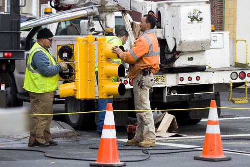
As your humble narrator scuttles from place to place, turning over rocks to see what blind albino abnormalities might lurk beneath, a significant amount of road construction is encountered. New York is always in a state of near collapse and an army of municipal and contractor labor is kept busy filling in the cracks. Conflicted over sneaking pictures of these folks, I nevertheless find them fascinating, for the high visibility colors they wear excite the eye.
from workzonesafety.org
Title: ANSI/ISEA 107-2004: Revised American National Standard for High-Visibility Safety Apparel and HeadwearAbstract: This standard provides a uniform, authoritative guide for the design, performance specifications, and use of high-visibility and reflective apparel including vests, jackets, bib/jumpsuit coveralls, trousers and harnesses. Garments that meet this standard can be worn 24 hours a day to provide users with a high level of conspicuity through the use of combined fluorescent and retroreflective materials. The revised version of the standard expands the product coverage to include high-visibility headwear. It also contains additional testing procedures for knitted fabrics used as background material, and eliminates tests from the previous edition that added no value. Publisher: International Safety Equipment Association

Third Avenue Manhattan – photo by Mitch Waxman
If it won’t blind or distract the crews, don’t forget that this is heavy industry and quite dangerous work, try turning on the camera flash when photographing them. The reflective fabrics, technically retroreflective fabrics (which function like a Cat’s eyeshine), will blaze up and be the brightest point in the photo. New York City street signs also function in a similar fashion, and even the weakest flash will light them up from blocks away. Try it, especially on a dark and stormy day, the effects are somewhat unpredictable and often produce a prismatic and surreal photo.
from simplifiedsafety.org
Class 1: needs to be conspicuous and use retroreflective materials not less than 25mm in width.
- Used when workers are well separated from traffic
- Vehicle speeds of less than 25 mph
- Parking attendants
- Shopping cart retrievers
- Warehouse workers
- Roadside/sidewalk maintenance workers
- Delivery vehicle drivers
Class 2: maintains superior visibility and are more conspicuous than the Class 1 garments. Minimum width of retroreflective material used on these is not less than 35mm.
- Used when workers are on or near roadways
- Vehicle speeds of 25 to 50 mph
- Roadway construction workers
- Utility workers
- Survey crews
- Law enforcement personnel
- Crossing guards
- High-volume parking lot or toll-gate attendants
- Airport baggage handlers and ground crews
- Railway workers
- Emergency response personnel
- Accident site investigators
Class 3: has greatest visibility. Maintains more retroreflective material than Class 2 and must have sleeves with retroreflective material between the shoulders and elbows. Not less than 50mm wide of retroreflective material.
- Used for workers in high risk situations
- Allows them to be seen from a minimum distance of 1,280 ft.
- Vehicle speeds of greater than 50 mph
- Roadway construction workers
- Utility workers
- Survey crews
- Emergency response personnel

31st street, Astoria – photo by Mitch Waxman
All of the municipal and construction rules are meant to conform to the national OSHA specifications, but individual city organizations have their own wrinkle on safety gear. MTA workers, for instance, are often observed wearing goggles and ear protection as they work. No doubt, this is due to individual union agreements and task specific requirements.
from nysdot.gov
All DOT employees, contractor employees and visitors must wear protective helmets and high visibility construction apparel while working within a highway right of way or contract limits. Flaggers must wear high visibility traffic control apparel when directing or spotting traffic. High-visibility apparel is not required for employees and visitors when they are within a completely enclosed cab constructed of steel frame and glass, or inside a motor vehicle.

37th avenue, Dutch Kills – photo by Mitch Waxman
NYFD, of course, has the most stringent series of rules for its crews. In the shot above, a 5 alarm fire at an industrial warehouse was belching black smoke into the street, but the firefighters are clearly identifiable through the murk- due to camera flash. Be careful around NYFD however, as they’re kind of busy people, and you don’t want to distract them. Also, should there be any piezoelectric activated equipment in use- DO NOT use your flash for fear of activating something.
from fasny.com
Back in November of 2008, there was a lot of confusion about the use of high-visibility vests at roadway incidents due to a new Federal Highway Administration (FHWA) Rule. The new regulation, Rule 634, stated that “All workers within the right-of-way of a Federal-aid highway who are exposed either to traffic (vehicles using the highway for purposes of travel) or to construction equipment within the work area shall wear high-visibility safety apparel.”
That regulation created a dilemma for fire departments who were truly interested in protecting their personnel. The training classes and material used by the Emergency Responder Safety Institute (ERSI) for years has suggested the use of high-visibility garments for public safety personnel when working around traffic. NFPA 1500, the Firefighter Health and Safety Standard has included a requirement for firefighters to wear safety vests at traffic incidents in the last two most recent editions. NIOSH Line of Duty Death Investigations have also included recommendations for responders to wear highly visible flagger vests when exposed to moving traffic. In the fire service community it was generally understood that the vests were not appropriate personal protective equipment (PPE) for personnel who were actively engaged in firefighting operations because those garments are not designed for exposure to fire, heat flame or hazardous materials. Rule 634, as originally published however did not outline any exemptions for firefighters engaged in direct firefighting operations and that created the dilemma.

Bridge Plaza North, Queens Plaza – photo by Mitch Waxman
The shot above is fascinating to me, for reasons that have little to do with the safety equipment exhibited. The trench that this trio is working in is down by Queens Plaza, and the cutaway shows a historical record. Notice the top layer of asphalt, then two distinct layers of cobblestones, then dirt and rock fill. Asphalt- modern, cobbles 1- the construction of the Queensboro bridge and associated roadways, cobbles 2- the pre bridge street, dirt and fill- that’s a 19th century, civil war era street. I’d love to have an archaeologist sift through this trench, but there’s nothing of historic importance in Queens… according to the City.
Note- the Charles Rudebaker wiki quote below… I’m a little squirrely on this particular wikipedia entry. The only info I could find on Rudebaker, a New Yorker who supposedly invented the Traffic Cone, parroted this exact wording all across the net. Take it with a grain of salt, until I can find out more. It very well might be a “false meme” which is a sort of “Lulz“.
from wikipedia
Traffic cones, also called road cones, highway cones, safety cones or construction cones, are usually cone-shaped markers that are placed on roads or footpaths to temporarily redirect traffic in a safe manner. They are often used to create separation or merge lanes during road construction projects or automobile accidents, although heavier, more permanent markers or signs are used if the diversion is to stay in place for a long period of time.
Traffic cones were invented in 1914 by Charles P. Rudebaker. Although originally made of concrete, today’s versions are more commonly brightly-coloured thermoplastic or rubber cones. Not all traffic cones are conical. Pillar shaped movable bollards fulfil a similar function.
cry fowl, and let slip…

– photo by Mitch Waxman
This threesome was observed recently, hanging around industrial Queens. Two males and a female, it seemed that they were up to no good, and didn’t have a reason for being in the neighborhood. There was nothing specific that drew my suspicions, let’s just call it instinct.
from wikipedia
The Mallard (Anas platyrhynchos), the best-known and most recognizable of all ducks, is a dabbling duck which breeds throughout the temperate and sub-tropical areas of North America, Europe, Asia, Africa, New Zealand (where it is currently the most common duck species), and Australia. It is strongly migratory in the northern parts of its breeding range, and winters farther south. For example, in North America it winters south to Mexico, but also regularly strays into Central America and the Caribbean between September and May.
The Mallard is the ancestor of all domestic ducks, except the few breeds derived from the unrelated Muscovy Duck (Cairinia moschata).

– photo by Mitch Waxman
When confronted and questioned, they claimed that coming here during the winter months is a family tradition. The place isn’t what it was in the time of their grandparents or great grandparents, they asserted, but nostalgia compels them to visit the area annually. Additionally, the subjects said that the place was once a paradise.
from birdguides.com
The Mallard is our commonest duck, the one you are most likely to be greeted by if you throw out food at your local park pond. Some Mallards have been domesticated and so you may also see Mallard-like hybrids showing bewildering colours from khaki brown to pure white. The displaying male Mallard shows his colours very clearly as well as the diagnostic curly black uppertail feathers. The female Mallard is the standard dabbling duck against which all the others should be compared. Mallard in flight can be told by their relatively large size, the contrastingly dark-chested appearance of the males and the fact that the white borders on either side of the dark blue speculum are both equally obvious.

– photo by Mitch Waxman
They alleged that just before the civil war, there were oysters, deer, and forests in the area- and their extended family would join them here for feasts and bacchanal.
from wikipedia
Ducks exploit a variety of food sources such as grasses, aquatic plants, fish, insects, small amphibians, worms, and small molluscs.
Diving ducks and sea ducks forage deep underwater. To be able to submerge more easily, the diving ducks are heavier than dabbling ducks, and therefore have more difficulty taking off to fly.
Dabbling ducks feed on the surface of water or on land, or as deep as they can reach by up-ending without completely submerging. Along the edge of the beak there is a comb-like structure called a pecten. This strains the water squirting from the side of the beak and traps any food. The pecten is also used to preen feathers.
A few specialized species such as the smew, goosander, and the mergansers are adapted to catch and swallow large fish.
The others have the characteristic wide flat beak designed for dredging-type jobs such as pulling up waterweed, pulling worms and small molluscs out of mud, searching for insect larvae, and bulk jobs such as holding and turning headfirst and swallowing a squirming frog. To avoid injury when digging into sediment it has no cere. but the nostrils come out through hard horn.

– photo by Mitch Waxman
But, their story doesn’t feel right, they were up to something. Call it a hunch, but I don’t trust those ducks at Dutch Kills. Not the first time that a duck has been involved with trouble around these parts.
from the annals of Newtown
The barn of Thomas Woodward, a worthy inhabitant, who lived where Mr. Victor now does, in Newtown village, was used by the enemy as a hospital for the sick soldiery. On a winter’s night Mr. Woodward was aroused by a noise among his ducks, at the rear of the house. Opening the back door, he could see no one, for the night was foggy. He however discharged his gun at a venture, expecting only to frighten the intruder, but the next morning a soldier was found dead a short distance from the house, with a duck under his coat. The soldiers were so exasperated at Woodward, that he continued to be in great fear for his life. It has been said that he was not called to account for this deed, but from the nature of the act, and the wrath excited, such an omission would have been extraordinary. Besides, I find him arraigned “a prisoner” before a court-martial, April 26th, 1782, though unfortunately the offence is not stated. He was favored in this case by the intercession of Serj. Major B. Rathbone, of the grenadiers, who had quartered at his house.
Linkapalooza

– photo by Mitch Waxman
Conspiring against the timely posting of these missives, confluences of external forces have rendered me somewhat inert for the last couple of days. Time Warner Cable, whose reliability is best compared to some third world provider of rolling blackouts and occasional electrification, knocked out my service wednesday night during my usual “blog time”. Frustrated, as it was network not node that had malfunctioned, I scuttled off to bed. Assuring myself that I’d finish up the post thursday, I discovered that WordPress had gone dark. Wordpress is, of course, the blogging service and software suite that delivers Newtown Pentacle and 9.2 million other blogs to the interwebs on a daily basis.
The vehicle in the image above is an “Astoria Express” school bus, a Bluebird TC/2000, incidentally. It’s one of the many heavy vehicles whizzing around us, half noticed, all the time.
from wikipedia
In 1948, the Blue Bird All American was the first transit-style school bus to be popularized by an East Coast manufacturer. California-based manufacturers Crown, Gillig and Seattle-based Kenworth-Pacific had introduced transit-style school buses long before Blue Bird; while these were marketed outside the West Coast, they did not achieve a national following. With the All American’s design, Blue Bird had chosen a path of slow evolution.
By 1987, the version of the All American on the market was almost 40 years old and Blue Bird was looking for an updated design to sell for a lower price (to attract large fleet orders) without cutting too many corners on quality. The TC/2000 was introduced for 1988 using essentially the same exterior design as the All American with minor changes to lower production costs. Most of these design changes were visible on the front. The All American’s massive amount of chrome trim was pared down to a bare minimum, and four headlights were replaced with two. Inside, the All American’s side control panel was retained, but the wood-panel dashboard was replaced with a simpler black fiberboard design clustered closer to the driver (who was greeted with a smaller steering wheel). As the TC/2000 was focused on being a no-frills design, hydraulic brakes and a gasoline engine were standard specifications, but most were ordered with diesel engines and some were ordered with air brakes. Seating capacity ranged from 54 to 90 students in the FE and 66 to 84 in the RE (introduced in 1991).

– photo by Mitch Waxman
I’ve been noticing a lot of traffic accidents lately, minor impacts and benders of fenders. This one in Dutch Kills is fairly typical, a gypsy cab hits a non union contractors van, no one is hurt and damage is cosmetic. Nothing will get reported, a couple of bucks will change hands, and its done. One lane and local in nature, one wonders how this scene will play out in 10 years when Dutch Kills has been reborn as a little Manhattan. Clicking through to the link below will open a FEIS pdf from nyc.gov discussing the anticipated environmental effects of adding 35,000 apartments, 9 hotels (6-12 stories), and adding another major transportation hub (at Queens Blvd. and Skillman Avenue) to the Great Machine.
from nyc.gov
SUBAREA C, ADJACENT TO 36th AVENUE
As shown in Figure 9-8, the streetscape in Subarea C is marked by trees and street furniture that enhance the pedestrian experience of the streets surrounding the subway stop at 31st Street and 36th Avenue. Further, mixed-use buildings that feature restaurants and neighborhood business establishments at ground floor, line 37th Avenue, and reinforce the pedestrian friendly character of this Subarea.
The traffic volume and pattern here can best be described as a busy but relatively uncongested two-lanes of traffic found on rectangular grid streets typical of the Dutch Kills neighborhood. Street parking is readily available to the businesses that line 36th Avenue, as well as 31st Street located under the elevated subway structure. Although the prevailing streetwalls in this area are not overbearing, few opportunities for views outside the Subarea are available, largely due to the elevated subway platform along 31st Street as shown in Figure 9-8.
In its entirety, Subarea C serves as a commercial and transportation hub of the larger neighborhood marked by significant pedestrian traffic. A diverse mixed-use sector, this Subarea serves as a highlight of the Dutch Kills neighborhood with an inviting and lively street presence that is aged but well maintained.

– photo by Mitch Waxman
Despite the cheery demeanor your humble narrator is distinguished by and reknowned for, the dirge of February darkness continues. This Mack Truck (a Brooklyn born company) pictured above is at the DOT yard found along the Newtown Creek on the Brooklyn side of the Pulaski Bridge. An unremarkable brute, it is nevertheless one of the motive engines that keep New York from collapsing into the seas or bursting into flame. DOT isn’t the “sexiest” service job in the city- that’s Sludge Boat Captain– but they do have some of the coolest gear.
Having no connections to the DOT, however, are recent revelations of extensive concentrations of perchloroethylene in the ground further down the creek near Bushwick- as reported by Andy Campbell in the Brooklyn Paper.
from wikipedia
- 1890: John M. Mack gets a job at Fallesen & Berry, a carriage and wagon company in Brooklyn, New York.
- 1893: Mack and his brother, Augustus F. Mack, buy the company John worked for.
- 1894: A third Mack brother, William C. Mack, joins his brothers in the company’s operations. The Macks try working with steam powered and electric motor cars.
- 1900s: Inspired by Orville and Wilbur Wright, Willis Carrier and Henry Ford’s inventions, John Mack has a vision, dreaming about producing heavy duty trucks and engines.
- 1900: The Macks open their first bus manufacturing plant. The Mack bus, ordered by a sightseeing company, is delivered.
- 1902: The Mack Brothers Company established in New York.
- 1904: The company introduces the name Manhattan on its products.
- 1905: Allentown selected as the home of main manufacturing operations, and headquarters. A fourth Mack brother, Joseph Mack, becomes a stockholder. Mack begins to make rail cars and locomotives.
- 1910: The Manhattan name changed; from now on, the trucks are known as Mack Trucks. Charles Mack, a fifth Mack brother, joins the company.

– photo by Mitch Waxman
There are so many different kinds of trucks in these parts, have you ever noticed the variety? These particular specimens are craft service trucks, mobile kitchens that serve surprisingly sophisticated food at television and film shoots all over the city. This well appointed set of comestible wagons can be found in their off time along the Dutch Kills extant of the Newtown Creek- which is right behind that concrete barrier that the snow is piled against. One wonders if the Clooneys or Jolies of the world know that these gourmet kitchens spend their off time along Newtown Creek. Welcome to Queens.
Speaking of Newtown and Queens- this Sunday, the Newtown Historical Society (which I am a member of) will be doing a presentation at the First Presbyterian Church of Newtown and providing a sort of craft service- slices of Pippin. Following text with contact info and schedule quoted from newtownhistorical.org
(February 12, 2010) The Newtown Historical Society will be presenting a free lecture and slideshow about the historic Newtown Pippin apple at the First Presbyterian Church of Newtown located at Queens Blvd & 54th Avenue in Elmhurst, on Sunday, February 21st, 2010 at 12:30pm.
The venue was the site of a planting in 2002 which brought the apple back to its area of origin for the first time since the early 19th century. The presentation will explain the history of the apple in Queens and the new replanting project that has been underway for the past year. Speakers will include Bob Singleton, Vice President of the Greater Astoria Historical Society, Erik Baard, Co-founder of the Newtown Pippin Project, and Marjorie Melikian, Historian for the First Presbyterian Church of Newtown. Council Member James Gennaro’s 2009 resolution calling for recognition of the Newtown Pippin as the official apple of the City of New York will also be discussed and samples of the apples will be available for tasting. For more information, please call the Newtown Historical Society at 718-366-3715 or e-mail newtownhistory@gmail.com.
from wikipedia
In the mid-1960’s, Crafts Service Employees still operated as general laborers. They had also became in charge of answering the telephone and making coffee. At Universal Studios, they had huge roll-around carts where they would brew coffee. These carts could be shut during takes so that the bubbling machines wouldn’t spoil a sound take. There was a dish where you could throw a quarter for your coffee at Universal, not at other studios. Eventually, the laborers added doughnuts as a revenue stream, but often had to interrupt the display to dig a trench for dolly tracks or clean up after animals.
In European union film studios, buffets would be set out in lieu of a lunch break, so as not to disrupt the momentum of the day. At four-thirty in the afternoon, the crew would vote on whether they should continue working on overtime, or wrap for the day. As low-budget and non-union filmmaking took hold in the USA, production companies would provide day-long buffet spreads to make up for long hours and lower wages.
As crews migrated to union films and studios, they came to expect these “spreads,” so laborers got a budget and laid out tables overflowing with Ritz Crackers, spray-on cheese, tanks of Dinty Moore Chili, peanut butter, Slim Jims, Ding Dongs and bottles of YooHoo. Much of this was disastrous to expensive wardrobe, and as the day wore on and on, the pickin’s became slim, and the “cut it yourself” salami quite slimey.
Stars, checking out these layouts were appalled at the quality and demanded better stuff. It also became a tradition for Crafts Service to set out a special treat in the afternoon, rumaki, cheese and turkey wraps, sliced cold cuts with your choice of breads.
Occasionally there are two craft service stations, with one being for cast and crew and another for non-union background actors. The food provided can vary widely with pilots often offering very limited food, while big budget shows often offer generous food and drinks.

– photo by Mitch Waxman
Another event to put on your calendars is the DOT presentation of potential replacements for the Kosciuszko Bridge. I missed the meeting last night in Middle Village, but will be attending the meeting at St. Cecilia’s in Greenpoint on February 24th. The timesnewsweekly.com site offers a description and CGI renderings of the massive process that’s about to begin, with reportage by Robert Pozarycki. This is going to affect the entire Newtown Pentacle, and its time to get involved, lords and ladies. Change is arriving at the Newtown Creek.
Pictured above are the refrigerated trucks of an online grocer, well known in the community, coming and going from their loading docks on the occluded and vestigial 53rd avenue along the Newtown Creek here in Queens.
from wikipedia
FreshDirect uses SAP AG software to process thousands of orders placed on its website every night. Orders are dispatched to the kitchen, bakery, deli as well as fresh storage rooms, produce ripening rooms and production areas within the company’s refrigerated facility. All order components are custom-cut, packaged, weighed and priced. In the case of dry goods or frozen foods, items are picked from storage before being placed inside bins that travel along conveyors to the sorting area. There, products in a customer’s order are scanned and gathered in corrugated fiberboard boxes. The boxes are labeled, recorded and loaded into refrigerated delivery trucks.
FreshDirect is based in a 300,000-square-foot (28,000 m2) building in Long Island City and is one of the largest employers in the area. Though the website and plant processes were in development for several years before its public launch, the company made its first deliveries to Roosevelt Island on July 11, 2002. FreshDirect has since expanded service to Manhattan, Brooklyn, Queens, the The Bronx and parts of Nassau County, Westchester County and New Jersey. The company now has almost 2,000 employees, 250,000 customers, and has delivered more than 6,000,000 orders.
affordable housing development on Borden Avenue

– photo by Mitch Waxman
Let me state outright, and at the very start of this post- that the individual discussed here surely must be the toughest person in Queens. The indomitable “life will not beat me, no matter what” spirit of setting up housekeeping in this particular locale signals an iron resolve. This is the Borden Avenue Bridge, entering its second year of emergency construction, spanning the malefic waters of the Dutch Kills– a tributary of the Newtown Creek.
from wikipedia
Dutch Kills is a sub-division of the larger neighborhood of Long Island City in the New York City borough of Queens. It was a hamlet, named for its navigable tributary of Newtown Creek, that occupied what today is centrally Queensboro Plaza. Dutch Kills was an important road hub during the American Revolutionary War, and the site of a British Army garrison from 1776 to 1783. The area supported farms during the 19th Century, and finally consolidated in 1870 with the villages of Astoria, Ravenswood, Hunters Point, Middletown, Sunnyside and Bowery Bay to form Long Island City.

– photo by Mitch Waxman
Observation over time, for this shack or shanty had been established in the first weeks of construction some 14 months ago, has revealed this fellow (I’ve only seen one man emerge from it, perhaps there are others- I can’t say) to be a “crow”. As explained in the past, the nascent recycling industries along the Newtown Creek purchase scrap metals by the pound, and a street level economy subsists on castaway steel, iron, and copper items scavenged from the surrounding industrial and residential trash. There is a small army of these metal collectors, whose blackened and soiled garments have garnered the nomen “Crows” to themselves. Some are driven by need or malice to steal, and lamp posts stripped of access doors and internal copper wire are a common sight around the area. Reports from area cemeteries also point to this population for the identity of vandals who remove the white bronze and copper ornamentation from their grounds.
from the DOT website on the history of the Borden Avenue Bridge, which spans Dutch Kills.
Borden Avenue is a two-lane local City street in Queens. Borden Avenue runs east-west extending from Second Street at the East River to Greenpoint Avenue. The Borden Avenue Bridge over Dutch Kills is located just south of the Long Island Expressway between 27th Street and Review Avenue in the Sunnyside section of Queens. Borden Avenue Bridge is a retractile type moveable bridge. The general appearance of the bridge remains the same as when it was first opened in 1908. The bridge structure carries a two-lane two-way vehicular roadway with sidewalks on either side. The roadway width is 10.5m and the sidewalks are 2.0 m. The west approach and east approach roadways, which are wider than the bridge roadway, are 15.3m and 13.0m respectively. The bridge provides a horizontal clearance of 14.9m and a vertical clearance in the closed position of 1.2m at MHW and 2.7m at MLW.
As part of the construction of Borden Avenue in 1868, a wooden bridge was built over Dutch Kills. This bridge was later replaced by an iron swing bridge, which was removed in 1906. The current bridge was opened on March 25, 1908 at a cost of $157,606. The deck’s original design consisted of creosote-treated wood blocks, with two trolley tracks in the roadway. Character-defining features of this bridge include the stucco-clad operator’s house, four pairs of rails, and a rock-faced stone retaining wall. The gable-on-hip roof of the operator’s house retains the original clay tile at the upper part. Although alterations have been made, the bridge is a rare survivor of its type and retains sufficient period integrity to convey its historic design significance.
The bridge will be closed for construction through July 2009. In addition, there will be parking restrictions in the vicinity of the bridge from January through July 2009 at all times from 25th Street to 30th Place between Borden Avenue and Hunter’s Point/49th Avenue and from 50th Avenue to 51st Avenue between 27th Street and 25th Street.

– photo by Mitch Waxman
As mentioned, the Crow who has set up housekeeping here surely must have a strong and robust physical constitution. The Dutch Kills is one of the darkest parts of the story of the Newtown Creek, a stagnant and poison patch of murky water which exhibits open sewers. The smell of the Dutch Kills in summer, reminiscent of an aquatic reptile tank in need of a water change, is best described by using the analogy of a rotting Ham sandwich. These are nearly the head waters of the Dutch Kills- located at the end of the “empty corridor“, quite near its junction with the noisome Newtown Creek, but is hardly the worst part of it. Penetrating further back to Hunters Point Avenue and all the way to its ending at 47th avenue and 29th street, near the Degnon Terminal, one experiences the olfactory ragnarok in full (I’ll be taking us back there in a post or two, by the way).
also from the DOT website:
The New York City Department of Transportation is performing emergency repair work on the Borden Avenue Bridge. Contract work commenced in January 2009.
During the initial phase of construction, additional areas of structural deterioration in the bridge abutment were identified which required an expansion of the original contract scope of work. The expanded scope of work required excavation in areas that were previously expected to remain undisturbed.
During the excavation of one of these areas, a pocket of contaminated soil was identified. The contamination was analyzed by an accredited testing laboratory and classified as “contaminated non-hazardous”. As such, it poses no significant health risk to workers or the surrounding community. However, precautionary measures will be taken and every effort is being made to remove and dispose of the contamination quickly, yet safely, within all New York City and State guidelines. The history and nature of the industrial community surrounding the bridge revealed that one or more of the previous users of the industrial waterway is the source of the contamination.

– photo by Mitch Waxman
On the plus side, however, someone has already “homesteaded” this up and coming area. Urban pioneers such as this Crow were the ones who established Williamsburg and DUMBO as residential centers, with shanty villages in the 1980’s. The views in the neighborhood are fantastic, with panoramic city skylines and the noble Empire State Building looming over Borden Avenue. Also, views of area bridges, like the Queens Midtown Expressway elevated section of the LIE directly overhead are spectacular. That’s why this neighborhood, ripe for residential development, is called DULIE (Down Under the Long Island Expressway) around Newtown Pentacle HQ.
from nydailynews.com
THE REOPENING of a Long Island City bridge that was closed for emergency repairs is now being pushed back because of toxic sludge found in the soil around the structure.
The century-old Borden Ave. Bridge, which handled nearly 16,000 vehicles a day before it was shut down, was abruptly closed on Dec. 31 because of structural problems.

– photo by Mitch Waxman
To the north, a spectacular fire recently erased a century old abandoned factory, and the ongoing saga of the Borden Avenue Bridge reconstruction has already cleared away the strip club on the corner- as well as several other area businesses which have somehow survived in this lonely corner of Queens for decades. Borden Avenue begins in Long Island City near Hunters Point, and is a local viaduct carrying vehicle traffic toward Greenpoint Avenue where a cloverleaf of onramps presents the option to entrance either the BQE or LIE which provide southern egress to Brooklyn, and all points east.
from nytimes.com
“Even though it’s not the prettiest bridge, people find beauty in it,” said Sam Schwartz, a transportation consultant and the president of the city’s Bridge Centennial Commission, a nonprofit group whose mission is to celebrate six New York bridges that are about a century old. He described the bridge’s retractile feature as “very elegant.”
The Borden Avenue Bridge has not displayed its elegance much lately, however. Commercial marine traffic along Dutch Kills is highly diminished; the bridge last opened for a passing vessel in 2005.
The Transportation Department estimated the cost to stabilize the abutment at $14 million, or, if the wall had to be rebuilt, at $37 million.

– photo by Mitch Waxman
The vast majority of the population in this section of Queens- bordering Blissville, Tower Town at Hunters Point, and Laurel Hill- are “just passing through” on the elevated highway some 10 stories above the putrefaction of the Dutch Kills. The blighting effect of the Borden Avenue Bridge reconstruction has had no small effect on area businesses, which are dependent on trade from passing trucks and cars seeking a shortcut from the Midtown Tunnel traffic flowing out of Manhattan nearby the Pulaski Bridge. It has also created a barrier between the Hunters Point neighborhood and the vastness of Queens. Such disruptive traffic flow would have been anathema to the builder of the Bridge, Edward Byrne.
from wikipedia
Edward Byrne began his civil engineering career in 1886 with the New York City Aqueduct Commission on the construction of the Croton Water Supply System. It is of interest that on this project he met Robert Ridgway, who also was destined to become a distinguished engineer and an outstanding civil servant.
From 1889 to the close of 1897, Byrne worked on highways and bridges for the old Department of Public Works of New York City.
On January 1, 1898, he joined the Department of Bridges and began a striking and noteworthy service which ended in November, 1933, with his resignation from the position of Chief Engineer of the Department of Plant and Structures (the successor of the Bridge Department), in order to assume the duties of Chief Engineer of the Triborough Bridge. His thirty-six years of service in the Department of Bridges, and its successor, the Department of Plant and Structures, may be divided into two periods.
1898-1911
During this period, he was in charge of bridge construction and maintenance, supervizing the construction of the Willis Avenue Bridge over the Harlem River, the Vernon Avenue Bridge, the Borden Avenue and Hunters Point Bridges over Dutch Kills, and the old bridge over Flushing River.


