Archive for the ‘DUKBO’ Category
poised on
Happy Earth Day, from the Poison Cauldron in DUKBO.

– photo by Mitch Waxman
Last week, a humble narrator found himself in Greenpoint over in Brooklyn. One was scuttling along a proscribed route whose intention and path was built around a walking tour conducted for a private group. Given the enormous construction project underway in the area, the NYS DOT’s construction of a replacement for the 1939 vintage Kosciuszko Bridge which carries the Brooklyn Queens Expressway over Newtown Creek, there is little certainty that just because you can move from “point A to point B” via one street or another on one day you can do it on another due to street closures and ongoing construction. From a vehicular POV, it’s actually a bit of a challenge to negotiate the streets hereabouts – there’s detours and so on – but from a pedestrian’s perspective, it’s a real bugbear as you find yourself dodging heavy trucks and moving through an enormous cloud of airborne dust and particulates in this area which are less than desirable to breathe in.
This is the area I describe as “The Poison Cauldron of the Newtown Creek” after all.

– photo by Mitch Waxman
I just got invited to attend a tour of the actual construction site with the DOT show runners next week, so for today I’ll abstain from making a full progress report as by next week I’ll have heard it directly “from the horse’s mouth” and I’ll have shots from within the fence lines to show you.
Saying that, observationally, the project continues to move along at a fast rate, and the roadways of the new bridge are stretching towards the turgid waters of the Newtown Creek.

– photo by Mitch Waxman
For the curious, one would like to reiterate that whereas this area is a photographic wonderland, I cannot describe how dangerous it is and that it’s really best for you to avoid the area for a number of environmental and safety reasons. A humble narrator has received multiple hours of “safety training” from various industrial giants along the Creek (requirements for stepping on several sites around the waterway include a mandatory “union” safety course) and I’m versed in the mores and methods of how to move about safely when the sort of equipment you see above is passing by.
There’s a reason I call it “the Poison Cauldron.” This area in Brooklyn’s DUKBO hosts a startling number of waste transfer stations, and all of that airborne particulate mentioned above is literally just hanging in the air.
“follow” me on Twitter- @newtownpentacle
Walking Tour – Saturday, April 23rd, 2016 –
First Calvary Cemetery Walk.
Join Newtown Creek Alliance historian Mitch Waxman at First Calvary Cemetery, found in LIC’s Blissville neighborhood along Newtown Creek. Attendance limited to 15 people.
Click here for more info and ticketing.
catenary connections
Just one more from the Creeklands, in today’s post.

– photo by Mitch Waxman
Last weekend, a humble narrator somehow found himself up in Ridgewood on Fairview Avenue off Linden and it was decided that I’d walk home to Astoria since it was a fairly nice afternoon. It’s literally “all downhill,” after all, and not that far. My path carried me down off of the proverbial “ridge” for which the community is named, and down through the valley of tears which the loquacious Newtown Creek flows through.
Once again, my path found me in West Maspeth (or Berlin). Topography is something I notice continually as I wander around Queens, and the area around Newtown Creek is shaped like a sort of soup bowl. Proper Maspeth, as in the Mount Olivette Cemetery area along Grand Avenue, is embedded into the terminal moraine of Long Island – true rock. All of LIC, Astoria – pretty much anything west of the high point in Maspeth, is sitting on a giant pile of glacial till which is supported on the back of a giant underground Boulder called a craton.
Ridgewood literally sits on a rocky ridge which leads north/east to the Maspeth Plateau. Seriously. The British mapped it all out during the Revolutionary war.

– photo by Mitch Waxman
Having a couple of hours of light left before the vampires began to awaken, I decided to wander around a bit after turning up on 48th street. “Up” is apt, as you are climbing away from one of the lowest points in all of New York City which is nearby Maspeth Creek on 49th street. 48th street continues to rise until it meets the Long Island Expressway near Third Calvary Cemetery and crests at Queens Blvd. in Sunnyside (which is built on another elevation, but an elluvial one).
The best way I can describe the up and down nature of the hills leading from Ridgewood to Astoria would be ripples in stone rather than water with Newtown Creek at the center. There’s a conflicting set of ripples leading away from the East River and Bowery Bay which apparent in Ravenswood/Dutch Kills and Astoria, respectively. Hunters Point is flat as a pancake.

– photo by Mitch Waxman
Turning onto 55th avenue, carven into what was once known as “Berlin Hill,” this little house was encountered at 46th street. Before you ask, I have no idea what’s up with the office chair tied to the pole. There are just some things you don’t want to inquire into too deeply. It always amazed me – here in the middle of what can only be described as a “post industrial and apocalyptic” landscape defined by cemeteries and highways and a nearby superfund site – here – people actually live here. Funny thing is, it used to be worse, when the acid factory was still up and running a couple of blocks away.
The people who live here must… have to be some of the most resilient folks on the earth.

– photo by Mitch Waxman
This is DUKBO – Down Under the Kosciuszko Bridge Onramp. A couple of hundred thousand vehicle trips a day rumble through here on the highway alone. There’s heavy trucking businesses, like UPS, and other huge warehouse operations that are busily at work here twenty four hours a day, and there’s nearby freight rail tracks operating at street grade. Enormous fleets of concrete trucks are based here, and the number of light trucks and automobiles that roll through the local streets are uncountable.
And people live here.

– photo by Mitch Waxman
44th street near 54th road, and a line of 20th century row homes which are spectacularly well kept. Acros the street is a yard hosting tower cranes, and a block away is the LIE interchange ramp with the BQE. This is about midpoint on Berlin Hill, and 44th street used to called Locust Street hereabouts.
Locust continued north back then, heading for Sunnyside, before the “House of Moses” first landed on the neighborhood back in the 1930’s. Moses kept coming back to this neighborhood, smashing his roads and bridges into it, until the early 70’s.

– photo by Mitch Waxman
The border between Newtown and Long Island City was just a block away – the Kosciuszko Bridge sits atop it. On the LIC side is Laurel Hill (Calvary Cemetery) in Blissville.
This section of West Maspeth was formally part of Newtown (prior to NY City consolidation) – the municipal entity which had evolved from Dutch colonial to British and later American governance. Newtown county was once enormous and contained a good chunk of what is now Nassau County, but in the context of which I’m speaking – it’s the municipality which was centered in Elmhurst near the intersection of Queens Blvd. and Broadway.

– photo by Mitch Waxman
The first time I wandered through this area, many years ago, I had a very odd conversation with a very skinny and somewhat disheveled fellow standing in front of the home on the corner of 44th and the Queens Midtown Expwy. service road that is pictured above.
He insisted that “he knew that I knew that he knew that I know, and that he knew things which I didn’t know nor could I understand what he knew, but he knew that I knew that he knew and he was ok with that.” I thanked him and moved on, after affirming that he didn’t want me to take his picture.

– photo by Mitch Waxman
The high point of this hill/ripple once called “Berlin” is up on 46th street. As a point of interest, there is no 45th street found between 44th and 46th hereabouts – no doubt to confuse invaders.
As opined endlessly in prior posts, the DOB records for western Queens are spotty, but as far as I’ve been able to determine – the house pictured above and below on 54th avenue dates back to 1915.

– photo by Mitch Waxman
On other rambles through this section, kid’s bicycles and toys have been noticed on both porch and staircase. Not sure if it’s still occupied, but there’s a car parked in the driveway on the other side of this home. Notice how there are no side windows? It’s the last survivor of a series of old row houses – a type of working man’s quarters which folks from New Orleans might call a “shotgun.”

– photo by Mitch Waxman
Passing under the Kosciuszko Bridge, via “used to be 43rd street” I made my way towards 43rd street and headed back to Astoria.
Next week – something completely different!
“follow” me on Twitter- @newtownpentacle
trammeled less
A bit of the Newtown Creek which I’ve oddly enough never shown you – in today’s post.

– photo by Mitch Waxman
There’s a bunch of streets around the Newtown Creek which are cul-de-sacs, as in there’s only only way in and one way out. One of these cul-de-sacs in Queens is just beyond “Deadman’s Curve” in industrial Maspeth, on the LIRR Lower Montauk Branch tracks, which these days are freight only. The street is either called 57th Avenue or Galasso Place, and I’m not entirely sure if it’s a private or public way. The property to the south, I’ve always been told, belongs to the Galasso Trucking people, but I can’t pronounce that for certain.
If I was trespassing, I can’t say or not.

– photo by Mitch Waxman
There’s a rail spur that leads off of the Montauk Line on the rail bed, and the roadway to the north – Rust Street – follows the ancient property line of the LIRR tracks. I always say that when you find a street that exhibits a long arcing curve, you’ve found a relict of the locomotive city.
The 20th century “automotive city’s” streets follow straight lines, the 19th century’s “locomotive city’s” are all parabolas.

– photo by Mitch Waxman
This is looking back to the west where you can see the old spur leaving the main Lower Montauk tracks. That’s the end of “Deadman’s Curve” you’re looking at. It’s called that because of “The Berlinville Railway Disaster,” and because laborers at Phelps Dodge used to run across the tracks here, and once upon a time, this was a VERY busy rail center that saw long freight trains moving back and forth between Long Island City and points east.
Lots and lots of people got killed during the dash across the tracks, but they were willing to take their chances rather than clock in a minute late and lose an entire hour of pay.

– fire insurance map from Belcher Hyde “Newtown, 1916”
As you can see in the 1916 map above, which is a fire insurance map, the shoreline of this area was VERY different a century ago than it is today, and the only thing which hasn’t changed one little bit is the pathway of the Lower Montauk Branch tracks. There’s nowhere near the number of rail spurs there used to be of course, but then again there’s nowhere even close to the amount of industry present that there was back then.
Modern day 57th avenue corresponds to “Creek Street (Hanover Avenue)” and these shots were gathered in the region which once hosted the now demapped Berlin Avenue back to Munich Street. That’s the 19th century street grid you’re looking at, lords and ladies, before the United States Army Corps of Engineers did their thing to the shorelines and bulkheads of Newtown Creek during the First World War.

– photo by Mitch Waxman
Just beyond the property between the 57th avenue and the water is Newtown Creek’s intersection with its tributary Maspeth Creek. I couldn’t resist focusing in on this banged up construction equipment, incidentally. It’s a weakness of mine, can’t resist this sort of thing.

– photo by Mitch Waxman
There were a few pieces of such heavy equipment laying around back here, all exhibiting broken windows. This is one of the most out of the way and remote spots in Western Queens… can’t imagine somebody coming here to just vandalize the odd machine, it’s weird.

– photo by Mitch Waxman
There was quite a bit of construction debris in the area visible from the road.

– photo by Mitch Waxman
This is the spot at which I might have stepped off the public way, or not? 57th avenue had a bit of sewer work going on at the unfinished and unpaved end, which terminated at a barbed wire fence. It seemed as if this fenceline was the western side of the plot occupied by a plumbing supply company which borders most of the length of Maspeth Creek whose street entrance is found on 49th street, but I could be wrong.

– photo by Mitch Waxman
The rail spur actually had a chain link fence built over it, which was kind of interesting for a couple of reasons. Partially, it was because the rest of the fence is pretty much gone.

– photo by Mitch Waxman
If I’m reading the old maps correctly, this entire area – about half of the length of 57th avenue – is the former footprint of National Enameling and Stamping company, as you’ll notice in the map above. There was all sorts of nasty happening along this stretch a century back, including a phosphates works.
For those of you not in the know, a phosphate mill was in the fertilizer and gunpowder business, and in the business of mining nitrogen out of manure and animal carcasses. It was considered a “low” profession, as the workers in this sort of industry picked up a horrible stink from particulates that became embedded into their skin, and you couldn’t bathe it out nor perfume it away.
A lot of Union supporters found their jobs at more attractive industrial occupations dry up after they announced their intentions to organize, and phosphate mills ended up being their only option. They were called “stinkers,” and weren’t allowed into saloons or church due to the reek. Nobody would want to associate with them, lest they share their fate.

– photo by Mitch Waxman
Now, as to the reason why you don’t see many posts from a humble narrator exploring the cul-de-sacs around the Newtown Creek. The simple reason is that I’m on foot, rather than vehicle or bicycle. If something goes wrong back here – whether it be guard dogs or somebody offended at the idea of a photographer wandering through, I’m hosed. There are places along the Creek in which you want to tread softly, this is one of them.
Could you explain to a 911 operator where you were, if you break a bone or get chewed on by a Rottweiler, on what was formerly Creek Street?
“follow” me on Twitter- @newtownpentacle
wholesome pursuits
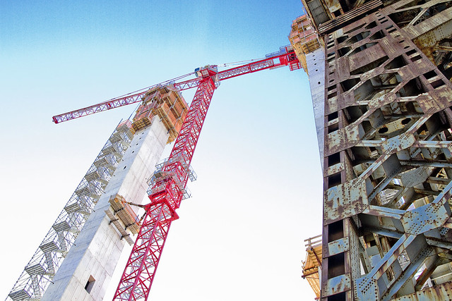
Checking in on the Kosciuszko Bridge project, in Today’s Post.

– photo by Mitch Waxman
Several progress reports have been offered on the NYS DOT’s Kosciuszko Bridge replacement project. I seem to be the only person In New York paying any attention to the project, and there’s been a series of prior posts on the bridge presented at this – your Newtown Pentacle – chronicling the project.
To start – this 2012 post tells you everything you could want to know about Robert Moses, Fiorella LaGuardia, and the origins of the 1939 model Kosciuszko Bridge. Just before construction started, I swept through both the Brooklyn and Queens sides of Newtown Creek in the area I call “DUKBO” – Down Under the Kosciuszko Bridge Onramp. Here’s a 2014 post, and another, showing what things used to look like on the Brooklyn side, and one dating back to 2010, and 2012 discussing the Queens side – this. Construction started, and this 2014 post offers a look at things. There’s shots from the water of Newtown Creek, in this June 2015 post, and in this September 2015 post, which shows the bridge support towers rising.

– photo by Mitch Waxman
At the end of 2015, I got to visit the work site in Brooklyn with the DOT folks, as described in this post, and this one. I also walked the Queens side back in December. Today’s post contains images from the last weekend of February in 2016, and takes a look at the Queens side, at the border of Blissville and West Maspeth.
In the first shot, I’m exiting an arch at 43rd street which leads to Laurel Hill Blvd., which leads to the spot shown in the second. If these shots look similar to the ones which have been embedded into prior posts, btw, it is quite intentional.
Construction equipment is everywhere at this point. Part of the Kosciuszko Bridge replacement project involves the redesign of the cloverleaf exchange with the Long Island Expressway, and since the bridge plus it’s approaches involve an astounding 2.1 miles of structure – this is one of the biggest capital projects in NYC that’s happened in my lifetime, and certainly a huge moment in the history of my beloved Creek.

– photo by Mitch Waxman
The odd spiral walkway over the highway which allows pedestrian and bicycle access (and which is surprisingly well used) is going to be rebuilt as a part of the project as well.

– photo by Mitch Waxman
Down on Laurel Hill Blvd., heading south towards Review Avenue and Newtown Creek. Calvary Cemetery is on the right, or west, side of the street. The red brick approach structures on the left are going to be demolished when traffic is rerouted onto the new span.

– photo by Mitch Waxman
Looking east along 54th avenue, which has been closed to traffic.

– photo by Mitch Waxman
Looking south along Laurel Hill Blvd., towards Brooklyn and Newtown Creek, at 54th road.

– photo by Mitch Waxman
Poking the lens through a hole in the fence under the current Kosciuszko Bridge, at what used to be the NYPD’s towing impound lot for Queens, but is now the staging area and offices of the DOT. .

– photo by Mitch Waxman
Over on “used to be 43rd street,” and looking in a southwestern direction, you can see the new bridge’s roadway rising alongside the 1939 model.

– photo by Mitch Waxman
Looking west towards Manhattan and Calvary Cemetery at 55th avenue.

– photo by Mitch Waxman
There was a lot of activity underway while these shots were captured, with construction workers and union guys moving heavy equipment around and doing all sorts of stuff. Welding, moving cranes about, working with concrete – that sort of thing.

– photo by Mitch Waxman
Closer to the Newtown Creek, and looking over the former site of the Phelps Dodge company – a multi acre property deemed too toxic to be used as a parking lot for trucks. An early chemical factory – Nichols, later General Chemical, predated the Phelps Dodge copper refining operation which was once here.

– photo by Mitch Waxman
A better view of the Queens side ramp under construction.

– photo by Mitch Waxman
Looking across the Newtown Creek to Brooklyn, where the roadway ramp is nearly finished and the concrete towers which the cable stays that will support the span over the water will be tied up to are practically complete.

– photo by Mitch Waxman
Back on Review Avenue/56th road, looking south towards Brooklyn.

– photo by Mitch Waxman
Same spot, but looking north towards Sunnyside and Astoria from Review Avenue/56th road.
As a note – this stretch of road, which begins at Borden Avenue – is Review Avenue until the K Bridge, then it becomes 56th road until meeting 56th street whereupon it becomes Rust Street, which it remains until its terminus at Flushing Avenue.

– photo by Mitch Waxman
Whatever you want to call it, the engineers of the NYS DOT have spanned the street with a new roadway.

– photo by Mitch Waxman
The DOT plan focused attention on the Brooklyn side first, given how densely packed that section of DUKBO was, and how much more work that entailed. The Queens side, which has a lot more “elbow room” was always meant to be handled several months behind it on their schedule.

– photo by Mitch Waxman
Looking back east, from the intersection of Laurel Hill Blvd. and Review Avenue, at the border of LIC’s Blissville and West Maspeth (or Berlin) in Queens’s DUKBO at the fabulous Newtown Creek.
The term “House of Moses” keeps on going through my head whenever I think about this project, incidentally. Every living New Yorker lives in the house that Robert Moses built, after all, and a big chunk of his early work is getting replaced. Luckily, I’m there to get shots of the show.
“follow” me on Twitter- @newtownpentacle
hunched servitor
Breaking windows, on the Newtown Creek.
– photo by Mitch Waxman
Recent controversy, and there’s always controversy, revolving around the Newtown Creek Superfund project has been swirling. Here’s the situation, which requires a bit of prologue for the uninitiated.
The Federal EPA has listed Newtown Creek as a Superfund site, which makes them the executive power responsible for its cleanup according to a bit of legislation called CERCLA. The EPA named several corporate entities as “PRP’s” or “Potentially Responisble Parties” who are culpable for the despoilment of the environment hereabouts. These PRP’s are the usual suspects – Oil companies, Gas Companies, a refinery. There are five of them, all conglomerate entities which absorbed one historic property or another over the years – ExxonMobil, National Grid, etc. There’s a sixth party which hasn’t been “officially” designated a PRP, which is the NYC DEP, a governmental entity responsible for (amongst other things) the sewer system of New York City.

– photo by Mitch Waxman
As you’d expect, every one of the PRP’s wants to get out of this Superfund thing having spent as little as is possible on the cleanup. This is normal, and logical. The Corporations have an army of lawyers, and so does the DEP. Finger pointing is also normal in a situation like this, just as it would be for children who broke a school window while playing baseball. The corporate PRP’s are in the position of having to protect their shareholders from undue costs, as is the DEP in the case of taxpayers. Again, broken school window, baseball. The difference between government and corporation, however… well, the corporate manager will accept the fact that he’s cooked for breaking the pane and that it’s cheaper to just fix the window and get on with the business of earning money, while the government will try and tell you that the window shouldn’t have been there in the first place but the school they built needed windows by law so you just have to accept the broken window until next spring when the “new and better placed window bill” will be heroically sent to an indifferent Albany… and that after a sixteen year period of committee hearings… and… terrorists… and… Basically, they pass the buck down to the next election cycle. I’m prejudiced, I guess, as I always worked corporate and understand the internal processes a lot better than the intentionally Byzantine workings of government officialdom.
This is where the Federal EPA comes in, in their executive function. All of the PRP’s have contracted with environmental testing firms to perform the schedule of analysis which EPA requires in order to design a remedy for the environmental situation on the Newtown Creek. When the remedy is codified, it will be contractors hired by those self same PRP’s which will do the actual work, under Federal oversight. Meantime, everybody is blaming everybody else for whatever they can, hoping the other guy gets stuck with paying to fix the busted window.
A recent presentation offered by the NYC DEP discussed a process called “Ebullition.”

– photo by Mitch Waxman
Coal Tar Sludge is pretty ugly stuff, if you’re alive. It’s a by product of the gasification of coal, a product of what was once called “pneumatic chemistry.” National Grid is a multinational conglomerate that owns the holdings of what was once Brooklyn Union Gas in New York City. BUG had a massive manufactured gas plant at the border of Bushwick, Williamsburg, and Greenpoint. In the waters of Newtown Creek found off the National Grid bulkheads, NYC DEP’s environmental contractors observed an astounding 18 feet of coal tar sludge in the sediments of Newtown Creek. Natural processes – springs and ground water entering the bed of the waterway from below, for instance – cause bits of this coal tar sludge to migrate out of the sediment bed, which is called “Black Mayonnaise.”
The environmental types refer to this sort of thing as NAPL, or Non Aqueous Phase Liquid. That’s a fancy way of indicating that oil and water don’t mix, as the coal tar sludge – like petroleum – remains distinct from the water column surrounding it.

– photo by Mitch Waxman
Pictured above is one of those bubbles of NAPL, or Coal Tar sludge which found its way to the surface of the water via the ebullition process. Surface tension breaks the bubble and begins to spread it into a disc. Presuming it doesn’t end up coating a bulkhead or rock somewhere between here and the East River, by the time this coal tar sludge reaches the east river it will just look like a bit of oil spread out over an area of several feet.
The NYC DEP, and their contractors, presented findings which suggested that as much as 5,000 KG of this stuff migrates up from the bottom sediments annually. They offered that in comparison, the combined sewers operated by DEP (which along Newtown Creek are amongst the largest in NYC) only deposit 27 KG of solute into the water. They also spent quite a bit of time critiquing the corporate PRP’s Contractor’s methodologies and procedures. After the presentation, it was time for questions and I asked a few pointed ones.

– photo by Mitch Waxman
Is this 18 feet of coal tar sludge an ongoing or historic event?
“Good question” was the answer.
Given the fact that DEP has been paying fines on the combined sewers to the Feds since 1983, coincidentally the same year that DEP was created, you must have good records of what’s been flowing out of your pipes since then. That 27 KG number, how does it compare historically with those records?
“We’ll have to get back to you.”
I’m certain that – historically – some of that coal tar and petroleum in the sediment bed must have been carried into the water from upland sources via your pipes, when you observed this 18 foot high wall of coal tar sludge, did you notice if any of your out falls were nearby?
“The sewers have never carried oil, it’s illegal”
But what about the 1950’s when Greenpoint’s aquifer was on fire, and the sixties when manhole covers were erupting on gouts of flame, and the 80’s when it was discovered that petroleum fumes in the sewer pipes were above the upper explosive limit?
“Sir, I don’t know what you think the DEP has done to you, but on behalf of the Agency I’d like to apologize”
That’s called “crackpotting” btw. and that pissed me off.

– photo by Mitch Waxman
Are the folks who run oil companies a bunch of bastards? You bet. Global Gas conglomerates are not operated by nice guys either, nor copper refineries. Know how Rockefeller made his money? Wasn’t by being a cool guy. Anybody in a position of real power is by definition “kind of a dick.” Obama would pull your tongue out and strangle you with it if he had to, but he doesn’t because there’s thousands of people who work for him that are specially trained to do so. Just because you work for the Government it doesn’t mean you’re some sort of altruist.
I cannot count the number of lies I’ve been told by employees of the NYC DEP over the years. Promises made last only as long as a Commissioner’s term, or a Mayor’s. Saying that, this is just one tiny sliver – the political and managerial department of the Agency – of an enormous 6,000 person organization which manages and polices the reservoirs, runs 14 sewer plants, possesses a small navy, handles air and noise environmental issues citywide, and has a $1.2 Billion budget. I’ve known people who work for the DEP that are amazing, and I’ve also met the political gasbags.
This is not some little mom and pop operation, the DEP.

– photo by Mitch Waxman
Thing is, what the DEP management team is trying to do is to reduce their exposure to having to pay out for the cleaning up of the so called “Black Mayonnaise” which sits 20-30 feet deep in the Newtown Creek, and I can’t say I blame them. Like any entity, corporate or otherwise, they will have to pass the costs of this operation on to their customers.
Unlike a corporation, which would be put into a competitive advantage should it be forced to raise prices and drive customers to a competitor’s cheaper products, there is unfortunately only one City government to be found and you just have to pay the taxes that they inflict. There is no political will to raise water taxes in NYC after a roughly 400% rise in rates which occurred during the 12 years of Michael Bloomberg’s administration… so… do the math. The DEP people will say and do anything to avoid culpability, or delay the inevitable as long as they can and pass the buck to some new Mayor or Commisioner.
Crackpot me? Don’t piss off the photographer, doc, I’ve got pictures to back my side up.

– photo by Mitch Waxman
There’s a saying which was passed down to me by my Dad and Uncles who had served in the military – “It’s a big shit sandwich and we all have to take a bite, so grab a napkin.”
Since the Superfund listing for Newtown Creek was made public, a humble narrator has been prophesying that the most interesting part of this story wasn’t going to be the oil companies trying to snake out of town and deny responsibility. Simply put, that’s the expensive way to go for them, as the courts and Feds will just stack fines up on them which they’ll have to pay IN ADDITION to the costs of the cleanup. It’s simpler, and cheaper, to cooperate. Nope, since the beginning of this tale I’ve been saying that “the fascinating part of this story will be watching the vertical silos of power in NYC’s government struggle and writhe against a higher authority.” Local authority, even that juggernaut in lower Manhattan, legally collapses before that of the Federal Government.
The EPA said that they’re willing to consider DEP’s Ebullitions study, and it’s data, but won’t be basing their decisions on either local government or corporate side’s assertions. The same DEP official who “crack potted” me in the earlier discussion mentioned above, upon hearing the EPA pronounce the substance of this statement, announced to a room full of people that DEP’s data “is just as good, if not better, or far better than EPA’s.” This is from the same official who claimed that it wasn’t going to be Superfund that cleans the Creek, rather DEP’s Long Term Control Plan – which is being designed by the same “ass coverers” and bureaucrats who haven’t done squat about it since the agency was created in 1983 by merging several smaller municipal entities which were responsible in the first place for dumping raw sewage into the waterway every time it rains.
Anyway, that’s the whole Ebullition thing for you, and a bunch of PRP’s who broke a window while playing ball. The one who threw the ball, the one who hit the ball, and the rest of the field. Meanwhile the window is hanging wide open and it’s raining into the school.
“follow” me on Twitter- @newtownpentacle


