Posts Tagged ‘Amtrak’
every hand
Wednesday

– photo by Mitch Waxman
562,000 square feet. Built between 1927 and 1933, which is when it opened. Designed by the successor to Chicago’s D.H. Burnham & Company, who provided architectural services for both Washington D.C. and Pittsburgh’s Union Stations. Currently the property of Amtrak, 2955 Market Street in West Philadelphia is officially referred to as “William H. Gray III 30th Street Station” or colloquially as “30th Street Station.”
It is bloody magnificent, and speaks to the power and majesty of one of the great American corporate powers which has passed into history and out of our cultural consciousness – the Pennsylvania Railroad.

– photo by Mitch Waxman
The largest corporation in the United States for more than a hundred years, PRR was founded in 1846. It grew, by 1882, to a size that saw its annual budget superseded only by that of the Federal Government. By 1926 – it had acquired, merged with, or owned 800 other rail companies. PRR operated nationally, and owned or operated nearly 12,000 miles of track in the northeastern United States, and was headquartered in Philadelphia. PRR was the primary carrier and transportation for John D. Rockefeller’s Standard Oil Company. Manufactured goods like refined oil from eastern port cities went west and south, cotton and timber went north, and agricultural products and raw petroleum went east to feed and employ the immigrant masses working in the coastal factories. All of this activity was train based.
Despite its capital intensive business, the PRR paid out the longest dividend payment in American business history to its stockholders from its founding in 1846 until its first reported losses in 1946. By WW2, it had annihilated all but one of its major rivals – the NY Central Railroad. The two rail giants were decimated by the arrival of the Interstate Highway system and containerization, which kicked off an era of deindustrialization in the North Eastern United States. In the end, they merged operations, becoming the Penn Central Railroad.
Bankruptcy was declared in 1968 for the combined Penn Central, ultimately resulting in President Richard Nixon nationalizing their assets as Conrail (freight) and Amtrak (passenger) in 1971. Their inner city and suburban commuter rail assets – Long Island Rail Road, for instance – were assigned to newly minted State level counterparts of Amtrak like MTA in New York State, or as in Philadelphia’s case, SEPTA.
Again – I’m not a rail historian. If you want to know more, I’d suggest taking a class, doing some googling, or reading up on the subject. It’s a fascinating subject, really.

– photo by Mitch Waxman
That’s the modern day Philadelphia skyline, as seen from the entry to 30th Street station.
It’s hard to conceive of the sort of monopoly power that PRR enjoyed in the American economy without referring to modern day technology companies like Apple or Google. Additionally, the National Security aspect of their business cannot be understated. Military conscripts were shipped to military bases for basic training via the rail, and trained soldiers were then delivered to the Atlantic port cities for overseas deployment by the PRR and others. Weapons and supply items could be manufactured in safe inland factories nearby sources of mineral supply, and then also be sent to the ports using rail.
Standard Oil is mentioned above, but the tonnages of coal, timber, mineral ore, agricultural products, and factory produced manufactured goods transported by this corporate goliath literally allowed the United States of America to evolve into a global superpower by connecting its most distant natural resources to each other with a high speed iron road. Rail doesn’t seem quick in an era when private space flight is possible, but until the 1930’s – the fastest speed most people ever travelled other than by rail was governed by a horse.
The corporation is actually still extant, but they’re in the property and casualty insurance business these days, and are now called “American Premier Underwriters.” Who knew?

– photo by Mitch Waxman
As I’ve said a few times in these posts about Philadelphia – as a New Yorker, I’m duty bound to shit talk Phillie – but in the particular case of 30th street Station, they’ve got us beat. Yeah, we’ve got Grand Central, but our Pennsylvania Railroad station – Old Penn Station – was demolished in 1963 to make way for the harbinger of the dystopian shithole version of NYC we all know in the modern day – modern day Penn Station.
Pictured above is the entrance to 30th Street Station.

– photo by Mitch Waxman
30th street Station received refurbishment and modernization upgrades in 1991. It’s one of the busiest intermodal train stations in the country, and Pennsylvania’s SEPTA system uses it as a regional hub for its commuter rail operations. There’s a separate subway station nearby called the “30th Street Subway station” and there’s streetcar/trolley service associated with that facility as well. Down below the ornate frontage, there are two levels of track, with the upper one hosting 3 east/west oriented platforms, and a lower level which offers 6 north/south ones.
No surprise here, but there’s cops and drug/bomb sniffer doggies roaming all over the joint. I’d advise you to not travel with your dynamite or heroin collection through 30th Street Station.

– photo by Mitch Waxman
A nuanced bit of trivia is offered here, which speaks to the actuality of the rail world. It’s a station – which indicates that it’s not a final stop with a turnaround track – in which case it would be a terminal. NY Central Railroad’s Grand Central Terminal in New York is a terminal for modern day MTA Metro North commuter rail, but the new MTA LIRR East Side Access stop deep below it will be a station. Get it? Station means stop, terminal means end. The 7 line subway has terminals at Hudson Yards and Flushing, everything in between, including the platforms at Grand Central Terminal is a stop.
It’s all so complicated.
If you haven’t yet subscribed to Newtown Pentacle, please consider doing so using the “sign me up” button and field at the top right.
Also, I’d greatly appreciate it if any of you could share these posts out to your social media accounts if you like them. I’m about to start doing tours of Newtown Creek again, I think, and would like to increase the “reach” and readership of this continuing effort.
“follow” me on Twitter- @newtownpentacle
Buy a book!
“In the Shadows at Newtown Creek,” an 88 page softcover 8.5×11 magazine format photo book by Mitch Waxman, is now on sale at blurb.com for $30.
menacing dreams
Tuesday

– photo by Mitch Waxman
Despite its appearance, the Market Street Bridge crossing West Philadelphia’s Schuykill River is actually fairly modern, having been built in 1932. It’s the fifth bridge in this location, with the first one having opened to traffic in 1805. It was a wooden span, called “The Permanent Bridge” but it wasn’t, and it burned down in 1850. The second one, similarly impermanent, also immolated in 1875. Another wooden crossing then stood here for 13 years, between 1875 and 1888, and the town fathers of Philadelphia seem to have gotten the message when a wrought iron span was built. The iron one then made way for this stone variant in the early 20th century.
Kind of like the Three Little Pigs and the big bad Wolf, this bridge story, huh? Wood, iron, & stone instead of straw, wood, brick.

– photo by Mitch Waxman
Grrr. When Old Penn Station was demolished in NYC, the still extant Pennsylvania Railroad donated four of the Eagle statues which used to adorn it to the City of Philadelphia in 1963. Seriously, you cannot escape NYC, no matter where you are. It is the conveyor belt of American history, and ultimately everything everywhere is somehow connected, or sympathetic to, or exists in consequence of the archipelago City.
It seems that there was a pre revolutionary ferry which operated either at the site of this bridge, or pretty close to it, which was established in 1673. The warring sides in the American Revolution independently built floating pontoon bridges to move troops and equipment across the Schuykill River here, predating the aforementioned and so called “Permanent Bridge.”

– photo by Mitch Waxman
That’s the 1990 vintage Walnut Street Bridge which was the vantage point from which I shot the photos in yesterday’s post. My understanding is that the masonry that the modern steel is affixed to is original to an earlier span of the same name.
At the time of the American Revolution, if you were taking bets on what would end becoming the largest and most important City on the Atlantic Coast, most takers would have put their money on Boston or Philadelphia. Charleston would have also gotten some action, but only as an outlier. NYC wasn’t all that important in the late 18th century, other than as a safe harbor which led to Long Island Sound, Albany, and New England, before the Erie Canal was built in the 19th century. It was that bit of infrastructure spending which gave NYS the moniker “Empire State.” From the minute it opened, Boston and Philadelphia began to decline economically, but they largely didn’t realize it until just after World War 1. By WW2, it was obvious.
Saying that – and again, as a New Yorker I’m duty bound to shit talk Philadelphia – Philadelphia is actually quite an interesting place beyond the whole Liberty Bell and Ben Franklin era. The City of Philadelphia is also the County of Philadelphia (since 1854). It’s second best in terms of population, with just over 1.6 million people living in the city and its greater metropolitan area has 6.2 million residents. It was founded in 1682, and one of the interesting things about Philadelphia in the modern day is that it’s a “minority majority” city demographically. Census data reports about 37% of its population as being non Hispanic White people, with a 42% majority Non Hispanic Black population. Everybody from everywhere else in the world seems to have at least one cousin in Philadelphia, so all the tribes of man – from East Asians to Native Americans, and every flavor of the Spanish speaking peoples, turn up in the census mix here.
As a note – I hate ethno supremacy and race talk, and specifically avoid using terms like “non Hispanic white” in my daily round, but when you’re passing along what the census says it doesn’t make sense to say it in your own voice. Over simplification of the complexity of American racism annoys me, and skirts the heart of the problem, which is the diminution of an individual into a “them.” If you’ve ever met an actual white supremacist, you’d have learned that they don’t think the French or Irish or Russians are “white.” Same for the Greeks and Italians. Certainly not Jews or the Portuguese. We are all assholes to each other all the time, and while we split hairs over ancestry and the ethnic propensities of one cultural group or another towards sin or virtue, the political bosses laugh and distribute your tax money to their sponsors while you’re busy calling somebody else a racist. There’s a whole lot of prejudiced people, but actual “racists” are a lot rarer. You can teach away prejudice, but racism is like a religion and it’s a lot harder to root out.
Lumping individuals into large ethnic groups and classifying them according to the accident of their birth is – in fact – racist, nativist, and leads to nationalism. Talk to people as individuals, instead of “meme-ing” them. This identity politics thing is going to lead to the end of this country.

– photo by Mitch Waxman
“William H. Gray III 30th Street Station,” or just 30th Street Station, is found along the Schuykill River, which the Schuykill Expressway runs alongside of, and the Market Street Bridge frames the left side of the shot. I’m actually shooting from the Market Street Bridge in this one, and that uninspiring truss bridge at the right of the shot is – I think – the 1959 vintage John F. Kennedy Boulevard Bridge.
30th Street Station is an intermodal train station which opened in 1933. Amtrak, SEPTA, and N.J. Transit operate trains from here. There’s a parking garage as well, and several local and interstate bus routes treat the area around the station as a hub. In addition to public transit, private companies like Bolt and Megabus also operate nearby.

– photo by Mitch Waxman
30th Street Station hosts several Amtrak offices “up stairs,” and its thought to be one of the busiest transit hubs in the entire country. Connected to it, but due to time constraints not photographed, are Amtrak’s Penn Coach Yard and Race Street repair and maintenance facilities which are kind of an regional analogue to the Sunnyside Yards, found in NYC’s Borough of Queens, which I often discuss. Next time I’m here in America’s “less than” city, I’ll try and explore a bit further afield.
It seems that a local corporation foots the bill for decorative bridge lighting on the Schuykill River, and I’d have loved to stick around until it got dark… but I had a train to catch.

– photo by Mitch Waxman
In the next couple of posts, we’ll be taking a look at Philadelphia’s 30th Street Station, and what I observed while waiting for the Amtrak people to announce which track my NYC bound train was going to leave from.
More tomorrow – at this – your Newtown Pentacle.
Also, if you enjoyed this post, or Newtown Pentacle in general – would it be too much to ask for you to share it out to your social media feeds? Maybe just hit “like” or leave a comment?
“follow” me on Twitter- @newtownpentacle
Buy a book!
“In the Shadows at Newtown Creek,” an 88 page softcover 8.5×11 magazine format photo book by Mitch Waxman, is now on sale at blurb.com for $30.
hideous gnawing
Monday

– photo by Mitch Waxman
Last stop on my Amtrak adventures was, as the old vaudeville joke offers – 4th prize – a visit to Philadelphia. Amtrak’s Pennsylvanian Line service carries you from Pittsburgh to Philadelphia’s 30th street Station, after a fairly long journey through mostly rural areas. For this leg of the journey, I only had about 4 hours to get busy, and an hour of that was spent inhaling something that they call “pizza” in Philadelphia but isn’t, and a couple of pints of Yuengling beer.
30th street Station is found along the Schuykill River, which figures prominently in today’s and tomorrow’s post. It seems that every time I had a beer in the state of Pennsylvania on this trip, it seems that it was a Yuengling – which is the oldest brewing company in the United States – operating since 1829 in Pottsville, at the other side of this River. Coincidence? Hmm.
Idiot man child, with a camera, wandering abandoned waterfronts and junk yards, right?

– photo by Mitch Waxman
The Schuykill River is a tributary of the larger Delaware River, traveling from Pennsylvania’s Pottsville to Philadelphia, where it joins with the larger Delaware River nearby the former Philadelphia Navy Yard. Its drainage shed is about 200 square miles, and it’s fed by multiple upland tributaries that are largely in “coal country.” A large and expensive project was undertaken in Pennsylvania – just after the Second World War in 1948 – to clean up the islands of coal dust silt that had formed in the Philadelphia stretch of the Schuykill River due to upland industrial and mining activities, interfering with its navigability.
Due to my limited time here, I never got too far away from 30th street Station and the Schuykill River. Luckily, there’s a series of interesting bridges and other attractions right in this area, which I’m told is the transition point between “proper” Philadelphia and “University City.” These posts are all from the same West Philadelphia border zone with University City, which is home to six colleges or university level learning institutions including the University of Pennsylvania and Drexel. Accordingly, there’s a whole lot of youngsters milling about. They seemed nice.

– photo by Mitch Waxman
Given the brevity of time spent there, I couldn’t do my usual “talk to strangers” deal and learn the local lay of the land. Instead, it was just me and Google maps. This shot was captured from the busy Walnut Street Bridge, looking towards the Chestnut Street Bridge.
That’s the second Chestnut Street Bridge, actually. The first one opened up in 1866, and was constructed from cast iron. The modern iteration was opened in 1957, and has been receiving a refurbishment due to its age since 2019. Construction was only meant to last a year, but Covid.
Walnut Street Bridge, which I was standing on, is of 1990 vintage and replaced an earlier 1893 version demolished in 1988. The masonry piers of the 1893 version support the modern bridge.

– photo by Mitch Waxman
The PennDOT maintains the Schuykill Expressway, which I’m led to believe is colloquially referred to by locals as “The Skook” and or the “The Surekill Distressway.” It’s part of Interstate 76 and concurrent with US 1 in Philadelphia, and is a primary traffic corridor leading into Philadelphia from points west. It opened in 1959, and is representational of the mistake that an entire generation of Robert Moses inspired urban planners made in the post World War 2 era, creating high speed roads along waterfronts (like NYC’s FDR Drive) that isolated both public and business from the City shorelines. About 163,000 vehicle trips a day travelled this route, pre Covid. That makes it the busiest road in all of Pennsylvania. There’s a modern day Schuykill River Trail for bikes and pedestrians on the parallel bank.
There’s meant to be quite a bit of “new economy” action happening on that side of the Schuykill River, but again – I was here for 4 hours so I’ll take your word for it. I was mainly busy trying to get a few shots before I had to get back on the Amtrak to NYC.

– photo by Mitch Waxman
As you’ve likely discerned by now, I had set up the camera for longish exposures with the ND filter that I’ve been mentioning. That’s “Neutral Density” for those of you who aren’t photography nerds, and it’s a disc of glass which appears black to the naked eye. This particular model is “10 stops,” which translates to “ten stops of light” being held back from the filter. Simply, it’s a monocular sunglass for your camera.
What this thing does is allow me to expose for 15-30 seconds at a narrow aperture in broad afternoon daylight. It allows me to make a series of creative decisions as to how much texture you see in the water, or how blurred and “streaky” the automotive tail lights you see on the off ramp of the Schuykill Expressway are. Options.

– photo by Mitch Waxman
It’s my duty as a New Yorker to shit talk Philadelphia. Boston? Yeah, it’s “less than” but it’s alright, and actually a hell of a town if you know the right crowd. You gotta respect Chicago, period. Fuck Los Angeles, it’s a god damned shopping mall with houses, like Atlanta and Miami. Denver is evil incarnate. Never been to Toronto or San Francisco, can’t comment. Philadelphia? Phillie? Pfah.
That’s my rap about the major U.S. cities of English speaking North America.
Truth be told, given the slide back towards “dystopian shithole” that NYC has been on for the last decade or so, Phillie is looking good to me. At least the rent is a bit lower, as are the taxes. When you’re comparing your home base in NYC with… Philadelphia… and saying “meh, it’s better in some ways,” maybe… things have arrived at a pretty bad juncture moment in New York City.
“follow” me on Twitter- @newtownpentacle
Buy a book!
“In the Shadows at Newtown Creek,” an 88 page softcover 8.5×11 magazine format photo book by Mitch Waxman, is now on sale at blurb.com for $30.
bacterial agent
Friday

– photo by Mitch Waxman
An early assignation with Amtrak awaited me, and I was out of my rented Pittsburghian bed by 4:45 in the morning. A quick once over of the AirBNB revealed that I had left the place in the same fettle as I had found it, and after a quick checklist of gear status was accomplished, I grabbed one last shot from the 23rd floor of the Clark Building.
Well, almost the last one.

– photo by Mitch Waxman
I stopped off at the garbage room nearby the elevator banks, to discard a bit of trash I’d generated during my stay, and couldn’t resist this shot of the Roberto Clemente and Andy Warhol bridges all lit up.
A visit to a nearby convenience store saw me buying coffee and other travel supplies for a scheduled 7 hour long trip on Amtrak to my next destination. Seriously – if they ever put the rail pass on sale again, I’m grabbing one. All of this travel ultimately cost $299. Best deal, EVER.

– photo by Mitch Waxman
At the train station, the now familiar routine of Amtrak continued. Passengers heading towards the same or similar destinations were directed into appropriate rail cars. Mask on, bags stowed, and onboard America’s railway was a humble narrator.
I settled into my seat, and relaxed. It had been an intense 72 hours. Heck, it had been an intense 100 hours, really, if you count the Washington D.C. leg of this trip in.

– photo by Mitch Waxman
This wasn’t the car I was riding in, actually. This shot was captured when I was making my way back to the cafe car. On my way to Pittsburgh, I rode Amtrak’s Capitol Line from Washington D.C., and now I was on the Pennsylvanian line. Apparently, this car would fill up, when we reached Pennsylvania’s Lancaster County. It seems that Amish and Mennonite people are ok with riding the train, so long as someone else is driving it, and this car would be filled up by citizens from the “Pennsylvania Dutch Country” later on in the day.
Me? I had a long ride ahead of me, and this time around I wasn’t so exhausted that I just passed out, like I did after leaving Washington. I played with my phone, shot a few pics out the window, and spent a lot of time thinking about things while staring out the window.
I think I might buy some U.S. Savings Bonds with a 5 year term to hedge against inflation, that’s one of the things I thought about. Also, I added a couple of bits and bobs that I didn’t know I needed until this last week into my BH Photo shopping cart too. Step up filter rings, my wire cable release stopped working 24 hours into this journey and needed replacement – that sort of stuff. I also pondered whether joining the Postal Service would pay off from a pension point of view given my age. Nice thing about riding the train is the quiet time to think without distractions.
– photo by Mitch Waxman
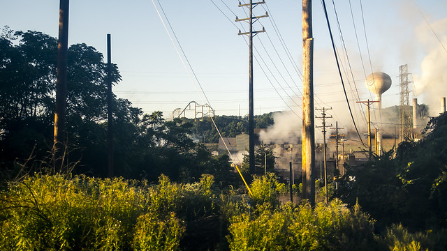
The foam collar I had fashioned to cancel out window reflections was again employed as we hurtled past steel mills and other industrial wonders along the way. Boy, oh boy do I want to spend some time around here with a car, after having socially networked my way into these sort of properties to “do my thing.”
What an amazing part of this country Western Pennsylvania is.

– photo by Mitch Waxman
Amtrak passed over a river, and the Google maps app on my phone informed me that we were passing in quite close proximity to the infamous Three Mile Island Nuclear Plant, but I couldn’t see it’s iconic cooling towers. Next time… and with wheels.
Amtrak would be delivering me to my next destination in the late afternoon/evening time of day. My photo time would be severely constrained, a mere three and change hours. I also needed to fill some of that time with purely biological needs – a meal, and a spot where I didn’t have to mask up – as onboard the Amtrak. More on all that next week, at this – your Newtown Pentacle.
“follow” me on Twitter- @newtownpentacle
Buy a book!
“In the Shadows at Newtown Creek,” an 88 page softcover 8.5×11 magazine format photo book by Mitch Waxman, is now on sale at blurb.com for $30.
abnormal toughness
Monday

– photo by Mitch Waxman
One last week of posts from my 72 hours in Pittsburgh, Pennsylvania starts today. As mentioned in the past, one travelled around the Northeastern United States a bit in September, using an Amtrak rail pass to move about. After riding Pittsburgh’s funicular railways – or Inclines, as they refer to them here – one made his way down to the south side of the Monongahela River and resumed scuttling along the Three Rivers Heritage Trail pathway. Pittsburgh’s volatile weather kept on churning the sky, so it was overcast and in the high 60’s during this part of my day.
Pictured above is the Fort Pitt Bridge. Even for a city of 446 bridges, this 1959 vintage double decked bowstring arch bridge is a fairly major crossing. Fort Pitt Bridge is (entrance to exit ramp) 1,207 feet long, and the main span over the river is 750 feet. It clears the water by 47 feet, replaced an earlier span called the Point Bridge, and is operated by the PennDOT. Fort Pitt Bridge connects downtown Pittsburgh’s “Golden Triangle” with several local, State, and Interstate high speed roads via the Fort Pitt Tunnel, which is dug through Mt. Washington. It’s apparently the first computer designed bridge, and this structure continues the practice here in Pittsburgh of a bridge having multiple names. It’s also known as the “Parkway West #1 Bridge” apparently.

– photo by Mitch Waxman
The boat tour I had a ticket for didn’t leave for a couple of hours, and I was hoping to find someone somewhere to sell me a cold beer. Unfortunately, due to Covid and the economic fallout thereof, this was a somewhat quixotic quest for a humble narrator. I found myself, thereby, at “Station Square.”
Station Square is a 52 acre property housed in the former environs and properties of the Pittsburgh & Lake Erie Railroad company. There’s a sports stadium (Highmark Stadium), a Hard Rock Cafe, a marina, a hotel, a mass transit “T” station, and a bunch of other chain store hospitality businesses which would be quite familiar to anyone who’s wandered off a cruise ship in the Caribbean. Unfortunately for me, due to Covid, almost everything was closed. Fortunately for me, the practice they seem to employ here in Pittsburgh of creating elevated and public overlook platforms continued. I noticed this bit of kit when walking towards one of those overlooks.
That’s a Bessemer Converter pictured above, which sat alongside another piece of industrial equipment left behind from the Steel City era. The old office building of P&LERR is also still standing, and I’ll show you that when the “from the water” shots start tomorrow.

– photo by Mitch Waxman
From that public overlook platform, which I guess was the equivalent of about three stories up, a great view of the 1883 vintage Smithfield Street Bridge was there for the taking. This is a verrrrrrry important bridge, from the “history of civil engineering in these United States” POV. Next time I’m in Pittsburgh, I plan on getting all granular about this particular span and photographing every single rivet. That’s how important it is. I’ll talk about the why’s and wherefore to back up my interest in subsequent posts from the water when I was able to get the camera closer to it. Suffice to say, for now, that the second oldest steel bridge in the United States is still standing in Pittsburgh. The oldest steel bridge in the USA is the 1874 Eads Bridge over the Mississippi River in St. Louis, before you ask.
I literally found out about this bridge and its significance while I was physically in Pittsburgh, by the way. I had a prepared shot list and itinerary for the trip, but had also built lots of “serendipity” time into the camera’s schedule. One of the mistakes you can make on a journey like this is to have decided in advance what you’re going to discover or encounter. It’s good to have some sort of structure for your travels, but you also don’t want to limit where the camera wants to be pointed. I had no idea this outlook viewing platform even existed until I was standing in front of it, let alone that it would be publicly accessible, for example.

– photo by Mitch Waxman
If I had stuck to a proscribed list, thereby, I never would have gotten the shot above of a CSX freight train roaring along what – I believe – were once the tracks of the B&O railroad which are still quite active here on the south side of the Monongahela River. CSX is a freight railroad operator that is fairly continental in size, ranging along the east coast of the United States and the Canadian provinces of Ontario and Quebec. The company was formed in 1980, and is one of the private capital entities which has grown up in the ashes of the post Conrail/Amtrak era which saw the bankruptcy and collapse of the PennCentral mega corporation which forced Richard Nixon to nationalize the rails as a strategic national asset. Again – I’m not a railfan, or a rail historian. I’m an interested lookie loo, and I highly suggest you read up on this interesting topic, or talk to an actual expert about it. I mainly like taking pictures of trains.
Later in the day, I also witnessed Norfolk & Southern led freight trains broiling through here. The haul in all cases seemed to be a combination of mineral (coal, coke, etc.), tanker, and cargo box cars.

– photo by Mitch Waxman
Finally, it was almost time to board the boat for my appointed 60 minute tour. A pedestrian tunnel allows one to travel under the rail tracks from Station Square, and I soon found myself on a dock set into the Monongahela River. While I was cooling my heels waiting for the excursion to begin, a masonry structure caught my eye. There’s two bridge towers, bereft of their crossing span, which can be observed on either side of the river. I was told that the span used to operate as a railroad bridge. The rail bridge fed into the Golden Triangle river delta section of downtown, and after the deindustrialization era began it had no purpose so it was torn down. The masonry towers that supported it were left in place and they’re supposedly “for sale” but there are serious limitations on what you can do with them so nobody wants to purchase the things.
The deckhands for the boat tour began to check our tickets and it was time to board the boat. I was alone, of course, but there were probably thirty or so other people on the boat.

– photo by Mitch Waxman
Gateway Clipper is the analogue of NYC’s Circle Line here in Pittsburgh. They’re been operating in the Steel City since 1958, and employ a small fleet of excursion vessels. The founder of Gateway Clipper was John E. Connelly, who went on to become quite wealthy in the Riverboat Casino business on the Mississippi River, and was also the founder of NYC’s World Yacht which operates out of Manhattan’s Chelsea Piers complex on the Hudson River. He was also, I’m informed, instrumental in developing Chelsea Piers as a tourist and leisure destination.
Gateway Clipper does ferry service for Steelers and Pirates games, but their main interest is in the tourist and “function” business. As I was opining to my NY Harbor pals when I got back to New York, they have a novel solution for high capacity excursion vessels in their fleet – a tug push boat which is permanently affixed to a flat top barge that has a thousand seat catering hall built on top of it. That’s the Empress and the Empress 2 for all of you vesseltracker peeps.
Tomorrow – the long foreshadowed boat tour of Pittsburgh, and revelations about the Smithfield Street Bridge.
“follow” me on Twitter- @newtownpentacle
Buy a book!
“In the Shadows at Newtown Creek,” an 88 page softcover 8.5×11 magazine format photo book by Mitch Waxman, is now on sale at blurb.com for $30.


