Posts Tagged ‘Emsworth Lock and Dam’
On the hunt
Thursday

– photo by Mitch Waxman
After visiting Emsworth Locks and Dam along the Ohio River, located just outside Pittsburgh, one noticed a plastic box labeled with ‘take one’ that contained xerox flyers proclaiming this spot as being ‘Buzzie’s Corner.’
I haven’t been able to find out too much about this cognomen, but apparently this was, and is, a popular railfanning location. There’s a website: Buzzie’s Corner, but the proprietor thereof confesses their own ignorance as to the origin of the name and whom Buzzie was or is.
I’m reminded of a Staten Island spot on the Kill Van Kull back in NYC which my friends and I started called ‘Skelson’s Office’ in honor of our dearly departed pal John Skelson – a photographer who lived nearby that spent countless hours photographing the parade of maritime vessels exiting and entering Port Elizabeth Newark from a certain spot on the shoreline.
Man, I’ve got a lot of dead friends.
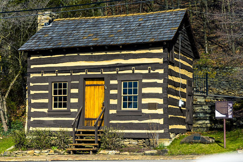
– photo by Mitch Waxman
Historically preserved, restored, and moved from its original location, pictured above is a 1797 vintage log cabin dubbed the Dickson Log House. The Buzzie’s Corner site has a page devoted to its story – check it out here.
Me? It was time to move on to another location and see what could be seen from it. A few miles down the river was found a neat little town which looked a great deal like a fishing village. It was all of two to three blocks in depth, and pavement on its roads stopped about 200 feet from the highway off ramp that took me there. At the very end of an unpaved and muddy road is a small park with a baseball field that sits right along the same Norfolk Southern tracks mentioned yesterday.
I discovered that the end of this road is where the local ‘working guys’ go ‘cribbing,’ meaning that this where they park their trucks while taking a nap at work.
– photo by Mitch Waxman
Still batting zero on the train front, I keyed in the next destination on my phone, and let Google maps guide me to another spot I wanted to check out. A rather circuitous route was laid out for me, which allowed for visual inspection of a nearby suburb. One is often annoyed by the navigational suggestions hereabouts. Google doesn’t seem to take into account that their ‘shorter by three seconds’ route requires driving up a mountain and back down again when a U or K Turn would have done the job more simply and not burned out a bunch of fuel.
What also annoys me is these sorts of routes send motorists into residential neighborhoods, increasing traffic flow in precisely the areas where you want it to be cut down.
Back tomorrow.
“follow” me on Twitter- @newtownpentacle
Buy a book!
“In the Shadows at Newtown Creek,” an 88 page softcover 8.5×11 magazine format photo book by Mitch Waxman, is now on sale at blurb.com for $30.
Emsworth Lock and Dam
Wednesday
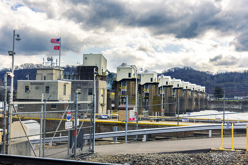
– photo by Mitch Waxman
As part of a humble narrator’s continuing exploration of the Pittsburgh metro area, an afternoon in late March found me standing at the fence lines of an United States Army Corps of Engineers installation called the Emsworth Locks and Dam, on the Ohio River. As it turned out, I missed a dramatic set of events here which would occur in early April when an unusually high volume of rainfall caused all sorts of chaos here in the local vicinity.
Hullabaloo, I tell’s ya, hullabaloo.
The Three Rivers overflowed their banks which flooded several waterfront parcels, and here at Emsworth – 26 maritime barges which were tied up upriver that were full of minerals got loose from their moorings, and ended up wedged up against the dam.
Before you ask, I followed my usual policy of staying the hell away from such horrors unless someone was specifically going to be paying me to take the risk, in order to get a photo or deliver a video.
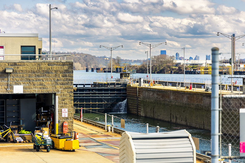
– photo by Mitch Waxman
As mentioned above, this particular afternoon was one of my ‘exploratory trips’ wherein a series of waypoints were encoded into a Google map, which I then followed while driving the Mobile Oppression Platform from place to place. This one wasn’t a walk, it was a drive.
So far, my ‘get out there and see something’ instincts have been drawing me up the Monongahela and Allegheny rivers away from the center of Pittsburgh, with just a few ventures out and along the Ohio.
There’s a series of GPS waypoints which I’ve tagged along this river’s banks – boat launches, public parks, trails, etc. – which I’ve planned on visiting sometime in the near future, or in the case of this week’s posts – now. There’ll come a moment sometime in the future when I’m actually crossing into – y’know, the State of Ohio – which is about a 90 minute drive from Pittsburgh, here in the Commonwealth of Pennsylvania.
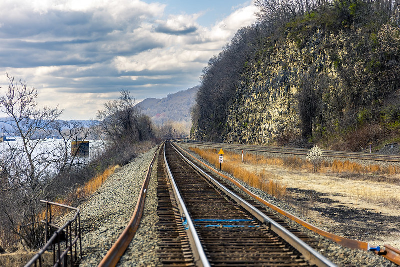
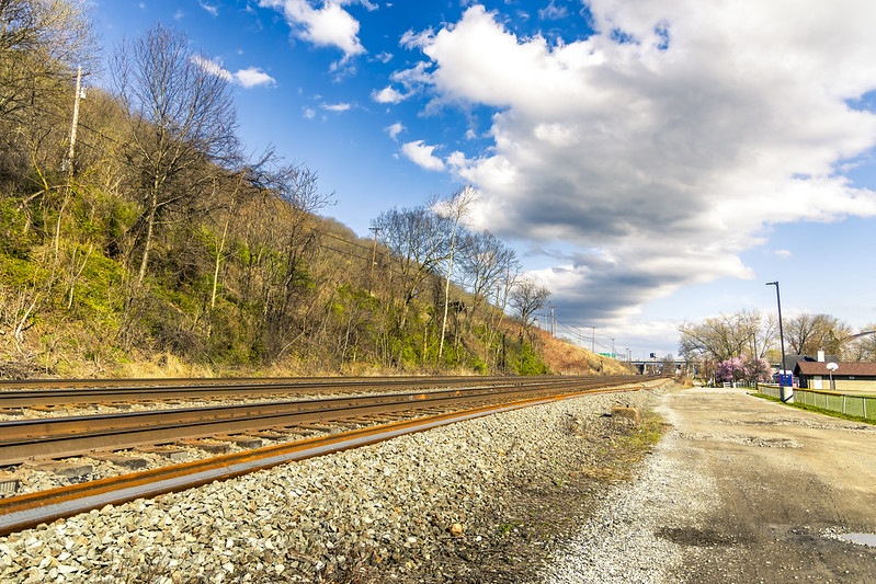
– photo by Mitch Waxman
Along the Ohio River, and this shot is from the northern side of the waterbody, there’s a pretty expansive series of rail tracks which are used by the Norfolk Southern outfit. I was hoping to catch a shot of a passing train when I was here, but no such luck was on offer. Have to get myself one of those railfan scanner radios one of these days, so I know if something interesting is coming my way.
Go west, old man.
Back with all that, at this – your Newtown Pentacle, tomorrow.
“follow” me on Twitter- @newtownpentacle
Buy a book!
“In the Shadows at Newtown Creek,” an 88 page softcover 8.5×11 magazine format photo book by Mitch Waxman, is now on sale at blurb.com for $30.


