Posts Tagged ‘Long Island City’
frightful vistas
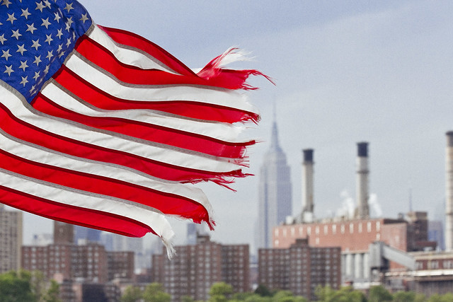
On this day in 1931, the Empire State Building opened for business.
– photo by Mitch Waxman
The Empire State Building was completed a month and a half ahead of schedule, no doubt due to the influence of the “official” head of the project’s influence. A mostly ceremonial and political position, former NYS Governor Al Smith was nevertheless the boss. The real players in the construction of the icon were an investor group led by Louis G. Kaufman, Ellis P. Earle, John J. Raskob, Coleman du Pont, and Pierre S. du Pont.
John J. Raskob was the prime mover, however. Everything and everybody else on the project were just political window dressing or finance.

– photo by Mitch Waxman
The Empire State Building was designed by William F. Lamb, of the architectural firm Shreve, Lamb and Harmon. The actual construction of the thing was accomplished under the oversight of the Starrett Brothers and Eken, Paul and William and James Farley’s General Builders Supply Corporation handled material delivery and deployment. John W. Bowser was the construction superintendent of the project, and structural engineer for the building was a fellow named Homer G. Balcom.
The plan for the Empire State Building was presented to the public on January 8, 1930. The entire operation, which included demolishing the old Waldorf Astoria which stood on the site, was accomplished in 16 months. The actual erection of the Empire State began in March of 1930.

– photo by Mitch Waxman
Just the facts; the Empire State Building rises 1,860 steps from the first to the 102nd floor, and it’s said to weigh 365,000 short tons (331,122 t). It encloses an internal volume of 37,000,000 cubic feet, and its exterior is covered in 200,000 cubic feet of limestone and granite. Construction of the tower incorporated ten million bricks, 370 short tons of steel, 1,172 miles of elevator cable and 2,000,000 feet of electrical wires. The building has a capacity for 20,000 tenants and 15,000 visitors. To the 102nd floor, Empire State is 1,250 ft tall, but is 1,453 feet 8 9⁄16 inches when you include its 203 ft pinnacle.
According to official records, the construction cost 7 lives, but contemporaneous socialist newspapers claimed that 42 deaths occurred during construction.

– photo by Mitch Waxman
Personally speaking, I can tell you that the easiest way to say “New York City” in a photograph is to frame the Empire State Building into it. One of the “seven wonders of the modern world,” and for much of the twentieth century the tallest structure on earth, Empire State Building was the first of the “super talls,” although the Chrysler Building did technically arrive on the scene first. It’s pretty commonplace to see skyscrapers these days, but the significance of the Empire State Building to the generation that saw it rise – at the astounding pace of 4 1/2 stories a week – cannot be overstated.
For that NYC generation, who were either immigrants or the children of immigrants, the future had arrived.

– photo by Mitch Waxman
When the generations of immigrants who pulsed into NYC during the high tide years of emigration – the 1850’s through the 1920’s – arrived here, what they found were a few grandiose structures like the Woolworth Building or the odd church or cathedral, but these were the exception. Manhattan had unpaved streets which pigs roamed around at night, and the building stock in NYC was squat. Tenements spread out in every direction, punctuated by occasional six to eight story industrial or office buildings.
Up until the 20th century – ship masts, industrial chimneys, Trinity Church’s steeple, and the towers of the Brooklyn Bridge formed the skyline.

– photo by Mitch Waxman
For those of us who grew up in NYC, the Empire State Building was always aspirational. It represented “the City,” where we’d make our fortunes someday, escaping the humiliations and constraints of the blue collar neighborhoods we were born into. When returning from someplace else, spotting the Empire State Building was a signal that home was near.
Happy 87th Birthday, old fella.
Upcoming Tours and Events
May 12th – Exploring Long Island City – with NY Adventure Club.
Long Island City is a tale of two cities; one filled with glittering water-front skyscrapers and manicured parks, and the other, a highly active ground transportation & distribution zone vital to the New York economy — which will prevail?
Tickets and more details here.
May 17th – Port Newark Boat Tour – with Working Harbor Committee.
For an exciting adventure, go behind the scenes of the bustling Port of NY & NJ on our Hidden Harbor Tour® of Port Newark! Get an insider’s view of the 3rd largest port in the nation, where container ships dock and unload their goods from around the world. See how the working harbor really works and learn about what all those ships and tugs do. See giant container terminals, oil docks, dry dock repair, and more! Tickets and more details here.
“follow” me on Twitter- @newtownpentacle
plainly audible
Back and forth, back and forth, it never ends.

– photo by Mitch Waxman
Meeting season seems to be upon us all, wherein the various affiliations, causes, and organizations which I’m involved with want to get together in a room somewhere and discuss policy, plans, and or problems related to the issues of the day. Somehow this almost always involves me having to scuttle to Long Island City or Greenpoint at an inconvenient time, but it does allow for intervals on the journey to do a little shooting. Pictured above, a Long Island Railroad Mainline train set on its way from the City to points east, and crossing through the Sunnyside Yards.

– photo by Mitch Waxman
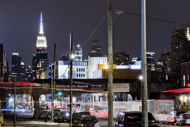
Intrigued as I’ve been with long exposure shooting for the last several months, an endeavor which is usually carried out at night, whenever I’ve got a spot I can do a long exposure during daylight hours, I take it. That’s about two seconds of accumulated time from Queens Plaza in the shot above. I found a nicely positioned steel bracket which braces the construction scaffolding at one of the tower apartment construction sites on which to brace the camera, lock in the focus, and hold down the shutter button while watching the Fords roll by.

– photo by Mitch Waxman
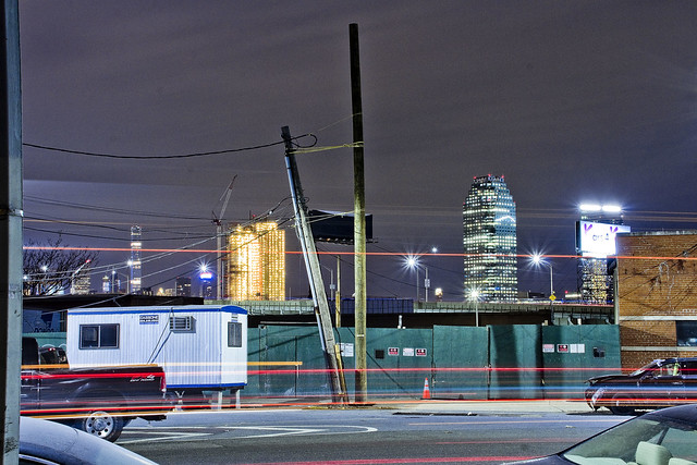
An even longer exposure from the other night on Kingsland Avenue in Greenpoint, alongside the Unnamed Canal sub tributary of the fabulous Newtown Creek. It depicts a somewhat abandoned Department of Sanitation Marine Transfer Station which sits on the shoreline street end of North Henry Street (whose north/south path is interrupted by the sewer plant). The fences were locked up about a year or so ago, and you used to be able to go in there and explore. I think they’re using it to warehouse “stuff” now, but can’t really say for sure. At the very least, they’ve fixed the lights inside the thing.
Upcoming Tours and Events
April 29 – Bushwick-Ridgewood borderline Walking Tour – with Newtown Historical Society.
Join Kevin Walsh and Mitch Waxman as they take us along the border of Brooklyn and Queens, Bushwick and Ridgewood, with stops at English Kills, an historic colonial Dutch home, and all kinds of fun and quirky locations. End with an optional dinner on Myrtle Avenue before heading back to the Myrtle-Wyckoff subway station. Tix are only $5 so reserve your space today!
Tickets and more details here.
“follow” me on Twitter- @newtownpentacle
most unplaceable
Odds and ends, needles and thread.
– photo by Mitch Waxman
On this day in 404 B.C., the Peloponnesian War ended when the Spartans crushed the Athenians with a naval blockade. Sometime later, in 1792 A.D. the French rolled out the guillotine for the first time, ending the life of a highwayman named Nicolas J. Pelletier. In 1859, ground was broken for the Suez Canal by French and English engineers. The Spanish American War officially began with a declaration by the United States Government on April 25 in 1898. In 1945, American and Soviet troops joined up at the River Elbe in Germany. In 1953, Crick and Watson publish their paper describing DNA, and in 1960 the US Navy Submarine Triton competes the first submerged circumnavigation of the earth. In 1983, Pioneer 10 travelled beyond the orbit of Pluto. In 1940, Al Pacino was born. So was Edward R. Murrow, but that was in 1908.
Today is also World Malaria Day.

– photo by Mitch Waxman
On this day in 1901, New York became the first state to require automobiles to carry license plates. During the First World War, the disastrous Gallipoli Campaign was launched in 1915. In 1945, what would become the United Nations sat down to chat, plan, and organize in San Francisco. Polaroid introduced the instant camera to customers in 1972, and the Hubble Space Telescope was deployed from the Space Shuttle Discovery in 1990.
Personally, I’m stuck in front of the computer at HQ all day today and have an abundance of tasks to accomplish.

– photo by Mitch Waxman
One will be writing tour descriptions for upcoming excursions around the fabled Newtown Creek and larger harbor, developing the shots I managed to squeak out last night before it started raining again, and generally servicing the needs of an increasingly elderly dog named Zuzu today. A busy few days are in front of me, which will be carrying the camera across the concretized realities of the great human hive, with everything culminating in a tour I’m conducting with my pal Kevin Walsh from Forgotten-NY for the Newtown Historical Society on Sunday. Link for tix is below, which are only $5.
Come with?
Upcoming Tours and Events
April 29 – Bushwick-Ridgewood borderline Walking Tour – with Newtown Historical Society.
Join Kevin Walsh and Mitch Waxman as they take us along the border of Brooklyn and Queens, Bushwick and Ridgewood, with stops at English Kills, an historic colonial Dutch home, and all kinds of fun and quirky locations. End with an optional dinner on Myrtle Avenue before heading back to the Myrtle-Wyckoff subway station. Tix are only $5 so reserve your space today!
Tickets and more details here.
“follow” me on Twitter- @newtownpentacle
sleeping quarters
Hitting the shutter button in Blissville.

– photo by Mitch Waxman
After having attended a community meeting at Point B (Blissville) the other night, regarding the homeless shelter situation, one decided to scuttle back to Point A (Astoria) and take advantage of the warming climatological conditions photographically. Pictured above is a line in the sand known as the Fairfield Inn, whose owners decided to answer an RFP – Request for Proposal – from the City’s Department of Homeless Services and convert their hotel to a 154 room homeless shelter. The shot is from Van Dam Street.
– photo by Mitch Waxman
Pictured above is the inviting street scene here along Van Dam, with its ever present traffic.
Were the City actually serious about its responsibility towards helping the unhoused, officialdom might be looking into finding ways to create, sustain, and expand blue collar employment but that’s not how our Mayor thinks. His current plan is to expand and extend the usage of Homeless Hotels in pursuance of ending their use, which is the same logic that addicts offer when going on a binge the night before entering rehab.

– photo by Mitch Waxman
Just two blocks away is where Van Dam feeds into the Long Island Expressway. Three blocks in the other direction is the Newtown Creek.

– photo by Mitch Waxman
Blissville is largely an M1, or heavy manufacturing area, according to City Planning. The shot above was captured directly across the street from the Fairfield Inn.
Inviting, ain’t it?

– photo by Mitch Waxman
That’s the enigmatic “Blissville Flatiron” pictured above, an apartment house on Van Dam Street.
One has looked into the history of the flatiron in the past, but never too deeply. I like not knowing something about the Creeklands, and would prefer to preserve the mystery. The only clue to its past is on a concrete panel which reads “S.M. 1916.”

– photo by Mitch Waxman
My path home to Point A carried me, as always, to Newtown Creek. The shot above looks northwards along the Dutch Kills tributary towards the Hunetrs Point Avenue Bridge.
Upcoming Tours and Events
April 29 – Bushwick-Ridgewood borderline Walking Tour – with Newtown Historical Society.
Join Kevin Walsh and Mitch Waxman as they take us along the border of Brooklyn and Queens, Bushwick and Ridgewood, with stops at English Kills, an historic colonial Dutch home, and all kinds of fun and quirky locations. End with an optional dinner on Myrtle Avenue before heading back to the Myrtle-Wyckoff subway station. Tix are only $5 so reserve your space today!
Tickets and more details here.
“follow” me on Twitter- @newtownpentacle
rather gruesomely
Like every other bit of wind blown trash in NYC, this is where I belong.

– photo by Mitch Waxman
Despite being a shambling and sclerotic mess, nevertheless does a humble narrator scuttle on about and around the Newtown Creek in the middle of the night. Recent endeavor found one in Blissville to attend a meeting of the newly created Blissville Civic Association, which the community has formed in response to the Mayor dropping multiple homeless shelters into their midst, and afterwards one set out to a nearby tributary of that legendary cataract of urban malfeasance known as the Newtown Creek – specifically Long Island City’s Dutch Kills.
That’s the Borden Avenue Bridge in the shot above, but don’t ask me where the shot was captured from as I’d have to confess to a misdemeanor. Suffice to say that every nook and cranny is known to me. It’s all I’ve got, ultimately.

– photo by Mitch Waxman
Either the world happens to you, or you happen to the world.
That’s the Long Island Expressway above, riding on a truss bridge that carries it some one hundred and six feet over the waters of Dutch Kills. The height was determined by the demands of the War Department of the Federal Government, who had laid down the law to State of New York that the LIE would need to allow egress for maritime vessels on Dutch Kills, and specifically vessels of the Naval surface warfare type.

– photo by Mitch Waxman
One has read some of the planning documents for this section of the LIE, which is officially the Queens Midtown Expressway, and sections of said plans discussed the need to defend Newtown Creek and the larger harbor of New York against a potential maritime invasion by German naval forces in the run up to WW2. One of the guiding principles was the defense of the industrial zones, and the East River corridor specifically. The Navy’s theory was that the Kriegsmarine would enter New York Harbor via the Narrows between Brooklyn and Staten Island (there was no bridge there in the 1930’s) and that would be the most strategic and effective spot to interdict the German Navy. Accordingly, in the case of such an invasion they would have stationed Destroyer class vessels in Newtown Creek and the Gowanus (as well as other places) to act as protective bulwarks for the industrial operations.
The Navy plan also intended for the Destroyers to fire artillery southwards over Brooklyn to shell the Narrows on vast parabolas. The people in Bay Ridge would have loved that one, I tell you, had it been commonly known. Fuhgeddaboutit.
Upcoming Tours and Events
April 29 – Bushwick-Ridgewood borderline Walking Tour – with Newtown Historical Society.
Join Kevin Walsh and Mitch Waxman as they take us along the border of Brooklyn and Queens, Bushwick and Ridgewood, with stops at English Kills, an historic colonial Dutch home, and all kinds of fun and quirky locations. End with an optional dinner on Myrtle Avenue before heading back to the Myrtle-Wyckoff subway station. Tix are only $5 so reserve your space today!
Tickets and more details here.
“follow” me on Twitter- @newtownpentacle


