Posts Tagged ‘New York City’
Kill Van Kull walk 1

– photo by Mitch Waxman
A legendarily squalid and desolate abode of pirates, gangsters, and irresolute opportunists- the docks of Manhattan- have been recast by modernity as “the financial district”- and simply referred to as “wall street”. The end of the line, the Staten Island Ferry docks at South Ferry and offers a free maritime connection between the far flung Staten Island and Manhattan across New York Harbor. The boat leaves every half hour, like clockwork (and the fleet is orange).
from wikipedia
The origin of the name South Ferry is probably one of the more misunderstood trivia, even to New Yorkers accustomed to using it in a geographical sense. One would suppose that it is so called because it is at the southern tip of Manhattan, and it hosts ferries. In actuality, it was the name of the South Ferry, one of several ferries between what were then the separate cities of New York and Brooklyn. The “Old Ferry”, which later was renamed the “Fulton Ferry”, crossed between Manhattan and Brooklyn from streets that in each city would eventually be renamed “Fulton Street” after the ferry company. The “New Ferry” crossed further east, between Catherine Street in Manhattan, and Main Street in Brooklyn.
As the City of Brooklyn grew, the area south of Atlantic Avenue (known as “South Brooklyn”) began to become built-up, but lacked easy access to the ferry terminals in the northern parts of the city of Brooklyn. Thus, a new ferry was established in 1836 to take passengers directly to Atlantic Avenue and the southern parts of the City of Brooklyn, and so was called the “South Ferry”. The ferry connected to the foot of Atlantic Avenue in Brooklyn and the Brooklyn and Jamaica Railroad (later part of the Long Island Rail Road) through the Cobble Hill Tunnel. In addition, South Ferry was the name of the Brooklyn landing and ferry house of the aforementioned ferry.

– photo by Mitch Waxman
Another great opportunity to take photos of the shining city is offered by this short trip, and one must pick a spot soon after boarding or the masses of camera wielding citizenry will cheat you out from an unoccluded vantage point. Staten Island is a rapidly growing part of New York City, a hilly district of quiet and well planted streets that frame envious homes on one shore, and highways lined with medium density apartment houses and condominiums on the other which are served by a never ending series of strip malls and the occasional “big box” store. The older sections of the community are of maritime heritage, largely, and clustered around the Kill Van Kull.
from wikipedia
In the 1700s ferry service between Staten Island and the city of New York (then occupying only the southern tip of Manhattan) was conducted by private individuals with “periaugers”, shallow-draft, two-masted sailboats used for local traffic in New York harbor. In the early 1800s, Vice President (and former New York governor) Daniel D. Tompkins secured a charter for the Richmond Turnpike Company, as part of his efforts to develop the village of Tompkinsville; though intended to build a highway across Staten Island, the company also received the right to run a ferry to New York. The Richmond Turnpike Company is the direct ancestor of the current municipal ferry.
In 1817 the Richmond Turnpike Company began to run the first motorized ferry between New York and Staten Island, the steam-powered Nautilus. It was commanded by Captain John De Forest, the brother-in-law of a young man named Cornelius Vanderbilt. In 1838 Vanderbilt, who had grown wealthy in the steamboat business in New York waters, bought control of the company. Except for a brief period in the 1850s, he would remain the dominant figure in the ferry until the Civil War, when he sold it to the Staten Island Railway, led by his brother Jacob Vanderbilt. (Three of the Staten Island ferries were requisitioned by the United States Army for service in the war, but none ever returned to New York harbor.)
– photo by Mitch Waxman
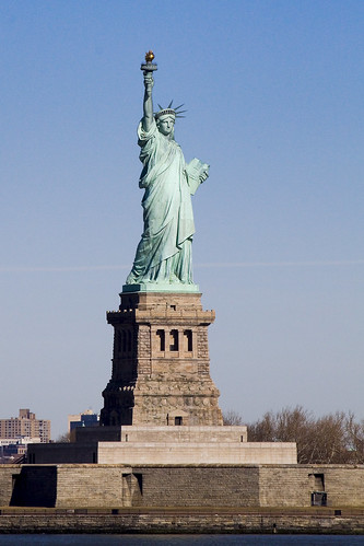
Just after passing Liberty Island, an abundance of industrial terminals and petroleum mills are apparent. A dizzying display of technology may be observed as the Ferry makes its way from Manhattan to Staten Island, and the lighting conditions demand a morning trip for photographic opportunities to be realized. You don’t have to be up fiendishly early, these shots for instance, were from a ferry ride that left Manhattan at 9:30 AM.
from nyc.gov
The Staten Island Ferry has been a municipal service since 1905, and currently carries over 21 million passengers annually on a 5.2-mile run between the St. George Terminal in Staten Island and the Whitehall Terminal in lower Manhattan. Service is provided 24 hours a day, 365 days a year. The Staten Island Ferry is the most reliable form of mass transit, with an on-time performance of over 96 percent.
A typical weekday schedule involves the use of five boats to transport approximately 65,000 passengers daily (110 daily trips). A four-boat (15 minute headway) rush hour schedule is maintained. During the day, between rush hours, boats are regularly fueled and maintenance work is performed. Terminals are cleaned around the clock and routine terminal maintenance is performed on the day shift. On weekends, three boats are used (64 trips each weekend day). Over 33,000 trips are made annually. Ferry terminal supervisors, assigned around the clock at both Whitehall and St. George, are responsible for ensuring that the ferry operates according to its published schedule (pdf) or (html).

– photo by Mitch Waxman
That’s the Vane Bros. Choptank, a very modern tug built by Thoma-Sea, a shipbuilder which operates out of the Lockport shipyard in Houma, LA. Vane Bros. and its plans for an ultra modern fleet was featured in a 2007 feature at professionalmariner.com.
from vanebrothers.com
The tug Choptank is the fifth in a line of Patapsco-class tugs. Like her sister tugs, she was designed by Frank Basile of Entech & Associates, and built by the Thoma-Sea Boat Builders in Houma, Louisiana. She joined the fleet in January 2007, and was subsequently named one of the “17 top new tugs of 2007” by American Tugboat Review, an annual publication of Professional Mariner.
The Choptank is 95’ long, 34’ abeam, and 15’ deep. Her gross tonnage is 99 tons. She is powered by two CAT 3516, 2100 horsepower engines with Kort nozzles, and maintains running speeds of better than 12 knots. Featuring a model bow and square stern, her fuel capacity is approximately 90,000 gallons. Potable water capacity is approximately 9,000 gallons. With accommodations for seven crew members, the Choptank is dedicated to 50-class tank barges on the coastwide trade.

– photo by Mitch Waxman
I love this boat, the Tug Ellen McAllister. A familiar sight in New York Harbor, it’s actually the same age as I am. I mentioned this ship in a posting about last June’s Working Harbor Committee “Sunset Cruise”.
The tug Ellen McAllister was originally built for the U.S. Navy, as the Piqua, at the Marinette Marine Shipyards in Wisconsin in July of 1967. The Piqua’s anchorage for many years was at Holy Loch, Scotland. It spent most of its naval career providing tug services for the 1st naval district and the Atlantic Fleet. It was sold under its current name in 2001 to McAllister Towing.
– photo by Mitch Waxman
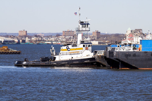
Over there, that’s the Peter F. Gallatly, another Thoma-Sea built ship. A 1,200 HP, 327 GT tugboat, it went into service in December of 2008.
PETER F. GELLATLY
Official #: 1212432
- Year Built: December, 2008
- Dimensions: 100’L x 34’B x 15’D (Molded)
- Gross Tons: 327 tons
- Net Tons: 98 tons
- Draft Loaded: 13.6 Feet
- Speed Light: 11 Knots
- Classifications: Endorsement for Oceans, Coastwise Trade, ABS Load Line
- Eye Level: Lower Pilot House (23 Feet)
- Upper Pilot House (40 Feet)
- Capacities:
- Fuel Oil 85,900 Gallons
- Lube Oil 662 Gallons
- Hydraulic Oil 496 Gallons
- Gear Oil 662 Gallons
- Potable Water 8,816 Gallons
- Ballast Water 10,621 Gallons
- Dirty Bilge 1,263 Gallons
- Dirty Lube Oil 1,306 Gallons
- Grey/Brown Water 3,898 Gallons (ZERO (0) Discharge Compliant)
- Horse Power: 4,200 Continuous
- Main Engines: (2) 3516 CAT @ 1600 RPM Tier 2 Compliant
- Reduction Gears: (2) Reintjes WAF 11 37 7.087:1 Reduction with Shaft Brakes
- Propellers: (2) Rolls-Royce Stainless Steel (4) Blades GWAN 104″ x 77″
- Pitch ABS Open Wheel
- Shafts: 9 1/2″ Diameter
- Generators: (2) John Deere 6068T 99KW 120/208V Tier 2 Complaint
- Towing Winch: (1) Intercon DD200 Double Drum with Level Winder and Capsan
- 2,200′ x 2 ¼” Galv. Cable
- 1,000′ x 1 3/4″ Galv. Cable
- John Deere Engine, Torque Converter Tier 2 Complaint
- Towing Arch: 8″ x Sch. 120 with (2) Bronze Bushed Sheaves
- Air Compressors: (2) Quincy 325 Operating @ 150 PSI with 160 Gallon Receiver
- C02 System: Herbert Hiller

– photo by Mitch Waxman
Just as the Ferry was maneuvering into its dock at St. George Terminal on Staten Island, Ellen McAllister was good enough to move into an egregious spot. This tugboat, of course, was the Division A winner of the 17th Annual Running of the Great North River Tugboat Race & Competition in 2009 and its Captain, Kirk Watts, won the contest for “Best Tattoo”. I was on a circleline observer boat at the event, and photos from the race can be found in this set at flickr.
from tuginformation.weebly.com
McAllister Towing is one of the oldest and largest marine towing and transportation companies in the United States. They operate a fleet of more than seventy tugboats and twelve barges along the East Coast from Portland, Maine to San Juan, Puerto Rico.
Although their corporate headquarters are located in New York City they operates in the ports of: Portland Maine, Staten Island New York, Philadelphia, Pennsylvania; Baltimore, Maryland; Hampton Roads, Virginia; Wilmington North Carolina, Georgetown, and Charleston, South Carolina as well as Jacksonville, and Port Everglades, Florida; including San Juan Puerto Rico. McAllister engages in ship docking, general harbor towing, coastal towing and bulk transportation.
Captain James McAllister started the first McAllister enterprise shortly after he arrived from Cushendall, County Antrim, Ireland . Together with his brothers and in-laws, McAllister formed the Greenpoint Lighterage Company. They augmented the lighterage business with towing, with the acquisition of their first steam tug, the R.W. Burke, in the 1880’s, while the Brooklyn Bridge was still being built. In the early twentieth century there was a period of innovation and expansion. Captain James was one of the first to convert a sail lighter into a bulk oil carrier, for the transport of oil around New York Harbor. The company also became known nationally for its salvage work, which extended from the West Indies, along the Atlantic Coast as far north as Maine.
In 1909, the company acquired the Starin Fleet of steamboat excursion vessels, forming the McAllister Steamboat Company, which was then among the largest excursion boat operators in New York, with regular runs to the Statue of Liberty, Bear Mountain, Coney Island, and Long Island. After the death of Captain James in 1916, his four sons assumed control of the company. The new partnership consisted of James, John E., Charles D. and William H., the second generation of McAllisters.
exhausted
Phew. Busy couple of days… sorry for the lack of contact. Creek week is extending into next week as well, but check out what I did on Friday the 5th.
– photo by Mitch Waxman
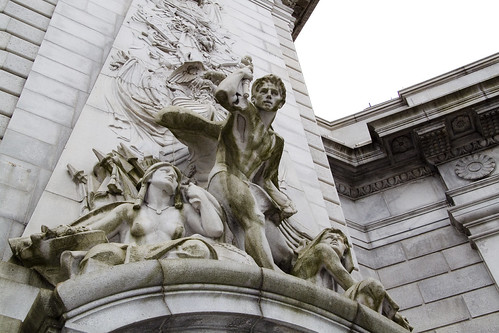
On Friday, I attended a ceremony which placed a time capsule in the Manhattan Bridge, then walked from Chinatown to Astoria, developed a LOT of photos, slept 4 hours.
Saturday- woke up, took a ride on the Staten Island Ferry, then walked part of the Kill Van Kull shoreline , visited my sick mom in the hospital, and came back to Astoria.
Tomorrow is the “St. Pat’s Day for All” parade in Sunnyside- which promises to be enjoyable AND photogenic- if you’re around the neighborhood- don’t miss it.
Now, here’s a few shots from the Manhattan Bridge event.

DOT Commissioner Janette Sadik-Khan – photo by Mitch Waxman
from nyc.gov
Janette Sadik-Khan serves as the Commissioner of the New York City Department of Transportation since her appointment by Mayor Michael R. Bloomberg in April of 2007. She manages 4,500 skilled employees with wide ranging expertise from engineering to construction finance, to marine navigation, and is responsible for 6,000 miles of streets and highways, nearly 800 bridges, 1.3 million street signs, 300,000 streetlights and 12,000 signalized intersections, as well as the Staten Island Ferry, the nation’s busiest commuter ferry service carrying over 19 million passengers annually.
Since her appointment, Sadik-Khan has implemented an ambitious program to improve safety, mobility and sustainability throughout New York City, and ensure a state of good repair on all the Department’s roads and bridges. In April 2008 the Agency published its Strategic Plan, Sustainable Streets. Projects highlighted in that plan include the first Select Bus routes for NYC, the NYC Plaza Program, the creation of Broadway Boulevard in midtown Manhattan, the addition of 200 miles of on-street bike lanes, car-free summer streets and weekend pedestrian walks.

“Gridlock Sam” Schwartz – photo by Mitch Waxman
from gridlocksam.com
From 1982-86, Sam Schwartz served an extremely successful term as New York City’s Traffic Commissioner before going on to serve the next four years as the New York City Department of Transportation’s Chief Engineer/First Deputy Commissioner.
After nearly twenty years with the New York City Department of Transportation, Mr. Schwartz moved from public service in 1990 to join Hayden-Wegman Consulting Engineers, Inc. as Senior Vice President in charge of transportation engineering, infrastructure, quality control and planning.
In the summer of 1995, The Sam Schwartz Engineering opened its doors with a staff of two. Since that time, the company has grown to include over sixty diverse professionals. Today, under Sam’s direction, The Sam Schwartz Engineering produces some of the finest work in civil engineering, planning, and urban design.

Henry Perahia, Deputy Commissioner Chief Bridge Officer DOT – photo by Mitch Waxman
from nyc.gov
In 1998 Mr. Perahia was promoted to Chief Engineer of the Department. In 1999, he was given the added responsibilities of Chief Bridge Officer. As Chief Engineer, he serves as the Department’s representative on all engineering issues, including review of all major Department projects, response to engineering emergencies, and advising the Commissioner on all engineering issues. As Chief Bridge Officer, he is responsible for the planning and administration of all aspects of design, construction and maintenance of approximately 750 City-owned bridges, tunnels, and culverts, with an annual capital program of approximately $500 million and an annual expense budget of approximately $56 million.
The Division of Bridges is responsible for maintaining the structural integrity of all City owned bridges and tunnels. It undertakes the design and construction of all rehabilitation and reconstruction work, including in-house design, engineering support, engineering review, and quality assurance. It inspects the City’s bridges to identify hazardous or potentially hazardous.

A few of the items that were placed in the Time Capsule – photo by Mitch Waxman

The assembled crowd of dignitaries, DOT workers, and invited well wishers – photo by Mitch Waxman

The time capsule was sealed up within the ornate arches of the Bridge – photo by Mitch Waxman

Specifically, right about here (this is inside the arch) – photo by Mitch Waxman

How could I not have a look around? I mean, how often are you inside the Manhattan Bridge, after all? – photo by Mitch Waxman

A window? – photo by Mitch Waxman

Here’s the view from said window – photo by Mitch Waxman
for the complete set of photos at flickr- click here
strange and brooding apprehensions
CREEK WEEK continues… for the first installment, from the mouth at the East River to the Pulaski Bridge, click here. For more on just the Pulaski Bridge, click here.

– photo by Mitch Waxman (from the Queens Museum of Art’s “Panorama of the City of New York”)
Moving a quarter mile eastward along the Queens bulkheads of the Newtown Creek from the Pulaski Bridge, the first tributary encountered by the intrepid urban explorer and photographer is a canalized horror called the Dutch Kills.
This branch of the Newtown Creek watershed is about an hour’s walk from Newtown Pentacle HQ, and its locale is visited or transited rather regularly by your humble narrator, as I perform the penitential exertions ordered by my physicians as the curative for certain extant health issues. All ‘effed up, my version of such wholesome activity requires the presence of the macabre, and some element of existential danger. Luckily- the Newtown Creek offers, to those who seek it, succor and salvation for a variety of desires.
Detailed postings, in and around the immediate neighborhood of the Dutch Kills waterway, include:
- Dutch Kills, or let the Photos do the Walking
- Long Island City Zen 2 -The Empty Corridor
- Weird Synchronicity
- After the Fire
- affordable housing development on Borden Avenue
- cry fowl, and let slip…
from wikipedia
Dutch Kills is a sub-division of the larger neighborhood of Long Island City in the New York City borough of Queens. It was a hamlet, named for its navigable tributary of Newtown Creek, that occupied what today is centrally Queensboro Plaza. Dutch Kills was an important road hub during the American Revolutionary War, and the site of a British Army garrison from 1776 to 1783. The area supported farms during the 19th Century, and finally consolidated in 1870 with the villages of Astoria, Ravenswood, Hunters Point, Middletown, Sunnyside and Bowery Bay to form Long Island City.

– photo by Mitch Waxman
Leaving the main course of the Newtown Creek, just .8 of a mile beyond its mouth, the first thing one encounters is a somewhat worse for wear railroad swing bridge- called the Long Island Railroad Bridge. Reports from “railfans” and “foamers” (and confirmed by the Coast Guard) state that the bridge hasn’t opened since 2002, which has orphaned the Dutch Kills from its parent waterway and cut the canal off from its intended usage. If my readings of old maps are correct (they often aren’t), these two tracks carry (or at least carried) rail traffic from either the Montauk Cutoff and Montauk Branch tracks, connecting the LIRR to the Sunnyside Yard and Wheelspur Yard with the tracks leading west to Hellsgate and east to Long Island. Notable former sights along this bank of the Newtown Creek would have been the City of New York’s Poultry Yard and the still extant Texas Oil Co.
For an extensive series of historical photos, discussion of the function and design of these tracks, and the industrial centers they once served- trainsarefun.com is the place to go. Special attention is called to this 1860 map of the area– which details the natural flow of the wetlands and shows the Dutch Kills as being a far larger body of water than it is today.
from Queens Borough, New York City, 1910-1920
During 1914 bulkhead lines were established by the United States Government for Dutch Kills Creek, a tributary of Newtown Creek, thus putting this stream under the jurisdiction of the War Department. The bulkhead lines as approved on October 29, 1914, give a width varying from 200 feet at its junction with Newtown Creek to 150 feet at the head of the stream, and include a large basin in the Degnon Terminal where car floats can be docked. The widths of the channel to be dredged under the appropriation of $510,000 mentioned previously, range from 160 feet at Newtown Creek to 75 feet at the turning basin. The Long Island Railroad plans to establish at this point a large wholesale public market, estimated to cost nearly $5,000,000.
Among the larger industrial plants in the Degnon Terminal served by this stream are : Loose Wiles Biscuit Company, American Ever Ready Works, White Motor Company, Sawyer Biscuit Company, Defender Manufacturing Company, Pittsburg Plate Glass Company, Marcus Ward, Brett Lithograph Company, Waldes, Inc., Norma Company of America, Manhattan-Rome Company, American Chicle Co. and The Palmolive Co.

– photo by Mitch Waxman
From Borden avenue, the second rail bridge is observed, which I believe to be the Montauk Cutoff track and a bascule type drawbridge. The canalized Dutch Kills, with its high bulkheads and rail connections, served as a water connection to NY Harbor for several heavy manufacturers in the area including F.A. Hunt, Holdtronics, New York Envelope, and American Chicle. The rail/dock complex, collectively, was known as the Degnon terminal. A short but sweet history of the Degnon Terminal can be accessed at members.trainweb.com. Michael Degnon was a master builder, one of the great men of the early 20th century in Queens, and is buried in Calvary Cemetery. Check out this nytimes.com article which discusses an expansion of his operations at the Dutch Kills in 1922 that brought floor space at his Degnon Terminal up to an astounding three million square feet.
from forgotten-ny.com
Michael Degnon was the contractor for the Steinway Tunnel, the first rail link to connect Manhattan and Queens, and also the contractor for the Sunnyside Yards. He decided to build his own railway, called Degnon Terminal, adjacent to the Sunnyside Yards and constructed large factories and warehouses complete with sidings facing the railroad tracks. This was attractive to his clients, since shipping goods via rail was now more accessible and less expensive for them. Some of the Terminal’s early clients were Sunshine Biscuit Company, Packard Automobile Company, American Ever Ready Company, and American Chicle Company. Of course, the rising cost of doing business in New York forced all of these companies to find other cities in which to manufacture. The sidings haven’t seen rail traffic since 1989, and the tracks are now either paved over or overgrown with weeds (some of which can be seen on FNY’s Disappearing Railroad Blues page). In its heyday, Degnon Terminal employed 16,000 workers.

– photo by Mitch Waxman
The currently “under construction” Borden Avenue Bridge allows vehicle and pedestrian traffic to cross the Dutch Kills. This is the point at which the water quality declines seriously, as the only fresh water entering its stagnant depths are combined sewer outputs (CSO’s) and runoff from the concretized industrial landscape surrounding it (which carry a stream of road salt, engine and exhaust residue, and whatever else might be on the road or sidewalk into the water every time it rains). The bridge recently celebrated its centennial, incidentally.
from the army corps of engineers, discussing precautions for the collecting, handling, and testing of Dutch Kills underwater sediments:
All individuals involved in handling contaminated sediment are required to use protective equipment and to submit to blood and urine tests. The protective equipment consists of:
from nyc.gov
As part of the construction of Borden Avenue in 1868, a wooden bridge was built over Dutch Kills. This bridge was later replaced by an iron swing bridge, which was removed in 1906. The current bridge was opened on March 25, 1908 at a cost of $157,606. The deck’s original design consisted of creosote-treated wood blocks, with two trolley tracks in the roadway. Character-defining features of this bridge include the stucco-clad operator’s house, four pairs of rails, and a rock-faced stone retaining wall. The gable-on-hip roof of the operator’s house retains the original clay tile at the upper part. Although alterations have been made, the bridge is a rare survivor of its type and retains sufficient period integrity to convey its historic design significance.
The Department of Transportation has identified a pocket of contaminated soil which has been classified as “contaminated non-hazardous”. As such, it poses no significant health risk to workers or the surrounding community. However, precautionary measures will be taken and every effort is being made to remove and dispose of the contamination quickly, yet safely, within all New York City and State guidelines. A Corrective Action Plan (CAP) for the removal and disposal of the contamination has been submitted to the NYS Department of Environmental Conservation (NYSDEC) for review and approval.

– photo by Mitch Waxman
Sewer construction projects along Hunters Point Avenue revealed that the swampy nature of western Queens is unchanged. These ground waters, as you might observe by the chalk markings on the pilings, would be some 13 feet beneath the streets. The vertical clearance of the nearby Hunters Point Avenue Bridge (and street grade) is approximately 15 feet over the water, so this would make sense.
Never forget, lords and ladies, that this Long Island City of ours is a swamp which was “reclaimed” by industrial means just within the last 150 years. The “ground” in most of the area is actually a sort of pier or dock, with timber pilings supporting cement clad fill. Just two stories down are the waters of the Newtown Creek and it’s tributaries, and this sort of subterrene terraforming is typical for most of the spongy land directly surrounding the Newtown Creek.
Who can guess, what poisons there are, laying in the mud waiting to hatch out?
from hydroqaul.com
Like a number of other local tributaries to New York Harbor, Newtown Creek is now simply a peripheral canal system fed by tides, CSO and stormwater discharges. None of its original freshwater creeks and extensive wetlands exist anymore, the whole area having been transformed into a series of canals by channelization, land reclamation (filling) and bulkheading. Biological abundance and diversity is impaired by reductions in the amount and variety of physical habitat, and by a vulnerability of the remaining habitat to retention and accumulation of pollutants. Although no scientific studies have been identified prior to 2001, it can be expected that biota of Newtown Creek reflect similar conditions in other highly impacted waterbodies around the harbor. Thus, a fouling community composed of epibenthic invertebrates such as barnacles and sea squirts should be present on pilings and bulkheads; a fairly homogenous community of benthic invertebrates dominated by tolerant forms of polychaete worms should be found in the sediments, and a typical assemblage of regionally indigenous fish such as striped bass, winter flounder, bay anchovy, Atlantic menhaden, snapper bluefish, sea robin and tautog may come and go as water levels and quality permit.

– photo by Mitch Waxman
The Hunter’s Point Avenue Bridge offers spectacular views of the Long Island Expressway with Brooklyn beyond, and from its walkway; the bulkheads marking the end of the Dutch Kills are visible. This is a dead zone, check out riverkeeper.org’s analysis of the waters here over a multiple year period. The foulness of these waters are part of the historical record, which an a New York Times article from March of 1871 proves, and the evidences of one’s own senses suggest.
from nyc.gov
The Hunters Point Bridge over Dutch Kills is situated between 27th Street and 30th Street in the Long Island City section of Queens, and is four blocks upstream of the Borden Avenue Bridge. It is a bascule bridge with a span of 21.8m. The general appearance of the bridge has been significantly changed since it was first opened in 1910. The bridge provides a channel with a horizontal clearance of 18.3m and a vertical clearance, in the closed position, of 2.4m at MHW and 4.0m at MLW. The bridge structure carries a two-lane, two-way vehicular roadway with sidewalks on either side. The roadway width is 11.0m, while the sidewalks are 1.8m wide. The width of the approach roadways vary from the width of the bridge roadway. The west approach and east approach roadways are 13.4m and 9.1m, respectively.
The first bridge at this site, a wooden structure, was replaced by an iron bridge in 1874. That bridge was permanently closed in 1907 due to movement of the west abutment, which prevented the draw from closing. It was replaced in 1910 by a double-leaf bascule bridge, designed by the Scherzer Rolling Lift Bridge Company. The bridge was rebuilt in the early 1980’s as a single-leaf bascule, incorporating the foundations of the previous bridge.

– photo by Mitch Waxman
At the end of the Dutch Kills, one finds a concrete company, and the former Degnon Terminal home of Sunshine Biscuits, which today serves as the “C’ building of the LaGuardia Community College campus (found between 29th and 30th streets and between 47th avenue and the intersection of Skillman and Thompson avenues). Additionally, the greater astoria historical society has posted a photo at smugmug that shows the rest of the scene in the shot above dating from 1966.
speaking of gahs, they have a short history of Sunshine Biscuit’s “thousand window factory” which can be accessed by clicking here

– photo by Mitch Waxman
A quick glance down at the banks of Dutch Kills reveal the true nature of things here, it is not uncommon to half glance at dead things floating by, suspended by their internal gases. At high tide on the East River, aquatic life often finds its way into the Newtown Creek and become entrapped in the oxygen deprived water. This provides ample food for thriving colonies of carnivorous worms and shore line scavengers- mainly river rats, the cats that prey on them, and various birds.
Few if any dogs have I observed down here, even where you’d expect them to be. Guard dogs are unemployed around these parts, and I’ve never seen a feral dog roaming around in all the time I spend scuttling around the area- but that’s probably because of all the trucks. I do know a fat old dog who’s chained to a fish butcher on 51st avenue, but she’s mainly interested in her sunny sidewalk and sleeping.
from nytimes.com
Hunters Point South, for its part, will have 5,000 homes built on 30 acres on the edge of the East River, near Newtown Creek. Three thousand of the homes will be set aside for families whose annual income totals $126,000 or less, with 800 of them destined specifically to families who earn less than $61,400 a year. There will also be 300 units built for low-income senior citizens and at least 225 units devoted to a middle-class homeownership program.
“We’re creating a model,” said Councilman Eric N. Gioia, whose district includes the area where the project will be built. “We’re creating housing where all New Yorkers can live together, in the same neighborhood.”

– photo by Mitch Waxman
At the end of Dutch Kills, near 47th avenue, illegal dumping seems to be a community passion. There is even a rusted out and derelict barge which seems to finally be sinking. As always, admonishment and advice for the urban explorer to ignore the temptation to climb out and take a look applies. The wet filth that lines the shore here stinks of sulphur compounds, and the smell of a sick aquarium permeates the breeze. This is also a HAZMAT zone, and nautical charts reveal that the water depth here is 13-15 feet, roughly a third deeper than it is in the channel. Don’t screw around back here, lords and ladies, you can get seriously hurt.
from nyc.gov, on the waterfront revitalization section of the Hunters Point South development plan
Policy 6.2: Direct public funding for flood prevention or erosion control measures to those locations where the investment will yield significant public benefit.
The proposed actions do not include public structural flood and erosion control projects. The central and eastern portion of Site A and much of Site B are within the 100-year floodplain.
The New York City Building Code (Title 27, Subchapter 4, Article 10) requires that residential buildings have a finished floor elevation (FFE) at or above the 100-year floodplain, while the Federal Emergency Management Agency (FEMA) requires the FFE to be one foot above the 100-year floodplain. In accordance with these regulations and as stated above, clean fill would be used to raise the development area, including the areas for new streets and buildings, as well as portions of the project sites designated for the waterfront park or other open space areas that would not be covered by impervious surface or structures. Raising the elevation of the project sites above the 100-year flood elevation would ensure protection of public health and safety, the new buildings and open space areas, public investment of city infrastructure, and enhancement of natural habitats. The proposed actions are consistent with this policy.

– photo by Mitch Waxman
On the Brooklyn side of the Newtown Creek is another tributary called Whale Creek (don’t worry, we’ll be going there soon enough), alongside which the magnificent Newtown Creek Wastewater Treatment Plant hums and belches methane in storied Greenpoint. This spot on 29th street, at the end of the Dutch Kills, is just under a half mile from the main channel.
A Newtown Pentacle posting from October of 2009 explored this Temple of Cloacina, which is a 24 hours a day municipal workhorse. The plant processes a significant percentage of the 1.1 billion gallons of sewage New York produces every day, delivering it in a milled and concentrated form to a pumping tank and dock in Greenpoint directly across the Creek from the forthcoming Hunters Point South development which is just starting on the Queens shoreline. In still another posting, we followed some sludge boats- the M/V Newtown Creek, North River, and the Red Hook, as they traveled past Hallet’s Cove and Astoria up the East River.
from nyc.gov
Dewatering reduces the liquid volume of sludge by about 90%. New York City operates dewatering facilities at eight of its 14 treatment plants. At these facilities, digested sludge is sent through large centrifuges that operate like the spin cycle of a washing machine. The force from the very fast spinning of the centrifuges separates most of the water from the solids in the sludge, creating a substance knows as biosolids. The water drawn from the spinning process is then returned to the head of the plant for reprocessing. Adding a substance called organic polymer improves the consistency of the “cake”, resulting in a firmer, more manageable product. The biosolids cake is approximately 25 to 27 percent solid material.

Hunters Point to Dutch Kills with Whale Creek on the left – photo by Mitch Waxman (from the Queens Museum of Art’s “Panorama of the City of New York”)
Creek Week continues… at this, your Newtown Pentacle. Prepare to penetrate into the darkness of the tomb legions, lords and ladies… as we move eastward.
Crazy Bastards

– photo by Mitch Waxman
Obligations and appointments in Manhattan during the early part of the day afforded me an opportunity to take advantage of yesterday’s relatively warm weather, and walk home along the Queensboro bridge.
Pleasant walk, except for a bicyclist who aggressively charged past me on the pedestrian side of the walk (the side with the little people icons painted on the pavement is for pedestrians, not the side with the little bicycle icons which is for bicycles). I politely… really… informed him that he was meant to be in his appointed lane, and the yuppie coward rode a short distance away and then gave me the finger. I shouted expletives, hurled defamatory accusations, and bellowed threats involving breaking his finger off and repositioning it elsewhere on his body. He then gave me two fingers and rode off.
Vehicles on the streets of New York, ALL VEHICLES, should require an operators license, insurance, and an identifying license plate- all things being equal… imho.
Anyway, while muttering profane and unutterable invocations to certain unknowable entities designed to bring a flaming case of psoriasis raining down upon this optic yellow lycra lad, I noticed an amazing scene. This has to be one of the world’s craziest jobs, standing on one foot at what has to be something like 200-225 feet over the East River on a windy day.
from nydailynews.com
The $25-million modernization project will keep the Roosevelt Island tram closed until Sept. 2., leaving riders without their quickest mode of transportation between the island and the East Side of Manhattan.
Commuters can still take the F train, the Q102 bus, or take $1 shuttle buses to the Queens Plaza subway station and the E, G, R and V trains.

– photo by Mitch Waxman
NY1’s morning news had run a story yesterday, which had penetrated through my morning fog, about the Roosevelt Island Tram being shut down for repairs, and then I happened across these Crazy Bastards making it happen.
from ny1.com
While the F train does stop on the island for its 14,000 residents, they say they expect more crowded trains and longer commute times. The four-minute tram ride carries two-million people a year.
“It’s going to be terrible. It’s going to be awful,” said a Roosevelt Island resident. “It’s going to add at least a half hour to my commute, which is already long.”
“We hope it’s only six months and not, you know, nine months or a year before it comes back,” said another. “I have doubts.”

– photo by Mitch Waxman
Creek Week continues later on tonight- sorry for the delay, but I’m still straightening out a few details in the next post, and I just wanted to share these photos while “the pixels were still drying”.
Kneeling upright

– photo by Mitch Waxman
The local supermarket, a Pathmark on Northern Blvd., has installed a device on its shopping carts that lock the wheels when you try to roll them off the property line. A buried wire, perhaps, or some sort of radio signal keeps the carts from distributing themselves around the neighborhood like the Home Depot and Stop n’ Shop carts that can found in basements and garages across the Newtown Pentacle. Once, this was the preferred cargo carrier for New York’s unfortunates, an uncovered wagon for the concrete prairies.
from wikipedia
Shopping cart theft can be a costly problem with stores that use them. Often the carts end up in apartment complexes, low-income housing, bus stops or locations where the person doing the shopping is unlikely to own a car. The carts, which cost between $75 and $150 each, have been used for such purposes as barbecue pits, go-carts, laundry trolleys and even shelters, or they are simply abandoned. Because such losses can be substantial (up to $800 million globally lost every year), stores have resorted to various systems to prevent theft. Stores may use one or more of these systems (i.e., cart retrieval and electronic).
Cart retrieval service
Some stores utilize a cart retrieval service, which collects carts found off the store’s premises and returns them to the store for a fee. The drawbacks of this measure include that it is reactive instead of proactive (i.e., it can only be used once a cart has been taken from the premises), can become costly, and does nothing to deter hoarders. Some retrieval services have also been caught taking carts from the store’s parking lot and turning them in as stray carts.
Electronic
Electronic systems are being increasingly used by stores because of their successful deterrence. In principle, the system is similar to electric fences that give dogs’ necks a yank when they cross an underground boundary. Each shopping cart is fitted with an electronic locking wheel, or ‘boot’. A transmitter with a thin wire is placed around the perimeter of the parking lot. The boot locks when the cart leaves the designated area. Store personnel must then deactivate the lock with a hand-held remote to return the cart to stock. Often a line is painted in front of the broadcast range to warn customers that their cart will stop when rolled past the line.

– photo by Mitch Waxman
The cheap wire shopping carts offered to perform the curb to house function today just can’t compare. The bottle and can collectors favor this sort of model, and an iteration of it is found in my own kitchen. It’s not sturdy, quite unstable, and has an incontrovertibly high center of gravity making it prone to unexpected tipping. A sudden abundance of laundry here at Pentacle HQ was instrumental in discovering its load capacity was a mere 80 pounds (don’t ask) which causes the wheels to snap off. A sturdy supermarket style cart carries an unknown, but substantially higher weight.
from nyc.gov
To ready your metal, glass and plastic containers for recycling, rinse them clean and place them in a clear bag or blue-labeled container; caps and lids should be removed. You should place paper recycling in a separate clear bag or green-labeled container and tie flattened corrugated cardboard with strong twine.
Collect glass, plastic or aluminum beverage containers with a 5-cent deposit, such as those for beer, soda and other carbonated drinks, and take them to a local grocery, deli or other store for recycling. (You can also put your redeemable cans and bottles out with your other recyclables where needy individuals may find them and turn them in for the nickel deposit.)
If you live in a building that does not recycle, contact your building manager or superintendent to set up a recycling system for tenants. You can report recycling violations anonymously online or by calling 311.

– photo by Mitch Waxman
To a veteran of the 1980’s and early 90’s iteration of New York City- when 42nd street at Times Square was called “dadeuce”- a time when endemic homeless populations ruled the streets, it is disturbing to see their population swelling again. The local Croats and Serbs refer to the village madmen as “sin eaters”, and the more august members of the community have other colorful terms to describe them. New immigrants are typically less than charitable toward such individuals, but to be fair- their perspective is that of having showed up in this country with just a suitcase and then building a life for themselves within just a few years. It is inconceivable to these new citizens to see an American who would live in such a state, when the solution to all their problems is “work”, an opportunity not available or perhaps denied in their countries of origin.
from wikipedia
The term sin-eater refers to a person who, through ritual means, would take on by means of food and drink the sins of a deceased person, thus absolving his or her soul and allowing that person to rest in peace. In the study of folklore sin-eating is considered a form of religious magic.
This ritual is said to have been practised in parts of England and Scotland, and allegedly survived until modern times in Wales. Traditionally, it is performed by a beggar and certain villages maintained their own sin-eaters. They would be brought to the dying person’s bedside, where a relative would place a crust of bread on the breast of the dying and pass a bowl of ale to him over the corpse. After praying or reciting the ritual, he would then drink and remove the bread from the breast and eat it, the act of which would remove the sin from the dying person and take it into himself.

– photo by Mitch Waxman
The fellow pictured above, a “regular” along Northern Blvd., is actually quite mad. I’ve spoken to him- he calls me “Mr. Camera Lens Man”. Back in my merciless youth, a time when I scorned weakness and foreswore empathy, individuals who exhibited similar appearance and behavior were christened Shipwreck Victims. They appear to have been deposited on the sidewalk by some titanic wave, mournfully lost in a foreign city. For many years, I lived on the corner of 100th and Broadway in Manhattan, and the neighborhood had a colorful cast of mendicants.
from nypirg.org
- In its 1998 survey of 30 cities, the U.S. Conference of Mayors found that the homeless population was 49% African-American, 32% Caucasian, 12% Hispanic, 4% Native American, and 3% Asian (U.S. Conference of Mayors, 1998).
- 46% of cities surveyed by the U.S. Conference of Mayors identified domestic violence as a primary cause of homelessness (U.S. Conference of Mayors, 1998).
- Research indicates that 40% of homeless men have served in the armed forces, as compared to 34% of the general adult male population (Rosenheck, Robert, Homeless Veterans, in Homelessness in America, 1996).
- Approximately 20-25% of the single adult homeless population suffers from some form of severe and persistent mental illness (Koegel, Paul, The Causes of Homelessness, Homelessness in America, 1996, Oryx Press.). According to the Federal Task Force on Homelessness and Severe Mental Illness, only 5-7% of homeless persons with mental illness require institutionalization; most can live in the community with the appropriate supportive housing options (Federal Task Force on Homelessness and Severe Mental Illness, 1992).

– photo by Mitch Waxman
Larry “the Wild Man” Hogue haunted 96th street, terrifying residents and attacking random passerby- the Police had him on a revolving door version of jail. This was, of course, before Rudy Giuliani defined the Bill of Rights as containing no provision guaranteeing the right to sleep in the street.
There was Raggedy Andy, who suffered from AIDS, and would tell you as a matter of fact that he didn’t want handout money for food, he was going to use it to buy crack. Andy was meant to take the homeless bus every night to a medical dorm at Riker’s Island, to get his antibiotics for the various infections afflicting his skeletal frame, but the trip from the upper west side would deliver him there at 2:30 AM and wake up was at 6 so he only went 3-4 times a week (or so he said). The original “ship wreck victim”, along with “the suffering man” and my 80 year old friend Bent Willette (who was on heroin since the 1930’s- an astounding run- in her 70’s she started doing crack to “stay alert”) worked the 96th street and Broadway subway stop. On the east side, my pal Ricky lived behind the basketball game in a Third Avenue Irish bar, working for drinks as a bar back and signing his social security check over to the owner as rent for the pile of rags he slept on. An NYU student dormitory is there now.
from the nydailynews.com site, dated May 30, 2009
Larry Hogue, a drug-addicted wacko who terrorized Upper West Siders in the 1990s, strolled away from the Creedmoor Psychiatric Center in Queens on Thursday.
The notorious hell-raiser was arrested “without incident” in his old stomping grounds Saturday morning after being spotted on 96th St. between Broadway and Amsterdam, cops said.

– photo by Mitch Waxman
In the angle between Astoria and Woodside, all along the LIRR tracks- I observe long established homeless camps. There’s a well developed one on Shore Road by Astoria Park at the river bank, down at the bottom of the wall. LIC’s empty corridor, and all along Borden Avenue as it tracks toward the hallowed altitude of Calvary sustains a large population of tyvek tents. A few weeks ago I showed you the Black Crow’s nest at Dutch Kill’s Borden Avenue Bridge, and a while back ran a few shots of the troll who lives up the block (he does live under a bridge).
Don’t get me wrong, I’m not making fun of these people, or making light of their desperate plight or calling for the massive powers of the government to do anything at all. Most of the homeless guys (especially guys) that I know are square pegs, or addicted to something, or stark raving mad. This is one of those societal “things” that cannot be fixed, and its a problem as old as civilization. See, the problem is that this population resists being “civilized” (read civilized as a verb) which they perceive as living in a prison. As always, no moral overlays- not good nor bad- just “is”.
Build all the shelters you want to, but all that Raggedy Andy wanted was to just get high and be left alone, especially when it was snowing.


