Posts Tagged ‘Pittsburgh’
God almighty
Thursday

– photo by Mitch Waxman
Scuttling about in Pittsburgh’s Oakland, along a fairly random path, one encountered several amazing religious buildings. Pictured above is a Jewish Synagogue, dubbed “Rodef Shalom,” which was designed by Henry Hornbostel – who is better known back in NYC as the designer behind the Manhattan Bridge’s accoutrements. Hornbostel also worked on Queensboro, Hell Gate, and Pelham Park Bridges for NYC. The congregation’s website can be accessed here.
One intends on finding a way to get invited into this building with the camera sometime in the future. The sheer scope of this building is colossal, and it promises to be something far more grandiose within than the Eldridge Street Synagogue in Manhattan.
That’s the purpose of scouting, incidentally. Didn’t even know this was here before I was walking past it.

– photo by Mitch Waxman
A couple of blocks away, these amazing mosaics were adorning a Byzantine Catholic Church. This particular church is dubbed the “Holy Spirit Byzantine Catholic Church.” Everybody knows that I’m a fan of photographing the ritual life of the Catholic Church in particular, and that I’m absolutely floored by Orthodox or Greek Churches. There’s a combination? Another institution that I’ve got to find some social engineering solution for getting the camera into.
Scuttling, always scuttling. One thing about Oakland, unlike the rest of Pittsburgh, is that there didn’t seem to be many opportunities to use a public bathroom. Most of the “street life” in this zone was focused on the campus of the university, with an absolute dearth of shops and restaurants, at least in the section that I was in. I did tug on the entrance doors of both the synagogue and church, but they were locked. This wasn’t exactly the sort of place where “watering the bushes” would be embraced by the local Gendarmerie either, so a certain sense of uneasiness set in.
This sort of created a time limit for me. Tick tock.

– photo by Mitch Waxman
The fortress like building above caught my eye, and it turns out that it’s the “Central District Catholic High School.” Amongst its many, many famous alumni is Horror Movie legend and Monessan native Tom Savini.
One negotiated his way back to the parking lot where the Mobile Oppression Platform was waiting. It was just about “rush hour” in Pittsburgh and Our Lady of the Pentacle was cooking dinner back at home.
On a side note, strictly from the transplanted New Yorker’s POV –
Pfah, they call this traffic? You want traffic, try the BQE at 8 in the morning. Traffic… traffic doesn’t move at 30 mph, or even 15 mph. Traffic is when you turn off the car on the LIE in Maspeth and get out of the thing to stand on the highway and have a quick stretch. Traffic is three hours to get from Queens to Staten Island, or an hour and a half from Astoria to Flushing because Biden’s in town… traffic…
“follow” me on Twitter- @newtownpentacle
Buy a book!
“In the Shadows at Newtown Creek,” an 88 page softcover 8.5×11 magazine format photo book by Mitch Waxman, is now on sale at blurb.com for $30.
Walking in Oakland
Wednesday

– photo by Mitch Waxman
The section of Pittsburgh where you’ll find the campuses of major universities – notably University of Pittsburgh or UPITT and Carnegie Mellon (as well as hospitals and medical centers, several museums, and a gaggle of religious buildings) – is called Oakland. Oakland is divided up into distinct sections, but I’d be lying if I could tell you anything about them yet. The shots in todays post are from my literal third visit to the area since moving here, and the last time I was here it was all indoors at a museum.
The enormous 42 story building prominently occupying the shots in todays post is the UPITT campus’ Cathedral of Learning.

– photo by Mitch Waxman
I really hadn’t planned a route for this exploratory scuttle, and instead used the Cathedral as a waypoint for navigation purposes. The Mobile Oppression Platform was stowed away on the roof of a for-pay parking garage, where I paid the highest fee I’ve encountered so far in Pittsburgh for parking – $15 for about three hours. The parking garage was part of the Carnegie Mellon campus, and on the exit stairs taken back down to the street there were a set of doors that led to a set of bleachers on the Carnegie Mellon campus overlooking some sort of sports ball field which also had a running track around it.
I’m still very much in scouting mode these days, and on this particular afternoon I wanted to travel light. Didn’t even bring a camera bag. Had a spare battery and a lens cloth in my sweatshirt pocket, the 85mm f2 was on the camera and a 35mm f1.8 lens was in the coat pocket of the filthy black raincoat which I call my “street cassock.”

– photo by Mitch Waxman
I spent a couple three hours wandering around and looking at what was on offer for perusal. This sort of area, given the high profile “Ivy League” nature of its institutions, is what an archaeologist would call a “ritual center.” People want their particular “deal” to be noticed and acknowledged by the up and coming generations of cultural and political leadership in such ritual centers, so they spend big when building monuments to a spiritual path or political ideation.
There were several grandiose and architecturally distinguished religious structures in the area, some of which will be discussed tomorrow. I found the Carnegie Mellon campus area to be a bit architecturally sterile, personally, but I didn’t venture too far into it from the street side and thereby I don’t really have a fully formed opinion to offer on the subject.
More tomorrow.
“follow” me on Twitter- @newtownpentacle
Buy a book!
“In the Shadows at Newtown Creek,” an 88 page softcover 8.5×11 magazine format photo book by Mitch Waxman, is now on sale at blurb.com for $30.
Pittsburgh, 3 ways
Tuesday

– photo by Mitch Waxman
As opined yesterday, a humble narrator fell victim to biology over the weekend when a stomach bug announced its residency within. Labyrinthine gut notwithstanding, one normally enjoys a quite predictable schedule – alimentary speaking – so an interruption of the normal procedure for nutrient processing was quite a surprise. Coupled with a mild fever which brought waves of sweaty overheating followed by goose bumps and shivering chills, I’d be reluctant to recommend the experience to you, lords and ladies.
Due to being laid low, and my temporary residence in front of the porcelain pulpit in the bathroom, the normal schedule went down the drain along with everything else I was capable of expressing. Hence, archive shots greet you again today.
– photo by Mitch Waxman
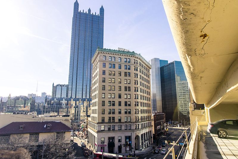
The castellation adorned skyscraper is the PPG Tower, which seems to be the de facto center of the City, here in Pittsburgh. PPG Place is the complex which the tower, a 40 story building designed by Philip Johnson and John Burgee, is found in. The PPG Industries outfit (1883 founded Pittsburgh Plate Glass) has its hands in several industrial sectors which include coatings, house paints, and glazes as well as the manufacture of architectural, automotive, and optical glass. If your eyeglasses use ‘Transitions’ lenses which darken into sunglasses when you walk out into sunlight, you’re a customer.
This shot is from one of the multi story parking lots found in the center of the City of Pittsburgh, which I’ve learned offer interesting points of view.

– photo by Mitch Waxman
PPG is one of the major corporate players here in Pittsburgh, as I’m finding out. On a “behind the lens” note, it’s also one of the set pieces in a shot which says “Pittsburgh.” Back in NYC, that role was played by Empire State and Chrysler buildings with newcomer One World Trade in terms of visually setting a “place.” The East River bridges also performed that function.
Back tomorrow with something new. I’m feeling back to about 80% today. Nothing survives in me for long, as my inner workings are incredibly toxic. Back in January, just after getting here, Covid appeared within and I managed to annihilate that microbial scourge in about 72 hours. Often, it feels as if my white blood cells respond to how angry I am about feeling sick, and the more pissed off I get about it the quicker that they go to work. Probably just hormones, but don’t mess with my personal mythologies – I’m special.
I credit my super charged immune system to the years spent along that ribbon of municipal neglect known as the sewage charged Newtown Creek.
“follow” me on Twitter- @newtownpentacle
Buy a book!
“In the Shadows at Newtown Creek,” an 88 page softcover 8.5×11 magazine format photo book by Mitch Waxman, is now on sale at blurb.com for $30.
a day late and a dollar short
Monday

– photo by Mitch Waxman
One was forced into reaching into the recent archives for today’s post, due to a recently suffered stomach bug which derailed a humble narrator. It was one of those fever and chills with vomit and diarrhea ones, which is ever so pleasant to live through but reminds one of the larger human experience. Saying all that, I don’t have anything new to show you in today’s post, so I looked around for a few shots which I don’t think have made it into other posts.
The one above is from a neighborhood called Polish Hill, here in Pittsburgh.

– photo by Mitch Waxman
McKeesport is a community due east of Pittsburgh, and that’s where I was when a CSX freight train suddenly appeared.
Right now, I’m really missing the cushion of images which I’d built in NYC. When I had ‘nothing,’ there was always a subway post or some yada yada about Sunnyside Yards that a narrative could be conjured out of, but that was then and this is now. I’m just getting started here in Pittsburgh, and my resources are thin.

– photo by Mitch Waxman
I’m feeling a whole lot better at the time of this writing, what I’d describe as 50%. That’s a major improvement over the day before, which saw me regularly disappearing into the bedroom for three hour long naps during the daylight hours. I slept so much yesterday that my fingernails had visibly lengthened and needed a trim.
Back tomorrow with – probably- another archive post.
“follow” me on Twitter- @newtownpentacle
Buy a book!
“In the Shadows at Newtown Creek,” an 88 page softcover 8.5×11 magazine format photo book by Mitch Waxman, is now on sale at blurb.com for $30.
Fall Run Park
Wednesday
– photo by Mitch Waxman
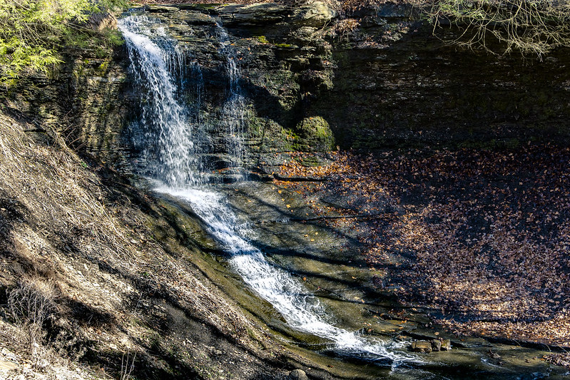
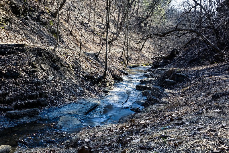
Last weekend, Our Lady of the Pentacle and myself were desirous of taking advantage of yet another unseasonably warm day here in Pittsburgh, so we piled into the Mobile Oppression Platform and drove about twenty minutes to Fall Run Park in the Glenshaw section of Shaler Township.
It’s a ‘run’ rather than a creek or a stream, which is a waterway term I’d never encountered before moving to Pittsburgh. Apparently ‘run’ is synonymous with ‘creek,’ but the former is indicative of rapidly flowing water, whereas the latter indicates slow moving or meandering water. According to legal officialdom – “run of the river means a facility where there is a continuous discharge of water without storage and release of water.”
There’s also a ‘riffle’ to consider, but there you go. There’s a big bunch of runs found in the Pittsburgh area. Has to do with the topology.
– photo by Mitch Waxman
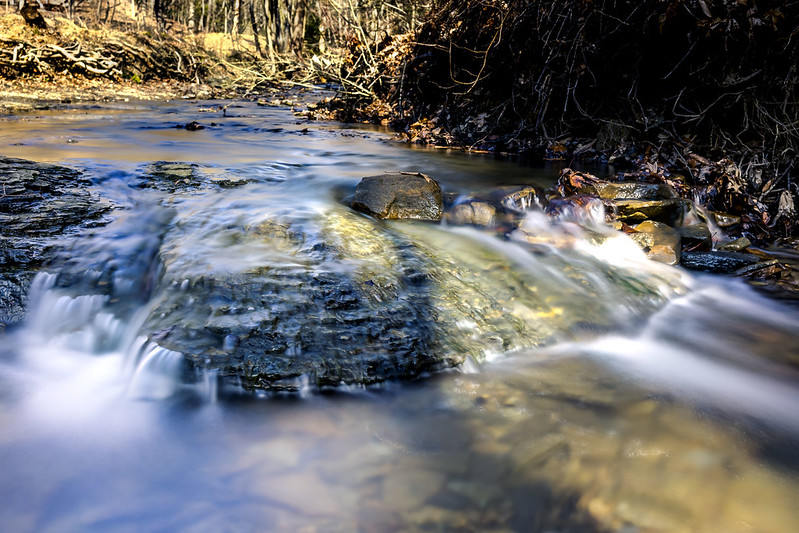
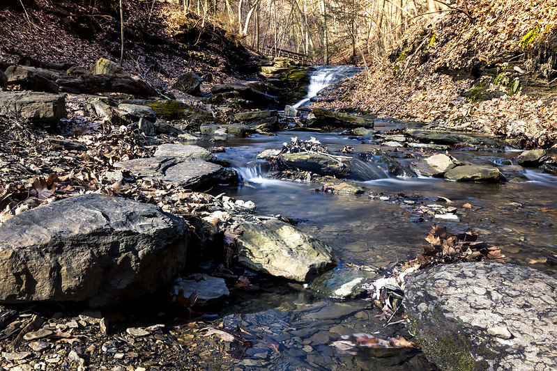
Seldom was the water more than a few inches deep, but it was shooting down hill at a good clip. The park was pretty well attended, and people were there with their kids and dogs. Lots of people, including Our Lady and myself, we’re stepping into the water’s bed in spots we here it was about an inch deep. The underlying rocks were quite slippery, as you’d imagine water polished stone with algae growing on it to be.
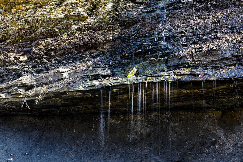
The geology of this place is absolutely fascinating, with sedimentary rock formations that were laid down during the Ordovician Era which is pretty much “pre fishies.” This ancient geology’s tectonic journeys around the globe, especially during the later Carboniferous Era, is why Pennsylvania has so much coal, oil, and gas locked up in the ground. The Appalachian chain is considered to be one of the oldest sets of mountains on the planet.
I just have to say it:
Who can guess, all there is, that might be buried down there?
– photo by Mitch Waxman
I know less about geography than I do about buying women’s shoes, but according to a bit of reading on the topic, the Appalachia’s are about 480 million years old. When the supercontinent which formed them broke apart, sections of this range ended up in both Scotland and Morocco as well as North America. Somewhere between 250 and 66 million years ago (Dinosaur time), the Appalachias – once as tall as the modern day Himalayas – had eroded down to flat ground. Uplift began during the Cenozoic Era, which started 66 million years ago and is the one we’re a part of, and the mountains began to rise. Water erosion cut through the sedimentary stones, revealing the layer cake of its geology. All of those individual layers include a treasury of minerals, including coal.
Really, this is the sort of hell which Our Lady has to live with. I can’t go to a freaking park without reading up on the history of plate tectonics, life on earth, and forming some familiarity with geologic theory.
– photo by Mitch Waxman
Due to the steep slopes and deep valleys here in Pittsburgh, there’s flowing water everywhere you look for it. The watershed here is vast. I still haven’t ventured into a proper set of woods, but there are conservation areas, national and state parks, and huge tracts set aside for hunting that are within easy reach.
Me? I was busy with the camera for a bit before the park got too crowded.

– photo by Mitch Waxman
The water was shallow enough for me to just stride into the flow and set the tripod down in the stream bed, which is something I never did at Newtown Creek or the East River – for obvious reasons.
I think I overdid it with the long exposures in these, losing the texture of the flowing water entirely. Next time around, I’m going to cut my exposure time in half.
– photo by Mitch Waxman
Shaler Township is about a 15 minute drive northeast of Downtown Pittsburgh. Definitely coming back to this spot in about a month when there’s going to be greenery sprouting out of the ground.
Back tomorrow.
“follow” me on Twitter- @newtownpentacle
Buy a book!
“In the Shadows at Newtown Creek,” an 88 page softcover 8.5×11 magazine format photo book by Mitch Waxman, is now on sale at blurb.com for $30.


