Archive for May 2010
roadside shrine

– photo by Mitch Waxman
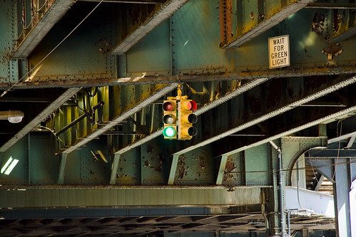
The Brooklyn Queens Expressway rudely occludes the sky at Laurel Hill Blvd. and 58th street in Queens, drowning the ancient lane in supernal shades. The Boulevard transits through the hallowed ground of Calvary Cemetery, between the second and third sections. Often I’ve wondered if the street itself is on hallowed ground.
from encarta.msn.com
hal·lowed [ hállōd ]
adjective. Definition:
- sanctified: holy or kept for religious use- buried in hallowed ground
- respected: regarded with great respect or reverence- the hallowed pages of our country’s history

– photo by Mitch Waxman
A cool and breezy place, as the eye of god itself never shines upon this asphalt, it is a route I favor when returning from sojourns in Maspeth or East Williamsburgh to the remote and troubled hillocks that my beloved Astoria is arrayed upon.
from nycroads.com
SERVING INDUSTRIAL AND DEFENSE NEEDS: In 1940, New York City arterial coordinator Robert Moses recommended that the road, which he saw as a gap in the metropolitan arterial system, “should be filled immediately as an aid to the national defense.” He went on the make the following case for the expressway:
In 1940, Robert Moses recommended that the road, which he saw as a gap in the metropolitan arterial system, “should be filled immediately as an aid to the national defense.” He further went on as follows:
With the completion of through arteries under construction in Brooklyn and Queens, more traffic will be funneled into the Williamsburg and Manhattan bridges than the streets tapping these bridgeheads can carry. The present streets are narrow and congested, with crossings at every block. The crazy quilt pattern of the streets inherited from the villages that grew together to form the present borough adds to the difficulty of travel.
This proposed artery should be built for six lanes of express traffic, separated for most of its length from service roads by malls. It is estimated that construction will cost $5,100,000. This project would require the acquisition of land assessed at approximately $7,000,000, and utilize city-owned property assessed at $345,00

– photo by Mitch Waxman
Encountering a roadside shrine is always an interesting experience, and such tributes are normally found at or near the site of a vehicular accident that claimed lives. In this case, the evidence presented would seem to indicate that 3 men in their 20’s died here- named Tommy, Arturo, and Eric according to the graffiti- although police reports differ from the scrawls on the name of the third man and call him Pedro.
Apparently, the accident occurred nearly one year ago, and made the news at NY1 and at ABC.
from forumnewsgroup.blogspot.com
Three men died last Thursday night when their car slammed into a concrete barrier on Laurel Hill Boulevard after skidding across the road. Police say the driver lost control of his 1992 Volvo while trying to pass another car at a high rate of speed.
A bottle of vodka and small amount of cocaine were later found inside the obliterated car, according to Deputy Inspector Thomas Kavanagh, commanding officer of the 108th Precinct. There was a witness to the crash, which happened at about 10:30 p.m. near 58th Street, where the boulevard runs beneath the expressway and through the cemetery.
The driver, 26-year-old Pedro Sanchez of Brooklyn, and his two passengers, Thomas Owens and Eric Sanguenette, both 27 of Woodside, were pronounced dead at Elmhurst Hospital.

– photo by Mitch Waxman
Increasingly common in the last decade, such roadside shrines have been commented on before at this- your Newtown Pentacle. Another tragic accident that snuffed out young lives due to automotive excess was discussed in the post “A shrine in Greenpoint“.
from usatoday.com
Once an occasional sight along the nation’s highways, roadside memorials have sprouted in recent years like wildflowers after spring rains. There were 42,800 traffic fatalities in the USA last year. No statistics exist on memorials, though one national survey this year by the Maryland Department of Transportation estimates markers are erected after 10% to 20% of fatal crashes.
Family and friends increasingly want to mark the spot, and that can be a problem for everything from motorist safety to road maintenance to those who oppose religious symbols on public land.

– photo by Mitch Waxman
Newtown Pentacle, on behalf of our readers, offers our sympathies to the family and friends of the occupants of the car.
from wikipedia
Roadside memorials have been placed for centuries.
The origin of roadside crosses in the United States has its roots with the early Hispanic settlers of the Southwestern United States, and are common in areas with large Hispanic populations. Formerly, in funerary processions where a group would process from a church to a graveyard carrying a coffin, the bearers would take a rest, or “descanso” in Spanish, and wherever they set the coffin down, a cross would be placed there in memory of the event. The modern practice of roadside shrines commemorate the last place a person was alive before being killed in a car crash, even if they should die in the hospital after the crash.
In the southwestern United States, they are also common at historic parajes on old long distance trails, going back to the roots of the tradition, and also marked the graves of people who died while traveling. A descanso may be decorated specially for the holidays, and for significant anniversaries in the person’s life. A descanso for a child may be decorated with special toys, even toy vignettes of family life, and votive candles may be placed there on special nights.
restless lichens

– photo by Mitch Waxman
A sharp eyed reader and fellow haunter of the tombs tipped me on to this, something I never noticed on 58th street, a sidewalk deprived viaduct that runs between two cemeteries- New Calvary and Mt. Zion.
Mount Zion Cemetery encompasses an area of 78 acres. This cemetery is located in Maspeth, Queens near the Manhattan Border. When this cemetery was first established the surrounding area was considered to be rural. There was an ongoing need for burial spaces to accommodate the explosion of the immigrant population in not only Queens, but also the nearby neighborhoods of Manhattan and Brooklyn. Mount Zion Cemetery has more than 210,000 burials on its 78 acres making it one of the more interesting burial grounds.

– photo by Mitch Waxman
Nitre dripping, the walls of Zion are composed of conventional mortar and stone for much of their length, protecting its centuries of interments with a stout but rusty fence.
from wikipedia
Masonry is the building of structures from individual units laid in and bound together by mortar; the term masonry can also refer to the units themselves. The common materials of masonry construction are brick, stone such as marble, granite, travertine, limestone; concrete block, glass block, and tile. Masonry is generally a highly durable form of construction. However, the materials used, the quality of the mortar and workmanship, and the pattern in which the units are assembled can strongly affect the durability of the overall masonry construction.

– photo by Mitch Waxman
As one nears Laurel Hill Blvd. and the stature of the masonry wall shrinks back to a human scale, a curious heterogeneousness in its composition is noticed. Suddenly granite and “finishing marble” is noticed.
from wikipedia
Sculpture
White marble was prized for its use in sculptures since classical times. This preference has to do with the softness and relative isotropy and homogeneity, and a relative resistance to shattering. Also, the low index of refraction of calcite allows light to penetrate several millimeters into the stone before being scattered out, resulting in the characteristic “waxy” look which gives “life” to marble sculptures of the human body.
Construction marble
Construction marble is a stone which is composed of calcite, dolomite or serpentine which is capable of taking a polish. More generally in construction, specifically the dimension stone trade, the term “marble” is used for any crystalline calcitic rock (and some non-calcitic rocks) useful as building stone. For example, Tennessee marble is really a dense granular fossiliferous gray to pink to maroon Ordovician limestone that geologists call the Holston Formation.

– photo by Mitch Waxman
Proceeding up the block, certain familiar shapes become recognizable in the wall, and a cold dread is realized. Tombstones. They used tombstones to make this part of the wall.
from wikipedia
The stele (plural stelae), as they are called in an archaeological context, is one of the oldest forms of funerary art. Originally, a tombstone was the stone lid of a stone coffin, or the coffin itself, and a gravestone was the stone slab that was laid over a grave. Now all three terms are also used for markers placed at the head of the grave. Originally graves in the 1700s also contained footstones to demarcate the foot end of the grave. Footstones were rarely carved with more than the deceased’s initials and year of death, and many cemeteries and churchyards have removed them to make cutting the grass easier. Note however that in many UK cemeteries the principal, and indeed only, marker is placed at the foot of the grave.
Graves and any related memorials are a focus for mourning and remembrance. The names of relatives are often added to a gravestone over the years, so that one marker may chronicle the passing of an entire family spread over decades. Since gravestones and a plot in a cemetery or churchyard cost money, they are also a symbol of wealth or prominence in a community. Some gravestones were even commissioned and erected to their own memory by people who were still living, as a testament to their wealth and status. In a Christian context, the very wealthy often erected elaborate memorials within churches rather than having simply external gravestones.

– photo by Mitch Waxman
Section markers and footpath monuments are used, as well as grave markers whose screed faces inward. Oh what treasures may be entrusted to the grave’s holding that only some future archaeologist will know?
from sciencedaily.com
“Until now we have relied on evidence from medieval rubbish – including food remains, pottery and other finds – to build up a picture of medieval life in the city. This group of burials represents the first opportunity to examine the medieval population itself, in terms of life expectancy, stature and health.
“Evidence of some communal burials and high infant mortality also indicate evidence of infection and disease.
“The skeletons are very well preserved – some were in coffins and others weren’t and were placed in shrouds. We were expecting there to be some 300 skeletons- but the scale of this discovery is stunning.”
The site dates from between the 12th century and the mid 1500s and is part of the medieval church of St Peter’s – one of two parish churches in the city which disappeared in the late medieval period.
the horror

– photo by Mitch Waxman
Walking past the Sunnyside Yard on Skillman Avenue recently, your humble narrator encountered this loathsome package at the corner of 39th street. Foul seeming, I thought that I had found some sort of crime scene for a moment, until I realized that the bag was professionally sealed and laden with government regulated text.

– photo by Mitch Waxman
13.7 pounds of Chicken Pot Pie soup lay percolating on the sidewalk bathing in the radiate gaze of the thermonuclear eye of god itself. The questions that arise in my mind are multitudinous.
Project Firebox 3

Project Firebox, 6551 – photo by Mitch Waxman
Northern Blvd., battered and apparently out of order. Also, just as a note- the numbers assigned to the fireboxes have NOTHING to do with FDNY numerical assignations.
from forgotten-ny.com
A road runs from the East River to the tip of the North Fork of Long Island, running through Long Island City, Woodside, Jackson Heights, Flushing, Auburndale, Bayside, Douglaston, Little Neck, Great Neck, Munsey Park, Port Washington, Muttontown, East Norwich, Oyster Bay Cove, Cold Spring Harbor, Huntington, Northport, Smithtown, Stony Brook, St. James, Port Jefferson, Rocky Point, East Shoreham, Wading River, Calverton, Riverhead, Aquebogue, Jamesport, Mattituck, Cutchogue, Southold, Greenport, Orient and Orient Point, and would go further were an ocean not in the way. It is a precolonial trace used by Native Americans before Verrazano and the Dutchmen who followed him caught sight of the lengthy island along whose north shore it limns. It’s Jackson Avenue, North Hempstead Turnpike, Lawrence Hill Road, Fort Salonga Road, North Country Road, Main Road, Route 25A, Route 25, and in NYC and Nassau County, it’s Northern Boulevard.
Roosevelt Ave.

– photo by Mitch Waxman
Explorations of the more distant areas of the Newtown Pentacle are consuming. Of late, I find myself wandering the vast corridor of Roosevelt Avenue, which of course connects to the historic Greenpoint Avenue- running across the seldom commented border of Brooklyn and Queens- crossing that shunned strait referred to as the Newtown Creek, and heading for the distant East River. The view above is far from that storied waterway, as Roosevelt Avenue follows the Great Machine toward Flushing, and was shot in Woodside.
from wikipedia
Woodside is a neighborhood in the western portion of the New York City borough of Queens. It is bordered on the south by Maspeth, on the north by Astoria, on the west by Sunnyside and on the east by Elmhurst and Jackson Heights. Its ZIP code is 11377. Some areas are widely residential and very quiet, while others (especially closer to Roosevelt Avenue) are more urban. The neighborhood is located in Queens Community Board 1 and Queens Community Board 2.
In the 19th century the area was part of the Town of Newtown (now Elmhurst). The adjacent area of Winfield was largely incorporated into the post office serving Woodside and as a consequence Winfield lost much of its identity distinct from Woodside.
– photo by Mitch Waxman
Not too far away is the Broadway intersection in Jackson Heights, near the very model of a major modern intermodal transportation hub at the Roosevelt Avenue 74th Street station.
from subwaynut.com
The Roosevelt Avenue-Jackson Heights is the one intermediate express station on the Queens Blvd Line, one of the most heavily used and crowded subway trunk lines. The station in addition to serving the large surrounding shopping district of Jackson Heights is also a major transfer point for passengers between express and local trains, to the number 7 line, whose local station at 74 Street-Broadway is located on its elevated structure above the station, as well as to six bus routes to surrounding areas without subway service, most of which begin and end in the station’s covered bus loop and layover area just outside the main station building entrance at street level. To facilitate this the station has two relatively narrow by IND standards for a busy transfer point island platforms for the four track line and a full length mezzanine that is almost still completely open with the exception of a small section of it at the extreme eastern end, albeit only the portion above the Manhattan-bound platform. Here some sort of non-public area has been carved out of the mezzanine and has been fully tiled over as part of the stations recent renovations. The mezzanine also has a number of glassed off areas along it, that were built probably to entice a shopping concourse to open within fare control, although the only stores there so far are some Bank of America ATMs and what looks like a record store.

– photo by Mitch Waxman
Ethnographic scholars treasure this corridor, serving as a cutaway of immigration and sociological patterns. One end of the street is the high modernity of Queens Blvd. in Sunnyside just a few blocks from 2nd and 3rd Calvary Cemeteries, and as it travels through Woodside, Jackson Heights, Elmhurst, Corona, past Citifield, and into Flushing- one sees a cross section of the entire planet’s human infestation. North American, South American, European, African, Asian, Polar- all the tribes of man are here.
Incidentally, a surprising number of psychics, storefront healers, and ethno-religious peasant magick suppliers are observed along its route.
from wikipedia
A botánica (often written botanica and less commonly known as a hierbería or botica) is a retail store that sells folk medicine, religious candles and statuary, amulets, and other products regarded as magical or as alternative medicine. They also carry oils, incense, perfumes, scented sprays (many of which are thought to have special properties) and various brand name health care products.
These stores are common in many Hispanic American countries and communities of Latino people elsewhere. As such:
Botánicas now can be found in any U.S. city that has a sizable Latino/a population, particularly those with ties to the Caribbean. The number of botánicas found outside of New York and Miami has grown tremendously in the last ten years.
The name botánica is Spanish and translates as “botany” or “plant” store, referring to these establishments’ function as dispensaries of medicinal herbs. Medicinal herbs may be sold dried or fresh, prepackaged or in bulk.
Botánica almost always feature a variety of implements endemic to Roman Catholic religious practice such as rosary beads, holy water, and images of saints. Among the latter, the Virgin of Guadalupe and other devotional figures with a Latin American connection are especially well-represented. In addition, most have products associated with other spiritual practices such as candomblé, curanderismo, espiritismo, macumba and santeria.


