Archive for the ‘Mt. Zion Cemetery’ Category
hyper glycemic
Get off my lawn.

– photo by Mitch Waxman
Oh, industrial Maspeth… the only place these days where a humble narrator can find any peace. Unfortunately, the Real Estate Industrial Complex has noticed the place in recent months, and there’s been series of flurried exchanges of industrial properties taking place thereabouts which have involved eye watering amounts of cash. This is never a good sign for an industrial neighborhood, and it means that City Hall’s officiates must be receiving visits from their paymasters in the banking and bond industries of Manhattan. I’ve always believed industrial Maspeth to be “proofed” against artisanal anything, except for a beat down, but a humble narrator is getting a bit worried about my happy place. When the REIC shit flies begin to gather, it never ends well for any neighborhood.
All the poisons in the mud will hatch out eventually, I presume.

– photo by Mitch Waxman
The Coca Cola plant on Borden has been bought by Home Depot, I’m told. Additionally, Fed-Ex and UPS continue to acquire properties in the area. A warehouse on the corner of Grand and Rust just changed hands for forty two million buckaroos. Magnification of truck and auto traffic is therefore on the menu for this already busy area and the neighborhoods surrounding it. Nobody is talking about protected bike lanes in industrial Maspeth, yet, as the particular group of busy bodies who push that agenda seem to be currently focused on Sunnyside.
I would offer that there are places in industrial Maspeth where you won’t find sidewalks, and others where the sidewalks are de facto parking lots for semi trucks.

– photo by Mitch Waxman
A conversation yesterday with a friend who works in officialdom occurred, which was focused on the first of two Blissville homeless shelter protests (yesterday was at Gracie Mansion, today’s will be at City Hall at noon. I’ll be there, and wearing a suit!) and eventually drifted over to definitions of political terminologies. The term “progressive” came up, which is a particular bugbear for a humble narrator. A lot of modern politicos use that one to describe themselves and their stance. I remind them that “progress” was the watchword used by Robert Moses when he was justifying the sacrifices of local communities who needed to get out of the way of his highways. New Yorkers who lived in the age of “progress” saw whole neighborhoods disappear in the name of urban renewal, or slum clearance, and Moses had no ethical problem with digging up graveyards to make way for his roads in its name. Today’s “progressives” call themselves that because the word “liberal” has been so thoroughly and successfully demonized by the other side of the national political argument that it’s become political suicide to describe yourself as such. Their take is that the tax burden should be increased on the well off to aid the less lucky. That isn’t progress, that’s socialism, and under that philosophic approach to things the revenues collected by the state in the name of helping the poor usually end up getting spent on the expansion of the government bureaucracy which administers the process. This was the ultimate failing of the New Deal, which allowed people like Robert Moses to run amok in places like industrial Maspeth. It also gave rise to Barry Goldwater, Reagan, and the modern day conservative movement. Institutional memory is entirely absent in the modern world, I tell you.
I favor the Eleanor Roosevelt definition of progressivism – “We all do better when we’re all doing better.” I interpret that to mean that by setting the stage for all tiers of the economic spectrum to succeed, the “raft” is lifted for all.
Upcoming Tours and Events
June 9th – Exploring Long Island City – with NY Adventure Club.
Long Island City is a tale of two cities; one filled with glittering water-front skyscrapers and manicured parks, and the other, a highly active ground transportation & distribution zone vital to the New York economy — which will prevail?
Tickets and more details here.
May 17th – Port Newark Boat Tour – with Working Harbor Committee.
For an exciting adventure, go behind the scenes of the bustling Port of NY & NJ on our Hidden Harbor Tour® of Port Newark! Get an insider’s view of the 3rd largest port in the nation, where container ships dock and unload their goods from around the world. See how the working harbor really works and learn about what all those ships and tugs do. See giant container terminals, oil docks, dry dock repair, and more! Tickets and more details here.
“follow” me on Twitter- @newtownpentacle
luring skylines
Only the lonely…

– photo by Mitch Waxman
Girt in filthy black outer wear, with camera dangling, recent endeavor found a humble narrator scuttling in the general direction of Bushwick from Astoria. Crossing the Newtown Creek at just the right spot is critical, as the various street grids of the ancient communities which surround it are often at odds with each other and can be described as dangerously heterogenous. Walk over the wrong bridge and you could have easily added a half hour to the journey.
In the case of walking from Astoria to Bushwick, the best path to follow is actually one through Sunnyside, Woodside, and Maspeth. You want to aim yourself at the Grand Street Bridge, where you’ll get a nice view of the Koscisuzcko Bridge if you get there at the right time of day.

– photo by Mitch Waxman
Using knowledge of the old municipal grids which signified the borders of the independent towns and villages, one threw himself inexorably south and east. Crossing the former Thomson Avenue, now called Queens Blvd., nearby its intersection with Greenpoint/Roosevelt Avenue vouchsafed me passage out of the street pattern of the Middleburgh section of Long Island City now known as Sunnyside. The natural turn one would make at this point is about ten blocks eastwards at 58th street nearby the so called “Big Six” buildings, which is less than pedestrian friendly and visually “meh.”

– photo by Mitch Waxman
Instead, one cut through the funereal properties of the Roman Catholic Church called “Second Calvary Cemetery,” a path which guaranteed one a bit of quietude and solace. One always feels at home amongst the tomb legions, for their condemnations and judgment are always silent. There are four Calvary Cemeteries, by the way, which share common supervision under an organization called “the Trustees of Old St. Patrick’s cathedral.” The local manager – over the groundskeepers, interments, office, and all other existential issues is provided by a fellow named Joe.

– photo by Mitch Waxman
As is the case with many cemeteries in Queens, a highway bisects the property. In this case, it’s the Brooklyn Queens Expressway, and although the local street below it has no street signs or other demarcations – it’s Laurel Hill Blvd. The Calvary’s on the southern extent of the highway are Calvary #’s three and four. You end up on 58th street anyway, at the end of this street, where a southern or right turn is exacted. You’re still in Woodside at this point, incidentally.
The sidewalks stop about halfway between 58th street’s two corners, and it’s a long block between the BQE and the Long Island Expressway, I tell ya, and there ain’t no sidewalks for most of it.

– photo by Mitch Waxman
Along 58th, on the east side of the street, is Mount Zion cemetery. Third Calvary is across the road, on the west side. Mount Zion is a Jewish cemetery, and was primarily set up for folks who lived on the crowded Lower East side of lower Manhattan. This graveyard uses every possible square inch of space for interments.

– photo by Mitch Waxman
It was on 58th street, along the wrought iron gates of Mount Zion Cemetery, that the latest trophy of the Queens Cobbler was observed. The Queens Cobbler is – of course – a local serial killer who leaves behind single shoes as ghastly trophies of his or her nefarious activities.
One couldn’t linger though, as a particular form of psychological torment was awaiting me in Bushwick and I didn’t want to be late.
“follow” me on Twitter- @newtownpentacle
dizzily down
From the perspective of a wandering mendicant…

– photo by Mitch Waxman
Often have I commented on the hazy “intertidal” zones found along the former borders of long forgotten town and village municipalities in Western Queens – in fact, I’ve coined the term “angles between” for them. There’s – functionally – no one alive today who has a personal remembrance of Maspeth or Woodside being referred to as towns or villages with clearly defined borders due to urban sprawl and the life’s work of Robert Moses. When the City of Greater New York consolidated Long Island City and the county of Newtown into a new entity called “Queens,” it’s at these hazy border areas that the Manhattan people got away with literal “bloody murder.” The export of Manhattan’s dirty industries, it’s unwanted poor, the corpses of its dead – all were sent east to what was – then – a still quite agricultural community called Queens. This also happened to the Bronx and Staten Island, and to a lesser degree Brooklyn.
The local politicians in the “lesser” boroughs were more than happy to take on the cemeteries, heavy industries, and garbage handlers in the name of “progress” and doing favors for the hidden elites of Manhattan.

– photo by Mitch Waxman
The Shining City of Manhattan replaced its tenements, its abattoirs, its manufactured gas plants with what at the time would have referred to as “modern” apartment blocks. For you real estate savvy types – that’s so called “pre war” developments like Tudor City in Murray Hill, Peter Cooper Town/Stuyvesant Village which sits on the former site of several Manufactured Gas Plants, or the United Nations building (built into the former site of several slaughterhouses and abattoirs that was known as “blood alley”). The process of converting industrial Manhattan over to a residential and commercial center kicked into high gear in the years before and directly following the Second World War, the age of “urban renewal.” That’s when the highways were jammed through on Long Island, the dairy farms of Queens were converted to housing tracts, and the “Manhattancentric” school of thought concerning development really kicked in. The tenements emptied as the teeming masses sought a better life in Queens, and further east in suburban Nassau and Suffolk counties. This turned Western Queens into a transit corridor for trade and commuters.
It’s all about “the City” and literally all roads for hundreds of miles in any direction lead to Manhattan.
– photo by Mitch Waxman
Mt. Zion cemetery – that’s its Maurice Avenue fence line pictured above and it’s in the center of all the shots in today’s post – is categorically in Maspeth, and it is infested with tiny gecko like lizards. Saying that, it also defines Maspeth’s blurry border with Woodside in the same way that Maspeth’s border with LIC’s Blissville section is defined by the Koscisuzcko Bridge. The cemetery is fairly ancient by Queens’s standard, it’s roughly 78 acres in size, there’s around 210,000 interments therein, and its first burial in Mt. Zion was conducted in 1893. There used to be a Gypsy encampment here, a shanty town that was home to a Romani tribe from Transylvania that called itself the “Rudari,” or “Ludar,” depending on whom you ask. The Rudari, just for the sake of literary trivia, are the same tribe that worked for Count Dracula in the Bram Stoker novel named for the vampire lord. The historical record of Queens usually refers to them as “The Maspeth Gypsy’s,” and it should be mentioned that referring to them using such nomenclature would be considered a racist hate crime and slur in the modern day European Union.
The Rudari were renowned for copper working and animal training. The reason that the circus train still comes to Western Queens every year is that the circus industry used to buy trained critters – bears, horses, etc. – from them. Many Rudari found work at the Phelps Dodge copper refinery along Newtown Creek, and remnants of their community persist to this day in the Sunnyside Gardens area along Queens Blvd.

– photo by Mitch Waxman
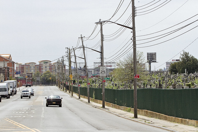
There are a series of semi detached one and two story homes in the area directly surrounding Mt. Zion, which are sandwiched between the Long Island Expressway and Brooklyn Queens Expressway. To the south is the heavy manufacturing district surrounding the eastern side of Newtown Creek and its tributary Maspeth Creek. Mixed use industrial zoning directly touches the cemetery, and hundreds of truck based warehouse businesses are located hereabouts. There is also a large footprint Coca Cola distribution center nearby, and a primary shipping hub for United Parcel Service is less than a mile away, as is the warehouse and distribution center for the Duane Reade retail empire. Mt. Zion’s western side is directly across the street from the Second, Third, and Fourth sections of Calvary Cemetery. Pictured in the first shot of today’s post is part of the Department of Sanitation’s colossal vehicle maintenance facility, which is right next door to an NYPD vehicle maintenance facility, and there’s an FDNY vehicle maintenance facility nearby as well. Suffice to say that these are heavily travelled streets, here under the Long Island Expressway and just a short walk away from Newtown Creek.
If you talk to the people who live anywhere near this area, their common complaint always involves the amount of trucks and cars which use their neighborhood as a thoroughfare. Of course, talking to the people of Queens is considered an obstacle by City Hall, and a loathsome requirement when implementing their policies.

– photo by Mitch Waxman
Mt. Zion cemetery was set up for members of the Jewish community, whose burial laws are a bit different than the Catholic ones. Jews are meant to buried singularly, rather than having multiple bodies in the same gravesite as in the Catholic tradition. This means that Mt. Zion sprawls and has the appearance of being overcrowded. There are sections of the cemetery which are virtually impassable due to this, where it is impossible to find a place to put your foot down between the rows of tombstones.
The streets surrounding it are barren, virtually treeless, and are a favored spot for illegal dumping of construction debris and other garbage.

– photo by Mitch Waxman
The reason that this little travelogue is being presented today involves the plans recently presented by the De Blasio administration to convert a hotel in the area over to a homeless shelter. A subsequent post will detail the hotel and the area directly surrounding it, but this is the northern side of the zone which the “Big Little Mayor” has picked to warehouse those who are considered socially and economically undesirable. The community of Maspeth has responded with their characteristic flair, and pushed back on City Hall with considerable skill and energy. City Hall, as is its habit under the current Mayor reacted to the protests by implying that Maspeth’s indignation is fueled by racism. Several publications picked up this theme, and the Internet commentarium knee jerk followed the rhetoric offered by the administration of the “Dope from Park Slope.”
My personal views on the Maspeth shelter project were the subject of a debate recently with a former colleague whose views and perspectives I greatly respect, but the argument I make about the placement of people – people who exist at the lowest end of the socio-economic spectrum – in this area is that it’s a human rights violation.
Simply put, it ain’t exactly a bed of salubrious roses out around these parts even if you’ve got money in your pocket, let alone when you’re down and out. This wouldn’t be a shelter, this would be a penal colony.

– photo by Mitch Waxman
Maspeth, as in the community of, has been doing a great job of demonstrating its objections to the placement of a homeless shelter hereabouts. They don’t need me to chime in, or make war, for them.
What I’ve found disturbing is that the knee jerk reportage mentioned above that describes their objections in terms of “rich white people” not wanting “poor black people” in their neighborhood – which has been presented by news sites that have covered the protests.

– photo by Mitch Waxman
To start, there’s a few different sides to Maspeth. To the south and east, you do indeed have a somewhat suburban and moneyed section that is populated by people of European decent. To the south and west you’ve got an industrial zone, but you’ll find the odd block of homes in there, the residents of which are a hodge podge of “everybody.” On the north western side, here around Mt. Zion, my observations have revealed a population who are pretty much the same mix of people you see everywhere in Woodside, Sunnyside, Astoria and so on. East and Southeast Asians, Africans and African Americans, Irish, Jews, Italians, Levantines, Middle Easterners – the whole “vibrant diversity” mix that the politicians are always crowing about.
The “homeless” are not a monolithic people comprised from a single racial group with a common ancestor. Who these “homeless” are would be best defined, by Marxist economists, as the “underclass” and what they have in common is not the color of their skin but grinding poverty. I’ve always argued that just calling these people “the homeless” is dehumanizing and that it’s done by those armchair academics who have never actually known someone living on the street in any context other than dropping a quarter in their cup. There is no “homeless problem,” rather there’s tens of thousands of individual problems. Siting them away from a familiar setting, breaking whatever they have left of a social network, treating them like something to be warehoused in a neighborhood of warehouses – this ain’t the right idea.
On the subject of every neighborhood having to do “its fair share” – Maspeth already handles close to 20% of NYC’s garbage, it hosts the LIE and BQE, has several NYS and one Federal Superfund sites in it, and there are intersections where close to 3-400 heavy trucks an hour roll through on their way to Manhattan. The garbage train also transits through Maspeth a few times a day, which represents and comingles Brooklyn’s share of the garbage handling with Maspeth’s.

– photo by Mitch Waxman
There are virtually no mass transit lines available from this location, police patrols are infrequent at best, and at night this is a virtually abandoned part of the city. Bus service is spotty, and it’s one of the places in Queens where you truly need a personal vehicle to get around.
There are streets with no sidewalks here in the half mile around the proposed shelter.

– photo by Mitch Waxman
The shocking ignorance of City Hall regarding the existential realities of Western Queens never fails to amaze me. All they seem to know about our neighborhoods is what they see on maps rolled out on mahogany desktops that have pins stuck into them by paid cronies. I’ve met several members of the Dept. of City Planning over the years, and the ones who I respect the hell out of are the ones who put on a pair of sneakers periodically and go out for walks in the areas they’re assigned to. I don’t always agree with their choices, but I do respect them.
I have a random idea, which is to site a homeless shelter on 11th street in Park Slope, just off fifth avenue.
Tomorrow, we’ll cross under the highway and take a direct look at what Mayor Bill De Blasio considers as being a good fit for one of the most vulnerable populations of people in NYC to call their temporary home, since he hasn’t decided to lead by example and convert his aforementioned house on Park Slope’s 11th street over to either affordable housing or for use as a shelter.
Upcoming tours and events:
“First Calvary Cemetery” walking tour
with Brooklyn Brainery, Saturday, October 8th from 11:00 a.m. to 1:00 p.m.
Click here for tickets.
“follow” me on Twitter- @newtownpentacle
breezed aperture
Wandering, ever wandering, and warnings.

– photo by Mitch Waxman
One found himself in Maspeth and scuttling past Mount Zion Cemetery recently, on the Maurice Avenue side. As is my habit, vast self recrimination and a certain series of guilty remembrances was underway. One likes to pull at scabs, feel the texture of the many scars which scribe, and generally feel rotten about every decision I’ve ever made. This thought process is actually something I schedule away for when I’m by myself on these long walks around the Newtown Pentacle, so as to keep others from having to experience who – and what – I really am.
One was musing about footprints while walking past the great burial ground. There’s the environmentalist and hiker etho about “leaving behind nothing but footprints,” the historian’s one about “tracking the footprints of giants,” and the Brooklyn one about “sticking my boot up yo ass.” The latter is what I’m focused on at the moment.

– photo by Mitch Waxman
“Being Creative” doesn’t necessarily mean wanting to draw a picture in my current world view. When I use that statement these days, I’m mainly thinking about Dharma. You can either create or destroy in this world we commonly hold, and the choice you make between those two poles reflects whom you aspire to be. Struggling to be “creative” against my darker urges to “crush, kill, and cause anyone I disagree with to perish in fire” is sort of what one has been aspiring to in the last decade.
Saying that, one grows weary of having to contantly reaffirm that I am exactly who I claim to be and not the shadow agent of some moneyed cabal. I have no agenda, no goal, no desire. All I want is for environmental conditions to not suck as hard as they do, and for the City to stop dumping raw sewage into the water. I also want to remind people that places like Mount Zion have a long and storied past, and that few remember the Maspeth Gypsies or the Native Americans who once called this place home as institutional memory is in short supply amongst modern people.

– photo by Mitch Waxman
It is enough to breed paranoia, and the next person who accuses me of being a shill for some malign corporate or governmental entity is going to receive the full Brooklyn footprint mentioned above, and I wear a size 11 shoe. This line of thought, however, is what one struggles against. It’s “not creative,” rather it’s destructive.
Nothing is achieved by destruction save the feeling of superiority over others. It gets nothing done, and the divisive process of internecine warfare amongst like minded individuals actually results in those aforementioned malign corporate or governmental entities winning the day as the field has been cleared of opponents. We agree on more than we disagree about, let’s fix the things we agree on and then argue the rest when the work is done.

– photo by Mitch Waxman
Green and growing places are good. Concrete and highways are bad. Can we agree on that?
Thoughts like these are what one prefers to think about, rather than planning the destruction of enemies and anticipating the lamentations of their women and children. Don’t mess with a humble narrator, accusers, because a great wheel will roll right the hell over you and crush you down into the poison loam of Queens.
You don’t want to make me angry, as you won’t like me when I’m angry.
“follow” me on Twitter- @newtownpentacle
Upcoming Tours –
October 3rd, 2015
Calvary Cemetery Walking Tour
with Atlas Obscura, click here for details and tickets
henceforward have
Anniversaries, antichrists, and apocalypse.

– photo by Mitch Waxman
Something about the centennial mark of the “fin de siécle” made one think about Mt. Zion cemetery, which is pictured in today’s post. The term refers to the end of the 19th century in its literal interpretation, but broader usage of “fin de siécle” is meant to imply the sense of doom which the late 19th century’s artists and academics expressed. They knew it was coming, the end of the age, an apocalypse.

– photo by Mitch Waxman
There’s interpretation and intuition being offered everywhere online today about the century marker for the First World War’s official start. There’s the version of the story which talks about all the war dead, the one where the United States became “America!!!” because of the conflict, and the chestnut about the decline of the European peninsula from its former status as the center of colonial supremacy. The antichrist appeared in Russia, and he raised a godless rogue state from the ashes of the Tsarist form of government.

– photo by Mitch Waxman
Personally, I’ve always ascribed to the concept of the “Second Thirty Years War” when describing the state of world affairs between 1914 and 1945, but that period is less “fin de siécle” and more “birth pangs of the modern era,” from our perspective. We know how the story comes out.
The First World War was actually a war of industrial bases when you think about it. Vast international death machines require long logistical supply lines, or so I am told, many of which stretched all the back to my beloved Newtown Creek oddly enough. Given my particular love of the industrial sectors of LIC and Greenpoint surrounding the waterway, which were at their height during WW1, I try to only think of cemeteries when considering the conflict. Keeps me even, and helps hint at why Granpa Alex didn’t ever want to talk about the war.
“follow” me on Twitter- @newtownpentacle


