Archive for 2010
the horror

– photo by Mitch Waxman
Walking past the Sunnyside Yard on Skillman Avenue recently, your humble narrator encountered this loathsome package at the corner of 39th street. Foul seeming, I thought that I had found some sort of crime scene for a moment, until I realized that the bag was professionally sealed and laden with government regulated text.

– photo by Mitch Waxman
13.7 pounds of Chicken Pot Pie soup lay percolating on the sidewalk bathing in the radiate gaze of the thermonuclear eye of god itself. The questions that arise in my mind are multitudinous.
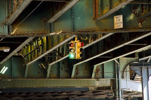
Project Firebox 3

Project Firebox, 6551 – photo by Mitch Waxman
Northern Blvd., battered and apparently out of order. Also, just as a note- the numbers assigned to the fireboxes have NOTHING to do with FDNY numerical assignations.
from forgotten-ny.com
A road runs from the East River to the tip of the North Fork of Long Island, running through Long Island City, Woodside, Jackson Heights, Flushing, Auburndale, Bayside, Douglaston, Little Neck, Great Neck, Munsey Park, Port Washington, Muttontown, East Norwich, Oyster Bay Cove, Cold Spring Harbor, Huntington, Northport, Smithtown, Stony Brook, St. James, Port Jefferson, Rocky Point, East Shoreham, Wading River, Calverton, Riverhead, Aquebogue, Jamesport, Mattituck, Cutchogue, Southold, Greenport, Orient and Orient Point, and would go further were an ocean not in the way. It is a precolonial trace used by Native Americans before Verrazano and the Dutchmen who followed him caught sight of the lengthy island along whose north shore it limns. It’s Jackson Avenue, North Hempstead Turnpike, Lawrence Hill Road, Fort Salonga Road, North Country Road, Main Road, Route 25A, Route 25, and in NYC and Nassau County, it’s Northern Boulevard.
Roosevelt Ave.

– photo by Mitch Waxman
Explorations of the more distant areas of the Newtown Pentacle are consuming. Of late, I find myself wandering the vast corridor of Roosevelt Avenue, which of course connects to the historic Greenpoint Avenue- running across the seldom commented border of Brooklyn and Queens- crossing that shunned strait referred to as the Newtown Creek, and heading for the distant East River. The view above is far from that storied waterway, as Roosevelt Avenue follows the Great Machine toward Flushing, and was shot in Woodside.
from wikipedia
Woodside is a neighborhood in the western portion of the New York City borough of Queens. It is bordered on the south by Maspeth, on the north by Astoria, on the west by Sunnyside and on the east by Elmhurst and Jackson Heights. Its ZIP code is 11377. Some areas are widely residential and very quiet, while others (especially closer to Roosevelt Avenue) are more urban. The neighborhood is located in Queens Community Board 1 and Queens Community Board 2.
In the 19th century the area was part of the Town of Newtown (now Elmhurst). The adjacent area of Winfield was largely incorporated into the post office serving Woodside and as a consequence Winfield lost much of its identity distinct from Woodside.
– photo by Mitch Waxman
Not too far away is the Broadway intersection in Jackson Heights, near the very model of a major modern intermodal transportation hub at the Roosevelt Avenue 74th Street station.
from subwaynut.com
The Roosevelt Avenue-Jackson Heights is the one intermediate express station on the Queens Blvd Line, one of the most heavily used and crowded subway trunk lines. The station in addition to serving the large surrounding shopping district of Jackson Heights is also a major transfer point for passengers between express and local trains, to the number 7 line, whose local station at 74 Street-Broadway is located on its elevated structure above the station, as well as to six bus routes to surrounding areas without subway service, most of which begin and end in the station’s covered bus loop and layover area just outside the main station building entrance at street level. To facilitate this the station has two relatively narrow by IND standards for a busy transfer point island platforms for the four track line and a full length mezzanine that is almost still completely open with the exception of a small section of it at the extreme eastern end, albeit only the portion above the Manhattan-bound platform. Here some sort of non-public area has been carved out of the mezzanine and has been fully tiled over as part of the stations recent renovations. The mezzanine also has a number of glassed off areas along it, that were built probably to entice a shopping concourse to open within fare control, although the only stores there so far are some Bank of America ATMs and what looks like a record store.

– photo by Mitch Waxman
Ethnographic scholars treasure this corridor, serving as a cutaway of immigration and sociological patterns. One end of the street is the high modernity of Queens Blvd. in Sunnyside just a few blocks from 2nd and 3rd Calvary Cemeteries, and as it travels through Woodside, Jackson Heights, Elmhurst, Corona, past Citifield, and into Flushing- one sees a cross section of the entire planet’s human infestation. North American, South American, European, African, Asian, Polar- all the tribes of man are here.
Incidentally, a surprising number of psychics, storefront healers, and ethno-religious peasant magick suppliers are observed along its route.
from wikipedia
A botánica (often written botanica and less commonly known as a hierbería or botica) is a retail store that sells folk medicine, religious candles and statuary, amulets, and other products regarded as magical or as alternative medicine. They also carry oils, incense, perfumes, scented sprays (many of which are thought to have special properties) and various brand name health care products.
These stores are common in many Hispanic American countries and communities of Latino people elsewhere. As such:
Botánicas now can be found in any U.S. city that has a sizable Latino/a population, particularly those with ties to the Caribbean. The number of botánicas found outside of New York and Miami has grown tremendously in the last ten years.
The name botánica is Spanish and translates as “botany” or “plant” store, referring to these establishments’ function as dispensaries of medicinal herbs. Medicinal herbs may be sold dried or fresh, prepackaged or in bulk.
Botánica almost always feature a variety of implements endemic to Roman Catholic religious practice such as rosary beads, holy water, and images of saints. Among the latter, the Virgin of Guadalupe and other devotional figures with a Latin American connection are especially well-represented. In addition, most have products associated with other spiritual practices such as candomblé, curanderismo, espiritismo, macumba and santeria.
opiate peace

– photo by Mitch Waxman
This is not a dead place, this Creek which forms the currently undefended border between much of Brooklyn and Queens, despite wholly inaccurate statements to the contrary recently presented by major publications. To begin with, there is the teeming human infestation, whose population is in the millions. Additionally- migratory birds, invertebrate and vertebrate water fauna, and an enormous hidden population of higher mammals lurk amongst the canalized shorelines of the Newtown Creek.
from the nytimes.com– an article that gets a lot of things completely wrong, which is surprising for the times, and seems to be shilling against “Big Oil”
People don’t often think of urban creeks as biodiverse waterways, but Newtown Creek was once a rich tidal estuary popular among hunters and fishermen. Starting in the 1870s, however, Standard Oil and other refineries began spilling or dumping excess fuels and toxic chemicals into the water or onto the soil, slowly poisoning the ecosystem.

– photo by Mitch Waxman
Famously and recently, a Dolphin’s appearance near the Pulaski Bridge excited the neighboring communities, but such extravagances of nature would have a difficult time at Newtown Creek. There are ocean going and brackish water fish that get swept into the Creek by the East River’s irresistible tidal cycles, which actually drown in the oxygen poor water, but I’ve observed other things swimming in its shallow depths. Weird squamous things that defy description, burrowers and soft bodied tunnelers which thrive in the putrid muds that line its soft bottom. Perhaps, when the federal EPA superfund work begins, studies of these uncommented organisms will commence.
Hey, not everything that lives is beautiful, but against all the odds- life is tenacious and nature will find a way to get by.
from epa.gov
Newtown Creek is a part of the New York – New Jersey Harbor Estuary that forms the northernmost border between the New York City boroughs of Brooklyn and Queens. In the mid 1800s, the area adjacent to the 3.8 mile Newtown Creek was one of the busiest hubs of industrial activity in New York City. More than 50 refineries were located along its banks, including oil refineries, petrochemical plants, fertilizer and glue factories, sawmills, and lumber and coal yards. The creek was crowded with commercial vessels, including large boats bringing in raw materials and fuel and taking out oil, chemicals and metals. In addition to the industrial pollution that resulted from all of this activity, the city began dumping raw sewage directly into the water in 1856. During World War II, the creek was one of the busiest ports in the nation. Currently, factories and facilities still operate along the creek. Various contaminated sites along the creek have contributed to the contamination at Newtown Creek. Today, as a result of its industrial history, including countless spills, Newtown Creek is one of the nation’s most polluted waterways.
Various sediment and surface water samples have been taken along the creek. Pesticides, metals, PCBs, and volatile organic compounds (VOCs), which are potentially harmful contaminants that can easily evaporate into the air, have been detected at the creek.
In the early 1990s, New York State declared that Newtown Creek was not meeting water quality standards under the Clean Water Act. Since then, a number of government sponsored cleanups of the creek have taken place. The New York City Department of Environmental Protection has sampled sediment and surface water at a number of locations along the creek since 1980. In 2009, EPA will further sample the sediment throughout the length of Newtown Creek and its tributaries. The samples will be analyzed for a wide range of industrial contaminants. EPA will use the data collected to define the nature of the environmental problems associated with Newtown Creek as a whole.
Project Firebox 2

Project Firebox, 4930 – photo by Mitch Waxman
This battered sentinel is found on Skillman Avenue, just across the street from the cyclopean Sunnyside Yards.
from wikipedia
The yard is owned by Amtrak, but it is also used by New Jersey Transit. The shared tracks of the Long Island Rail Road (LIRR) Main Line and Amtrak’s Northeast Corridor pass along the southern edge of the yard. Plans for the LIRR East Side Access project to build tracks to Grand Central Terminal would have those tracks diverging in the vicinity of, or perhaps through, the Sunnyside Yard.
Northeast of the yard a balloon track (or reverse loop) is used for “U-turning” Amtrak and NJ Transit trains which terminate at Penn Station. Leading eastward near the south side of the yard, this balloon track switches off and turns left under the LIRR/Amtrak tracks, turns left once again, and merges with the Sunnyside yard track to turn the train west toward Penn Station.


