Archive for 2012
guarded inquiries

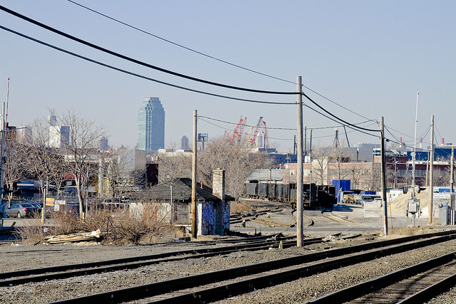
– photo by Mitch Waxman
There are lots and lots of Newtown Creek oriented things going on in the next week or two. Tonight is a meeting of the Newtown Creek Monitoring Committee which will be in Greenpoint at the estimable Newtown Creek Wastewater Wastewater Treatment Plant. Details are below.
What: Newtown Creek Monitoring Committee DEP Meeting
When: February 16 at 6:30 p.m.
Where: Newtown Creek Wastewater Treatment Facility, 329 Greenpoint Ave. (not in the visitor’s center, ask at the guard box)

– photo by Mitch Waxman
More details on the event listed below can be found at the Newtown Creek Alliance website, but this will be a joint DEP/DEC show which is aimed at (and I quote):
As part of development of a water quality improvement plan for Newtown Creek, the New York State Department of Environmental Conservation (NYSDEC) and the New York City Department of Environmental Protection (DEP) are holding a public meeting to present information and obtain public input. NYSDEC and DEP want to consider and, as appropriate, include comments from the public in the Newtown Creek Watershed/Waterbody Facility Plan (WWFP) before it is finalized. A WWFP is the initial step in the process toward achieving water quality goals for Newtown Creek. Following final WWFP approvals, DEP will commence the Long Term Control Plan for Newtown Creek.
What: DEP/DEC meeting on the Newtown Creek Watershed/Waterbody Facility Plan
When: Wednesday, February 22, 2012 at 6:30 pm
Where: The Newtown Creek Wastewater Treatment Facility Visitor Center 329 Greenpoint Avenue, Brooklyn NY 11222. Enter at the intersection of Greenpoint Avenue and Humboldt Street

My own attempt at presenting a cogent narrative and historical journey “up the creek” is up coming as well-
Your humble narrator will be narrating humbly on Friday, February 24th at 7:30 P.M. for the “Ridgewood Democratic Club, 60-70 Putnam Avenue, Ridgewood, NY 11385” as the “Newtown Creek Magic Lantern Show” is presented to their esteemed group. The club hosts a public meeting, with guests and neighbors welcome, and say that refreshments will be served.
The “Magic Lantern Show” is actually a slideshow, packed with informative text and graphics, wherein we approach and explore the entire Newtown Creek. Every tributary, bridge, and significant spot are examined and illustrated with photography. This virtual tour will be augmented by personal observation and recollection by yours truly, with a question and answer period following.
For those of you who might have seen it last year, the presentation has been streamlined, augmented with new views, and updated with some of the emerging stories about Newtown Creek which have been exclusively reported on at this- your Newtown Pentacle.
For more information, please contact me here.
What: Newtown Creek Magic Lantern Show
When: Friday, February 24th at 7:30 P.M.
Where: Ridgewood Democratic Club, 60-70 Putnam Avenue, Ridgewood, NY 11385

– photo by Mitch Waxman
Lastly, the keen intellect of the Newtown Creek Alliance’s leadership will be on display, as they emerge from that hidden base maintained by the group somewhere in the vast watershed- I’m not allowed to say where it is, nor could I- as I’ve been blindfolded every time that I’ve been brought there. This will be a public meeting, wherein the status of ongoing projects will be explored and presented cogently.
What: Newtown Creek Alliance Public Meeting
When: Monday, Feb 27 at 6pm
Where: LaGuardia Community College, 31-10 Thomson Avenue, Long Island City, N.Y. 11101 E500 (E Building) Directions and map
demoniac alteration

– photo by Mitch Waxman
Fiery concatenation and syncopated horror haunt my steps whenever visting DUKBO.
Sarcastic and conceit laden, the label I give to this place is nevertheless apropos, for it is very much Down Under the Kosciuszko Bridge Onramp.
Welcome to DUKBO on the Brooklyn side of Newtown Creek- beneath the thrice damned Kosciuszko Bridge. It’s the sort of place which might best be described as either an “M1 industrial zone” or as a “literal hell on earth”.
Either way, it has been like this around here since around the Civil War.
from Harper’s weekly, Volume 38, 1894- courtesy Google books
AN INSALUBRIOUS VALLEY.
The city of Brooklyn, having purged itself of the malodorous political institutions that were so long a blot upon its southern border, might well turn its attention to some nuisances of a more literally malodorous kind that flourish along its northern border, a detailed description of which will be found in another column of the Weekly’. It appears that in an early day the valley of Newtown Creek, which is the boundary between Kings and Queens counties, was selected by various manufacturers as an eligible site for the location of factories. The location was then far on the outskirts of the city, and no doubt quite unobjectionable. A great variety of institutions were set iu operation here, including those useful and necessary but unpleasant factories whose purpose it is to transform the animal refuse of a city into merchantable produce. The gases generated by these factories had an odor almost unendurable, as any one can testify who was accustomed to travel on the Long Island Railroad from the Thirty-fourth Street ferry in years gone by.

– photo by Mitch Waxman
Elucidating on J. Rosenberg’s “model tallow rendering factory”, or the infamous Night Soil Dock of Conrad Wissell, or the extant nightmares of the Kings County Chemical works would be superfluous if describing the 19th century industries located on either side of the Newtown Creek as “dirty”.
They were good guys, who at least attempted to reform their industrial practices. It was the smaller operators in the distillery and fat rendering trades who were truly vile, at least according to the historical record.
Describing the transport and storage of rotting butchers scrap, animal waste, rotten eggs, and dead horses- all of which sat stinking in the summer sun while waiting to be weighed by the rendering plant bosses- or envisioning the attendant plagues of insect and rodentine vermin which followed these redolent piles (whose numbers were checked only by the acid rain and those environmental calamities which were caused by unregulated petroleum and chemical interests) from points all over the cities of Brooklyn, Long Island City, and New York would surely be a form of macabre and historical pornography.
However, that’s what the businesses here used as raw materials.
from The Sanitary Era, Volume 1, 1887, courtesy google books
Newtown Creek — No city in the Union has so foul a pest hole at its boundaries as Brooklyn. The sludge acid discharged from the works of the Standard Oil Company seems to possess an ominous potency for stirring up the sewage in the creek, and its black and thickened current seethes with bubbles of sulphuretted hydrogen. The shores, banked with this acid and with nameless filth, empoison the atmosphere at low water, while every rising tide seems to free a new supply of sludge. When to the oil industry is added the manufacture of fertilizers and a plenitude of pigs along Queens County shore, the sources of supply for a great nuisance or a grievous plague are discernible to all but official eyes and nostrils. Newtown Creek should be filled up, though not with sludge acid, and the nuisance makers removed to a distance. Our, Health Commissioner is authority for the statement that “You might as well try to fight the devil as the Standard Oil Company.”

– photo by Mitch Waxman
There have always been jobs here, the sort of jobs which those who cannot find employment in conventional occupations covet. Topical observation of the area reveals the modern presence of scrap yards, abattoirs, warehouse and trucking concerns, and light manufacturing facilities. Of course, the gargantuan National Grid property is nearby, but that’s a horse of a different shade.
There are a LOT of scrap yards in this little slice, this angle between the neighborhoods of Greenpoint and East Williamsburg, which creates a concentrating point for heavy metals. Of course, this is still preferable to the lagoons of sludge acid and animal waste which distinguished the place 100 years ago.
from The City record, Volume 6, Part 4, 1878, courtesy google books
Newtown Creek for many years has been a source of nuisance. It receives the contents of several of the large sewers ot Brooklyn. From above Penny Bridge to the East river are factories of various descriptions, oil refiners, fat inciters, gut cleaners, distilleries, car stables, super-phosphate factories, ammonia works, varnish works, and last, but not least, immense piles of stable manure, stored for future shipment, the refuse from all of which runs into the creek, and polluting the waters to such an extent as to have killed all the fish.
At low tide acres of land, covered to the depth of several inches with fat, the refuse of the oil-stills, are exposed. At high tide the oily portion of this refuse floats on the surface of the water, still giving forth its characteristic tarry odor. To add to this, many oil works, when the storage tanks are full, run their waste alkali and even their sludge-acid into the creek; in the latter case giving rise to the well known sludge smell.

– photo by Mitch Waxman
Faceless, those who labor here find themselves stained with “the colour”, an iridescent sheen permeating the Creeklands that no known detergent can easily remove. These laborers are exposed to precipitate from the endless truck and automotive traffic passing by on the highway and bridge above, a dusty particulate rises from tire shattered roadways, and the very air they breathe is a poisonous fume of industrial chemicals and spent fuel. Live poultry concerns, some quite large, maintain depots here as well. The birds, like the workers, quickly display the colour.
This colour is like no earthly hue, rather it is like something from out of space, and a stark contrast to the Shining City of the western horizon just a few miles away.
from nytimes.com
THE NUISANCES MUST GO; Gov. Flower Says that Newtown Creek Must Be Purified. FIVE FACTORIES ORDERED CLOSED Private Business Not to be Allowed to Jeopardize the Health of Brooklyn and Long Island City
proper turns
– photo by Mitch Waxman
Once upon a time, this wasn’t the proverbial “wrong side of the tracks”, rather this was the center of town. 18th century residents would ask “what on earth could have happened to Maspeth Creek” were they able, and “where is the Town Dock which DeWitt Clinton himself used- where is it”?
What happened?

– photo by Mitch Waxman
19th Century residents and passerby would inquire what disaster occurred, that Haberman’s and Nichols Chemical and all of Berlin and Blissville have disappeared and been forgotten? What has happened to the great factories, the mills, and the hustle and bustle? Where have all the railroads gone, can one paltry freight line actually be charged with servicing all of Newtown Creek?

– photo by Mitch Waxman
For your humble narrator, a good place to ponder this sort of question has always been the Clinton Diner.
This little oasis has hosted a full group from a bus tour I helped conduct, acts a central meeting point for all sorts of Newtown Creek functions, and has provided a much needed cup of coffee and clean rest room to a half frozen yet quite humble narrator on more than one occasion.
It’s also sitting pretty much on a shoreline that Maspeth Creek once flowed past.

– photo by Mitch Waxman
Accordingly, a “Happy Valentine’s” day shout out to the Clinton Diner is offered today.
It would be meaningless to offer you shots of its interior as it has been featured more than once in the cinema. Witness below the trademark dolly shot of Martin Scorcese in Goodfellas… The window booth that DeNiro and Liotta are sitting in is the one with the “Go Giants” signage in the shot above.
And a happy valentine’s day greeting is offered to you as well, lords and ladies… or a giddy Lupercalia.
The Clinton Diner is found at 5626 Maspeth Ave., Maspeth, NY 11378-2248 (718) 894-3475
traitorous somnolence

– photo by Mitch Waxman
On one of the lonely transmigrations which your humble narrator famously engages in, actually vast pedestrian journeys across the concrete desolations of Western Queens, the walk up 58th street- the former Betts Avenue of colonial era Newtown- might be the loneliest of all. Rimmed by polyandrions of gargantuan acreage, this street hosts no sidewalk to speak of and one must pick ones way in the manner of some roadside mendicant. It is a valley whose cliffs are the masonry walls and iron gates of cemeteries.
This neighborhood is neither Woodside nor Maspeth, it is the angle found between them.
A personal preference is marked for the Eastern side of the street, which follows the stout iron of Mt. Zion’s fences.

– photo by Mitch Waxman
The former home of the so called Maspeth Gypsies, a tribe of Romani whose expulsion by Police in the early 20th century is spoken of in hushed whispers by the Centenarians of ancient Maspeth, Mt. Zion is a cemetery set aside for adherents of the Hebrew faith. It is located across the street from the vastness of 3rd Calvary, a Catholic cemetery. Mt. Zion seems crowded, due to the Hebraic tradition of installing a single occupant in a grave, unlike the Roman Catholic institution across the street.
Its residents, at least in this section of the cemetery, are long gone- most of the stones speak to their passing away in a time period long before even rumors of a Second World War became extant in the community.

– photo by Mitch Waxman
Peeking through the rotting iron of the fences while trudging along the other day, your humble narrator noticed this small offering hidden away between the cast iron palisade and the first row of graves (or last, were you within the parcel).
Similarities to other instances of peasant magick at St. Michael’s Cemetery in Astoria which have been detailed in prior Newtown Pentacle postings should be remarked upon.

– photo by Mitch Waxman
Probably “Afro-Cuban” in origin, the possible etymology of this odd tableau is betrayed by the presence of the Cigar. Tobacco plays a large ritual role in the so called syncretic faiths of Latin and Caribbean religions, and the manufactured item is often used as an offering to the Orisha or Loa- as a symbol of sacrificial wealth or as an embodiment of the virility or power of the magick worker.
Of course, sometimes a cigar is just a cigar, as the oft quoted (and incorrectly attributed) Freudian saying goes.

– photo by Mitch Waxman
The aluminum pan leaning against the monument contained a burnt offering of some kind, which appeared to be a textile wrapped around something occluded from view, and mingled with a piece of thin wood or perhaps the shell of a coconut which has been cut into some sort of odd shape.

– photo by Mitch Waxman
A closer shot of the arrangement. It would appear that some sort of accelerant was used to accomplish the combustion, something that would have burned off quickly like liquor. The fabric seems charred or singed more than immolated, as if the flames were extinguished quickly.
Of course, your humble narrator is no fire inspector nor arson investigation expert (or an authority on afro-cuban syncretic religious practices for that matter), so these callow observations should be considered mere speculation.

– photo by Mitch Waxman
This is not the first time which arcane leave behinds have been personally observed along this wall, which you’ll notice is constructed out of tombstones. A photo has been run here of a hand carved mortar and pestle which contained an odd ashy substance. The image dates back several years which implies that acolytes and devotees of whatever these forces which are being invoked here, in the heart of the Cemetery Belt, have been at work for a very long time.
One wonders, and more than wonders- could the so called Maspeth Gypsies tell us a thing or two about these legend haunted lowlands found at this angle between Woodside and Maspeth?
wild dances

– photo by Mitch Waxman
It’s Maritime Sunday again, here at your Newtown Pentacle, a weekly post which focuses in on and examines some aspect of NY Harbor- or the Sixth Borough as our friends from Tugster call it.
As many of you know, your humble narrator is quite the enthusiast for such matters, and serves as a Steering Committee member for the Working Harbor Committee. This role and set of interests often puts me in a position to witness and photograph interesting circumstance around the harbor, which these “Maritime Sunday” postings endeavor to share.
Today’s spotlight is cast upon the Moran Towing Tug “Kimberly Turecamo”.

– photo by Mitch Waxman
There are quite a few tugs with the surname Turecamo that are operated by Moran Towing, the result of a merger between two towing companies in the age of corporate expansion and conglomeration. The founder of Turecamo Coastal was born on an island in the Tyrrhenian Sea called Isola Lipari, part of the Aeolian Archipelago that straddles the distance between Mount Vesuvius and Mount Etna in fabled Italy. Lipari has a long and sordid history, a story which stretches back in time to the Estruscans, Greeks, and the Romans. The Island was once conquered by Arab Pirates, after all.
This of course, has nothing to do with the Tugboat Kimberly Turecamo, its just nice to know where certain folks hail from. The guy from Cake Boss on the TLC Channel, and Natalie Imbruglia- their dads come from Isola Lipari as well.
Turecamo Coastal and Harbor Towing Corporation was foundeded by Bartholdi Turecamo, who immigrated from Isola Lipari, a small island between the northern coast of Sicily and the southern tip of Italy. As an immigrant Turecamo found work in road construction around New York.

– photo by Mitch Waxman
Kimberly Turecamo, the tug, is from Louisiana. She also was one of the ships which assisted in the evacuation of lower Manhattan on September 11, 2001. One of the great stories from that day, it’s only the persistent modesty of those sailors who managed to move more than a quarter million people out of harms way that prevents this story from pervading the popular imagination.
Sailors are a different breed, and immodest only amongst themselves.
from morantug.com
It is reported that as many as 300,000 people were evacuated from lower Manhattan during an eight hour period following the attacks. When the evacuation first began, Moran had 11 tugs on the scene, each taking as many as 100 people to designated sites around the port, and to New Jersey. “After the initial surge of evacuation, we went down to about five boats on the scene, still working around the clock, and after four or five days we still had two boats working there at the end,” said Keyes. “As soon as the people were taken off, the boats were used for moving emergency crews, equipment and supplies.”
Moran tugs logged a total of 256 hours during the operation, according to Keyes. The tug Turecamo Boys was on the scene longest, with 84 hours logged, followed by Marie J. Turecamo with 51 hours and Margaret Moran with 49 hours. Other tugs involved with the evacuation were Nancy Moran, Brendan Turecamo, Kathleen Turecamo, Diana Moran, Kimberly Turecamo, Miriam Moran, Turecamo Girls and Catherine Turecamo.

– photo by Mitch Waxman
The iconic white “M” on their black stacks, coupled with the scarlet hull and white detailing, make Moran tugs the easiest craft to spot in NY Harbor. As mentioned in the past, there is just something iconic about them, and if you were to ask someone to describe a tugboat blindly- they would probably craft an image of something not unlike the Kimberly Turecamo.
Built in 1980, by McDermott Shipyard of Morgan City, Louisiana (hull #255) as the Rebecca P.
The tug was later acquired by Turecamo Maritime where she was renamed as the Kimberly Turecamo .
In 1998, Turecamo Maritime was acquired by the Moran Towing Corporation where the tug retained her name.

– photo by Mitch Waxman
Kimberly Turecamo is at work in the shot above, guiding a fuel tanker through the narrow Kill Van Kull waterway. The Kill Van Kull at it’s narrowest point, between New Jersey and Staten Island, is a scant thousand feet wide and might boast a depth of merely 40-45 feet above the soft bottom. The cargo ships which come here in pursuit of trade are ocean going vessels whose titan engines would provide a lack of subtlety in handing such conditions.
The Kill Van Kull is a tidal straight, incidentally.
from morantug.com
Moran commenced operations in 1860 when founder Michael Moran opened a towing brokerage, Moran Towing and Transportation Company, in New York Harbor. The company was transformed from a brokerage into an owner-operator of tugboats in 1863, when it purchased a one-half interest in the tugboat Ida Miller for $2,700.
At the time, the Harbor was alive with ships – many of them still sail-powered – and Moran’s enterprise soon grew into a fleet of tugboats. It was Michael Moran himself who painted the first white “M” on a Moran tugboat stack, reportedly around 1880.

– photo by Mitch Waxman
An interesting bit of trivia about the harbor of New York is that its natural depth is a mere 17 feet, but was deepened by the actions of dredging to 24 feet before the end of the 19th century. The large ships of modernity utilize shipping channels which are deeper than the surrounding area, in particular the Ambrose Channel- a 1914 construct.
Ambrose leads the way in from a spectacular natural formation, a depression on the continental shelf called the New York Bight.
The Bight is clove by the terrifying depths of the Hudson Canyon.
from wikipedia
The western edge of Newark Bay was originally shallow tidal wetlands covering approximately 12 square miles (31 km2). In 1910s the City of Newark began excavating an angled shipping channel in the northeastern quadrant of the wetland which formed the basis of Port Newark. Work on the channel and terminal facilities on its north side accelerated during World War I, when the federal government took control of Port Newark. During the war there were close to 25,000 troops stationed at the Newark Bay Shipyard.


