Archive for May 2nd, 2014
amidst marshes
Now & Then on Newtown Creek.

– photo by Mitch Waxman
The shot above depicts the scene on Newtown Creek, as witnessed from the site of the Brooklyn side landing of the long dismantled Meeker Avenue or Penny Bridge, as it appeared in March of 2014. This is the very edge of the borough, where Meeker ends its long northward trek across the infinity of Brooklyn at Newtown Creek. Its kind of a forgotten spot, with Blissville in Queens occupying most of the image.
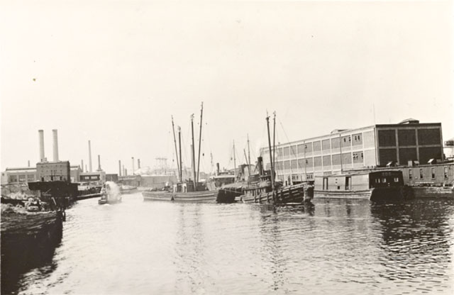
– photo by Percy Loomis Sperr
This shot, found in the collections of the New York Public Library, depicts the same scene back in 1939 from nearly the same spot. The well ensconced oil industry is quite active, as evinced by the abundance of chimneys. Notice that you can’t see Manhattan’s skyline in this one. Could be weather, or the choices made by the photographer, Percy Loomis Sperr. It’s probably because of the pall of smoke, smog, and industrial emissions in which Newtown Creek was famously cloaked during its heyday.
There are two public Newtown Creek walking tours coming up, one in Queens and one that walks the currently undefended border of the two boroughs.
DUPBO, with Newtown Creek Alliance and MAS Janeswalk, on May 3rd.
Click here for more info and ticketing.
Modern Corridor, with Brooklyn Brainery, on May 18th.
Click here for more info and ticketing.
“follow” me on Twitter- @newtownpentacle


