Archive for 2017
shrewd guessing
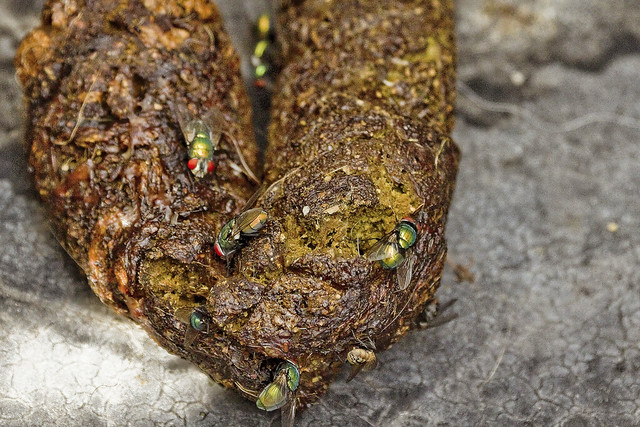
It’s National Cream Filled Donut Day, in these United States.

– photo by Mitch Waxman
Over the Labor Day weekend, on September the 3rd to be exact, our Working Harbor Committee presented the 25th Annual Great North River Tugboat Race and Competition on the Hudson River. It was raining at a pretty good clip, which kind of sucked, but… tugboat race. I mean… tugboat race.
That’s a brand new tug above, the Capt. Brian A. McAllister.

– photo by Mitch Waxman
As is usual for the tug race (this is my seventh or eighth time photographing the event), I was onboard the “official” race boat, but due to the inclement weather and a variety of other conditions, one wasn’t in the best place to shoot the actual race this year. Normally, I like having Manhattan in the background, looking northwards across the competition. Construction barges and other maritime impediments forced the race to occur in the west channel of the river this year, so all you got for background is New Jersey.
No offense to New Jersey is intended, of course, but y’all haven’t got an Empire State Building on your side. It seems nice over there though.

– photo by Mitch Waxman
My favorite part of the Tug Race, from a photographic perspective, has always been the line toss competition. That’s Donjon towing’s Mary Alice Tug in the shot above.

– photo by Mitch Waxman
This rope was a thrown from a tug based at Millers Landing, the Susan Mller.

– photo by Mitch Waxman
The Mister T tug also gave it a go.

– photo by Mitch Waxman
This one was hurled by a crewman of the tug James William.
Upcoming Tours and events
The Insalubrious Valley of the Newtown Creek Walking Tour,
with Atlas Obscura – Saturday, September 23rd, 11 a.m. – 1:30 p.m.
Join us on the wrong side of the tracks for an exploration of the hidden industrial heartlands of Brooklyn and Queens, with Newtown Creek Alliance Historian Mitch Waxman – details here.
“follow” me on Twitter- @newtownpentacle
mute clue
It’s National Chocolate Day, in these United States.

– photo by Mitch Waxman
As mentioned yesterday, one seems to have been hanging around in Astoria quite a bit recently. The long walks from the ancient village which a humble narrator is known for undertaking, carrying one from Astoria in North West Queens to all sorts of distant locales, require a bit of time to undertake and a variety of factors have limited the open windows of time needed to commit them. Fear not, for vast overland crossings through the concrete devastations are being planned and will be embarked upon shortly, whereupon description of said events will be presented at this – your Newtown Pentacle.
Just in the name of getting some exercise, for myself and the camera alike, I’ve been perambulating about in a roughly two mile circle from HQ for the last few weeks.

– photo by Mitch Waxman
The world is a scary place. It’s full of wildly unpredictable people, some of whom just might be a part of some sadist doomsday cult who seek the world’s end. Others are just stupid, and you can see it on their faces when they try to think about something. The other day on the train, I sat there watching some woman visibly thinking. Her brow beedled, she silently mouthed words, and was apparently either rehearsing or reviewing an argument she either had lost or will lose when she has it. Occasionally, she would pull out her phone and fire off a text missive, which was angrily stabbed out with her digitus tertius or “curse” finger. Lip reading informs that she was upset at somebody she knew who had said hello to her “ex.” She kept on mouthing the word “ratchet.”
She had her two kids watching the display, one of whom was licking the subway seat. There really is no hope.

– photo by Mitch Waxman
Astoria is decidedly carnivorous, as a rule. Don’t get me wrong, “we gots our vegans ’round here’s,” but most of the people you meet in the neighborhood talk about some kind of meat when you ask “what’s for dinner?” I know I do, but when I came across this display of half pig in a butcher shop window, one became entranced by its gruesome spectacle and the illusion of some monstrous face screaming in terror.
Pareidolia (/pærɪˈdoʊliə/ parr-i-DOH-lee-ə) is what it’s called when your brain perceives facial structures in inanimate objects. According to studies of the psychological phenomena, if you’re like me and you see “faces” in a LOT of inanimate objects and every cloud reminds you of some esoteric critter, it’s sympomatic of a highly neurotic personality type. Me, neurotic?
Who knew?
Upcoming Tours and events
The Insalubrious Valley of the Newtown Creek Walking Tour,
with Atlas Obscura – Saturday, September 23rd, 11 a.m. – 1:30 p.m.
Join us on the wrong side of the tracks for an exploration of the hidden industrial heartlands of Brooklyn and Queens, with Newtown Creek Alliance Historian Mitch Waxman – details here.
“follow” me on Twitter- @newtownpentacle
mental complexity
It’s National Chocolate Milkshake Day, in these United States.

– photo by Mitch Waxman
My daily walk for the last few weeks, due to certain constraints on schedule and other obligations, has been decidedly local in nature and a humble narrator has seldom found himself less than an hour from HQ before its time to turn around and head back. As I enjoy the distinct pleasure of living on the southern side of Astoria, Queens – this isn’t that big a burden. Lurking, in fear – after all – around Western Queens is one of my favorite activities.
There’s always something interesting happening here in the ancient village.

– photo by Mitch Waxman
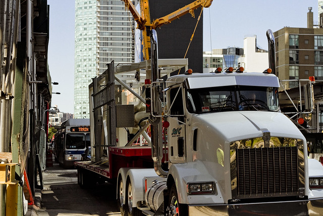
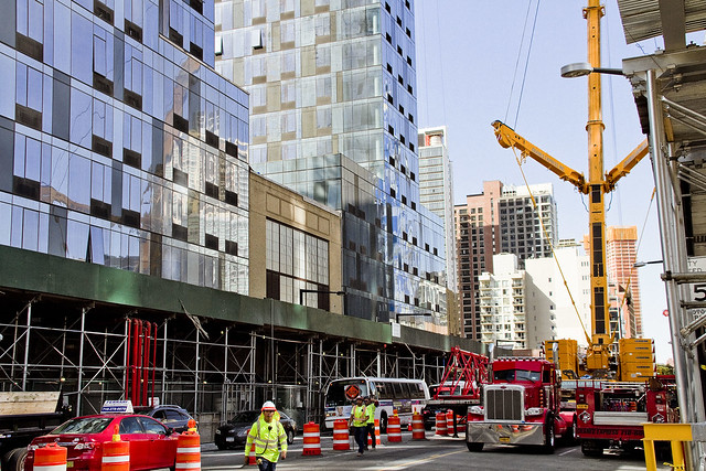
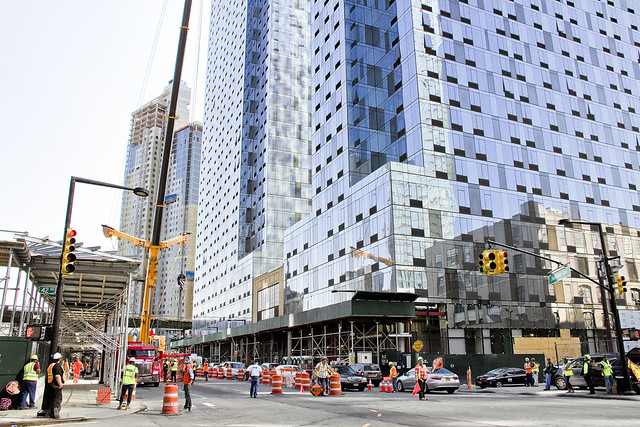
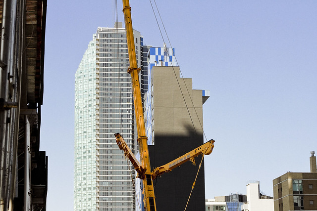
Over on Steinway Street’s intersection with 34th avenue, there’s a mid sized construction job going on. A former one story furniture store is being converted over to a multi story residential dealie. The iron workers have been busy at this corner all summer, doing their thing, and a whole crew of local lords and ladies have been observed entering and leaving the job site in their bright yellow vests since last winter.
I know that to some calloused eyes this is “gentrification” occurring, but it’s hard to argue against creating both a bunch of construction jobs and some new housing units that are so close to the 34th avenue side of the Steinway Street stop on the R and M lines. Y’know, no form of housing is “affordable” unless you’ve got an opportunity for gainful employment and the chance to earn a living from it. That is, unless your idea of “affordable” involves the redistribution of earned wealth from someone else’s pocket into yours.
Just saying.

– photo by Mitch Waxman
On this particular day, a crane was delivering steel beams and the union guys were crawling all over the skeleton of the new building. I can tell that they’re Union, as you’ll notice all of the safety equipment they’ve got on display. If this was a non Union job, these cats would be sporting baseball hats instead of hard hats, and the safety harnesses they’re wearing would be absent or made of duct tape.

– photo by Mitch Waxman
They seemed to know their business, these fellows (I think they’re fellows at least, as I wasn’t close enough to discern sex), and after snapping out a few shots I moved on. My half way point destination for the afternoon walk was set to be Queens Blvd. in Sunnyside, where an easterly turn would be undertaken towards Roosevelt Avenue and a return back to Astoria’s Broadway in the 40’s would be accomplished via Woodside Avenue.
– photo by Mitch Waxman
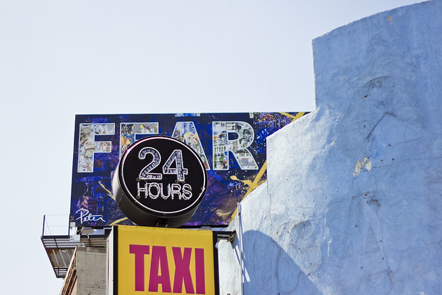
Walking south down Steinway Street, where it transmogrifies into 39th street at Northern Blvd., one encountered this little assemblage of compound signage. It somehow fit my mood, and current worldview.
You people scare the hell out of me.
Upcoming Tours and events
The Insalubrious Valley of the Newtown Creek Walking Tour,
with Atlas Obscura – Saturday, September 23rd, 11 a.m. – 1:30 p.m.
Join us on the wrong side of the tracks for an exploration of the hidden industrial heartlands of Brooklyn and Queens, with Newtown Creek Alliance Historian Mitch Waxman – details here.
“follow” me on Twitter- @newtownpentacle
absent friends 2017
It’s National Hot Cross Bun Day, in these United States.

– photo by Mitch Waxman
Last night, our Lady of the Pentacle and myself headed down to the East River waterfront in pursuance of getting a few shots of the tribute in lights, an annual display commemorating the September 11th attacks.

– photo by Mitch Waxman
A NYC Ferry rolled through the shot while my shutter was wide open, and the happy accident presented above occurred.

– photo by Mitch Waxman
Never forget. Never Surrender.
Upcoming Tours and events
The Insalubrious Valley of the Newtown Creek Walking Tour,
with Atlas Obscura – Saturday, September 23rd, 11 a.m. – 1:30 p.m.
Join us on the wrong side of the tracks for an exploration of the hidden industrial heartlands of Brooklyn and Queens, with Newtown Creek Alliance Historian Mitch Waxman – details here.
“follow” me on Twitter- @newtownpentacle
increasingly rigid
It’s National Date-Nut Bread Day, in these United States.
– photo by Mitch Waxman
Hunters Point is a section of Long Island City. Most modern people refer to it “as” Long Island City, but LIC – as in the “independent municipality of” – includes the neighborhoods of Astoria, Sunnyside, Blissville, Ravenswood, Dutch Kills, and Hunters Point as well. Hunters Point is pretty much defined as the zone sitting between Skillman Avenue to the east, the East River to the west, Queens Plaza to the north, and Newtown Creek to the south. The independent municipality of LIC’s old borders ran eastwards to what’s now the Kosciuszcko Bridge and Woodside Avenue to the east, Bowery Bay on the north, Newtown Creek on the south, and by the East River to the west.
The Dutch arrived in this peninsular area, sparsely populated by bands of the Lenape, back in the 1640’s. The first European land holder was a Dutch Priest named Dominie Everardus Bogardus, and back then LIC was referred to as “Dominie’s Hoek.” Bogardus, whom the historical record is not kind to, died in a shipwreck in 1647. Hunters Point, as defined above, came into the possession of a Dutch Sea Captain named Peter Praa, and the land stayed in his family until just before the American Revolution. At that time, the deed was in the hands of a Praa descendent named Anna Hunter. That’s why it’s called Hunters Point.

– photo by Mitch Waxman
Anna Hunter had three sons, and in the name of family unity and amity, her will stipulated that the land be sold off to avoid them fighting over the inheritance. By the time of the Civil War, the land had been divided into lots and sold off to a number of different concerns. The village, or town, of Hunters Point was a part of a county municipal organization called “Newtown” whose borders stretched all the way into modern day Nassau County. Newtown was a relict of the Dutch civilization’s “Nieuwtown,” whose function and borders were continued by the British and later the American governments long after the Dutch. The British first called it “Nieuwe Stad,” and at the time of the Revolution it was “Newtown.”
In the early 19th century, NYC was a ship building colossus. Manhattan shoreline properties along the East River were dearly held, and massively expensive to acquire. Ship yards, carpentry shops, iron foundries, coal yards, and rope factories were moving their operations over to Williamsburg and Greenpoint in Brooklyn and moving steadily north.
Industrial piers began to appear along the busy East River in Hunters Point, and along Newtown Creek. In 1848, the Roman Catholic Church bought the Alsop farm in Blissville in pursuance of creating Calvary Cemetery. Vernon Avenue was created and paved, and a plank road was built connecting to agricultural Blissville. The plank road was named for its destination, at the Borden Dairy Farms in Maspeth, and it was erected out of the swampy lowlands adjoining the Newtown Creek in 1868.
In the 1860’s, railroad tracks were connected to the east river by a company that would soon call itself the Long Island Railroad. Industrialization got its footing in LIC, due to easy access to the railroad AND to the water. Speculators began buying up dismal tidal swamps, filling them in with garbage, dead animals, human waste, and other fill materials. The Borden Plank road was paved and became Borden Avenue.
In 1870, a group of ambitious and notorious politicians, railroad operatives, and robber barons were successful in their bid to secede from agricultural Newtown and the independent municipality of Long Island City was formed.
The first land grab in what we call Queens got underway.
– photo by Mitch Waxman
Over twenty nine years of glorious misrule and an infamously corrupt political environment, LIC grew into the workshop of America. Enormous factories opened, and the waterfront in Hunters Point became a maritime industrial center, with nearly all of the freight traffic carried by the Long Island Railroad moving through it. Sugar factories, steel mills, oil refineries, chemical plants, fat renderers, pickle factories, fertilizer mills, manure yards, dead animal wharves – you name it – it was here. The City of Greater New York consolidated itself in 1898, incorporating LIC into its now familiar five boroughs, all under the guidance of the notorious Tammany Hall leader Richard Croker. Manhattan began to convert its industrial shorelines over to residential districts, and started to export all of its dirty industries to its new holdings in Brooklyn, and to the newly named Queens.
Manhattan began a process which modernity would describe as gentrification, displacing the working class poor and encouraging them to move to newly constructed row housing in the “outer boroughs.” The row housing was constructed by political insiders like Cord Meyer. Mr. Meyer and his fellow real estate speculators like Michael Degnon had inside information from the politicians of Tammany Hall about where the roads and subways would be created and they began to buy up agricultural properties all over the former Newtown. Entire neighborhoods were created, seemingly overnight. Call it Elmhurst? That’s Cord Meyer Sr. you’re echoing.
In 1909, the Queensboro Bridge was opened for business. Hell Gate Bridge opened in 1917. The Sunnyside Yards opened in 1919, made possible by the Pennsylvania Railroad company, which also created the East River tunnels that LIRR and Amtrak use to this day. The subways made gradual appearances in the first, second, and third decades of the twentieth century. Notably, what we call the 7 line – which already had three stops connecting Hunters Point to Manhattan as of 1915 – opened the Corona extension in April of 1917.
The second land grab in Queens got underway.

– photo by Mitch Waxman
Manhattan’s infamous tenement slums began to empty, and the working class hordes of immigrants began to populate into the new residential neighborhoods in Brooklyn, Queens, and the Bronx. Hunters Point had a relatively small residential population, which was centered not in the industrial zone but rather in the neighborhoods surrounding it. Sunnyside Gardens was created as an early example of “affordable housing” and as a planned community in the late 1920’s, in response to the multi story apartment houses which began to rise in Dutch Kills and Astoria along the new subway lines. At the same time, Robert Moses had appeared on the scene, along with his Triborough Bridge project.
Mighty Triborough opened in 1936, and the highways that feed into it like the Grand Central Parkway soon followed. The age of the automobile arrived in Queens, which allowed for heavy residential construction in previously rural areas. Forest Hills and Rego Park, Bayside and Douglaston, even Jamaica were now connected to Manhattan. For those who supported Mr. Moses, the routes and off ramps of the new high speed roads were revealed. In 1940, the Long Island Expressway and Queens Midtown Tunnel appeared in Hunters Point, which effectively blighted and cut the ancient community in half.
The third land grab in Queens got underway.
– photo by Mitch Waxman
After the Second World War, things began to change in Hunters Point. New York City began a process of de industrialization that wouldn’t become truly apparent until the middle 1960’s. Heavy industry began migrating to the American south and west, where industrial campuses of collossal size could be constructed. The political establishment of NYC, still married to the industrial labor unions, realized that they had to do something to try and protect their base. In 1961, The Department of City planning (which was controlled by Robert Moses) issued a decree that Hunters Point was now an “M1” zone – the land was reserved exclusively for heavy manufacturing use only.
For the homeowners and residential community in Hunters Point (and in Dutch Kills as well), what that meant was that no bank would advance them credit for a mortgage, or loan them money for renovation projects on existing residential properties. The fly in the ointment this time around, however, was that because of a general decline of manufacturing activity in the entire Northeastern United States the industrial base was seeking to vacate New York City. By the 1970’s, you couldn’t give the land away in Hunters Point. The residential community dwindled, but narrow strips of habitation persisted. The political establishment was heavily involved in “urban renewal” projects, and floods of federal money enabled developers like the Tishmans, Trumps, and Lefraks to build massive commercial and housing projects in Manhattan, Brooklyn, and Queens. This is when the big landlords and the politicians first really got to know each other, and the current alliance between big real estate and the political establishment of Manhattan was cemented.
It’s also when, in an attempt to revive a moribund local economy, the City began giving away land to developers. This process really kicked into gear in the 1980’s, under Mayor Koch.
– photo by Mitch Waxman
In 1981, NYC City Planning rechristened Hunters Point as a “mixed use district.” The first large scale development that occurred after this was the Citigroup tower, which opened in 1993, a 53 story structure which was built on land formerly occupied by a hospital. In 1995, 2001, and again in 2004, City Planning opened up zoning restrictions on height in LIC – particularly along the Hunters Point waterfront. As restrictions were loosened, and residential corridors were created, there was some construction activity but it was a lot of smoke with very little flame. The New York Times and other cheerleaders for the real estate interests began to refer to Hunters Point as “LIC” and started calling it “the next big thing.” (City planning is currently working on further loosenings of zoning in Hunters Point, and preparing the “LIC Core” rezoning which will make it possible to build high density residential towers as far east as Steinway Street, along Northern Blvd.) The currently underway Hunters Point South development is billed as the largest “affordable” housing project in the United States, but it’s not affordable by many of the current residents of LIC.
The so called “Brooklyn miracle” happened instead. From the post industrial waterfront of Williamsburg all the way south to what is now referred to as “DUMBO,” high density towers rose and created the new “Gold Coast” of Long Island. In the last decade, financial speculators and globalist investors have driven the price of Brooklyn real estate so high that financiers have begun to focus in on Hunters Point and Astoria instead, looking for a “good buy.”
The fourth land grab in Queens is underway, as you read this.
– photo by Mitch Waxman
All of this development has avoided upgrading the municipal infrastructure which the new population would require – cops, fire department, sewerage, hospitals, schools. If you’re walking through one of the glorious new waterfront parks in Hunters Point, and you suddenly grab at your chest, where the FDNY ambulance will take you is either Bellevue Hospital in Manhattan, the Mount Sinai hospital on Crescent street in Astoria, or out to Elmhurst hospital. FDNY’s fire fighting apparatus in western Queens was designed for industrial fires, and the 108th precinct is housed in a tiny 19th century building which still has horse stables. The sewer plant servicing this gargantuan residential population was opened by Fiorella LaGuardia in 1936. Our transit needs far outweigh current capability. There are not enough school desks. Don’t get me started on the environmental legacy of all that industry which used to be here. The buildings being erected in the photos in today’s posts are on the site of a former chemical factory in Queens Plaza, for instance.
Simply put, “gentrification” is nothing new in Western Queens and it’s been going on since at least the Civil War. The “G bomb” has already been dropped, and it has gone off. A looming infrastructure crisis is just beginning.
Upcoming Tours and events
Calvary Cemetery Walking Tour, with Atlas Obscura – Saturday, September 9th, 11 a.m. – 1 p.m.
Explore NYC history, hidden inside sculptural monuments and mafioso grave sites, as you take in iconic city views on this walking tour, with Newtown Creek Alliance Historian Mitch Waxman – details here.
“follow” me on Twitter- @newtownpentacle


