Investigating the GAP, part one
Wednesday
– photo by Mitch Waxman
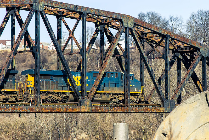
Last week, I showed you what the historic Homestead Pump House site on the Monongahela River looked like when bathed in thick fog. Lament was offered regarding the lack of a freight train transiting over the Pinkerton’s Landing or “Pemickey” Rail Bridge.
The Homestead Pump House is one of the trail heads for The Great Allegheny Passage or “GAP” rail to trail system. 150 miles in length, the rail to trail pathway follows several incorporated rights of way once operated by the B&O Railroad, Lake Erie Railroad, Union Railroad, and the Western Maryland Railway. You could theoretically walk or ride a bike to Washington D.C. on this path, which is paved in asphalt or crushed limestone – depending on where you are – and graded in accordance with the rail standard of one foot of elevation for every hundred feet.
Pictured above, this time around my dreams of a train moving over the bridge came true as a CSX freight train appeared and I was able to get a few shots of its transit across the rail bridge.
– photo by Mitch Waxman
The Homestead site has a parking lot, one which leads to the actual trail after a short walk on a sidewalk. I did all the remote scouting that was warranted, using Google maps and a few other tools as well as watching a YouTube video offered by some bloke who rode the trail on a bike. One still hasn’t purchased a shuttle craft bike which will accompany me in the cargo area of the Mobile Oppression Platform (that’s the nickname I’ve assigned to my Toyota), and be deployed for hyper local transport.
I don’t really keep track of how many miles I walk. Sometimes, after a walk I’ll check my phone to see how many steps it perceived me as taking on an excursion. If there’s any accuracy to that data, I walked on the trail about 4 miles in and 4 miles back. It was an extremely easy walk, thanks to the pavement and the easy grading in elevation. There were even installed park benches for taking a break along the route, but one of my rules involves not sitting down when you’re out. Keep moving until you’re back where you started.
– photo by Mitch Waxman
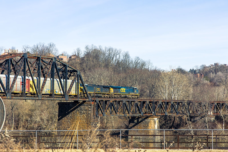
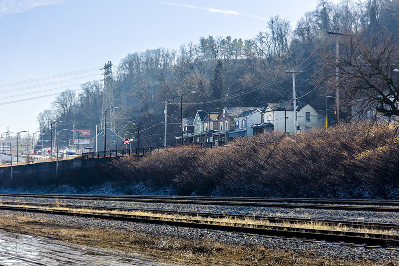
Active rail tracks are visible for the entire section of the GAP I visited. Defunct gas and rail infrastructure was noticed on the water facing shoreline for a good chunk of this distance, and there was a high volume road at the top of a shallow ridge overlooking the whole shebang. The municipality of Homestead was where I entered the trail, and there were markers here and there letting you know what town you were walking through.
That’s how I learned there’s a place called Munhall in Pennsylvania, those signs. There were actually a fair number of people using the trail for running and bike riding for a weekday afternoon in January. A good proportion of the bike riders were wearing the “outfit” – the helmet with the rear view mirror on it and a polyester bike shirt, stretchy shorts, and those special bicycle shoes. Like I said – the outfit. Most of the bikes were road racers, but I spotted a couple of pedal assist electric ones too.
– photo by Mitch Waxman
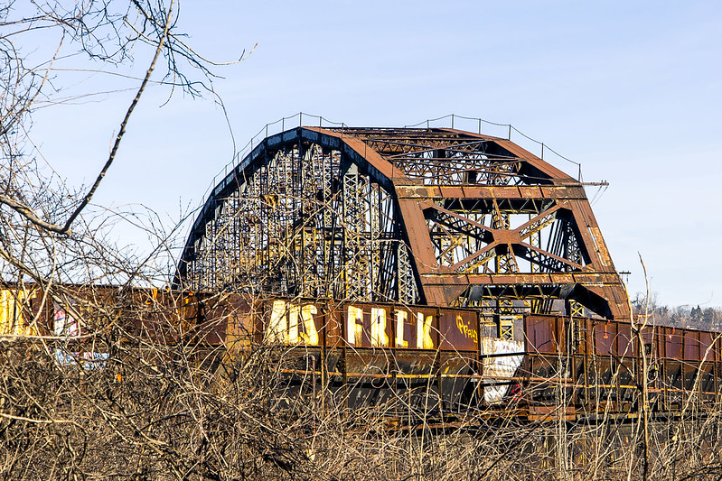
That’s the Carrie Furnace Hot Metal Bridge pictured above, I believe. Before you ask – of course I looked, and yes you can, and no it’s probably not ok but there doesn’t seem to be anybody watching, so of course, but no, not this time around. Next time, maybe.
I continued along the GAP trail, scuttling along at a leisurely pace.
– photo by Mitch Waxman
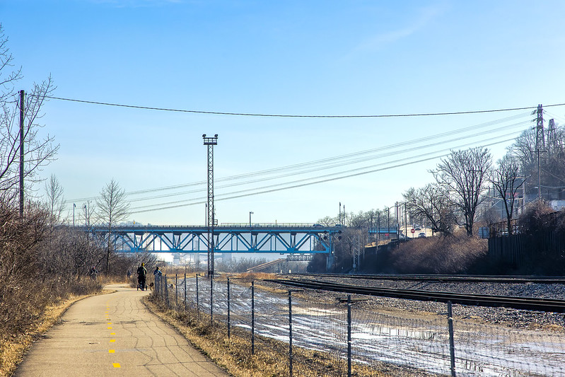
Once you’re a fair bit into the GAP trail, you’re completely separated from the surrounding town and of course – there’s no automobile traffic zipping along at high speeds to worry about.
On a personal note – it’s been a very long time since I’ve had the time to take a very long walk like this one. It felt very good to stretch the legs, kick the heels, and point the toes. Ultimately, this was another scouting expedition. It was mid afternoon, and the light was a ghastly thing to handle. For the ultimate destination I had in mind, this scouting revealed it as an early morning or sunset sort of deal. It’s also a winter thing, as the foliage must obscure all of the cool stuff you can see from this path during the warmer months when the trees are clad.

– photo by Mitch Waxman
The GAP follows under the Rankin Bridge spanning the Monongahela River. The 1951 bridge has a fairly convoluted history, and it once was used to carry Trolley traffic as well as motor vehicular flow, apparently. There’s a few very nice points of view in this section of the trail that I’m going to return to in the future. For this trip, my main interest was in getting close to the Mon Valley works, and I still had a few miles to walk to get there.
More tomorrow, from the GAP.
“follow” me on Twitter- @newtownpentacle
Buy a book!
“In the Shadows at Newtown Creek,” an 88 page softcover 8.5×11 magazine format photo book by Mitch Waxman, is now on sale at blurb.com for $30.


Good to see you having fun again exploring.
Tommy Efreeti
January 25, 2023 at 4:33 pm
[…] A couple of weeks ago, the Great Allegheny Passage’s trail in Homestead was discussed – part 1, part 2, part […]
Fort Pitt Bridge, part 2 | The Newtown Pentacle
February 8, 2023 at 11:45 am
[…] while back, I offered several posts (Part one, Part Two, Part Three) from the section of the GAP stretching from Homestead to a point directly […]
Second GAP: Part 1 | The Newtown Pentacle
March 6, 2023 at 11:15 am