Archive for the ‘Brooklyn Queens Expressway’ Category
stinking marsh
It’s National Junk Food Day, in these United States.
– photo by Mitch Waxman
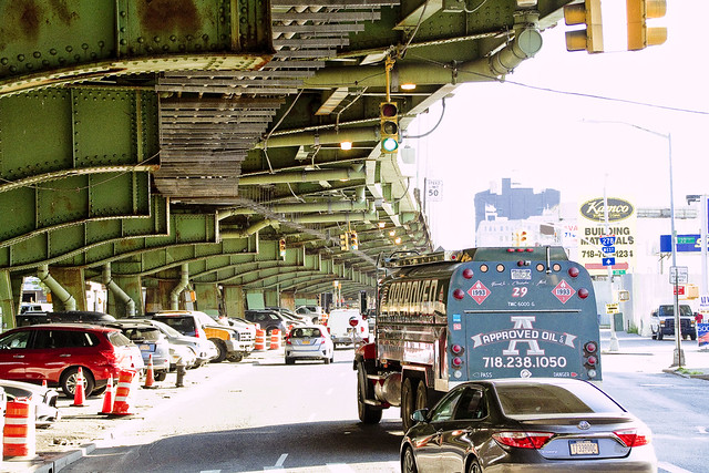
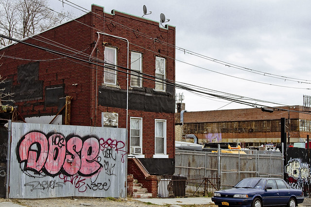
As the shots from my latest adventure are finally done with the developing process but I haven’t had the chance to write and research as of yet, a single shot greets you today, at this – your Newtown Pentacle. Depicting a section of Brooklyn’s Third Avenue in Sunset Park, which is likely the least pedestrian friendly section of the entire borough of Brooklyn, that’s the Gowanus Expressway on the left.
Upcoming Tours and events
The Poison Cauldron of the Newtown Creek Walking Tour, with Atlas Obscura – July 22nd, 11 a.m. – 2 p.m..
Explore the hellish waste transfer and petroleum districts of North Brooklyn on this daring walk towards the doomed Kosciuszko Bridge, with NCA Historian Mitch Waxman – details here.
“follow” me on Twitter- @newtownpentacle
loosely knit
It’s National Piña Colada Day, in these United States.

– photo by Mitch Waxman
Given that the final weeks of the old Kosciuszcko Bridge spanning the fabled Newtown Creek are at last upon us, one has been determined to record a few portrait shots to commemorate its long tenancy over the waterway. To wit, last week, one determined that it was time to carry the tripod all the way to eastern Greenpoint and stand there in the dark while shooting the end of an era in this particular corridor of the “House of Moses.” The tripod was needed to allow for long exposure, hyperfocal aperture depth, and deep saturation. Where I was will be instantly recognizable to some Newtown Creek enthusiasts, but to most – not so much. It’s off the beaten path, off the pavement in fact, and my specific vantage was shielded from street lights, perfectly dark, and stunk to high heaven from a passing slick of sewage.
Ahh… my beloved Newtown Creek.
I’m pretty happy with what I got in the shot above, which is a 30 second exposure captured at about 9:10 p.m. As always, if you click the photo it will open up a new window to Flickr, where you can zoom in or whatever.

– photo by Mitch Waxman
While I was there – and as you’d imagine – one shot multiple variations of the first shot in today’s post using different exposure triangles, but it was randomly decided at the end of my little seission to pivot the tripod head about and get some shots of the surrounding creek as well. This is looking northward at the Queens side, and that black slab forming the background against the sky is the tree line of First Calvary Cemetery.
Documenting this project has been a long standing project of mine – this 2012 post tells you everything you could want to know about Robert Moses, Fiorella LaGuardia, and the origins of the 1939 model Kosciuszko Bridge. Just before construction started, I swept through both the Brooklyn and Queens sides of Newtown Creek in the area I call “DUKBO” – Down Under the Kosciuszko Bridge Onramp. Here’s a 2014 post, and another, showing what things used to look like on the Brooklyn side, and one dating back to 2010, and from 2012 discussing the Queens side – this. Construction started, and this 2014 post offers a look at things. There’s shots from the water of Newtown Creek, in this June 2015 post, and in this September 2015 post, which shows the bridge support towers rising. Additionally, this post from March of 2016 detailed the action on the Queens side. Most recently, here’s one from May of 2016, and one from June of the same year. Here’s one from August of 2016, the December 2016 one, one from March of 2017 which discusses the demolition of the 1939 bridge.
Most recently – a post showing what I saw during a pre opening walk through in early April of 2017, and the fanfare surrounding the opening of half of the new bridge in April of 2017, and a walk through of the Brooklyn side job site in June of 2017.

– photo by Mitch Waxman
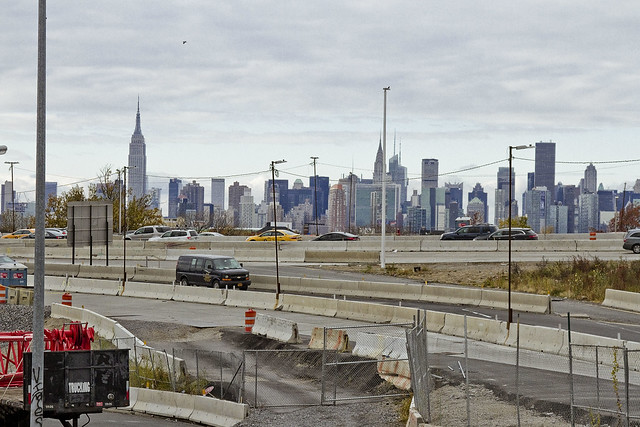
Looking west along the Newtown Creek, towards the Shining City of Manhattan. The burning thermonuclear eye of God itself doesn’t dip behind the skyline until about 8:30 this time of year, and the shot was captured less than five minutes after the first shot in today’s post. That’s about when Indecided to break down the gear and head back to the rolling hills of Astoria, after having spent about an hour at my location.
As far as the burning question everybody’s been asking me – no, I don’t have any intel on when the old bridge is coming down or not. Newtown Creek Alliance has recently published this post, which discusses the issue in detail and tells you what to expect from the operation.
Upcoming Tours and events
13 Steps Around Dutch Kills Walking Tour, with Newtown Creek Alliance – July 15th, 10 a.m. – 1 p.m..
The “then and now” of Newtown Creek’s Dutch Kills tributary in LIC, once known as the “workshop of the United States.” with NCA Historian Mitch Waxman – details here.
The Poison Cauldron of the Newtown Creek Walking Tour, with Atlas Obscura – July 22nd, 11 a.m. – 2 p.m..
Explore the hellish waste transfer and petroleum districts of North Brooklyn on this daring walk towards the doomed Kosciuszko Bridge, with NCA Historian Mitch Waxman – details here.
“follow” me on Twitter- @newtownpentacle
resonant profanity
It’s National Ceviche Day, in these United States.

– photo by Mitch Waxman
“I’m late, I’m late, For a very important date. No time to say “Hello, Goodbye”. I’m late, I’m late, I’m late” is what was going through a humble narrator’s brain box last Saturday morning. Often is Lewis Carroll psychically conjured on my way to Newtown Creek, a place which is the very definition of “through the looking glass” for one such as myself.
Accordingly, a vehicular coach was summoned via the LYFT application found on my pocket telecommunications device, which automotively conveyed one to the poison cauldron of the Newtown Creek in Greenpoint. The driver, following the directions offered by a computer program on his own pocket telecommunications terminal, used the Brooklyn Queens Expressway for the trip. For once, rolling the dice on the BQE paid off and it was a quick journey between “Point A” in Astoria and “Point B” in Brooklyn.

– photo by Mitch Waxman
We crossed the lugubrious Newtown Creek on the sparkling new 2017 model Kosciuszcko Bridge, with the 1939 version just to the west. As one such as myself cannot turn down an opportunity to record and catalog any and all visual experiences encountered in the City of Greater New York, the camera was being waved around in the back seat as the driver performed his particular function in the front.

– photo by Mitch Waxman
The NYS DOT is currently working on the dismantling of the 1939 version, which is at an early stage. Newtown Creek Alliance has recently prepared and propagated a post describing what we know about the various stages, scheduling, and status of the demolition project for the so called “K Bridge,” and it can be accessed here.

– photo by Mitch Waxman
You may recall that I was up here for opening day of the new bridge back in April, but that was on foot. Dedicated pedestrian that I am, it’s an odd thing to actually be riding in an “auto-mobile,” but since I had experienced a fairly late night the evening before – one had risen later than planned and there was no way that I was going to get to Brooklyn from Astoria on time via perambulatory means.
I’m actually obsessed with being “on time” and am particularly keen on “being early” for events and meetings. It’s kind of a “thing” with me. My parents always insisted that you arrive early to appointments, as that’s at least one thing that the people you’re going to see can’t hold against you. Mom always said “you can’t do anything about being ugly, stupid, ungrateful, and unlikeable but at least you can be early.” I’m all ‘effed up.

– photo by Mitch Waxman
This wasn’t a tour, per se, as in one I was conducting of the area which I’ve long referred to as “DUKBO” or Down Under the Kosciuszcko Bridge Onramp.” Instead, the NYS DOT is in the early stages of planning two parks – one in Queens and one here in Brooklyn. They called together members of the K Bridge Stakeholders Advisory Committee (I’m on that one) and the Brooklyn Parks group “Open Space Alliance,” or OSA, to discuss the space and begin the process of planning.
I showed up wearing my Newtown Creek Alliance hat, but since we were going to enter the job site, it was soon replaced by a hard hat that said “Skanska.”
– photo by Mitch Waxman
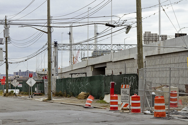
My LYFT driver was instructed by both myself and the computer program on his pocket computer terminal to exit the BQE at the Meeker avenue stop, which was terribly exciting for one such as myself as I’m a “creek geek.”
Kept on thinking about that white rabbit, me. It was nearly the time for the meetup with DOT and OSA, and I’d still have to walk a block or two to the location.

– photo by Mitch Waxman
That’s the east side of Meeker Avenue pictured above, with its newly constructed on-ramps and approach roadways feeding traffic from Brooklyn into Queens. It’s been so chaotic in this area for the last few years, what with the construction and all, that it was quite a relief to see a bit of calm inserted back into DUKBO.

– photo by Mitch Waxman
Saying that, there was still quite a hullabaloo going on in DUKBO.
The demolition of the 1939 bridge will be the supreme focus of all the concerned parties for the next several months, but for right now the teams of contractors and union hard hats are making busy with repaving local roads and improving the subterranean infrastructure (sewers, drains etc.) that serve the new bridge. I know the folks who live in the house that that backhoe is working in front of, who are… shall we just say… anxious for the project to conclude.
Tomorrow, I’ll show you what I saw whilst wearing the hard hat in DUKBO.
Upcoming Tours and events
Newtown Creek, Greenpoint to Hunters Point, walking tour with NYCH2O – June 29th, 7-9 p.m..
Experience and learn the history of the western side of Newtown Creek, as well as the East River Parks Hunters Point with NCA Historian Mitch Waxman – details here.
“follow” me on Twitter- @newtownpentacle
doglike lopers
The concrete devastations, in today’s post.
– photo by Mitch Waxman
As I’ve mentioned several times recently, an effort is under way to revisit a number of spots which I’ve not set foot in for a while. When I first began wandering around Newtown Creek and the neighborhoods surrounding it, a point was made to visit every single block, but in recent months and years, temporal exigency has caused one to travel along “efficient” routes to get from Point A (A as in Astoria) to Points B, C, and so on.
Accordingly, since I seem to have all the time in the world at the moment, I’m taking the road less travelled and revisiting a few locales which have been off my radar for a bit. To wit, pictured above is the view from 53rd avenue at the angle between Sunnyside and West Maspeth, looking west towards the BQE/LIE interchange.
– photo by Mitch Waxman
Prior to the installation of the two highways, roughly 75-80 years ago, this was a place where working people still lived. There was a neighborhood here, at the western border of Newtown’s Maspeth section and the eastern border of LIC’s Blissville subdivision. That’s when Robert Moses, with his New Meeker Avenue Bridge (Kosciuszko Bridge), and Brooklyn Queens Connecting highway, and Long Island Expressway came to town. Zoning decisions made in Manhattan during the post WW2 era rendered this area as “M1” – meaning it is designated for heavy manufacturing usage only.
Regardless of how the City people decided this land should be used, residential usage continued and there are still a small number of fairly ancient homes found peppered in amongst the warehouses, factories and construction oriented tower crane storage yards hereabouts.
– photo by Mitch Waxman
Funny thing is that this neighborhood is – observationally – one of the last places in NYC where you can “leave your front door open.” Saying that, when I use the term “concretized devastations of Western Queens” this section of industrial Maspeth is what I’m usually thinking of.
Most of the surviving homes I see in this neighborhood are typified by what you see above, wood frame row houses which date back to around 1900 or so. There’s a few older houses nearby which are a bit “grander” and speak to an earlier incarnation of this area. A few have disappeared “under my watch,” and have been replaced with bland cinder block warehouse or industrial buildings. Can’t really speak to “who” lives here, amongst the cranes and highways.
– photo by Mitch Waxman
All I can tell you is that they have an amazing view. This POV is on the rising bluff which once led to a prominent hill to the south called Berlin. The next highest prominence to the west would have been Laurel Hill, which Calvary Cemetery was carved into. This section of Maspeth was actually called “Berlin” until the First World War, when it was changed for obvious reasons to West Maspeth. To the east, the land’s declination rises until it meets a ridge which signals the beginning of the terminal moraine of Long Island nearby Mount Olivette and Lutheran Cemeteries. That ridge, which sports the same sort of rocky geology that lends its name to Ridgewood, is “real” land. Everything west of Laurel Hill is elluvial fill deposited by glacial process and sediment delivered by flooding from the Newtown Creek and East River.
Climate change and rising sea level wise, this likely will be the East River coastline someday.
– photo by Mitch Waxman
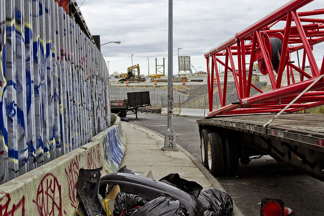
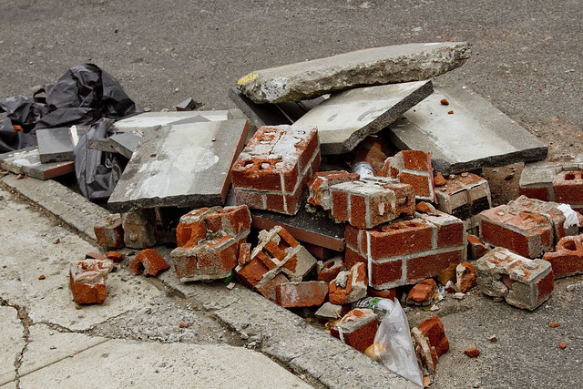
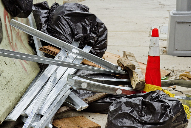
Looping around to the south, as the BQE and LIE interchange cut off egress east/west, an ad hoc art gallery is encountered. Illegal dumping, as I’ve often opined, is the unofficial nativist art form of the Borough of Queens. Combined with long fence lines that are covered in crude graffiti, you’ll encounter several installations along this route which offer intriguing intellectual postulates from the local artistic community.
Everything here is artisanal, incidentally.
– photo by Mitch Waxman
The reality of these installations are that this is simply a convenient place for a low level building contractor to dispose of construction debris without having to pay a dumping fee, but allow me to stay “high brow” in my assessments.
These dumpers really do seem to pay some attention to composition and color, however.
– photo by Mitch Waxman
53rd avenue terminates in a parabola which carries it into 43rd street, a colonial era pathway that once connected to Newtown Creek from Bowery Bay in Astoria. The road transected the properties of (amongst several other famous Dutch and English family names from the colonial era) the Riker’s, Skillman’s, and Alsops along its route, and according to the historic record – it was paved with crushed oyster shells. All that changed, of course, when first the Long Island Railroad and later Robert Moses came to town.
43rd street still exists in a fairly unbroken line from Astoria to Northern Blvd. and then crosses the Sunnyside Yards south into Sunnyside where it crosses Queens Blvd. and Greenpoint Avenue. When it crosses under the Long Island Expressway overpass, it resumes its pre municipal consolidation name – Laurel Hill Blvd.
– photo by Mitch Waxman
The “43rd street” you encounter in this section of industrial Maspeth, however, is disconnected from the northern section. The last homes on 43rd street went “bye-bye” just a few years ago, due to a smallish construction project going on in the area. With fewer people watching, and caring, the artisanal illegal dumping in this area has amplified.
– photo by Mitch Waxman
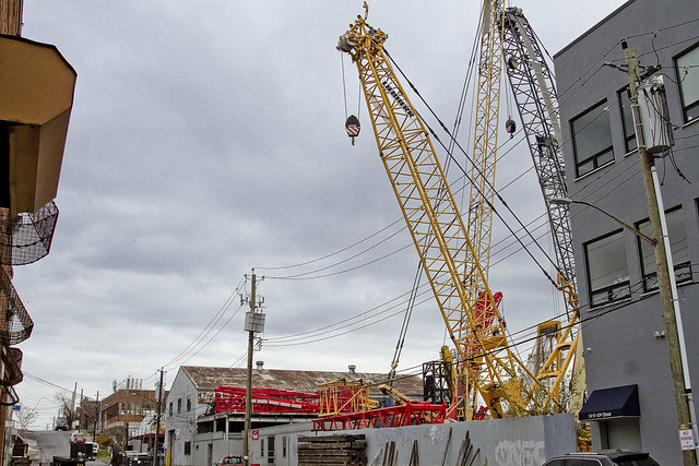
In the shot above, you can discern why I sometimes refer to this section as the “crane district.”
You can also plainly see the sharp rise in altitude hereabouts. This is, as mentioned, largely an industrial zone. There’s a lot of heavy industry going on. Warehouse operations, severely heavy truck traffic, waste transfer stations – Newtown Creek is just a few thousand feet to the south.
– photo by Mitch Waxman
Speaking of Newtown Creek, that smallish construction operation I mentioned earlier is the Kosciuszko Bridge replacement project, which crosses the waterway. If memory serves, that means that something like a half million vehicles a day pass through this pass between Berlin and Laurel Hills. The Kosciuszko Bridge was opened in 1939, and the Queens side approach was built into a shallow valley found between the two landforms, and over a lost tributary of Newtown Creek which was called “Wolf Creek.”
– photo by Mitch Waxman
That’s that, then. See you next week, at this – your Newtown Pentacle.
“follow” me on Twitter- @newtownpentacle
prodigious grasp
From high atop Greenpoint.

– photo by Mitch Waxman
The eight anaerobic digester eggs of the Newtown Creek Wastewater Treatment plant in Greenpoint gather a lot of attention. At the very top of these stainless steel vessels are catwalks which connect them together into two groups of four. You’re something like 140 feet up, and the entire assembly is wrapped in blue green glass.
The shot above looks southwest, across Brooklyn.

– photo by Mitch Waxman
On top of each of the individual eggs, you’ll find all sorts of plumbing and control mechanisms. There’s also a view port through which you can observe the bubbling sludge as its “cooked” by the biological processes within.

– photo by Mitch Waxman
Just for perspective, here’s a look at the things from outside the plant. The shots in today’s post were captured from the catwalk closest to the camera.

– photo by Mitch Waxman
It’s actually fairly challenging to shoot from the catwalks, as that green glass screws around with the camera’s light meter and sensors. There’s also reflections to deal with, which you’ll see a few of in these shots, and needless to say – the glass ain’t exactly super clean.

– photo by Mitch Waxman
Looking down at Kingsland Avenue and Allocco Recyling, over the methane jets which burn off the mephitic gas produced by the digester eggs.

– photo by Mitch Waxman
Looking towards the Greenpoint Avenue Bridge, towards Blissville in Queens.

– photo by Mitch Waxman
Looking west, over the Newtown Creek Wastewater Treatment Plant’s grounds, towards Manhattan.

– photo by Mitch Waxman
Another perspective on the Greenpoint Avenue Bridge, this time with Blissville’s former Van Iderstine property, Calvary Cemetery, and the Kosciuszcko Bridge at the Maspeth border in frame.

– photo by Mitch Waxman
The Kosciuszcko Bridge replacement project is in the background, with a “green asphalt” plant and a Waste Management transfer station in the fore. That’s Newtown Creek flowing on the right side of the shot.

– photo by Mitch Waxman
A wider view of the scene, this time you’ve got the ExxonMobil 400 Kingsland Avenue property in view as well.

– photo by Mitch Waxman
Tomorrow – Creek Week continues, but from an entirely different perspective.
Upcoming Events and Tours
Wednesday, August 3rd, 6:30 p.m. – 8:30 p.m. –
Glittering Realms Walking Tour,
with NYC H2O. Click here for more details.
Saturday, August 6th, 2:00 p.m. – 4:00 p.m. –
Insalubrious Valley Walking Tour,
with NY Adventure Club. Click here for more details.
Sunday, August 14th, 11:00 p.m. – 1:00 p.m. –
Calvary Cemetery Walking Tour,
with Atlas Obscura. Click here for more details.
Sunday, August 21, 11:00 a.m. – 1:00 p.m. –
Poison Cauldron Walking Tour,
with Atlas Obscura. Click here for more details.
“follow” me on Twitter- @newtownpentacle


