Archive for the ‘Maspeth’ Category
Astoria to Calvary 5- the bitter end
Altissima quaeque flumina minimo sono labi
The deepest rivers flow with the least sound

47th avenue – photo by Mitch Waxman
In the first installment of this photowalk–
we scuttled through western Queens – descending from Astoria down to Northern Blvd.
In the second,
we lurked, fearfully, down vestigial 37th avenue – past an anomalous municipal building and fortress church.
In the third,
we marched defiantly into the Sunnyside, and were thunderstruck by the colossus Sunnyside Rail Yard.
In the fourth,
ruminated on the Boulevard of Death, and gazed upon Aviation High School.
Today, we arrive at Calvary, and suddenly connect with several other posts. Witness…

47th avenue Street Sign – photo by Mitch Waxman
Leaving Aviation High School behind you, Newtownicans, continue up the hill that 36th street transverses. Look to your right, where the western end of 47th avenue is blocked by the Sunnyside Yard – and you will collide with an older post here at the Newtown Pentacle- “Dutch Kills- or let the photos do the walking“.

47th Avenue – photo by Mitch Waxman
The nearby corner of 47th st. and Van Dam St., which skirts the shadowed valley of that great hill in which Calvary Cemetery is embedded, is where the New York State Queensboro Correctional Facility is located. Just a few blocks beyond the gaol at 29th street is the Dutch Kills tributary of the Newtown Creek.
A spectacular riot played out here and in many other New York City Jails in 1970, in response to the poor conditions found in the State and City corrections systems of the 1960’s presaging the Attica riot in upstate New York. This event (and other problems he had in Queens) foreshadowed the jaundiced legacy that Mayor John V. Lindsay‘s political career would be remembered by, and the riots were organized and led by the Black Panther Party and Young Lords.
There are many jails here on the Queens side of the Newtown Pentacle, notably Rikers Island, a seething asp caged just off the shoreline of ptolemaic Astoria.
from time.com
The worst jail crisis in the city’s history began at lunchtime four days earlier at the 95-year-old Branch Queens House of Detention for Men. Inmates snatched keys from unarmed guards and made a frantic dash through the halls, unlocking cells all the way. The rioters turned on faucets to flood several floors, set fire to furniture and bedding, heaved debris and an eight-foot wooden bench out of broken cell windows. In a new political twist, they also hung the flag of the black liberation movement from a top-floor window. Over the next three days, more riots flared at other city jails, including the Tombs. In all, more than 2,500 inmates joined the rampage and seized 32 hostages—all for the sake of airing their grievances.

36th street, moving up toward Laurel Hill – photo by Mitch Waxman
The proclivity of the ground will take a sharp upturn here, and one becomes increasingly cognizant of the natural lay of the land- with its boulderized hillocks rising from sand and muddy clay- and its formation by the glacial actions of the Wisconsin Ice Age.
from geo.hunter.cuny.edu– An intriguing description of the strata found in the New York Bight.
from wikipedia
The island’s tallest natural point is Jayne’s Hill near Melville, with an elevation of 400.9 feet (122.2 m) above sea level. Long Island is separated from the mainland by the East River, which is actually not a river, but a tidal strait. Long Island Sound forms the northern boundary of the island.

48th Avenue – photo by Mitch Waxman
48th avenue terminates at 30th street, a block from the Dutch Kills. 36th street is about to end too, when we reach the top of the hill. A forbidding stretch of unlettered warehouses describes 48th avenue as it slopes down the morraine carved declination, barren and treeless.

36th street, Antennae- photo by Mitch Waxman
Between 48th and Hunters Point Avenue- you will find more warehouses, a very impressive broadcast antennae, and a gigantic charismatic church operating out of an altered workhouse.

36th street, St. Raphael on Horizon – photo by Mitch Waxman
At the corner of 48th street, St Raphael’s comes into view. Ahem, sorry but now’s when I reveal a few more of our hidden connections:
Cross 36th street at Hunters Point Avenue and Continue all around Calvary Cemetery in “Walking Widdershins to Calvary“
excerpt from July 31, 2009

-photo by Mitch Waxman
Click here to preview this photowalk in a google map
Hunters Point avenue intersects with the ancient course of Greenpoint Avenue at the degenerate extant of Long Island City. The Queens Midtown Expressway also comes back down to earth here, feeding Manhattan vehicular traffic to all points east. This is a very busy intersection, so be mindful of traffic, as fellow pedestrians are rare.
As with anyplace else in Queens you’d want to see, Forgotten-NY has been through here before. Click here for their page on Blissville and Laurel Hill.

-photo by Mitch Waxman
St. Raphael’s R.C. Church is on Greenpoint Avenue in a neighborhood called (atavistically) Blissville. A wooden frame building was built for St. Raphael’s in 1867, and served as the mortuary chapel for the newly built Calvary Cemetery. The current gothic influenced structure was completed in 1885, and has served both Calvary and the surrounding community since. This is one of the highest points in these parts, and the church steeple often acts as a reference point when negotiating the byzantine tangle of streets around the Newtown Creek. The architect is rumored to have been Patrick Keeley.
Enter Calvary Cemetery in “Calvary Cemetery Walk“
excerpt from August 5, 2009

-photo by Mitch Waxman
Just across the street from the site of the former LIRR Penny Bridge station. Easily accessed via the street, upon crossing the gates of Calvary, one will find a staircase carven into the hill by whose ascent the Newtown acropolis may be obtained. Cresting over the surrounding neighborhoods, and soaring over theNewtown Creek’s former wetlands, Calvary Cemetery keeps its secrets buried in centuried silence. Looking south toward Brooklyn, the Kosciuszko bridge approach of the Brooklyn Queens Expressway looms over its passage, carrying millions of vehicles over and across the necropolis of New York City.

-photo by Mitch Waxman
Phantoms of what could have been haunt Calvary, roaming in soliloquy amongst the avenues of nitredripping marble. The 1918 superflu and an earlier cholera epidemic staffed the ranks here with both the sacred and the profane. St. Patrick’s in Manhattan used this place for the interment of New York’s best and brightest. This is where the ossified remnants of the men who died battling the traitorous slavers of theConfederate South can be found in the Newtown mud. In subterranean vaults of marble and basalt, and within leaden coffins, these gentlemen– the ultimate product of an age of victorian aspirations- lie in putrid splendor, alongside the occasional merchant and immigrant whose life savings were traded to purchase their final resting place.
Pass by Calvary Cemetery and into Maspeth and the Newtown Creek in “Dead Ends, A short walk from Maspeth to Calvary“
excerpt from July 29, 2009
However, we are on the industrial side of town- down by the Newtown Creek- where the sins of our fathers continue to haunt modernity.
This is where we left off on July 16th- at the corner of 56th road, between 48th and 50th streets in Queens. This is an insanely dangerous patch of road running through a literal industrial backwater, so be careful. Last time we walked down the Maspeth Plank Road toward Brooklyn, today we’re going another way- tracing the course of the Newtown Creek on the Queens side for a while.

-photo by Mitch Waxman
From the vantage point above, look to your right, and you’ll see the Kosciuszko bridge. Head in that direction, which is roughly northwest and toward Manhattan. You’ll be walking down 56th rd. for a little while. The sidewalk on the Creek side is fairly non-existent, so cross the street. Watch out for trucks. Why was I here on foot, you ask?
Catching up with the Pentacle

Newtown Creek Bulkhead Fungus – photo by Mitch Waxman
Terms coined by the Newtown Pentacle in recent posts for future usage by the Real Estate Industry when the economy cycles back up-
DUPBO– Down under the Pulaski Bridge Onramp
DUGABO– Down under the Greenpoint avenue Bridge Onramp
DULIE– Down under the Long Island Expressway
DURFKO- Down under the Robert F. Kennedy Bridge Onramp
aka
DUTBO– Down under the Triborough Bridge Onramp
DUKBO– Down under the Kosciuszko Bridge Onramp
DUTZBO– Down under the Tappan Zee Bridge Onramp
DUGWO– Down under the George Washington Bridge Onramp
Sorry for the “clip show” today, I’m running a little late on my schedule, and the next “Astoria to Calvary” photowalk installment will be ready tomorrow.
also: Click here for a fascinating experience one pedestrian had down by Gantry Plaza Park. This is precisely the sort of thing that I’m constantly droning on about…
Also, something I found while doing research on Northern Blvd.- or how Robert Moses almost did to western Queens what he did to the South Bronx.
Dead Ends, A short walk from Maspeth to Calvary
Feel like taking a walk? I’ll show you something cool… Bring your camera- and ID
Anything you may experience, in situ, by following these walking directions is at your OWN RISK, and is offered by the Newtown Pentacle for documentary and entertainment purposes only. Remember- the rule we follow at the Newtown Pentacle is to NEVER trespass. Like Vampires, Newtownicans should wait to be invited into a house before they can do their work. Also, Please note — if something you read here is inaccurate, DO NOT BE SHY- contact me– additions and corrections are always welcome at the Newtown Pentacle.
Over Hill and Dale part 2- Newtown Creek to Calvary
So, last time, I left you on the wrong side of the tracks in Maspeth. Sorry, it can be a very nice place, and there is extremely good italian food for sale in the residential parts of Maspeth that shouldn’t be missed.
However, we are on the industrial side of town- down by the Newtown Creek- where the sins of our fathers continue to haunt modernity.
This is where we left off on July 16th- at the corner of 56th road, between 48th and 50th streets in Queens. This is an insanely dangerous patch of road running through a literal industrial backwater, so be careful. Last time we walked down the Maspeth Plank Road toward Brooklyn, today we’re going another way- tracing the course of the Newtown Creek on the Queens side for a while.
-photo by Mitch Waxman
From the vantage point above, look to your right, and you’ll see the Kosciuszko bridge. Head in that direction, which is roughly northwest and toward Manhattan. You’ll be walking down 56th rd. for a little while. The sidewalk on the Creek side is fairly non-existent, so cross the street. Watch out for trucks. Why was I here on foot, you ask?
Check out a google map of this post here. The previous Maspeth walk map can be found here.

-photo by Mitch Waxman
This walk is one that would be quite familiar to anyone living in the last century. If one was visiting a grave at Calvary, from the Brooklyn side, you’d cross Penny Bridge or the Maspeth Avenue Plank Road and head to Laurel Hill. This is a heavily industrialized section of the Newtown Creek, one which has fallen into a sort of holding pattern over the last couple of decades. Once upon a time there was a copper refinery here, one that was owned by a company called Phelps Dodge.


-photos by Mitch Waxman
At 43rd street, look to your left and see a railroad track, and the crossing over to 57th avenue. That’s Restaurant Depot on the left, the Newtown Creek is dead ahead. That’s Brooklyn on the horizon.

-photo by Mitch Waxman
from queenslibrary.org
A history of the Laurel Hill Chemical works from the beginning in 1852, from the Phelps Dodge Corporation Laurel Hill Plant Records, 1893-1983.
The following is a chronology of Phelps Dodge Corporation’s Laurel Hill Plant starting with William Henry Nichols, the man who co-founded the original chemical plant, G.H. Nichols and Company at the site in 1872; continuing to when it was purchased by Phelps Dodge Corporation in 1930; and ending in 2000 when all the structures were finally demolished.
Chronology
1852
William Henry Nichols was born to George Henry and Sara Elizabeth (Harris) Nichols in Brooklyn, New York, January 9, 1852.
1870
William Henry Nichols and his friend Charles W. Walter started making acids.
1872
To expand their acid production to sulfphurc acid and support their entrepreneurial needs William H. Nichols and Charles W. Walter, with the financial backing of William’s father George Henry Nichols, formed the G. H. Nichols and Company. The new company so named, because not only did George Henry provide the majority of the capital, but also the two men were too young to incorporate a company in New York State. During the year the company began purchasing land and building buildings in the Laurel Hill (now Maspeth) neighborhood of Queens, New York on Newtown Creek. Not only did the site offer good fishing, it afforded convenient water and rail transportation to move their raw and finished material.
1870s-1880s
Their sulphuric acid, produced from brimstone, was stronger than the industry standard upsetting their competition but greatly increasing their market share.
1880s
The company and adjoining landowner Samuel Schifflin purchased and filled in a portion of Newtown Creek.
1880s early
The company developed and installed a special burner at the plant to produce sulfuric acid from pyrites, a cheaper raw material with a stable price. They purchased a Canadian pyrite mine to ensure a steady supply of the raw material. The by-product from this process is copper matte which they sold.
1880
During this year the company built and renovated a number of buildings on the grounds including: two shops on the south side of the South Side Rail Road tracks (now owned by the Long Island Rail Road); a building built by Samuel Berg Strasser and his employees; and large additions to buildings on both sides of the railroad tracks.
1881
The company continued to enlarge and improve their plant and docks and lighters were used to ship their acids on Newtown Creek.
1884
The company purchased four acres from the Rapleye Estate on Washington Avenue (now 43rd Street) and surveyed the land for a machinery and acid manufacturing building. Construction began on the new building that extends the entire block on Washington Avenue to the railroad.
1880’s mid
A confluence of two issues, their copper matte stopped selling and the copper refinery industry’s need for a proper method for analyzing the metallurgy of copper, propelled the company to discover a new process to refine copper called the electrolytic method. This process was a commercial success producing almost 100% pure copper which they named, the famous brand, N.L.S. (Nichols Lake Substitute) Copper.
1890
This year the company built two new acid manufacturing buildings, the first of this kind in the world.
1891
William Henry Nichols renamed the company from G.H. Nichols and Company to Nichols Chemical Company. The new company was incorporated the week of January 8, to manufacture sulphuric, muriatic, nitric, and acetic acid, other chemicals, and by-products. A new four story 200 foot by 120 foot building was built on Newtown Creek.
1895
The first contract was signed by Phelps Dodge Corporation and the Nichols Copper Company to have Phelps Dodge deliver a minimum of 1,000,000 pounds of blister copper over three years. This began an economically symbiotic relationship that lasted until 1922, in which Phelps Dodge provided 90% of the blister copper Nichols Copper Company used to produce almost 100% pure copper.
1899
The first important merger of chemical companies in the United States occurred when twelve companies with nineteen plants merged to create the General Chemical Company with William Henry Nichols as chairman. The Nichols Chemical Company sold its Laurel Hill Plant and land to General Chemical for $250,000. This same year plans were filed for the erection of their, 315 feet high and 36 feet in diameter, steel chimney.
1901
On the plant grounds, General Chemical erected the tallest chimney in the United States to blow the smoke and gases from its furnace away from the neighborhood. For the past number of years neighbor surrounding the plant complained vociferously about the pollution from the factory. Only after a study found that nitric, muriatic, and sulphuric acids from the plant were destroying local cemeteries’ tombstones did the company try and alleviate the problem by building the chimney. This same year the company filed plans with the New York City’s Department of Buildings in Queens to build another 150 foot chimney, an ore breaker, a storage tank, a boiler house, and a stable.
1903
A fire, started in a building used to manufacture sulphite of copper, destroys this building and two others causing $250,000 worth of damage, to this date it was the most costly fire in Newtown.
1904
For $42,500 the company purchased from Alice H. Stebbins a major tract of land whose border was 200 feet on Locust Avenue (now 44th Street), 725 feet on River Avenue (47th Street if it extended to Newtown Creek), 825 feet on Clinton Avenue (now 56th Road), and 195 feet on Newtown Creek. That same year for $25,000 they purchased another tract from Alice H. Stebbins, Mary S. Dodge, Mary J. and William J. Schiefflin, and Eleanor J. Taft whose border was 828 feet on Clifton Avenue (46th Street if it extended to Newtown Creek), 200 feet on South Avenue (a street that was on the south side of the South Side Rail Road tracks), 755 feet on River Avenue (47th Street if it extended to Newtown Creek) and 195 feet on Newtown Creek.
1912
Another major fire occurred at the plant causing $100,000 worth of damage to a building 200 feet along Washington Avenue (now 43rd Street) and 200 feet along the Long Island Rail Road tracks.
1913
During this year the landscape of the neighborhood changed considerably with the removal of the streets, Washington, Clay, Hamilton, Fulton, Clifton, and River Avenues, on plant property between the railroad tracks and Newtown Creek. Also the railroad tracks were elevated and the remaining part of Washington Avenue was made a private road. This same year the company stated that they will be increasing their workforce from 1200 to 5000 people.
1914
The plant received 150,000 tons of copper ore.
1916
The company received approval from the New York City Board of Estimates to build a boardwalk on the stretch of land on the north side of the railroad tracks, nicknamed “Death Avenue” for the many pedestrian fatalities involving trains.
1919
The company employees 1,750 people. Along with other companies along the creek they petition the city to close the streets that were not officially opened between the railroad tracks and Newtown Creek. The petition was denied by the city and the borough because it would eliminate miles of streets and cut off public access to the waterfront.
1920
Property is expanded when the company filled in some of Newtown Creek. That same year the company was expected to be tried for illegally building a freight shed on a portion of Creek Street (57th Avenue if it extended into the plant).
1920s
In exchange for stock in the company Phelps Dodge invested $3.5 million in Nichols Copper Company’s plant modernization projects. This increased the production of copper dramatically at the plant.
1930
Dr. William Henry Nichols died. This same year, Phelps Dodge bought the Laurel Hill Plant.
1940
The following products were produced at the plant: copper, silver, gold, copper and nickel sulphates, and small amounts of selenium, tellurium, platinum, and palladium. This same year more of Newtown Creek was filled in giving the plant its final size of 35.60 acres.
1940’s
During this decade the plant began importing blister copper from Africa, South America, and scrap copper from other cities, after Phelps Dodge built a refinery in El Paso, Texas.
1956
The company constructed additions to the plant’s electrolytic tank house to increase there capacity to 35,000 tons of refined copper per month. They also increased the production of wire bars. In 1956, the plant was comprised “of a custom smelter, copper refining, and copper sulphate plant. The smelter produces blister copper from the treatment of ores, concentrates, and various kinds of scrap and copper bearing materials. The refinery treats the blister copper produced by the Laurel Hill Smelter, blister and anode copper received from others on custom basis, and high grade scrap copper. Several types of copper sulphate are produced and some refined nickel sulphate.” The plant experiences an unauthorized employee strike from January 10 – February 12.
1963
The customer smelter at the plant is permanently closed in August 1963, because the limited availability of scrap copper and other raw materials and “declining treatment toll margins among custom smelters” made the smelter unprofitable. People were laid off, the smelter was dismantled, and the parts were sold. The El Paso Refinery was able to maintain the company’s production levels.
1965
Capacity of the multiple refining system was increased by 24,000 tons per year and a gas fired vertical melting furnace was installed.
1966
The furnace for removing insulation from copper wire was “placed in limited operation,” and a new building to house equipment for the receipt and sampling of incoming materials was completed.
1967
Installation began in December of a new anode casting furnace with a waste heat boiler and a new anode casting wheel.
1971
On November 1, 1971, the company permanently shut down part of the plant’s electrolytic tank house and ceased the treatment of #2 scrap, because the facilities were built prior to 1900 and were becoming too expensive to maintain and operate. The El Paso Refinery was able to fulfill the company’s production needs.
1984
The company closed the plant permanently in February 1984, due to high costs and changing markets. The plant’s final products, which they had been producing throughout the twentieth century, were copper, silver, gold, copper and nickel sulphates, and small amounts of selenium, tellurium, platinum, and palladium. The El Paso Refinery was expected to fulfill the company’s production needs.
1986
The company sold the land to the United States Postal Service on September 1986.
1996
The postal service sued the company because they did not sufficiently clean up the site and the court ordered Phelps Dodge Corporation to buy back the property.
2001
All the buildings were torn down.


-photo by Mitch Waxman
from habitatmap.org:
Phelps Dodge – Laurel Hill Development
Address
42-02 56th Rd., Queens, NY 11378
Categories
Health, Water and Toxics
Neighborhood
Maspeth
Keywords
Phelps Dodge, copper, refinery, Superfund, Freeport-McMoRan
Owner/Occupant
Restaurant Depot now occupies the center of the site
Phelps Dodge once operated a copper refining and chemical production facility at this location. Currently Sagres Partners (a subsidiary of Galasso Trucking) owns the center of the site and has leased the space to Restaurant Depot, Boston Coach, and Galasso Trucking. The properties leased to Boston Coach and Galasso Trucking serve as storage lots for their vehicle fleets. Restaurant Depot (a subsidiary of Jetro Holdings) is wholesale food warehouse franchise.
Phelps Dodge maintains ownership of the empty rubble strewn eastern and western sections of the site, though Sagres Partners has contracted to buy these properties at a later date. These parcels will need to be capped with clean soil and pavement before they can be developed. The fifteen foot wide strip of land that runs along the border of Newtown Creek will remain the property of Phelps Dodge indefinitely, as they are responsible for maintaining the retaining wall and groundwater pumps that prevent toxic soil and groundwater from migrating into Newtown Creek from beneath the site.
Previously barring entrance to the western third of the site, this sign has now been taken down.
According to a report by Cushman & Wakefield filed with the Securities and Exchange Commission, Sagres Partners sold three parcels of land from the former Phelps Dodge site to three separate entities in 2005. A 108,900 sq. ft. parcel was sold to Radhaswamy for $8 million, a 65,000 sq. ft. parcel was sold to Montebello Italian Food Company for $5.4 million, and a 120,000 sq. ft. parcel was sold to Thai Food Company for $9.8 million. By Summer 2008 none of these entities had developed their properties and it is not known whether they still own them.
In 2007, Phelps Dodge Refining Corporation was acquired by Freeport-McMoran Copper & Gold Inc., the world’s largest publicly traded copper company, for $26 billion. Headquartered in Phoenix, Arizona, Freeport-McMoran conducts its business through its principal operating subsidiaries: PT Freeport Indonesia, Phelps Dodge, and Atlantic Copper. Freeport McMoran principally mines copper, gold and molybdenum and they have mining operations throughout the Southwestern United States, Peru, Chile, Indonesia, and the Democratic Republic of Congo.
According to an investigative report by the New York Times Freeport-McMoRan bribed Indonesian politicians and military officers and utilized the Indonesian military to threaten, harass, and kill those in opposition to their mines and mining practices. In addition, Freeport-McMoRan has dumped millions of tons of toxic mine tailings into watersheds in Indonesia thereby polluting the environment, destroying livelihoods, and poisoning thousands of people.
Location Details
The Phelps Dodge Laurel Hill Industrial Facility circa 1933. All the buildings pictured were demolished in 2000.
After 113 years of continuous industrial copper and chemical production, the Phelps Dodge Laurel Hill Works industrial facility ceased operations in December of 1983.[1] After shutting down, the property lay vacant for several years until the US Postal Service agreed to buy it in 1987 for $14.7 million. Much to their chagrin, the Postal Service soon discovered that the property was too polluted to develop leading to a 1992 lawsuit against Phelps Dodge by the US Attorney General. The suit was settled in 1997, the terms of which required Phelps Dodge to take back the property, remit the purchase price plus interest, and enter into negotiations with the NY State Department of Environmental Conservation (DEC) to arrange a clean up of the property.
Two years later, in 1999, Phelps Dodge negotiated a Consent Decree with DEC to develop a remedial action plan for the site. In 2000 the site was razed and thousands of tons of hazardous soil and sludge (contaminated with cadmium, chromium, copper, lead, mercury, petroleum hydrocarbons, PCBs and more) were hauled away and a retaining wall and groundwater pump were installed along the creek-front to prevent toxic soil and groundwater from migrating into Newtown Creek from beneath the site. Phelps Dodge spent over $30 million cleaning up the property, an amount considered inadequate by some members of the community who wanted a complete remediation of the site at an estimated cost of over $200 million.
Looking west across the site towards the Kosciuszko Bridge
In 2004 construction began on the now completed Restaurant Depot, a 75,000 square-foot wholesale food warehouse franchise. The properties just east of Restaurant Depot are used by Boston Coach and Galasso Trucking as storage lots for their vehicle fleets.
The Phelps Dodge Laurel Hill copper smelter may now be history but its toxic legacy continues to live on in the sediments and surface waters of Newtown Creek. To date, Phelps Dodge has yet to take any responsibility for, and begin removing, the toxic waste they dumped into the Creek for over a century. In February 2007, Phelps Dodge refusal to clean up the Creek lead the Attorney General of New York, Andrew Cuomo, to announce his intention to sue them for endangering the “health and the environment in Newtown Creek and portions of the adjacent shoreline”.


-photos by Mitch Waxman
Crossing the tracks (this is a city sidewalk, 43rd street and 57th avenue), i walked back into the parking lot of Restaurant Depot (which is a “public area” on private property). This was dumb, and borderline trespassing, but I was prepared to go inside the store and buy a gross of strawberries if I had to. Just a customer, Mr. Security Guard… Hopefully- this is one of the parts of Newtown Creek known for its love of photographers and its ribald sense of humor. The hair on the back of my neck was standing up so I just kept moving, and snapped my shots as I walked. I knew a security camera or two was on me and didn’t want to wear out my welcome.


-photo by Mitch Waxman
There were rail tracks here once, on the docks. Wow. Just wow.

-photo by Mitch Waxman
I kind of figure I’m not going to be seeing the Kosciuszko bridge for much longer. Its scheduled to be replaced, so I’ve been trying to record its last seasons in some detail. This is still in the Restaurant Depot parking lot, but I’m already walking a bit faster. Hidden eyes were keenly felt- sorry security guys.

-photo by Mitch Waxman
Looking back at 57th avenue, from down under the Kosciuszko bridge (DUKBO)- I turned back onto 43rd street, and hurriedly made a left onto 56th road. Continue in the western direction toward the intersection with Laurel Hill Blvd.

-photo by Mitch Waxman
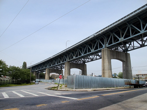
High above me, the Brooklyn Queens Expressway crosses the Kosciuszko Bridge. On the easterly side of the street is a police tow yard.
For those of you reading this from outside the City of Greater New York, this is a great example of the macabre logic that the City operates under. The one tow yard in all of Queens is at one the most inaccessible by mass transit, seldom traveled to, and hard to find spots in all of Queens.
-photo by Mitch Waxman
I consider this corner- where Laurel Hill Blvd. meets 56th rd. and Calvary Cemetery to be a Long Island City, Laurel Hill, and Maspeth bordeline locus point. I’m sure this is also my personal opinion, and that I’m probably wrong. All I can say is that it feels like a border between the neighborhoods.

-photo by Mitch Waxman
On the Newtown Creek side of Laurel Hill Blvd. are a series of heavy industry sites. One or two are available for sale or development, if you’re interested in buying 200 years of ecological damage.

-photo by Mitch Waxman
When we arrive at Laurel Hill Blvd, corner of Review- the signs are clear.

-photo by Mitch Waxman
Just look across the street, where the gates of Calvary Cemetery beckon (and which we’ll be exploring in the next installment).
Or look behind you, at the sadly neglected site of the historic LIRR Penny Bridge station.


-photo by Mitch Waxman
Nazi grafiti has appeared here just recently. This sort of ugly street iconography has been appearing all over LIC and Greenpoint lately.
Not too worried about it, as New York City has a way of squashing bugs when they scuttle across the floor. These guys are going to get caught in the act, and if they are very lucky, it’ll be by the cops.
More to come.
the Wrong side of the tracks, a walk in Maspeth
Feel like taking a walk? I’ll show you something cool… Bring your camera- and ID
Anything you may experience, in situ, by following these walking directions is at your OWN RISK, and is offered by the Newtown Pentacle for documentary and entertainment purposes only. Remember- the rule we follow at the Newtown Pentacle is to NEVER trespass. Like Vampires, Newtownicans should wait to be invited into a house before they can do their work. To wit. Also, Please note — the opinions expressed in italics in this story are the author’s opinions and observations and not necessarily factual.
Over Hill and Dale, part 1- Maspeth Creek
check out the walk in a Google Map here.
-photo by Mitch Waxman
This is another Saturday or Sunday kind of photowalk thing. You really don’t want to be here during the week on foot. VERY dangerous place.
At 56th road, between 48th and 50th streets in Queens, is a non-existent crosswalk found at the confluence of 49th street and an active (street-grade level) railroad track. This is an insanely dangerous patch of road running through a literal industrial backwater.
Be ever so careful crossing here- remember that guy who got dragged a few months ago? That happened not too far from here. There are giant machines flying around at top speed all around you. Be wary. We’re going to walk part of the Maspeth Plank Road today, more or less.

-photo by Mitch Waxman
Incidentally, these rail tracks and buildings are the proposed site for the Maspeth Rail Tunnel.
WRONG- Christina from Forgotten-NY was kind enough to correct us here.
“I appreciate the walk through Maspeth however there is no planned tunnel construction Queens for the Cross Harbor Project. Phelps Dodge would be the site of an intermodal rail-to-truck facility. The tunnel is from NJ to Bklyn. Here is a map.”

-photo by Mitch Waxman
On your left is an enigmatic site that the DEP has labeled “the Maspeth Project”. This, of course, sets me off into endless speculations. As does the term “Maspeth Railroad Place site” that’s used to describe it.
from the DEC
Administrative Information
Site Name: Maspeth Project
Site Code: B00152
Program: Environmental Restoration Program
Classification: A
EPA ID Number:
Location
DEC Region: 2
Address: 57-15 49th Street
City: New York City Zip: 11378-
County:Queens
Latitude: 40.724616420
Longitude: -73.919630760
Site Type:
Estimated Size: 2.800 Acres
Site Description
The Maspeth Railroad Place site is located in an industrialized area of Queens County, New York. The site is approximately 3-acres in size, and can be found at 57-15 49th Street. The main site features include a fenced lot which constitutes the majority of the site. There are no perminent structures on the lot. The headwaters of Maspeth Creek are located approximately 100 hundred feet from the site. The site is currently vacant, though there is evidence of some trespassing. The site is surrounded by industrial/commercial properties on all sides. The site has had several industrial/commercial uses over the years, but is reported to have been most recently the site of a bus maintenance facility. A former chemicals blending operation was located immediately adjacent to the site, and there was some concern that wastes from that operation could have contaminated the site. The Remedial Investigation is complete, and the alternatives analysis has been submitted in draft form. The City of New York has amended the State Assistance Contract to include funds for removing an underground storage tank which was found during the site investigation. That work was conducted in the spring and summer of 2008. Work continues on finalizing the alternatives analysis.
Contaminants of Concern (Including Materials Disposed)
Type of Waste Quantity of Waste
BENZO(A)PYRENE UNKNOWN
BIS(2-ETHYLHEXYL)PHTHALATE UNKNOWN
XYLENE (MIXED) UNKNOWN
Site Environmental Assessment
The primary contaminants of concern at the site are petroleum related compounds. Preliminary data indicated the possible presence of a common plasticizer (bis-2-ethylhexyl pthalate) at elevated levels in groundwater and soils, however, more recent data indicated much lower levels than previously reported. The study is on-going, but some localized soils and groundwater contamination has been identified. Groundwater is above standards for petroleum compounds. The site has not been determined to be a significant threat to the environment.
Site Health Assessment
Soil and groundwater are contaminated with petroleum-related volatile and semi-volatile organic compounds. Exposure to contaminated groundwater is not expected because the area is served by public water. The area is heavily industrialized and the site is partially fenced, but tresspassers may be exposed to contaminated surface soil.

-photo by Mitch Waxman
from Serphin Maltese’s website
10/4/00 BROWNFIELDS GRANT TO HELP MASPETH
Wednesday, 04 October 2000 00:00
News Archives – 2000
Senator Serphin R. Maltese (Queens) announced a $412,500 grant from the Clean Water/Clean Air Bond Act will be used to investigate potential environmental contamination at the site of the Maspeth Project.
“On behalf of the residents and their families of the Maspeth and Queens communities, I wish to express our sincere appreciation to Governor Pataki for this vital brownfields funding. It will enable us to investigate and clean up property in many of our vibrant Queens neighborhoods,” said Senator Maltese.
“New York’s Brownfields Program is helping cities across the State revitalize our urban landscape by turning abandoned and underused properties into community assets,” said Governor Pataki. “This grant is a perfect example of how funding from the Clean Water/Clean Air Bond Act is fostering environmental renewal, creating economic opportunity and improving the quality of life of all New Yorkers.”
Senator Maltese explained that the brownfields grant will be used to investigate suspected contamination at a 2.8 acre site located at 57-15 49th Street in Maspeth. The property, which the City acquired after it was condemned, is located in a heavy manufacturing zone and has been vacant for many years. The site was previously used for bus maintenance and storage, a silkscreen printing facility and a graphic dye cutter operation. The City plans to use the site for a consolidated water and sewer maintenance facility for the NYC Department of Environmental Protection.
“New York’s Brownfields Program is one of the best-funded of its kind in the nation and it is helping bring jobs, parks and new housing to communities throughout the state at sites that previously were unusable,” said Senator Maltese.
The Clean Water/Clean Air Bond Act, proposed by Governor Pataki and approved by voters in 1996, authorizes $1.75 billion for several environmental programs. It includes $200 million for grants to municipalities for costs associated with the investigation and cleanup of brownfields, which are abandoned or underused properties where real or perceived environmental contamination hinders the potential for redevelopment.
For more on Serphin Maltese, click here.

-photo by Mitch Waxman
On your right- the Kosciuszko bridge in the background, with the Davis & Warshow warehouse in the foreground, and the Newtown Creek spreads greasily around you. Get your shots in this summer, Newtownicans, the bridge is scheduled to be replaced and then torn down.

-photo by Mitch Waxman
Maspeth Creek is a tributary of the Newtown Creek that makes its first noxious appearance here. It is the most polluted part of the Newtown Creek watershed. One wonders how long this waterway, which drew the Dutch here, will survive modernity. This, of course, is not the first indignity suffered by nature at the hands of municipal planners.

-photo by Mitch Waxman
Water quality is always terrible here, but I’ve seen it worse than this. There’s an outfall sewer directly below the camera’s POV. The smell is…
from the EPA
Address Maspeth Creek, Queens, NY
Categories Water, Sewage/Garbage, Health and Toxics Neighborhood Maspeth
Keywords CSO, Newtown Creek Owner/Occupant NYC Department of Environmental Protection – if you see discharge during dry weather call 311 with the outfall number ready
Location Details CSO Outfall NC-077 -discharges 288.7M gallons per year into English Kills -Tier 2 outfall -Ranked 25 out of over 400 in terms of volume -located at Maspeth Creek

-photo by Mitch Waxman
Did you know that one leg of the new City Water Tunnel number 3 runs from Maspeth to Red Hook? Eventually, it will be a subterranean conduit for drinking water running throughout the entire city, when completed in 2020.

-photo by Mitch Waxman
Advice:
Maspeth avenue is populated by many, many people who wouldn’t like you taking their picture, lords and ladies of Newtown. If you catch my drift, this is a good place to be covert with your camera. Not to imply that corruption and racketeering ever had anything to do with any of the neighborhoods surrounding the Newtown Creek- or that the New York City garbage hauling and trucking industries have ever been anything other than above board, but watch out for yourself here.
These days- in our modern New York- where there has been no police corruption since 1992, and crime has fallen an aggregate 79% in that period, people have gotten used to walking around like they’re safe or something.

-photo by Mitch Waxman
Proceeding around the bend from 49th street to 48 st, on your right will be a succession of recycling and garbage processing companies, and a huge sanitation garage dominates the end of the block at the turn to 58th road.
Be conservative with your camera here. Cop hassles are the last thing you’re worrying about around these parts- its private security and union guys. This is not the safe little world you know from television, this is the real world with its own set of rules- and you are a guest on these streets. Don’t fool around with these fencelines, urban explorer types. And look out for trucks.

-photo by Mitch Waxman
On your left are a series of faceless factories squatting squamously in the Newtown sun.

-photo by Mitch Waxman
At the end of 58th road are the remains of the Maspeth Avenue Bridge- a toll bridge whose owners were incorporated as early as 1836. Its the last visible remnant of the Maspeth Plank Road, which last crossed the Newtown Creek in 1875.
forgotten-ny went down the Newtown Creek a few years ago on the John J. Harvey fireboat- check it out.
from one of my earlier postings that connects up with this one-
The Night Soil and Offal Docks, and Jell-O
…over on the Greenpoint side when I read about “Conrad Wessel’s noxious and pestilential night soil and offal dock on Furman’s Island, along the Newtown Creek”. This reference was connected to Gov. Flower’s “smelling committee” which traveled up Newtown Creek in a steamboat during the summer of 1894 to confirm that the waterway did, in fact, smell. The Smelling Committee placed much blame for the miasma which permeated Long Island City, Dutch Kills, and Greenpoint at the doorstep of the bone boilers on Furman’s Island.
A muddy patch midway at the branch of Maspeth Creek with the main waterway, Furman’s (originally Smith’s) island was connected to the shore by a plank road. This plank road would later become Maspeth Avenue. At the corner of Gardner, where the Maspeth Tanks towered until just recently- was Peter Cooper’s Glue Factory. This picture is from the Brooklyn public library:

-photo by Mitch Waxman
To your right will be a gigantic Sanitation Garage, to your left is 47th street, in front of you is a patch of mud and the Newtown Creek and what remains of another world.
If you’re heading back to Greenpoint or Williamsburg- take 47th to Grand Avenue and make a right to go over the Grand Avenue Bridge.
Before Grand St. in Brooklyn was extended into Queens (where it becomes Grand Avenue), the Maspeth Avenue Bridge (along with Penny Bridge) served the 19th century multitudes traveling to and from the Cemetery Belt- specifically Calvary and Mt. Zion.
from another one of my earlier postings that connects up with this one-
Death was and is big business, and Long Island City was and is all about business. Ferry service ran from Manhattan and Brooklyn bringing the bereaved up Newtown Creek to the New Calvary Pier in Blissville.
The Long Island Railroad maintained a station at Penny Bridge carrying mourners from all points east. Funeral processions involved marching bands and extensive paegentry. A trip to the graveyard was like visiting a sculpture park for the whole family, with exquisite landscaping and an arboretum of exotic trees and flowering plants sprouting from a grassy hill. Clothes were crisply laundered in boiling water (using lye as a detergent), children ordered to behave or else . What a change, if only for a few hours, from the gaslit darkness of Manhattan’s tenement alleys. A beautiful day with the family, spent at the Newtown Creek.

-photo by Mitch Waxman
Take one last look, HEY- that’s the Empire State Building, isn’t that cool? Told you I’d show you something cool.


