Archive for the ‘newtown creek’ Category
neighboring alcove
Kosciuszcko Bridge project in today’s post.

– photo by Mitch Waxman
A couple of weekends ago, I decided to take the camera out for a walk and we headed on over to the Queens side of DUKBO – Down Under the Kosciuszcko Bridge Onramp. Most of what’s going on at the work site right now, which will result in the second half of the new bridge, seems to involve foundation and structural work. Laurel Hill Blvd. is largely closed to traffic due to the construction, as you’d imagine.
The shot above looks south along Laurel Hill Blvd. towards Brooklyn.

– photo by Mitch Waxman
The steel piles above are the firmament which will carry the approach ramp for the bridge, which in turn carries the Brooklyn Queens Expressway. These will be the southbound lanes, which are also meant to host the bicycle and pedestrian lane that I – for one – am pretty excited about. I’ve seen renderings of the planned bike and pedestrian section and it promises to be a photographer’s dream come true.

– photo by Mitch Waxman
Documenting this project has been a long standing project of mine – this 2012 post tells you everything you could want to know about Robert Moses, Fiorella LaGuardia, and the origins of the 1939 model Kosciuszcko Bridge. Just before construction started, I swept through both the Brooklyn and Queens sides of Newtown Creek in the area I call “DUKBO” – Down Under the Kosciuszcko Bridge Onramp. Here’s a 2014 post, and another, showing what things used to look like on the Brooklyn side, and one dating back to 2010, and from 2012 discussing the Queens side – this. Construction started, and this 2014 post offers a look at things. There’s shots from the water of Newtown Creek, in this June 2015 post, and in this September 2015 post, which shows the bridge support towers rising. Additionally, this post from March of 2016 detailed the action on the Queens side. Most recently, here’s one from May of 2016, and one from June of the same year. Here’s one from August of 2016, the December 2016 one, one from March of 2017 which discusses the demolition of the 1939 bridge.
Here’s a post showing what I saw during a pre opening walk through in early April of 2017, and the fanfare surrounding the opening of half of the new bridge in April of 2017, a walk through of the Brooklyn side job site in June of 2017. Here’s some night shots from early July of 2017. A series of posts focused in on the removal of the central truss of the 1939 bridge from the summer of 2017 – a timelapse, some stills, and the barging out of the truss.
Most recently, in late September of 2017, a final series of shots of the old bridge were captured in this post. Acquisition of a souvenir chunk of steel from the 1939 bridge was described in this post, and a video of the “energetic felling” of the approaches on October 1st was offered in this one. Still shots and views of the aftermath from the waters of Newtown Creek from later in the day on Oct. 1 are found in this posting, and the aftermath of the demolition as seen from Calvary Cemetery in LIC’s Blissville section in this post from October 5th. This post from December of 2017 closed out an event filled year in DUKBO, and a visit to the site at night is described in this March of 2018 post.

– photo by Mitch Waxman
That’s the first section of the new bridge, which opened last year, and as seen from 43rd street in industrial Maspeth.
The NYS DOT has committed to making the currently dirt and equipment filled lots along 43rd street available to the NYC Parks Dept. for conversion to public “green space.” There’s other spots around the project which will turned into publicly accessible areas, but most will be shadowed by the onramps.

– photo by Mitch Waxman
One scuttled across the Lower Montauk tracks of the Long Island Railroad to get a better view of the progress at the construction site. The land in this spot used to be the home of a company called Phelps Dodge, which acquired it from the original tenant – General Chemical. General Chemical manufactured sulphuric acid hereabouts, and Phelps Dodge incorporated the GC campus into their operations, which was mainly copper refining.
This section of the LIRR tracks used to be known as “Deadman’s curve” for all the factory workers who were struck by speeding locomotives hereabouts. It’s also the site of the Berlinville Railroad disaster, where two LIRR trains collided in 1893. Check out this contemporaneous NY Times piece for more on that.

– photo by Mitch Waxman
After having crossed the tracks and a byway formerly known as “Creek Street“ the still forming concrete towers which will support the “cable stay” roadway of the second bridge came into view. Having followed the project so closely as the first half of the new K-Bridge went up, it’s actually pretty interesting to watch them working on it this time around, given that I know how the story plays out.

– photo by Mitch Waxman
The shot above, depicting the teeny tiny construction workers moving around on ladders, is included for scale. Down on the ground, these guys are HUGE, six + footers who weigh a couple of hundred pounds each and who tower over a humble narrator. On the K-Bridge site, they look like action figures.
I continued along my southern path and headed down to the bulkheads of that lugubrious cataract of urban neglect known as the Newtown Creek.

– photo by Mitch Waxman
The Kosciuszcko Bridge is found 2.1 miles from the East River, and overflies the Newtown Creek. It carries the Brooklyn Queens Expressway from the border of Sunnyside/Blissville/Maspth in Queens to Greenpoint/Bushwick/Williamsburg in Brooklyn.
Newtown Creek itself is an inland tributary of the East River, and extends 3.8 miles eastward of the larger waterway. There are multiple tributaries of Newtown Creek itself which extend into Long Island City, Bushwick, and Maspeth.

– photo by Mitch Waxman
Having satisfied myself with a “check in” on the bridge project, one began his trek towards home and HQ in Astoria.
Sometime during this week, I plan on heading over to Greenpoint to see what’s doing with the K-Bridge project over there. I’ll let y’all know what I find.
“follow” me on Twitter- @newtownpentacle
stinking ossuaries
Scuttling, always scuttling.
– photo by Mitch Waxman
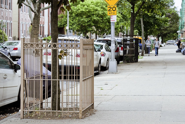
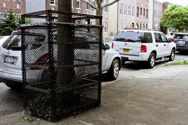
Whenever I mention the 1980’s to those who grew up in Long Island City and Astoria, a shudder seems to go through them. I’ve always wondered if that shudder has anything to do with why all the trees are in cages.
I’ve asked a few of the lifers, but boiling down the answers offered by them reveals one singular truth, which is simply expressed by describing the Croatian people as being remarkably tight lipped. There’s some gesturing involved in their answers, and sometimes a few words in a language which I can never understand (I’ve tried). Regardless, something motivated several of them to build iron cages for the street trees around here. I’ve learned to just accept things over the years which I’ve dwelt here in Astoria, Queens.
Such is my lot.
– photo by Mitch Waxman
One is in a weird place, in terms of his mood. Feeling increasingly obsequious, and often wondering who the old fellow staring back at me from the bathroom mirror is, a humble narrator nevertheless sallies forth. Like the trees here in Astoria, there are iron bars and fences all around me. Often it feels as if one is juggling chain saws, and that one slip up will result in disaster. The whole “angry young man” thing is no longer a valid posture, as I’ve instead found myself cast as a broken old man. Such is the wheel of life, however, and there’s no point in moaning about it.
There are still battles to fight, and wars to win.
– photo by Mitch Waxman
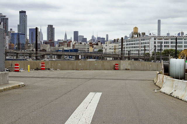
Speaking of, that’s the Sunnyside Yards (est. 1909) pictured above. The shots in today’s post, from this point onward, were all captured along 43rd street while walking south. 43rd street, once you cross Northern Blvd. from the blessed rolling hills of almond eyed Astoria, used to be called Laurel Hill Blvd. It connected the eastern side of LIC’s Blissville over by Newtown Creek and Calvary Cemetery with Middleburgh, which modernity calls Sunnyside. That was before the Long Island Expressway and the Brooklyn Queens Expressway, and even before Queens Blvd. and the IRT Flushing Line were created in the 20th century.
Referring to old maps of Western Queens requires the usage of three distinct sets of documents, as they’ve (a shadowy cabal, probably) renamed and reoriented the streets so many times in Queens that it’s confusing as all get out figuring out what something used to be called. There’s a few “landmark” lanes which you can use to figure out relative positioning, like Jackson Avenue or Steinway Street, but even then…
– photo by Mitch Waxman
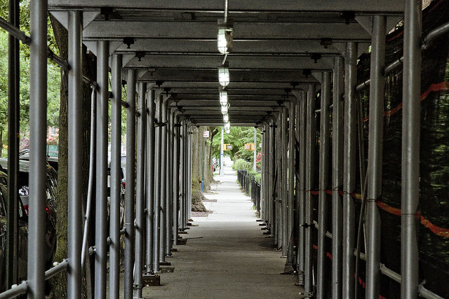
43rd street, as a pathway to Newtown Creek, has been off my radar for the last few years due to the Koscisuzcko Bridge construction project. Just this last winter, the newly rebuilt pedestrian bridge spanning the onramp to the BQE from the LIE was opened. It replaced an older iteration as part of the bridge project, and I’m in the process of reinstalling this pathway as part of my mental map for “where do I want to go today” usage.
The scaffolding in the shot above obscures the Celtic Park apartment complex, so named for a former beer garden and complex of athletic fields which the development is named for. The Celtic Park, as it was known, was designed and situated to take advantage of the huge numbers of Irish Catholic New Yorkers who came to Queens to visit loved ones in the various properties maintained by Calvary Cemetery found nearby in Blissville and Woodside.
– photo by Mitch Waxman
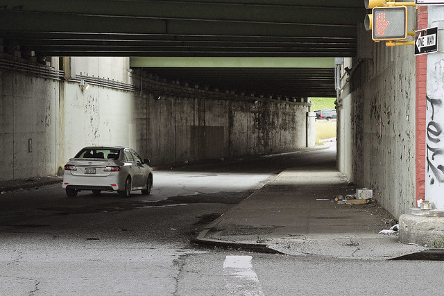
One improvement which hasn’t occurred, and I plan on getting after the K-Bridge team about it next time I see them, is the approach to the pedestrian and bicycle bridge that joins 43rd street with the stubby three block stretch of Laurel Hill Blvd. found on the south side of the LIE. The trestle seen above carries the Long Island Expressway, and acts as a seldom mentioned approach to the BQE and Koscisuzcko Bridge itself.
It’s fairly terrifying walking along this stretch of sidewalk, with traffic ramping up to highway speeds alongside of you. A series of jersey barriers would cheaply and effectively address the issue. I’m on it, don’t worry.
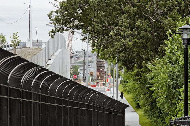
– photo by Mitch Waxman
Aforementioned, that’s the extant section of Laurel Hill Blvd. mentioned above. To the west (or right) is Blissville’s Calvary Cemetery, to the east (or left) is the BQE and industrial Maspeth. This is also more or less the legal border which once existed between the independent municipalities of Long Island City and Newtown, prior to the consolidation of the City of Greater New York.
Tomorrow – so, what’s going on with the Kosciuszcko Bridge project?
“follow” me on Twitter- @newtownpentacle
abstract malingering
Friday odds and ends.

– photo by Mitch Waxman
A sudden explosion of cast off gloves, observed, makes one wonder if the Queens Cobbler has been joined by a new fiend whom I’ve been referring to as the “Queens Gaunter.” The name “Gaunter” is derived from a fairly archaic English, incidentally, and it’s from the same root of the word which “Gauntlet” comes from. In the Industrial Age, the name of the profession became the rather plain “glove maker” in the case of male oriented hand coverings, whereas lady gloves were prepared by milliners. That’s a work glove pictured above, which is unisex, and it was found in Maspeth. Perhaps the “Maspeth Milliner” rather than “Queens Gaunter,” with the latter having a bit more of a salubrious “roll off the tongue” should be used for this recently discovered companion to the Queens Cobbler? You can record your preferences in the comments, Queensicans.
One doubts that this red handed glove is in anyway related to the Ulster based “Red Hand Commandos” of West Belfast, incidentally, but you never know.

– photo by Mitch Waxman
Down at my beloved Newtown Creek the other day, one grew fascinated by these derelict piles along the former Phelps Dodge property’s waterfront. One whipped out the tripod, lowered the camera’s ISO and narrowed the lens’s aperture to its absolute in pursuance of “slowing the shot down.” This is the exact moment when I decided that I have to buy an ND filter next time I’m at “beards and hats” over in the city, incidentally. I really, really wanted to turn the water into a milky smear with perfectly glassine reflectivity here.
These piles supported a heavy pier which had rail tracks on it, once. Most of the property which Phelps Dodge used to operate on is fill. There’s a congressional act, whose name escapes me at this writing, which allows for corporate entities to buy underwater property along industrial waterways like Newtown Creek as long as they “improve” it by filling it in. This process was usually accomplished by building heavy timber box frames that were then submerged and loaded up with whatever material the industrial concern wished to use. In the case of Phelps, it was industrial slag from their copper refining operation mixed with rock and soil.

– photo by Mitch Waxman
Industrial Maspeth, which one has repeatedly described as being his “happy place,” seldom disappoints the wandering mendicant and itinerant shutterbug. Encountered at the Kosciuszcko Bridge construction site, this array of spent coffee cups embedded in the chain link of a hurricane fence entranced me.
Next week, I’ll update y’all on the progress that the NYS DOT is making on phase 2 of the bridge project, so there’s something to live for.
Upcoming Tours and Events
June 9th – Exploring Long Island City – with NY Adventure Club.
Long Island City is a tale of two cities; one filled with glittering water-front skyscrapers and manicured parks, and the other, a highly active ground transportation & distribution zone vital to the New York economy — which will prevail?
Tickets and more details here.
“follow” me on Twitter- @newtownpentacle
rapid onset
Broken and battered.

– photo by Mitch Waxman
I’m so fatigued at the moment that I’ve become plain old mean. A single shot today, go enjoy your weekend. If you see me coming, just go the other way, as it won’t end well. Back Monday with a more optimistic and or positive attitude.
Upcoming Tours and Events
June 9th – Exploring Long Island City – with NY Adventure Club.
Long Island City is a tale of two cities; one filled with glittering water-front skyscrapers and manicured parks, and the other, a highly active ground transportation & distribution zone vital to the New York economy — which will prevail?
Tickets and more details here.
“follow” me on Twitter- @newtownpentacle
hereditary predilection
Queens is mad as hell, and we’re not going to take it anymore.

– photo by Mitch Waxman
No more. The Mayor’s plan to warehouse New York City’s most vulnerable citizens in a neighborhood of warehouses, two blocks from the Newtown Creek Federal Superfund Site and one block from the Long Island Expressway – thereby creating a two to one ratio of actual residents to homeless shelter residents in the Blissville section of Long Island City – seems to have become the straw that broke the proverbial camel’s back. No more. The needs of the elites of Manhattan do not outweigh the needs of Queens. No more.
On Tuesday last, Councilmember Jimmy Van Bramer grilled DHS Commisioner Stephen Banks about this plan at City Hall, and community members gathered on the steps of City Hall in protest over the Mayor’s plan. Assemblymember Cathy Nolan sent her representative David Agioloro to show her support for the cause. No more.

– photo by Mitch Waxman
Monday last, at Gracie Mansion, Congresswoman Carolyn Maloney joined with the Blissville Civic Association to protest the Mayor’s plan at the gates of the Manhattan mansion he lives in. Western Queens’s elected officials stand in solidarity with Blissville, as does Brent O’Leary of the Hunters Point Civic Association, Senator Michael Gianaris, and your humble narrator. No more.

– photo by Mitch Waxman
Next week, as a note, the NYS DEC will be presenting their findings regarding the Blissville Seep – where oil has been migrating into the waters of Newtown Creek from the Queens side bulkheads less than a mile from the Mayor’s three homeless shelter. Their informal presentation on the former Queens County Oil Works of Charles Pratt will take place on Thursday, May 24th at the NYS DEC offices on 21st street in LIC.
No more.
Upcoming Tours and Events
June 9th – Exploring Long Island City – with NY Adventure Club.
Long Island City is a tale of two cities; one filled with glittering water-front skyscrapers and manicured parks, and the other, a highly active ground transportation & distribution zone vital to the New York economy — which will prevail?
Tickets and more details here.
May 17th – Port Newark Boat Tour – with Working Harbor Committee.
For an exciting adventure, go behind the scenes of the bustling Port of NY & NJ on our Hidden Harbor Tour® of Port Newark! Get an insider’s view of the 3rd largest port in the nation, where container ships dock and unload their goods from around the world. See how the working harbor really works and learn about what all those ships and tugs do. See giant container terminals, oil docks, dry dock repair, and more! Tickets and more details here.
“follow” me on Twitter- @newtownpentacle


