Archive for the ‘newtown creek’ Category
ratstravaganza or “I am not that demon swineherd”

– photo by Mitch Waxman
The voice was familiar, polished by Marlboro and inflected by origin and experience in Astoria, when it asked “Do you want to take pictures of rats… I mean a whole lot of rats?”. One of my buddies, employed by a mid size garbage haulage company based in Maspeth, described the scene to me in lurid detail- when his trucks returned to the garage from a weekly garbage run (they normally specialize in certain recyclable materials, but also handle organics) rats would pour out of them and claim free reign over the enormous structure for a few hours. A home grown colony of rats, as well, were known to come spilling out of the walls when the lights went down.
from wikipedia, and note- this isn’t the company “waste management”, just the subject
Waste management is the collection, transport, processing, recycling or disposal, and monitoring of waste materials. The term usually relates to materials produced by human activity, and is generally undertaken to reduce their effect on health, the environment or aesthetics. Waste management is also carried out to recover resources from it. Waste management can involve solid, liquid, gaseous or radioactive substances, with different methods and fields of expertise for each.
Waste management practices differ for developed and developing nations, for urban and rural areas, and for residential and industrial producers. Management for non-hazardous residential and institutional waste in metropolitan areas is usually the responsibility of local government authorities, while management for non-hazardous commercial and industrial waste is usually the responsibility of the generator.

– photo by Mitch Waxman
Dark and effluent, the garage is a multiple acre building with 40-50 foot ceilings and cinder block walls. Industrial equipment is installed directly into concrete flooring, and in places there are pits and deep channels that allow the automated equipment room to operate. An amiable Brooklynite agreed to accompany me around the place, and steer me from hazardous drops familiar to him after a life time of occupation at the facility. I had to rely on flash photography and high ISO settings, as the quick moving rodents shied away from any attempt at lighting.
from wikipedia
Rats are known to burrow extensively, both in the wild and in captivity, if given access to a suitable substrate. Rats generally begin a new burrow adjacent to an object or structure, as this provides a sturdy “roof” for the section of the burrow nearest to the ground’s surface. Burrows usually develop to eventually include multiple levels of tunnels, as well as a secondary entrance. Older male rats will generally not burrow, while young males and females will burrow vigorously.
Burrows provide rats with shelter and food storage as well as safe, thermoregulated nest sites. Rats use their burrows to escape from perceived threats in the surrounding environment—for example, rats will retreat to their burrows following a sudden, loud noise or while fleeing an intruder. Burrowing can therefore be described as a “pre-encounter defensive behavior”, as opposed to a “post-encounter defensive behavior”, such as flight, freezing, or avoidance of a threatening stimulus.

– photo by Mitch Waxman
Scurriers abound in this cairn of municipal waste management, which is built in the industrial heartland of the Newtown Creek. Concentric layers of factory and mill are pancaked beneath the structures that have survived into modernity. Beneath the ground, collapsed crawl spaces and forgotten pipelines rifle through the poison soil. Memory of these voids beneath Maspeth is long dead, and the architectural plans that detail their course have long since turned to dust… or have been recycled.
from wikipedia
Industrial archaeology, like other branches of archaeology, is the study of material culture from the past, but with a focus on industry. Strictly speaking, industrial archaeology includes sites from the earliest times (such as prehistoric copper mining in the British Peak District) to the most recent (such as coal mining sites in the UK closed in the 1980s). However, since large-scale industrialisation began only in the eighteenth century it is often understood to relate to that and later periods. Industrial archaeologists aim to record and understand the remains of industrialisation, including the technology, transport and buildings associated with manufacture or raw material production. Their work encompasses traditional archaeology, engineering, architecture, economics and the social history of manufacturing/extractive industry as well as the transport and utilities sector.
The term ‘industrial archaeology’ was coined in the 1950s in Birmingham, England by Michael Rix (academic) although its meaning and interpretation has changed. Its development as a separate subject was further stimulated by the campaign to save the Euston Arch. Palmer and Neaverson (Industrial Archaeology Principles and Practice, 1998) defined it as: “the systematic study of structures and artefacts as a means of enlarging our understanding of the industrial past.”
Initially practiced largely by amateurs, it was at first looked down upon by professional archaeologists. However, it has now been welcomed into mainstream archaeology. Since the timeframe of study is usually relatively recent, industrial archaeology is often (but not always) able to achieve a more reliable and absolute recording of past behaviour than is possible for the more remote past.

– photo by Mitch Waxman
Urban explorers have brought reports of this underworld to the surface, but they will only discuss the subject after a series of stiff drinks. Following the natural course of water, voids in the subsurface are found and accessed through sewer and electrical utility vaults. Compass readings and radio telephony are impossible beneath the streets, and hushed allusions to a pair from East Williamsburg who are rumored to have never returned from the sepulchral depths verge on urban legend. As one proceeds closer to the Newtown Creek, vast middens of rats are mentioned, living amidst and in some cases feeding on an oozing black jelly whose vile smell vaguely suggests vaseline mixed with ham.
from wikipedia
Petroleum jelly, petrolatum or soft paraffin[1], CAS number 8009-03-8, is a semi-solid mixture of hydrocarbons (with carbon numbers mainly higher than 25), originally promoted as a topical ointment for its healing properties. Its folkloric medicinal value as a “cure-all” has since been limited by better scientific understanding of appropriate and inappropriate uses (see Uses below). However, it is recognized by the U.S. Food and Drug Administration (FDA) as an approved over-the-counter (OTC) skin protectant and remains widely used in cosmetic skin care.
The raw material for petroleum jelly was discovered in 1859 in Titusville, Pennsylvania, United States, on some of the country’s first oil rigs. Workers disliked the paraffin-like material forming on rigs because it caused them to malfunction, but they used it on cuts and burns because it hastened healing.
Robert Chesebrough, a young chemist whose previous work of distilling fuel from the oil of sperm whales had been rendered obsolete by petroleum, went to Titusville to see what new materials had commercial potential. Chesebrough took the unrefined black “rod wax”, as the drillers called it, back to his laboratory to refine it and explore potential uses. Chesebrough discovered that by distilling the lighter, thinner oil products from the rod wax, he could create a light-colored gel. Chesebrough patented the process of making petroleum jelly by U.S. Patent No. 127,568 in 1872. The process involved vacuum distillation of the crude material followed by filtration of the still residue through bone char.
Chesebrough traveled around New York demonstrating the product to encourage sales by burning his skin with acid or an open flame, then spreading the ointment on his injuries and showing his past injuries healed, he claimed, by his miracle product.
He opened his first factory in 1870 in Brooklyn, United States. The brand name “Vaseline” has been anecdotally claimed to be from the German word for water, wasser (pronounced vahser), and the Greek word for oil, elaion, but this is unconfirmed.
The part of Brooklyn Chesebrough located his factory in, incidentally, was Red Hook and it was at Columbia and Delevan Streets.

– photo by Mitch Waxman
My guide in the garage informed me that these rats were nearly impossible to control via the use of baited traps and poisons. It was his supposition that the whole place was poisoned, afflicted with some sort of chemical overdose, and pointed out the stunted trees that dot the area. I mentioned “the colour” and he said that was as good a name for it as any. He went on to say that the only thing which has alleviated the rat population in the garage at all is a raccoon which has taken up residence in the place.
That’s a raccoon, -which just showed up- in Maspeth, a few blocks from Newtown Creek.
from wikipedia
The area known today as Maspeth was chartered by Dutch and English settlers in the mid-17th century. The Dutch had purchased land in the area known today as Queens in 1635, and within a few years began chartering towns. In 1642 they settled Maspat, under a charter granted to Rev. Francis Doughty. Maspat became the first European settlement in Queens. The settlement was leveled the following year in an attack by Native Indians, and the surviving settlers returned to Manhattan. It wasn’t until nine years later, in 1652, that settlers ventured back to the area, settling an area slightly inland from the previous Maspat location. This new area was called Middleburg, and eventually developed into what is now the town of Elmhurst, bordering Maspeth. Following the immigration waves of the 19th century, Maspeth was home to a shanty town of Boyash (Ludar) Gypsies between 1925 and 1939, though this was eventually bulldozed.

– photo by Mitch Waxman
As we headed back for the office section of the facility, where my buddy awaited, my guide pointed out the cinder block wall and the apertures chewed through it by the rats. The rats are in the walls… there are rats in the walls, the rats… in… the… walls…
Just then, my buddy walked out and asked if I enjoyed my “ratstravaganza”.
from HP Lovecraft’s “Rats in the walls” at wikisource
When Dr Trask, the anthropologist, stopped to classify the skulls, he found a degraded mixture which utterly baffled him. They were mostly lower than the Piltdown man in the scale of evolution, but in every case definitely human. Many were of higher grade, and a very few were the skulls of supremely and sensitively developed types. All the bones were gnawed, mostly by rats, but somewhat by others of the half-human drove. Mixed with them were many tiny bones of rats — fallen members of the lethal army which closed the ancient epic.
I wonder that any man among us lived and kept his sanity through that hideous day of discovery. Not Hoffman nor Huysmans could conceive a scene more wildly incredible, more frenetically repellent, or more Gothically grotesque than the twilit grotto through which we seven staggered; each stumbling on revelation after revelation, and trying to keep for the nonce from thinking of the events which must have taken place there three hundred, or a thousand, or two thousand or ten thousand years ago. It was the antechamber of hell, and poor Thornton fainted again when Trask told him that some of the skeleton things must have descended as quadrupeds through the last twenty or more generations.
Horror piled on horror as we began to interpret the architectural remains. The quadruped things — with their occasional recruits from the biped class — had been kept in stone pens, out of which they must have broken in their last delirium of hunger or rat-fear. There had been great herds of them, evidently fattened on the coarse vegetables whose remains could be found as a sort of poisonous ensilage at the bottom of the huge stone bins older than Rome. I knew now why my ancestors had had such excessive gardens — would to heaven I could forget! The purpose of the herds I did not have to ask.
Gods Gift to Pain

Please click through to Flickr and the larger incarnations of the above shot- it’s composed of 7 photos stitched together. Thats 7 fifteen megapixel shots and its HUGE – photo by Mitch Waxman
That extinction of hope called the Newtown Creek enjoys a series of canalized industrial waterways which act as tributaries to its main course. In the past we have visited Dutch Kills, Whale Creek, Maspeth Creek… today, it’s time for a visit to the vicious end of it all.
note: This post violates a number of the rules followed by this, your Newtown Pentacle, regarding rail tracks and probable trespass of private property… yet my hypocrisy knows no bounds. Realize, however, that I was with learned company- individuals overly familiar with this area, its mores, and the rail schedules. Do not come here, especially by yourself- for reasons later explained in this very post!
Welcome to the poison heartlands of New York City, where foul ichors flow freely, and English Kills bubbles in the afternoon sun.
from wikipedia
Newtown Creek is a 3.5 mi (6 km) estuary that forms part of the border between the boroughs of Brooklyn and Queens, in New York City, New York, United States. It derives its name from New Town (Nieuwe Stad), which was the name for the Dutch and British settlement in what is now Elmhurst, Queens. Channelization made it one of the most heavily used bodies of water in the Port of New York and New Jersey and thus one of the most polluted industrial sites in America, containing years of discarded toxins, an estimated 30 million gallons of spilled oil, and raw sewage from New York City’s sewer system. Newtown Creek was proposed as a potential Superfund site in September 2009.

– photo by Mitch Waxman
This is as bad as it gets, one of the few places along the Creek where exposure to the water is life threatening in the short term.
Sure, if you fall off the Grand Avenue Bridge, you’re going to experience broad spectrum antibiotics administered intravenously over the course of a week or two in the hospital- but this stuff is pure dragon blood.
Nauseous miasmas were luckily carried away by stiff breezes, but several times- your humble narrator felt one of his spells coming on.
Up until the latter part of the 20th Century, industries along the creek had free reign over the disposal of unwanted byproducts. With little-to-no government regulation or knowledge of impacts on human health and the environment, it made business sense to pollute the creek. The legacy of this history today is a 17 million gallon underground oil spill caused by Standard Oil’s progeny companies—7 million gallons more than the Exxon Valdez spill in 1989, copper contamination of the Phelps Dodge superfund site, bubbling from the creek bed in the English Kill reach due to increases of hydrogen sulfide and a lack of dissolved oxygen, and creekbeds coated with of old tires, car frames, seats and loose paper. Nearly the entire creek had the sheen and smell of petroleum, with the bed and banks slicked black.
There is no natural freshwater flow into the creek as the historic tributaries were covered over. Flow exclusively consists of contaminated stormwater runoff, carrying trash from numerous bridges, unsewered and wholly paved streets and industrial sites, waste transfer stations, and combined sewer overflows (CSOs) from the city’s sewer system. Moreover, severely toxic groundwater seeps through the bed and banks of the creek. Every year Newtown Creek receives 14,000 million gallons of combined sewage overflow, a mixture of rainwater runoff, raw domestic sewage, and industrial wastewater that overwhelms treatment plants every time it rains. There are also discharges from numerous permitted and unpermitted pollution sources. The creek is mostly stagnant, meaning all the pollutants that have entered the creek over the past two centuries have never left. The creek is also home to a federal Superfund site, several State Superfund sites and numerous brownfields that have not yet secured the attention of regulators.
All is not lost, however. Recently, life is returning to the creek. You can find blue crabs at the mouth, fish swim in its waters, and waterfowl are prevalent. Wetland plants are taking over the abandoned bulkheads and sediment piles and school children are growing oysters, which serve as natural water filters. The Newtown Creek Alliance is actively fighting to help life return to the creek by decreasing pollution and increasing the wetlands along the creek.

– photo by Mitch Waxman
The sickly vegetation, everything, was pulsing with “the colour”. Neither black nor white nor gray, but somehow “shiny”, this alien colour – like something out of space- permeates and identifies the creeklands. Nothing moved, but seemed instead to sway against the wind instead of with it.
In 1655, Director Stuyvesant being absent on an expedition against the Swedes on the Delaware, a horde of armed Indians landed at New Amsterdam, and began to break into houses for plunder. Driven back by the soldiers and armed citizens, they fell upon the unprotected Dutch farmers in the vicinity, many of whom were slain and others taken into captivity. The troubles experienced from the savages were now so alarming as to require the residents of Mespat Kills to concentrate for mutual safety. They, therefore, formed a village on “Smith’s Island,” at the English Kills. The Hon. Nicasius De Sille, who had a patent for the island, had the direction of the new settlement, and called it Aernhem after his native place.

– photo by Mitch Waxman
Dead things were observed in the filth, amongst other unidentifiable shapes and eyeless tubiforms that slithered and flopped and listened from the littoral mud. A vague sense of being watched affected my guides and I, and the loneliness of our location created a sense of certain misgivings which was both real and profound. Nevertheless, I continued my incessant photography, trying to make the best of limited access.
from The Eastern District of Brooklyn By Eugene L. Armbruster, via google books
BEYOND THE NEWTOWN CREEK
In the olden times the lands on both sides of Newtown Creek were most intimately connected. County lines were unknown, the creeks were dividing lines between the several plantations, for the reason that lands near a creek were taken up in preference to others, and the creeks were used in place of roads to transport the produce of the farms to the river, and thus it was made possible to reach the fort on Manhattan Island.
The territory along the Newtown Creek, as far as “Old Calvary Cemetery” and along the East River to a point about where the river is now crossed by the Queensboro bridge and following the line of the bridge past the plaza, was known as Dutch Kills. On the other side of Old Calvary was a settlement of men from New England and, therefore, named English Kills. The Dutch Kills and the English Kills, as well as the rest of the out-plantations along the East River, were settlements politically independent of each other and subject only to the Director-General and Council at Manhattan Island, but became some time later parts of the town of Newtown.

– photo by Mitch Waxman
This place, the very end of English Kills in East Williamsburgh, is non navigable and well beyond the containment boom that is observable from the Metropolitan Avenue Bridge. It hosts a rather large CSO (combined sewer outlet), and is crossed by a rail bridge which connects the massive Waste Management operation to infinite Brooklyn on one side and Queens on the other. The wooden structures which are so pleasingly posed, in their relict decay, are the remains of a former rail bridge which served the same purpose as the modern bridge.
The desk chair above is anybody’s guess.
from habitatmap.org
Combined Sewer Outfall – Newtown Creek 015
- Address Johnson Ave., Brooklyn, NY
- Neighborhood Newtown Creek
- Owner/Occupant NYC DEP
- Location Details Combined Sewer Overflow Outfall NC-015:
- discharges 344.4M gallons per year into English Kills
- Tier 2 outfall
- Ranked 20 out of over 400 in terms of volume
- located at Johnson Ave

– photo by Mitch Waxman
The shores were littered with death and disposal, and I spotted this sad little duck perched out on one of the rail structures. It didn’t seem to be moving very much, and its posture suggested sickness.
The City of New York has plans for this area. Check out page 29 of this PDF
DEP proposes to construct a 9 million gallon CSO storage facility to improve water quality by reducing the CSO discharged into the English Kills during rain storms when the CSO exceeds the capacity of the combined sewers. When this occurs, the CSO would be bypassed to the storage facility. At the end of the rain event the CSO would flow by gravity or be pumped back to the sewer system to be conveyed to the Newtown Creek Water Pollution Control Plant (WPCP) for treatment. This system was recommended by the Newtown Creek Water Quality Facility Planning Project (WQFP), a study that was part of the Citywide Combined Sewer Overflow abatement program.

– photo by Mitch Waxman
Here’s a close up of the duck, which is what I was shooting when my companions and I heard a series of voices and shuffling from the overgrown border of one of the warehouses that abuts the English Kills. Haste was made for a more advantageous position, as we were downhill and the water was at our backs. Strange gutterals were heard emanating from somewhere back in the forbidden brush, a sound almost reminiscent of a dog or bear attempting to speak as a man might- an imitation of speech rather than true use of language.
from epa.gov
Various sediment and surface water samples have been taken along the creek. Pesticides, metals, PCBs, and volatile organic compounds (VOCs), which are potentially harmful contaminants that can easily evaporate into the air, have been detected at the creek.
In the early 1990s, New York State declared that Newtown Creek was not meeting water quality standards under the Clean Water Act. Since then, a number of government sponsored cleanups of the creek have taken place. The New York City Department of Environmental Protection has sampled sediment and surface water at a number of locations along the creek since 1980. In 2009, EPA will further sample the sediment throughout the length of Newtown Creek and its tributaries. The samples will be analyzed for a wide range of industrial contaminants. EPA will use the data collected to define the nature of the environmental problems associated with Newtown Creek as a whole.

– photo by Mitch Waxman
2 men, whose macabre appearance and bizarre style of dress took me aback, emerged from down this trail. Something odd was happening back there, and it was decided that discretion was the best part of valor, and we prepared to exit. Allowing the two men to gain some distance from us (I did not photograph them, out of cowardice) I swung my camera back toward the water and the Waste Management fenceline just as music began to play somewhere back in this wood of suspicion and horror.
from wikipedia
Waste Management, Inc. (NYSE: WM) is a waste management, comprehensive waste, and environmental services company in North America. The company is headquartered in Suite 4000 at the First City Tower in Downtown Houston, Texas, in the United States.
The company’s network includes 367 collection operations, 355 transfer stations, 273 active landfill disposal sites, 16 waste-to-energy plants, 134 recycling plants, 111 beneficial-use landfill gas projects and 6 independent power production plants. Waste Management offers environmental services to nearly 20 million residential, industrial, municipal and commercial customers in the United States, Canada, and Puerto Rico. With 21,000 collection and transfer vehicles, the company has the largest trucking fleet in the waste industry. Together with its competitor Republic Services, Inc, the two handle more than half of all garbage collection in the United States.

– photo by Mitch Waxman
I shot this photo figuring it to be the end of this post, but that’s when I noticed it…
from wikipedia
The eastern half of East Williamsburg, roughly bounded by the Newtown Creek East and by the BQE and Flushing Avenue on the North and South, is mostly zoned for industry with some residential housing mixed among the warehouses and factories. The section is currently referred to by the city as the East Williamsburg Industrial Park (EWIP), or formally the East Williamsburg In-Place Industrial Park (EWIPIP)[8]. The western boundary runs approximately along Kinsgland Ave, then Morgan Avenue and then just East of Bushwick Avenue.
The EWIP is one of eight In-Place Industrial Parks in New York City and is managed by the East Williamsburg Valley Industrial Development Corporation (EWVIDCO), a company founded in 1982 with the goal of revitalizing East Williamsburg by attracting new businesses, providing business assistance to existing firms and grow overall job opportunities in the neighborhood
Historically, this neighboorhood was not part of the Village of Williamsburgh. In the late 1800s the region east of Smith Street (now Humboldt Street), west of the Newtown Creek, south of Meeker Avenue (now the BQE service road)), and north of Metropolitan Avenue was the 18th ward of the City of Brooklyn[10]. The north part of the EWIP is served by the Greenpoint Post Office and is considered by some to be part of Greenpoint. The portion of the EWIP to the South of Metropolitan Avenue was historically part of Bushwick and is still referred by many as being in Bushwick.

– photo by Mitch Waxman
I really have no idea what this is about, and I have read every crackpot theory that has ever been concocted. It very well could just be “ironic” hipster graffiti. I really don’t know, but it’s here at the end of English Kills, where at least two VERY odd characters are camped out. The things I noticed about these two fellows, you see, was this…
Two skinny white guys, late 40’s- early 50’s. Gray hair, both of them. They walked kind of stiff, and they had the colour on them. They lived back there, was my impression. A lot of “down on their luck” people live in these kinds of places- that’s not odd. What was odd- every item of clothing they were wearing still had price tags on them, and their shoes weren’t placed on their feet correctly- one of them had the left foot in the right shoe and so on. It was as if they weren’t used to wearing the clothing of men- or at least the men of this era.
from wikipedia
While it is generally accepted that some homeless people in large cities do indeed make use of accessible, abandoned underground structures for shelter, urban legends persist that make stronger assertions. These include claims that ‘mole people’ have formed small, ordered societies similar to tribes, numbering up to hundreds living underground year-round. It has also been suggested that they have developed their own cultural traits and even have electricity by illegal hook-up. The subject has attracted some attention from sociologists but is a highly controversial subject due to a lack of evidence.
Jennifer Toth’s 1993 book The Mole People: Life In The Tunnels Beneath New York City, [1] written while she was an intern at the Los Angeles Times, is allegedly a true account of travels in the tunnels and interviews with tunnel dwellers. The book helped canonize the image of the mole people as an ordered society living literally under people’s feet, reminiscent of the Morlocks of science fiction writer H.G. Wells.

– photo by Mitch Waxman
As the sign at English Kills says, the one with the little pitchfork in the lower left hand corner:
“In Gods Blessed Darkness Rambo Harnesses Light as Gods Gift to Pain”.
Bigskybrooklyn got some shots of the place during the defoliated winter, which shows a shack back there- check them out.
from nyc.gov
New York City has an estimated 3,306 unsheltered individuals according to HOPE 2008-a ratio of 1 unsheltered homeless individual to 2,485* of the general city population. San Francisco has a 1 in 269 ratio; followed by Seattle with 1 in 295; Miami-Dade County with 1 in 1,741; and Chicago with 1 in 1,798.
There were an estimated 1,263 unsheltered individuals in Manhattan; 279 in the Bronx; 336 in Brooklyn; 135 in Queens; and 152 in Staten Island for a total of 2,165 on the surface (meaning streets and parks). There were 1,141 unsheltered individuals in the subways. Additionally, the Single Adult Shelter Census showed a decline by 19 percent from 8,687 in 2005 to 6,998 in 2008.
enchanting metamorphoses

– photo by Mitch Waxman
Recent announcements have heralded the formal beginnings of the process which will transmogrify the ancient Hunters Point section of Long Island City irrevocably. The support of overt interests of the Manhattan political elite have been made in public, and the financial and real estate folks are in line behind the project.
Behold, the future home of an estimated 11,000 people, imagine Tower Town.
from nyc.gov
More than 5,000 new apartments are anticipated to be constructed in the primary neighborhood character study area by 2017, including completion of the residential development at Queens West and many other mid-size residential buildings throughout the immediate area. Almost 11,000 new residents are expected in the primary study area as a result of this new construction activity.
As the primary study area (and the secondary study area, discussed below) becomes more densely developed, traffic and pedestrian volumes will increase noticeably from the current levels. Intersections throughout the area will be more congested in the morning, midday, and evening peak hours. The intersections that currently experience some congestion on Vernon Boulevard will be noticeably more congested, with some levels of service D and even LOS F, indicating high to unacceptable delays. In addition, other intersections along Vernon Boulevard in the primary study area will also have moderate to high congestion in the peak hours. On the east-west avenues in the area near the project sites (i.e., 48th, 49th, 50th, and 51st Avenues) traffic volumes are expected to increase slightly.
Pedestrian volumes will also increase in the future without the proposed actions, but sidewalks, corners, and crosswalks will generally continue to operate at acceptable levels. The crosswalk across Vernon Boulevard on the north side of 50th Avenue will, however, become noticeably congested during the morning peak hour, as people cross to enter the subway station there. This crosswalk will operate at LOS E, as will the subway stair closest to the corner (Stair S8). Buses serving the primary study area will also be noticeably more crowded.

– photo by Mitch Waxman
Direct sightlines of the heroic Manhattan skyline will be offered by these new high rise buildings, and soar over the starry old coastline that has known only industrial usage since the first Europeans arrived on the archipelago we know as New York. Its value for industry has long been exhausted, and today it is a brutal waste of land.
also from nyc.gov
The proposed actions would almost double the study area’s population. However, the proposed actions’ mix of affordable and market-rate housing could serve to relieve rather than increase residential market pressure in the study area. Additionally, given the very strong trend already in place in the neighborhood, the new population at Sites A and B would not be expected to introduce or accelerate a trend toward increased market rents in the study area that might cause significant indirect residential displacement. The redevelopment of Site B would introduce new residential uses to the Long Island City industrial area south of Borden Avenue. It is possible that the introduction of this residential use could lead to some limited indirect business displacement because of increased rent pressures. However, the potential for indirect displacement resulting from increased rent pressure is limited, and would not result in significant adverse indirect displacement impacts.

– photo by Mitch Waxman
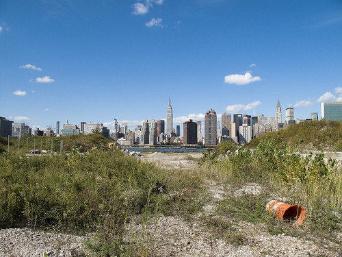
The new development, a planned community with parks and schools, will extend far from the river- nearly all the way to the Pulaski Bridge with a basketball court and green space sited for the location of the old Vernon Avenue Bridge. The shining city of Queens, and a monument to a revolutionary and aggressive group of city planners, the story of Tower Town has begun.
also from nyc.gov
The Hunter’s Point South Rezoning and Related Actions would allow Site A and Site B to be redeveloped with largely residential buildings with building components ranging in height from
40 to 400 feet. Ground floors would include local retail, lobby, and community facility uses. On Site A, a network of new streets, sidewalks, and bikeways would be developed, creating seven new city blocks from the single 30-acre parcel it is today. Center Boulevard would be continued southward onto Site A and would connect to the rest of the street network. On Site B, it is anticipated that a new publicly accessible private road and open space would roughly bisect the site. The new residential buildings would vary in height, with bases ranging in height from 40 to 70 feet and high rise elements ranging in height from 250 to 400 feet. Nine towers would be developed on Site A, and four towers would be developed on Site B. Ground floors would be occupied by local retail and other commercial uses and community facility uses. A new public school would serve the residents of the buildings and the surrounding neighborhood and create a varied and active streetscape.
In addition, a new public waterfront park would be developed along the East River and Newtown Creek frontages of Site A and a shore public walkway would be developed along the Newtown Creek frontage of Site B. An additional linear public park would also be developed on the south side of 55th Avenue between Center Boulevard and 2nd Street, and a similar public open space would be developed on the south side of the publicly accessible private road on Parcel B, creating a wide boulevard on that street. The new waterfront parks and open spaces on Sites A and B along the East River and Newtown Creek waterfronts would provide greatly increased public access to waterfront views. Wide views of the waterfront and Manhattan would be available from locations throughout the park.
Overall, the proposed actions would change the character of Sites A and B from a commercial and industrial neighborhood to a residential neighborhood. This new residential neighborhood would incorporate retail and park uses that would attract visitors. On both Site A and Site B, pedestrian activity and vehicular activity would increase substantially over existing conditions.
– photo by Mitch Waxman
Tower Town is impossible to argue against, this real estate- former home to rail and ferry docks, and 19th century barge based casinos, and printing plants, and refineries, and power plants- is a blight on the city, and an uncomfortable reminder of that earlier time when brick strewn lots were not remarkable but common.
An economic boom in construction and real estate sales will come, when it is built. A new tax base of luxury and glamour will come to western Queens, and a wildfire of enhanced valuation will spur growth throughout surrounding riverine communities- further enhancing the economy and strengthening their own tax base- Dutch Kills first, then Astoria, and Greenpoint.
Tower Town at Hunters Point South, Atlantic Yards in Brooklyn, Flushing Commons, Willets Point, the Kosciuszko Bridge replacement.
All at once.
from “Air Quality In Queens County” at synapse-energy.com
In the interest of protecting the environment and public health of Northwest Queens, the Natural Resource Defense Council (NRDC) and the Citizens Helping Organize for a Klean Environment (CHOKE) participated in the New York State Article X permitting process for several new power plants proposed in Northwest Queens. One of their objectives was to have a study conducted to analyze the contributors to air pollution in Northwest Queens and to identify possible strategies for improving air quality and reducing risks to public health. As part of the Article X permitting process for its 250 MW Ravenswood Combined Cycle project, KeySpan committed to funding such a study as a community benefit. CHOKE and NRDC contracted with Synapse to conduct this study. The conclusions and recommendations are those of the authors but do not necessarily reflect the position of KeySpan.
One of the reasons that Queens County was chosen for this study is that it is home to many sources of air pollution. In the northwest corner of the county there currently are four large power plants, which together house 46 electric generating units. The county also contains an extensive transportation network that includes the Long Island Expressway, the Brooklyn Queens Expressway, the Grand Central Parkway, two highway bridges, a tunnel to Manhattan, and two airports, along with over 400 miles of arterial and local roads. Queens also has several large industries, and some 2.2 million residents, leading to significant economic activity which contributes to air quality problems.

– photo by Mitch Waxman
A small and insignificant scuttling thing who some might describe as a man, your humble narrator has spent a good deal of time wandering about the lonely industrial frontages of Hunters Point and expended some effort into learning its past. My opinion of this project is meaningless, it is a gathering thunderhead, and Manhattan is coming to Queens. There is just one thing that has been glossed over in mainstream reports about this place…
…this waterfront property…
from a Newtown Pentacle post of 6/7/2009
In 1697, a Dutch sea captain named Peter Praa bought the Bogardus properties and set up farming. He died in 1740, and the land was left to his granddaughter Anne Bennet. Her son, Jacob Diks, inherited next and he passed the land to his daughter- Anna Hunter. In 1817, Hunter, who had three sons, left the land to her children under the proviso that it be sold and the moneys divided evenly between them. This is why the “Mispat” became known as “Hunter’s Point”.

– photo by Mitch Waxman
For the water that promoters of this plan mention is the East River, not the water that has defined it throughout all recorded time.
from a Newtown Pentacle post of 2/28/10:
3.8 miles long, its mouth is directly opposite the Bellevue Psychiatric Hospital in Manhattan, and defines the currently undefended border between North Brooklyn and Western Queens. Estimates state that some 14 million gallons of combined sewage, storm runoff, and industrial waste provide the only flow of water into the Creek. It’s waters are opaque, and in the height of summer turn an unnatural shade of green.
The soft bottom of the waterway is 15-20 feet below the surface of the water, and the hard bottom is occluded by a gelatinous sediment known as “Black Mayonnaise”. Composed of petroleum residues, coal tar, PCB’s, and human excrement- it lies 15 feet thick on the bed. The oxygen content of the water drops precipitously as soon as one leaves the East River. The first of the drawbridges which cross it- known as the Pulaski Bridge, is the borderline beyond which immersion in this water is worthy of full HAZMAT gear and first responders institute biological decontamination procedures for anyone who finds themselves in it.
As I’ve mentioned in the past… the chemicals Putrescine (an organic chemical compound NH2(CH2)4NH2 (1,4-diaminobutane or butanediamine) and Cadaverine (a toxic diamine with the formula NH2(CH2)5NH2)which are produced by the rotting and putrefaction of animal flesh are abundantly found in the Newtown Creek under industrial aliases like Acrylonitrile and are prominent members on the EPA’s list of Volatile Organic Compounds– or VOC’s..
Who can guess, what it is, that may be buried down there?

– photo by Mitch Waxman
Tower Town, you see, will be built along the Creek as well…
…the Newtown Creek…
from epa.gov
“Newtown Creek is one of the most grossly-contaminated waterways in the country,” said Acting Regional Administrator George Pavlou. “By listing the creek, EPA can focus on doing the extensive sampling needed to figure out the best way to address the contamination and see the work through.”
EPA responded to requests by members of Congress to evaluate specific sites along the creek by publishing a September 2007 report that contained a review of past work and recommendations regarding future work at Newtown Creek. The state of New York referred the site to EPA due to the complex nature of the contamination along the creek.
Newtown Creek is part of the core area of the New York-New Jersey Harbor Estuary, which has been designated by EPA as an “estuary of national significance.” Despite the ongoing pollution problems, some residents currently use the creek for recreational purposes such as kayaking, while others catch fish for consumption out of it. Various sediment and surface water samples have been taken along the creek and reveal the presence of pesticides, metals, PCBs, and volatile organic compounds (VOCs), which are potentially harmful contaminants that can easily evaporate into the air.
In the mid -1800s, the area adjacent to the 3.8-mile Newtown Creek was one of the busiest hubs of industrial activity in New York City. More than 50 industrial facilities were located along its banks, including oil refineries, petrochemical plants, fertilizer and glue factories, sawmills, and lumber and coal yards. The creek was crowded with commercial vessels, including large boats bringing in raw materials and fuel and taking out oil, chemicals and metals. In addition to the industrial pollution that resulted from all of this activity, the city began dumping raw sewage directly into the water in 1856. During World War II, the creek was one of the busiest ports in the nation. Some factories and facilities still operate along it, and various adjacent contaminated sites have contributed to its contamination. Today, as a result of its industrial history, including countless spills, Newtown Creek is badly polluted.
12 stations of the Newtown Pentacle
It’s wonderful to be here, It’s certainly a thrill. You’re such a lovely audience,
We’d like to take you home with us, We’d love to take you home.
I don’t really want to stop the show, But I thought that you might like to know,
That the singer’s going to sing a song, And he wants you all to sing along.
Sgt. Pepper’s Lonely Hearts Club Band (Lennon/McCartney)
Its been a fascinating 12 months, Lords and Ladies, and I believe that I’ve stayed on mission at this one year anniversary of this blog. 270 posts, in case you were wondering, some large others small. The blog itself has received a little over 43,000 views and the photos the posts are based on at flickr have been witnessed some 76,577 times. Not bad, and both sets of gross statistics are growing on a nice curve. The number 1 post, historically, is Newtown Creek Waste Water Treatment Plant .
Here’s a few of the Newtown Pentacle’s greatest hits, which are not “by the numbers”:
from the very first posting of May 29, 2009:
What is “The Newtown Pentacle”?
The colonial era towns of Greenpoint, Brooklyn and the Queens towns of Astoria, Ravenswood, Hunter’s Point, Bowery Bay, and Middletown were called Newtown in Dutch and English times. In the early 19th century, the Queens villages combined to form Long Island City. The industrial center of the area was and still is Newtown Creek. The most polluted body of water on earth, this ancient inlet was once home to the Maspaetche Indians. Dutch Orchards and English farms gave way to Yankee rail and then Standard Oil as time went by. Today, its waters are a curious shade of copper green, and the largest oil spill in history gurgles back and forth through deep subterranean channels between Green Point and Long Island City. The architecture of the place is disturbingly heterogeneous. A rough tumble of styles are represented in this area — 19th century wrought iron row houses predominate, but 18th century warehouses are still on active duty in some places. Near Hunter’s Point and in Old Astoria, Antebellum mansions abut hideous Le Corbusier-influenced modernism. To the south and the east can be found some of the most interesting stone work in New York City as one explores the cemetery belt along the Brooklyn and Queens border.
Three million New Yorkers lie in Calvary cemetery alone. In this, the Necropolis of New York City, the living population of Queens is outnumbered three to one.
After a health scare a couple of years ago, my doctors recommended a course of clean living and regimen of physical exercise as the best curative. An amateur antiquarian and connoisseur of odd information, I elected to use my prescriptive exertions as an opportunity to explore and record. I toured crumbling Long Island City, the tree lined lanes of Victorian Astoria, and rusty coastlines of foetid Newtown Creek. Headphones on, camera in hand. The journey has taken me to many odd and forgotten places, and led me to discover a fascinating group of people. Follow me on these long walks, I promise you’ll see something amazing.
from June 4, 2009
The Night Soil and Offal Docks, and Jell-O
Not Furmans Island, but pretty close by in 2008

I was seeking out some information on a shunned 1960′s religious group which had headquartered at a disused 19th century Satmar Yeshiva (which burned to ash in 1973) over on the Greenpoint side when I read about “Conrad Wessel’s noxious and pestilential night soil and offal dock on Furman’s Island, along the Newtown Creek”. This reference was connected to Gov. Flower’s “smelling committee” which traveled up Newtown Creek in a steamboat during the summer of 1894 to confirm that the waterway did, in fact, smell. The Smelling Committee placed much blame for the miasma which permeated Long Island City, Dutch Kills, and Greenpoint at the doorstep of the bone boilers on Furman’s Island.
from July 16th, 2009

-photo by Mitch Waxman
Just off the corner of Steinway is 38-13 Northern Blvd. It stands opposite the cyclopean Standard Motor Products building, and at the foot of the bridge which carries Steinway into 39th street and south to Skillman Avenue over the Sunnyside Yards. Currently, the structure houses part of the NYPD’s ESU units- the Emergency Medical Squad. The building was originally a firehouse- the Hook and Ladder 66.
The earliest volunteer fire company in Newtown was organized in 1843- the Wadownock Fire, Hook & Ladder No. 1. By 1902, there were 66 distinct volunteer fire departments in Queens. 19th century Long Island City was served by (amongst others) the Astoria Engine Co., the Hunter Engine Co., the Mohawk Hose Co., and the Tiger Hose Co. In 1890, the legislature of New York State abolished the volunteer departments, seeking to create a paid and professional force of firefighters. In Long Island City, as many as nine units were created, and then reorganized in 1894, as rampant political corruption had rendered the new units impotent against all but the smallest blazes. This corruption was centered around Long Island City’s mayor- Patrick “Battleax” Gleason- or was at least blamed on him by his enemies in the press.
The critical date for this story is 1898, when Long Island City joined in the municipality of the City of Greater New York, and its firefighters joined the FDNY.
from August 12th, 2009
The Terracotta House, or… what is that?

New York Architectural Terra-Cotta Works, LIC -photo by Mitch Waxman
After an apocalyptic fire in 1886, the New York Architectural Terra-Cotta Works needed a new headquarters. One that befit its role as the preeminent manufacturer of architectural ceramics.
Built in 1892 as an office for the company that supplied terra-cotta for Carnegie Hall and the Ansonia Hotel, among others. The company went out of business in the 1930s, and the building became vacant. It was eventually bought in 1965 by Citibank. Its ruins can be found at 42-10 – 42-16 Vernon Avenue, across the street from the sumptuous hedonism of the newly opened Ravel Hotel, and next door to the venerable and recently feted span of the Queensboro Bridge. It was landmarked in 1982.
Two and one half stories, the structure is actually the front office of an industrial complex that was once surrounded by a 12 foot high wall of brick, which enclosed an open storage yard, a 5 story factory, and the kilnworks one would expect to find at such a large endeavor. Its satisfying design was crafted by Francis H. Kimball, architect of the celebrated Montauk Club in Brooklyn, and it is in the Tudor Revival Style.
from September 12th, 2009

Grand Street – North East – photo by Mitch Waxman
Gaze upon the coils of the dragon and despair.
Scuttling like some Kafkaesque cliche’– away from those tremulous revelations manifested just up the street in DUMABO– at the Metropolitan Avenue Bridge over the English Kills- around soiled patches of broken pavement and across a sandy substrate of glittering and powderized glass- between towering fencelines whose attendant armies of guardian birds voicing their mocking cry of “Ia, IA” or “tekeli-li” – the Grand Street Bridge is suddenly risen above the Newtown Creek’s miasmic banks- and your humble narrator falls unabashedly to the tainted ground before it. This is a standing stone, an ancient artifact, and like the Greenpoint Avenue Bridge– an urban talisman of those days when the Tiger came to the Newtown Pentacle.
from October 15th, 2009
Newtown Creek Waste Water Treatment Plant
LO… Behold and tremble, for the Newtown Pentacle is back in session.

– photo by Mitch Waxman
A fitting temple has been erected to an ancient goddess by the redoubtable engineers of the DEP, a shining secular cathedral which looms over storied Greenpoint, this is the Newtown Creek Wastewater Treatment Plant (referred to as the NCWWTP from this point on), whose guarded interiors were revealed to an eager public via the auspices of the 2009 Open House New York event.
from November 13, 2009
Tales of Calvary 4- Triskadekaphobic Paranoia

– photo by Mitch Waxman
Near the crest of one of Calvary Cemetery’s hills, can be found what I’ve described in previous posts as “a tree that is fed by some morbid nutrition”.
A convenient afternoon vantage point for photographing the Johnston mausoleum and a frequent destination, a Hallowmas (nov. 1) stroll through Calvary revealed some interesting goings on beneath the swollen boughs of this loathsome landmark.
note: I returned the following Sunday (nov. 7) for further observations, to this alien vista of titan blocks and sky flung monoliths.
from December 1, 2009
Mt. Zion 1 – imps of the perverse

– photo by Mitch Waxman
What would appear to be a Jewish section of the vast funerary complex that is 2nd and 3rd Calvary Cemeteries, is actually a distinct cemetery organized as and referred to as Mount Zion.
It made a convenient hiding spot for me one day when a group of children on Maurice Avenue took notice of me and began to follow me around. The possibility of some vaguely malign intention toward me, on their part, caused a near faint and I ran away- here’s what happened.
Narrow, juvenile faces, their appearance and aspect were dominated by a toothy grimace- much wider than the usual proportion- and oddly jowled chins. The corners of their mouths stretched to mid cheek and passed well beyond the bulging center point of those widely set and unblinking milky blue eyes- which I attribute to the possibly mutagenic qualities of the chemical pollution of that nearby extinction of hope called the Newtown Creek.
A little girl amongst them, barefoot and carrying a polydactyl calico which was buzzing with attention, pointed me out and all the other odd looking children turned and stared in my direction. A vast physical coward, and unable to withstand even the thought of defending myself against a crowd of 10 year olds, your humble narrator screamed a shrill shriek and broke into a clumsy run to make an escape to hallowed ground.
from January 31st, 2010

Queensboro Bridge and associated structures- “The Great Machine” – photo by Mitch Waxman
Queensboro, whose steel has cantilevered the flow of traffic to the shining city from the fabled vastness of the Long Island since 1909, is merely the focal point of a polyglot mechanism whose works spread into the east. The backbone of New York City runs through the marshy hillocks of western Queens.
As I’ve said in the past:
Airports, railroad yards, maritime facilities, petrochemical storage and processing, illegal and legal dumping, sewer plants, waste and recycling facilities, cemeteries. The borders of the Newtown Pentacle’s left ventricle are festooned with heavy industry and the toll taken on the health of both land and population is manifest. A vast national agglutination of technologies and a sprawl of transportation arteries stretching across the continent are all centered on Manhattan- which is powered, fed, and flushed by that which may be found around a shimmering ribbon of abnormality called the Newtown Creek.
Light rail (subway) and vehicle traffic focus toward Queens Plaza, and within a three mile radius of this place can be found- the East River subway tunnels, the Midtown Tunnel, multiple ferry docks, and the titanSunnyside Rail Yard which connects to the Hells Gate Rail Bridge. This “Great Machine” is the motive engine that allows millions to enter and leave Manhattan on a daily and reliable schedule from North Brooklyn, Queens, Suffolk and Nassau Counties. The great endeavor called “The East Side Access Project” and its associated tunneling is also occurring nearby, which will terminate at a planned LIRR station sited for the corner of Queens Blvd. and Skillman Avenue.
from February 6th, 2010

Red Crow van spotted – photo by Mitch Waxman
Returning from a trip to Third Calvary Cemetery the other day (searching for Gilman) to my Astoria, I came across this red van with a disturbingly heterogeneous collection of mattresses affixed to it. This red van is a familiar sight around the neighborhood, personal conveyance of a Crow. For clarity and codification lords and ladies, this gentleman shall be referred to as “Red Crow”, here at your Newtown Pentacle.
from March 15th, 2010

– photo by Mitch Waxman
He died alone, squirming in agony, surrounded by strangers. His last friend and only true colleague had recently used a colt handgun to commit suicide, and the only woman he ever loved had left him years ago. Instead he lay there alone in the charity ward- dying in anonymity and pain as his parents had. An orphan raised by matron aunts who indulged and spoiled the strange child who came to them in their dotage- they left him unprepared for adulthood. He retreated into his letters, wrote his stories, and never knew he would live on in the dreams of the sensitive and artistic forever more.
Just 14 months previous to his death, the newspapers detailed the lurid crimes of Albert Fish- the Gray Man, the Werewolf of Wysteria, the Brooklyn Vampire, The Boogeyman– who was executed at SingSing. The good old days, indeed.
from April 3rd, 2010

– photo by Mitch Waxman
Note: One of those things that your humble narrator is guilty of is a tendency, when confronted with something alien or unknown, to “fill in the blanks” via an inexact mixing of logical supposition and impressionist reasoning. The opposite of exactitude, this can result in wild ideas and false assumptions being presented and accepted as fact. I would love to tell you which cultic group these artifacts belong to- but the fact is that I just don’t know. Certain assumptions can be hazarded, based on cursory resemblance and observed phenomena, but they will be guesses. Don’t assume my interpretation of things is correct.
Witness, then, what I observed in St. Michael’s Cemetery on the Saturday before Easter- April 3rd, 2010- right about here.
from May 22, 2010

– photo by Mitch Waxman
This is not a dead place, this Creek which forms the currently undefended border between much of Brooklyn and Queens, despite wholly inaccurate statements to the contrary recently presented by major publications. To begin with, there is the teeming human infestation, whose population is in the millions. Additionally- migratory birds, invertebrate and vertebrate water fauna, and an enormous hidden population of higher mammals lurk amongst the canalized shorelines of the Newtown Creek.
from the nytimes.com– an article that gets a lot of things completely wrong, which is surprising for the times, and seems to be shilling against “Big Oil”
People don’t often think of urban creeks as biodiverse waterways, but Newtown Creek was once a rich tidal estuary popular among hunters and fishermen. Starting in the 1870s, however, Standard Oil and other refineries began spilling or dumping excess fuels and toxic chemicals into the water or onto the soil, slowly poisoning the ecosystem.
We are just getting started, Lords and Ladies, on this very bumpy ride through the realities of the Newtown Pentacle.
Project Firebox 5

Project Firebox, 1314 – photo by Mitch Waxman
Storied and replete with historical allegories and cautionary tales, Greenpoint in Brooklyn hosts some of New York’s most ancient street furniture. This survivor of the 20th century, I am told by certain reputable experts, would have had a lit globe at its summit when new. Said globe would light to indicate to arriving firefighters where the fire alarm was raised. This is on Provost street, near the Newtown Creek Wastewater Treatment Plant.
As it turns out, Provost street is named for one of the original European settlers of Greenpoint:
from nyc-architecture.com
The Praa’s and Volchertsen’s, together, with the Mesorole’s, Calyer’s, Provoost’s, and Bennet’s formed the core of settler farmer families that lived and flourished on the land consisting of Green Point. They and their ancestors would do so for almost 200 years. The fertile land provided enough to supply the needs of the families that toiled on the land, and an abundant excess to trade at nearby markets. Each family kept a large row boat on the river to transport their harvest to the markets downstream in the emerging cities of Williamsburg and Brooklyn, and across the river in New York. Thus, Green Point became a major agricultural center and breadbasket for the area. It’s grains, cereals, fruits, vegetables and livestock made it possible for others to take up other trades in the New World, and contributed to the overall success of the pioneer efforts of that era.


