Archive for the ‘newtown creek’ Category
That’s Just Grand

-photo by Mitch Waxman
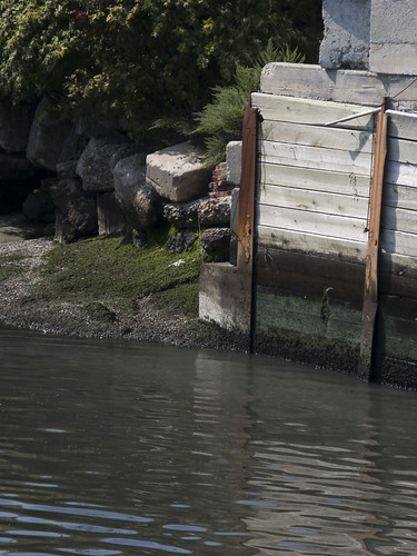
In 1894, George Roeschman (an employee of Hardy, Voorhies and co.- a lumber yard on Grand St. in Williamsburg) was accosted by 3 men as he was trying to cross the Grand St. Bridge over the Newtown Creek. He was struck over the head, had a sack pulled over him, and roughly thrown to his fate in the inky waters. After scrambling up the slimy banks, Roeschman didn’t report the crime to Police officials immediately for fear of retribution by these highwaymen. Four bodies had recently been found along this branch of the Newtown Creek, all were victims of a similar modus operandi.
-photo by Mitch Waxman
In the same year, on October 16, the body of a 40 year old man was found nearby. His identity was never ascertained and he has lain in centuried silence at the City’s potter’s field since.

-photo by Mitch Waxman
Nearby, a scoundrel named Pete Hess and his friend Schulz once buried a baby, alive, in the mud of the Newtown Creek. Both men received lengthy stretches at Sing-Sing for the murder of “Baby Wertheimer”.
There is a long history of criminal derring-do associated with the Newtown Creek. Check out this NYtimes article from 1996 for the story of Captain Lau and the Barones.
Newtown Creek musings

enormous stitched panorama, Pulaski Bridge- photo by Mitch Waxman- (click images for larger views at flickr, worth it)
Over the last several weeks- I have been honored to encounter an interesting community of historians, photographers, and maritime enthusiasts. A lot of these people asked me how I got so into this whole history thing. My standard answer has been “Newtown Creek”.
My long suffering wife has often been reduced to a stupor by my endless musings over the deeper meanings represented by the curious location of some manhole cover I found on Northern Blvd, or speculations about the carefully obscured origins of our modern city.
If you are religious, pray for her strength and tenacity against these spouse inflicted irritations to her infinite patience, if you’re not a churchgoer- raise a glass in her name and toast- to our lady of the Pentacle.

Newtown Creek, NYC panorama, Queens museum of art- photo by Mitch Waxman
Since I found the place, (like most New Yorkers, I had no idea that Newtown Creek even existed a few years ago) the Newtown Creek has had some kind of hold on me. My actual first reaction was:
Putrid, this dripping eidolon of unwholesome revelation which sits between Brooklyn and Queens is an abomination- a comfirmation of all that is unclean- unholy- and detestable. A ghoulish shade of decay, antiquity, and dissolution hanging about it- the Newtown Creek has that awful bearing which, in any sane world, a merciful earth should not have to endure.

Newtown Creek- photo by Mitch Waxman
My inclinations and interests have always tended to touch upon those subjects ignored and shunned by the madding crowd. After all, have I wandered through nitre choked graveyards in winter, and amidst the cloaking shadows of the urban wastelands in the hellish inferno of a New York heat wave for any reason other than joy? What drew me to the story of the Newtown Creek, at first, was the quivering green immensity of the place- the horror- which is nepenthe to me. The esthetics of the place began to infiltrate and infect me.

Rail Bridge near the junction of the Dutch Kills and the Newtown Creek- 3 exposure HDR photo by Mitch Waxman
I started reading up on the Newtown Creek, and found the Newtown Creek Alliance, and saw youtube videos from Riverkeeper, and read the history (Greater Astoria Historical Society‘s LIC book is a must have), and followed Forgotten-NY around the place (via their gold standard website). I found my long walks less and less of a burden, and I became mezmerized by the idea of exploring this strange and horribly exciting place. Camera in hand, I set out on foot. If you want to see anything in New York, you have to be on foot.

Petro history- from Newtown Creek Alliance tour of the Newtown Creek- photo by Mitch Waxman
There is a beauty to this cradle of the industrial revolution that contemporary reading would call Dickensian. Its the wide open skylines (squat, most buildings are under 3 stories, and loading docks are set back from the street to allow trucks to berth), the maddening shadows dropping off the elevated highway whose roadways- in some places- are over 10 stories above, and the sudden drop-offs whenever fenced off bulkheads signal the presence of water. Its the supernal way that the oddly colored water dapples reflected orange or green light up into the underpinnings of those highways, or the constant appearances of rail tracks both active and abandoned. Perhaps- its just the counterpoint of a shining city hanging over the miasmic occlusion rising off of the Newtown Creek.

from Metropolitan Avenue Bridge- (click images for larger views at flickr, worth it)- photo by Mitch Waxman
Maybe its the sure knowledge that change and progress have arrived in Long Island City again, and that in the near future all of this will be gone- buried under towering apartment houses and obscured by cosmetic improvements meant to obscure the past and hide what it is that may still lurk down here.

LIE- stitched panorama photo by Mitch Waxman- (click images for larger views at flickr, worth it)
Dutch Kills, or let the Photos do the Walking
Anything you may experience, in situ, by following these walking directions is at your OWN RISK, and is offered by the Newtown Pentacle for documentary and entertainment purposes only. Remember- the rule we follow at the Newtown Pentacle is to NEVER trespass. Like Vampires, Newtownicans should wait to be invited into a house before they can do their work. To wit.
Feel like taking a walk? I’ll show you something cool… Bring your camera- and ID

Truck at 47th avenue and 28th street, Long Island City -photo by Mitch Waxman
from wikipedia
Dutch Kills is a sub-division of the larger neighborhood of Long Island City in the New York City borough of Queens. It was a hamlet, named for its navigable tributary of Newtown Creek, that occupied what today is centrally Queensboro Plaza. Dutch Kills was an important road hub during the American Revolutionary War, and the site of a British Army garrison from 1776 to 1783. The area supported farms during the 19th Century, and finally consolidated in 1870 with the villages of Astoria, Ravenswood, Hunters Point, Middletown, Sunnyside and Bowery Bay to form Long Island City.
Dutch Kills is one of the extant branches of the Newtown Creek, and located not too far from the Degnon Terminal complex (part of the Sunnyside Yards).
Get to 47th avenue and 28th street, early morning or late afternoon are probably best because of the whole sunlight east west thing. Weekends are good because there is a lot less going on in the industrial zones of the Newtown Pentacle.
Assuming you’re coming from the north (skillman or thomson avenues)- You’ll find a series of construction sites behind and to the left of you, and a cement factory (New York Concrete Supply)in front of you. Cross the street and make a left. Look west, and you’ll be reassured by seeing Manhattan.
I’m going to say this over and over- but be REALLY MINDFUL OF TRUCKS, and… be a smart new yorker- if you’re snapping pics and a guy who looks just like a mobster walks in front of you in Long Island City- He doesn’t just look like a mobster- HE IS A MOBSTER. Don’t be a schmuck.
View Dutch Kills in a google map

Concrete Trucks on 47th avenue, Long Island City -photo by Mitch Waxman
Walk to 29th street, which is a very dangerous place for pedestrians. BE CAREFUL. There is no sidewalk, and it is a shortcut to Thomson Avenue and Queens Blvd for traffic coming off the LIE. To your right is Dutch Kills, at its terminus. By the way, the concrete guys REALLY don’t like having their pictures taken.

Concrete Trucks on 29th street, Long Island City -photo by Mitch Waxman
Make the right at the corner of 29th street. DO NOT CLIMB DOWN ON TO THE RUSTY BARGE, you will get hurt and fall into the water with an open wound. When you smell the water, you’ll understand my warnings. 29th street is VERY dangerous. Lots of great Creek kind of shots, but mind yourself, there’s better stuff ahead with safe vantage points.

Dutch Kills from 29th street -photo by sweetpea212– a member of our Newtown Pentacle Flickr group
All along the Newtown Creek, there are abandoned barges and other vessels. This particular one has been sitting here for at least 3 years. Resist the urge, urban explorers, its not worth it. Also, note the storm sewer in the center of the above shot.

Structure I am desirous of having a chance to get inside legally, with my camera -photo by Mitch Waxman
At the other end of 29th street- Welcome to an insanely dangerous parking and loading dock for the crumbling Hunterspoint Steel building.
Big old factory on Hunters Point Avenue, has severed rail tracks and abandoned waterfront loading docks. Has a “for sale” sign on it. Perfect lair for supervillian, close to highway and trains.
from trainsarefun.com:
track map as of 1966 for the area- legend is
7 Staley Elevator 8 Conran Supply 9 Best Wholesale 9a Masbrook Wholesale 9b Saxon Paper 10 Principe Danna 11 Sunshine Biscuit (Garage) 12 Sunshine Biscuit (Factory) 13 Bell River Corp. 14 American Chicle Corp. 15 Equitable Paper Corp. 16 Wheeling Corrugated 17 Gimbel Bros. 18 R.H. Macy 19 Simons 20 Concrete Steel 21 Phillip A. Hunt 21a Saxon Paper 22 Standard Wine & Liquor 23 Harrison Building 24 J.H. Rhodes 25 Hunters Point Steel 26 Standard Folding Box Company 27 United Parcel 28 Star Liquor 29 Viking Criterion Paper

CAREFULLY cross Hunter’s Point Avenue and make a right. Proceed to the Hunters Point Avenue Bridge.

Water the color of Tea, from Hunters Point Avenue Bridge -photo by Mitch Waxman
Hunters Point Avenue Bridge. Stop and look around. Take pictures- this is a great vantage point. This is the place you are also most likely to exchange friendly greetings with law enforcement or private security. Be nice, smile- you’re not doing anything wrong- and you even remembered to carry ID.

Water the color of antifreeze, from Hunters Point Avenue Bridge -photo by Mitch Waxman
Most of the cops who’ve pulled over and asked me what I’m up to are just doing their job. So are we, lords and ladies of Newtown.
The Police respond to fear and anger in ways injurious to your freedom. You be nice, and so will they. Its really not an adversarial encounter unless you make it so. If they’re jerks, insist on a supervisor or superior officer’s involvement (which may mean a trip to the station house- adventure!). Young cops are zealous and eager to enforce, older cops don’t want their retirement to get jammed up with a civil rights case. An older cop will also realize that you’re “harmless” faster than a young one.
Here’s a great description of your rights as a photographer. Besides, the commish has already pronounced NYPD’s stand on photography.

Dirty Birds, from Hunters Point Avenue Bridge -photo by Mitch Waxman
The Hunters Point Avenue Bridge over Dutch Kills is a Bascule bridge.
from the NYC.gov DOT website:
Easily the most popular type of movable bridge in existence today, bascule bridges are designed to pivot on a fixed axis. Usually this type of bridge consists of movable ‘leaves’ fixed to each end of the channel. The leaves are precisely counterbalanced by weights of sufficient size that relatively little motor power is required for their operation – usually just enough to overcome inertia, frictional resistance, wind and snow loads.
Bascule bridges are simple and speedy to operate, and because of the relatively small amount of electricity needed for movement, cost efficient.
The Hunters Point Avenue Bridge offers spectacular views north and south. That’s the concrete factory from the first photos in the distance.

from Hunters Point Avenue Bridge looking north -photo by Mitch Waxman
There’s a surreal beauty to this tributary of the Newtown Creek, an isolated loneliness. It’s a dead place, the corpse of a mighty age of enterprise.

from Hunters Point Avenue Bridge, looking north -photo by Mitch Waxman
Looking north, the LIE bridges the Dutch Kills.
Yes, these trees and plants are hideously overgrown and show all the signs of having been fed from some morbid nutrition. There is a tenebrous darkness that radiates about them… I know. The fact though, is that if you give nature just a little time, even here in the home of the darkest industrial mills… It’s kind of a nice idea- isn’t it- rebirth.
from Queens Borough, New York City, 1910-1920
During 1914 bulkhead lines were established by the United States Government for Dutch Kills Creek, a tributary of Newtown Creek, thus putting this stream under the jurisdiction of the War Department. The bulkhead lines as approved on October 29, 1914, give a width varying from 200 feet at its junction with Newtown Creek to 150 feet at the head of the stream, and include a large basin in the Degnon Terminal where car floats can be docked. The widths of the channel to be dredged under the appropriation of $510,000 mentioned previously, range from 160 feet at Newtown Creek to 75 feet at the turning basin. The Long Island Railroad plans to establish at this point a large wholesale public market, estimated to cost nearly $5,000,000.
Among the larger industrial plants in the Degnon Terminal served by this stream are : Loose Wiles Biscuit Company, American Ever Ready Works, White Motor Company, Sawyer Biscuit Company, Defender Manufacturing Company, Pittsburg Plate Glass Company, Marcus Ward, Brett Lithograph Company, Waldes, Inc., Norma Company of America, Manhattan-Rome Company, American Chicle Co. and The Palmolive Co.

from Hunters Point Avenue Bridge, looking southeast -photo by Mitch Waxman
Continue down Hunters Point Avenue and make a left at 27th street. (as of 6/27/2009- intersection at Borden still closed due to bridge reconstruction).
A fantastic series of abandoned industrial buildings are on the left. Photograph quickly, Newtownicans, these are being torn to shreds by those dastardly developers right now.

Creek Car, from 27th street -photo by Mitch Waxman
My favorite spot on these 3,000 feet in Queens is (was) undoubtedly the corner of Borden Avenue and 27th street. On your right is an abandoned strip club called Infinity, in front of you is the Borden Avenue Bridge, to your left and below is the Dutch Kills, above you is the LIE.

Water the color of ice -photo by Mitch Waxman
The west bank of Dutch Kills was always an easy shot for me in the mornings and early afternoon. Unfortunately, the construction of the coffer dam for the bridge reconstruction has removed many of the charismatic and idiosyncratic features I’m so drawn to. What foul battrachian horrors might lurk in the slime down there, and who can guess what it is that the construction might have stirred up?

Same vantage as above, in a different season -photo by Mitch Waxman
Ghosts are found here. Phantoms of the clear eyed mariners who inhabited this world, drifting by in wooden ships. Protruding from cement and clinging mud alike are the skeletal remains of rail lines which led from factory floor to dock, defining both building and waterway. Every fallow and abandoned spot finds nature battling to rescue her ruined child from the degradations heaped upon it.

And they built a giant steel highway 106 feet over it.-photo by Mitch Waxman
The pacific quality of the water in these photos, with their mirror like reflectivity, actually betrays a numbing truth. The stillness of the water in this crumbling canal allows it to steadily accrete a sedimentary ichor of pollutants which cake the shorelines, and its percentage of dissolved oxygen is so low that these opaque and stench producing depths can be described as stagnant and injurious to life.
Denied the curative effects of erosion, as provided by strong tide and swift current, the concentration of pollutants here seems worse than anywhere else on the Newtown Creek waterway- except for the lamentable Maspeth Creek. Floating poop is the least of it, there’s lead and arsenic and dioxin in that mud. Who can guess it is that might be breeding down there? What foul congress of poisons awaits the future?
from an army corps of engineers documeent discussing precautions for the collecting, handling, and testing of Dutch Kills sediments:
All individuals involved in handling contaminated sediment are required to use protective equipment and to submit to blood and urine tests. The protective equipment consists of:
from nycroads.com
BEGINNING OUT OF THE TUNNEL: The first section of the Long Island Expressway, a one-mile-long, six-lane viaduct over Long Island City, Queens, opened to traffic in 1940 after one year of construction. The new viaduct, whose opening coincided with that of the twin-tube Queens-Midtown Tunnel at its western terminus, had its eastern terminus at the new Brooklyn-Queens Expressway (I-278). At its highest point, the viaduct rises 106 feet above Dutch Kills

Borden Avenue Bridge -photo by Mitch Waxman
Well, here we are, on the Borden Avenue Bridge. Check out these flashy drawbridge lights. Isn’t that cool? Told you I’d show you something cool…
from the DOT website on the history of the Borden Avenue Bridge, which spans Dutch Kills.
Borden Avenue is a two-lane local City street in Queens. Borden Avenue runs east-west extending from Second Street at the East River to Greenpoint Avenue. The Borden Avenue Bridge over Dutch Kills is located just south of the Long Island Expressway between 27th Street and Review Avenue in the Sunnyside section of Queens. Borden Avenue Bridge is a retractile type moveable bridge. The general appearance of the bridge remains the same as when it was first opened in 1908. The bridge structure carries a two-lane two-way vehicular roadway with sidewalks on either side. The roadway width is 10.5m and the sidewalks are 2.0 m. The west approach and east approach roadways, which are wider than the bridge roadway, are 15.3m and 13.0m respectively. The bridge provides a horizontal clearance of 14.9m and a vertical clearance in the closed position of 1.2m at MHW and 2.7m at MLW.
As part of the construction of Borden Avenue in 1868, a wooden bridge was built over Dutch Kills. This bridge was later replaced by an iron swing bridge, which was removed in 1906. The current bridge was opened on March 25, 1908 at a cost of $157,606. The deck’s original design consisted of creosote-treated wood blocks, with two trolley tracks in the roadway. Character-defining features of this bridge include the stucco-clad operator’s house, four pairs of rails, and a rock-faced stone retaining wall. The gable-on-hip roof of the operator’s house retains the original clay tile at the upper part. Although alterations have been made, the bridge is a rare survivor of its type and retains sufficient period integrity to convey its historic design significance.
The bridge will be closed for construction through July 2009. In addition, there will be parking restrictions in the vicinity of the bridge from January through July 2009 at all times from 25th Street to 30th Place between Borden Avenue and Hunter’s Point/49th Avenue and from 50th Avenue to 51st Avenue between 27th Street and 25th Street.

There are also two LIRR rail bridges, visible from Borden Avenue, which are articulated (moving) across the Dutch Kills. Shot taken from upon the waters of the Newtown Creek looking North -photo by Mitch Waxman
Rosetta Stones
From Queens Borough, New York City, 1910-1920; the borough of homes and industry, a descriptive and illustrated book setting forth its wonderful growth and development in commerce, industry and homes during the past ten years … a prediction of even greater growth during the next ten years … and a statement of its many advantages, attractions and possibilities as a section wherein to live, to work and to succeed (1920)
Published in 1920, by the New York, L. I. Star Pub. Co.
Found at archive.org, download the 33 megabyte pdf scan of the book here
NEWTOWN CREEK
Newtown Creek, which is known as the “busiest waterway of its size in the world,” is a tidal arm of the East River, dividing the Boroughs of Queens and Brooklyn for a distance of four miles. It empties into the East River directly opposite 34th Street, Manhattan. The importance of this stream is strikingly shown by comparing its activities with those of the Mississippi River, which from New Orleans to St. Paul is 1,000 miles in length and flows through the heart of a great industrial section. According to recent figures, 5,500,000 tons of freight are carried annually on the upper and lower reaches of this longest river in the world. While for the three years 1915-16-17, the tonnage on the four miles of Newtown Creek averaged 5,620,000 tons. The value of the tonnage on the Mississippi River is approximately $100,000,000 per annum, while on Newtown Creek, it has averaged more than $200,000,000 per annum for the past ten years. The chief commodities transported on this surprising waterway are copper ore and its products, petroleum, lumber, coal, chemicals and building materials.
In 1917, 517,601 tons of copper ore and copper manufactures were transported on Newtown Creek a tonnage valued at $230,000,000, which is an amount greater than the total value of all the manufactured products of either Kansas City, Minneapolis or San Francisco, and greater than the value of exports from Boston or Philadelphia. Huge oil refineries on both sides of the stream ship annually 250,000,0000 gallons of petroleum. There is still room for growth both in the commerce on the stream and the manufacturing plants which now line its borders. There are large undeveloped tracts in Queens adjoining this stream such as the Degnon Terminal with huge industrial plants that have been erected during the past seven years, and where many more will be erected during the coming ten years. One of the largest undeveloped tracts of land at the head of the stream is the 150 acre tract of the Palmer Waterfront Land and Improvement Company, in the Maspeth section, which is served by rail as well as water, and on which several large manufacturing plants have been located within the past few years. The character of tonnage on this waterway can best be shown by the following table for one recent year,
1917 : Article Estimated Value Net Tons
- General Merchandise
$8,734,301 or 132,602 VNT - Coal and other fuel and cord wood
$4,337,378 or 1,373,035 VNT - Lumber, railroad ties and piles
$6,940,388 or 443,027 VNT - Steel and products
$1,254,557 or 32,369 VNT - Copper ore and products
$180,275,507 or 413,837 VNT - Petroleum $15,744,584 or 868,464 VNT
- Brick, (building and fire) $722,197 or 242,734 VNT
- Crushed stone
$130,041 or 155,309 VNT - Gravel and sand
$450,198 or 656,908 VNT - Cement, lime, etc
$1,855,511 or 306,519 VNT - Paving blocks
$32,275 or 31,164 VNT - Plaster, whiting, sulphur, chalk, etc
$506,505 or 58,262 VNT - Fertilizer and steam bone
$632,702 or 88,109 VNT - Ice
$141,279 or 47,093 VNT - Ashes, cinders and slag
$85,670 or 100,890 VNT - Molasses
$528,000 or 48,768 VNT - All other materials
$490,916 or 155,404 VNT - TOTAL . . . $226,862,015 or
5,154,500 VNT
The Federal Government is now starting dredging operations which will provide for a channel varying from 250 to 125 feet in width, and 20 to 18 feet in depth, at mean low water, from the East River to the head of navigation in the creek. The mean range of tide is 4^ feet. More than 1,475,000 cubic yards will be dredged from the channel. The appropriation of $510,000 for this work, included in the Rivers and Harbors Bill of 1919, was secured through the joint efforts of the Queensboro Chamber of Commerce and Congressman Charles Pope Caldwell. The tonnage and value for the 10 years 1908 to 1918 inclusive is given in the following table :
Year Tonnage Value
- 1908- 4,181,528 or $229,994,000
- 1909- 5,113,628 or $253,003,000
- 1910- 3,861,852 or $139,378,000
- 1911- 5,435,016 or $191,747,000
- 1912- 4,921,843 or $225,416,000
- 1913- 5,141,516 or $226,962,000
- 1914- 4,445,556 or $147,739,000
- 1915- 5,756,102 or $147,086,000
- 1916- 5,915,150 or $201,581,000
- 1917- 5,215,820 or $294,701,000
- 1918- 4,369,136 or $322,960,000
- TOTAL . . . .
‘ 54,337,197 or $2,380,567,000 - AVERAGE PER YEAR. . .
5,433,719 or $238,056,700
Some further idea of the immense commerce of this waterway can be obtained from the figures compiled by the Department of Plant and Structures of New York City, which show that during the year 1918, 59,389 boats passed through the Vernon Avenue Bridge, 56,735 passed through the Greenpoint Avenue Bridge, 27,000 through the Meeker Street Bridge and 5,007 through the Grand Street Bridge. Steamers schooners and unrigged vessels are the principal freight carriers. Their drafts range from 5^ to 20 feet; 2 to 19 feet; 2 to 18 feet respectively. Some steamers of still larger draft lighter in their cargoes.
Among the larger plants on the Queens shore of Newtown Creek are the National Sugar Refining Company, Nichols Copper Company, National Enameling and Stamping Company, General Chemical Company, Standard Oil Refineries. American Agricultural Chemical Company, and the Wrigley Chewing Gum Company.
DUTCH KILLS CREEK During 1914 bulkhead lines were established by the United States Govern- ment for Dutch Kills Creek, a tributary of Newtown Creek, thus putting this stream under the jurisdiction of the War Department. The bulkhead lines as approved on October 29, 1914, give a width varying from 200 feet at its junction with Newtown Creek to 150 feet at the head of the stream, and include a large basin in the Degnon Terminal where car floats can be docked. The widths of the channel to be dredged under the appropriation of $510,000 mentioned previously, range from 160 feet at Newtown Creek to 75 feet at the turning basin. The Long Island Railroad plans to establish at this point a large wholesale public market, estimated to cost nearly $5,000,000.
Among the larger industrial plants in the Degnon Terminal served by this stream are : Loose Wiles Biscuit Company, American Ever Ready Works, White Motor Company, Sawyer Biscuit Company, Defender Manufacturing Company, Pittsburg Plate Glass Company, Marcus Ward, Brett Lithograph Company, Waldes, Inc., Norma Company of America, Manhattan-Rome Company, American Chicle Co. and The Palmolive Co.
Long Island City zen
Know this spot?

Long Island City -photo by Mitch Waxman
It’s a backroad, by LIC standards.
It’s 51st Avenue and what would be 21st street, and it smells heavily from the garbage bins of a commercial fish butcher just up the block on the corner of 23rd street. During the festering heat of the late summer in New York, crossing the street- if not avoiding the block all together- is advisable. Across the street are fallow lots of illegally dumped industrial garbage and the Crows picking it over.
Crows are metal collectors, usually immigrants who have a tradition of “ship-breaking” or “shanty towns” in their country of origin. They see value in what others see as trash.
Metal buyers in Long Island City and especially Greenpoint and East Williamsburg pay, by the pound, for the collected materials. If copper wire is found, the collector is expected to burn off the insulation, despite the toxicity of doing so. Its not the buyers problem, he just wants the commodity. Want to see it in action- hang out on the corner of Greenpoint avenue and Moultrie St. in Greenpoint, Brooklyn. This is recycling.

Pretty darn close to 51st Avenue and what would be 21st street- It’s the Circus Train!!! -photo by Mitch Waxman
In 1908, a fire at the nearby Blanchard Building- which housed the works of J.F. Blanchard, makers of fireproof doors and shutters- was started by an inferno at the Pratt & Lambert varnish works next door. The fire soon began to spread and a great crowd watched as groups of firemen tried to battle the out of control blaze. The great fear was that the nearby Columbia Paper Bag company would be set alight, which would provide ample fuel for an inferno that might spread beyond Borden Avenue and to the shores of the Newtown Creek.
There is a Blanchard Building on the site today, and it does seem quite fireproof, although Blanchard is long gone. J.F. Blanchard eventually merged with the John W. Rapp company and became the United States Metal Products Company.
View the Blanchard Building in a google map, clicking streetview- from the LIE- its the large structure with the two billboards.
Blanchard manufactured hollow, sheet-metal, fireproof doors. Their Type A and Type B were endorsed by the National Board of Fire Underwriters in Chicago. Installation of thee doors would reduce fire insurance costs by a significant margin. A major influence on the bottom line here in the dense agglutination of industry here on the Newtown Creek.

Down under the Long Island Expressway- DULIE -photo by Mitch Waxman
51st avenue dead ends at the Long Island Railroad tracks, and what would be 21st street is a pedestrian rail bridge (which Forgotten-Ny once christened “the 21st street Bridge“) that goes over the train tracks and under the Highway, which channels the constant stream of vehicular traffic (some 83,900 cars and trucks a day) flowing east out of the toll plaza at the Midtown Tunnel to the highways threading out through Queens and ultimately to Long Island.
note- this bridge has a lamppost which was one of the ones tagged with “occult” grafiti, as discussed in an earlier post.

LIRR crosses Borden Avenue -photo by Mitch Waxman
Nearby, the 800 pound gorilla crosses Borden Avenue at grade (street level). One of the few places in New York City that the Long Island Rail Road still does so.
These tracks lead between the Hunters Point Avenue station and the Long Island City station, and up until the 1950’s such grade crossings were a constant nuisance and mortal threat to the citizens of Long Island City- here in the Newtown Pentacle.


