Archive for the ‘Photowalks’ Category
eastern headland
Cool cars trucks, in today’s post.

– photo by Mitch Waxman
Wandering home one day, I encountered this fantastically retro GMC RV parked alongside the Sunnyside Yards on 43rd street. Fiberglass body panels, panel truck frame… I didn’t check the registration sticker, but I think this is a GMC Motorhome, which was produced from 1973-8. There were only about 12,000 of these manufactured, and according to online sources, 7,000 of those are still registered and on the road.
They really knew how to make ’em back then, huh? This sucker is almost as old as me.

– photo by Mitch Waxman
A fence was down at the Sunnyside Yards the same day I spotted the GMC Motorhome, revealing the cable truck seen above. Love the wooden spools, I do. Made me think that some titanic tailor had taken up residence at what was once the world’s largest railroad coach yard, and had used up all the threading which the truck brought in.
If you’re a giant, you can’t buy off the rack, as even a “big and tall” clothing shop has limits. Just ask the Mayor… as the Dope from Park Slope is Brobigdagnian. Maybe the giant tailor is working for him.

– photo by Mitch Waxman
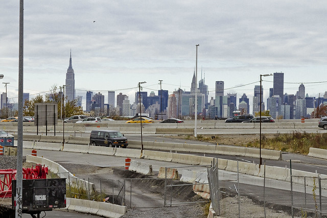
Over on Northern Blvd., the delivery of automobiles is a daily occurrence. I’ve mentioned before that this sort of sight brings out my inner seven year old in the same way that FDNY engine units screaming by does. There’s a reason that I call Northern Blvd. “the Carridor” y’know.
“follow” me on Twitter- @newtownpentacle
terrible keenness
The southern side of Woodside, in today’s post.

– photo by Mitch Waxman
On the 27th of December in 1657, the Flushing Remonstrance was presented to Peter Stuyvesant, over in the City. That’s your Queens history factoid of the day. I’m going to a holiday party in the City tonight, and I can virtually guarantee that nothing quite so earth shattering as the emergence of the legal precursor of Constitutionally protected religious freedom will emerge from the endeavor. There will likely be soft cheeses, crackers, and wine however.
Life is shit.

– photo by Mitch Waxman
Recently, whilst wandering along the fence lines of and through the “House of Moses” in Elmhurst, Winfield, and Woodside the other day I got to thinking about something that bugs me. During political type conversations with various folks in the last couple of years, a common statement has been offered to me which states that the U.S.’s Constitutional Bill of Rights “grants” me this and that (including the notion of the freedom of conscience which was first clarified to Peter Stuyvesant way back in 1657 Queens). If you check the actual language of the thing – it “acknowledges” “certain inalienable human rights.”
“Grant” means that it gives you these rights, and that it can take them back if warranted. That’s “stinking thinking” if you ask me, but what do I know? I’m no law scholar, just some idiot with a camera and an afternoon off, which I spent walking along a highway in Queens. I do know what “inalienable” means, however, and that “acknowledge” is better than “grant.”
Think about it in terms of acknowledging the right you have to live another day without being murdered, versus being granted another murder free day. This is the sort of stuff which keeps me up nights, incidentally.

– photo by Mitch Waxman
Anywho, the little path I picked for myself was quite hilly. I followed Laurel Hill Blvd. in Woodside while trailing the BQE on my way back to Astoria from Elmhurst. My pal Kevin Walsh from Forgotten-NY could probably have built around a hundred posts out of the area I wandered through, but as I’ve mentioned in the past – residential neighborhoods ain’t my thing.
I like the wastelands, which is why I was walking along a highway. I picked the hilly path just for the cardio.

– photo by Mitch Waxman
There are numerous scenarios which I can envision that would explain the shot above. I prefer the one involving modesty, wherein a naked hydrant was somehow offensive and one of the neighbors decided that it needed some dress up.
You don’t ask, in Queens.
– photo by Mitch Waxman
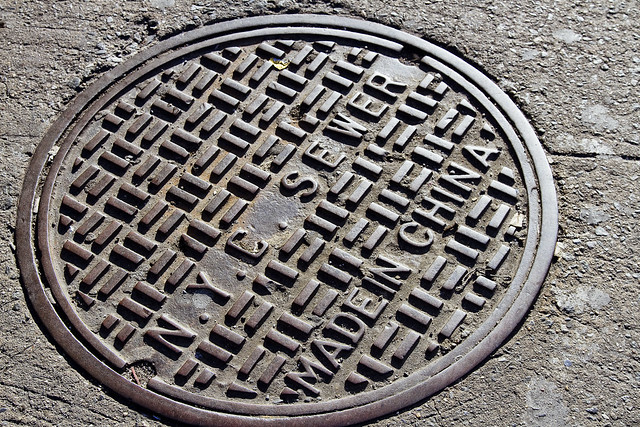
I’ve been looking and looking for the last few months, and finally I’ve spotted another type of manhole or access cover which I haven’t previously recorded. On the whole subject of trade, international deficits, and so on – why aren’t we forging these things in the United States? I’m positive that “made in Pittsburgh” would fit if a smaller font was used.
“follow” me on Twitter- @newtownpentacle
easily showing
Continuing archive week, in today’s post.

– photo by Mitch Waxman
One of my favorite “night shots” of the last few years is presented above, depicting the mausoleum of Stephen Whitney in Brooklyn’s Greenwood Cemetery. I was there well after dark with the folks from Atlas Obscura, on a summer night when I and two other narrators read Lovecraft’s “Horror at Red Hook” to a group of tapophiles.

– photo by Mitch Waxman
I was actually listening to the Horror at Red Hook audiobook (Audiorealms version, Wayne June narrating) when I caught this shot under the 7 train tracks on Queens Blvd. over in Sunnyside.

– photo by Mitch Waxman
I was thinking about Lovecraft, in general, when the shot above was captured in the Lower East Side section of Manhattan not too far from Hester Street. As a note, Jakob Riis described this area as being “Jewtown” or “The Ghetto” in his many anecdotal accounts of life in 19th century NYC.
“follow” me on Twitter- @newtownpentacle
clung round
Night time in Queens, in today’s post.

– photo by Mitch Waxman
This week, you can expect exactly zero newly minted shots from this humble narrator. One part of the reason for that is that Xmas week postings are (annually speaking) the ones with the lowest readership at this – your Newtown Pentacle, the other is that due to the gloom, wet, and cold last week – I wasn’t exactly outside a whole lot. As is my habit, a few shots were selected from the archives for presentation, your consideration and possible amusement.
That’s Sunnyside Gardens in the shot above, shot sometime in the late night or early morning, if memory serves.

– photo by Mitch Waxman
Point A in my life is Astoria, Queens. All journeys start at “Point A,” for me, and end there as well.
Pictured above is 31st street beneath the elevated tracks of the Subway, on a drizzle choked evening.

– photo by Mitch Waxman
Speaking of the elevated, I stand by my assertion that the 7 line is the most photogenic of all NYC’s Subway lines. That’s her, crashing through LIC.
“follow” me on Twitter- @newtownpentacle
doglike lopers
The concrete devastations, in today’s post.
– photo by Mitch Waxman
As I’ve mentioned several times recently, an effort is under way to revisit a number of spots which I’ve not set foot in for a while. When I first began wandering around Newtown Creek and the neighborhoods surrounding it, a point was made to visit every single block, but in recent months and years, temporal exigency has caused one to travel along “efficient” routes to get from Point A (A as in Astoria) to Points B, C, and so on.
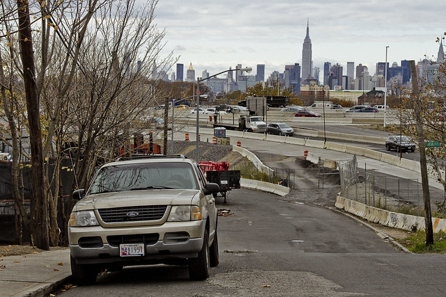
Accordingly, since I seem to have all the time in the world at the moment, I’m taking the road less travelled and revisiting a few locales which have been off my radar for a bit. To wit, pictured above is the view from 53rd avenue at the angle between Sunnyside and West Maspeth, looking west towards the BQE/LIE interchange.
– photo by Mitch Waxman
Prior to the installation of the two highways, roughly 75-80 years ago, this was a place where working people still lived. There was a neighborhood here, at the western border of Newtown’s Maspeth section and the eastern border of LIC’s Blissville subdivision. That’s when Robert Moses, with his New Meeker Avenue Bridge (Kosciuszko Bridge), and Brooklyn Queens Connecting highway, and Long Island Expressway came to town. Zoning decisions made in Manhattan during the post WW2 era rendered this area as “M1” – meaning it is designated for heavy manufacturing usage only.
Regardless of how the City people decided this land should be used, residential usage continued and there are still a small number of fairly ancient homes found peppered in amongst the warehouses, factories and construction oriented tower crane storage yards hereabouts.
– photo by Mitch Waxman
Funny thing is that this neighborhood is – observationally – one of the last places in NYC where you can “leave your front door open.” Saying that, when I use the term “concretized devastations of Western Queens” this section of industrial Maspeth is what I’m usually thinking of.
Most of the surviving homes I see in this neighborhood are typified by what you see above, wood frame row houses which date back to around 1900 or so. There’s a few older houses nearby which are a bit “grander” and speak to an earlier incarnation of this area. A few have disappeared “under my watch,” and have been replaced with bland cinder block warehouse or industrial buildings. Can’t really speak to “who” lives here, amongst the cranes and highways.
– photo by Mitch Waxman
All I can tell you is that they have an amazing view. This POV is on the rising bluff which once led to a prominent hill to the south called Berlin. The next highest prominence to the west would have been Laurel Hill, which Calvary Cemetery was carved into. This section of Maspeth was actually called “Berlin” until the First World War, when it was changed for obvious reasons to West Maspeth. To the east, the land’s declination rises until it meets a ridge which signals the beginning of the terminal moraine of Long Island nearby Mount Olivette and Lutheran Cemeteries. That ridge, which sports the same sort of rocky geology that lends its name to Ridgewood, is “real” land. Everything west of Laurel Hill is elluvial fill deposited by glacial process and sediment delivered by flooding from the Newtown Creek and East River.
Climate change and rising sea level wise, this likely will be the East River coastline someday.
– photo by Mitch Waxman
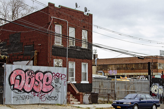
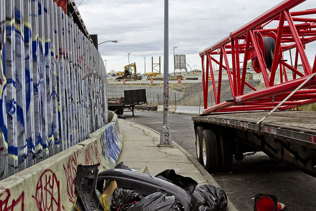
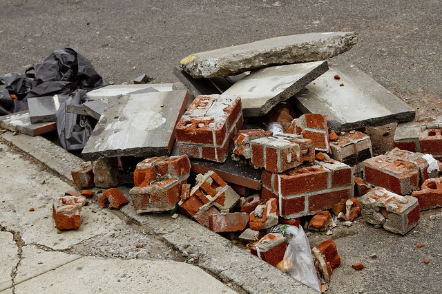
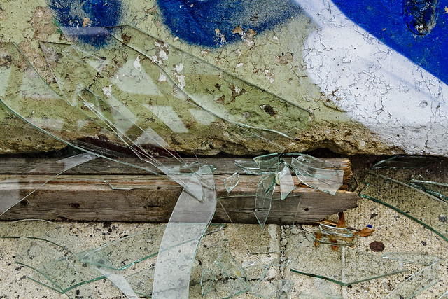
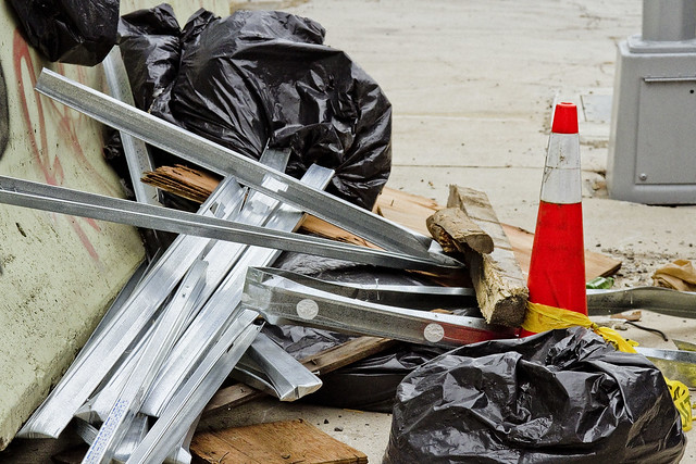
Looping around to the south, as the BQE and LIE interchange cut off egress east/west, an ad hoc art gallery is encountered. Illegal dumping, as I’ve often opined, is the unofficial nativist art form of the Borough of Queens. Combined with long fence lines that are covered in crude graffiti, you’ll encounter several installations along this route which offer intriguing intellectual postulates from the local artistic community.
Everything here is artisanal, incidentally.
– photo by Mitch Waxman
The reality of these installations are that this is simply a convenient place for a low level building contractor to dispose of construction debris without having to pay a dumping fee, but allow me to stay “high brow” in my assessments.
These dumpers really do seem to pay some attention to composition and color, however.
– photo by Mitch Waxman
53rd avenue terminates in a parabola which carries it into 43rd street, a colonial era pathway that once connected to Newtown Creek from Bowery Bay in Astoria. The road transected the properties of (amongst several other famous Dutch and English family names from the colonial era) the Riker’s, Skillman’s, and Alsops along its route, and according to the historic record – it was paved with crushed oyster shells. All that changed, of course, when first the Long Island Railroad and later Robert Moses came to town.
43rd street still exists in a fairly unbroken line from Astoria to Northern Blvd. and then crosses the Sunnyside Yards south into Sunnyside where it crosses Queens Blvd. and Greenpoint Avenue. When it crosses under the Long Island Expressway overpass, it resumes its pre municipal consolidation name – Laurel Hill Blvd.
– photo by Mitch Waxman
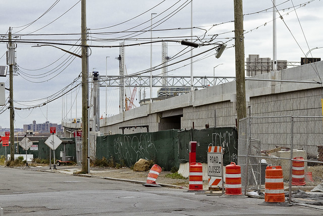
The “43rd street” you encounter in this section of industrial Maspeth, however, is disconnected from the northern section. The last homes on 43rd street went “bye-bye” just a few years ago, due to a smallish construction project going on in the area. With fewer people watching, and caring, the artisanal illegal dumping in this area has amplified.
– photo by Mitch Waxman
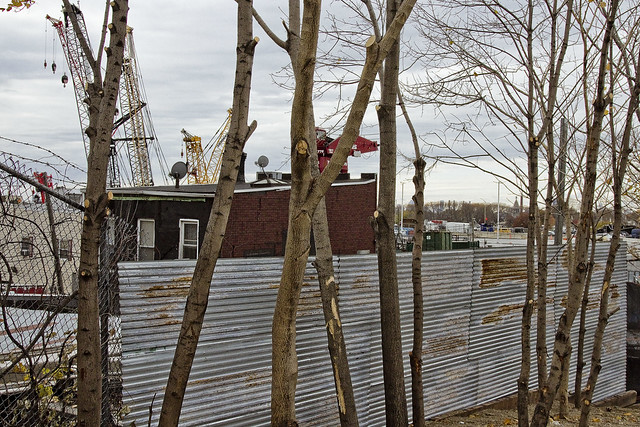
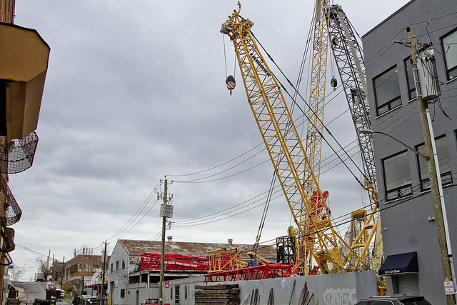
In the shot above, you can discern why I sometimes refer to this section as the “crane district.”
You can also plainly see the sharp rise in altitude hereabouts. This is, as mentioned, largely an industrial zone. There’s a lot of heavy industry going on. Warehouse operations, severely heavy truck traffic, waste transfer stations – Newtown Creek is just a few thousand feet to the south.
– photo by Mitch Waxman
Speaking of Newtown Creek, that smallish construction operation I mentioned earlier is the Kosciuszko Bridge replacement project, which crosses the waterway. If memory serves, that means that something like a half million vehicles a day pass through this pass between Berlin and Laurel Hills. The Kosciuszko Bridge was opened in 1939, and the Queens side approach was built into a shallow valley found between the two landforms, and over a lost tributary of Newtown Creek which was called “Wolf Creek.”
– photo by Mitch Waxman
That’s that, then. See you next week, at this – your Newtown Pentacle.
“follow” me on Twitter- @newtownpentacle


