Archive for the ‘Queens’ Category
perilous disposition
Notes:
- Don’t miss the Hunter’s Point Avenue Bridge Centennial this weekend, on December 11th, a free event. For more on the HPA Bridge Centennial, click here.
- Also, please consider purchasing a copy of the first Newtown Pentacle book: “Newtown Creek for the Vulgarly Curious” – a fully annotated 68 page, full-color journey from the mouth of Newtown Creek at the East River all the way back to the heart of darkness at English Kills, with photos and text by Mitch Waxman.

– photo by Mitch Waxman
Thrice damned, the Kosciuszko Bridge is scheduled for demolition and replacement, and with it shall go the last of Blissville (or Berlin, or West Maspeth, or Laurel Hill- depends on who you ask to describe this “angle” between neighborhoods).
Recent obligation called on me to enter the historic quarter of Ridgewood, and I embarked on the long walk from Astoria with the intention of “checking in” on the area. Unfortunately, seasonal variance in environmental temperature and atmospheric conditions are taking their usual toll on my delicate physical constitution.
from wikipedia
The Kosciuszko Bridge is a truss bridge that spans Newtown Creek between the New York City boroughs of Brooklyn and Queens, connecting Greenpoint, Brooklyn and Maspeth, Queens. It is a part of Interstate 278, which is also locally known as the Brooklyn-Queens Expressway. The bridge opened in 1939, replacing the Penny Bridge from Meeker Avenue in Brooklyn to Review Avenue and Laurel Hill Boulevard, and is the only bridge over Newtown Creek that is not a drawbridge. It was named in honor of Tadeusz Kościuszko, a Polish volunteer who was a General in the American Revolutionary War. Two of the bridge towers are surmounted with eagles, one is the Polish eagle, and the other the American eagle.

– photo by Mitch Waxman
Numbing begins for me at higher temperatures than most, and even the high 40’s and low 50’s call for woolen hats and gloves, and insulation about the torso is absolutely critical. This ridiculous assortment of threadbare garments forces me to move in a stiff and corpse like fashion, and stepping onto a bathroom scale reveals that my full winter gear (with camera) adds some 30 pounds to my weight. Like one of “Marius’s mules” however, your humble narrator nevertheless endures in his self enforced march across the concrete landscape of the Newtown Pentacle. The awful thing, however, was not the suffering of one sickly and somewhat insane narrator- it was what I could not have seen on 54th avenue.
Also, we’ve been to 43rd street before, in the “Maspeth? Laurel Hill? Where am I?” posting of 9/3/2009.
from forumnewsgroup.blogspot.com
…To accomplish this, the new bridge will be built next to the existing structure, and all six lanes of traffic will be shifted onto what will eventually be the eastbound structure. The existing bridge will be demolished, and a new structure for westbound traffic will then be built in its place.
The current bridge carries three lanes of traffic in each direction. The final product will include five lanes into Queens and four into Brooklyn, along with a pathway for bicyclists and pedestrians that promises to provide a “terrific view of the Manhattan skyline,” according to Adams. The new bridge will also feature standard-width lanes, shoulders for disabled vehicles and better sight lines for drivers, according to Adams. “This will have significant improvements on the merging problems that exist today,” he said.
The state is continuing to negotiate with property owners within the 1.1 mile construction zone to acquire easements and land needed for the project. That is expected to be completed by 2013. The state is also working with the city Parks Department on a new greenspace that is planned for beneath the approach to the bridge on the Queens side, but Parks was unable to provide details about that.

– photo by Mitch Waxman
The so called sidewalks which underlie the approaches to the Kosciuszko Bridge (thrice damned) are pedestrian in name only, and the evidence of gathered diesel dust and undisturbed deposits of windblown graveyard soil suggests that no other boots save my own have traversed the space in any recent memory. This is a place for the automobile, the truck, and those who cross it by foot must be sagacious and alert.
While passing from Laurel Hill Blvd. to 54th avenue via one of these underpass viaducts, something impossible was suggested rather than observed as scratching about in these deposits. It could not have been what peripheral observation suggests, and it is far more likely that I am suffering from some early phase of macular degeneration or an undiagnosed neurological condition than that which I believed I saw could be material and real.
For now, I’m keeping my observation to myself, lest some guardian of the public good who might be reading this recommend me to the psychological hospitals at Wards Island for both my own protection and that of the community at large.
Suffice to say, what I think I saw cannot exist in any world governed by wholesome laws of physics and or familiar biology, but it is probably best to avoid the drainage pipes which carry storm runoff from the Kosciuszko Bridge’s BQE down to the streets of this angle between neighborhoods- just in case.
from nysdot.gov
In the early to mid 19th century, virtually the only development along the channels of the Newtown Creek drainage were crossings for roads and turnpikes that linked nearby villages and led to East River ferries. A highway between Bushwick and Newtown was in place by 1670,including a wooden bridge that was most likely the first road crossing of the creek, at approximately the location of present Meeker Avenue. This crossing was replaced circa 1812-14 by the Penny Bridge, a toll bridge on the Newtown and Bushwick Turnpike Road. The first crossing of English Kills along the present Metropolitan Avenue opened circa 1814-16 as part ofthe Williamsburg and Jamaica Turnpike. These remained the only bridges into the 1840s when nearby urban development stimulated more road construction across the marshy drainage. Mid-19th century bridges included the Maspeth Avenue Plank Road to Newtown (1846), and the Greenpoint and Flushing Plank Road linking the Greenpoint ferry to the new Calvary Cemeteryvia present Greenpoint Avenue (1853-54).
The 1848 establishment of the large Catholic cemetery (Calvary Cemetery), on an old estate north of the Penny Bridge, reflected the absenceof any competing land use demands along most of the waterway. Water transport remained a better means of moving goods and people between the local villages and nearby urban areas;steamboats served the cemetery until around 1870. Local road development in the late 1860s included the first Vernon Avenue Bridge over Newtown Creek (removed and replaced by the Pulaski Bridge), and a bridge over Dutch Kills on present Borden Avenue. In part to secure public funding for street improvements in Hunter’s Point, Henry Anable sought to incorporate the area in 1870 as part of Long Island City, which also absorbed the villages of Astoria, Ravenswood, and Dutch Kills

– photo by Mitch Waxman
The easements sought for the footprint of the new bridge in Queens will obliterate the last of the residences here. Consultations with knowledgeable sources, including the research staff at Newtown Creek Alliance and Forgotten-NY as well as a coterie of online sources for ancient maps and lost railroad sidings, suggest that the area modernity refers to as “Blissville” or “Laurel Hill” or “West Maspeth” was referred to in earlier times as “Berlin” or “Berlin Hill” or “Berlinville”.
The inestimable Kevin Walsh of Forgotten-NY, ever generous with his encyclopedic grasp of the history of the Megalopolis, actually supplied links to jpegs of century old maps which describe this place for consideration by the curious and inform the modern viewer as to the atavist nomenclature of the very streets themselves.
Luckily, 2 of these maps may be found online and are publicly available for inspection, here and here.
also from nysdot.gov
In October 1936, the Commissioner of Plants and Structures for the City of New York proposed a high level fixed span that would provide 125 feet above MHW between bulkheads. This bridge today is known as the Kosciuszko Bridge and replaced the Meeker Avenue Bridge. The marine community for sometime in the 1930’s had sought to have the Meeker Avenue Bridge replaced and supported the proposed 125’ vertical clearance for the new bridge.
At that time, the companies and organizations included: Queensboro Corporation, New England Navigation, Brooklyn Union Gas Company, Mystic Steamship Company, Tide Water Oil Company, Brooklyn Chamber of Commerce, New York Towboat Exchange, Inc., the Port Authority of New York/New Jersey, and Card Towing Line.
However, two Corporations, Merritt-Chapman & Scott Corporation and Cross, Austin & Ireland Lumber Company with docks above the bridge objected to any clearance less than 135 feet above MHW and requested that a vertical clearance of 150 feet be required.

– photo by Mitch Waxman
If my reading of these maps is correct (they often aren’t, so decide for yourself), then these doomed houses are the last residential survivors of Washington Avenue (43rd street) between Waters Ave. (54th rd.) and Columbia Ave. (55th ave.). Sources also inform that that the remarkable declination of this area is not part of “Laurel Hill” – the geological feature which Calvary Cemetery is carven into – but is instead “Berlin Hill”. Other… documentation… provided to me remains confidential, but confirms the olden names of these lanes.
- Our friends at forgotten-ny have, of course, been in this spot before- check out the FNY page on Blissville/Laurel Hill for an overview of the entire area and a scholarly erudition which sets the gold standard for the entire genre of urban exploration.
from nysdot.gov
On page 17 of this slideshow presentation from the NYS DOT, one might observe the footprint expected for the Queens side of the Kosciuszcko Bridge project. The technical term for the properties affected, incidentally, is easement– which the State will be acquiring using its voluminous power of eminent domain.

– photo by Mitch Waxman
All that remains here now is industry, and a somewhat relict rail line. When the construction on the new Kosciuszko Bridge (thrice damned) begins, the long and cold winter nights in Berlinville will belong only to those who lie within venerable Calvary, and to that which could not have been reaching out from a drainage pipe beneath the Kosciuszko Bridge (thrice damned) and grasping at a startled pigeon, and whatever festering things there may be which lurk in that nearby stagnation of innocence called the Newtown Creek.
Such things, and places, do not exist- after all.
from wikipedia
In forensics, skeletonization refers to the complete decomposition of the non-bony tissues of a corpse, leading to a bare skeleton. In a temperate climate, it usually requires three weeks to several years for a body to completely decompose into a skeleton, depending on factors such as temperature, presence of insects, and submergence in a substrate such as water. In the tropics, skeletonization can occur in weeks, while in the Andes Mountains or tundra, skeletonization will never occur if subzero temperatures persist. Natural embalming processes in peat bogs or salt deserts can delay the process indefinitely, sometimes resulting in natural mummies
The rate of skeletonization and the present condition of the corpse can be used to determine the time of death.
After skeletonization has occurred, if scavenging animals do not destroy the bones, the skeleton of mid to large size mammals such as humans takes about twenty years to be completely dissolved by acids in the soil leaving no trace of the organism. In neutral pH soil or sand, the skeleton will persist for at least several thousand years before it finally disintegrates. Infrequently, however, the skeleton can undergo fossilization, leaving an impression of the bone that can persist for millions of years.
ceaseless mazes

– photo by Mitch Waxman
While wandering about near the former Phelps Dodge property at the Newtown Creek, a juggernaut was observed as it hurtled along on standard gauge.
from wikipedia
There is an urban legend that Julius Caesar specified a legal width for chariots at the width of standard gauge, causing road ruts at that width, so all later wagons had to have the same width or else risk having one set of wheels suddenly fall into one deep rut but not the other.
In fact, the origins of the standard gauge considerably pre-date the Roman Empire, and may even pre-date the invention of the wheel. The width of prehistoric vehicles was determined by a number of interacting factors which gave rise to a fairly standard vehicle width of a little under 2 metres (6.6 ft). These factors have changed little over the millennia, and are still reflected in today’s motor vehicles. Road rutting was common in early roads, even with stone pavements. The initial impetus for the ruts probably came from the grooves made by sleds and slide cars dragged over the surfaces of ancient trackways. Since early carts had no steering and no brakes, negotiating hills and curves was dangerous, and cutting ruts into the stone helped them negotiate the hazardous parts of the roads.
Neolithic wheeled carts found in Europe had gauges varying from 130 to 175 centimetres (4 ft 3 in to 5 ft 9 in). By the Bronze age, wheel gauges appeared to have stabilized between 140 to 145 centimetres (4 ft 7 in to 4 ft 9 in) which was attributed to a tradition in ancient technology which was perpetuated throughout European history. The ancient Assyrians, Babylonians, Persians and Greeks constructed roads with artificial wheelruts cut in rock spaced the wheelspan of an ordinary carriage. Such ancient stone rutways connected major cities with sacred sites, such as Athens to Eleusis, Sparta to Ayklia, or Elis to Olympia. The gauge of these stone grooves was 138 to 144 centimetres (4 ft 6 in to 4 ft 9 in). The largest number of preserved stone trackways, over 150, are found on Malta.
Some of these ancient stone rutways were very ambitious. Around 600 BC the citizens of ancient Corinth constructed the Diolkos, which some consider the world’s first railway, a granite road with grooved tracks along which large wooden flatbed cars carrying ships and their cargo were pulled by slaves or draft animals. The space between the grooved tracks in the granite was a consistent 1.5 metres (4 ft 11 in).
The Roman Empire actually made less use of stone trackways than the prior Greek civilization because the Roman roads were much better than those of previous civilizations. However, there is evidence that the Romans used a more or less consistent wheel gauge adopted from the Greeks throughout Europe, and brought it to England with the Roman conquest of Britain in AD 43. After the Roman departure from Britain, this more-or-less standard gauge continued in use, so the wheel gauge of animal drawn vehicles in 19th century Britain was 1.4 to 1.5 metres (4 ft 7 in to 4 ft 10 in). In 1814 George Stephenson copied the gauge of British coal wagons in his area (about 1.42 metres (4 ft 8 in)) for his new locomotive, and for technical reasons widened it slightly to achieve the modern railway standard gauge of 1.435 metres (4 ft 8.5 in).

– photo by Mitch Waxman
Thrumming, the juggernaut was witnessed crossing beneath the relict corrosion of the estimable Kosciuszko Bridge. Certain sources reveal that the bewildering and unstoppable mechanism was constructed during the bicentennial of the nation, and served as a motive engine for passenger travel (as part of the Long Island Railroad) before entering its present occupation as a freight hauler.
from wikipedia
The New York and Atlantic Railway (NY&A) (reporting mark NYA) is a short line railroad formed in 1997 to provide freight service over the tracks of the Long Island Rail Road, a public commuter rail agency which had decided to privatize its freight operations. NY&A operates exclusively on Long Island, New York and is connected to the mainland via the Hell Gate Bridge and a car float – the New York Cross Harbor Railroad – from Brooklyn to New Jersey. Lumber, building products, scrap metal, construction & demolition debris, bio-diesel fuel, food, beer, gravel, propane, chemicals, structural steel, plastics and recyclable cardboard/paper are NYA’s main traffic. Occasionally, NYA transports utility poles and electrical transformers to the LIPA facility in Hicksville, which has its own spurs. NYA also moves municipal solid waste in sealed containers on COFC trains.
Some NYA customers are located off-line, and make use of NYA’s team tracks to receive or ship products. Team tracks are located in Bay Ridge, Hicksville, Huntington, Greenlawn, St. James, Islip, Richmond Hill, Maspeth, Speonk, Medford, Yaphank, Southold and elsewhere on the Long Island Rail Road lines which NYA serves. Most of NYA’s customers have their own spurs, making the use of team tracks unnecessary.
Other occasional products shipped to Long Island via the NYA is bentonite and rock salt. The LIRR and the NYCTA both receive new passenger equipment via the NYA, and ship out old, retired equipment for scrapping by way of the NYA.The NY&A officially took over Long Island Rail Road’s freight operations on May 11, 1997. The initial franchise was for 20 years.

– photo by Mitch Waxman
There are some who can describe this vast agglutination of engineered and finely tuned machinery in excruciating detail, and discuss exactitudes and certain notable exceptions to its operation. Your humble narrator, however, firmly pronounces ignorance of the deeper mysteries which surround and inform the world of the “railfan“.
I may spot the occasional train, but I am not a “trainspotter“. The good folks at trainsarefun.com are though, and they offer this photo from 1974 as well as tremendous insight to the rich history of these tracks.
from wikipedia
An EMD GP38-2 is a four-axle diesel-electric locomotive of the road switcher type built by General Motors Electro-Motive Division. Part of the EMD Dash 2 line, the GP38-2 was an upgraded version of the earlier GP38. Power was provided by an EMD 645E 16-cylinder engine, which generated 2000 horsepower (1.5 MW).
The GP38-2 differs externally from the earlier GP38 only in minor details. There is a cooling water level sight glass on the right side of the hood, and the battery box covers are bolted down, instead of hinged. It can be distinguished from the contemporary GP39-2 and GP40-2 in that its Roots blown engine had two exhaust stacks, one each side of the dynamic brake fan if fitted, while the turbocharged GP39-2 and GP40-2 has a single stack. The GP39-2 has two radiator fans on the rear of the long hood like the GP38-2, however the GP40-2 has three. It was also available with either a high short hood, which is common on Norfolk Southern units, or a low short hood, which is common on most other railroads.
singular caravan

– photo by Mitch Waxman
The odd ways and methods of thought which your humble narrator exhibits mystify even himself. Walking down Laurel Hill Blvd. one fine day, and upon observing that most mundane and usual of creatures- the Squirrel- I realized that near total ignorance of the studied actuality of the animal was mine.
This happens to me often, sometimes it’s a foodstuff- like honey for instance. “How does one produce Honey industrially?” (which I’ve mentioned before), or “How, exactly, is Jell-O made?”. The latter case, incidentally, produced an answer so horrible and pregnant with latent disgust that I haven’t eaten the stuff since.
If you enjoy gelatin desserts, don’t ever, EVER try to find out. It’s not what you think it is, and the simplest thing to say is that the process for producing the stuff was invented in the 19th century at Newtown Creek…
from wikipedia
The living squirrels are divided into 5 subfamilies, with about 50 genera and nearly 280 species. The oldest squirrel fossil, Hesperopetes, dates back to the Chadronian (Late Eocene, about 40 – 35 million years ago), and is similar to modern flying squirrels.
During the latest Eocene to the Miocene, there were a variety of squirrels which cannot be assigned with certainty to any living lineage. At least some of these probably were variants of the oldest, basal “proto-squirrels” (in the sense that they lacked the full range of living squirrels’ autapomorphies). The distribution and diversity of such ancient and ancestral forms suggests that the squirrels as a group might have originated in North America.
Apart from these sometimes little-known fossil forms, the phylogeny of the living squirrels is fairly straightforward. There are three main lineages, one comprising the Ratufinae (Oriental giant squirrels). These contain a mere handful of living species in tropical Asia. The Neotropical Pygmy Squirrel of tropical South America is the sole living member of the Sciurillinae. The third lineage is by far the largest and contains all other subfamilies; it has a near-cosmopolitan distribution. This further supports the hypothesis that the common ancestor of all squirrels living and fossil lived in North America, as these three most ancient lineages seem to have radiated from there – if squirrels had originated in Eurasia for example, one would expect quite ancient lineages in Africa, but African squirrels seem to be of more recent origin.
The main group of squirrels also can be split up in three, which yields the remaining subfamilies. The Sciurinae contains the flying squirrels (Pteromyini) and the Sciurini, which among others contains the American tree squirrels; the former have often been considered a separate subfamily but are now seen as a tribe of the Sciurinae. The pine squirrels (Tamiasciurus) on the other hand are usually included with the main tree squirrel lineage, but appear to be about as distinct as the flying squirrels; hence they are sometimes considered a distinct tribe, Tamiasciurini.

– photo by Mitch Waxman
These sort of questions are not good ones to ask, as often the answers present casual barbarism and bloody reality in a matter of fact fashion, and such information blackens the heart and calcifies the mind. Would it aid me, in any way whatsoever, to find out that there might have been some carnivorous Ice Age Squirrel the size of a Buffalo or something? Would it not in fact, be somewhat wiser to apply the limited intellect and time left to me on this mortal coil in pursuit of acquiring the sort of skills which would allow me to gather and hoard material wealth to myself?
Perhaps I could apply my time to more fruitful pursuits than those already explored, apply for and attain some sort of professional license and become a realtor or exterminator or something? Perhaps some novel combination of the two would be possible, and certainly more useful than spending an entire day thinking about common urban rodents.
from wikipedia
Squirrels are generally intelligent and persistent animals. In residential neighborhoods, they are notorious for discovering clever methods to circumvent obstacles in order to eat out of bird feeders. Tree squirrels also create minor annoyances by digging in planting pots and flower beds to pull out bulbs which they chew on, to either bury or recover seeds and nuts, and for building nests within human domiciles, including attics and basements. Squirrels use their keen sense of smell to locate buried nuts and can dig extensive holes in the process. Birds, especially crows, will sometimes watch a squirrel bury a nut, then dig it up as soon as the squirrel leaves. Although they are expert climbers, and primarily arboreal, squirrels also thrive in urban environments, where they have adapted to humans.

– photo by Mitch Waxman
Alas, this fascination for the obscure and bizarre marks me, as always… an Outsider… condemned to feel at home only amongst the tomb legions.
from wikipedia
In Norse mythology, Ratatoskr (Old Norse, generally considered “drill-tooth” or “bore-tooth”) is a squirrel who runs up and down the world tree Yggdrasil to carry messages between the unnamed eagle, perched atop Yggdrasil, and the wyrm Níðhöggr, who dwells beneath one of the three roots of the tree. Ratatoskr is attested in the Poetic Edda, compiled in the 13th century from earlier traditional sources, and the Prose Edda, written in the 13th century by Snorri Sturluson. Scholars have proposed theories about the implications of the squirrel.
Ratatosk is the squirrel who there shall run
On the ash-tree Yggdrasil;
From above the words of the eagle he bears,
And tells them to Nithhogg beneath.
Hunters Point Avenue Bridge Centennial, Dec. 11

– photo by Mitch Waxman
Gaze upon it, lords and ladies, a risible talisman of permanence amidst an ever changing industrial landscape… The Hunters Point Avenue Bridge.
A recent post was offered for consideration at this, your Newtown Pentacle, which hinted at certain remarkable events about to occur in its environs and discussed a small part of the rather expansive history of this largish bit of motile steel which spans Dutch Kills.
Glory then, in the announcement of a free walking tour celebrating its centennial.
from nycbridges100.org

NEW YORK CITY BRIDGE CENTENNIAL COMMISSION AND NEWTOWN CREEK ALLIANCE TO HOST WALKING TOUR OVER HUNTERS POINT AVENUE BRIDGE MORNING OF DECEMBER 11TH
The New York City Bridge Centennial Commission (NYC BCC) and Newtown Creek Alliance announced today that they will sponsor a free walking tour of the Hunters Point Avenue Bridge in Long Island City on Saturday, December 11, 2010 at 11 a.m. to celebrate its 100th birthday.
“It’s important to celebrate these milestones as a way to show how much we rely on all these crossings in our day-to-day lives,” said NYC BCC President Sam Schwartz.

– photo by Mitch Waxman
Your tour guides for this centennial event will be Newtown Creek Alliance and Working Harbor Committee’s Bernard Ente, and a certain humble narrator will be assisting him in meager ways.
This location is awfully close to both legendary Greenpoint and to the heart of Long Island City, and quite close to Manhattan via subway. Here’s a google map with the location of the Bridge, and the meet-up point at 21st street and Hunters Point Avenue is called out.
from nycbridges100.org
The original Hunters Point Avenue Bridge dates back to 1874 when the bridge was a wooden structure. From 1874 to 1907 an iron bridge was in place before being replaced in 1910 by a double-leaf bascule bridge. It was again rebuilt in the early 1980s as a single-leaf bascule bridge. Bascule bridges are designed with a counterweight that balances the span as it swings upward (a single leaf lifts up from one end while a double leaf lifts up from both sides in the middle of the span).
The bridge is located between 27th and 30th streets in Long Island City and is situated four blocks east of the Borden Avenue Bridge. The span is 21.8 meters long and has two lanes, one in each direction. It has experienced higher traffic volumes over the last year and a half while the Borden Avenue Bridge has been closed for construction in this heavily industrialized area.

– photo by Mitch Waxman
Spectacular views of Dutch Kills, as well as knowledgeable and unbiased narration, can be had for the price of attendance alone. Attendees are advised to bring cameras, as this is a particularly photogenic section of the Newtown Creek watershed.
from nycbridges100.org
The meeting point for the tour will be at Hunters Point Avenue at 21st Street outside the 7 train station. If you would like to participate, please email tour guide Bernie Ente at info@entephoto.com.
About the NYC Bridge Centennial Commission
The NYC Bridge Centennial Commission is a 501 c 3 non-profit comprised of public and privateorganizations to commemorate the centennials of several NYC bridges and raise infrastructure awareness.
About the Newtown Creek Alliance
The Newtown Creek Alliance represents interests of community residents and local businesses who arededicated to restoring community health and vibrant water dependent commerce along Newtown Creek.

– photo by Mitch Waxman
Dutch Kills is a familiar sight to regular readers of this, your Newtown Pentacle, but must be experienced first hand by all interested in the story of the Newtown Creek. This will not be a rigorous walking experience- sneakers or other comfortable shoes should be sufficient as we won’t be leaving the sidewalk- but if icy conditions occur- use good judgement.
Undoubtedly, it will be cold, and the event will be happening rain, shine, or snow- so gauge your outerwear according to forecasted weather conditions.
For those interested in further discussion with other antiquarians and enthusiasts, we are planning an after event visit to a local diner for coffee, luncheon, and conversation.
from nyc.gov
Hunters Point Avenue is a two-lane local City street in Queens. Hunters Point Avenue is oriented east-west and extends from 21st Street to the Long Island Expressway/Brooklyn Queens Expressway interchange in Queens. The avenue is parallel to and approximately one block south of the Long Island Expressway. The Hunters Point Bridge over Dutch Kills is situated between 27th Street and 30th Street in the Long Island City section of Queens, and is four blocks upstream of the Borden Avenue Bridge. It is a bascule bridge with a span of 21.8m. The general appearance of the bridge has been significantly changed since it was first opened in 1910. The bridge provides a channel with a horizontal clearance of 18.3m and a vertical clearance, in the closed position, of 2.4m at MHW and 4.0m at MLW. The bridge structure carries a two-lane, two-way vehicular roadway with sidewalks on either side. The roadway width is 11.0m, while the sidewalks are 1.8m wide. The width of the approach roadways vary from the width of the bridge roadway. The west approach and east approach roadways are 13.4m and 9.1m, respectively.
The first bridge at this site, a wooden structure, was replaced by an iron bridge in 1874. That bridge was permanently closed in 1907 due to movement of the west abutment, which prevented the draw from closing. It was replaced in 1910 by a double-leaf bascule bridge, designed by the Scherzer Rolling Lift Bridge Company. The bridge was rebuilt in the early 1980′s as a single-leaf bascule, incorporating the foundations of the previous bridge.
Incidentally…
a photo in the same series as the one below was recently exhibited here- in the “from some point in space” posting about Dutch Kills and the Hunters Point Avenue Bridge.

– photo by Mitch Waxman
While doing supplemental research about the place, I came across the following shot embedded in a scanned “google book”, and the two images form an interesting parallel. The BW shot, you see, is from 1921.
Coincidence abounds, but I believe my forebear was shooting from a similar if not same vantage as I would be at some four score and nine years or 24,855 days later.

– Photo from “The Newtown Creek industrial district of New York City By Merchants’ Association of New York. Industrial Bureau”
confines of our kingdom
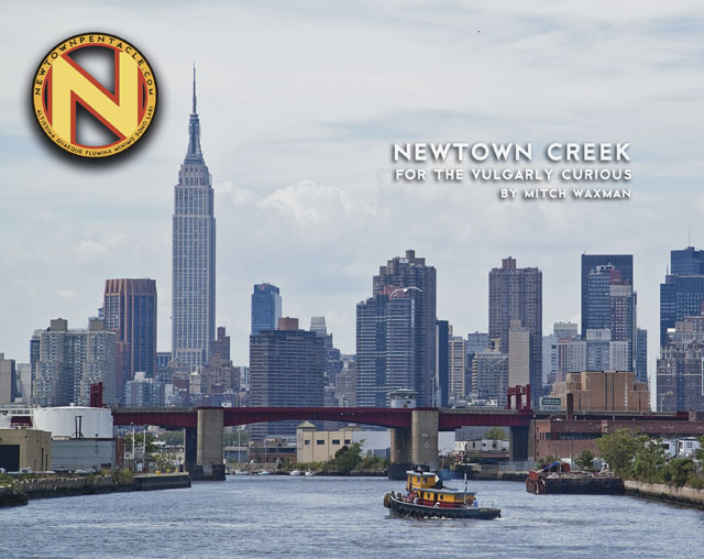
“Newtown Creek for the Vulgarly Curious” is a fully annotated 68 page, full-color journey from the mouth of Newtown Creek at the East River all the way back to the heart of darkness at English Kills, with photos and text by Mitch Waxman.
Check out the preview of the book at lulu.com, which is handling printing and order fulfillment, by clicking here.
Every book sold contributes directly to the material support and continuance of this, your Newtown Pentacle.


