Posts Tagged ‘Blissville’
sheerly perpindicular
It’s Friday the 13th…

– photo by Mitch Waxman
Tapophile? Ghoul? Trespasser? I’ve been called all of these things because of my devotion to studying the history of First Calvary Cemetery in the Blissville neighborhood of Long Island City. Calvary Cemetery, for the uninitiates amongst you, was founded by the Roman Catholic Church in 1848 to comply with New York City’s “Rural Cemetery Act” which proscribed the continuing interment of cadavers in Manhattan due to fears of contagious disease. Prior to this, it was common for churches to have graveyards, and far more common was the usage of the dirt floor basements of tenements as ad hoc burial spots for the poor. The law commanded all the major religious denominations to acquire and maintain cemeteries in “rural areas” to house their congregants – which at the time – was a description that included the south eastern corner of Blissville near its border with the Berlin section of Maspeth. The cemetery was consecrated by Archbishop “Dagger” John Hughes in 1848, and there are literally millions buried in this – the original property – and in the nearby Second, Third, and Fourth Calvary Cemeteries. The law also requires the disinterment of buried bodies, which was a ghastly process that occurred in the dead of night, and vast numbers of human remains were removed from their Manhattan graves and barged across the river for reinterment in the new rural cemeteries. There are so many cemeteries in the surrounding neighborhoods of Brooklyn and Queens that the term “cemetery belt” is commonly used to describe the vast acreages of graves. All of these are not Roman Catholic ones, of course. There’s a cemetery for everyone.
For Catholics, however, all roads lead to Calvary.
Calvary Cemetery was founded, and continues to be maintained, by the Roman Catholic Church – specifically by the Trustees of Old St. Patrick’s Cathedral in Manhattan, and it is a very special place. The Trustees consider the cemetery to be an extension of the altar at the Cathedral. To one such as myself, Calvary is a history book, left sitting wide open and found along the Queens shoreline of the noisome Newtown Creek.

– photo by Mitch Waxman
Your best bet is to wander in here, roam around a bit and see what you can see. If you come here looking for something specific, it’s going to be quite frustrating. Let the place talk to you, and it’ll show you exactly what you need to see – just like Queens itself. Don’t force it. Look up, down, all around. Notice things. If you take a hard look at these things, you might be offered a lost or occluded slice of the history of New York City.
That’s the grave of the Malone family – Father Sylvester Malone, his brother Edward and his sister in law Annie. Slice.

– photo by Mitch Waxman
Father Malone… wow… it’s actually amazing to me that he’s not still spoken of in North Brooklyn. Beloved in life, Sylvester Malone was born in Ireland’s County Meath. Malone was recruited to the priesthood by Reverend Andrew Byrne in 1838, and came to America with him. In NYC, Malone fell into the circle of priests surrounding Archbishop John Hughes, and was ordained at Old St. Patrick’s Cathedral in 1844. Malone was shortly assigned to Old St. Mary’s church in Williamsburg. Malone worked a Parish circuit that included the East River side of Newtown (including Astoria’s Hallets Cove) and the former Boswijck – or Bushwick – Colony, including Greenpoint, Williamsburg, and Bushwick. Malone formed a friendship with architect Patrick Keely (who also designed St. Anthony’s in Greenpoint and more than 200 other new gothic churches in the northeastern United States) and the two oversaw the construction of Sts. Peter and Paul church in Williamsburg, which Malone was permanently assigned to in 1852.
The inscription on his memorial reads:
Sylvester Malone. Pastor of St. Peter and Paul’s Church for fifty five years. Regent of the University of the State of New York. Live in Charity with all of your fellow citizens. A curse on prejudice and ignorance. Bane of the human family. As long as you have existence, there can be but little peace and charity.

– photo by Mitch Waxman
Malone was known for his open acceptance of people of other faiths, regularly attending the Jewish community’s Purim Ball, visiting the Masonic Hall, was an outspoken abolitionist, and encouraged his flock to perceive other faiths and cultures as neighbors rather than adversaries. Famously, he was one of the first Catholic priests to embrace the African Americans in his community, presenting honors to the Civil War’s Black Veterans Association. He happily interacted with Protestant denominations as well. While researching this post, some of the earliest usages of the term “tolerance” jumped out at me. You don’t hear much about the modern political concept of “tolerance” in the 19th century, and almost never from the pen of an Irish born Catholic priest based in industrial Brooklyn.
Malone was also a regent of the State University of New York, and remained at Sts. Peter and Paul Church until his death in 1899. Unfortunately, the original building housing his church was demolished in 1957, so I can’t show you that. A modern church building sits on the old site, but the influential gothic design of the original is lost to modernity except for a few blurry old photos.

– photo by Mitch Waxman
There were three Malone Brothers, with Sylvester being the senior. Brother Patrick was the middle son and a Civil Engineer by trade, and Edward was the youngest. Edward fought in the Civil War, was a physician and surgeon of some renown, and died at the age of 52. Patrick and Edward actually died within a few months of each other in 1890. There was a sister too, but I can’t tell you anything about her, and I’m not sure if she ever left Europe or not.
Dr. Edward Malone was born Aug. 5, 1832, and died June 16, 1890. His wife, Annie Loyola Malone, died July 13, 1916.

– photo by Mitch Waxman
You never know what, or who, you’re going to find in LIC’s Calvary Cemetery.

“follow” me on Twitter- @newtownpentacle
possible reinforcements
Block by block in LIC, from grave to rail.

– photo by Mitch Waxman
In a post last week – I mentioned that shortly after visiting the Kosciuszko Bridge construction site, the burning thermonuclear eye of God itself had managed to burn off the atmospheric gray miasma which had occluded it. As I moved inexorably northwards back to Astoria, via First Calvary Cemetery, the sky – and light – seemed to get better and better.
Pictured above is the skyline of the Modern Corridor of LIC, rising beyond the tombstones set into what those who lived during the colonial era would have called Laurel Hill. Note the change in elevation. The flood plain of the East River and the Newtown Creek is what they’re built on. Back here in Blissville, the ground begins to rise as you head eastwards towards the start of the terminal moraine of Long Island in Maspeth, and the bluff which gives Ridgewood its name.

– photo by Mitch Waxman
That’s the main gate of Calvary Cemetery above, stout ironwork which is decorated with the fasces of the Romans. Obviously, leaving Calvary is a privilege, as most who enter it stay there forever. In the distance, beyond the Queens Midtown Expressway section of the world’s longest parking lot – called the Long Island Expressway (in hushed whispers) – is the Degnon Terminal. The former industrial park adjoins LIC’s tributary of Newtown Creek, called Dutch Kills.
The street closest to the gates is Greenpoint Avenue. To the left, or south – is the infinity of Brooklyn.

– photo by Mitch Waxman
The LIE arrived in Long Island City as the same time as the Midtown Tunnel, and a year after the Kosciuszko Bridge opened. It cut LIC in half, but when you’re in the “House of Moses,” that’s a typical and oft repeated story. An argument I often end up in is with those who have grown up in Western Queens who tell me that they don’t live in LIC. They’ll claim Sunnyside or Astoria are distinct, separate, and that LIC is “over there.”
If you live in a zip code that starts with “111” you live in Long Island City. That’s the code associated with the municipality’s former holding by the United States Post Office. Using the example of the “Miracle on 34th street” movie, if th USPS says it – it’s true. I win.

– photo by Mitch Waxman
This used to be Hoffman Avenue, in a time during which virtually no one currently alive would remember. It’s in Sunnyside, which is the name assigned to the neighborhood surrounding Queens Blvd. shortly after the IRT Flushing Line was built and opened. The so called “Philadelphia plan” rechristened the north/south “named” streets of “Long Island City” heights, later Sunnyside, with numbers instead of names like “Bliss” or “Lowery” or “Laurel Hill Blvd.”.

– photo by Mitch Waxman
An east/west avenue, Skillman is named for an old farming family and provides the century old southern border for the Sunnyside Yards. There used to be a “Pest House” nearby, during colonial and early 19th century times, where sick and dying residents would be quarantined away from the rest of the population to avoid the spread of epidemics. Skillman Avenue is built on a bluff, or ridge, that used to look down on the pestilential swamps that sat between it and through which Jackson (modern day Northern Blvd.) Avenue was built.
All of that changed with City consolidation in 1898, and the later construction of the gargantuan Sunnyside Yards by the Pennsylvania Railroad company at the start of the 20th century. Robert Moses renamed the stretch of Jackson Avenue that goes from 31st street to Flushing as Northern Blvd.

– photo by Mitch Waxman
Famously, I can describe where you’ll find every single hole in the fencing surrounding the 180 plus acre Sunnyside Yards complex is located, and the one which provided vantage in the shot above is one of my favorites. It overlooks the Long Island Railroad Main Line, which has been carrying commuters from east to west, and back again, since 1870.
“follow” me on Twitter- @newtownpentacle
dark and shapely
Kosciuszko, Kosciuszko, men have named you…

– photo by Mitch Waxman
Over Thankgiving weekend, a visit was paid to the hazy borderlands of West Maspeth and Blissville. My goal was to check in on and shoot some photos on the progress the NYS DOT is making on Phase One of the Kosciuszko Bridge replacement project. Phase One involves the creation of half of the new span, the rerouting of the Brooklyn Queens Expressway, and the demolition of the 1939 era Kosciuszko Bridge, which overflies the lugubrious Newtown Creek.
Documenting this project has been a long standing project of mine – this 2012 post tells you everything you could want to know about Robert Moses, Fiorella LaGuardia, and the origins of the 1939 model Kosciuszko Bridge. Just before construction started, I swept through both the Brooklyn and Queens sides of Newtown Creek in the area I call “DUKBO” – Down Under the Kosciuszko Bridge Onramp. Here’s a 2014 post, and another, showing what things used to look like on the Brooklyn side, and one dating back to 2010, and from 2012 discussing the Queens side – this. Construction started, and this 2014 post offers a look at things. There’s shots from the water of Newtown Creek, in this June 2015 post, and in this September 2015 post, which shows the bridge support towers rising. Additionally, this post from March of 2016 detailed the action on the Queens side. Most recently, here’s one from May of 2016, and one from June of the same year. Finally, here’s one from August of 2016.

– photo by Mitch Waxman
The roadway now extends out over the water and is firmly shadowing the concrete devastations of Queens, nearly crossing the LIRR Lower Montauk tracks. The BQE Onramp also seems to be coming along, and I suspect that the DOT’s contractors will be joining the bridge span to the Queens side approaches pretty soon.

– photo by Mitch Waxman
Speaking of the BQE Onramp, there it is. In the foreground is one of the structural steel sections which will be joined to the span and support the road surface. Not pictured are the “panels” of the road surface, which arrived a couple of days later and which were noticed during a subsequent and unrelated visit to the area.

– photo by Mitch Waxman
In the shot above, you can see how the sections are attached. This is a cable stay bridge, of course. The roadway above will carry four lanes of two way traffic, but it’s just half of the new bridge. When the western half of the project is complete, there will be four lanes in each direction, and there’s also going to be a bicycle and pedestrian path.
That’s awesome. Cannot wait to shoot from up there.

– photo by Mitch Waxman
The new bridge, as I’ve been mentioning for several years at this point, is going to be quite a bit lower than the 1939 model. That’s going to bring noise issues to Maspeth and Blissville, I fear, but let’s see what DOT has planned.

– photo by Mitch Waxman
The NYS DOT is currently wondering what to do with the areas on both sides of the Creek which these columns rise from. There’s talk of public space and treating the two spots in the manner of a park or playground.
– photo by Mitch Waxman
Further back in Queens, to the north actually, the approaches to the new bridge seem to be ready for business. I haven’t managed to get up there yet, but cross your fingers, maybe I can talk the DOT folks into a walk through soon.

– photo by Mitch Waxman
Given the fantastic sort of luck for which I’m distinguished, just as I started back for home (cutting through Calvary Cemetery) the misty murk occluding the burning thermonuclear eye of God itself began to break up, allowing the sky to turn blue and light to suffuse. I turned around and grabbed one last shot, while cursing.
“follow” me on Twitter- @newtownpentacle
leaping shadows
Lets talk about the Kosciuszcko Bridge, huh?

– photo by Mitch Waxman
Since the big bridge over Newtown Creek’s 77th birthday is coming up – August 23rd for the vulgarly curious – one decided to walk over and through Calvary Cemetery into West Maspeth the other day and check out the latest progress which the NYS DOT and their contractors are making on replacing it. The Kosciuszcko Bridge replacement project is humming along.
As a note, this post represents no special access or anything, just some specialized knowledge about Newtown Creek and the points of view thereupon which I am privy to. If there’s an angle of view on the Creek I don’t know about by this point, I will buy you a drink for showing it to me.

– photo by Mitch Waxman
As is my habit, one has been keeping a running tally of posts about the project.
To start – this 2012 post tells you everything you could want to know about Robert Moses, Fiorella LaGuardia, and the origins of the 1939 model Kosciuszko Bridge. Just before construction started, I swept through both the Brooklyn and Queens sides of Newtown Creek in the area I call “DUKBO” – Down Under the Kosciuszko Bridge Onramp. Here’s a 2014 post, and another, showing what things used to look like on the Brooklyn side, and one dating back to 2010, and from 2012 discussing the Queens side – this. Construction started, and this 2014 post offers a look at things. There’s shots from the water of Newtown Creek, in this June 2015 post, and in this September 2015 post, which shows the bridge support towers rising. Additionally, this post from March of 2016 detailed the action on the Queens side. Most recently, here’s one from May of 2016, and one from June of the same year.

– photo by Mitch Waxman
The roadway which will be the easterly BQE section leading out of Queens is now largely in place. There’s still a bunch of work going on up there, presumptively it involves the sort of rebar work observed in the May 2016 post linked to above.

– photo by Mitch Waxman
The shape of the cable stay section of the new bridge is beginning to form up as well.

– photo by Mitch Waxman
The steel sections are prefabricated and shipped to the job site via flat bed truck, where they’re then hoisted up and attached to the towers and cables.

– photo by Mitch Waxman
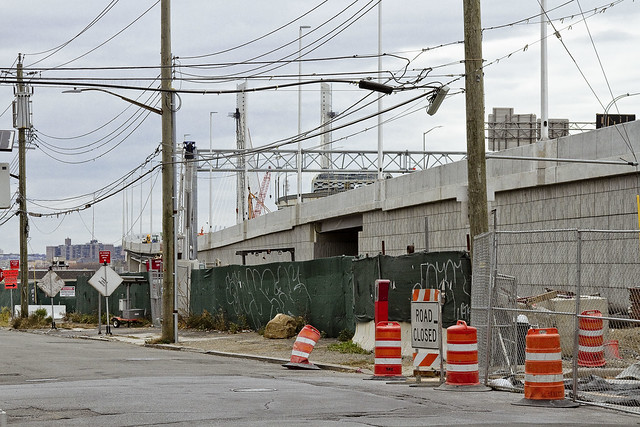
Looking down 56th road from Blissville into Maspeth. The area in the left hand side of the shot used to be an NYPD tow yard, which was a great example of NYC’s macabre sense of humor. NYPD tow pounds are typically in places which you can’t reach without a car, and since they’ve just taken your car…

– photo by Mitch Waxman
Looking north towards Sunnyside from 56th road. You can really discern the difference in height between the 1939 and modern bridges in the shot above. Apparently, part of the traffic engineering underlying the new bridge project is to eliminate the steep incline from the approaches.

– photo by Mitch Waxman
Looking south towards Brooklyn, while still on 56th road. The property fence line I’m shooting over is the former home of the Phelps Dodge refinery, which is said to be a particularly toxic hot spot.

– photo by Mitch Waxman
A bit closer to the water, on another part of the former Phelps Dodge properties which isn’t quite so “hot,” pollution wise. This is the parking lot of a wholesaler catering to the restaurant trade.

– photo by Mitch Waxman
The cable stay span of the new bridge is growing steadily towards Brooklyn in the shot above. To me, it looks like it’s going to be connected to the Brooklyn side ramp fairly soon.

– photo by Mitch Waxman
A close up on the ramp, and you can see the itty bitty construction guys at work right on the edge.

– photo by Mitch Waxman
Same perspective, but wide angle. That’s the Newtown Creek flowing below, and we are looking west towards Manhattan. Again, notice the height differential between the two spans.

– photo by Mitch Waxman
Looking south again, this time from Maspeth’s 43rd street. The contractors have a lot of their equipment and prefabricated materials staged out here.

– photo by Mitch Waxman
Back on 43rd street, but this time from the very edge of the project site, looking south along the spine of the BQE.
There you are.
Upcoming Events and Tours
Sunday, August 14th, 11:00 p.m. – 1:00 p.m. –
Calvary Cemetery Walking Tour,
with Atlas Obscura. Click here for more details.
Sunday, August 21, 11:00 a.m. – 1:00 p.m. –
Poison Cauldron Walking Tour,
with Atlas Obscura. Click here for more details.
Wednesday, August 24, 6:00 p.m. – 8:00 p.m. –
Port Newark Boat Tour,
with Working Harbor Committee. Click here for more details.
“follow” me on Twitter- @newtownpentacle
angled planes
Not rodents, the groundling burrowers are instead mammalian and obligate nasal breathers.

– photo by Mitch Waxman
The groundling burrowers have a nearly 360 degree field of vision, with their only blind spot directly in front of them at the tip of their nose. They are crepuscular (meaning they’re most active around dawn and again at dusk), and are digigrades (meaning that they walk around on their toes – five on the front feet and four on their stern). The sound of their screams are blood chilling, they have two sets of those chisel like front teeth, and just about every predator you can think of is after them. When one of their number spots danger, the groundlings are known to thump their powerful hind legs on the ground to alert the others.
The burrowers watch the skies. Death circles above.

– photo by Mitch Waxman
The groundlings burrow into the loam. Their tunnel entrances are well hidden, from above. The tunnels themselves are called burrows. If and when a complex of these subterranean tunnels – or burrows – is found, it’s referred to as a “warren.” More than half of the population of their entire race is found in North America. The males are called “bucks” and the females “does.” Should you find a place where a warren exists, you have likely found what’s known as either a nest, or a “herd,” but what is referred to most commonly as a “colony.”
The burrowers watch the horizons, for death can come at them from all sides.

– photo by Mitch Waxman
They don’t burrow deeply, the groundlings. If at all possible, they’ll move into deep burrows dug by other animals, true rodents such as groundhogs or rats. In an ideal world, perfection would be a series of already excavated voids in the earth, which these lagomorphs could theoretically connect via individual burrows and create a multi acre warren. This would form a hidden groundling metropolis of prodigious size.
Safety is found below, where death means solace.

– photo by Mitch Waxman
First Calvary Cemetery in LIC’s Blissville section, in NYC’s borough of Queens. Founded by Archbishop Dagger John Hughes in 1848 as the primary burial ground for the Roman Catholic Church of NYC. The final mailing address for millions of humans, it is observably infested with obligate nasal breathers – these groundling burrowers. Were it only possible to witness a cross section of the mound Calvary is built into, called Laurel Hill, and the warren it contains…
Who can guess, all there is, that might be buried down there?
Upcoming Events and Tours
Sunday, August 14th, 11:00 p.m. – 1:00 p.m. –
Calvary Cemetery Walking Tour,
with Atlas Obscura. Click here for more details.
Sunday, August 21, 11:00 a.m. – 1:00 p.m. –
Poison Cauldron Walking Tour,
with Atlas Obscura. Click here for more details.
Wednesday, August 24, 6:00 p.m. – 8:00 p.m. –
Port Newark Boat Tour,
with Working Harbor Committee. Click here for more details.
“follow” me on Twitter- @newtownpentacle


