Posts Tagged ‘Flushing Bay Promenade’
present bungalow
Flushing Bay, in today’s post.

– photo by Mitch Waxman
Last week I attended a meeting thrown by the NYC Parks Dept. detailing their $35 million dollar upgrades to the World Fair Marina in Flushing Bay. The plans involved relocating and rebuilding one of the docks, installing a new facility house and refueling dock, and installing a bunch of new street furniture on the public sections of the marina (benches, lamp posts etc.) It was my kind of meeting, truth be told, where the government people deliver their information in a punchy and well organized fashion, and public commentary is offered in a businesslike and terse fashion. My main interest in attending revolves around a long term bit of advocacy for Newtown Creek’s Queens shoreline which I’ve been working on, namely the creation of a similar marina on the Newtown Creek coastline Long Island City, and I wanted to take a look at “how it’s done” in the modern era.
Afterwards, a bit of time was spent outside with the camera and tripod, shooting into foggy darkness.

– photo by Mitch Waxman
Just like the Dutch Kills tributary of Newtown Creek, the NYC DEP has been experimenting with the installation and planting of greenery, specifically Saw Grasses, in the littoral zones at Flushing Bay. Littoral means the intertidal area of the shoreline, and they’re engaged in the project for the same reasons that they are at Newtown Creek – mitigating the long term environmental consequences of an abundance of their Combined Sewer Outfalls on the waterway. DEP, or the New York City Department of Environmental Protection if you must, inherited a messy combination of underground pipes from precursor agencies when their organization was created during a 1983 City charter revision, many of which were installed in a hodge podge manner and prior to the Federal Clean Water act.
Due to the outfalls, a lot of raw sewage has historically found its way into area waterways, and the section of Flushing Bay nearby LaGuardia Airport and the World Fair Marina is notoriously and reliably smelly. The creation of these engineered wetlands is an attempt to harness the curative powers and mechanisms of nature in pursuance of fixing a manmade problem.

– photo by Mitch Waxman
This is the section of the north shore of Queens which isn’t forbidden, as a note. There’s a NYC Parks property which sits between the water and the Grand Central Parkway called the Flushing Bay Promenade. It’s 1.4 miles long, starts at the equivalent of 27th avenue, and is a modern addition to the Flushing Meadows Corona Park facility whose creation was funded by the NYC DEP in return for Parks allowing them to build a sewer retention tank in the main park.
When it warms up a bit, I plan on bringing the camera back out here to the promenade and do some exploring.
“follow” me on Twitter- @newtownpentacle
without warning
A fairly novel spot found in north western Queens, in today’s post.
– photo by Mitch Waxman
As mentioned last week, one enacted a “bat out of hell” protocol when Our Lady of the Pentacle allowed me a brief furlough from a kitchen renovation project here at HQ. My perambulation was committed in an easterly direction along Northern Blvd., which ceases to be pedestrian friendly at 114th street. A northerly turn found me at the intersection of Astoria Blvd. and Ditmars, and since it was a warm afternoon, tree lined Ditmars was the route I elected to take back towards the rolling hills of almond eyed Astoria.
When you say “North Western Queens,” one thinks of jails and airports and power plants and stadiums, and as pictured above – the barrier parkway known as the Grand Central.
There is, however, something else found hereabouts.

– photo by Mitch Waxman
Along Ditmars Blvd., this inviting pedestrian path beckons. Signage found at its intersection informs that this is NYC Parks Department property, and a part of the Flushing Meadows Corona complex.

– photo by Mitch Waxman
The Worlds Fair Marina is noticed first, a boat basin servicing a fleet of privately owned pleasure craft.

– photo by Mitch Waxman
Then, looking to the west and LaGuardia Airport, you observe a part of the Flushing Bay Promenade. Asking around at my local bar, none of the native Astorian lifers even knew this park existed.
Perhaps it’s better known in East Elmhurst, which is the community that hosts it, but my Astoria peeps professed complete ignorance on the subject.

– photo by Mitch Waxman
To the east, something that every Queensican is intimately aware of will be found, the home of our lamentable Mets baseball team at Citifield. Just beyond the stadium are the main sections of Flushing Meadows Corona Park.

– photo by Mitch Waxman
To the west is LaGuardia Airport, and this spot along Flushing Bay was a great location from which to observe the goings on thereabouts.
The NYC Parks Dept. makes this page available at their website, describing the history and rather recent creation of the Flushing Bay Promenade, which is connected to the presence of a large NYC DEP “Combined Sewer Outfall” gray infrastructure project nearby.

– photo by Mitch Waxman
At the western edge of the park was a somewhat natural shoreline, and lots of birds were observed flitting about. Luckily it was high tide when I was visiting, as anyone who has driven along the Grand Central Parkway can describe the sickening rotten egg smell which out gasses from the mud flats here at low tide.

– photo by Mitch Waxman
A smallish homeless camp was observed right along the walls of LaGuardia Airport, and there were makeshift shanties and fabric tents arrayed amongst the tree line. I didn’t venture into the area any further than as indicated in the shot above, however, as I avoid taking shots of residences no matter what their status is.

– photo by Mitch Waxman
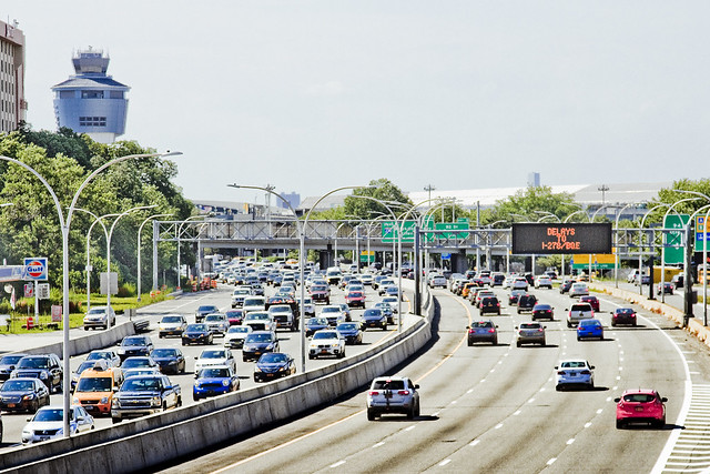
The high speed road known as the Grand Central Parkway, pictured above as seen from within the Flushing Bay Promenade, was constructed in the 1930’s. Part of the Triborough Bridge build out, the Grand Central was widened in the post WW2 period to its current dimensions. Another project from the House of Moses.
Robert Moses was a very clever man who mastered the bureacracy of State, City, and Federal highway systems – earning himself the appellations of both “Master Builder” and “Power Broker.” Moses held near absolute power over highway and bridge building, as well as public housing and parks, for nearly forty years before Governor Nelson Rockefeller ousted him from government in 1974.
The NYC we all know is the City that Moses built.

– photo by Mitch Waxman
As with all things government, specificity is key to understanding a thing. The reason that it’s the Grand Central “Parkway,” instead of highway or expressway, are the grassy and wooded medians that run alongside it. Since these medians are titular “parklands,” Moses had broader powers of eminent domain when claiming and remodeling the area to drive a high speed road through it.
Moses also built LaGuardia Airport, incidentally.
“follow” me on Twitter- @newtownpentacle
Upcoming Tours –
August 2nd, 2015
The Insalubrious Valley of the Newtown Creek – Bushwick & Mapeth Walking Tour
with Newtown Creek Alliance, click here for details and tickets.
August 8th, 2015
13 Steps Around Dutch Kills – LIC Walking Tour
with Atlas Obscura, click here for details and tickets


