Posts Tagged ‘Long Island City’
learned abroad
Is it “Hell in a hand basket,” or are our hand baskets sending us to hell?

– photo by Mitch Waxman
One of the very few places where my personal ideology aligns with that of the Dope from Park Slope – aka the current Mayor of the City of Greater New York – concerns discouraging the continued usage of those plastic shopping bags that every shop in NYC jams their goods into. I’m old enough to remember when the then ubiquitous brown paper bag was phased out in favor of these things. The excuse at the time was that “it saved trees” not using paper.
Of course, in the current era of ubiquitous municipal recyling programs, those paper bags would be worth a small fortune on the “pulp” market. The plastic ones, well, they ain’t exactly saving any trees here in Queens.

– photo by Mitch Waxman
This unfortunate example of the urban arbor is found on 43rd street, just off Northern Blvd. It serves the community as a rake set high into the air column, gathering unto itself wind blown trash. Given that the common plastic grocery sack couldn’t be better designed, as far as parasailing, the air is sometimes thick around Western Queens with these things. Ask my colleague Will Elkins (at Newtown Creek Alliance) about how many of these things he scoops out of the water every year.
Plastic, ultimately, is a waste product of the oil refining process, just like asphalt. That means that the manufacture of new plastic items, in particular poly vinyl chloride based ones, uses a super cheap “feed stock” and are massively profitable to produce and sell accordingly. If some science fiction like limitless and clean energy source was discovered today, we’d still be using petroleum a century from now, so this is a problem that isn’t going away.
People from industrialized countries might say “oil? if we went all “sci fi power source,” it would disappear.” Remember that right now and today in 2018, at least 50% of all living humans use wood fires to heat their homes and cook their food. Coal is still used in massive quantities all over the world, and the underlying technology behind even a nuclear power plant is ultimately a steam driven engine. “Installed base” is the conversation, not fuel source. Just saying.

– photo by Mitch Waxman
One of the things which right wingers opine about environmentalists is that they often have no idea what they’re doing and have just jumped onto an issue because it’s fashionable. They will point out misreadings of climatological data which predicted a new ice age starting in the 1990’s, or mock the banning of CFC accelerants and the so called “Ozone Hole” during the late 1980’s. They will declare many, many things which paint a picture of vainglorious hippies tilting at imaginary windmills that just get in the way of National Business, and which put “hard working Americans” out of work. The more extreme amongst them will say that this all part of God’s plan for us, and not to worry about the natural environment. Faith sustains, not nature.
I submit the photos in today’s post, and ask “did the trees in Eden look like this”?
“follow” me on Twitter- @newtownpentacle
ancient hill
183 square acres, and you can’t even catch a train there.

– photo by Mitch Waxman
On the way home from the Degnon Terminal and Dutch Kills, my habit is to walk up the hill on Skillman Avenue alongside the Sunnyside Yards. It’s actually set against a pretty subtle but noticeable incline, Skillman from Thomson Avenue to 39th street, and the walk is actually decent cardio (it’s no Maspeth, though). You also get to see trains along the way, which is always a plus for one such as myself. Luckily the fences are in atrocious condition and there’s all sorts of places you can stick a lens through and get some shots.
Since I had the tripod with me, I rigged it up a few times when I saw something interesting. These are long exposures, which causes passing vehicles, and trains, to blur into streaks of light. In the shot above, that’s the 7 Subway line exiting Queens Plaza above, and the Long Island Railroad transiting below.

– photo by Mitch Waxman
One of the busiest intersections I’ve ever encountered is at Skillman Avenue and Queens Boulevard. An insane amount of traffic moves through it on a twenty four hour and seven day a week schedule, heading to and from the Queensboro Bridge. There are vampires reported to be living in the steel overpasses as well, so you have to stay alert and wary around these parts because of both traffic and the undead. Queens Plaza is complicated.
That’s another 7 train at the top of the shot, if you’re the curious type.

– photo by Mitch Waxman
Crossing the yards at 39th street, which becomes Steinway Street on the other side of Northern Blvd., I did another setup at one of the many fence holes I’ve catalogued over the years. That set of green, red, and white streaks you see are a passing Long Island Railroad train at the Harold Interlocking. It’s the busiest train junction in the country, as a note, and almost 800 trains a day streak through here on their way to and from the City, last I checked.
Why is it called the “Harold Interlocking”? Ask some of the octogenarian Queensicans you meet in neighborhood bars around Sunnyside, Woodside, or Astoria and they’ll tell you that 39th street used to be called Harold Avenue back in the old days of long ago and far away. DO NOT drop John Lindsay or Bill de Blasio’s name, at your peril.
“follow” me on Twitter- @newtownpentacle
blossoming orchards
Down under the Long Island Expressway, or DULIE, in today’s post.

– photo by Mitch Waxman
So, after shlepping my tripod setup around Dutch Kills last weekend, I decided that I just wasn’t done yet. Heading east alongst the venerable avenue of Borden, a humble narrator found a few interesting spots to do a “setup” and get clicking. It was DULIE which captured my attention on this leg of the walk.
As mentioned in an earlier post, the LIE and Queens Midtown Tunnel opened for business in November of 1940. The LIE, where it crosses the sediment choked waters of Newtown Creek’s Dutch Kills tributary here in Long Island City, rises one hundred and six feet above the water. This means a lot of steel supports, and an empty corridor found beneath it.

– photo by Mitch Waxman
One is obsessed with this section of LIC, as so much has happened here. The General Electric Vehicle Company complex was just a block away, so were a couple of steel factories. A fossilized rail spur can still be found here and there, winding it way around and between the factories, but the locomotive city is long gone. It’s all about the internal combustion engine in modernity – the automobile city.
The principal proponent of the latter didn’t begin the Queens Midtown Tunnel, he just took it over towards the end of the project and made sure the LIE would be his baby. I’m speaking of Robert Moses, of course.

– photo by Mitch Waxman
The sewer grates up on the LIE connect to long vertical pipes, which just empty out onto the ground, and their flow carries all sorts of “yuck” down into LIC from the expressway high above. There’s meant to be a little concrete spillway which would carry the liquid and solute “spill” into a second grate, one which basically empties into Dutch Kills, but the build up of “crapola” around the pipe creates sickly mounds of toxic soil like the one pictured above.
Hey, I’m not judging, I love places like this.

– photo by Mitch Waxman
As a note, whenever I’m describing an encounter with the Gendarmes or some zealous security guard, I always go on about “there being no law forbidding…” and “if you can see it from the sidewalk…”.
In the case of the other night however – picture this: some weird looking bearded old man standing in pitch darkness on a Sunday night with a camera tripod under the LIE, wearing a reflective vest over a filthy black raincoat – I was ready to converse with somebody wearing a badge about what I was up to. You’d just figure that, right?
The cops though, three cruiser units worth spaced out over the evening, just drove on by me. I mean… I felt suspicious looking. The reflective vest is very good camouflage. Instead of being high visibility as promised, it’s a near invisibility prophylactic against “why are you taking pickchas of dat?”

– photo by Mitch Waxman
One was growing fatigued by this point, it was well after ten, and a humble narrator embraced an ideation about starting out for home. One last long exposure shot from DULIE was executed, and thereupon the tripod kit was folded up into its traveling configuration and a lens swap occurred.

– photo by Mitch Waxman
The lens I’ve been using for the series of night shots recently has been a Sigma 18-300 – which is by definition a “daylight lens, given that at full zoom it’s aperture is only f6.3. Tripod shots, like the ones I’ve recently been producing, make the usage of extremely narrow apertures possible – which in turn allows for a deep field of focus. Impossible for handheld usage in low light, however, this lens is. It’s singular virtue is the zoom range, ultimately. I’ve got better lenses, including a different Sigma, but this particular specimen allows me to carry just one lens.
I’ve always got a “nifty fifty” lens in my bag, however, which allows me to open up the aperture to f1.8, allowing a lot more light in. That’s the one I snapped onto the camera, which coincidentally lightened the gizmo by about a pound and a half. Lotta glass inside that Sigma, but you don’t really feel the weight of it when it’s in the bag.
“follow” me on Twitter- @newtownpentacle
long miles
Borden Avenue Bridge and environs, in today’s post.

– photo by Mitch Waxman
There have been three Borden Avenue Bridges, the first being a wooden draw bridge that opened when Borden Avenue was created in 1868. It was replaced by an iron swing bridge which was demolished in 1906, and the modern day retractile bridge was opened on the 25th of March in 1908. It cost $157, 606 to build in 1908. That would be $4,365,073 in modern money, adjusted for inflation.
A bargain, no?

– photo by Mitch Waxman
Borden Avenue Bridge is one of only two retractile bridges in NYC, the other one being the infinestimal Carroll Street Bridge over the Gowanus Canal. This specie of movable bridge is actually quite common in other cities, notably Chicago.
Chicago ain’t got a view like the one above though, I’d wager.

– photo by Mitch Waxman
To the south of Borden Avenue, one might notice the two railroad bridges spanning Dutch Kills – Cabin M and DB Cabin. The latter carries traffic for the Lower Montauk Branch of the LIRR from the Wheelspur to Blissville Yards, all of which which are mainly used for freight these days. Cabin M connects to the Montauk Cutoff, a now severed connection to the Sunnyside Yards and the LIRR Main Line tracks.
Just beyond the two rail bridges is the main body of Newtown Creek.
– photo by Mitch Waxman
Dutch Kills itself, in this area around the Borden Avenue Bridge, is stagnant and choked with wind blown garbage. A tepid current in the water creates a vertical rather than horizontal flow pattern, which factors into the accretion of sediments on the bottom. These sediment beds, which are found across the entire Newtown Creek watershed and represent a centuries long cross section of industrial and municipal pollution, are the reason that the Creek and its tributaries are a superfund site.
At low tide, mounds of this material become exposed to the air.

– photo by Mitch Waxman
For many years, there was a shanty dwelling here, occupied by some unknown entity. Hurricane Sandy ended that tenancy.

– photo by Mitch Waxman
My chosen path next carried me eastwards on Borden Avenue, away from my beloved Creek and deeper into the post industrial landscape of Long Island City. The concrete devastations were calling to me.
“follow” me on Twitter- @newtownpentacle
quietly slipped
After dark peregrinations about the Newtown Creek.

– photo by Mitch Waxman
That’s the Hunters Point Avenue Bridge pictured above, a centuried single bascule drawbridge. Your humble narrator was actually a Parade Marshal for the centennial celebration, back in 2010. The first Hunters Point Avenue Bridge, which sat on roughly the same spot, was erected in 1874 and was made of wood. It opened and closed thanks to a mule walking on a turntable. The modern bridge is the property of the NYC Department of Transportation, and the agency has been working on the span since last summer, repairing and upgrading electronics which were damaged by Hurricane Sandy back in 2012.
The water it overflies is the Dutch Kills Tributary of the Newtown Creek, which branches off of the main waterway about 3/4 of a mile from the East River. Dutch Kills itself, in its modern incarnation, is about 3/4 of a mile long. It once ran all the way through the modern day Sunnyside Yards and fed into a marsh/swamp which would have been centered at 29th street and Jackson Avenue in LIC. That’s just before the elevated Subway breaks off to the North along 31st street and Jackson widens to become Northern Blvd.

– photo by Mitch Waxman
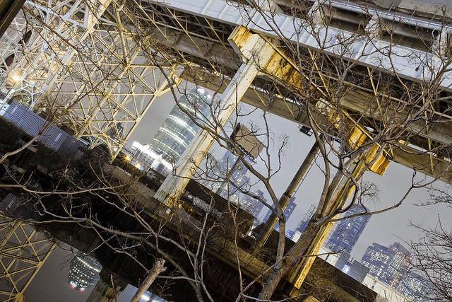
Over the years, one has spent a considerable amount of time along the canalized shorelines of Dutch Kills. There’s a mega structure crossing it, the truss carrying the Long Island Expressway some one hundred and six feet over the water.
November 15th of 1940 is when this section of the LIE opened, and the “high speed road” carries vehicle traffic first to the Queens Midtown Tunnel and then into Manhattan.

– photo by Mitch Waxman
Looking to the north/west, the turning basin of Dutch Kills and the remains of the Degnon Terminal.
A turning basin is an engineered section of a waterway shaped to allow an articulated tugboat and barge egress to rotate and turn around. The Degnon Terminal offered ship to rail connections back in the early 20th century, and cargo could be loaded or unloaded onto a terminal railway or onto freight cars of the Long Island Railroad for delivery to extant points.

– photo by Mitch Waxman
On the east side of Dutch Kills, the FedEx people have a large shipping depot that squats squamously. A LEED certified facility, the FedEx property nevertheless logarithmically magnifies the number of trucks worming through traffic to LIC every day from Kennedy Airport.
Semi trucks carry FedEx cargo here from the airport, delivery vans carry it out to their end customers.

– photo by Mitch Waxman
When these shots were captured, the air was terribly still. Without any sort of atmospheric perturbence, the tepid currents of Dutch Kills’ fluids barely register as a ripple on the surface.
Last time I checked, the LIE carried about 90,000 vehicle trips a day in this section (called the Queens Midtown Expressway), which translates out to around 32 million vehicles annually. The drains on the LIE are not connected to the City’s sewer system and instead drain directly into Dutch Kills. At least there’s some current, I guess.

– photo by Mitch Waxman
My path next carried the camera south to Borden Avenue.
The street dates back to 1868, when it was built as a plank road through the swamps surrounding Dutch Kills. It got its name in a traditional fashion for the 19th century, named for where it was going. It used to be the pathway to the Borden Dairy farm up the hill in Maspeth, and was constructed to allow easy egress for fresh milk to travel to market in Manhattan and beyond.
“follow” me on Twitter- @newtownpentacle


