Posts Tagged ‘Long Island City’
accursed sorceror
It’s National Butterscotch Pudding Day, in these United States.

– photo by Mitch Waxman
My route on the Calvary Cemetery walk I conducted a couple of weeks ago enters the Cemetery on the Review Avenue side, by the old Penny Bridge. As mentioned in yesterday’s post, my habit is to walk out the route of a walking tour a couple of days prior to committing it, so one headed over to First Calvary in the name of doing just that.
I had badly misjudged my clothing choices, in terms of dressing for the weather when leaving the house, as it had gotten quite warm and humid as I was walking from Astoria to Blissville and one was clothed for fall rather than summer. Not wanting to walk down the sun choked sidewalk on Review Avenue in such uncomfortable clime, I instead entered the polyandrion via the Greenpoint Avenue gates and cut across the property in the direction of the Penny Bridge entrance – hoping that the cover of the tree canopies would provide some surcease from the radiations of the burning thermonuclear eye of God itself. This sojourn provided me with few trees unfortunately. An interval in a distaff section of the place that I seldom visit occurred instead. As always, the needs of the camera outweigh the needs of the man, so I toughed it out and suffered through the heat. As an aside, my headphones were in my ears, and I was participating in a group call with the environmental community of Newtown Creek and the Federal Environmental Protection Agency regarding the ongoing superfund process. For those of you reading this who were on the call, this is what I was doing while we were talking.
The shot above looks out at the intersection of Greenpoint Avenue/Review Avenue/Vandam Street at the off ramp of the Greenpoint Avenue Bridge, shot from the heights of Calvary’s walls, for the vulgarly curious.
I always have an ulterior motive, it seems, or at the very least – I’m a champion level multitasker.

– photo by Mitch Waxman
My ulterior motive this particular day involved gathering a few last shots of the 1939 Koscisuzcko Bridge, whose final destruction is imminent. Any day now, it’s going to be “energetically demolished” with explosive charges. I’m not spilling any beans when I say it was meant to be this Sunday – the 24th (the commander of the 94th precinct in Greenpoint took care of that one), but that date has now been moved back once again. It’s not for me to say when the date is, but it won’t be long now, I may or may not have been told.
The path carried me along the high masonry wall of First Calvary, and along the southern border of the place.

– photo by Mitch Waxman
Along said path, I encountered this tree. Like all the trees which throw their roots down into the loam at Calvary, I can assure you that it’s fed by a morbid nutrition. The rather thorough cocooning of its branches and leaves though, filled me with an existential dread of the sort only condemned men would know.
I’m all ‘effed up.

– photo by Mitch Waxman
There seemed to be some of sort of insect civilization at work within the webbing. If the old adage that “you are what you eat” holds true, the reality of this hidden hive lurking in a tree rooted in the nitre choked soil of Calvary Cemetery – found in a place called Blissville along the fabulous Newtown Creek – one would not like to inquire too deeply into the life cycles of these organisms.
Conversely, I want to know EVERYTHING about the little buggers.

– photo by Mitch Waxman
One took a wide berth around this tree, lest its inhabitants center their interest upon a humble narrator.
You can’t be too careful, I always say, around the tomb legions.

– photo by Mitch Waxman
My path continued along the high masonry wall of First Calvary, towards the Penny Bridge gates and the Alsop Cemetery, which was ancient when the Dutch lost regency of this land to the British. By this point, my error in judgement regarding garment choices and weather were dragging my energy down, it should mention. As my grandmother would have said – I was all f’shvitzed. Fatigue related to heat began to set in, and only one expression of resigned horror was able to escape my lips.
Upcoming Tours and events
The Insalubrious Valley of the Newtown Creek Walking Tour,
with Atlas Obscura – Saturday, September 23rd, 11 a.m. – 1:30 p.m.
Join us on the wrong side of the tracks for an exploration of the hidden industrial heartlands of Brooklyn and Queens, with Newtown Creek Alliance Historian Mitch Waxman – details here.
Exploring Long Island City, from Luxury Waterfront to Abandoned Factories Walking Tour,
with NY Adventure Club – Saturday, October 7th, 1 p.m. – 3 p.m.
Long Island City is a tale of two cities; one filled with glittering water-front skyscrapers and manicured parks, and the other, a highly active ground transportation & distribution zone vital to the New York economy — which will prevail? With Newtown Creek Alliance Historian Mitch Waxman – details here.
“follow” me on Twitter- @newtownpentacle
enough rumors
It’s National Cheeseburger Day, in these United States.

– photo by Mitch Waxman
My habit, when conducting a walking tour on any given Saturday or Sunday, is to rewalk the route a couple of days in advance of the actual event. The reason for this is twofold – first to scout any new or emergent obstacles along the path, second to reacquaint myself with all the little details. In the case of First Calvary Cemetery, which I conducted a tour of just last week, it’s about getting all the sight lines lined up. Everybody who comes to Calvary with me on one of these walks always comments about how I “find the needles in the haystack” so easily. Short answer is that I do, in fact, know the place like the back of my hand. Long answer is that I was just there a day or two ago and walked out the route to ensure that I don’t end up looking like a dope searching for the grave of Esther Ennis (the very first interment, which is marked by a tiny foot stone) in front of a group of people.
Accordingly, a couple of days before the tour, I trekked over to Blissville from Astoria to take a walk amongst the tomb legions. As always, the camera was dangling at my side.

– photo by Mitch Waxman
There’s a 24/7 line up of traffic on Greenpoint Avenue where drivers wait at a traffic light to enter the onramp for the Long Island Expressway, and of late two enterprising fellows have been working the lineup. The gentleman on the left is selling bottles of water and other consumable items to the passing motorists, whilst the fellow in the middle of the street is holding up a cardboard sign proclaiming his destitution and adjuring them to donate charitable contributions to help him weather an existential crisis.
There’s some kind of parable at work in the comparison between their two approaches at survival. Boot straps versus appealing to guilty compassion, that sort of thing.

– photo by Mitch Waxman
Whatever approach any of us have evolved at survival, however, is ultimately pointless and doomed to failure.
All roads lead to Calvary, as they used to say back in Manhattan’s Five Points during the 19th century “Gangs of New York” era. If you think about it, that’s kind of a relief. Whenever my pal Mattie the Vampire back here in Astoria discusses Constantinople, he gets a sad look in his watery yellow eyes, and I get the sense that immortality – or at least Mattie’s version of it – ain’t all that it’s cracked up to be.
Upcoming Tours and events
The Insalubrious Valley of the Newtown Creek Walking Tour,
with Atlas Obscura – Saturday, September 23rd, 11 a.m. – 1:30 p.m.
Join us on the wrong side of the tracks for an exploration of the hidden industrial heartlands of Brooklyn and Queens, with Newtown Creek Alliance Historian Mitch Waxman – details here.
Exploring Long Island City, from Luxury Waterfront to Abandoned Factories Walking Tour,
with NY Adventure Club – Saturday, October 7th, 1 p.m. – 3 p.m.
Long Island City is a tale of two cities; one filled with glittering water-front skyscrapers and manicured parks, and the other, a highly active ground transportation & distribution zone vital to the New York economy — which will prevail? With Newtown Creek Alliance Historian Mitch Waxman – details here.
“follow” me on Twitter- @newtownpentacle
deliberate effacement
It’s National Double Cheeseburger Day, in these United States.

– photo by Mitch Waxman
Often, it seems as if all of Western Queens is a “work zone,” and it’s impossible to go more than a few blocks without seeing the telltale “high visibility” orange vests and barriers of one work crew or another. The folks in the shot above work for a company called “Hecla,” and they were doing some sort of street work that involved setting down a large concrete pad into 48th avenue, adjoining a bus stop.
As a side note, I associate the word “Hecla” with a very active Icelandic stratovolcano (a volcanic ridge, actually, which rises nearly 5,000 feet high) which medieval Europeans believed to be the entrance to hell. The Icelandic spelling is actually “Hekla,” but both spellings are apparently used for this subarctic fire mountain. The most active part of the Hecla stratovolcano is a fiery fissure called “Heklugjá.” “Hekla Fell” is where witches are still meant to gather at Easter.

– photo by Mitch Waxman
Given that Queens sits nestled in a combination of elluvial deposits and post glacial rubble piled up around a “Y” shaped ridge of Manhattan schist and other hard rocks that form a very long island, we don’t have to worry too much about magma exploding out of the manhole covers anytime soon, but one thing I’ve learned over the nearly two decades I’ve lived hereabouts is to not take much for granted. You never know what’s going to happen next.
Would not be surprised one little bit – for instance – if a group of witches gathered at the corner of Greenpoint Avenue and 43rd street, pictured above, on Easter. Occult tradition states that between Good Friday and Easter Sunday, the throne of Heaven is empty and that the elder devil Satan is free to do his thing. People confuse Satan and Lucifer all the time, by the way, which annoys me.
As above, so below. Satan is the “adversary” to Yahweh the father (Old Testament), as Lucifer is to Jesus the son. The whole Holy Ghost trinity thing is what gives heaven’s armies their edge, and why Christians fear the coming of the antichrist, which will even the odds between the two sides.
But I digress.

– photo by Mitch Waxman
Personally, I think all of the construction Orange is pretty cool, visually. I wish that instead of the sapphire glass which will inevitably be clad around the tragically named – and branded – 5ptz residential luxury tower in LIC, they’d design in some nice orange motifs.
Orange reminds one of hell, and fire, and the consequence of embracing one or more of the seven deadly sins – greed, avarice, and so on. Christian scholar Jeffrey Burton Russell posits that the devil’s incarnation in the modern age isn’t the Bronze Age Satan, nor the medieval Lucifer – rather it’s either the lord of lust called Asmodeus or the demon God of greed called Mammon.
Upcoming Tours and events
The Insalubrious Valley of the Newtown Creek Walking Tour,
with Atlas Obscura – Saturday, September 23rd, 11 a.m. – 1:30 p.m.
Join us on the wrong side of the tracks for an exploration of the hidden industrial heartlands of Brooklyn and Queens, with Newtown Creek Alliance Historian Mitch Waxman – details here.
“follow” me on Twitter- @newtownpentacle
absent friends 2017
It’s National Hot Cross Bun Day, in these United States.

– photo by Mitch Waxman
Last night, our Lady of the Pentacle and myself headed down to the East River waterfront in pursuance of getting a few shots of the tribute in lights, an annual display commemorating the September 11th attacks.

– photo by Mitch Waxman
A NYC Ferry rolled through the shot while my shutter was wide open, and the happy accident presented above occurred.

– photo by Mitch Waxman
Never forget. Never Surrender.
Upcoming Tours and events
The Insalubrious Valley of the Newtown Creek Walking Tour,
with Atlas Obscura – Saturday, September 23rd, 11 a.m. – 1:30 p.m.
Join us on the wrong side of the tracks for an exploration of the hidden industrial heartlands of Brooklyn and Queens, with Newtown Creek Alliance Historian Mitch Waxman – details here.
“follow” me on Twitter- @newtownpentacle
increasingly rigid
It’s National Date-Nut Bread Day, in these United States.
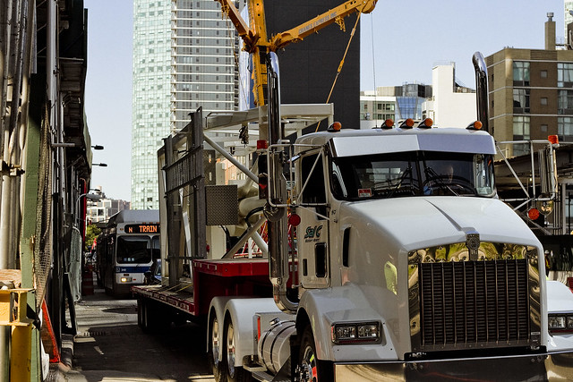
– photo by Mitch Waxman
Hunters Point is a section of Long Island City. Most modern people refer to it “as” Long Island City, but LIC – as in the “independent municipality of” – includes the neighborhoods of Astoria, Sunnyside, Blissville, Ravenswood, Dutch Kills, and Hunters Point as well. Hunters Point is pretty much defined as the zone sitting between Skillman Avenue to the east, the East River to the west, Queens Plaza to the north, and Newtown Creek to the south. The independent municipality of LIC’s old borders ran eastwards to what’s now the Kosciuszcko Bridge and Woodside Avenue to the east, Bowery Bay on the north, Newtown Creek on the south, and by the East River to the west.
The Dutch arrived in this peninsular area, sparsely populated by bands of the Lenape, back in the 1640’s. The first European land holder was a Dutch Priest named Dominie Everardus Bogardus, and back then LIC was referred to as “Dominie’s Hoek.” Bogardus, whom the historical record is not kind to, died in a shipwreck in 1647. Hunters Point, as defined above, came into the possession of a Dutch Sea Captain named Peter Praa, and the land stayed in his family until just before the American Revolution. At that time, the deed was in the hands of a Praa descendent named Anna Hunter. That’s why it’s called Hunters Point.
– photo by Mitch Waxman
Anna Hunter had three sons, and in the name of family unity and amity, her will stipulated that the land be sold off to avoid them fighting over the inheritance. By the time of the Civil War, the land had been divided into lots and sold off to a number of different concerns. The village, or town, of Hunters Point was a part of a county municipal organization called “Newtown” whose borders stretched all the way into modern day Nassau County. Newtown was a relict of the Dutch civilization’s “Nieuwtown,” whose function and borders were continued by the British and later the American governments long after the Dutch. The British first called it “Nieuwe Stad,” and at the time of the Revolution it was “Newtown.”
In the early 19th century, NYC was a ship building colossus. Manhattan shoreline properties along the East River were dearly held, and massively expensive to acquire. Ship yards, carpentry shops, iron foundries, coal yards, and rope factories were moving their operations over to Williamsburg and Greenpoint in Brooklyn and moving steadily north.
Industrial piers began to appear along the busy East River in Hunters Point, and along Newtown Creek. In 1848, the Roman Catholic Church bought the Alsop farm in Blissville in pursuance of creating Calvary Cemetery. Vernon Avenue was created and paved, and a plank road was built connecting to agricultural Blissville. The plank road was named for its destination, at the Borden Dairy Farms in Maspeth, and it was erected out of the swampy lowlands adjoining the Newtown Creek in 1868.
In the 1860’s, railroad tracks were connected to the east river by a company that would soon call itself the Long Island Railroad. Industrialization got its footing in LIC, due to easy access to the railroad AND to the water. Speculators began buying up dismal tidal swamps, filling them in with garbage, dead animals, human waste, and other fill materials. The Borden Plank road was paved and became Borden Avenue.
In 1870, a group of ambitious and notorious politicians, railroad operatives, and robber barons were successful in their bid to secede from agricultural Newtown and the independent municipality of Long Island City was formed.
The first land grab in what we call Queens got underway.
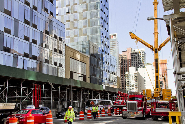
– photo by Mitch Waxman
Over twenty nine years of glorious misrule and an infamously corrupt political environment, LIC grew into the workshop of America. Enormous factories opened, and the waterfront in Hunters Point became a maritime industrial center, with nearly all of the freight traffic carried by the Long Island Railroad moving through it. Sugar factories, steel mills, oil refineries, chemical plants, fat renderers, pickle factories, fertilizer mills, manure yards, dead animal wharves – you name it – it was here. The City of Greater New York consolidated itself in 1898, incorporating LIC into its now familiar five boroughs, all under the guidance of the notorious Tammany Hall leader Richard Croker. Manhattan began to convert its industrial shorelines over to residential districts, and started to export all of its dirty industries to its new holdings in Brooklyn, and to the newly named Queens.
Manhattan began a process which modernity would describe as gentrification, displacing the working class poor and encouraging them to move to newly constructed row housing in the “outer boroughs.” The row housing was constructed by political insiders like Cord Meyer. Mr. Meyer and his fellow real estate speculators like Michael Degnon had inside information from the politicians of Tammany Hall about where the roads and subways would be created and they began to buy up agricultural properties all over the former Newtown. Entire neighborhoods were created, seemingly overnight. Call it Elmhurst? That’s Cord Meyer Sr. you’re echoing.
In 1909, the Queensboro Bridge was opened for business. Hell Gate Bridge opened in 1917. The Sunnyside Yards opened in 1919, made possible by the Pennsylvania Railroad company, which also created the East River tunnels that LIRR and Amtrak use to this day. The subways made gradual appearances in the first, second, and third decades of the twentieth century. Notably, what we call the 7 line – which already had three stops connecting Hunters Point to Manhattan as of 1915 – opened the Corona extension in April of 1917.
The second land grab in Queens got underway.
– photo by Mitch Waxman
Manhattan’s infamous tenement slums began to empty, and the working class hordes of immigrants began to populate into the new residential neighborhoods in Brooklyn, Queens, and the Bronx. Hunters Point had a relatively small residential population, which was centered not in the industrial zone but rather in the neighborhoods surrounding it. Sunnyside Gardens was created as an early example of “affordable housing” and as a planned community in the late 1920’s, in response to the multi story apartment houses which began to rise in Dutch Kills and Astoria along the new subway lines. At the same time, Robert Moses had appeared on the scene, along with his Triborough Bridge project.
Mighty Triborough opened in 1936, and the highways that feed into it like the Grand Central Parkway soon followed. The age of the automobile arrived in Queens, which allowed for heavy residential construction in previously rural areas. Forest Hills and Rego Park, Bayside and Douglaston, even Jamaica were now connected to Manhattan. For those who supported Mr. Moses, the routes and off ramps of the new high speed roads were revealed. In 1940, the Long Island Expressway and Queens Midtown Tunnel appeared in Hunters Point, which effectively blighted and cut the ancient community in half.
The third land grab in Queens got underway.
– photo by Mitch Waxman
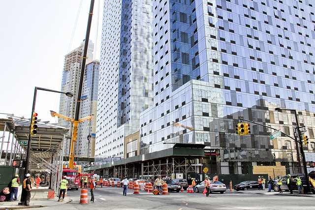
After the Second World War, things began to change in Hunters Point. New York City began a process of de industrialization that wouldn’t become truly apparent until the middle 1960’s. Heavy industry began migrating to the American south and west, where industrial campuses of collossal size could be constructed. The political establishment of NYC, still married to the industrial labor unions, realized that they had to do something to try and protect their base. In 1961, The Department of City planning (which was controlled by Robert Moses) issued a decree that Hunters Point was now an “M1” zone – the land was reserved exclusively for heavy manufacturing use only.
For the homeowners and residential community in Hunters Point (and in Dutch Kills as well), what that meant was that no bank would advance them credit for a mortgage, or loan them money for renovation projects on existing residential properties. The fly in the ointment this time around, however, was that because of a general decline of manufacturing activity in the entire Northeastern United States the industrial base was seeking to vacate New York City. By the 1970’s, you couldn’t give the land away in Hunters Point. The residential community dwindled, but narrow strips of habitation persisted. The political establishment was heavily involved in “urban renewal” projects, and floods of federal money enabled developers like the Tishmans, Trumps, and Lefraks to build massive commercial and housing projects in Manhattan, Brooklyn, and Queens. This is when the big landlords and the politicians first really got to know each other, and the current alliance between big real estate and the political establishment of Manhattan was cemented.
It’s also when, in an attempt to revive a moribund local economy, the City began giving away land to developers. This process really kicked into gear in the 1980’s, under Mayor Koch.
– photo by Mitch Waxman
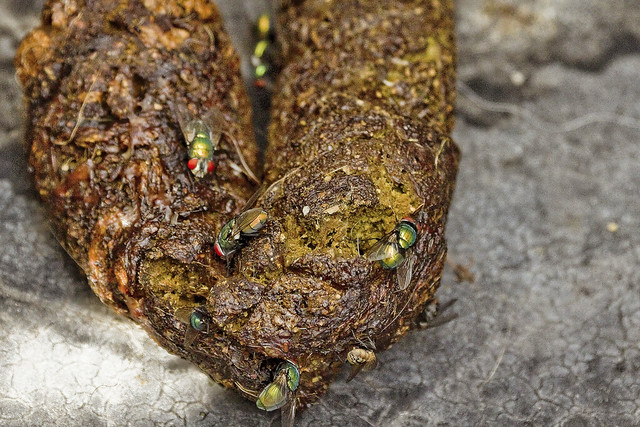
In 1981, NYC City Planning rechristened Hunters Point as a “mixed use district.” The first large scale development that occurred after this was the Citigroup tower, which opened in 1993, a 53 story structure which was built on land formerly occupied by a hospital. In 1995, 2001, and again in 2004, City Planning opened up zoning restrictions on height in LIC – particularly along the Hunters Point waterfront. As restrictions were loosened, and residential corridors were created, there was some construction activity but it was a lot of smoke with very little flame. The New York Times and other cheerleaders for the real estate interests began to refer to Hunters Point as “LIC” and started calling it “the next big thing.” (City planning is currently working on further loosenings of zoning in Hunters Point, and preparing the “LIC Core” rezoning which will make it possible to build high density residential towers as far east as Steinway Street, along Northern Blvd.) The currently underway Hunters Point South development is billed as the largest “affordable” housing project in the United States, but it’s not affordable by many of the current residents of LIC.
The so called “Brooklyn miracle” happened instead. From the post industrial waterfront of Williamsburg all the way south to what is now referred to as “DUMBO,” high density towers rose and created the new “Gold Coast” of Long Island. In the last decade, financial speculators and globalist investors have driven the price of Brooklyn real estate so high that financiers have begun to focus in on Hunters Point and Astoria instead, looking for a “good buy.”
The fourth land grab in Queens is underway, as you read this.
– photo by Mitch Waxman
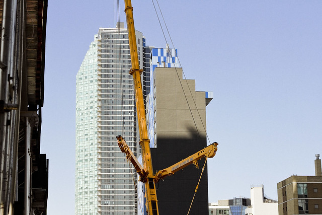
All of this development has avoided upgrading the municipal infrastructure which the new population would require – cops, fire department, sewerage, hospitals, schools. If you’re walking through one of the glorious new waterfront parks in Hunters Point, and you suddenly grab at your chest, where the FDNY ambulance will take you is either Bellevue Hospital in Manhattan, the Mount Sinai hospital on Crescent street in Astoria, or out to Elmhurst hospital. FDNY’s fire fighting apparatus in western Queens was designed for industrial fires, and the 108th precinct is housed in a tiny 19th century building which still has horse stables. The sewer plant servicing this gargantuan residential population was opened by Fiorella LaGuardia in 1936. Our transit needs far outweigh current capability. There are not enough school desks. Don’t get me started on the environmental legacy of all that industry which used to be here. The buildings being erected in the photos in today’s posts are on the site of a former chemical factory in Queens Plaza, for instance.
Simply put, “gentrification” is nothing new in Western Queens and it’s been going on since at least the Civil War. The “G bomb” has already been dropped, and it has gone off. A looming infrastructure crisis is just beginning.
Upcoming Tours and events
Calvary Cemetery Walking Tour, with Atlas Obscura – Saturday, September 9th, 11 a.m. – 1 p.m.
Explore NYC history, hidden inside sculptural monuments and mafioso grave sites, as you take in iconic city views on this walking tour, with Newtown Creek Alliance Historian Mitch Waxman – details here.
“follow” me on Twitter- @newtownpentacle


 The Newtown Pentacle