Posts Tagged ‘Maspeth’
phenomenal boldness
It’s National Peaches ‘N’ Cream Day, in these United States.

– photo by Mitch Waxman
As described yesterday, the Open House NY organization created an event with the NYC Department of Sanitation at the latter’s enormous “General Repair Shop” on 58th street, right on the hazy border between Woodside and Maspeth. The shop handles vehicle maintenance for DSNY and for several other city agencies, as well as building maintenance for the various Sanitation facilities scattered throughout the 5 boroughs.

– photo by Mitch Waxman
It seems that the City’s snow removal equipment takes quite a beating during the winter, and part of the job for the working stiffs here is to recondition and repair it.

– photo by Mitch Waxman
The amount and kinds of equipment on display in the various shop sections was staggering, which included the chassis straightener pictured above. A couple of the folks on the tour were mechanics, and they looked like kids in a candy store.

– photo by Mitch Waxman
There are multiple floors in the General Repair Shop building, which was erected in 1964.
Everything I’ve shown you so far was from one of the upper floors, which is accessed by the vehicular ramps found on 58th street. Downstairs, we visited several smaller shops, including this one which was dedicated to woodworking.

– photo by Mitch Waxman
The section pictured above is a sheet metal, and general metal working, shop.

– photo by Mitch Waxman
An abundance of inventory was available, and I can’t imagine the logistic difficulties of keeping the army of labor employed in this giant facility armed with everything they’d need to do their jobs.

– photo by Mitch Waxman
This lathe caught my eye, if for no other reason than its scale. Apparently, they can fabricate axles for trucks with this gizmo.

– photo by Mitch Waxman
The sort of esoteric industrial age equipment found hereabouts was incredible, and the sort of stuff you might be able to find on a WW2 era Navy ship. That’s a “turret lathe” if you’re curious.
– photo by Mitch Waxman
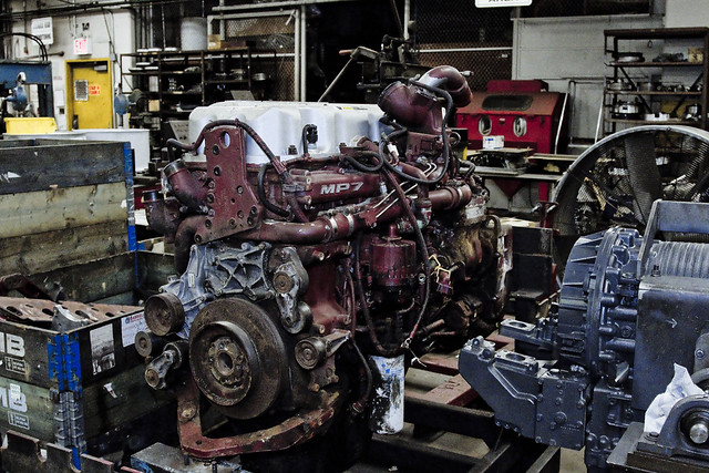
An engine mechanic’s shop was visited, where truck engines were being broken down and rebuilt.

– photo by Mitch Waxman
It goes without mentioning that the Sanitation Department keeps a clean house.
Despite all of this material, and its occupation, the place was clean as a whistle. We were told that the “Commish” had been there earlier in the day, so maybe that’s why, but in my experience the folks who handle our collective mess are generally “obsessive compulsive” about staying clean. Never known an off duty Sanitation worker who wasn’t sweet smelling and perfectly groomed.

– photo by Mitch Waxman
Couldn’t resist a close up on those gear heads.

– photo by Mitch Waxman
The Open House NY tour lasted a couple of hours, and our last stop was at a “clean room” with a vehicle emissions testing lab. An MTA Bus was secured in place by stout chains, and positioned over steel cylinders set into the flooring.

– photo by Mitch Waxman
The bus was actuated, and its engine roared into action. If the wheels had been able to gain purchase, it would have likely been moving at thirty to forty miles an hour.

– photo by Mitch Waxman
All sorts of scientific “tackle” had been attached to its exhaust system, which gathered its emissions and ran it through filtration materials to test what the thing breathes out.

– photo by Mitch Waxman
The OHNY tour ended, and we tourists were released back into the darkness of industrial Maspeth. It was time for DSNY to get back to work. Me too, and I had to evacuate the area before the night gaunts and ghasts at the nearby Mt. Zion and Third Calvary Cemeteries realized that I was in the neighborhood after the burning thermonuclear eye of God itself had dipped behind the Shining City of Manhattan.
Upcoming Tours and events
Newtown Creek, Greenpoint to Hunters Point, walking tour with NYCH2O – June 29th, 7-9 p.m..
Experience and learn the history of the western side of Newtown Creek, as well as the East River Parks Hunters Point with NCA Historian Mitch Waxman – details here.
“follow” me on Twitter- @newtownpentacle
damaged youths
It’s National Banana Creme Pie Day, in these United States.

– photo by Mitch Waxman
Sorry gang, another short post greets you today. It’s been one thing after another around HQ, with first a minor injury and now a nasty head cold… a humble narrator just can’t seem to win for losing during the last couple of weeks. A post of some length and profundity will arrive in your inboxes tomorrow, but for today you’ll have to be satisfied with contemplating the weirdly colored waters of the fabled Newtown Creek.
“follow” me on Twitter- @newtownpentacle
awestruck party
It’s Fred Korematsu Day of Civil Liberties and the Constitution, in the states of California and Virginia.

– photo by Mitch Waxman
Throw your hands in the air, like you just don’t care.
That’s what most of the residents of Queens do when the subject of Newtown Creek comes up. That’s Brooklyn’s problem, not ours. Then I tell them about how the decisions affecting Queens are being made by the “transplant hipsters of Brooklyn” whom they revile, and that whereas Brooklyn is going to be getting new parks and other municipal goodies out of this Superfund thing… Queens is largely being left out of the equation. That riles the north shore peeps up a bit, but they still don’t get involved. Since the people of Queens are disinterested, so is elected officialdom.
Fish, or cut bait. If neither, then get out of the way.

– photo by Mitch Waxman
I’ve always chalked it up to topography. If you’re in East Williamsburg, or Greenpoint, Newtown Creek is part of your life whenever you open your window. The Brooklyn, or south side, of the Newtown Creek hosts residential properties which are literally across the street from the bulkheads. The Queens, or north side, communities generally have a buffer zone of industrial buildings and highways separating them from the water. Newtown Creek is a half mile from residential Sunnyside.
In Queens, they complain about truck traffic, hipsters, and gentrification.

– photo by Mitch Waxman
We are at a critical juncture, Newtown Creek wise. The science from all parties involved in the cleanup is beginning to be compiled. The DEP, in particular, is about to lock itself into a quarter century long program of construction and strategic maneuvering. Around a year or so from now, the oil and gas people will be doing the same and committing to a strategic course.
Ultimately, EPA will be doing the same thing and deciding on their course of action, but given the current political crisis in the Federal Government there is no real day to day guarantee that there will be an Environmental Protection Agency which resembles the current one.
What do clean and accessible waterways mean to President Trump and Steve Bannon?

– photo by Mitch Waxman
There is going to be a meeting, the latest of many, of the Newtown Creek Community Advisory Group (CAG) on the first of February. If the shot above looks good to you, and you’d like to see more of the same – don’t come. If you care about not having a billion and a half gallons of raw sewage a year spilling onto mounds of poisonous and century old industrial waste, do come. Pipe up, we need voices and perspectives from outside the echo chamber.
Details on the meeting – time, place, etc. – can be accessed at this link. We could use some Queensican bodies in the room.

– photo by Mitch Waxman
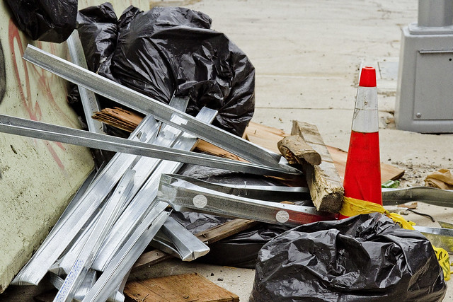
The shots in today’s post were gathered on the eastern side of the Newtown Creek, in Ridgewood and Maspeth. The environmental conditions in these industrial buffer zones are off the charts bad. You don’t have to look far to find dead birds, rats, all sorts of unlucky critters who innocently wandered in here. It wasn’t the Creek that killed them, it was the hundreds of heavy trucks.
As a note to Maspeth and Ridgewood residents – this is where the trucking you complain about comes from.

– photo by Mitch Waxman
There’s a vision of what the future can hold for generations unborn that we have all been working for and towards. An industrial canal which also welcomes recreational boaters. An industrial canal which was the most significant job creation engine NYC has ever seen and which can be so again. A mixed use waterway in which business and the ecology operate hand in hand.
Ever heard of the “Maspeth heat island effect”? It’s the reason why your energy bills are so high during the summer, and it’s caused by the complete lack of green space in these industrial neighborhoods, which causes temperatures hereabouts to be ten or more degrees warmer during the summer than in surrounding communities. Is that Brooklyn’s problem? What about the trucks, or the garbage trains?

– photo by Mitch Waxman
This post is meant to scold, and compel. Get involved, whatever your point of view is. The political elites of our City will not care unless you care.
“follow” me on Twitter- @newtownpentacle
doglike lopers
The concrete devastations, in today’s post.
– photo by Mitch Waxman
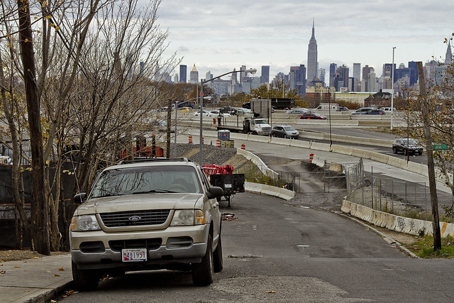
As I’ve mentioned several times recently, an effort is under way to revisit a number of spots which I’ve not set foot in for a while. When I first began wandering around Newtown Creek and the neighborhoods surrounding it, a point was made to visit every single block, but in recent months and years, temporal exigency has caused one to travel along “efficient” routes to get from Point A (A as in Astoria) to Points B, C, and so on.
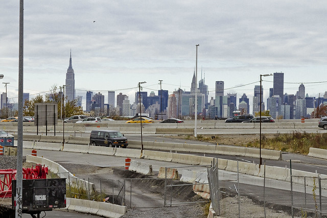
Accordingly, since I seem to have all the time in the world at the moment, I’m taking the road less travelled and revisiting a few locales which have been off my radar for a bit. To wit, pictured above is the view from 53rd avenue at the angle between Sunnyside and West Maspeth, looking west towards the BQE/LIE interchange.
– photo by Mitch Waxman
Prior to the installation of the two highways, roughly 75-80 years ago, this was a place where working people still lived. There was a neighborhood here, at the western border of Newtown’s Maspeth section and the eastern border of LIC’s Blissville subdivision. That’s when Robert Moses, with his New Meeker Avenue Bridge (Kosciuszko Bridge), and Brooklyn Queens Connecting highway, and Long Island Expressway came to town. Zoning decisions made in Manhattan during the post WW2 era rendered this area as “M1” – meaning it is designated for heavy manufacturing usage only.
Regardless of how the City people decided this land should be used, residential usage continued and there are still a small number of fairly ancient homes found peppered in amongst the warehouses, factories and construction oriented tower crane storage yards hereabouts.
– photo by Mitch Waxman
Funny thing is that this neighborhood is – observationally – one of the last places in NYC where you can “leave your front door open.” Saying that, when I use the term “concretized devastations of Western Queens” this section of industrial Maspeth is what I’m usually thinking of.
Most of the surviving homes I see in this neighborhood are typified by what you see above, wood frame row houses which date back to around 1900 or so. There’s a few older houses nearby which are a bit “grander” and speak to an earlier incarnation of this area. A few have disappeared “under my watch,” and have been replaced with bland cinder block warehouse or industrial buildings. Can’t really speak to “who” lives here, amongst the cranes and highways.
– photo by Mitch Waxman
All I can tell you is that they have an amazing view. This POV is on the rising bluff which once led to a prominent hill to the south called Berlin. The next highest prominence to the west would have been Laurel Hill, which Calvary Cemetery was carved into. This section of Maspeth was actually called “Berlin” until the First World War, when it was changed for obvious reasons to West Maspeth. To the east, the land’s declination rises until it meets a ridge which signals the beginning of the terminal moraine of Long Island nearby Mount Olivette and Lutheran Cemeteries. That ridge, which sports the same sort of rocky geology that lends its name to Ridgewood, is “real” land. Everything west of Laurel Hill is elluvial fill deposited by glacial process and sediment delivered by flooding from the Newtown Creek and East River.
Climate change and rising sea level wise, this likely will be the East River coastline someday.
– photo by Mitch Waxman
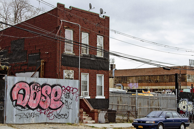
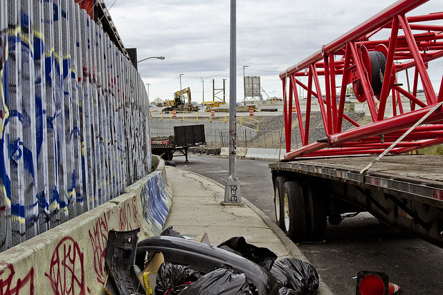
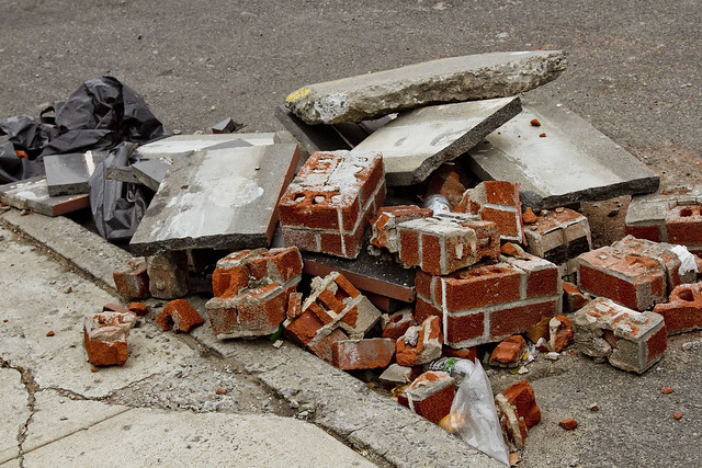
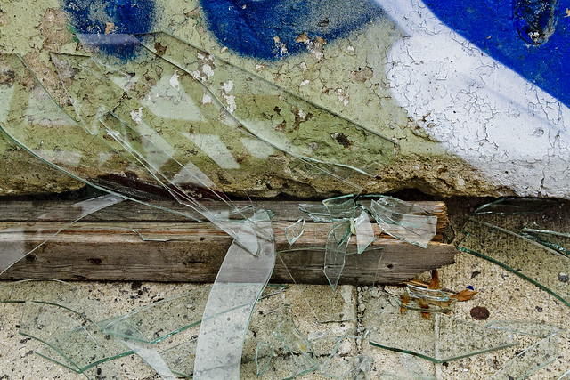
Looping around to the south, as the BQE and LIE interchange cut off egress east/west, an ad hoc art gallery is encountered. Illegal dumping, as I’ve often opined, is the unofficial nativist art form of the Borough of Queens. Combined with long fence lines that are covered in crude graffiti, you’ll encounter several installations along this route which offer intriguing intellectual postulates from the local artistic community.
Everything here is artisanal, incidentally.
– photo by Mitch Waxman
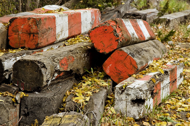
The reality of these installations are that this is simply a convenient place for a low level building contractor to dispose of construction debris without having to pay a dumping fee, but allow me to stay “high brow” in my assessments.
These dumpers really do seem to pay some attention to composition and color, however.
– photo by Mitch Waxman
53rd avenue terminates in a parabola which carries it into 43rd street, a colonial era pathway that once connected to Newtown Creek from Bowery Bay in Astoria. The road transected the properties of (amongst several other famous Dutch and English family names from the colonial era) the Riker’s, Skillman’s, and Alsops along its route, and according to the historic record – it was paved with crushed oyster shells. All that changed, of course, when first the Long Island Railroad and later Robert Moses came to town.
43rd street still exists in a fairly unbroken line from Astoria to Northern Blvd. and then crosses the Sunnyside Yards south into Sunnyside where it crosses Queens Blvd. and Greenpoint Avenue. When it crosses under the Long Island Expressway overpass, it resumes its pre municipal consolidation name – Laurel Hill Blvd.
– photo by Mitch Waxman
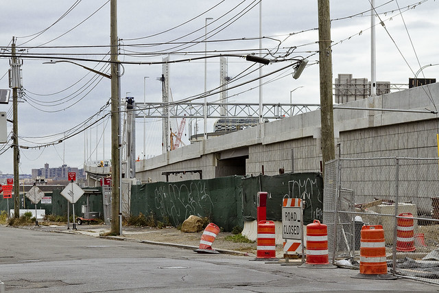
The “43rd street” you encounter in this section of industrial Maspeth, however, is disconnected from the northern section. The last homes on 43rd street went “bye-bye” just a few years ago, due to a smallish construction project going on in the area. With fewer people watching, and caring, the artisanal illegal dumping in this area has amplified.
– photo by Mitch Waxman
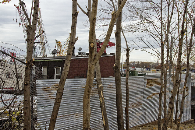
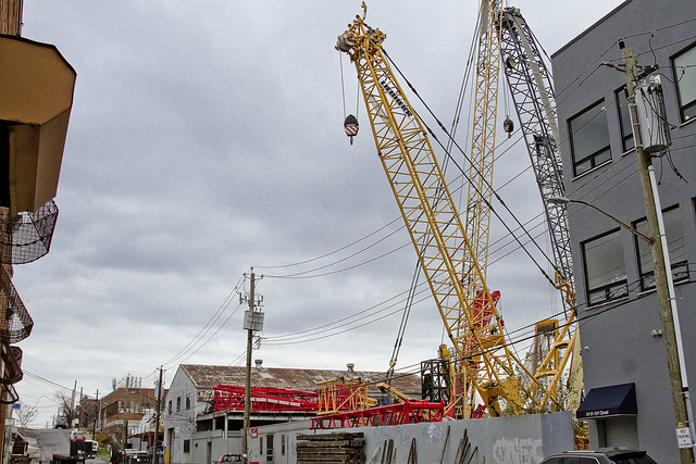
In the shot above, you can discern why I sometimes refer to this section as the “crane district.”
You can also plainly see the sharp rise in altitude hereabouts. This is, as mentioned, largely an industrial zone. There’s a lot of heavy industry going on. Warehouse operations, severely heavy truck traffic, waste transfer stations – Newtown Creek is just a few thousand feet to the south.
– photo by Mitch Waxman
Speaking of Newtown Creek, that smallish construction operation I mentioned earlier is the Kosciuszko Bridge replacement project, which crosses the waterway. If memory serves, that means that something like a half million vehicles a day pass through this pass between Berlin and Laurel Hills. The Kosciuszko Bridge was opened in 1939, and the Queens side approach was built into a shallow valley found between the two landforms, and over a lost tributary of Newtown Creek which was called “Wolf Creek.”
– photo by Mitch Waxman
That’s that, then. See you next week, at this – your Newtown Pentacle.
“follow” me on Twitter- @newtownpentacle
dark and shapely
Kosciuszko, Kosciuszko, men have named you…

– photo by Mitch Waxman
Over Thankgiving weekend, a visit was paid to the hazy borderlands of West Maspeth and Blissville. My goal was to check in on and shoot some photos on the progress the NYS DOT is making on Phase One of the Kosciuszko Bridge replacement project. Phase One involves the creation of half of the new span, the rerouting of the Brooklyn Queens Expressway, and the demolition of the 1939 era Kosciuszko Bridge, which overflies the lugubrious Newtown Creek.
Documenting this project has been a long standing project of mine – this 2012 post tells you everything you could want to know about Robert Moses, Fiorella LaGuardia, and the origins of the 1939 model Kosciuszko Bridge. Just before construction started, I swept through both the Brooklyn and Queens sides of Newtown Creek in the area I call “DUKBO” – Down Under the Kosciuszko Bridge Onramp. Here’s a 2014 post, and another, showing what things used to look like on the Brooklyn side, and one dating back to 2010, and from 2012 discussing the Queens side – this. Construction started, and this 2014 post offers a look at things. There’s shots from the water of Newtown Creek, in this June 2015 post, and in this September 2015 post, which shows the bridge support towers rising. Additionally, this post from March of 2016 detailed the action on the Queens side. Most recently, here’s one from May of 2016, and one from June of the same year. Finally, here’s one from August of 2016.

– photo by Mitch Waxman
The roadway now extends out over the water and is firmly shadowing the concrete devastations of Queens, nearly crossing the LIRR Lower Montauk tracks. The BQE Onramp also seems to be coming along, and I suspect that the DOT’s contractors will be joining the bridge span to the Queens side approaches pretty soon.

– photo by Mitch Waxman
Speaking of the BQE Onramp, there it is. In the foreground is one of the structural steel sections which will be joined to the span and support the road surface. Not pictured are the “panels” of the road surface, which arrived a couple of days later and which were noticed during a subsequent and unrelated visit to the area.

– photo by Mitch Waxman
In the shot above, you can see how the sections are attached. This is a cable stay bridge, of course. The roadway above will carry four lanes of two way traffic, but it’s just half of the new bridge. When the western half of the project is complete, there will be four lanes in each direction, and there’s also going to be a bicycle and pedestrian path.
That’s awesome. Cannot wait to shoot from up there.

– photo by Mitch Waxman
The new bridge, as I’ve been mentioning for several years at this point, is going to be quite a bit lower than the 1939 model. That’s going to bring noise issues to Maspeth and Blissville, I fear, but let’s see what DOT has planned.

– photo by Mitch Waxman
The NYS DOT is currently wondering what to do with the areas on both sides of the Creek which these columns rise from. There’s talk of public space and treating the two spots in the manner of a park or playground.
– photo by Mitch Waxman
Further back in Queens, to the north actually, the approaches to the new bridge seem to be ready for business. I haven’t managed to get up there yet, but cross your fingers, maybe I can talk the DOT folks into a walk through soon.

– photo by Mitch Waxman
Given the fantastic sort of luck for which I’m distinguished, just as I started back for home (cutting through Calvary Cemetery) the misty murk occluding the burning thermonuclear eye of God itself began to break up, allowing the sky to turn blue and light to suffuse. I turned around and grabbed one last shot, while cursing.
“follow” me on Twitter- @newtownpentacle


