Posts Tagged ‘photowalk’
dark figures
If only I could be laconic, if.
– photo by Mitch Waxman
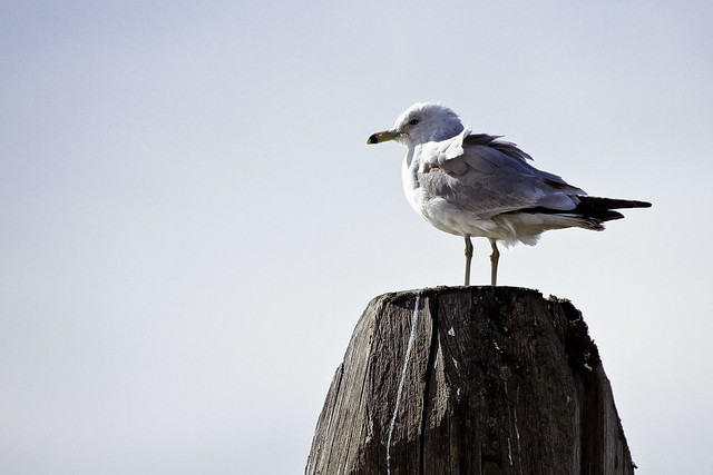
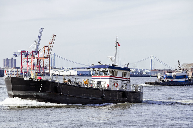
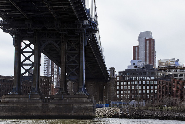
Sunday last, I conducted a tour for the NY Transit Museum onboard an NYC Ferry. The narrative was governed by the history of ferries in NYC, with a general historical overlay of the East River corridor. There’s a lot of information to pass on, and I will admit that it’s a bit of struggle to fit it all in. The tour left from Pier 11 in Manhattan, and we debarked the boat in LIC. Given that it’s a transit museum group, the last third of the tour focuses in on the former ferry services of the Long Island Railroad offered out of Hunters Point and then I take the group a few blocks into LIC. I can usually produce a LIRR engine sitting on a sidetrack thereabouts, and there’s always the Sunnyside Yards to talk about as well.
It was really, really cold for April last Sunday, in the 30’s when I left HQ.
– photo by Mitch Waxman
This is the second time I’ve narrated this particular tour, and hopefully will be presenting it again in the near future. Saying that, now that it’s been spoken aloud a few times, I’ve got some rewriting to do in the name of brevity and clarity. It’s so easy to bog down in historical minutia when discussing the East River, you have to be careful when narrating lest you lose the audience’s attention in a swirl of details. I never structure what I’m going to say as a dry recitation of facts and dates, which is the worst possible way to relate historical data, in my view. It’s a story, so tell it like a story, with a beginning/middle/end.
The cool thing about the Transit Museum is that they outfit me with a little closed circuit radio microphone and all the tour participants get these little radio headsets, so I don’t need to yell the whole time. That took a bit of adjustment time for me, as I’m used to using a booming voice and certain style of pronunciation on tours. Speaking into a mike is more a “radio situation” where you want to get all mellifluous in terms of vocalizations.
– photo by Mitch Waxman
Suffice to say that shortly after the Civil War there were as many as 21 seperate “official” ferry lines crossing back and forth between Brooklyn and Queens and Manhattan. Like a lot of 19th century industries, a politically connected monopoly emerged out of a company founded by Livingstone and Fulton which made regulation and inspection by Government officialdom go away, creating a lassez faire system whose excesses eventually led to the General Slocum disaster in 1915 1904 which made the idea of getting on a ferry rather unpalatable to early 20th century New Yorkers in the same way that entering a giant office building in the years following 9/11 was an unsettling experience. The Coast Guard was put in charge of safety matters, and they began to enforce strict safety regulations and practices on the ferry industry.
Then came Robert Moses…
Upcoming Tours and Events
April 14 – Exploring Long Island City – with NY Adventure Club.
Long Island City is a tale of two cities; one filled with glittering water-front skyscrapers and manicured parks, and the other, a highly active ground transportation & distribution zone vital to the New York economy — which will prevail?
Tickets and more details here.
April 15- Newtown Creekathon – with Newtown Creek Alliance.
That grueling 13 and change mile death march through the bowels of New York City known as the “Newtown Creekathon” will be held on that day, and I’ll be leading the charge as we hit every little corner and section of the waterway. This will be quite an undertaking, last year half the crowd tagged out before we hit the half way point. Have you got what it takes the walk the enitre Newtown Creek?
Click here to reserve a spot on the Creekathon.
“follow” me on Twitter- @newtownpentacle
burns best
Visiting one of the seats of empire, in today’s post.

– photo by Mitch Waxman
Long have my eyes wished to look upon this place, found in Lower Manhattan at Bowling Green nearby Battery Park, and literally across the street from that charging bull statue which is meant to represent capitalism. You can put up all the bronze monuments you want to capitalism that you’d like to, but nobody – and I mean nobody – can hold a candle to what “the man” built at 26 Broadway nearby “de Waalstraat.” This was the center of the American Imperium, ultimately. If you want to answer the question Americans were asking directly after the attacks of Septmber 11th, 2001 – “Why do they hate us?” – you can start weaving the answer to them right here at 26 Broadway.
As a note, a long time before this 31 story office building’s opening in 1928, 26 Broadway was Alexander Hamilton’s home address.

– photo by Mitch Waxman
Like the entity which inhabited it, the building is an agglutination which solidified and agglutinated over time and was built by many hands.
The original building at 26 Broadway was ten stories tall and went up in 1885. It was expanded in 1895, and then again in 1921 (that construction took 7 years, finishing in 1928) which resulted in its current form. The original structure is contained somewhere within the 1928 version, which was the tallest building in Lower Manhattan when it was finished. 26 Broadway is crowned by a pyramid shaped structure that was once illuminated, meant to act as a beacon for ships entering New York Harbor, and said pyramid was modeled after the Mausoleum of Maussollos in the City of Halicarnassus – part of the 4th century b.c. Achaemenid Empire in modern day Turkey. “Maussollos” is where modernity derives the word mausoleum from, incidentally.
The master of the early modern world had moved his organization here to Bowling Green back in 1885, from Cleveland.

– photo by Mitch Waxman
We live in an era defined by the fact that he once walked amongst us. We live in an era during which the corporate leader is exalted as a princeps, and ruthless business tactics are celebrated. This was not so when he was born in 1839. In his lifetime, he was viewed as the epitome of American villainy. He is the model for Mr. Burns from the Simpsons cartoon, Mr. Potter from Frank Capra’s “it’s a wonderful life,” and Lex Luthor from the Superman mythos. His empire made him the richest person in recorded history, wealthier than all the kings and queens of England, the Pharoahs of Egypt, and all the Caesars of Rome – put together. Only Augustus Caesar enjoyed personal wealth and power that began to approach his. His instrument – “the organization” as he called it – controlled better than 90% of American petroleum production, and 26 Broadway was his headquarters.
This is the former home and HQ of the Standard Oil Company, and it’s master was John D. Rockefeller.

– photo by Mitch Waxman
One normally eschews visiting this section of Manhattan unless it’s absolutely necessary. A meeting I was invited to was being held “nearby Bowling Green,” as I was told. Once I consented to attend, and was then told the address where the gathering would be occurring, a broad smile broke out across my normally sullen and sunken countenance.
Esso, as Standard Oil’s New Jersey arm became known in the early 20th century – it’s Exxon now – was headquartered here until 1946. Greenpoint’s Mobil, the New York operation, was similarly managed out of the Standard Oil Building at 26 Broadway until 1956.

– photo by Mitch Waxman
The views from 26 Broadway are exactly what one would expect in terms of being spectacular.
The crowded warrens of the lesser corporate towers fill the streets abundantly, and humanity is fairly removed from the equation, reduced to the status of crawling insects from this perpective. You see a few survivors of the Beaux Arts era from up here – the old Customs House (modern day Museum of the American Indian) pictured in the previous shot, the Cunard building, Castle Clinton over in Battery Park. The most important building in this area, saving the actual Stock Exchange – in terms of American History – is the Standard Oil building.

– photo by Mitch Waxman
In his lifetime, John D. Rockefeller was reviled. He was, personally, the “one percent.” A culture which celebrated the self made man nevertheless saw this self made man as a monster, despite his best efforts to demonstrate his humanity and Christian virtues. In his later life, seeking to salvage the family name from infamy, Rockefeller and his sons began a career of philanthropy which familial descendants continue to this day. Standard Oil was notoriously ruthless in the continental territories of the United States, but it’s when you look overseas that the true scope and infamy of their ambitions become clear. The company’s agents, operating in the smoking ruins of the Ottoman Empire after the First World War, began troublesome relationships with the Sheiks and Mullahs of the Arabian Penninsula (along with British Petroleum and Royal Dutch Shell) whose consequences continue to bedevil the American Imperium to this day.
Why hit the World Trade Center? It was the personal project of John D. Rockefeller’s grandson David. Memory is held long in the near east, and revenge is a dish best served cold.
Upcoming Tours and Events
April 14 – Exploring Long Island City – with NY Adventure Club.
Long Island City is a tale of two cities; one filled with glittering water-front skyscrapers and manicured parks, and the other, a highly active ground transportation & distribution zone vital to the New York economy — which will prevail?
Tickets and more details here.
April 15- Newtown Creekathon – with Newtown Creek Alliance.
That grueling 13 and change mile death march through the bowels of New York City known as the “Newtown Creekathon” will be held on that day, and I’ll be leading the charge as we hit every little corner and section of the waterway. This will be quite an undertaking, last year half the crowd tagged out before we hit the half way point. Have you got what it takes the walk the enitre Newtown Creek?
Click here to reserve a spot on the Creekathon.
“follow” me on Twitter- @newtownpentacle
muffled oaths
More Astoria night time action, in today’s post.

– photo by Mitch Waxman
An expressway “cloverleaf exchange” between the Brooklyn Queens Expressway, the Grand Central Parkway, and the local street grid is found on Astoria Blvd. in the high 40’s and 50’s blocks A small industrial zone exists thereabouts, which is quite a busy place during working hours. At night, it’s a ghost town inhabited by rats, cats, and me.
Also, the one guy on a delivery bike who rode through the shot while the shutter was open.

– photo by Mitch Waxman
I find these kinds of structures fascinating, there’s something about the curving steel and concrete which are lit by harsh sodium fixtures which I just can’t get enough of. The cool coloration of the City’s new LED street lamps provide for a very interesting color contrast, to my eye.

– photo by Mitch Waxman
A point of pride for me is knowing where to find hidden byways like the stairs pictured above, which carry you over and through the tangle of high speed roads from one sidewalk plateau to another.

– photo by Mitch Waxman
Said plateau is pictured in full above, roughly a full story of elevation from one level to the next.
As a kid growing up in south east Brooklyn, it was critical to know about places like this when fleeing random dangers or avoiding the attentions of law enforcement. My little group of idiots favored the usage of back yards and the jumping of divider fences, or just running across the roofs of connected homes and garages.

– photo by Mitch Waxman
As an addendum to a recent conversation I had on social media with a bicycle enthusiast, who was aghast at my assertion that bike lanes in Astoria are superfluous as bike riders use every paved surface available to them, the red light trail over the sidewalk comes from the tail light of an electric bike which zipped past me at speed on the sidewalk.

– photo by Mitch Waxman
This shot looks down on the street where the first shot was captured. That’s the Brooklyn Queens Expressway running in the trench.
Robert Moses was entirely specific when assigning nomenclature to his roads, and it all depended on where he was getting to the money from to build them. Parkways have planted dividers and shoulders – built with “parks” money. Expressways have more exits feeding into local streets than Highways – or High Speed Ways – do. Thruways have even fewer exits, which can be 5-10 miles away from each other. The latter three were generally built with slum clearance or urban renewal funds. There was a method to that man’s madness, I tell you.
Upcoming Tours and Events
April 14 – Exploring Long Island City – with NY Adventure Club.
Long Island City is a tale of two cities; one filled with glittering water-front skyscrapers and manicured parks, and the other, a highly active ground transportation & distribution zone vital to the New York economy — which will prevail?
Tickets and more details here.
April 15- Newtown Creekathon – with Newtown Creek Alliance.
That grueling 13 and change mile death march through the bowels of New York City known as the “Newtown Creekathon” will be held on that day, and I’ll be leading the charge as we hit every little corner and section of the waterway. This will be quite an undertaking, last year half the crowd tagged out before we hit the half way point. Have you got what it takes the walk the enitre Newtown Creek?
Click here to reserve a spot on the Creekathon.
“follow” me on Twitter- @newtownpentacle
being wakeful
At Astoria’s edge, in today’s post.

– photo by Mitch Waxman
Sunday last, a humble narrator checked the weather forecast and realized quickly that this was likely going to be a fairly ghastly week as far as weather goes, and so packed up the night kit for an evening walk. My destination was not too far from HQ, a pedestrian bridge over the Grand Central Parkway which also overlooks St. Michael’s cemetery.
The shot above looks eastwards from the pedestrian bridge.

– photo by Mitch Waxman
That’s the pedestrian bridge pictured above. While I was shooting this, a bus discharged one of the families staying at the Westway Hotel homeless shelter on the other side of the parkway. They had a kid who couldn’t have been more than five who was absolutely fascinated by what I was doing, although mom and dad couldn’t have cared less that their kid was talking to strangers. Nice kid, I have to say, and I felt bad for him that his family was in the circumstance that they’re in. At least they landed in a shelter based in a neighborhood that has supermarkets and small businesses to find work in, unlike Blissville.
I wished them a happy Easter and got back to my business.

– photo by Mitch Waxman
As per usual, I was wearing the high visibility vest, before you ask.
There’s a sidewalk along the local access road alongside the highway (looking westwards above) which is scary as hell to walk down. The crash barriers stop on the other side of St. Michael’s driveway, and then you’re walking down an increasingly narrow sidewalk which in some places is no more than two feet in depth while traffic shoots right past you at speed. I did actually walk it the other night, which in retrospect was kind of a stupid move.

– photo by Mitch Waxman
Looking down on cemetery property, lit by street lamps and passing vehicle lights.
The last time I took a shot from this location, probably about five years ago, that grave with the disturbing subsidence and the two safety cones was in precisely the same condition as it is today.

– photo by Mitch Waxman
A bit of a longer shot looking south across a row of mausoleums at St. Michael’s. There’s a famous 20th century Mafia Don buried in one of those marble temples, as a note. The actual inspiration for “the Godfather” Vito Corleone, Frank Costello. In 1974, a rival named Carmine Gallante was alleged to have to have detonated explosives at Costello’s grave to settle an old score and announce his return to “the syndicate” after a long jail sentence.
Of course, there’s no such thing as the Mafia.

– photo by Mitch Waxman
Looking back towards the Grand Central, eastwards towards the East Elmhurst neighborhood.
The Grand Central is one of the arterial roads built by Robert Moses back in the 1930’s to guarantee high volume usage of the Triborough Bridge’s toll plazas. His engineers carved a trench through Astoria to carry the Grand Central, forever dividing the community into the Ditmars side on the north, and the Broadway side to the south.
Upcoming Tours and Events
April 14 – Exploring Long Island City – with NY Adventure Club.
Long Island City is a tale of two cities; one filled with glittering water-front skyscrapers and manicured parks, and the other, a highly active ground transportation & distribution zone vital to the New York economy — which will prevail?
Tickets and more details here.
April 15- Newtown Creekathon – with Newtown Creek Alliance.
That grueling 13 and change mile death march through the bowels of New York City known as the “Newtown Creekathon” will be held on that day, and I’ll be leading the charge as we hit every little corner and section of the waterway. This will be quite an undertaking, last year half the crowd tagged out before we hit the half way point. Have you got what it takes the walk the enitre Newtown Creek?
Click here to reserve a spot on the Creekathon.
“follow” me on Twitter- @newtownpentacle
odd inquiries
The Shining City.

– photo by Mitch Waxman
Last week, I had to attend a seasonal setup meeting with the Working Harbor Committee over on the west side of midtown Manhattan, followed by meeting up with Our Lady of the Pentacle at Penn Station when she returned from a business trip. That gave me about an hour’s interval to play around with, which I used to do a few long exposure shots.
Funny bit was, regarding the shot above, the coppers pulled up next to me and parked their car. I figured I was about to have a conversation about what I was taking pictures of when one of the cops apologized and asked if they were blocking my shot. I laughed and explained that they had provided a beautiful bit of framing for me and thanked them.

– photo by Mitch Waxman
It was a pretty foggy night, and in all actuality I was wishing that I was anywhere but in midtown Manhattan. Saying that, I really started to groove on the way that the masses of tourists motion blurred into greasy smears as the always crazy traffic you encounter in these parts zipped about. You work with what you’ve got, after all.
Also, given that I generally don’t spend much time around these parts at night, I was startled at the return of the army of derelicts and addicts doing drug business right out in the open, just as they used to in the bad old days. “Giuliani Time” is over, it seems. Within an hour spent between 42nd and 34th, I was able to scope out the network of customer finders, the drug runners, the junkies assigned to delivery duty, and even figure out who was holding the stash and cash.

– photo by Mitch Waxman
For one reason or another, noticing this sort of thing has always been a talent of mine. Maybe it’s just that I grew up in 1970’s and 80’s New York. Maybe it’s a shame I never joined the police. I would have made a lousy cop, as I’d be shooting people for minor infractions and being a general hardass about every little thing – the kind of cop that other cops hate.
I actually do shoot at people all the time, but it’s with a camera.
Upcoming Tours and Events
April 14 – Exploring Long Island City – with NY Adventure Club.
Long Island City is a tale of two cities; one filled with glittering water-front skyscrapers and manicured parks, and the other, a highly active ground transportation & distribution zone vital to the New York economy — which will prevail?
Tickets and more details here.
April 15- Newtown Creekathon – with Newtown Creek Alliance.
That grueling 13 and change mile death march through the bowels of New York City known as the “Newtown Creekathon” will be held on that day, and I’ll be leading the charge as we hit every little corner and section of the waterway. This will be quite an undertaking, last year half the crowd tagged out before we hit the half way point. Have you got what it takes the walk the enitre Newtown Creek?
Click here to reserve a spot on the Creekathon.
“follow” me on Twitter- @newtownpentacle


