Posts Tagged ‘Pittsburgh’
a day late and a dollar short
Monday

– photo by Mitch Waxman
One was forced into reaching into the recent archives for today’s post, due to a recently suffered stomach bug which derailed a humble narrator. It was one of those fever and chills with vomit and diarrhea ones, which is ever so pleasant to live through but reminds one of the larger human experience. Saying all that, I don’t have anything new to show you in today’s post, so I looked around for a few shots which I don’t think have made it into other posts.
The one above is from a neighborhood called Polish Hill, here in Pittsburgh.

– photo by Mitch Waxman
McKeesport is a community due east of Pittsburgh, and that’s where I was when a CSX freight train suddenly appeared.
Right now, I’m really missing the cushion of images which I’d built in NYC. When I had ‘nothing,’ there was always a subway post or some yada yada about Sunnyside Yards that a narrative could be conjured out of, but that was then and this is now. I’m just getting started here in Pittsburgh, and my resources are thin.

– photo by Mitch Waxman
I’m feeling a whole lot better at the time of this writing, what I’d describe as 50%. That’s a major improvement over the day before, which saw me regularly disappearing into the bedroom for three hour long naps during the daylight hours. I slept so much yesterday that my fingernails had visibly lengthened and needed a trim.
Back tomorrow with – probably- another archive post.
“follow” me on Twitter- @newtownpentacle
Buy a book!
“In the Shadows at Newtown Creek,” an 88 page softcover 8.5×11 magazine format photo book by Mitch Waxman, is now on sale at blurb.com for $30.
Fall Run Park
Wednesday
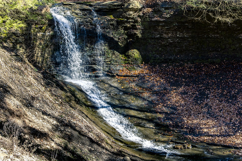
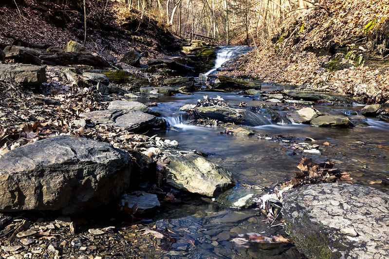
– photo by Mitch Waxman
Last weekend, Our Lady of the Pentacle and myself were desirous of taking advantage of yet another unseasonably warm day here in Pittsburgh, so we piled into the Mobile Oppression Platform and drove about twenty minutes to Fall Run Park in the Glenshaw section of Shaler Township.
It’s a ‘run’ rather than a creek or a stream, which is a waterway term I’d never encountered before moving to Pittsburgh. Apparently ‘run’ is synonymous with ‘creek,’ but the former is indicative of rapidly flowing water, whereas the latter indicates slow moving or meandering water. According to legal officialdom – “run of the river means a facility where there is a continuous discharge of water without storage and release of water.”
There’s also a ‘riffle’ to consider, but there you go. There’s a big bunch of runs found in the Pittsburgh area. Has to do with the topology.
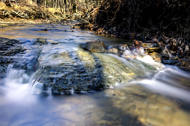
– photo by Mitch Waxman
Seldom was the water more than a few inches deep, but it was shooting down hill at a good clip. The park was pretty well attended, and people were there with their kids and dogs. Lots of people, including Our Lady and myself, we’re stepping into the water’s bed in spots we here it was about an inch deep. The underlying rocks were quite slippery, as you’d imagine water polished stone with algae growing on it to be.
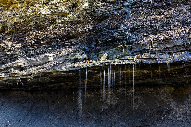
The geology of this place is absolutely fascinating, with sedimentary rock formations that were laid down during the Ordovician Era which is pretty much “pre fishies.” This ancient geology’s tectonic journeys around the globe, especially during the later Carboniferous Era, is why Pennsylvania has so much coal, oil, and gas locked up in the ground. The Appalachian chain is considered to be one of the oldest sets of mountains on the planet.
I just have to say it:
Who can guess, all there is, that might be buried down there?
– photo by Mitch Waxman
I know less about geography than I do about buying women’s shoes, but according to a bit of reading on the topic, the Appalachia’s are about 480 million years old. When the supercontinent which formed them broke apart, sections of this range ended up in both Scotland and Morocco as well as North America. Somewhere between 250 and 66 million years ago (Dinosaur time), the Appalachias – once as tall as the modern day Himalayas – had eroded down to flat ground. Uplift began during the Cenozoic Era, which started 66 million years ago and is the one we’re a part of, and the mountains began to rise. Water erosion cut through the sedimentary stones, revealing the layer cake of its geology. All of those individual layers include a treasury of minerals, including coal.
Really, this is the sort of hell which Our Lady has to live with. I can’t go to a freaking park without reading up on the history of plate tectonics, life on earth, and forming some familiarity with geologic theory.
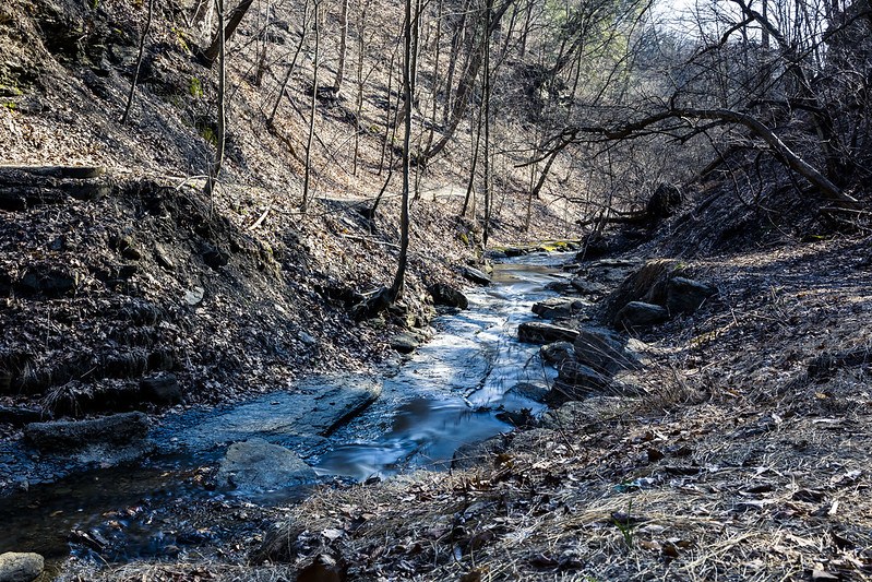
– photo by Mitch Waxman
Due to the steep slopes and deep valleys here in Pittsburgh, there’s flowing water everywhere you look for it. The watershed here is vast. I still haven’t ventured into a proper set of woods, but there are conservation areas, national and state parks, and huge tracts set aside for hunting that are within easy reach.
Me? I was busy with the camera for a bit before the park got too crowded.

– photo by Mitch Waxman
The water was shallow enough for me to just stride into the flow and set the tripod down in the stream bed, which is something I never did at Newtown Creek or the East River – for obvious reasons.
I think I overdid it with the long exposures in these, losing the texture of the flowing water entirely. Next time around, I’m going to cut my exposure time in half.
– photo by Mitch Waxman
Shaler Township is about a 15 minute drive northeast of Downtown Pittsburgh. Definitely coming back to this spot in about a month when there’s going to be greenery sprouting out of the ground.
Back tomorrow.
“follow” me on Twitter- @newtownpentacle
Buy a book!
“In the Shadows at Newtown Creek,” an 88 page softcover 8.5×11 magazine format photo book by Mitch Waxman, is now on sale at blurb.com for $30.
Second GAP: Part 1
Monday

– photo by Mitch Waxman
So much fun was had by a humble narrator on a recent unseasonably warm afternoon that it cast a shadow over the rest of my week. As mentioned here in the past, one of the most surprising public facilities in Pittsburgh’s neck of the woods are a network of ‘rail to trail’ paths which snake around the rivers and neighborhoods in the Right Of Way or “ROW” footprints of defunct railroads. One of these liminal spaces that I’m exploring on foot at the moment is called ‘The Great Appalachian Passage’ trail, a path which I could theoretically walk along all the way to Washington D.C. Right now I’m doing it in sections of between two and four miles at a time, thank you very much.
A while back, I offered several posts (Part one, Part Two, Part Three) from the section of the GAP stretching from Homestead to a point directly across the Monongahela River from the USS Mon Valley Works on the northern side of the waterway.

– photo by Mitch Waxman
Parking the Mobile Oppression Platform (my Toyota) at a designated parking lot for the GAP in the community of Duquesne, one gathered up his old kit bag and crossed a secondary arterial highway at an incredibly terrifying intersection. There was a light, yeah, but terrifying. Smile, smile, smile.
The GAP in this section is found somewhat inland from the Monongahela River’s shoreline. There’s an entire industrial zone humming away on the side between the path and the water, whereas on the other there are several sets of railroad tracks which all seemed pretty active as I was scuttling through.

– photo by Mitch Waxman
A pipe yard is one of the many attractions hereabouts. This might be a great spot to get all artsy fartsy sometime. That’s what a humble narrator pondered for a moment, but I kept on moving. There were acres of these pipes stacked neatly.
My goal for the day was to get to the spot I had walked to from the Homestead side and take a look at what sort of photo opportunities existed in the stretch closer to Duquesne. I’m looking for vantage points overlooking the USS Mon Valley Works, in pursuit of gathering cool photos of it from a distance.
I found and subscribed to a great YouTube channel offered by Pittsburgh Photographer Jeffrey Bowser, called “Fort Frick,” which offers several startlingly well done time-lapses of the Mon Valley Works that exploit the sort of ‘POV’s’ which I’m anxious to find. Check out the Fort Frick channel here. I’m a fan.

– photo by Mitch Waxman
So why the pipes? Seems that US Steel manufactures gas at a nearby plant in Clairton and the pipes carry it over to the furnaces at the Mon Valley Works, or at least that’s what I think is happening. The pipe yard is where they store the old and new ones. I’m probably wrong about something in there, so not sure and ‘dunno.’ What I can tell you is that when a charge of gas goes through those pipes and you’re standing directly under them – it’s disconcerting. That’s basically the Shofar of Hephaestus blowing hydrocarbons right there above your head, all American style.
The sound is something like “floooooomph pufffffassasss” followed by a deep vibration which echoes out of the pipes.

– photo by Mitch Waxman
It’s not just gas that’s getting pushed towards the steel mill, there’s also high voltage transmission lines snaking out of the hills and pushing current towards the place. It seems that there’s a nuclear generating plant about fifty or so miles west of here, right along the Ohio border.
Duquesne, the community which this pathway is found in, used to have its own blast furnace – at the time the largest on the planet. Its post industrial period, however, started in 1930. Today, Duquesne, like it’s neighbor Braddock across the river deals with a declining population and a whole lot of challenges. Average median income in Duquesne is about 25k a year. AMI indicates the 50% mark, so that means that half of its citizenry survives on far less than that number.

– photo by Mitch Waxman
That’s the Mon Valley Works, which still incorporates Carnegie’s 1875 vintage Edgar Thompson blast furnace into its operations. I knew about the air pollution issues associated with the three surviving steel mills in the Pittsburgh area before moving here., but in person… They burn coal and coke, which produces a significant plume of sulfur dioxide into the atmosphere. Depending on which way the wind is blowing on any given day, you might catch a slight whiff of a rotten egg smell where I live, which is about 10-15 miles from here. For the communities which actually neighbor these plants, it’s a real and ever present problem. Here’s where the emanates of the steel mills are blowing towards today.
Back tomorrow with more from the GAP. Trains! There’ll be trains.
“follow” me on Twitter- @newtownpentacle
Buy a book!
“In the Shadows at Newtown Creek,” an 88 page softcover 8.5×11 magazine format photo book by Mitch Waxman, is now on sale at blurb.com for $30.
Roaming
Friday

– photo by Mitch Waxman
Single images so far for the month of March, picked out of the archives, as a humble narrator is a bit behind on his schedule. I love the crazy road system here in Pittsburgh, and as always I’m intrigued by the parabolas and massing shapes of high speed roads.
Back next week with something a bit more in depth, at this – your Newtown Pentacle.
“follow” me on Twitter- @newtownpentacle
Buy a book!
“In the Shadows at Newtown Creek,” an 88 page softcover 8.5×11 magazine format photo book by Mitch Waxman, is now on sale at blurb.com for $30.
Speeding Locomotive
Thursday

– photo by Mitch Waxman
I’m a bit behind schedule today, so a single archive image captured back in August is on offer for this second day of March. That’s a CSX train rocketing through Pittsburgh. Back tomorrow.
“follow” me on Twitter- @newtownpentacle
Buy a book!
“In the Shadows at Newtown Creek,” an 88 page softcover 8.5×11 magazine format photo book by Mitch Waxman, is now on sale at blurb.com for $30.


