Posts Tagged ‘Pulaski Bridge’
Newtown Creek, and the Mountains of Madness

– photo by Mitch Waxman
A Friday, on March 19th the Hermetic Hungarian had left his laboratory workshop (a set of rooms on Manhattan’s decadent Upper West Side where he is exploring the deeper meanings and implications of esoteric 19th century clockworks) and ventured forth to Newtown.
The Hermetic Hungarian, referred to as HH from this point on, is a pale and sickly genius who has been intrigued by the presence of certain atavist religions and the persistence of modern adherents to these sects who remain extant along the poison shores surrounding an ancient industrial center called the Newtown Creek. HH had procured an automobile for the day’s exertions- as his fragile health precludes him from the long walks favored by your humble narrator which are so pedantically detailed at this- your Newtown Pentacle.

– photo by Mitch Waxman
Returning from a day of exploration, which first described the extensive branching of the transportation network referred to as “The Great Machine“, we proceeded to the currently undefended border of Maspeth and storied Greenpoint and crossed the Grand Avenue Bridge. HH was searching for evidences of a grandiose clockwork mechanism which long hours of research and supposition have led him to believe existed in the days of Trolley and Rail. Influenced by his metaphysical beliefs, which are both Hasidic and Buddhist in nature, the HH’s itinerary required his trip to be brief- and after spending an afternoon exploring the ancient climes of Newtown, Bushwyck, and Greenpoint- and we headed back toward a transportation artery that would allow him egress back to the Shining City and his hierophant isolations.

– photo by Mitch Waxman
On our return, the bascule mechanisms of the Pulaski Bridge suddenly sprang to life, allowing egress to the Newtown Creek for shipping. The first watchtower on the Creek, the Pulaski is also the busiest of its bridges. While traffic on the Newtown Creek is a shadow of what it once was, there is still a significant industrial presence on the maritime highway that requires connection with the vast enterprises of New York Harbor- especially the petrochemical empires that line the shores of the Kill Van Kull in distant… Staten Island. Additionally the car shredders and other recycling facilities, which bless Newtown with their labor, utilize barges to move their wares to distant customers.

– photo by Mitch Waxman
In this case, it is the petrochemical shipping industry which commanded the opening of the Pulaski Bridge, as evidenced by the appearance of the DBL 28 fuel Barge, a 28,000 BBL double hull tank barge (which conforms to the Oil Pollution Act of 1990’s requirements- no mean feat) which was built in 2006 and weighs some 2,146 gross tons.
from allbusiness.com
The 28,000 bbl capacity DBL 28 measures 297.6-feet in length, with a 54-foot beam and 13-foot depth. The DBL 28 is the first of a series of eight units currently in production at BMF for K-Sea. DBL 28 is coupled with an existing K-Sea tug using the state-of-the-art Beacon JAK 200 tug/barge Push-Pin coupler system, which is designed to increase operating efficiency and enhance safety and reliability by operating as a dual mode ITB. The series of barges are manned, non self-propelled, double hulled with a raked shaped bow, with six cargo tanks. The barges are classed Lakes, Bays & Sound (Inland) Tank Barges, ABS +A1 Oil Tank Barge, and USCG certified. The barges are being constructed primarily for bunkering and harbor service in ports on the U.S. East Coast.

– photo by Mitch Waxman
The fuel Barge was being guided by the K-Sea Davis Sea, a 2,000 HP 95 gross ton, 77 foot long tug whose mast spires nearly 57 feet over the water. Online sources describe the Davis Sea as possessing 6 foot diameter propeller screws, which are powered by twin engines, and as having been built in 1982.
from k-sea.com
K-Sea Transportation Partners L.P., headquartered in East Brunswick, New Jersey, is a leading provider of marine transportation, distribution and logistics services in the U.S. From locations in New York, Philadelphia, Norfolk, Seattle and Honolulu, K-Sea operates a large fleet of tugs and tank barges that serves a wide range of customers, including major oil companies, oil traders and refiners.

– photo by Mitch Waxman
The Davis Sea, of course, is named for the oceanic area along the coast of Eastern Antarctica which abutts the Shackleton and West ice shelfs. Lying along the Indian Ocean side of the polar wasteland, it is the coldest, windiest and driest section of the southern pole. Eastern Antarctica is still largely unknown to man, except by aerial and satellite observation- although the Soviet and American hegemonies established scientific research bases as early as the 1950’s in the relatively ice free coastal areas. Today, all of the great nations are represented in scientific exploration of this final frigid frontier.

– photo by Mitch Waxman
The Gamburtsev Mountain Range as well as the prominences of the Transantarctic Mountains, and the East Antarctica Ranges are amongst the oldest ranges on Earth, although some of these great structures are quite nearly buried beneath the glaciers they have formed. Hostile to normal terrestrial life, these mountains of madness are rumored to contain and house several obscure occult constructs including “The black pit,” “the carven rim,” “the protoShoggoths,” “the windowless solids with five dimensions,” “the nameless cylinder,” “the elder Pharos,” “Yog-Sothoth,” “the primal white jelly,” “the color out of space,” “the wings,” “the eyes in darkness,” “the moon-ladder,” “the original, the eternal, the undying,” and other queer occult concepts.

– photo by Mitch Waxman
Of course, your humble narrator digresses, influenced by a day spent with the limitless intellect of the Hermetic Hungarian- and the Davis Sea pictured above is merely a tugboat making it’s way down an urban waterway, and is not the seat of some cosmic horror which would shatter our notion of civilization and man’s place in the universal order.
The HH began frantically gesturing at me as I stood on the roadway of the Pulaski Bridge just then, lost down the soda straw reality of a telephoto lens.

– photo by Mitch Waxman
Its purpose accomplished, the drawbridge had returned to its vehicular roadway duties, and traffic flow between Greenpoint and Long Island City was about to resume. Angry at the inconveniences offered by the delay, anxious drivers were about to rocket forth into Queens, and would have hardly afforded a specimen such as myself the luxury of not being ground to paste beneath their spinning wheels.

– photo by Mitch Waxman
The Davis Sea proceeded up the Creek, no paddles required or missed. She sauntered past FreshDirect and the Newtown Creek Waste Water Treatment Plant at Whale Creek, churning the languid gelatins which line the Newtown Creek as it went. This must be a difficult course, as there is so little room for error in piloting the narrow and tightly populated channel.

– photo by Mitch Waxman
That is Calvary Cemetery on the horizon, with industrial Queens occupying the left side of the image. Just beyond is the Greenpoint Avenue Bridge and the significant petrochemical facilities- recently upgraded and enlarged and enjoyed by those on the Brooklyn shore – that adjoin it.

– photo by Mitch Waxman
Forced to begin speeding up, the Hermetic Hungarian allowed me one or two last shots of the Davis Sea as it passed into that world of ancient mariners and atavist custom which typify Newtown, while angry motorists behind us employed their horns to display displeasure at our lack of enthusiasm for leaving the scene. Their horns formed a mocking chorus, an antiphonal response to our absent haste whose sound can be described only as…
“Tekeli-li! Tekeli-li!” “Tekeli-li! Tekeli-li!” “Tekeli-li! Tekeli-li!”
Driven to madness by the sound, the Hermetic Hungarian began babbling madly, repeating the names of subway stops as we drove.
horrible and unearthly ululations…

– photo by Mitch Waxman (from the Queens Museum of Art’s “Panorama of the City of New York”)
Loathsomeness awaits, in the deep.
At the end of the Pleistocene, when the ice of the Wisconsinan glaciation was at last defeated by ocean and sun, the rubble which spilled from its ruptured facings piled up to form the terminal moraine of a cyclopean coastal sandbar, as well as many smaller islands. The torrents of flowing mud and water – acting in the manner of icy Lahars– interacted with this loose fill of titan boulders and frosty soil, amalgamating around stoney knobs of bedrock. These rough bits of rock, exposed by the motive traction exacted by ten thousand years of mile high ice, formed and agglutinated into an archipelago and estuary familiar to modernity as New York Harbor.
At the western tip of the sandbar, which european cartography called Long Island, an arabesque web of waterways was carved out of this turbulent tidal and river environment.
Welcome to the Newtown Creek.
from wikipedia
The Wisconsin Glacial Episode was the last major advance of continental glaciers in the North American Laurentide ice sheet. This glaciation is made of three glacial maxima (sometimes mistakenly called ice ages) separated by interglacial warm periods (such as the one we are living in). These glacial maxima are called, from oldest to youngest, Tahoe, Tenaya and Tioga. The Tahoe reached its maximum extent perhaps about 70,000 years ago, perhaps as a byproduct of the Toba super eruption. Little is known about the Tenaya. The Tioga was the least severe and last of the Wisconsin Episode. It began about 30,000 years ago, reached its greatest advance 21,000 years ago, and ended about 10,000 years ago. At the height of glaciation the Bering land bridge permitted migration of mammals such as humans to North America from Siberia.
It radically altered the geography of North America north of the Ohio River. At the height of the Wisconsin Episode glaciation, ice covered most of Canada, the Upper Midwest, and New England, as well as parts of Montana and Washington. On Kelleys Island in Lake Erie or in New York’s Central Park, the grooves left by these glaciers can be easily observed. In southwestern Saskatchewan and southeastern Alberta a suture zone between the Laurentide and Cordilleran ice sheets formed the Cypress Hills, which is the northernmost point in North America that remained south of the continental ice sheets.
The Great Lakes are the result of glacial scour and pooling of meltwater at the rim of the receding ice. When the enormous mass of the continental ice sheet retreated, the Great Lakes began gradually moving south due to isostatic rebound of the north shore. Niagara Falls is also a product of the glaciation, as is the course of the Ohio River, which largely supplanted the prior Teays River.
With the assistance of several very large glacial lakes, it carved the gorge now known as the Upper Mississippi River, filling into the Driftless Area and probably creating an annual ice-dam-burst.
In its retreat, the Wisconsin Episode glaciation left terminal moraines that form Long Island, Block Island, Cape Cod, Nomans Land, Marthas Vineyard, and Nantucket, and the Oak Ridges Moraine in south central Ontario, Canada. In Wisconsin itself, it left the Kettle Moraine. The drumlins and eskers formed at its melting edge are landmarks of the Lower Connecticut River Valley.

– photo by Mitch Waxman (from the Queens Museum of Art’s “Panorama of the City of New York”)
3.8 miles long, its mouth is directly opposite the Bellevue Psychiatric Hospital in Manhattan, and defines the currently undefended border between North Brooklyn and Western Queens. Estimates state that some 14 million gallons of combined sewage, storm runoff, and industrial waste provide the only flow of water into the Creek. It’s waters are opaque, and in the height of summer turn an unnatural shade of green.
The soft bottom of the waterway is 15-20 feet below the surface of the water, and the hard bottom is occluded by a gelatinous sediment known as “Black Mayonnaise”. Composed of petroleum residues, coal tar, PCB’s, and human excrement- it lies 15 feet thick on the bed. The oxygen content of the water drops precipitously as soon as one leaves the East River. The first of the drawbridges which cross it- known as the Pulaski Bridge, is the borderline beyond which immersion in this water is worthy of full HAZMAT gear and first responders institute biological decontamination procedures for anyone who finds themselves in it.
As I’ve mentioned in the past… the chemicals Putrescine (an organic chemical compound NH2(CH2)4NH2 (1,4-diaminobutane or butanediamine) and Cadaverine (a toxic diamine with the formula NH2(CH2)5NH2) which are produced by the rotting and putrefaction of animal flesh are abundantly found in the Newtown Creek under industrial aliases like Acrylonitrile and are prominent members on the EPA’s list of Volatile Organic Compounds– or VOC’s..
Who can guess, what it is, that may be buried down there?
from brookhaven national laboratories
Sediments from the New York/New Jersey Harborareas are dredged routinely to maintain navigable water depths for shipping channels and berthing areas to facilitate commerce and safe navigation. Historically, the dredged materials was disposed in the ocean. However, ocean disposal has been restricted due to greater regulatory restrictions on contaminant concentrations in the dredged sediments. The dredged sediments typically contain elevated levels of metals, polynuclear aromatichydrocarbons (PAHs) (tars, oils, fuels) polychlorinated biphenyls (PCBs), chlorinated pesticides and herbicides, dioxins (PCDDs), andfurans (PCDFs) as shown in Table 1-1[l] for Newtown Creek. Table 1-1, included at the end of this section, lists both the range previously available from the Request for Proposal and the average of six samples available to date for the treatability studies.The actual sediment used for the test was a black mayonnaise-like paste that contained few particles (or 0.2% on dry basis) greater than 2 mm, and exhibited an oily, foul odor.
BNL and other governmental federal and state agencies are in the process of developing risk-based and/or specific clean-up standards for the various locations where the treated sediment products are to be used. These standards are likely to be related to the soil clean-up criteria used based on direct soil contact (residential and non-residential) and/or impact to groundwater. For example, Appendix A contains the current soil clean-up criteria used by the State of New Jersey and the Maximum Concentration of Contaminants for the Toxicity Characteristic. Based on the sediment from Newtown Creek and the soil clean-up criteria for direct soil contact, some contaminants already meet the clean-up criteria while some need up to one or two orders-of-magnitude removal. The TCLP values for the Newtown Creek sediment are below the maximum toxicity characteristic value.

– photo by Mitch Waxman
There are 5 major vehicular traffic bridges which hurtle over the Newtown Creek, 3 of which are drawbridges and one is a non functioning swing bridge. It’s tributary branches are also crossed by a variety of other spans, from the high flying Queens Midtown Expressway section of the Long Island Expressway and the grade level Hunter’s Point Avenue drawbridge to the Borden Avenue retractile bridge over the Dutch Kills. Additionally, atavist rail bridges and trackbeds stretch from no longer existing car docks at Hunters Point to the massive rail terminals and switchings in Maspeth and lead to points further East. Municipal neglect has rendered many of these bridges dangerously decayed, non functional, or dangerous to operate. Once, this was the busiest industrial waterway in North America.
A spate of emergency repairs and reconstructions was conducted in the 1980’s and 90’s to shore up these crossings. For instance, the 1910 Hunter’s Point Avenue Bridge, originally a double leaf bascule design like the Pulaski, was replaced by a single leaf design and in 1987- the 1929 Greenpoint Avenue Bridge was rebuilt- and the 1959 Pulaski was rebuilt in the early 1990’s.
from nyc.gov
The Pulaski Bridge, which carries six lanes of traffic and a pedestrian sidewalk over Newton Creek and the Long Island Expressway, is orientated north-south and connects Greenpoint in Brooklyn to Long Island City in Queens. McGuinness Boulevard approaches the bridge from the south and Eleventh Street from the north. The Pulaski Bridge is a 54m double leaf, trunnion type bascule bridge. It has two 10.5m roadways divided by a concrete median barrier. It also carries a 2.7m pedestrian sidewalk. The bridge provides a channel with a horizontal clearance of 45.7m and a vertical clearance of 11.9m in the closed position at MHW and 13m MLW.

– photo by Mitch Waxman
There is a “colour” observed around the Newtown Creek. An iridescent sheen which seems to have been drawn from a palette not of this earth, rather it is best described as looking like some “Colour out of space“. Observable on every oil soaked cobblestone which pushes up through the asphalt, and pulsing through thorny vines which line the rotting bulkheads and sway against the putrid breeze, this colour is only the visible manifestation of a detestable lament which has infected the land and percolates in the swampy underworld hidden by piling and cement some 10-20 feet beneath the so called land. Wild catalogs of chemical compounds congeal in unknowable combinations, pooling in vast subterrene chambers and mixing with an underground water table that feed the sickly trees lining area streets.
Fish and invertebrates harvested from the Newtown Creek display open sores, unexplained tumors, and queerly mutated organs. Weird eyeless things can be seen wriggling in the filth, at low tide.
The surface of the water has tested positive for a variety of bacterial specie including Gonorrhea, Typhus, and Cholera.
from epa.gov
“Newtown Creek is one of the most grossly-contaminated waterways in the country,” said Acting Regional Administrator George Pavlou. “By listing the creek, EPA can focus on doing the extensive sampling needed to figure out the best way to address the contamination and see the work through.”
EPA responded to requests by members of Congress to evaluate specific sites along the creek by publishing a September 2007 report that contained a review of past work and recommendations regarding future work at Newtown Creek. The state of New York referred the site to EPA due to the complex nature of the contamination along the creek.
Newtown Creek is part of the core area of the New York-New Jersey Harbor Estuary, which has been designated by EPA as an “estuary of national significance.” Despite the ongoing pollution problems, some residents currently use the creek for recreational purposes such as kayaking, while others catch fish for consumption out of it. Various sediment and surface water samples have been taken along the creek and reveal the presence of pesticides, metals, PCBs, and volatile organic compounds (VOCs), which are potentially harmful contaminants that can easily evaporate into the air.
In the mid -1800s, the area adjacent to the 3.8-mile Newtown Creek was one of the busiest hubs of industrial activity in New York City. More than 50 industrial facilities were located along its banks, including oil refineries, petrochemical plants, fertilizer and glue factories, sawmills, and lumber and coal yards. The creek was crowded with commercial vessels, including large boats bringing in raw materials and fuel and taking out oil, chemicals and metals. In addition to the industrial pollution that resulted from all of this activity, the city began dumping raw sewage directly into the water in 1856. During World War II, the creek was one of the busiest ports in the nation. Some factories and facilities still operate along it, and various adjacent contaminated sites have contributed to its contamination. Today, as a result of its industrial history, including countless spills, Newtown Creek is badly polluted.

– photo by Mitch Waxman
The northern bank of the Newtown Creek forms the border of Long Island City, and swirls through Laurel Hill (or Blissville), Sunnyside, Ridgewood, and Maspeth in Queens. The southern bank in Brooklyn is dominated by the ancient cities of Greenpoint, Bushwick, and Williamsburg.
from wikipedia
Greenpoint was originally inhabited by Keskachauge (Keshaechqueren) Indians, a sub-tribe of the Lenape. Contemporary accounts describe it as remarkably verdant and beautiful, with Jack pine and oak forest, meadows, fresh water creeks and briny marshes. Water fowl and fish were abundant. The name originally referred to a small bluff of land jutting into the East River at what is now the westernmost end of Freeman Street, but eventually came to describe the whole peninsula.
In 1638 the Dutch West India Company negotiated the right to settle Brooklyn from the Lenape. The first recorded European settler of what is now Greenpoint was Dirck Volckertsen (Dutchified from Holgerssøn), a Norwegian immigrant who in 1645 built a one-and-a-half story farmhouse there with the help of two Dutch carpenters. It was in the contemporary Dutch style just west of what is now the intersection of Calyer St. and Franklin Street. There he planted orchards and raised crops, sheep and cattle. He was called Dirck de Noorman by the Dutch colonists of the region, Noorman being the Dutch word for “Norseman” or “Northman.”
Siderodromophobia

– photo by Mitch Waxman
This is another of those posts where someone will say “so, a train went by, huh? wow”, so let’s just get that right out of the way- Jan 20, Pulaski Bridge. So, tongue firmly in cheek, today’s session of the Newtown Pentacle…
Thankfully- as the nytimes.com site re-presents the reportage found in an AP feed instead of reporting on it themselves – it seems the psychiatric industrial complex is nearing the completion of the latest iteration of their operators manual for “normal” minds, called the DSM-5. All ‘effed up, your humble narrator has in the past detailed the multitudes of phobias, syndromes, and disorders which he falls victim to on a daily basis, and looks forward to the new volume which will offer the promise of even more vaguely defined and loosely described psychological states to hypochondriacally self diagnose and cling to.
from wikipedia
The DSM-IV-TR states, because it is produced for the completion of Federal legislative mandates, its use by people without clinical training can lead to inappropriate application of its contents. Appropriate use of the diagnostic criteria is said to require extensive clinical training, and its contents “cannot simply be applied in a cookbook fashion”. The APA notes diagnostic labels are primarily for use as a “convenient shorthand” among professionals. The DSM advises laypersons should consult the DSM only to obtain information, not to make diagnoses, and people who may have a mental disorder should be referred to psychological counseling or treatment. Further, a shared diagnosis/label may have different etiologies (causes) or require different treatments; the DSM contains no information regarding treatment or cause for this reason. The range of the DSM represents an extensive scope of psychiatric and psychological issues or conditions, and it is not exclusive to what may be considered “illnesses”.

– photo by Mitch Waxman
The DSM-4 has provided me with endless hours of enjoyment, allowing me to embrace the fullness of just how crazy I actually am. Regarded as a feckless quisling (I am the #1 and 2 hits at google for this term!) and physical coward, such a collection of “very bad ideas” is a treasure trove of joy to which I can ascribe every quirk of personality or failing of character to, a series of nails to hammer into my flesh. Luckily, the psycho net is broadly cast with a fine mesh- so I’ll have a lot of company in the mad ward. Especially when the enormous number of Newtown Pentacle readers who also suffer from Siderodromophobia reel away from their computers in horror after witnessing this posting.
Personality Disorder Not Otherwise Specified
This category is for disorders of personality functioning that do not meet criteria for any specific Personality Disorder. An example is the presence of features of more than one specific Personality Disorder that do not meet the full criteria for any one Personality Disorder (“mixed personality”), but that together cause clinically significant distress or impairment in one or more important areas of functioning (e.g., social or occupational). This category can also be used when the clinician judges that a specific Personality Disorder that is not included in the Classification is appropriate. Examples include depressive personality disorder and passive-aggressive personality disorder (see Appendix B in DSM-IVTR for suggested research criteria).

– photo by Mitch Waxman
For a while, I’ve been entertaining “Agoraphobia Without a History of Panic Disorder” but I really do enjoy being outside- scuttling in a fugue state along these Newtown streets beneath the burning thermonuclear eye of god itself in my filthy black raincoat while avoiding others and satisfying my suspicious notions which only I can see and reporting my findings here in vague, metaphorical, and overelaborate language. This doesn’t strictly adhere to AGWAHOPD.
I also really like “Avoidant personality disorder” for its self loathing, mistrust, and hypersensitivity to criticism. I do have a thin skin, after all, but lately- I’m leaning “schizotypal personality disorder”, baby. SPD, yo.
Schizotypal personality disorder, from wikipedia
A disorder characterized by eccentric behaviour and anomalies of thinking and affect which resemble those seen in schizophrenia, though no definite and characteristic schizophrenic anomalies have occurred at any stage. There is no dominant or typical disturbance, but any of the following may be present:
- inappropriate or constricted affect (the individual appears cold and aloof);
- behaviour or appearance that is odd, eccentric, or peculiar;
- poor rapport with others and a tendency to social withdrawal;
- odd beliefs or magical thinking, influencing behaviour and inconsistent with subcultural norms;
- suspiciousness or paranoid ideas;
- obsessive ruminations without inner resistance, often with dysmorphophobic, sexual or aggressive contents;
- unusual perceptual experiences including somatosensory (bodily) or other illusions, depersonalization or derealization;
- vague, circumstantial, metaphorical, overelaborate, or stereotyped thinking, manifested by odd speech or in other ways, without gross incoherence;
- occasional transient quasi-psychotic episodes with intense illusions, auditory or other hallucinations, and delusion-like ideas, usually occurring without external provocation.

– photo by Mitch Waxman
Man, that’s me! Point by point! Psych!
I don’t know why I’m so happy, though, it sounds like a nightmare.
Nightmare disorder, from wikipedia
Nightmare disorder, or dream anxiety disorder, is a sleep disorder characterized by frequent nightmares. The nightmares, which often portray the individual in a situation that jeopardizes their life or personal safety, usually occur during the second half of the sleeping process, called the REM stage. Though such nightmares occur within many people, those with nightmare disorder experience them with a greater frequency. The disorder’s DSM-IV number is 307.47.
In the cold waste 3
This is the 163rd posting of the Newtown Pentacle, last one of 2009, and just about 6 months into this little project. Halfway through writing this, I had to evacuate the building due to a fire in another apartment. NYFD was prompt and performed their work in the normal fashion. Thanks Guys, and Happy New Year… now on with the dirge, apostasy, and dire prophecies…

Gondor, or Manhattan- from recently completed sections of Gantry Plaza State Park – photo by Mitch Waxman
The new East River Parks are magnificent and welcome additions to the waterfront, a tony garland showcasing the shining shield wall of Manhattan, and a value adding loss leader for landlords to dazzle the prospective Tower People with. Queensbridge Park was similarly awe inspiring upon its completion in the 3rd incarnation of Ravenswood, until things went horribly wrong in the Housing Complex it was designed to serve and the vain optimists in City government lost interest in funding it.
Today, its bulkheads are collapsing into the river and the muddy ball fields and patchy lawns are shoddy at best. Perhaps the experiences of the Tower People will be different as the calendar pages roll by, here in the Newtown Pentacle.

From the Wheelspur Yard road crossing beneath the Pulaski Bridge – photo by Mitch Waxman
The story of Long Island City, as one proceeds south, is told in steel and concrete. Leave the modern world, which is possible in Long Island CIty, and see the apotheosis of victorian aspirations. The industrial past of the 19th century, whose cracked pavement and toxic inheritances define the modern era, can be accessed merely by crossing the street. By 2020, the Manhattan Skyline will be hidden behind even more Tower Condos, and Hunters Point will accommodate some 5,000 new housing units. Hotels and Parks are also planned.
All the while, the City is closing Queens Fire Houses and Hospitals.

LIE from the Pulaski Bridge – photo by Mitch Waxman
Surmount the Pulaski Bridge, but do not touch it with your bare skin. From here, the early and mid 20th century is visible. Witness a steel highway- Robert Moses’s LIE soaring over “the empty corridor“. It once carried the terrified middle class away from a troubled mid and late 20th century New York, in the manner of some open artery, creating the vast populations of suburban Long Island. It also blighted and depopulated western Queens, turning the valuable industrial land it shadowed into empty warehouses and abandoned brick lots. For the last half of the 20th century, Long Island City and the surrounding communities became ethnic ghettos and crime infested wards of municipal indifference. In this mid century midden, the rats ruled, and rat kings ruled over all.

Open air warehouse at Newtown Creek – photo by Mitch Waxman
And then there is the Creek. The Newtown Creek. I have a lot of purple prose fun with the Newtown Creek- these quotes are culled from various postings-
“I’d rather drink a glass of that queerly coloured effluviam which flows lugubriously through a crucible of dictatorial capitalism called the Newtown Creek.”
“just a little bit of the chemical recipe that produces an anaerobic broth like that found in the Newtown Creek”
“VOC’s are amongst the primary pollutants fouling the waters of a nearby cautionary tale called the Newtown Creek.”
“and indeed- swirling within a nearby cataract of tears called the Newtown Creek”
“which I attribute to the possibly mutagenic qualities of the chemical pollution of that nearby extinction of hope called the Newtown Creek.”
“languidly across that gelatinous slick of black water- called the Newtown Creek- triggered its horns”
“The secular spectacular merely whets the appetite of your humble narrator for the open skies and sacred vantages found along those unhallowed backwaters of an urban catastrophe called the Newtown Creek.”
“The motive engines of the Pulaski began grinding in those deep pilings sunken on both sides of that vexing mystery called the Newtown Creek”
” is powered, fed, and flushed by that which may be found around a shimmering ribbon of abnormality called the Newtown Creek.”
“flabby jowled, staring eyed, scaly group which had been tormenting me- and whose apparent leader was a young girl carrying a curiously polydactyl cat whose aspect “I did not like”- were running off in the direction of that stygian cataract called the Newtown Creek”
There is actually nothing funny about the Creek, its a sobering subject, but I do my best to keep things light. One of the maddening facts though, is that the open air warehouse observed above, is designated to become a City Park as the Hunters Point South phase of the Queenswest development gets rolling in 2010.

Still Waters Run Deep – photo by Mitch Waxman
The EPA comment period on the issue of “superfunding the creek” has just ended, and as expected, the Oligarchs of Manhattan have rendered their opinion that the Creek should remain under their jurisdiction.
Did you think, honestly, that City Hall is going to cede control over a 4 x1 mile strip of Brooklyn and Queens to Washington without a fight?
That’s what Superfund means, the feds TAKE OVER, for as long as it will take to clean up the mess. They will fine whoever they want to for whatever they want to, issue orders that MUST be followed by commoner and king alike, and will not take “NO” or “That isn’t possible in this climate” as an answer. In the case of the Newtown Creek, the estimates for completion of project (at the medium estimate) are 30-45 years (45 years ago in 1963, John Kennedy had just been assassinated in November and LBJ was president). A river of federal money will flush out the Newtown Creek, but the tide is going to hit the masters across the river in Manhattan.
Our fellow citizens in the Western States have been chaffing under the authority of the EPA for a long time, which has created an electoral preference for smaller and less intrusive government policy amongst the citizenry. A lack of “institutional memory”, a disturbing modern trend easily blamed on a 4th estate owned and operated by real estate interests, is a smoking volcano.

Your Humble Narrator – photo by Mitch Waxman
It is the end of a year of change- but all years are “years of change”. New York, and the United States on the whole, continue their trend toward apathy and quasi-fascism.
- The rich are always right- for by virtue of their fortunes they are proven so
- Our enemies are all around us- and we must consider which rights to trade away in the name of security
- Endless is war, with new fronts opening in Northern Africa and the Far East as we speak (did you notice how fast the story of “the underwear bomber” came together?)
- The burdens of the social contract suddenly seem to be too much to bear as the Baby Boomer population begins to retire.
Ceasar is just a few years away now, and will choose to reveal him or her self shortly- and offer clarity and purpose to the masses- who will love their Ceasar, along with the bread and circuses.
And all the poisons in the mud will leach out.
Massive NYC 2009 Marathon Photo set

– photo by Mitch Waxman
The 2009 NYC Marathon came hurtling through Long Island City just this past Sunday, which was November the First- which is also the celebrated anniversary of the abdication of the last Sultan of the House of Osman, and World Vegan Day. A fairly detailed posting about the 2008 Marathon which has lots of history on the race and running, as well as discussion of the Physical Culture movement, can be accessed here.

– photo by Mitch Waxman
Arriving early, a conspiritor and I nonchalantly greeted the small army of affable NYPD personnel, and mounted the Pulaski Bridge. At around 9am, the disabled competitors came barreling through. I can’t really think of what to call these devices. Wheelchair just doesn’t do technology like this justice. Affably, the NYPD then asked us to clear off the bridge.

– photo by Mitch Waxman
I followed the course as the Marathon runners blasted along. For me, the real show is always the sideline, but I shot a lot of pictures of the competitors between 9 and 12:30 in Long Island City.
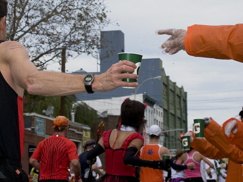
– photo by Mitch Waxman
If you’re a 2009 NYC marathon runner, looking for photos you might be in, click here to reach a huge set at flickr with the full range of shots.

– photo by Mitch Waxman
All along the route, bands were playing. This kid with the Tuba was in a school band that just finished playing “Play that funky music, white boy”.

– photo by Mitch Waxman
Hard rock bands also lined the route- these iconic minstrels were staked out directly across the street from the Citibank Megalith. The runners, toward the ever shadowed cobbles of sin pitted Queens Plaza, were Manhattan bound.

– photo by Mitch Waxman


