Archive for August 22nd, 2014
know thy zone
As everyone knows, August 23rd is the Night of the Living Dead. Prepare your “go bags,” Lords and Ladies, and know your zone.

– photo by Mitch Waxman
Famously, there are indeed more dead people in Queens than there are living. The Rural Cemeteries Act of 1847 forbade interments in Manhattan, which begat what is called “the Cemetery Belt” spanning the borders of Brooklyn and Queens. There are three million corpses in Calvary Cemetery alone. Should the dead rise this or any other year, we are going to be in a real pickle.
As a public service, zone maps of the danger that various communities face are offered in the hope that individuals can prepare for the coming storm.

Courtesy of openstreetmap.org, here’s a shot of western Long Island and the southern tip of Manhattan.

Here’s a rough illustration of our study area, the so called Newtown Pentacle. As you might notice, a significant number of cemeteries are found therein, and the area transverses from Bushwick to Astoria and from Flushing to the Wallabout.

– photo by Mitch Waxman
Nearly all of the area cemeteries are surrounded by stout fencing, and there are but a few points of egress into and out of the polyandrions. How well these often century old fence lines would do against an army of flesh eating ghouls is questionable, but one cannot speculate on their structural integrity.

First Calvary, in particular, is isolated by high walls and expressways from its environs, with only two points at which the slavering horde of undead assassins might access the surrounding neighborhoods. One would not want to be in West Maspeth or Blissville on Saturday night, however.

In the graphic above, the actual cemetery boundaries are roughly sketched out in orange.

– photo by Mitch Waxman
One would imagine that the NYPD would be forced to collapse the East River Tunnels and detonate the roadways of the great bridges to protect the Shining City of Manhattan from the onslaught of the Living Dead.
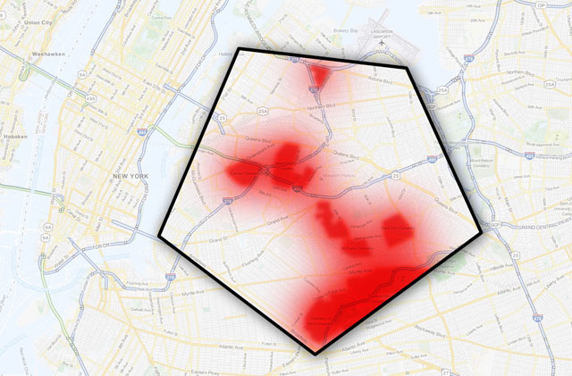
For those of us who reside in the Newtown Pentacle, this heat map is offered. The areas of darkest red are surely goners, and it is suggested that we refer to these areas as Zone A. Zones B & C likely have a fighting chance, should they be well prepared to shelter in place for an interval. Realistically, if you haven’t evacuated within the first twelve hours of the Night of the Living Dead, you’re already doomed.
Because Dawn is coming.
also, from youtube–
X
“follow” me on Twitter- @newtownpentacle


