Archive for September 19th, 2016
dizzily down
From the perspective of a wandering mendicant…

– photo by Mitch Waxman
Often have I commented on the hazy “intertidal” zones found along the former borders of long forgotten town and village municipalities in Western Queens – in fact, I’ve coined the term “angles between” for them. There’s – functionally – no one alive today who has a personal remembrance of Maspeth or Woodside being referred to as towns or villages with clearly defined borders due to urban sprawl and the life’s work of Robert Moses. When the City of Greater New York consolidated Long Island City and the county of Newtown into a new entity called “Queens,” it’s at these hazy border areas that the Manhattan people got away with literal “bloody murder.” The export of Manhattan’s dirty industries, it’s unwanted poor, the corpses of its dead – all were sent east to what was – then – a still quite agricultural community called Queens. This also happened to the Bronx and Staten Island, and to a lesser degree Brooklyn.
The local politicians in the “lesser” boroughs were more than happy to take on the cemeteries, heavy industries, and garbage handlers in the name of “progress” and doing favors for the hidden elites of Manhattan.

– photo by Mitch Waxman
The Shining City of Manhattan replaced its tenements, its abattoirs, its manufactured gas plants with what at the time would have referred to as “modern” apartment blocks. For you real estate savvy types – that’s so called “pre war” developments like Tudor City in Murray Hill, Peter Cooper Town/Stuyvesant Village which sits on the former site of several Manufactured Gas Plants, or the United Nations building (built into the former site of several slaughterhouses and abattoirs that was known as “blood alley”). The process of converting industrial Manhattan over to a residential and commercial center kicked into high gear in the years before and directly following the Second World War, the age of “urban renewal.” That’s when the highways were jammed through on Long Island, the dairy farms of Queens were converted to housing tracts, and the “Manhattancentric” school of thought concerning development really kicked in. The tenements emptied as the teeming masses sought a better life in Queens, and further east in suburban Nassau and Suffolk counties. This turned Western Queens into a transit corridor for trade and commuters.
It’s all about “the City” and literally all roads for hundreds of miles in any direction lead to Manhattan.
– photo by Mitch Waxman
Mt. Zion cemetery – that’s its Maurice Avenue fence line pictured above and it’s in the center of all the shots in today’s post – is categorically in Maspeth, and it is infested with tiny gecko like lizards. Saying that, it also defines Maspeth’s blurry border with Woodside in the same way that Maspeth’s border with LIC’s Blissville section is defined by the Koscisuzcko Bridge. The cemetery is fairly ancient by Queens’s standard, it’s roughly 78 acres in size, there’s around 210,000 interments therein, and its first burial in Mt. Zion was conducted in 1893. There used to be a Gypsy encampment here, a shanty town that was home to a Romani tribe from Transylvania that called itself the “Rudari,” or “Ludar,” depending on whom you ask. The Rudari, just for the sake of literary trivia, are the same tribe that worked for Count Dracula in the Bram Stoker novel named for the vampire lord. The historical record of Queens usually refers to them as “The Maspeth Gypsy’s,” and it should be mentioned that referring to them using such nomenclature would be considered a racist hate crime and slur in the modern day European Union.
The Rudari were renowned for copper working and animal training. The reason that the circus train still comes to Western Queens every year is that the circus industry used to buy trained critters – bears, horses, etc. – from them. Many Rudari found work at the Phelps Dodge copper refinery along Newtown Creek, and remnants of their community persist to this day in the Sunnyside Gardens area along Queens Blvd.

– photo by Mitch Waxman
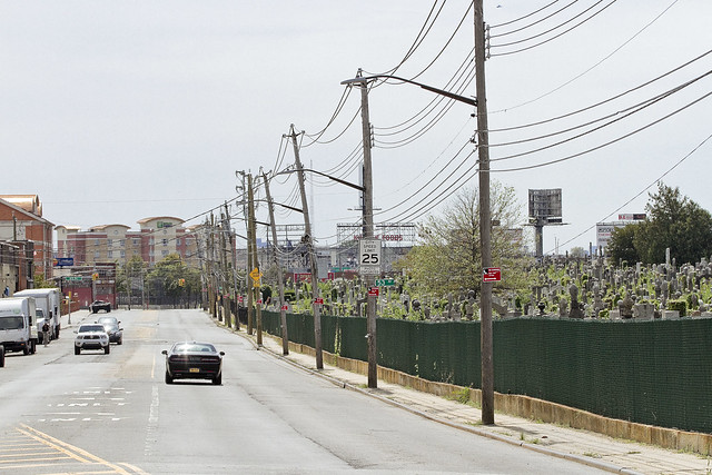
There are a series of semi detached one and two story homes in the area directly surrounding Mt. Zion, which are sandwiched between the Long Island Expressway and Brooklyn Queens Expressway. To the south is the heavy manufacturing district surrounding the eastern side of Newtown Creek and its tributary Maspeth Creek. Mixed use industrial zoning directly touches the cemetery, and hundreds of truck based warehouse businesses are located hereabouts. There is also a large footprint Coca Cola distribution center nearby, and a primary shipping hub for United Parcel Service is less than a mile away, as is the warehouse and distribution center for the Duane Reade retail empire. Mt. Zion’s western side is directly across the street from the Second, Third, and Fourth sections of Calvary Cemetery. Pictured in the first shot of today’s post is part of the Department of Sanitation’s colossal vehicle maintenance facility, which is right next door to an NYPD vehicle maintenance facility, and there’s an FDNY vehicle maintenance facility nearby as well. Suffice to say that these are heavily travelled streets, here under the Long Island Expressway and just a short walk away from Newtown Creek.
If you talk to the people who live anywhere near this area, their common complaint always involves the amount of trucks and cars which use their neighborhood as a thoroughfare. Of course, talking to the people of Queens is considered an obstacle by City Hall, and a loathsome requirement when implementing their policies.

– photo by Mitch Waxman
Mt. Zion cemetery was set up for members of the Jewish community, whose burial laws are a bit different than the Catholic ones. Jews are meant to buried singularly, rather than having multiple bodies in the same gravesite as in the Catholic tradition. This means that Mt. Zion sprawls and has the appearance of being overcrowded. There are sections of the cemetery which are virtually impassable due to this, where it is impossible to find a place to put your foot down between the rows of tombstones.
The streets surrounding it are barren, virtually treeless, and are a favored spot for illegal dumping of construction debris and other garbage.

– photo by Mitch Waxman
The reason that this little travelogue is being presented today involves the plans recently presented by the De Blasio administration to convert a hotel in the area over to a homeless shelter. A subsequent post will detail the hotel and the area directly surrounding it, but this is the northern side of the zone which the “Big Little Mayor” has picked to warehouse those who are considered socially and economically undesirable. The community of Maspeth has responded with their characteristic flair, and pushed back on City Hall with considerable skill and energy. City Hall, as is its habit under the current Mayor reacted to the protests by implying that Maspeth’s indignation is fueled by racism. Several publications picked up this theme, and the Internet commentarium knee jerk followed the rhetoric offered by the administration of the “Dope from Park Slope.”
My personal views on the Maspeth shelter project were the subject of a debate recently with a former colleague whose views and perspectives I greatly respect, but the argument I make about the placement of people – people who exist at the lowest end of the socio-economic spectrum – in this area is that it’s a human rights violation.
Simply put, it ain’t exactly a bed of salubrious roses out around these parts even if you’ve got money in your pocket, let alone when you’re down and out. This wouldn’t be a shelter, this would be a penal colony.

– photo by Mitch Waxman
Maspeth, as in the community of, has been doing a great job of demonstrating its objections to the placement of a homeless shelter hereabouts. They don’t need me to chime in, or make war, for them.
What I’ve found disturbing is that the knee jerk reportage mentioned above that describes their objections in terms of “rich white people” not wanting “poor black people” in their neighborhood – which has been presented by news sites that have covered the protests.

– photo by Mitch Waxman
To start, there’s a few different sides to Maspeth. To the south and east, you do indeed have a somewhat suburban and moneyed section that is populated by people of European decent. To the south and west you’ve got an industrial zone, but you’ll find the odd block of homes in there, the residents of which are a hodge podge of “everybody.” On the north western side, here around Mt. Zion, my observations have revealed a population who are pretty much the same mix of people you see everywhere in Woodside, Sunnyside, Astoria and so on. East and Southeast Asians, Africans and African Americans, Irish, Jews, Italians, Levantines, Middle Easterners – the whole “vibrant diversity” mix that the politicians are always crowing about.
The “homeless” are not a monolithic people comprised from a single racial group with a common ancestor. Who these “homeless” are would be best defined, by Marxist economists, as the “underclass” and what they have in common is not the color of their skin but grinding poverty. I’ve always argued that just calling these people “the homeless” is dehumanizing and that it’s done by those armchair academics who have never actually known someone living on the street in any context other than dropping a quarter in their cup. There is no “homeless problem,” rather there’s tens of thousands of individual problems. Siting them away from a familiar setting, breaking whatever they have left of a social network, treating them like something to be warehoused in a neighborhood of warehouses – this ain’t the right idea.
On the subject of every neighborhood having to do “its fair share” – Maspeth already handles close to 20% of NYC’s garbage, it hosts the LIE and BQE, has several NYS and one Federal Superfund sites in it, and there are intersections where close to 3-400 heavy trucks an hour roll through on their way to Manhattan. The garbage train also transits through Maspeth a few times a day, which represents and comingles Brooklyn’s share of the garbage handling with Maspeth’s.

– photo by Mitch Waxman
There are virtually no mass transit lines available from this location, police patrols are infrequent at best, and at night this is a virtually abandoned part of the city. Bus service is spotty, and it’s one of the places in Queens where you truly need a personal vehicle to get around.
There are streets with no sidewalks here in the half mile around the proposed shelter.

– photo by Mitch Waxman
The shocking ignorance of City Hall regarding the existential realities of Western Queens never fails to amaze me. All they seem to know about our neighborhoods is what they see on maps rolled out on mahogany desktops that have pins stuck into them by paid cronies. I’ve met several members of the Dept. of City Planning over the years, and the ones who I respect the hell out of are the ones who put on a pair of sneakers periodically and go out for walks in the areas they’re assigned to. I don’t always agree with their choices, but I do respect them.
I have a random idea, which is to site a homeless shelter on 11th street in Park Slope, just off fifth avenue.
Tomorrow, we’ll cross under the highway and take a direct look at what Mayor Bill De Blasio considers as being a good fit for one of the most vulnerable populations of people in NYC to call their temporary home, since he hasn’t decided to lead by example and convert his aforementioned house on Park Slope’s 11th street over to either affordable housing or for use as a shelter.
Upcoming tours and events:
“First Calvary Cemetery” walking tour
with Brooklyn Brainery, Saturday, October 8th from 11:00 a.m. to 1:00 p.m.
Click here for tickets.
“follow” me on Twitter- @newtownpentacle


