Archive for November 2016
blasphemous disturbance
Evil lurks, in darkness.

– photo by Mitch Waxman
One has long decried the presence of a horde of vampires in Queens Plaza, where they spend their days hiding in the steel of the elevated subways. The presence of the Baltic Strigoi and the Cretan Kalikantzaros in Astoria, the Liches and the syncretic wizardry of South America observed at St. Michael’s Cemetery, the Egyptian Djinn of Steinway Street, those curious Celtic creatures lurking in the post industrial subterrene voids of Blissville, and the unmentionable Dibbuks of the Chabad in Williamsburg have all been discussed in the past. These are all immigrant imps, however, carried to Brooklyn and Queens by the European masses. Supernatural immigrants from old world to new.
Occluded, however, are the belief systems of the original inhabitants of western Long Island.
from wikipedia
Kishelemukong is the creator god, not involved in the daily affairs of the Lenape. Instead, he directed the manitowak, the life-spirits of all living things, which were created by Kishelemukong. The manitowak were venerated in ceremonies, rituals, dreams, visions, games and ohtas (see below), as well as through the interventions of the Metinuwak, who were healers, spiritual and emotional guides, and religious leaders; they could communicate with the manitowak.

– photo by Mitch Waxman
Living, as we do, in a time when the 19th and 20th cultures of Brooklyn and Queens are being dismantled and burned away in the crucible of “development,” one has been ruminating of late about the aboriginal cultures which were similarly dismantled by the Manhattan people during earlier eras. The “Lenapehoking” pre conquest era has captured my interest, but I’m dismayed at the primary source materials which I’ve been able to lay my hands on. Unfountuntely, much of the early source material on the subject I’ve scanned propagates the mythology of the “Noble Savage” and what Kipling called “The White Man’s Burden.”
Problem is that almost everything I’ve been able to find on the Lenape – and their various cultural splinters around New York Harbor – was written by the very same people who decimated and conquered them. It’s a bit like reading a Nazi history of the Second World War, or a British history of their empire in the Raj. I’m looking for some guidance on the subject, books to read, scholars to query. I’ve already reached out through my social network to modern day members of the surviving Lenape nation, but that’s a set of relationships I’m just beginning to develop. Any suggestions on “what to read” would be greatly appreciated, if you happen to be clever about the subject, and I’d ask you to share links and suggestions “with the group” by dropping links into the comments link below.
from wikipedia
A noble savage is a literary stock character who embodies the concept of an idealized indigene, outsider, or “other” who has not been “corrupted” by civilization, and therefore symbolizes humanity’s innate goodness. In English, the phrase first appeared in the 17th century in John Dryden’s heroic play The Conquest of Granada (1672), wherein it was used in reference to newly created man. “Savage” at that time could mean “wild beast” as well as “wild man”. The phrase later became identified with the idealized picture of “nature’s gentleman”, which was an aspect of 18th-century sentimentalism.

– photo by Mitch Waxman
This line of inquiry was initiated for me by an argument I found myself in with an academic ignoramus who decided to describe the Lenape to an audience of students not too long ago. Her version of the Native Americans of New York Harbor was a composite of Hollywood representations of the Cree and Lakota cultures, which included teepees and solar worship.
I am quite familiar with the Native cultures of northern and central Mexico, as a note. The Mexica – or Aztec – imperial culture of Lake Texcoco is something which I’ve studied in great depth for instance. I can actually offer quotations of Aztec poetry, speak intelligently about their economy and agricultural systems, and have a more than passing knowledge of the complexity of their religious traditions. If the Mexica Triple Alliance Empire – Aztec is a Spanish word – had another hundred years to develop, the Europeans would have encountered an analogue of Cesarean Rome when they landed at Vera Cruz, and the story of the North American continent would have turned out VERY different than it did.
Wisdom of crowds time, lords and ladies – what and who should I be reading?
from wikipedia
The Lenape (/ləˈnɑːpɛ/) are a Native American tribe and First Nations band government. They are also called Delaware Indians and their historical territory included present day New Jersey and eastern Pennsylvania along the Delaware River watershed, western Long Island, and the Lower Hudson Valley.
Most Lenape were pushed out of their homeland during the 18th century by expanding European colonies, exacerbated by losses from intertribal conflicts. Lenape communities were weakened by newly introduced diseases, mainly smallpox, and violent conflict with Europeans. Iroquois people occasionally fought the Lenape. Surviving Lenape moved west into the upper Ohio River basin. The American Revolutionary War and United States’ independence pushed them farther west. In the 1860s, the United States government sent most Lenape remaining in the eastern United States to the Indian Territory (present-day Oklahoma and surrounding territory) under the Indian removal policy. In the 21st century, most Lenape now reside in the US state of Oklahoma, with some communities living also in Wisconsin, Ontario (Canada) and in their traditional homelands.
“follow” me on Twitter- @newtownpentacle
tapering arms
Back in lower Manhattan.

– photo by Mitch Waxman
Dover Street in Lower Manhattan is the stuff of historical legend. It starts its western path abruptly at South Street, and to the north is the tangled steel of the FDR Drive ramps and the always victorious Brooklyn Bridge. There are buildings on Dover which date back to the late 18th and early 19th centuries. The interesting thing is that they’re not churches, or government buildings, instead they’re shops with homes above.
As a note, when the British controlled Manhattan before and during the Revolutionary War, everything in the shot above was pretty much the East River. It’s all landfill, from the modern shoreline west to Front Street, which is coincidentally the corner this shot was captured on, meaning I was standing on the historic shoreline of the island. This is the northern extent of the South Street Seaport Historic District, and Peck Slip is about a block away. Governor Al Smith grew up in this neighborhood in the late 19th century, back when it was still a port, and Tammany ruled it all.
Al Smith is buried is buried in LIC’s Calvary Cemetery along the Newtown Creek.
Small world.
from wikipedia
The South Street Seaport is a historic area in the New York City borough of Manhattan, centered where Fulton Street meets the East River, and adjacent to the Financial District. The Seaport is a designated historic district, and is distinct from the neighboring Financial District. It is part of Manhattan Community Board 1 in Lower Manhattan, and is bounded by the Financial District to the west, southwest, and north; the East River to the southeast; and Two Bridges to the northeast.
It features some of the oldest architecture in downtown Manhattan, and includes the largest concentration of restored early 19th-century commercial buildings in the city. This includes renovated original mercantile buildings, renovated sailing ships, the former Fulton Fish Market, and modern tourist malls featuring food, shopping, and nightlife, with a view of the Brooklyn Bridge.

– photo by Mitch Waxman
Water Street at Dover is where you’ll find a solid claimant to the title of oldest bar in NYC. It’s the Bridge Cafe, which I’m told is still recovering from Hurricane Sandy damages. The original shell and frame of the building went up in 1794, and was altered steadily until the 1880’s when it assumed its present form. Bridge Cafe has a nice history of the building at their site. Doesn’t mention the great fire of 1835, but there you go.
Just down the block, Kit Burn’s “Sportsman Hall” at 273 Water Street was a saloon where you could watch bare knuckled humans boxing, or bet on the canine and rodentine combatants that were fighting in the 250 seat (400 standing) octagonal rat pit Kit maintained in the basement. The Sportsman Hall was housed in what’s considered to be the third oldest building in Manhattan (1773), which is now called the Joseph Rose House and Shop. Kit Burns and his competitors in the rat pit game are a big part of the reason that the ASPCA was formed back in 1866. Kit died in 1870, and is buried in LIC’s Calvary Cemetery along the Newtown Creek.
Small world.
from wikipedia
Born Christopher Keyburn in New York City on February 23, 1831, Burns joined the Dead Rabbits as a young man and, by the late 1840s, co-led the organization with Tommy Hadden. Both men started their own businesses in the Bowery with Burns opening his Sportsmen’s Hall on Water Street. His establishment was widely known for holding illegal bare-knuckle boxing prize fights as well as featuring such entertainment as the infamous “rat pit” where blood sports such as rat and dogfighting took place. In these events, large gray wharf rats were captured and set against dogs. These dogs, mostly terriers, were sometimes starved for several days beforehand and set against each other as well.

– photo by Mitch Waxman
Not too far away, over on Canal and Lafayette, is what was once known as the Bruce Building – 254-260 Canal Street. George Bruce was a rather successful printer when he started to build his NYC headquarters back in 1856. The Bruce Building was converted over to office space back in the late 1980’s, but what makes it really special are the iron works which dress the walls. They’re the (1850) patented work of James Bogardus, according to prevailing opinions. Bogardus was the guy who pioneered the cast iron facades commonly seen on Victorian era buildings in NYC and elsewhere.
James Bogardus is buried in Greenwood Cemetery, but he was a descendent of Dominie Everardus Bogardus, who died in a ship wreck in 1647. Dominie Bogardus was granted a piece of property by the Dutch colonial government across the river from Manhattan, a point of rocky land surrounded by swamps and salt marshes, which came to be called “Dominie’s Hoek.” It adjoined a fertile waterbody still called the Mispat, but which we know today as the Newtown Creek. The LIC saloon “Dominie’s Hook” is named after him. In 1825, the Hunter Family acquired the Hook, and its been called Hunters Point ever since.
Small world.
from wikipedia
The Reverend Everardus Bogardus (1607-1647) was the dominie of the New Netherlands, and was the second minister of the Dutch Reformed Church, the oldest established church in present-day New York, which was then located on Pearl Street (Manhattan) at its first location built in 1633, the year of his arrival. Bogardus was, in fact, the second clergyman in all of the New Netherlands. (The slightly obscure early history of the Dutch colony meant that he was often considered the first clergyman.
“follow” me on Twitter- @newtownpentacle
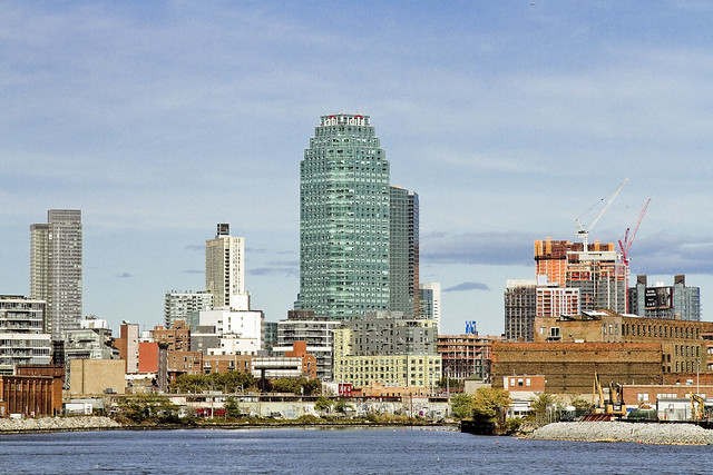
greater wildness
Vertigo, in today’s post.

– photo by Mitch Waxman
As mentioned a couple of weeks ago, one had attended a photo industry trade show at the Javitz Center. As this was the first time that circumstance had carried me to the newish Hudson Yards stop on the IRT Flushing line – conventionally referred to as the “7” – I decided to take a few minutes and record a few images.
There you go. Back to Manhattan. Sigh…
from wikipedia
The name “Manhattan” derives from the word Manna-hata, as written in the 1609 logbook of Robert Juet, an officer on Henry Hudson’s yacht Halve Maen (Half Moon). A 1610 map depicts the name as Manna-hata, twice, on both the west and east sides of the Mauritius River (later named the Hudson River). The word “Manhattan” has been translated as “island of many hills” from the Lenape language. The United States Postal Service prefers that mail addressed to Manhattan use “New York, NY” rather than “Manhattan, NY”.

– photo by Mitch Waxman
The thing that kept on striking me about visiting the new station was a sensation of vertigo. Normally, one is possessed of a sound and reliable bit of plumbing in the inner ear, but there was just something about the setup of the incredibly steep escalators which distinguish the new station that induced me to feel as if I was about to fall and tumble.
Given the sort of things I know about escalators, which are – functionally speaking – indistinguishable from industrial meat grinders, this was a real concern for one such as myself.
from wikipedia
Escalators, like moving walkways, are often powered by constant-speed alternating current motors[citation needed] and move at approximately 0.3–0.6 metres (1–2 ft) per second. The typical angle of inclination of an escalator to the horizontal floor level is 30 degrees with a standard rise up to about 18 metres (60 ft). Modern escalators have single-piece aluminum or stainless steel steps that move on a system of tracks in a continuous loop.

– photo by Mitch Waxman
Perhaps it’s the angle at which they’ve been set at. The Hudson Yards station platforms are found fairly deep in the ground, by NYC Subway standards. Comparable but still examples of the depth would be the 7’s Grand Central platform, or the 59th street and 3rd exit on the IND lines. Looking up rather than down, it felt a bit like the Smith/9th street stop on the F and G lines. Mr. Walsh from Forgotten-NY assures me that the deepest station in the system is in upper Manhattan, and I have few occasions to oppose his opinions so I’ll take his word on it, but Hudson Yards is deep.
from wikipedia
In January 2005, the New York City Council approved the rezoning of about 60 blocks from 28th to 43rd Streets, including the eastern portion of the West Side Yard. This did not include the western portion. In June 2005, the proposed West Side Stadium, to be built over the western portion for the New York City bid for the 2012 Summer Olympics, was defeated. Soon after, the Metropolitan Transportation Authority (MTA) thought of ways to redevelop the 26 acres (11 ha) yards. In conjunction with the government of New York City, the MTA issued a Request for Proposal (RFP) for 12,000,000 square feet (1,100,000 m2) of mixed-use space. The space was to be built on platforms over the rail yards, which would still be in use.

– photo by Mitch Waxman
There’s a mezzanine level where you’ll find the turnstiles, which is where the set of escalators in the shots above bring you. The mezzanine is fairly pleasing, design wise. There’s a whole bunch of arcing shapes moving against each other, tiled floors, and other “architect” looking features that are pretty pleasing to the eye. Or, to mine at least.
from wikipedia
The new construction, part of the city’s and the MTA’s master plan for the Far West Side, extended the IRT Flushing Line west from Times Square to Eleventh Avenue, then south to 34th Street. Although the West Side Stadium plan was rejected by city and state planning agencies, the 7 Subway Extension plan received approval to move ahead, as New York political leaders wanted to see the warehouse district west of Eighth Avenue and north of 34th Street redeveloped as part of the Hudson Yards Redevelopment Project, and subway service was to be an essential part of that effort. The extension also serves the Jacob K. Javits Convention Center, which was expanded in 2008–2014 and is located a block away from the station entrances.

– photo by Mitch Waxman
The big kahuna of the escalators, and the ones which caused me to begin to experience vertigo, are the ones which carry you down to the platforms themselves.
from wikipedia
Vertigo is when a person feels as if they or the objects around them are moving when they are not. Often it feels like a spinning or swaying movement. This may be associated with nausea, vomiting, sweating, or difficulties walking. It is typically worsened when the head is moved. Vertigo is the most common type of dizziness.

– photo by Mitch Waxman
The shot above is looking back up at where the previous photo was captured, and just the act of turning myself around forced my non camera arm to reflexively reach for some kind of support.
from wikipedia
The MTA completed excavation of a 150-foot (46 m) long cavern in June 2009. The cavern was dug below the bus entrance ramp to the lower level of the Port Authority Bus Terminal and formed part of the eastern end of the new extension and connected it to the Times Square station. At the same time, tunnels were being dug northward from the machine shaft at 26th Street; soft ground at 27th and 28th Street required 300 feet (91 m) of ground to be frozen so that the tunnel-boring machines could easily dig through the soil. On December 21, 2009, it was announced that a tunnel-boring machine broke through the 34th Street station cavern wall. Both tunnel-boring machines were scheduled to finish the required tunneling in the spring of 2010.

– photo by Mitch Waxman
I think it’s the “leading lines” which did it. There’s a real “THX 1138” vibe to this station, which seems to be part of a modern design aesthetic MTA is following. I’ve been to the Second Avenue Subway construction site and the new stations about to come on line are visually quite similar to the Hudson Yards stop.
from wikipedia
THX 1138 (pronounced “T-H-X Eleven Thirty-Eight”) is a 1971 science fiction film directed by George Lucas in his feature film directorial debut. The film was produced by Francis Ford Coppola and written by Lucas and Walter Murch. It stars Donald Pleasence and Robert Duvall and depicts a dystopian future in which the populace is controlled through android police officers and mandatory use of drugs that suppress emotion, including outlawed sexual desire.

– photo by Mitch Waxman
Down at the bottom, there’s another vaulted tunnel which terminates at yet another barrel vault, which is where the two tracks for the 7 train are found. This is a terminal stop, of course, so there must a turnaround track somewhere down there but I’ll be godamned if I knew where it was. Felt like like I was halfway to hell if truth be told. Dizzy, I got nervous, my chest grew tight, and it was oddly warm on the platform itself – given its depth.
Then again, Manhattan generally makes me experience both agita and angina, and often reminds me of hell.
from wikipedia
The main entrance, located at the southeast corner of the intersection of 34th Street and Hudson Boulevard, has a turtle shell-shaped glass canopy above it that allows light to shine on the upper mezzanine. The elevator is located south of 34th Street in Hudson Park, while the escalator entrance is located further east, closer to the boulevard. The ventilation building will be built over by developers at a future date. The second entrance, which will contain escalator entrances is at the southwest corner of 35th Street and Hudson Boulevard East. At both of the exits, the staircases and four escalators each go down 40 feet (12 m) to a fare control area, then another 80 feet (24 m) to the common lower mezzanine; the main entrance was completed by summer 2014, while the secondary entrance is still under construction and will be completed by 2016.
“follow” me on Twitter- @newtownpentacle
muffled conversation
There was quite a hullabaloo, here in Astoria.

– photo by Mitch Waxman
One received a text from a neighbor on the night of October 30th that there had been a vehicle collision involving the local gendarmes here in Astoria, so I grabbed the camera and headed down to take a look at what happened.
The NYPD unit involved was from the local precinct, the 114, and they had collided – at speed- with a civilian vehicle at the intersection of 45th street here on Broadway.

– photo by Mitch Waxman
Given that I’m a “yenta” and the whole neighborhood knows it, the neighbors began relating the story to me.
Apparently, the NYPD unit was in one of those big hurries that they periodically display, the kind when they don’t have their sirens or lights on. My understanding is that this is procedure when they’re trying to catch someone surreptitiously by sneaking up on them, or they’re enroute to assist another officer who is in a dicey situation.
Observationally, when Cops blow a light just cause they want to, they perform what could be best described as a rolling stop while doing so. They can also park pretty much anywhere they want to, and I see both as perks.

– photo by Mitch Waxman
One of the local Greeks informed me that he had witnessed the incident. The cops were moving through a red light at the corner of 45th street and Broadway at a considerable velocity when they contacted the front end of a sedan which was proceeding at speed through the green light. They tore the front end of the civilian car up, but neither car’s occupants were seriously hurt. That’s what the Greek guy said.

– photo by Mitch Waxman
That’s the bumper of the sedan, which was being operated by a fairly young guy who had two passengers with him. They were instructed to park around the corner, and seemed – to me at least – as quite anxious. On Broadway itself, there were multiple NYPD people investigating the event. There were ambulances, looking loo civilians like me, and the usual emergency crew that the City’s got.
Of course the three kids were anxious, how would you feel if you had just rammed a cop car?

– photo by Mitch Waxman
I ran into a couple of officers from the 114 a couple of days later (long story) and inquired as to the condition and health of their comrades. They informed that the two officers in the unit were fine, but had taken a couple of days off to recuperate nevertheless. No word on the three kids, however.
My personal belief is that all five participants in the accident probably had to go shopping for new underwear.
“follow” me on Twitter- @newtownpentacle
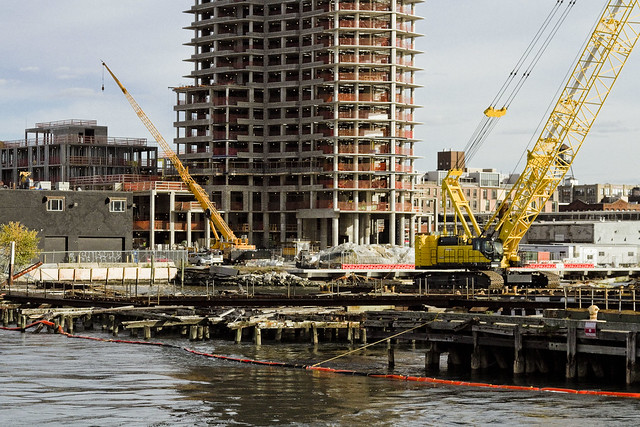
abominations and blasphemies
Fight.
– photo by Mitch Waxman
Gaze upon the Newtown Creek. Currently an EPA Superfund site. Is it going to be one for long? Will there be an EPA this time next year? Would this be a good place, instead, to site a black and gold casino? I’ve been considering the Trump victory, and its implications. I’ve been reading a bunch of stuff written by people like myself, who thought the Presidential Election would be a logical slam dunk in favor of the more qualified candidate. All of us “lefties” have had to admit that we were wrong in our assumptions that our fellow Americans would actually vote in their own economic and cultural interest.
C’Est la Vie.
– photo by Mitch Waxman
Early thoughts on the “new normal” involve trying to take advantage of it, which is the American Way. Should Mr. Trump make good on his promise to build a wall across the narrow part of the North American Continent, rebar and Portland Cement futures look like they’ll be a promising investment. Also, I’m planning on finding out who the leading players in immigration law are, and whether or not they are publicly traded companies.
It’s the EPA thing that we’re all talking about on the Creek, I would mention.
– photo by Mitch Waxman
It’s going to be a very interesting few years, I think.
Mainly, because the Republican Congress is likely going to eat the new President for lunch. Those are shark infested waters down in the District. Let’s face it though, all that Donald Trump actually wants to do stand in front of the cameras while cutting the ribbon on all the “bridges to nowhere” and crony projects they’re going to be building.
The game just continues.
– photo by Mitch Waxman
Personally, and as I’ve often opined – National Politics is way above my pay grade. I’ve got other, more decidedly local problems to worry about.

– photo by Mitch Waxman
One has been on a Newtown Creek vacation for the last month, and it’s time for me to get back on the job.
“follow” me on Twitter- @newtownpentacle


