gathered here
Mitch Waxman, working for YOU!

– photo by Mitch Waxman
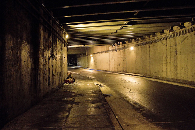
The pathway which will allow access to the bike and pedestrian lane of the new Kosciuszcko Bridge is pictured above, a terrifying “last mile” section which is owned by the City. This is the approach at “Queens Midtown Expressway” or “Borden Avenue” (depending on whose map it is) which you get to via a southward journey along 43rd street in Sunnyside. It’s also the onramp for the BQE, and there’s nothing separating you from traffic other than a three inch curb. If you’re wondering, this is actually a fairly well used foot path between industrial Maspeth and South Sunnyside – so it’s not just me.
Why do I go this particular way? I’ll show you at the end of the post.

– photo by Mitch Waxman
Inviting, ain’t it?
A humble narrator is ringing the alarm bells here for a fairly simple reason, the Kosciuszcko Bridge construction project is meant to be opening the second and final half of the project up to traffic (of all kinds) by the end of the summer, at the latest. The City, which is supposed to have been redesigning this section of things (they own it), hasn’t been shown to have started any risible progress yet. Supposedly NYC DOT has a design, but where is it? Shovels in the ground, boys?
I’d be happy with a bunch of jersey barriers, truth be told.

– photo by Mitch Waxman
For years, literally years, I’ve been keeping an eye on this one.
I cannot tell you how many times in Western Queens that I’ve had the sudden realization that the sidewalk I was scuttling on led onto a highway. One time, after leaving St. Michael’s cemetery, the section of Astoria Blvd. I was walking along suddenly became the shoulder lane of the Grand Central Parkway as the sidewalk just ended.
– photo by Mitch Waxman
This path leads to a pedestrian bridge, one that the K Bridge project has recently constructed as a replacement for a far older but similar lane. Friends who grew up on the southern flank of Sunnyside tell me that this path was well familiar to them growing up, and that the road and sidewalk conditions found in the shot above date back to their earliest recollection.

– photo by Mitch Waxman
Just last week, I was walking through here and spotted the condition above. Hadn’t been through in about a month, so it’s possible this collapsed in sewer grate had been lying in wait for an errant tire to enter it for weeks.
Here’s the “working for you part.”

– photo by Mitch Waxman
First things first, you document it. That’s me and the camera in the shadow on the left. Second, you report it.
Now, here’s the thing… I often have trouble making 311 or 911 operators understand that Queens has hyphenated addresses. Also, it took several paragraphs of text and a few photos to describe the location and condition of this place to you, my quite savvy and well traveled Lords and Ladies of the Pentacle. Additionally, this was a dangerous situation and I feared somebody could be seriously hurt if their tire entered the hole.
Prior experience with road condition and damaged sewer hatch reporting (yep, lots and lots of prior experience) has taught me that it can take weeks for the City to dispatch somebody to do repairs. They’ll send the cops out to throw down a traffic cone, but otherwise – weeks. I’m “Mitch Waxman” however, so a quick scan of the contact list on my phone allowed me to contact the K Bridge team’s Community Liason’s office, who in turn alerted the NYC DEP, whose sewer it is. DEP dispatched an emergency squad within the hour and they had the thing all fixed and repaired by the next morning. On the repair front, I let my pals at Jimmy Van Bramer’s office know about all the goings on and how great I thought it was how the K Bridge team and DEP handled the situation. That was also in the name of “reporting it” since JVB’s office keeps a list of complaints and problems in his District and since this one wouldn’t come to them via 311 or 911, there you are.
Nobody gets hurt. Street boo boo all better now.

– photo by Mitch Waxman
On the other side of the “last mile” path, there is a permanently installed concrete separation between you and the onramp of the BQE. Where it slopes down and ends is the demarcation point of NYC and NYS’s property lines, or so I’m told. Want to guess why they’re there?
Yeah, that was me, suggesting it to the Engineering Team at K Bridge sometime back in 2012 or 2013.

– photo by Mitch Waxman
My pal “Special” Ed once described his ideal job title as “freelance unsolicited criticism,” which would take the form of waking into a bank and decrying the arrangement of the padded ropes leading to the tellers, whereupon he would then hand them a bill for his services. I don’t charge, but I fear that I’m living out Ed’s dream. Ed used to live downstairs from me in an apartment building on Manhattan’s Upper West Side, one which was packed with high school and college friends. We lived a life disturbingly reminiscent of “Seinfeld,” I’m afraid. Ed had nothing in his refrigerator save for a single glass of water and a spoon, and stored his clothing in the kitchen cabinets. I miss Ed.
Pictured above is the K Bridge from that pedestrian ramp dealie which carries you over the onramps to it from the LIE onto Laurel Hill Blvd. at the border of Maspeth and Blissville, and between the Kosciuszcko Bridge and First Calvary Cemetery.

– photo by Mitch Waxman
This is why I go this particular way. The view.
Just imagine what treasures await, when the ped and bike path is open. That’s presuming you don’t get squished by traffic on your way here, and end up in there.
“follow” me on Twitter- @newtownpentacle


That last picture is why I used to come here all the time, park beneath the shadow of the old, rusty greenn Koscuiuszko, and look out, beyond the rippled tides of gravestones, at the far away spires of lights. It was beautiful – until those lights started encroaching, and coming, closer, closer and closer….do you remember a particular, ivy-covered post-lamp-pole? That was “my” spot, from right across the street, just past the underpass where Laurel Hill meets 54th. I composed a lot of bad poetry there, in all kinds of midnight weather.
https://goo.gl/maps/gh615XmcCmT2
Mitch, you need to stop pointing these things out to the City. It will be the death of all that you hold dear – when it’s been properly paved, and the sidewalk an interminably circuitous uroborus that pens in every part of the glass arboretum the City will eventually become, what will there be to behold but another twee cafe? I point my finger accusingly at thee – t’was ye that brought the likes of Atlas Obscura to haunt (and charge admission for) nocturnal graveyard gatherings and “urban hikes”. And in your footsteps follow the herds of sheeple who everyday pay $$(!) to poseurs for “graffiti tours” up the road from my parents’ home in Brooklyn..UGH. I kid, somewhat…those things would have happened regardless of how much they were hastened by your pioneering and documenting spirit.
Did you do this, too?
https://goo.gl/maps/pRvcJQcWTPG2
Of course…it is a “good” thing you are working for the masses to make these forgotten, secluded, overlooked spots “habitable”. As long as you keep up your diligent, noble efforts, this City shall never have any oasis-terminus, where “the sidewalk ends”.
Tommy Efreeti
February 5, 2019 at 2:49 pm
nope, the flushing avenue overpass is familiar and loved, but the fence wasn’t me.
Mitch Waxman
February 5, 2019 at 3:22 pm
Laurel & 54th (Rd), even. My memories remain sacrosanct, even if the reality on the (literal) ground now looks much different: keep the up the good work of erasing any local spots that provide that elusive, surreal Waldeinsamkeit!
Tommy Efreeti
February 5, 2019 at 2:53 pm