Author Archive
sardonic source
Wednesday

– photo by Mitch Waxman
A few more shots from West Virginia’s Wheeling today, and offered above is one from the walkway of the Wheeling Suspension Bridge, which is said to be the oldest bridge of this type still standing in the United States. Although I did offer a few observations in yesterday’s post which were colored by the political tides of the present day, that’s a subject which I assiduously avoided while “in country.”
Pepsi comes in a blue can, Coca Cola in a red one. Both are chemical concoctions that are really, really bad for your health and actually make you thirstier when you drink them. Water is clear, and when served icy cold, exactly what you need. Drink water to calm down, and avoid both red and blue talk – that’s my advice. Alternatively – take the Pepsi challenge or have a Coke and a smile and argue about which one “tastes great or is less filling” like a pack of lemmings while heading for a cliff.

– photo by Mitch Waxman
There were several utterly vacant buildings in Wheeling, including this old department store on Main Street. It was recently purchased by a church, I’m told. Apparently, a major project is underway in the City of Wheeling, revolving around the rejuvenation of the downtown area. Were Wheeling in NYC, I’d describe most of the downtown people I’d spoken to as being “hipsters.” Saying that, these were hipsters who owned houses and drove $50,000 trucks.
The sun was absolutely brutal on the day we were there, and the locals seemed to observe what Mediterranean communities call an “intermedio” during this hot part of the day – heading inside for a rest and a meal and then re-emerging after the heat and light subsided.

– photo by Mitch Waxman
Mad dogs and Englishmen, right? I’m crazy, and Our Lady is British, so…
I was nevertheless still marching around with the camera, capturing whatever glimpses of this little city that I could for the short interval I was there. Fascinating place, this is.

– photo by Mitch Waxman
Not sure what this building was originally purposed for. To me, it looks like there was a shop downstairs and warehouse space above. The windows on the street level had historic photos printed as posters displayed in them. The photos depicted street cars coming off of the Wheeling Suspension Bridge, and offered a “once upon a time, long ago” narrative of a thriving industrial city.
The “Rust Belt,” that’s what this section of the United States is called. The decline in manufacturing activity in the Rust Belt is universally described as being caused by NYC’s Wall Street driving corporate consolidations and selling off the assets. 1980 is considered to be the year that this process really kicked into gear. If you want a primer on this process, watch Oliver Stone’s film “Wall Street.”

– photo by Mitch Waxman
One thing, politics wise, that I can report to you is that whereas in prior trips to this section of the country I observed a plethora of red MAGA hats, coupled with car flags and lawn signs advocating for the disgraced former standard bearer of the Republican Party, this time around there was barely a red baseball hat to be seen. I wasn’t in the so called “blue state” areas, either, rather I was often moving about in extremely politically “conservative” communities with agricultural based economies for much of the time. What does that mean? Who knows? Nothing matters, nobody cares – remember? Drink water instead of Coke or Pepsi.
On our return from Wheeling to Pittsburgh proper, Our Lady of the Pentacle and myself checked into a different AirBNB than the one we had been staying in, this one was in the Bloomfield section. Bloomfield was apparently Pittsburgh’s Little Italy – back in the day. There was a definite “collegiate” feeling to the place, but that’s logical given the nearby Duquesne University and University of Pennsylvania (U Penn) campuses. This section of the City of Pittsburgh was quite “urban” as compared to the somewhat suburban vibe of Brookline, where our first rented room was located on the south side of the City.

– photo by Mitch Waxman
Given that my personal frame of reference is NYC based, I pronounced Bloomfield as reminding me a great deal of North Brooklyn prior to the ignition of the gentrification furnaces. Brookline, on the other hand, reminded me a great deal of Brooklyn’s Midwood, or Queens’ Forest Hills. Monroeville and Crandberry Township were not unlike the Nassau County “Five Towns” area, Wheeling felt a great deal like Yonkers or Newark, and Youngstown was reminiscent of the borderlands between Mt. Vernon and the Northern Bronx or the Queens/Nassau County line nearby JFK Airport. Latrobe was eerily similar to the rural counties around Albany and southern Vermont, and both Butler and Bethel Park reminded me of Westchester County’s tony Katonah or Mahopac.
Distance means something very different in this part of the country than it does in NYC. The highway speed limits range between 55 and 70, and a web of high speed roads penetrate even into the city center. “Traffic” is not what a New Yorker would call the congestion encountered on these roads. A “traffic jam” moves along at about 30-40 mph. I was chatting with one of the “Yinzers” about this, and described a recent trip that My Pal Val and I made to get to Fresh Kills on Staten Island from Astoria (38 miles) as having taken nearly two hours to complete. I helped them gather their jaw up off of the bar.
“Yinzer” is Pittsburgh slang for a native of the area.
“follow” me on Twitter- @newtownpentacle
Buy a book!
“In the Shadows at Newtown Creek,” an 88 page softcover 8.5×11 magazine format photo book by Mitch Waxman, is now on sale at blurb.com for $30.
assented without
Tuesday

– photo by Mitch Waxman
The western edges of the Greater Pittsburgh Metropolitan area are found in states outside of Pennsylvania. In the north, Youngstown is carved into Ohio. Youngstown is in a grim condition, I tell you. You can tell that the citizenry used to experience better times there, but that those times were a very, very long time and multiple generations ago. I didn’t take a single photo in Youngstown since, also as mentioned, I was driving the car. Our Lady of the Pentacle and myself decided to cut our explorations short in Youngstown, and proceeded southwards through Ohio.
Along the way, at a bathroomivation stop, I cracked out the shot above. It depicts a coal fired power plant in Brilliant, Ohio – shooting toxic shit into the sky. It’s called the “Cardinal Power Plant,” and it produces 1.8 gigawatts of electricity. The owners are midstream, in terms of installing equipment to bring themselves in line with EPA standards for emissions, which is an investment that no longer makes any sense since an activist group of judges on the Supreme Court have yanked the rug out from under such regulation. Nothing is better for business than having politics swing like a pendulum every few years, ain’t it?

– photo by Mitch Waxman
The southwestern section of the Pittsburgh area we were exploring, and where these shots were gathered, is found in West Virginia’s Wheeling. Wheeling is about an hour’s drive from downtown Pittsburgh and about two hours from Youngstown, and we arrived there in the very late afternoon – probably a little bit after 5. Let me tell you something about the sun in this section of the country, lords and ladies… I now fully understand the Roman’s worship of Sol Invictus, or the conquering sun. Holy smokes, it was strong.
The good news is that the car was parked, and that there are a couple of pretty interesting things in Wheeling to point a lens at.

– photo by Mitch Waxman
Boy oh boy, do I love learning new things.
Predicate: The National Road (aka the Cumberland Road) was the first highway built by the United States. 620 miles long, it starts at the Potomac River in Maryland’s Cumberland section, and ends at Vandalia in Illinois (about 60 miles northeast of St. Louis). The National Road was built between 1811 and 1837, and construction stopped when Congress ran out of money to fund it. The National Road is largely carried by Route 40 in modernity, and it touches or travels through Maryland, Pennsylvania, West Virginia, Ohio, Indiana, and Illinois.
The border of Ohio and West Virginia in Wheeling is defined by the Ohio River, which provided an impediment to traffic on the National Road until 1849.

– photo by Mitch Waxman
The Wheeling Suspension Bridge was thereby erected in 1849 to carry the National Road, and although it’s been improved or reconstructed several times since, this crossing of the Ohio River is the oldest suspension bridge in the country. For a few years, it was the largest suspension bridge that America could boast about as well.
It’s currently closed to vehicular traffic, due to somebody trying to drive an overweight road bus over it a few years ago, and there was a construction project underway at the time I was there to gussy and shore up the roadway. Saying that, the pedestrian and bike paths on it were open. Apparently, the project to rebuild the thing is where Senator Manchin decided to spend his “Biden Bucks” after voting against the infrastructure bill a couple of years ago.
Pork is pork, even in a red state, huh?

– photo by Mitch Waxman
West Virginia is one of our formerly “United” States which I’ve never had the pleasure of visiting, so these photos mark a first for me personally. Wheeling is ancient, by American standards. It was quite an industrial power in the First Civil War era, situated neatly nearby several other large industrial cities in the region like Pittsburgh and Youngstown and Cleveland. Wheeling was called “Nail City” for a while, and there was a thriving series of mills which produced iron products like stoves, boiler plates, and – as the nickname would imply – nails. They were also quite a power in the Tobacco business. In 1899, Wheeling saw the emergence of the National Tube Company, which manufactured iron pipes for plumbing usage. Believe it or not, Wheeling used to be a hotbed of socialist labor movement activity.
Wheeling began to decline as a manufacturing town after the Great Depression. Its downtown area, where we were, hosts a series of delightful late 19th century buildings, many of which are unfortunately crumbling. We found a great Tacqueria in Wheeling, and got to interact with several of the locals. While I was outside shooting a photo, Our Lady of the Pentacle got to meet the Mayor of Wheeling at the Tacqueria, who was coincidentally picking up a dinner order.

– photo by Mitch Waxman
Mid span on the Wheeling Suspension Bridge over the Ohio River, the 1955 vintage Fort Henry Bridge is observed. A “tied arch” bridge, it carries Interstate 70 over the Ohio River. Couldn’t help but crack out a couple of shots of the thing. I’m planning on spending some time in Wheeling in the future, I tell you.
More tomorrow from the great rusty unknown, at this – your Newtown Pentacle.
“follow” me on Twitter- @newtownpentacle
Buy a book!
“In the Shadows at Newtown Creek,” an 88 page softcover 8.5×11 magazine format photo book by Mitch Waxman, is now on sale at blurb.com for $30.
stifling age
Monday

– photo by Mitch Waxman
Pittsburgh’s Brookline neighborhood is where a rented, via AirBNB, set of rooms acted as a regional HQ for a late June trip to the area. I’ve mentioned the topography of Pittsburgh before as being extremely hilly, and the photo above was captured in pursuit of illustrating that particular point.
Photography wasn’t the primary goal of this outing, and I spent most of my waking hours behind the steering wheel of a rented car, tooling around the region.
Region, you ask?

– photo by Mitch Waxman
Day one saw me drive about 50 or so miles north of Pittsburgh to a town called Butler, for luncheon with a friend who’s in the real estate business in the area. Our conversation revolved around property tax and the common business practices that typify the rental market in the area. He recommended that we take a look at a nearby town called Kittanning. We ate burgers at a roadside “local.”
In 1727, this community was a Lenape village, which is where the name Kittanning originates from. The Europeans arrived in the area, and during the French and Indian War period – in 1757 – the community was demolished by a gunpowder explosion at a local armory which was heard in Pittsburgh – 44 miles to the south west. Kittanning was incorporated as a “Borough” in the post revolutionary period in 1803. It sits on the eastern bank of the Allegheny River, and pictured above is their 1932 vintage Kittanning Citizens Bridge. Nice little down on its luck sort of town, which hosts a lot of churches along the waterfront, for some reason.

– photo by Mitch Waxman
I had been driving since early in the day, and the banks of the Allegheny hereabout offered me a short opportunity to set up the camera and grab a couple of shots. There was a nearby dam which I was desperate to get next to, but there’ll be plenty of time for that sort of thing in the future. This particular trip revolved around getting to know the outlying sections of the “Greater Pittsburgh Metropolitan Area.”
Basically, if it was a named place that’s found on the weather map presented by the local CBS TV affiliate, we were there on this trip. I broke the journey up into the cardinal directions, and this particular day involved north and east. We visited Butler at the North, and Latrobe to the East, and a whole bunch of other places in between. “Reconnaissance” is what the Frenchers would call the effort.

– photo by Mitch Waxman
On our way back into the City of Pittsburgh from Latrobe and a bunch of other communities where Trump held his rallies, I had a pilgrimage to make. One of the suburbs of Pittsburgh is called Monroeville, and they have several shopping malls which can satisfy all the banal desires of those happy to be called “consumers.” There’s one location, however, which I had to visit.
When there’s no more room in hell, the dead will walk the earth… after all…

– photo by Mitch Waxman
One of the best horror movies EVER made is 1978’s “Dawn of the Dead,” wherein a group of survivors sit out a Zombie outbreak in a shopping mall. Director George Romero didn’t shy away from critiquing the consumerist culture of the Pittsburgh he lived in, and his movie was filmed at the Monroeville Mall. It’s been profoundly remodeled several times since the movie was filmed here, as you’d imagine.
How could I not? This is part of why I always describe Our Lady of the Pentacle as “long suffering.”

– photo by Mitch Waxman
We visited several of the towns and villages which comprise Pittsburgh’s greater metropolitan area, trying to get a feel for the various “zones” and their charms or vices. After a hearty meal at a roadhouse in the quite lovely Bethel Park section, we headed back to Brookline and absolutely annihilated a six pack of ice cold Yuengling beers while sitting on the porch at the AirBNB.
That’s the porch view, from Brookline PA., above.
“follow” me on Twitter- @newtownpentacle
Buy a book!
“In the Shadows at Newtown Creek,” an 88 page softcover 8.5×11 magazine format photo book by Mitch Waxman, is now on sale at blurb.com for $30.
return therefrom
Friday

– photo by Mitch Waxman
It was a simple plan, really, but what happens when you dare the MTA to screw your day up is where simple plans go all wrong. As mentioned in the past, a humble narrator’s normal habit is to be very early for any appointment. A 10:52 a.m. Amtrak assignation at Penn/Moynihan saw me leaving HQ at just after 9:15 a.m., and after purchasing supplies for a long train journey I was down in the station waiting for a subway by 9:35. Ample time to get there. Right?
Of course, neither the MTA nor I planned on the E sitting under the East River for a little better than 45 minutes, or me missing my Amtrak ticket because of the Subway delay. $111 later, after rapidly buying a second ticket for the last train from NYC to Pittsburgh, I was on my way. Of course, my original journey was going to be about 8 hours long, but thanks to MTA, I now had a 13 hour ride ahead of me – one which saw me riding a local service Amtrak to Washington DC and then transferring onto a Capitol Line Chicago bound train to get to Pittsburgh. Grrr.
– photos by Mitch Waxman
As is my habit in such circumstance, there’s no point in getting angry about it. I settled into a seat and stared out the window, shooting random photos out the windows. The YouTube video above has no sound, nor does the other one below. The one above depicts what I saw on the journey from NYC to Washington DC – which includes the northeast rail corridor in New Jersey, Philadelphia, and Baltimore.
I think it was something like four and change hours on this leg. Truth be told, it’s all kind of blurry after the ninth hour.

– photo by Mitch Waxman
There was a brief layover of about 40 minutes in Washington. The Amtrak ticket agent who saved my day back in NYC was fantastic, I should mention. I explained my situation to her, and she barked out “you’ve got seven minutes, give me a credit card and your drivers license.” That was followed by “sign this, and do you have explosives or weapons?” She handed me back my ID and credit card with the new ticket, and said “you have four minutes to catch the train at Track 15, RUN.”
When we arrived in Washington, I debarked the train and walked outside to get some air.

– photo by Mitch Waxman
At the appointed time, I began making my way down to the boarding area. The direct to Pittsburgh trip from NYC, as mentioned, is about 8 hours. This new combination, on the other hand, was going to be just over 13 hours. That’s Washington D.C.’s Union Station pictured above, by the way.
Our Lady of the Pentacle would be flying out from NYC the next day and meeting me at the airport in Pittsburgh, where our plan involved renting a car from the Avis outfit.

– photo by Mitch Waxman
Luckily, I ended up being assigned a seat on the Capitol Line next to a nice kid who liked to chat, and as it further turned out we shared several interests. He was a youngster, so we struck a deal where I’d buy the coffee if he would go wait on line at the cafe car for it at the other side of the train. This worked out great. For me, at least.
I played with my phone, stared out the Amtrak’s window, and occasionally affixed a little foam collar to my lens so that I could gather photos of the great American landscapes Amtrak puts on display as the train moved through basically all of Pennsylvania.
– photos by Mitch Waxman
It felt like I was on the cusp of attaining enlightenment, that’s how long this trip was… Saying that, I still prefer Amtrak to flying. It wasn’t their fault, me being delayed. For once, I didn’t leave my house two and a half hours in advance of an appointment, and thereby it’s my fault.
This was June 21st, incidentally.

– photo by Mitch Waxman
Just before midnight, Amtrak dropped me off in Pittsburgh. I still had to get to my rented room, an AirBNB found a few miles away in the Brookline section. A quick cab ride found me standing in front of the place at about 12:30 a.m. Funnily enough, about two blocks from where I was staying in Brookline, Pittsburgh has both a Flatbush and Queensboro Avenue. Brookline is really nice, but they obviously spelled it wrong. Lyn… it’s Brooklyn, not Brookline. Hicks.
More next week, at this – your traveling Newtown Pentacle.
“follow” me on Twitter- @newtownpentacle
Buy a book!
“In the Shadows at Newtown Creek,” an 88 page softcover 8.5×11 magazine format photo book by Mitch Waxman, is now on sale at blurb.com for $30.
stealthy whirring
Thursday

– photo by Mitch Waxman
June 19th saw Our Lady of the Pentacle and myself riding around on NYC Ferries for the afternoon and evening. I often espouse the virtues of this service, given its thrifty nature and the fact that you’re traveling around the City with a somewhat clean toilet nearby.
We were all over the East River.
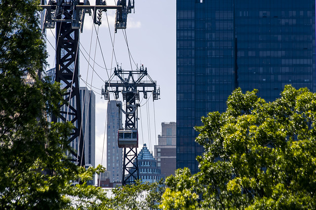
– photo by Mitch Waxman
We boarded the Astoria Line, which carried us southwards down the East River towards Manhattan’s Pier 11 Wall Street stop. Along the way, I spotted the Roosevelt Island Tram coming in for a landing from the East Side of Manhattan.
Have to ride that thing again, soon.
– photo by Mitch Waxman
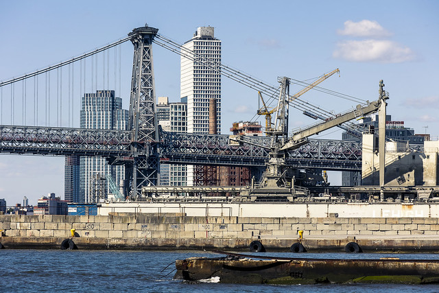
The Astoria line makes a stop at the Brooklyn Navy Yard, which always offers you something interesting to point a camera at.
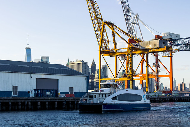
Next stop is Pier 11, where we transferred onto the South Brooklyn line and headed over to Red Hook. Our Lady wanted one of those Key Lime Pie thingamabobs.
– photo by Mitch Waxman
There was a bit of schedule disruption at the South Brooklyn Line’s Atlantic Basin/Red Hook stop and we got hung up there for about an hour. That sucked, but what are you gonna do?
Finally, the boat which would take us to Manhattan arrived.

– photo by Mitch Waxman
In the financial district, there’s an imposture set up for tourists called “Stone Street” which goes out of its way to look “old timey,” but other than some barely utilized historic building stock – it’s the financial district. There’s a pub called “Ulysses” there which has pretty decent burgers and the beer is only $8 a pint. By the financial district’s standard, that’s as cheap as it gets.
We had a drink and a meal, and decided that we would splurge on a nice air conditioned cab ride back to Queens.
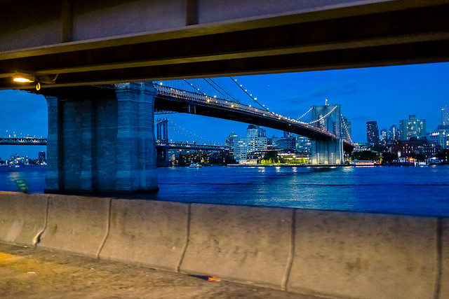
– photo by Mitch Waxman
When I’m paying for a ride, I like to at least get something out of it that I can keep, so my habit is to rig the camera up for high speed and low light shooting. Got this one just after we got onto the FDR Drive.
Tomorrow – something completely different.
“follow” me on Twitter- @newtownpentacle
Buy a book!
“In the Shadows at Newtown Creek,” an 88 page softcover 8.5×11 magazine format photo book by Mitch Waxman, is now on sale at blurb.com for $30.


