Archive for the ‘Long Island City’ Category
isolated phenomena

– photo by Mitch Waxman
Would that I never opened that hated letter. Oh, unhappy act.
A cloak of comfortable ignorance would still drape your humble narrator, and this existential terror would not subsume every moment of my days. In no uncertain terms, a large and shadowy cabal has taken notice of this- your Newtown Pentacle- and focused their attentions upon me. Vast machinations, whose byzantine splendor indicates a guiding master hand, closes about my throat. Proof of it arrived just the other day…
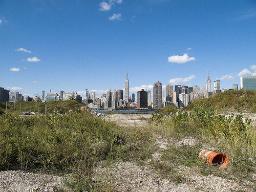
I’m all ‘effed up.
from wikipedia
Schizophrenia is often described in terms of positive and negative (or deficit) symptoms. The term positive symptoms refers to symptoms that most individuals do not normally experience but are present in schizophrenia. They include delusions, auditory hallucinations, and thought disorder, and are typically regarded as manifestations of psychosis. Negative symptoms are things that are not present in schizophrenic persons but are normally found in healthy persons, that is, symptoms that reflect the loss or absence of normal traits or abilities. Common negative symptoms include flat or blunted affect and emotion, poverty of speech (alogia), inability to experience pleasure (anhedonia), lack of desire to form relationships (asociality), and lack of motivation (avolition). Research suggests that negative symptoms contribute more to poor quality of life, functional disability, and the burden on others than do positive symptoms.
A third symptom grouping, the disorganization syndrome, is sometimes described, and includes chaotic speech, thought, and behavior. There is evidence for a number of other symptom classifications.

– photo by Mitch Waxman
Upon receipt of that malign missive, delivered by a sturdy Postal Employee who claims his name is “Mr. Lee”, a fugue state came over me and solace was sought in sanguine familiarity.
Often, when subsumed by malignity in my thought process, your humble narrator seeks out the familiar- something quantifiable, knowable, and grand. Strapping on my camera, and setting my iPhone to a playlist heavy on early Patti Smith, I descended from the densely populated hills of Astoria and set off for the Newtown Creek.
By the time that my playlist had cycled through the first 20 songs, and hit the Mountain Goats song “Lovecraft in Brooklyn“, I was in DUPBO (Down Under the Pulaski Bridge Onramp).
from wikipedia
Persecutory delusions, also known as querulant delusions, are the most common type of delusions.
The affected person believes they are being persecuted. Specifically, they have been defined as containing two central elements:
– The individual thinks that harm is occurring, or is going to occur,
– The individual thinks that the persecutor has the intention to cause harm.
– The perceived persecution may involve the theme of being followed, harassed, cheated, poisoned or drugged, conspired against, spied on, attacked, or obstructed in the pursuit of goals.
Sometimes the delusion is isolated and fragmented, but sometimes are well-organized belief systems involving a complex set of delusions (“systematized delusions”). People with a set of persecutory delusions may believe, for example, they are being followed by government organizations because the “persecuted” person has been falsely identified as a spy. These systems of beliefs can be so broad and complex that they can explain everything that happens to the person.

– photo by Mitch Waxman
The roaring silence of the place, which normally enhances the wonders observed in this forgotten and lonely angle between Long Island City and Greenpoint, did not comfort me. Suddenly, I was pulling the ear buds from my sense organs, as I perceived an antiphonal muttering that sounded like the hebraic ritual name assigned to me by prelates at the coming of age ceremonies well known to even Gentile readers.
Of course, it was just the coincidence of aural background sounds, the vast traffic flow and heavy infrastructure all around DUPBO causes everything around to vibrate slightly creating a sustained field of infrasound that is just beyond the limits of human auditory capabilities. I’m sure an Elephant or Cetacean could tell us what it sounds like, if only we could understand their languages.
from wikipedia
The ancient world viewed hallucinations as it did most of the natural world, with awe and superstition. As such, it was viewed as either a gift or curse by God, or the gods (depending on the specific culture). The oracles of ancient Greece were known to experience auditory hallucinations while breathing in certain neurologically active vapors, while the more pervasive delusions and symptomology were often viewed as possession by demonic forces as punishment for misdeeds.
Treatments
Treatment in the ancient world is ill documented, but there are some cases of therapeutics being used to attempt treatment, while the common treatment was sacrifice and prayer in an attempt to placate the gods. The Dark Ages saw the most horrific accounts where the suffered of auditory hallucinations were subjected to trepanning or trial as a witch. In other cases of extreme symptomology individuals were seen as being reduced to animals by a curse, these individuals were either left on the streets or imprisoned in insane asylums. It was the latter response that eventually led to modern psychiatric hospitals.

– photo by Mitch Waxman
Looking around me, only the poetry of the street stood, and I experienced goose bumps despite the sultry climes suffered by all New Yorkers that day. I imagined that… it must have been an imagining… a mind fever brought on by dehydration or thermal exhaustion… I imagined, damn it- imagined- that I heard a heavy splash in the waters of Newtown Creek, just over the wall separating DUPBO from its waterline…
I will not admit to it, running, except to say that I scuttled away… quickly, and set my iPhone to periodically email my location to Our Lady of the Pentacle should the need arise for her to attempt to find my remains.
from wikipedia
Hypervigilance is an enhanced state of sensory sensitivity accompanied by an exaggerated intensity of behaviors whose purpose is to detect threats. Hypervigilance is also accompanied by a state of increased anxiety which can cause exhaustion. Other symptoms include: abnormally increased arousal, a high responsiveness to stimuli and a constant scanning of the environment for threats. Hypervigilance can be a symptom of posttraumatic stress disorder and various types of anxiety disorder. It is distinguished from paranoia. Paranoid states, such as those in schizophrenia can seem superficially similar, but are in fact characteristically different.
Hypervigilance is differentiated from dysphoric hyperarousal in that the person remains cogent and aware of his surroundings. In dysphoric hyperarousal the PTSD victim may lose contact with reality and re-experience the traumatic event verbatim. Where there have been multiple traumas, a person may become hypervigilant and suffer severe anxiety attacks intense enough to induce a delusional state where the effect of the traumas overlap: e.g. one remembered firefight may seem too much like another for the person to maintain calm. This can result in the thousand yard stare.
Project Firebox 6

– photo by Mitch Waxman
The monstrous pride of this hold out from an earlier day serves sentinel duty on Vernon Blvd., near that point where the ancient path intersects with 44th avenue and curves south. A seller of ornate garden stones and ceramic artifices sits securely behind its steely gaze, and it was undoubtedly the good natured industry of that facility’s owners that created the decorative sidewalk which lends this Firebox its panache. Surely, it cannot just be the backdrop of the Shining City beyond?
a sea of roots

– photo by Mitch Waxman
Obliviated by exposure to the volatile climate of New York City, this cruciform statue adorns the small chapel found nearby the Johnston Mausoleum in First Calvary Cemetery. Depicting the latin, or suffering Christ, the affectation of its artificer in the choice of wood for its construction is both noted and appreciated. Raised in the Hebrew faith, your humble narrator abstains from ritual and dogma as an adult, and instead prefers to believe that every thing is true if one believes in it hard enough. Thor, Buddha, the Orishas, all true.
Atheism is a religion as well- a cohesive and dogmatic system of belief with absolute truths and undeniable heresies. It’s all magick, this jumping about and chest beating we call religion.
My personal world view and moral compass, of course, is built around the simple question “what would Superman do? or WWSD?” Measuring against this rubric, I must always come up short. Superman would have found Gilman by now, but he has x-ray eyes after all. I’m all ‘effed up.
Note: an interesting counterpoint to the suffering of the Latin Christ is the Hellenic “Christ as Athlete” tradition. This photo is from a Cretan church I visited a while back, it’s in a former fishing village called Kalives- notice the physicality and robust physique of the Eastern Christ in comparison to the mendicant like interpretations of the West. The Byzantine tradition focuses a great deal more on the power of the redeemed and revealed godhead, rather than dwelling on its journey “through the meat” that ends on Golgotha.

from wikipedia
Western crucifixes may show Christ dead or alive, the presence of the spear wound in his ribs traditionally indicating that he is dead. In either case his face very often shows his suffering. In Orthodoxy he has normally been shown as dead since around the end of the period of Byzantine Iconoclasm. Eastern crucifixes have Jesus’ two feet nailed side by side, rather than crossed one above the other, as Western crucifixes have showed them for many centuries. The crown of thorns is also generally absent in Eastern crucifixes, since the emphasis is not on Christ’s suffering, but on his triumph over sin and death. The “S”-shaped position of Jesus’ body on the cross is a Byzantine innovation of the late 10th century, though also found in the German Gero Cross of the same date. Probably more from Byzantine influence, it spread elsewhere in the West, especially to Italy, by the Romanesque period, though it was more usual in painting than sculpted corpuses. Since the Renaissance the “S”-shape is generally much less pronounced. Eastern Christian blessing crosses will often have the Crucifixion depicted on one side, and the Resurrection on the other, illustrating the understanding of Orthodox theology that the Crucifixion and Resurrection are two intimately related aspects of the same act of salvation.

– photo by Mitch Waxman
Whether decided by landscape design or geology, there are a series of steep hills at Calvary. Early maps and 19th century illustrations detail this land as quite hilly even before 1848, when the Rt. Rev. Bishop Hughes solemnly blessed and consecrated this place- formerly part of the Alsop plantation- as Calvary Cemetery on the 27th of July. The Alsops are still here, resting in a narrow plot of Protestant loam fenced off from the rest of the place. The deal that the Catholic Church struck with the family for the land stipulated that the protestant Alsop section must be maintained in perpetuity, and its organs have maintained the ancient agreement- rumor states that this is the only Protestant section to be found in a Catholic cemetery upon the Earth.
from junipercivic.com
The male children of the first Richard Alsop, Thomas, Richard and John, became prominent in the legal profession and mercantile life. The children of the second Richard adhered to the ancestral seat in Newtown and married into the Sacketts, the Brinckerhoffs the Whiteheads, the Fisks, the Woodwards and the Hazzards – names now extinct save as they appear on the tombstones, many of which are sadly neglected. The Alsop Cemetery is within Calvary Cemetery, which absorbed all of the property, and is thus certain of receiving proper care. The owner in trust of the reservation is William Alsop, the only living lineal descendant, who resides in New York at present, but for a great many years had his abode in Florida. The family relics have disappeared almost entirely. The only thing that remains to be cherished is an old clock, which is in the remaining descendant’s possession. The house itself, two centuries and a quarter old, has now disappeared forever.
The yellow fever epidemic of 1798 made havoc in the Alsop household, and two tombstones mark the graves of the victims, one of whom was Elizabeth Fish, the widow of Jonathan Fish. She was the widow of the grandfather of President Grant’s Secretary of State. Several slaves died of the contagion, and one at least called Venus, on account of her remarkable beauty, was buried in the family plot. The graves were made ready before death, and no coffins were used. The bodies were merely wrapped in the infected cloths, saturated with pitch and tar, and hastily interred. The slaves’ graves are not marked by stick or stone, because the custom of that time forbade it. The house at one time occupied by Peter Donohue, near the side entrance of Calvary, at Blissville, was built by Thomas Alsop, the father of William. Eventually, it fell into the hands of Paul Rapelyea. The farm surrounding it was part of the Alsop estate, derived from the marriage of Thomas Wandell with the widow Herrick, who owned it in 1750.
After the death of Richard Alsop in 1790, the property was divided between the sons, John and Thomas. John retained the old homestead, and Thomas received the Blissville section. John Alsop died in April 1837, and his widow sold the property to a corporation, and it now embraced in Calvary. John Alsop left no children. Thomas, his brother, married Catherine Brinckerhoff, the daughter of George, a Revolutionary patriot residing at Dutch Kills. A British officer, Finlay McKay, cut his name on a pane of glass in the old Brinckerhoff house in 1776, and it remains there to this day. The well on the Alsop property, which was sunk at the time the mansion was built, still supplies water to many families in the neighborhood. The house was one hundred feet long, and the first floor was divided into four rooms, with a hallway eighteen feet wide. Two round windows, resembling port holes, were cut in the ends of the building in 1776 by Lord Cornwallis for musket practice, and as lookouts to guard against surprise. The chimney place, around which the slaves need to gather, had the capacity of receiving logs of wood ten feet in length. Rufus King married Mary Alsop. He died at Jamaica in 1827. Of this union came John Alsop King, who was Governor of this state from 1857 to 1859.

– photo by Mitch Waxman
The Johnston Mausoleum is surely the grandest structure, beyond the ceremonial chapel of the Cemetery itself, to be found here at First Calvary. Smaller tombs and mausolea ring the hillsides, as do vaults whose gated entry points hide tunneled corridors which burrow into the earth to unknown depths. The shot above, for instance, was captured while standing on the earthworks which bury just such a vault. Just as every other form of city, the Necropolis maintains infrastructure. Calvary has its own sewer system, roads, and irrigation channels. A vast buried culvert underlies the place, providing drainage for this formerly swamped valley of the shadow. Who can guess, what it is, that might be buried down there?
from wikisource.org, “How the Other Half Lives, by Jacob Riis”
Life in the tenements in July and August spells death to an army of little ones whom the doctor’s skill is powerless to save. When the white badge of mourning flutters from every second door, sleepless mothers walk the streets in the gray of the early dawn, trying to stir a cooling breeze to fan the brow of the sick baby. There is no sadder sight than this patient devotion striving against fearfully hopeless odds. Fifty “summer doctors,” especially trained to this work, are then sent into the tenements by the Board of Health, with free advice and medicine for the poor. Devoted women follow in their track with care and nursing for the sick. Fresh-air excursions run daily out of New York on land and water; but despite all efforts the grave-diggers in Calvary work over-time, and little coffins are stacked mountains high on the deck of the Charity Commissioners’ boat when it makes its semi-weekly trips to the city cemetery.

– photo by Mitch Waxman
Disturbing subsidences aside, there is obviously an expensive schedule of groundskeeping kept here, despite the ravages wrought upon the statuary and monuments by the acid rain and corrosive miasma which arises from the nearby Brooklyn Queens Expressway and the Newtown Creek’s industrial activity. In all the time I’ve spent here, peaceful rustications of devastating loneliness, not once have I ever noted “the colour” which is both odd and remarkable. The pernicious influence of that otherworldly iridescence does not seem to penetrate the fencelines of Calvary. Perhaps it is hallowed, this ground, and the working invocations of Dagger John still protect this place from that which lies beyond its gates.
from wikipedia
John Joseph Hughes (June 24, 1797—January 3, 1864) was an Irish-born clergyman of the Roman Catholic Church. He was the fourth Bishop and first Archbishop of the Archdiocese of New York, serving between 1842 and his death in 1864.
A native of Northern Ireland, Hughes came to the United States in 1817, and became a priest in 1826 and a bishop in 1838. A figure of national prominence, he exercised great moral and social influence, and presided over a period of explosive growth for Catholicism in New York. He was regarded as “the best known, if not exactly the best loved, Catholic bishop in the country.” He also became known as “Dagger John” for his practice of signing his name with a dagger-like cross, as well as for his aggressive personality.

– photo by Mitch Waxman
Proverbial, the needle in a haystack your humble narrator seeks is the grave of a certain man, named Gilman. Engendering frustratingly unproductive journeys to dangerously obscure corners of the City of Greater New York in the name of finding a certain document, which might be used as a cypher to decode the ancient graveyards mysteries, my searching for Gilman is frustrated. Your humble narrator has been reduced to performing a visual census, wandering the place looking for his name recorded in stone.
from archny.org
Our Catholic Cemeteries have a history as old as the catacombs. Early in the development of our Catholic tradition, our forefathers in the Faith found the ministry of burial of the dead to be most important. From the catacombs, where early Christians met secretly in prayer and entombed the mortal remains of the early martyrs, to today where the Archdiocesan cemeteries serve the needs of the millions of Catholics located in the greater New York area, our Catholic cemeteries silently bear witness to the respect we give the human body, even in death, because of its status as Temple of the Holy Spirit. Our Catholic cemeteries, filled with artistic expressions of our religious traditions, provide an environment of comfort in times of sorrow and are meant to continually remind us that Jesus Christ promised one day we would all be together in the Eternal Life of Resurrection.

– photo by Mitch Waxman
By 1900, nearly three quarters of a million people were buried here. Today, millions of interments are recorded. Many of these gravesites, according to Catholic tradition, represent a multiplicity of individual burials. Many of the stones and markers which once adorned these family plots are gone- destroyed or misplaced by careless workers, vandals, or in some cases lightning. Whatever records there are, maps and charts of the place, are sealed and vouchsafed by the bishops- who state categorically that the history of Calvary is no one’s business but that of those who are resident there. Frustrated, is my search for Gilman- by the sudden realization that the word “Gilman” was used during the 19th century as a given name- as well as surname.
from wikipedia, another Gilman with no tangible relation to the enigmatic Massachusetts man…
Henry Gilman (May 9, 1893, – November 7, 1986) was an American organic chemist known as the father of organometallic chemistry, the field within which his most notable work was done. He discovered the Gilman reagent, which bears his name…
For a short time after receiving his Ph.D., Henry Gilman worked an associate professor at the University of Illinois after being invited by his former instructor Roger Adams. In 1919, Gilman moved on to become an assistant professor in charge of organic chemistry at Iowa State College of Agriculture and Mechanic Arts (now Iowa State University). At the age of 30, Gilman was given the title of full professor. While at Iowa State College, Gilman met Ruth V. Shaw, a student of his first-year organic chemistry class, and the two were married in 1929.
Gilman had high expectations for his graduate students, and it often took them more than twice as long as the norm to earn their degrees. They were expected to work in the research lab well into the night and on weekends. Gilman was known for frequently visiting the lab during the day and questioning each student as to what they had accomplished since his last visit. Gilman had another common practice for his graduate students. He would not assign a research project for his graduate students, but he would push students to produce a series of preparations. Students would write short publications that would spark ideas about additional experiments to perform, drawing all the material together to form a central thesis.
During his career, Gilman consulted for many companies such as Quaker Oats and DuPont, although he continued as a professor at Iowa State University, as it came to be known. At the usual retirement age of 70, at that time, Gilman chose not to retire from Iowa State University and remained active in research until 1975 when he was 82 years old.
World War II brought new opportunities for Gilman to do research for the government. He took part in the Manhattan Project, which was the code name for the government’s work on the atom bomb. Gilman concentrated on preparing volatile uranium derivatives, mainly dealing with alkoxides.

– photo by Mitch Waxman
Gilman… where is Gilman?
enchanting metamorphoses

– photo by Mitch Waxman
Recent announcements have heralded the formal beginnings of the process which will transmogrify the ancient Hunters Point section of Long Island City irrevocably. The support of overt interests of the Manhattan political elite have been made in public, and the financial and real estate folks are in line behind the project.
Behold, the future home of an estimated 11,000 people, imagine Tower Town.
from nyc.gov
More than 5,000 new apartments are anticipated to be constructed in the primary neighborhood character study area by 2017, including completion of the residential development at Queens West and many other mid-size residential buildings throughout the immediate area. Almost 11,000 new residents are expected in the primary study area as a result of this new construction activity.
As the primary study area (and the secondary study area, discussed below) becomes more densely developed, traffic and pedestrian volumes will increase noticeably from the current levels. Intersections throughout the area will be more congested in the morning, midday, and evening peak hours. The intersections that currently experience some congestion on Vernon Boulevard will be noticeably more congested, with some levels of service D and even LOS F, indicating high to unacceptable delays. In addition, other intersections along Vernon Boulevard in the primary study area will also have moderate to high congestion in the peak hours. On the east-west avenues in the area near the project sites (i.e., 48th, 49th, 50th, and 51st Avenues) traffic volumes are expected to increase slightly.
Pedestrian volumes will also increase in the future without the proposed actions, but sidewalks, corners, and crosswalks will generally continue to operate at acceptable levels. The crosswalk across Vernon Boulevard on the north side of 50th Avenue will, however, become noticeably congested during the morning peak hour, as people cross to enter the subway station there. This crosswalk will operate at LOS E, as will the subway stair closest to the corner (Stair S8). Buses serving the primary study area will also be noticeably more crowded.

– photo by Mitch Waxman
Direct sightlines of the heroic Manhattan skyline will be offered by these new high rise buildings, and soar over the starry old coastline that has known only industrial usage since the first Europeans arrived on the archipelago we know as New York. Its value for industry has long been exhausted, and today it is a brutal waste of land.
also from nyc.gov
The proposed actions would almost double the study area’s population. However, the proposed actions’ mix of affordable and market-rate housing could serve to relieve rather than increase residential market pressure in the study area. Additionally, given the very strong trend already in place in the neighborhood, the new population at Sites A and B would not be expected to introduce or accelerate a trend toward increased market rents in the study area that might cause significant indirect residential displacement. The redevelopment of Site B would introduce new residential uses to the Long Island City industrial area south of Borden Avenue. It is possible that the introduction of this residential use could lead to some limited indirect business displacement because of increased rent pressures. However, the potential for indirect displacement resulting from increased rent pressure is limited, and would not result in significant adverse indirect displacement impacts.

– photo by Mitch Waxman
The new development, a planned community with parks and schools, will extend far from the river- nearly all the way to the Pulaski Bridge with a basketball court and green space sited for the location of the old Vernon Avenue Bridge. The shining city of Queens, and a monument to a revolutionary and aggressive group of city planners, the story of Tower Town has begun.
also from nyc.gov
The Hunter’s Point South Rezoning and Related Actions would allow Site A and Site B to be redeveloped with largely residential buildings with building components ranging in height from
40 to 400 feet. Ground floors would include local retail, lobby, and community facility uses. On Site A, a network of new streets, sidewalks, and bikeways would be developed, creating seven new city blocks from the single 30-acre parcel it is today. Center Boulevard would be continued southward onto Site A and would connect to the rest of the street network. On Site B, it is anticipated that a new publicly accessible private road and open space would roughly bisect the site. The new residential buildings would vary in height, with bases ranging in height from 40 to 70 feet and high rise elements ranging in height from 250 to 400 feet. Nine towers would be developed on Site A, and four towers would be developed on Site B. Ground floors would be occupied by local retail and other commercial uses and community facility uses. A new public school would serve the residents of the buildings and the surrounding neighborhood and create a varied and active streetscape.
In addition, a new public waterfront park would be developed along the East River and Newtown Creek frontages of Site A and a shore public walkway would be developed along the Newtown Creek frontage of Site B. An additional linear public park would also be developed on the south side of 55th Avenue between Center Boulevard and 2nd Street, and a similar public open space would be developed on the south side of the publicly accessible private road on Parcel B, creating a wide boulevard on that street. The new waterfront parks and open spaces on Sites A and B along the East River and Newtown Creek waterfronts would provide greatly increased public access to waterfront views. Wide views of the waterfront and Manhattan would be available from locations throughout the park.
Overall, the proposed actions would change the character of Sites A and B from a commercial and industrial neighborhood to a residential neighborhood. This new residential neighborhood would incorporate retail and park uses that would attract visitors. On both Site A and Site B, pedestrian activity and vehicular activity would increase substantially over existing conditions.
– photo by Mitch Waxman
Tower Town is impossible to argue against, this real estate- former home to rail and ferry docks, and 19th century barge based casinos, and printing plants, and refineries, and power plants- is a blight on the city, and an uncomfortable reminder of that earlier time when brick strewn lots were not remarkable but common.
An economic boom in construction and real estate sales will come, when it is built. A new tax base of luxury and glamour will come to western Queens, and a wildfire of enhanced valuation will spur growth throughout surrounding riverine communities- further enhancing the economy and strengthening their own tax base- Dutch Kills first, then Astoria, and Greenpoint.
Tower Town at Hunters Point South, Atlantic Yards in Brooklyn, Flushing Commons, Willets Point, the Kosciuszko Bridge replacement.
All at once.
from “Air Quality In Queens County” at synapse-energy.com
In the interest of protecting the environment and public health of Northwest Queens, the Natural Resource Defense Council (NRDC) and the Citizens Helping Organize for a Klean Environment (CHOKE) participated in the New York State Article X permitting process for several new power plants proposed in Northwest Queens. One of their objectives was to have a study conducted to analyze the contributors to air pollution in Northwest Queens and to identify possible strategies for improving air quality and reducing risks to public health. As part of the Article X permitting process for its 250 MW Ravenswood Combined Cycle project, KeySpan committed to funding such a study as a community benefit. CHOKE and NRDC contracted with Synapse to conduct this study. The conclusions and recommendations are those of the authors but do not necessarily reflect the position of KeySpan.
One of the reasons that Queens County was chosen for this study is that it is home to many sources of air pollution. In the northwest corner of the county there currently are four large power plants, which together house 46 electric generating units. The county also contains an extensive transportation network that includes the Long Island Expressway, the Brooklyn Queens Expressway, the Grand Central Parkway, two highway bridges, a tunnel to Manhattan, and two airports, along with over 400 miles of arterial and local roads. Queens also has several large industries, and some 2.2 million residents, leading to significant economic activity which contributes to air quality problems.

– photo by Mitch Waxman
A small and insignificant scuttling thing who some might describe as a man, your humble narrator has spent a good deal of time wandering about the lonely industrial frontages of Hunters Point and expended some effort into learning its past. My opinion of this project is meaningless, it is a gathering thunderhead, and Manhattan is coming to Queens. There is just one thing that has been glossed over in mainstream reports about this place…
…this waterfront property…
from a Newtown Pentacle post of 6/7/2009
In 1697, a Dutch sea captain named Peter Praa bought the Bogardus properties and set up farming. He died in 1740, and the land was left to his granddaughter Anne Bennet. Her son, Jacob Diks, inherited next and he passed the land to his daughter- Anna Hunter. In 1817, Hunter, who had three sons, left the land to her children under the proviso that it be sold and the moneys divided evenly between them. This is why the “Mispat” became known as “Hunter’s Point”.

– photo by Mitch Waxman
For the water that promoters of this plan mention is the East River, not the water that has defined it throughout all recorded time.
from a Newtown Pentacle post of 2/28/10:
3.8 miles long, its mouth is directly opposite the Bellevue Psychiatric Hospital in Manhattan, and defines the currently undefended border between North Brooklyn and Western Queens. Estimates state that some 14 million gallons of combined sewage, storm runoff, and industrial waste provide the only flow of water into the Creek. It’s waters are opaque, and in the height of summer turn an unnatural shade of green.
The soft bottom of the waterway is 15-20 feet below the surface of the water, and the hard bottom is occluded by a gelatinous sediment known as “Black Mayonnaise”. Composed of petroleum residues, coal tar, PCB’s, and human excrement- it lies 15 feet thick on the bed. The oxygen content of the water drops precipitously as soon as one leaves the East River. The first of the drawbridges which cross it- known as the Pulaski Bridge, is the borderline beyond which immersion in this water is worthy of full HAZMAT gear and first responders institute biological decontamination procedures for anyone who finds themselves in it.
As I’ve mentioned in the past… the chemicals Putrescine (an organic chemical compound NH2(CH2)4NH2 (1,4-diaminobutane or butanediamine) and Cadaverine (a toxic diamine with the formula NH2(CH2)5NH2)which are produced by the rotting and putrefaction of animal flesh are abundantly found in the Newtown Creek under industrial aliases like Acrylonitrile and are prominent members on the EPA’s list of Volatile Organic Compounds– or VOC’s..
Who can guess, what it is, that may be buried down there?

– photo by Mitch Waxman
Tower Town, you see, will be built along the Creek as well…
…the Newtown Creek…
from epa.gov
“Newtown Creek is one of the most grossly-contaminated waterways in the country,” said Acting Regional Administrator George Pavlou. “By listing the creek, EPA can focus on doing the extensive sampling needed to figure out the best way to address the contamination and see the work through.”
EPA responded to requests by members of Congress to evaluate specific sites along the creek by publishing a September 2007 report that contained a review of past work and recommendations regarding future work at Newtown Creek. The state of New York referred the site to EPA due to the complex nature of the contamination along the creek.
Newtown Creek is part of the core area of the New York-New Jersey Harbor Estuary, which has been designated by EPA as an “estuary of national significance.” Despite the ongoing pollution problems, some residents currently use the creek for recreational purposes such as kayaking, while others catch fish for consumption out of it. Various sediment and surface water samples have been taken along the creek and reveal the presence of pesticides, metals, PCBs, and volatile organic compounds (VOCs), which are potentially harmful contaminants that can easily evaporate into the air.
In the mid -1800s, the area adjacent to the 3.8-mile Newtown Creek was one of the busiest hubs of industrial activity in New York City. More than 50 industrial facilities were located along its banks, including oil refineries, petrochemical plants, fertilizer and glue factories, sawmills, and lumber and coal yards. The creek was crowded with commercial vessels, including large boats bringing in raw materials and fuel and taking out oil, chemicals and metals. In addition to the industrial pollution that resulted from all of this activity, the city began dumping raw sewage directly into the water in 1856. During World War II, the creek was one of the busiest ports in the nation. Some factories and facilities still operate along it, and various adjacent contaminated sites have contributed to its contamination. Today, as a result of its industrial history, including countless spills, Newtown Creek is badly polluted.
12 stations of the Newtown Pentacle
It’s wonderful to be here, It’s certainly a thrill. You’re such a lovely audience,
We’d like to take you home with us, We’d love to take you home.
I don’t really want to stop the show, But I thought that you might like to know,
That the singer’s going to sing a song, And he wants you all to sing along.
Sgt. Pepper’s Lonely Hearts Club Band (Lennon/McCartney)
Its been a fascinating 12 months, Lords and Ladies, and I believe that I’ve stayed on mission at this one year anniversary of this blog. 270 posts, in case you were wondering, some large others small. The blog itself has received a little over 43,000 views and the photos the posts are based on at flickr have been witnessed some 76,577 times. Not bad, and both sets of gross statistics are growing on a nice curve. The number 1 post, historically, is Newtown Creek Waste Water Treatment Plant .
Here’s a few of the Newtown Pentacle’s greatest hits, which are not “by the numbers”:
from the very first posting of May 29, 2009:
What is “The Newtown Pentacle”?
The colonial era towns of Greenpoint, Brooklyn and the Queens towns of Astoria, Ravenswood, Hunter’s Point, Bowery Bay, and Middletown were called Newtown in Dutch and English times. In the early 19th century, the Queens villages combined to form Long Island City. The industrial center of the area was and still is Newtown Creek. The most polluted body of water on earth, this ancient inlet was once home to the Maspaetche Indians. Dutch Orchards and English farms gave way to Yankee rail and then Standard Oil as time went by. Today, its waters are a curious shade of copper green, and the largest oil spill in history gurgles back and forth through deep subterranean channels between Green Point and Long Island City. The architecture of the place is disturbingly heterogeneous. A rough tumble of styles are represented in this area — 19th century wrought iron row houses predominate, but 18th century warehouses are still on active duty in some places. Near Hunter’s Point and in Old Astoria, Antebellum mansions abut hideous Le Corbusier-influenced modernism. To the south and the east can be found some of the most interesting stone work in New York City as one explores the cemetery belt along the Brooklyn and Queens border.
Three million New Yorkers lie in Calvary cemetery alone. In this, the Necropolis of New York City, the living population of Queens is outnumbered three to one.
After a health scare a couple of years ago, my doctors recommended a course of clean living and regimen of physical exercise as the best curative. An amateur antiquarian and connoisseur of odd information, I elected to use my prescriptive exertions as an opportunity to explore and record. I toured crumbling Long Island City, the tree lined lanes of Victorian Astoria, and rusty coastlines of foetid Newtown Creek. Headphones on, camera in hand. The journey has taken me to many odd and forgotten places, and led me to discover a fascinating group of people. Follow me on these long walks, I promise you’ll see something amazing.
from June 4, 2009
The Night Soil and Offal Docks, and Jell-O
Not Furmans Island, but pretty close by in 2008

I was seeking out some information on a shunned 1960′s religious group which had headquartered at a disused 19th century Satmar Yeshiva (which burned to ash in 1973) over on the Greenpoint side when I read about “Conrad Wessel’s noxious and pestilential night soil and offal dock on Furman’s Island, along the Newtown Creek”. This reference was connected to Gov. Flower’s “smelling committee” which traveled up Newtown Creek in a steamboat during the summer of 1894 to confirm that the waterway did, in fact, smell. The Smelling Committee placed much blame for the miasma which permeated Long Island City, Dutch Kills, and Greenpoint at the doorstep of the bone boilers on Furman’s Island.
from July 16th, 2009

-photo by Mitch Waxman
Just off the corner of Steinway is 38-13 Northern Blvd. It stands opposite the cyclopean Standard Motor Products building, and at the foot of the bridge which carries Steinway into 39th street and south to Skillman Avenue over the Sunnyside Yards. Currently, the structure houses part of the NYPD’s ESU units- the Emergency Medical Squad. The building was originally a firehouse- the Hook and Ladder 66.
The earliest volunteer fire company in Newtown was organized in 1843- the Wadownock Fire, Hook & Ladder No. 1. By 1902, there were 66 distinct volunteer fire departments in Queens. 19th century Long Island City was served by (amongst others) the Astoria Engine Co., the Hunter Engine Co., the Mohawk Hose Co., and the Tiger Hose Co. In 1890, the legislature of New York State abolished the volunteer departments, seeking to create a paid and professional force of firefighters. In Long Island City, as many as nine units were created, and then reorganized in 1894, as rampant political corruption had rendered the new units impotent against all but the smallest blazes. This corruption was centered around Long Island City’s mayor- Patrick “Battleax” Gleason- or was at least blamed on him by his enemies in the press.
The critical date for this story is 1898, when Long Island City joined in the municipality of the City of Greater New York, and its firefighters joined the FDNY.
from August 12th, 2009
The Terracotta House, or… what is that?

New York Architectural Terra-Cotta Works, LIC -photo by Mitch Waxman
After an apocalyptic fire in 1886, the New York Architectural Terra-Cotta Works needed a new headquarters. One that befit its role as the preeminent manufacturer of architectural ceramics.
Built in 1892 as an office for the company that supplied terra-cotta for Carnegie Hall and the Ansonia Hotel, among others. The company went out of business in the 1930s, and the building became vacant. It was eventually bought in 1965 by Citibank. Its ruins can be found at 42-10 – 42-16 Vernon Avenue, across the street from the sumptuous hedonism of the newly opened Ravel Hotel, and next door to the venerable and recently feted span of the Queensboro Bridge. It was landmarked in 1982.
Two and one half stories, the structure is actually the front office of an industrial complex that was once surrounded by a 12 foot high wall of brick, which enclosed an open storage yard, a 5 story factory, and the kilnworks one would expect to find at such a large endeavor. Its satisfying design was crafted by Francis H. Kimball, architect of the celebrated Montauk Club in Brooklyn, and it is in the Tudor Revival Style.
from September 12th, 2009

Grand Street – North East – photo by Mitch Waxman
Gaze upon the coils of the dragon and despair.
Scuttling like some Kafkaesque cliche’– away from those tremulous revelations manifested just up the street in DUMABO– at the Metropolitan Avenue Bridge over the English Kills- around soiled patches of broken pavement and across a sandy substrate of glittering and powderized glass- between towering fencelines whose attendant armies of guardian birds voicing their mocking cry of “Ia, IA” or “tekeli-li” – the Grand Street Bridge is suddenly risen above the Newtown Creek’s miasmic banks- and your humble narrator falls unabashedly to the tainted ground before it. This is a standing stone, an ancient artifact, and like the Greenpoint Avenue Bridge– an urban talisman of those days when the Tiger came to the Newtown Pentacle.
from October 15th, 2009
Newtown Creek Waste Water Treatment Plant
LO… Behold and tremble, for the Newtown Pentacle is back in session.

– photo by Mitch Waxman
A fitting temple has been erected to an ancient goddess by the redoubtable engineers of the DEP, a shining secular cathedral which looms over storied Greenpoint, this is the Newtown Creek Wastewater Treatment Plant (referred to as the NCWWTP from this point on), whose guarded interiors were revealed to an eager public via the auspices of the 2009 Open House New York event.
from November 13, 2009
Tales of Calvary 4- Triskadekaphobic Paranoia

– photo by Mitch Waxman
Near the crest of one of Calvary Cemetery’s hills, can be found what I’ve described in previous posts as “a tree that is fed by some morbid nutrition”.
A convenient afternoon vantage point for photographing the Johnston mausoleum and a frequent destination, a Hallowmas (nov. 1) stroll through Calvary revealed some interesting goings on beneath the swollen boughs of this loathsome landmark.
note: I returned the following Sunday (nov. 7) for further observations, to this alien vista of titan blocks and sky flung monoliths.
from December 1, 2009
Mt. Zion 1 – imps of the perverse

– photo by Mitch Waxman
What would appear to be a Jewish section of the vast funerary complex that is 2nd and 3rd Calvary Cemeteries, is actually a distinct cemetery organized as and referred to as Mount Zion.
It made a convenient hiding spot for me one day when a group of children on Maurice Avenue took notice of me and began to follow me around. The possibility of some vaguely malign intention toward me, on their part, caused a near faint and I ran away- here’s what happened.
Narrow, juvenile faces, their appearance and aspect were dominated by a toothy grimace- much wider than the usual proportion- and oddly jowled chins. The corners of their mouths stretched to mid cheek and passed well beyond the bulging center point of those widely set and unblinking milky blue eyes- which I attribute to the possibly mutagenic qualities of the chemical pollution of that nearby extinction of hope called the Newtown Creek.
A little girl amongst them, barefoot and carrying a polydactyl calico which was buzzing with attention, pointed me out and all the other odd looking children turned and stared in my direction. A vast physical coward, and unable to withstand even the thought of defending myself against a crowd of 10 year olds, your humble narrator screamed a shrill shriek and broke into a clumsy run to make an escape to hallowed ground.
from January 31st, 2010

Queensboro Bridge and associated structures- “The Great Machine” – photo by Mitch Waxman
Queensboro, whose steel has cantilevered the flow of traffic to the shining city from the fabled vastness of the Long Island since 1909, is merely the focal point of a polyglot mechanism whose works spread into the east. The backbone of New York City runs through the marshy hillocks of western Queens.
As I’ve said in the past:
Airports, railroad yards, maritime facilities, petrochemical storage and processing, illegal and legal dumping, sewer plants, waste and recycling facilities, cemeteries. The borders of the Newtown Pentacle’s left ventricle are festooned with heavy industry and the toll taken on the health of both land and population is manifest. A vast national agglutination of technologies and a sprawl of transportation arteries stretching across the continent are all centered on Manhattan- which is powered, fed, and flushed by that which may be found around a shimmering ribbon of abnormality called the Newtown Creek.
Light rail (subway) and vehicle traffic focus toward Queens Plaza, and within a three mile radius of this place can be found- the East River subway tunnels, the Midtown Tunnel, multiple ferry docks, and the titanSunnyside Rail Yard which connects to the Hells Gate Rail Bridge. This “Great Machine” is the motive engine that allows millions to enter and leave Manhattan on a daily and reliable schedule from North Brooklyn, Queens, Suffolk and Nassau Counties. The great endeavor called “The East Side Access Project” and its associated tunneling is also occurring nearby, which will terminate at a planned LIRR station sited for the corner of Queens Blvd. and Skillman Avenue.
from February 6th, 2010

Red Crow van spotted – photo by Mitch Waxman
Returning from a trip to Third Calvary Cemetery the other day (searching for Gilman) to my Astoria, I came across this red van with a disturbingly heterogeneous collection of mattresses affixed to it. This red van is a familiar sight around the neighborhood, personal conveyance of a Crow. For clarity and codification lords and ladies, this gentleman shall be referred to as “Red Crow”, here at your Newtown Pentacle.
from March 15th, 2010

– photo by Mitch Waxman
He died alone, squirming in agony, surrounded by strangers. His last friend and only true colleague had recently used a colt handgun to commit suicide, and the only woman he ever loved had left him years ago. Instead he lay there alone in the charity ward- dying in anonymity and pain as his parents had. An orphan raised by matron aunts who indulged and spoiled the strange child who came to them in their dotage- they left him unprepared for adulthood. He retreated into his letters, wrote his stories, and never knew he would live on in the dreams of the sensitive and artistic forever more.
Just 14 months previous to his death, the newspapers detailed the lurid crimes of Albert Fish- the Gray Man, the Werewolf of Wysteria, the Brooklyn Vampire, The Boogeyman– who was executed at SingSing. The good old days, indeed.
from April 3rd, 2010

– photo by Mitch Waxman
Note: One of those things that your humble narrator is guilty of is a tendency, when confronted with something alien or unknown, to “fill in the blanks” via an inexact mixing of logical supposition and impressionist reasoning. The opposite of exactitude, this can result in wild ideas and false assumptions being presented and accepted as fact. I would love to tell you which cultic group these artifacts belong to- but the fact is that I just don’t know. Certain assumptions can be hazarded, based on cursory resemblance and observed phenomena, but they will be guesses. Don’t assume my interpretation of things is correct.
Witness, then, what I observed in St. Michael’s Cemetery on the Saturday before Easter- April 3rd, 2010- right about here.
from May 22, 2010

– photo by Mitch Waxman
This is not a dead place, this Creek which forms the currently undefended border between much of Brooklyn and Queens, despite wholly inaccurate statements to the contrary recently presented by major publications. To begin with, there is the teeming human infestation, whose population is in the millions. Additionally- migratory birds, invertebrate and vertebrate water fauna, and an enormous hidden population of higher mammals lurk amongst the canalized shorelines of the Newtown Creek.
from the nytimes.com– an article that gets a lot of things completely wrong, which is surprising for the times, and seems to be shilling against “Big Oil”
People don’t often think of urban creeks as biodiverse waterways, but Newtown Creek was once a rich tidal estuary popular among hunters and fishermen. Starting in the 1870s, however, Standard Oil and other refineries began spilling or dumping excess fuels and toxic chemicals into the water or onto the soil, slowly poisoning the ecosystem.
We are just getting started, Lords and Ladies, on this very bumpy ride through the realities of the Newtown Pentacle.


