Archive for the ‘Maspeth’ Category
with palpitant heart

– photo by Mitch Waxman
Startlingly interesting is the only way to describe the experiences of the preceding year. Attempts have been made to cogently describe and colorfully illustrate the encounters your humble narrator has enjoyed in this 10th year of the millennium. For those of you who have just recently started to read this, your Newtown Pentacle, this is your chance to check out some of the highlights of 2010 (according to me), and for the veteran Lords and Ladies of the Pentacle an opportunity to review.
If you’ll indulge me…
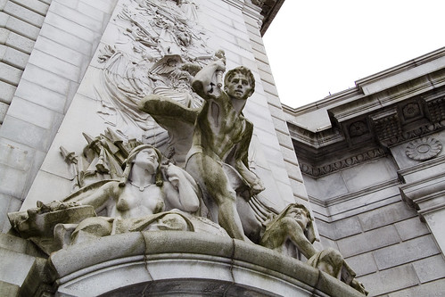
January, 2010- The Abbot

The sort of posting which satisfies me deeply, “The Abbot” monument found at Calvary focused my attentions on certain realities of 19th century New York, and proved my theory that Calvary Cemetery is the single greatest historical resource in Queens. Obviation of my satisfaction with the posting is provided by the admission that I had noticed the stone peripherally, found it interesting, and started shooting it with no idea at all about its meaning. Only at home, when reviewing the photos did the whole story come together. Al Smith is buried at Calvary as well (he’s the fellow who built the skyscraper seen in the night shot at the head of this post) but this paragraph is about January 2010 and Governor Smith’s story was told in 2009.
January, 2010- The Great Machine

Also in January, a pet ideation was advanced, one not of theory but of perception. The notion of the megalopolis figures heavily in my thinking- a concept that sees the eastern seaboard of the United States not as a series of cities, but rather one vast urban zone of varying densities with New York City at the titular center of a web of industry, transport, and agricultural systems. The center of the web has a center itself, which is Manhattan- specifically where it connects to “the Great Machine” of the Queensboro bridge and it’s corollaries.

– photo by Mitch Waxman
February 2010– Affordable Housing Development on Borden Avenue

This post, “Affordable Housing Development on Borden Avenue“, is included in the year end wrap up simply because it ended up being one of the more widely read and commented upon endeavors presented in 2010. Most likely, it was the linking shout out from Queenscrap that made it so, rather than any subjective quality or incisive observation. Homeless camps abound in the Newtown Pentacle, hidden away on seldom trodden lanes and along backwater pathways- in this case it’s alongside the oft delayed construction project at the Borden Avenue Bridge which spans Dutch Kills.
February 2010– horrible and unearthly ululations…

A lot of time was spent in 2010 trying to wrap my head fully around the story of the Newtown Creek (which culminated ultimately in the late October release of the first Newtown Pentacle book- Newtown Creek for the vulgarly curious) and “horrible and unearthly ululations…” was the first of several posts which attempted to boil complicated and obscure snippets of historical lore into a cohesive and accessible form. So much is made of the Greenpoint Oil Spill and the Meeker Avenue Plumes by the legal community, whose hungry jowls slaver and shake at the financial possibilities offered by the EPA’s superfund designation and various court decisions, that the true and terrible wonder of the Newtown Creek is often overlooked. This post and several others of its ilk attempt to present a fuller version of things, and act as reminders that what was may once again be.

– photo by Mitch Waxman
March 2010– The Shadow over Sunnyside

The St. Pat’s Day for All parade in Sunnyside is a yearly event which draws in a citywide coterie of political entities, all desperate for attention and attribution as being friendly to the GLTG members of the electorate. The parades origins are a reaction against the banning of outwardly gay marchers in the RC church’s own St. Patricks day parade in Manhattan. Despite its politically contentious birthing, the Sunnyside parade is actually a fun and light hearted event, and signals the coming of springtime in the Newtown Pentacle. While there principally to get shots of the political master race which rules over us, amongst the crowd I noticed small clots of dire intent armed with ugly signage. Research into this group, which was clearly coordinated and queerly ominous, revealed them to be adherents to a bastardized form of Catholic fundamentalism which has been outlawed and defined as a dangerous cult by several Nation-states. A shadow over Sunnyside indeed.
March 2010– Exhausted
A brighter experience for your humble narrator was the Manhattan Bridge Centennial Time Capsule event, on March 5. Interactions and conversations were enjoyed by the least of men with certain powers and potentates of the City of Greater New York and entry to the interior space of the Manhattan Bridge was obtained. One of the high points of my year, “Exhausted” detailed the embedding of a time capsule in the East River Bridge #2- aka the Manhattan Bridge. Remarkable self control was exercised when I met the DOT Commissioner, Jeanette Sadik-Khan. My sincerest desire was to bend her ear with my alleged wisdom about bike lanes and bridge safety- but self control was ascendent that day and only congratulations were offered to both her and the other staffers at DOT.

– photo by Mitch Waxman
April 2010– City of Marble and Beryl
Odd shenanigans were observed at St. Michael’s Cemetery here in Astoria, which were of a decidedly magickal nature. A ritual site that your humble narrator stumbled across was examined and evidentiary examination suggested that certain third world cults were extant here in the old village of Astoria, conducting midnight bacchanals concurrent with the lunar cycle. “City of Marble and Beryl” was but the first of many moons which witnessed a working of will amongst the desolations of our kind.
April 2010– Searching for Gilman

A good part of 2010 was spent “Searching for Gilman” at First Calvary Cemetery, which I am doing as you are reading this, assuming it’s the start of 2011 whenever you do. Gilman is the source of no small amount of pain and financial hardship around these parts, as your humble narrator has become dangerously obsessive and paranoid around the subject. A psychotic need to find Gilman’s grave torments me, coloring my days and painting my dreams a dull yellow.

– photo by Mitch Waxman
May 2010– the king in yellow, brick
Remiss would be apparent were I to not mention the “Madison Avenue Bridge Centennial” but “the king in yellow, brick” advanced another of my pet theories and served up a fascinating (to me at least) sequence of events and relationships which attempts to explain why those yellow Kreischer bricks are all over the older sections of Queens.
May 2010– after cycles incalculable

“After cycles incalculable” is another one of those perfect posts, from a personal perspective. Wandering around with a friend, which is a disturbing trend which developed over the course of 2010, at Skillman Avenue’s start we observed the Lemuria hatching in concordance with the anniversary of the Roman festival of Lemuralia in Long Island City.

– photo by Mitch Waxman
June 2010– from Hells Gate, loosed upon the world

When I set out on my little walks, there is seldom a destination in mind. Literally wandering, obscure symbols and pseudo occultism guide my steps- I’ll follow a black cat, or merely adopt a roughly heliotropic path using my own shadow as compass. At the very end of May, my feet carried me toward Astoria Park and the notorious section of the East River known as Hells Gate. The odd craft, an “unidentified floating object” if you would, which sped past my lens required more than a small bit of detective work to identify- which was detailed in “from Hells Gate, loosed upon the world“.
June 2010– Gods Gift to Pain

English Kills, which is the logical and modern end of Newtown Creek, is a heavily industrialized and largely anaerobic tributary of the larger waterway and is seldom visited (by me, at least) at its extant. One fine day, while hanging out with another Creek enthusiast (you should not go to this place alone), we decided to enter the largely hidden urban foyer which leads here- despite the fact that we were most likely trespassing- which violates Newtown Pentacle policy. The title of the post- “Gods Gift to Pain” was lifted from an enigmatic and appropriate bit of graffiti observed in this forgotten pace of dissolution and poison.

– photo by Mitch Waxman
The reason for Brooklyn, and Queens- why it was a viable alternative to living in Manhattan in the 19th century was defined by the horrors of tenement life. The grand old buildings with their high ceilings, thick plastered walls, convenient dumbwaiters, and incredibly ornate lobbies- the structures which distinguished and made life desirable in the incalculably distant boroughs, were built as an alternative to the crowded and dangerous tenements of “The City”- especially the warren which was known as the “Five Points“. Additionally, Calvary Cemetery (of particular interest to me, and perhaps, to you) was founded by the parishioners of Old St. Patrick’s Cathedral which is smack dab in the middle of this ancient labyrinth of poverty, crime, and squalor. It was decided that to fully understand what one observes in the remains of the supposed “answer to the problem”, exploration of “the problem” itself is required.
July 2010– Bandits Roost, 2010

Ideal source material for the textural and societal milieu of the Five Points is the admittedly biased “How the Other Half Lives” by 19th century do-gooder Jacob Riis. Speaking the truth that power wants to hear is always a sound move if one considers fiscal realities and historical reputation. Attempts were made to find the modern locale in which Riis shot some of his more famous shots, such as this visit to “Bandits Roost 2010“.
July 2010– The house of Dagger John

Another critical visitation for me, as part of my larger education and study of the early development of the City of Greater New York was occasioned on the day when I went to “The house of Dagger John“. Old St. Patrick’s Cathedral satisfies both my continuing fascination with the counterpoint of sacred and profane in the story of the Megalopolis, and figures largely in the predictions of certain obscure lore which governs the schedule of my researches.

– photo by Mitch Waxman
August 2010– not to harsh anyone’s buzz… but…

August of 2010 brought a posting which garnered a lot of attention, due to curbed.com noticing and linking to it. Simply noticing that a growing proliferation of small boats were berthing illegally at the Vernon Avenue street end, it would be irresponsible of me- given everything that I know about the location not to point out the mortal and existential danger that the operators of these boats were placing themselves in. It’s not even the water, really, its the high pressure natural gas line- the enormous CSO which drains LIC- the omnipresent heavy industrial maritime traffic- which makes the spot so hazardous. Mortal threats were received via email (which I’ve kept private), and the comments thread displayed an angry and accusatory tone. As is the case with all such critique, these comments were presented verbatim- here’s a taste: “i have red your article in which you show a great deal of unger towards me and my friends . i believe that you base your article on many misconceptions that are rooted in a lack of communication”, “Blogger or not, the prudent journalist would make an effort to uncover basic facts before publishing a story full of assumptions”, “are you just the type of little man that tells teacher when the cool kids make you feel inferior. The water is public domain! And according to maritime law it is not illegal to moor a boat as long as it safe and looked after.”, “They are not bothering anyone. And get sick from the canal, come on. They are not living down there as far as I know. Parking your boat in the canal is not going to get them sick! Stop over doing it.” Check out “not to harsh anyone’s buzz… but…“.
August 2010– lively antics

One of the greatest joys of living in Queens are the chance encounters you’ll have with people who hail from the furthest points of the compass, such as this Bouzouki player during another visit to Hells Gate. His “lively antics” added splendor to a brightly lit walk around Astoria.

– photo by Mitch Waxman
September 2010– Lucky Shot

Although veteran photographers caution me against use of this term, I call the photo above my “shot of the year”. The steel structure attached to the bottom of the Brooklyn Bridge was installed as part of a bridge painting and maintenance project, and I was luckily along on a Working Harbor trip just as the sun was setting. Right place, right time, it was a “Lucky Shot“.
September 2010– stronger than fear

The dynamic new Safeboats utilized by NYPD and other entities around the harbor were a frequent subject over several of the Working Harbor expeditions I was lucky enough to attend. The many shapes, colorways, and missions of these quick little patrol boats are a delight to observe- and to those who would work maritime malice upon the metropolis- they are the head of the spear. Check out “stronger than fear“.

– photo by Mitch Waxman
A high of the year was the Newtown Creek Cruise which I had the honor of co-narrating with Bernard Ente on October 24th, of course, but the main topic of conversation amongst the antiquarian and environmental communities of the Newtown Pentacle in October revolved around the EPA’s superfund announcement about Newtown Creek at the very end of September. October is spooky time around these parts, and I spent a little time digging around the area for thrills and chills as well.
October 2010– blurred outlines

As part of series of postings detailing what might be seen in the Brooklyn neighborhood of Greenpoint, “blurred outlines” discusses the alleged appearance of a pyrokinetic at 84 Guernsey Street in January of 1895.
October 2010– scenes familiar, and loved

One of my frequent walks through Calvary Cemetery took me to the curiously empty chapel which enjoys the paramount of Laurel Hill. I will admit that I came here this day seeking two things- one was a likely entrance to a vast subterranean structure which underlies the area- the other was a vain hope that the grave of Gilman might present itself in a section which was, at the time, not terribly familiar to me as I normally stay close to the fringes of the place where the whipporwills wail. I very well might have captured what mass media paranormal media sources describe as a ghost orb in “scenes familiar, and loved“.

– photo by Mitch Waxman
November 2010– peace rests nevermore

One of the goals of this, your Newtown Pentacle, is to provide some sort of documentation about this terrible and wonderful place called the Newtown Creek- and I’m happy to say that I was there when the then Attorney General and Governor Elect Andrew Cuomo announced the settlement of a lawsuit brought by his office on behalf of New York State against Exxon-Mobil which involved the Greenpoint Oil Spill. “Peace rests nevermore” indeed.
November 2010– shocking coruscations

Entertaining maritime folklore from past centuries was offered in “shocking coruscations“, which is told against a series of twilight photos from good old Hells Gate between the two great bridges.

– photo by Mitch Waxman
During the cold, when inclement clime restricts my movements and the black dog nips at my heels, I tend toward shorter postings- and in December of 2010 there were two “Then and Now” postings that really took my fancy. These posts are difficult because of the scarce source material available in the public domain, but fun nevertheless. In my usual fashion “dumb idiot” fashion, I had shot the modern views completely unaware of the original photo. Our friends at the Greater Astoria Historic Society have recently released a book of similar historical views, which is worthy of consideration.
December 2010– Bowery Savings Bank 2010 and 1903

As the title states, this is the iconic shell of a once essential and awesomely powerful institution called the Bowery Savings Bank in Manhattan, with a 1903 photo from a similar perspective.
December 2010– Hunters Point Avenue Bridge Centennial

If you told me a year ago that I’d end up doing a press conference with a United States Congresswoman, I’d have hit you. That’s how I ended up at the Degnon Terminal’s own Sunshine Biscuits (LaGuardia Community College) building though, and by an odd coincidence- found myself standing in nearly the same spot as some unknown photographer did in 1921. This posting was built around the announcement of the “Hunters Point Avenue Bridge Centennial” event.

– photo by Mitch Waxman
Overall, a positive and exciting year, despite the deaths of several members of my family.
For a while, I enjoyed a spot on the board of the nascent Newtown Historical Society as a trustee, which is a position that I’ve had to resign for a variety of personal reasons- but I’d like to thank fellow board members Kevin Walsh, Christina Wilkinson, Steve Garza, and Bob Singleton for an interesting and educational experience. Kevin Walsh of forgotten-ny gets a personal call out, as his support, knowledge, and encouragement has been invaluable. Special thanks also are extended toward Capt. John Doswell and Meg Black of the Working Harbor Committee, all the guys and gals aboard the John J. Harvey fireboat, and everybody else who allowed a piss poor specimen such as myself to come along on adventures. Bernard Ente of the Newtown Creek Alliance, Working Harbor, and others also receives a heartfelt gratitude and shout out from this humble mendicant. Standing on the shoulders of giants is difficult if you suffer from altitude related nosebleeds.
What’s next?
Tell you what, feel like taking a walk?
Meet me at the border of Brooklyn and Queens – bring a camera… and ID… I’ll show you something cool…
Low Tide at Maspeth Creek
– photos by Mitch Waxman
Shallow as it is, Maspeth Creek at an extreme low tide on Wednesday the 22nd of December.
perilous disposition
Notes:
- Don’t miss the Hunter’s Point Avenue Bridge Centennial this weekend, on December 11th, a free event. For more on the HPA Bridge Centennial, click here.
- Also, please consider purchasing a copy of the first Newtown Pentacle book: “Newtown Creek for the Vulgarly Curious” – a fully annotated 68 page, full-color journey from the mouth of Newtown Creek at the East River all the way back to the heart of darkness at English Kills, with photos and text by Mitch Waxman.

– photo by Mitch Waxman
Thrice damned, the Kosciuszko Bridge is scheduled for demolition and replacement, and with it shall go the last of Blissville (or Berlin, or West Maspeth, or Laurel Hill- depends on who you ask to describe this “angle” between neighborhoods).
Recent obligation called on me to enter the historic quarter of Ridgewood, and I embarked on the long walk from Astoria with the intention of “checking in” on the area. Unfortunately, seasonal variance in environmental temperature and atmospheric conditions are taking their usual toll on my delicate physical constitution.
from wikipedia
The Kosciuszko Bridge is a truss bridge that spans Newtown Creek between the New York City boroughs of Brooklyn and Queens, connecting Greenpoint, Brooklyn and Maspeth, Queens. It is a part of Interstate 278, which is also locally known as the Brooklyn-Queens Expressway. The bridge opened in 1939, replacing the Penny Bridge from Meeker Avenue in Brooklyn to Review Avenue and Laurel Hill Boulevard, and is the only bridge over Newtown Creek that is not a drawbridge. It was named in honor of Tadeusz Kościuszko, a Polish volunteer who was a General in the American Revolutionary War. Two of the bridge towers are surmounted with eagles, one is the Polish eagle, and the other the American eagle.

– photo by Mitch Waxman
Numbing begins for me at higher temperatures than most, and even the high 40’s and low 50’s call for woolen hats and gloves, and insulation about the torso is absolutely critical. This ridiculous assortment of threadbare garments forces me to move in a stiff and corpse like fashion, and stepping onto a bathroom scale reveals that my full winter gear (with camera) adds some 30 pounds to my weight. Like one of “Marius’s mules” however, your humble narrator nevertheless endures in his self enforced march across the concrete landscape of the Newtown Pentacle. The awful thing, however, was not the suffering of one sickly and somewhat insane narrator- it was what I could not have seen on 54th avenue.
Also, we’ve been to 43rd street before, in the “Maspeth? Laurel Hill? Where am I?” posting of 9/3/2009.
from forumnewsgroup.blogspot.com
…To accomplish this, the new bridge will be built next to the existing structure, and all six lanes of traffic will be shifted onto what will eventually be the eastbound structure. The existing bridge will be demolished, and a new structure for westbound traffic will then be built in its place.
The current bridge carries three lanes of traffic in each direction. The final product will include five lanes into Queens and four into Brooklyn, along with a pathway for bicyclists and pedestrians that promises to provide a “terrific view of the Manhattan skyline,” according to Adams. The new bridge will also feature standard-width lanes, shoulders for disabled vehicles and better sight lines for drivers, according to Adams. “This will have significant improvements on the merging problems that exist today,” he said.
The state is continuing to negotiate with property owners within the 1.1 mile construction zone to acquire easements and land needed for the project. That is expected to be completed by 2013. The state is also working with the city Parks Department on a new greenspace that is planned for beneath the approach to the bridge on the Queens side, but Parks was unable to provide details about that.

– photo by Mitch Waxman
The so called sidewalks which underlie the approaches to the Kosciuszko Bridge (thrice damned) are pedestrian in name only, and the evidence of gathered diesel dust and undisturbed deposits of windblown graveyard soil suggests that no other boots save my own have traversed the space in any recent memory. This is a place for the automobile, the truck, and those who cross it by foot must be sagacious and alert.
While passing from Laurel Hill Blvd. to 54th avenue via one of these underpass viaducts, something impossible was suggested rather than observed as scratching about in these deposits. It could not have been what peripheral observation suggests, and it is far more likely that I am suffering from some early phase of macular degeneration or an undiagnosed neurological condition than that which I believed I saw could be material and real.
For now, I’m keeping my observation to myself, lest some guardian of the public good who might be reading this recommend me to the psychological hospitals at Wards Island for both my own protection and that of the community at large.
Suffice to say, what I think I saw cannot exist in any world governed by wholesome laws of physics and or familiar biology, but it is probably best to avoid the drainage pipes which carry storm runoff from the Kosciuszko Bridge’s BQE down to the streets of this angle between neighborhoods- just in case.
from nysdot.gov
In the early to mid 19th century, virtually the only development along the channels of the Newtown Creek drainage were crossings for roads and turnpikes that linked nearby villages and led to East River ferries. A highway between Bushwick and Newtown was in place by 1670,including a wooden bridge that was most likely the first road crossing of the creek, at approximately the location of present Meeker Avenue. This crossing was replaced circa 1812-14 by the Penny Bridge, a toll bridge on the Newtown and Bushwick Turnpike Road. The first crossing of English Kills along the present Metropolitan Avenue opened circa 1814-16 as part ofthe Williamsburg and Jamaica Turnpike. These remained the only bridges into the 1840s when nearby urban development stimulated more road construction across the marshy drainage. Mid-19th century bridges included the Maspeth Avenue Plank Road to Newtown (1846), and the Greenpoint and Flushing Plank Road linking the Greenpoint ferry to the new Calvary Cemeteryvia present Greenpoint Avenue (1853-54).
The 1848 establishment of the large Catholic cemetery (Calvary Cemetery), on an old estate north of the Penny Bridge, reflected the absenceof any competing land use demands along most of the waterway. Water transport remained a better means of moving goods and people between the local villages and nearby urban areas;steamboats served the cemetery until around 1870. Local road development in the late 1860s included the first Vernon Avenue Bridge over Newtown Creek (removed and replaced by the Pulaski Bridge), and a bridge over Dutch Kills on present Borden Avenue. In part to secure public funding for street improvements in Hunter’s Point, Henry Anable sought to incorporate the area in 1870 as part of Long Island City, which also absorbed the villages of Astoria, Ravenswood, and Dutch Kills

– photo by Mitch Waxman
The easements sought for the footprint of the new bridge in Queens will obliterate the last of the residences here. Consultations with knowledgeable sources, including the research staff at Newtown Creek Alliance and Forgotten-NY as well as a coterie of online sources for ancient maps and lost railroad sidings, suggest that the area modernity refers to as “Blissville” or “Laurel Hill” or “West Maspeth” was referred to in earlier times as “Berlin” or “Berlin Hill” or “Berlinville”.
The inestimable Kevin Walsh of Forgotten-NY, ever generous with his encyclopedic grasp of the history of the Megalopolis, actually supplied links to jpegs of century old maps which describe this place for consideration by the curious and inform the modern viewer as to the atavist nomenclature of the very streets themselves.
Luckily, 2 of these maps may be found online and are publicly available for inspection, here and here.
also from nysdot.gov
In October 1936, the Commissioner of Plants and Structures for the City of New York proposed a high level fixed span that would provide 125 feet above MHW between bulkheads. This bridge today is known as the Kosciuszko Bridge and replaced the Meeker Avenue Bridge. The marine community for sometime in the 1930’s had sought to have the Meeker Avenue Bridge replaced and supported the proposed 125’ vertical clearance for the new bridge.
At that time, the companies and organizations included: Queensboro Corporation, New England Navigation, Brooklyn Union Gas Company, Mystic Steamship Company, Tide Water Oil Company, Brooklyn Chamber of Commerce, New York Towboat Exchange, Inc., the Port Authority of New York/New Jersey, and Card Towing Line.
However, two Corporations, Merritt-Chapman & Scott Corporation and Cross, Austin & Ireland Lumber Company with docks above the bridge objected to any clearance less than 135 feet above MHW and requested that a vertical clearance of 150 feet be required.

– photo by Mitch Waxman
If my reading of these maps is correct (they often aren’t, so decide for yourself), then these doomed houses are the last residential survivors of Washington Avenue (43rd street) between Waters Ave. (54th rd.) and Columbia Ave. (55th ave.). Sources also inform that that the remarkable declination of this area is not part of “Laurel Hill” – the geological feature which Calvary Cemetery is carven into – but is instead “Berlin Hill”. Other… documentation… provided to me remains confidential, but confirms the olden names of these lanes.
- Our friends at forgotten-ny have, of course, been in this spot before- check out the FNY page on Blissville/Laurel Hill for an overview of the entire area and a scholarly erudition which sets the gold standard for the entire genre of urban exploration.
from nysdot.gov
On page 17 of this slideshow presentation from the NYS DOT, one might observe the footprint expected for the Queens side of the Kosciuszcko Bridge project. The technical term for the properties affected, incidentally, is easement– which the State will be acquiring using its voluminous power of eminent domain.

– photo by Mitch Waxman
All that remains here now is industry, and a somewhat relict rail line. When the construction on the new Kosciuszko Bridge (thrice damned) begins, the long and cold winter nights in Berlinville will belong only to those who lie within venerable Calvary, and to that which could not have been reaching out from a drainage pipe beneath the Kosciuszko Bridge (thrice damned) and grasping at a startled pigeon, and whatever festering things there may be which lurk in that nearby stagnation of innocence called the Newtown Creek.
Such things, and places, do not exist- after all.
from wikipedia
In forensics, skeletonization refers to the complete decomposition of the non-bony tissues of a corpse, leading to a bare skeleton. In a temperate climate, it usually requires three weeks to several years for a body to completely decompose into a skeleton, depending on factors such as temperature, presence of insects, and submergence in a substrate such as water. In the tropics, skeletonization can occur in weeks, while in the Andes Mountains or tundra, skeletonization will never occur if subzero temperatures persist. Natural embalming processes in peat bogs or salt deserts can delay the process indefinitely, sometimes resulting in natural mummies
The rate of skeletonization and the present condition of the corpse can be used to determine the time of death.
After skeletonization has occurred, if scavenging animals do not destroy the bones, the skeleton of mid to large size mammals such as humans takes about twenty years to be completely dissolved by acids in the soil leaving no trace of the organism. In neutral pH soil or sand, the skeleton will persist for at least several thousand years before it finally disintegrates. Infrequently, however, the skeleton can undergo fossilization, leaving an impression of the bone that can persist for millions of years.
ceaseless mazes

– photo by Mitch Waxman
While wandering about near the former Phelps Dodge property at the Newtown Creek, a juggernaut was observed as it hurtled along on standard gauge.
from wikipedia
There is an urban legend that Julius Caesar specified a legal width for chariots at the width of standard gauge, causing road ruts at that width, so all later wagons had to have the same width or else risk having one set of wheels suddenly fall into one deep rut but not the other.
In fact, the origins of the standard gauge considerably pre-date the Roman Empire, and may even pre-date the invention of the wheel. The width of prehistoric vehicles was determined by a number of interacting factors which gave rise to a fairly standard vehicle width of a little under 2 metres (6.6 ft). These factors have changed little over the millennia, and are still reflected in today’s motor vehicles. Road rutting was common in early roads, even with stone pavements. The initial impetus for the ruts probably came from the grooves made by sleds and slide cars dragged over the surfaces of ancient trackways. Since early carts had no steering and no brakes, negotiating hills and curves was dangerous, and cutting ruts into the stone helped them negotiate the hazardous parts of the roads.
Neolithic wheeled carts found in Europe had gauges varying from 130 to 175 centimetres (4 ft 3 in to 5 ft 9 in). By the Bronze age, wheel gauges appeared to have stabilized between 140 to 145 centimetres (4 ft 7 in to 4 ft 9 in) which was attributed to a tradition in ancient technology which was perpetuated throughout European history. The ancient Assyrians, Babylonians, Persians and Greeks constructed roads with artificial wheelruts cut in rock spaced the wheelspan of an ordinary carriage. Such ancient stone rutways connected major cities with sacred sites, such as Athens to Eleusis, Sparta to Ayklia, or Elis to Olympia. The gauge of these stone grooves was 138 to 144 centimetres (4 ft 6 in to 4 ft 9 in). The largest number of preserved stone trackways, over 150, are found on Malta.
Some of these ancient stone rutways were very ambitious. Around 600 BC the citizens of ancient Corinth constructed the Diolkos, which some consider the world’s first railway, a granite road with grooved tracks along which large wooden flatbed cars carrying ships and their cargo were pulled by slaves or draft animals. The space between the grooved tracks in the granite was a consistent 1.5 metres (4 ft 11 in).
The Roman Empire actually made less use of stone trackways than the prior Greek civilization because the Roman roads were much better than those of previous civilizations. However, there is evidence that the Romans used a more or less consistent wheel gauge adopted from the Greeks throughout Europe, and brought it to England with the Roman conquest of Britain in AD 43. After the Roman departure from Britain, this more-or-less standard gauge continued in use, so the wheel gauge of animal drawn vehicles in 19th century Britain was 1.4 to 1.5 metres (4 ft 7 in to 4 ft 10 in). In 1814 George Stephenson copied the gauge of British coal wagons in his area (about 1.42 metres (4 ft 8 in)) for his new locomotive, and for technical reasons widened it slightly to achieve the modern railway standard gauge of 1.435 metres (4 ft 8.5 in).

– photo by Mitch Waxman
Thrumming, the juggernaut was witnessed crossing beneath the relict corrosion of the estimable Kosciuszko Bridge. Certain sources reveal that the bewildering and unstoppable mechanism was constructed during the bicentennial of the nation, and served as a motive engine for passenger travel (as part of the Long Island Railroad) before entering its present occupation as a freight hauler.
from wikipedia
The New York and Atlantic Railway (NY&A) (reporting mark NYA) is a short line railroad formed in 1997 to provide freight service over the tracks of the Long Island Rail Road, a public commuter rail agency which had decided to privatize its freight operations. NY&A operates exclusively on Long Island, New York and is connected to the mainland via the Hell Gate Bridge and a car float – the New York Cross Harbor Railroad – from Brooklyn to New Jersey. Lumber, building products, scrap metal, construction & demolition debris, bio-diesel fuel, food, beer, gravel, propane, chemicals, structural steel, plastics and recyclable cardboard/paper are NYA’s main traffic. Occasionally, NYA transports utility poles and electrical transformers to the LIPA facility in Hicksville, which has its own spurs. NYA also moves municipal solid waste in sealed containers on COFC trains.
Some NYA customers are located off-line, and make use of NYA’s team tracks to receive or ship products. Team tracks are located in Bay Ridge, Hicksville, Huntington, Greenlawn, St. James, Islip, Richmond Hill, Maspeth, Speonk, Medford, Yaphank, Southold and elsewhere on the Long Island Rail Road lines which NYA serves. Most of NYA’s customers have their own spurs, making the use of team tracks unnecessary.
Other occasional products shipped to Long Island via the NYA is bentonite and rock salt. The LIRR and the NYCTA both receive new passenger equipment via the NYA, and ship out old, retired equipment for scrapping by way of the NYA.The NY&A officially took over Long Island Rail Road’s freight operations on May 11, 1997. The initial franchise was for 20 years.

– photo by Mitch Waxman
There are some who can describe this vast agglutination of engineered and finely tuned machinery in excruciating detail, and discuss exactitudes and certain notable exceptions to its operation. Your humble narrator, however, firmly pronounces ignorance of the deeper mysteries which surround and inform the world of the “railfan“.
I may spot the occasional train, but I am not a “trainspotter“. The good folks at trainsarefun.com are though, and they offer this photo from 1974 as well as tremendous insight to the rich history of these tracks.
from wikipedia
An EMD GP38-2 is a four-axle diesel-electric locomotive of the road switcher type built by General Motors Electro-Motive Division. Part of the EMD Dash 2 line, the GP38-2 was an upgraded version of the earlier GP38. Power was provided by an EMD 645E 16-cylinder engine, which generated 2000 horsepower (1.5 MW).
The GP38-2 differs externally from the earlier GP38 only in minor details. There is a cooling water level sight glass on the right side of the hood, and the battery box covers are bolted down, instead of hinged. It can be distinguished from the contemporary GP39-2 and GP40-2 in that its Roots blown engine had two exhaust stacks, one each side of the dynamic brake fan if fitted, while the turbocharged GP39-2 and GP40-2 has a single stack. The GP39-2 has two radiator fans on the rear of the long hood like the GP38-2, however the GP40-2 has three. It was also available with either a high short hood, which is common on Norfolk Southern units, or a low short hood, which is common on most other railroads.
previous recollections

– photo by Mitch Waxman
Recently, I was obliged to meet up with a couple of guys from Williamsburg when they asked me to guide them through some of the Newtown Creek’s less well known attractions. My pithy reply was that I would be straddling the border of Brooklyn and Queens, and they should just meet me there- at the venerable Grand St. Bridge. I walked there from Astoria in record time, arriving quite a bit earlier than I had anticipated.
Luckily the morning was crisp, my coffee was hot, and the burning thermonuclear eye of god itself was shining strongly- which afforded me with a nice opportunity me to do a little shooting.
Note: I’m never sure how to describe the actual act of photography. Shoot, capture, take- all somewhat violent terms which don’t really fit the action. Sniper techniques do transfer neatly into telephoto work, exhaling while triggering the shutter and all that, but… it’s all rather soldier sounding isn’t it?
from wikipedia
Photography is the process, activity and art of creating still or moving pictures by recording radiation on a radiation-sensitive medium, such as a photographic film, or electronic image sensors. Photography uses foremost radiation in the UV, visible and near-IR spectrum.[1] For common purposes the term light is used instead of radiation. Light reflected or emitted from objects form a real image on a light sensitive area (film or plate) or a FPA pixel array sensor by means of a pin hole or lens in a device known as a camera during a timed exposure. The result on film or plate is a latent image, subsequently developed into a visual image (negative or diapositive). An image on paper base is known as a print. The result on the FPA pixel array sensor is an electrical charge at each pixel which is electronically processed and stored in a computer (raster)-image file for subsequent display or processing. Photography has many uses for business, science, manufacturing (f.i. Photolithography), art, and recreational purposes.
As far as can be ascertained, it was Sir John Herschel in a lecture before the Royal Society of London, on March 14, 1839 who made the word “photography” known to the whole world. But in an article published on February 25 of the same year in a german newspaper called the Vossische Zeitung, Johann von Maedler, a Berlin astronomer, used the word photography already. The word photography is based on the Greek φῶς (photos) “light” and γραφή (graphé) “representation by means of lines” or “drawing”, together meaning “drawing with light”

– photo by Mitch Waxman
Surreal, the waters around the Grand Street Bridge teem with that alien colour which typifies and describes the industrial hinterlands of that annihilation of innocence which is called the Newtown Creek. For an extensive description and history of this spot, a busy automotive and truck crossing in modernity, click the following for the Newtown Pentacle posting “a Grand Journey in DUGSBO”
from nyc.gov
Grand Street is a two-lane local City street in Queens and Kings Counties. Grand Street runs northeast and extends from the Brooklyn Queens Expressway in Brooklyn to Queens Boulevard in Queens. The road is known as Grand Street west of the bridge and Grand Avenue east of the bridge. The bridge is located between Gardner Avenue in Brooklyn and 47th Street in Queens. The Grand Street Bridge is a 69.2m long swing type bridge with a steel truss superstructure. The general appearance of the bridge remains the same as when it was opened in 1903. The bridge provides a channel with a horizontal clearance of 17.7m and a vertical clearance, in the closed position, of 3.0m at MHW and 4.6m at MLW. The bridge structure carries a two-lane two-way vehicular roadway with sidewalks on either side. The roadway width on the bridge is 6.0m and the sidewalks are 1.8m wide. The height restriction is 4.1m. The approach roadways are wider than the bridge roadway. For example, the width of Grand Avenue at the east approach to the bridge (near 47th Street) is 15.11m.
The first bridge on this site, opened in 1875, quickly became dilapidated due to improper maintenance. Its replacement, opened in 1890, was declared by the War Department in 1898 to be “an obstruction to navigation.” Following a thorough study, a plan was adopted in 1899 to improve the bridge and its approaches. The current bridge was opened on February 5, 1903 at a cost of $174,937.

– photo by Mitch Waxman
While pondering the atypical number of 19th century suicides which occurred here, a flock of geese happened along in this so called urban desert and distracted me from my usual morbid soliloquy. They were pecking at the manmade bulkheads, skimming for waterline plant life.
from wikipedia
The Canada Goose was one of the many species described by Linnaeus in his 18th-century work Systema Naturae. It belongs to the Branta genus of geese, which contains species with largely black plumage, distinguishing them from the grey species of the Anser genus. The specific epithet canadensis is a New Latin word meaning “from Canada”. According to the Oxford English Dictionary, the first citation for the ‘Canada Goose’ dates back to 1772. The Cackling Goose was formerly considered to be a set of subspecies of the Canada Goose.

– photo by Mitch Waxman
Nearby was this enormous creature, balancing on one foot . Unfortunately, it wasn’t disposed toward looking my way, despite my best Brooklyn exclamation of “hey, boid, overs here’s”. When a tractor trailer blew by, it suddenly exploded upward.
from wikipedia
New York dialect is predominantly characterized by the following sounds and speech patterns:
Vowels
- The low back chain shift The /ɔ/ vowel sound of words like talk, law, cross, and coffee and the often homophonous /ɔr/ in core and more are tensed and usually raised more than in General American. Labov (1966) describes this pattern as varying on a scale from [ɔ] to [ʊ]. An inglide typically accompanies higher variants giving [oə] or [ʊə]. /ɑ/ in father and /ɑr/ in car are backed, diphthongized, and sometimes rounded to [ɑə] or [ɒə]. The result is that card in New York can be similar to cod in parts of New England. In addition, a subset of words with /ɒ/ as in lot feature a lengthened and diphthongized variant, [ɑə]. This variant may appear before a word final voiced stop, /dʒ/, or /m/ (e.g., cob, cod, cog, lodge, bomb). It also occurs variably before voiced fricatives (e.g., bother), /ʃ/ (e.g., wash), and in the words on, John, and doll (Wells 1982: 514).
- The short-a split There is a class of words, with a historical short-a vowel, including plan, class, and bad, where the historical /æ/ is raised and tensed to an ingliding diphthong of the type [eə] or even [ɪə]. This class is similar to, but larger than, the BATH lexical set, in which Received Pronunciation uses the so-called broad A. Other words, such as plaque, clatter, and bat, retain a lax, low-front [æ], with the result that bad and bat have different vowels. A related (but slightly different) split has occurred in the dialect of Philadelphia. Although the lax and the tense reflexes of /æ/ are separate phonemes in these dialects, their distribution is largely predictable. See Phonemic æ-tensing in the Mid-Atlantic region for more details.
- /oʊ/ as in goat does not undergo fronting; instead, it remains [oʊ]. This groups New York with the “North” class of dialects rather than the “Midland”, in which /oʊ/ is fronted. Relatedly, /uː/ as in goose is not fronted and remains a back vowel [uː] or [ʊu]. This lack of fronting of /oʊ/ and /uː/ also distinguishes New York from nearby Philadelphia. Some speakers have a separate phoneme /ɪu/ in words such as tune, news, duke (historically a separate class). The phonemic status of this vowel is marginal. For example, Labov (1966) reports that New Yorkers may contrast [duː] do with [dɪu] dew though they may also have [dɪu] do. Still, dew is always [dɪu] and never [duː].
- Diphthongs The nucleus of the /aɪ/ diphthong is a back and sometimes rounded vowel [ɑ] or [ɒ] (right as [ɹɑɪt]) and the nucleus of the /aʊ/ diphthong is a front vowel [æ] (rout as [ɹæʊt]). The sociolinguistic evidence (Labov 1966) suggests that both of these developments are active changes. The fronted nucleus in /aʊ/ and the backed nucleus in /aɪ/ are more common among younger speakers, women, and the working and lower middle classes.
- pre-r distinctions New York accents lack most of the mergers before medial /r/ that many other modern American accents possess:
- The vowels in marry [mæri], merry [mɛri], and Mary [meri] ~ [mɛǝri] ~ [mɛri] show either a two- or three-way contrast.
- The vowels in furry /fɜri/ and hurry /hʌri/ are distinct.
- Words like orange, horrible, Florida and forest are pronounced /ɑrəndʒ/ and /fɑrəst/ with the same stressed vowel as pot, not with the same vowel as port as in much of the rest of the United States.
- Merger of /ɜr/ and /ɔɪ/: One of the stereotypes of New York speech is the use of a front-rising diphthong in words with /ɜr/ (e.g., nurse). This stereotype is popularly represented in stock phrases like “toity toid” for thirty-third. The phonetic reality of this variant is near [ɜɪ]. This variant may also appear in words with /ɔɪ/ (e.g., choice), resulting in verse and voice as homophones. The diphthongal variant for /ɜr/ is highly stigmatized. Labov’s data from the mid-1960s indicated the form was recessive then. Only two of his 51 speakers under age 20 used the form as compared with those over age 50 of whom 23 out of 30 used the form. Items with /ɔɪ/ may occur with [ɜr] (e.g., [tɜrlət] toilet), apparently as a result of hypercorrection. Younger New Yorkers (born since about 1950) are likely to use a rhotic [ɜr] in bird even if they use non-rhotic pronunciations of beard, bared, bard, board, boor, and butter.

– photo by Mitch Waxman
Turns out it’s a heron. Go figure, a heron at Newtown Creek.
from wikipedia
The herons are wading birds in the Ardeidae family. There are 64 recognised species in this family. Some are called egrets or bitterns instead of herons. Within the family, all members of the genera Botaurus and Ixobrychus are referred to as bitterns, and—including the Zigzag Heron or Zigzag Bittern—are a monophyletic group within the Ardeidae. However, egrets are not a biologically distinct group from the herons, and tend to be named differently because they are mainly white and/or have decorative plumes. Although egrets have the same build as the larger herons, they tend to be smaller.
The classification of the individual heron/egret species is fraught with difficulty, and there is still no clear consensus about the correct placement of many species into either of the two major genera, Ardea and Egretta. Similarly, the relationship of the genera in the family is not completely resolved. However, one species formerly considered to constitute a separate monotypic family Cochlearidae, the Boat-billed Heron, is now regarded as a member of the Ardeidae.
Although herons resemble birds in some other families, such as the storks, ibises and spoonbills, they differ from these in flying with their necks retracted, not outstretched. They are also one of the bird groups that have powder down.
Some members of this group nest colonially in trees; others, notably the bitterns, use reedbeds.

– photo by Mitch Waxman
That’s it for today, over the weekend I’ll be thrilling you with recent encounters your humble narrator has had with the political class who rule over New York City.
Also, please buy a copy of our book- Newtown Creek, for the vulgarly curious- here. Every copy sold contributes directly to sustaining and maintaining this- your Newtown Pentacle.
from wikipedia
Grand Street is a street in Williamsburg, Brooklyn, New York City, United States. The Grand Street (BMT Canarsie Line) subway station serves the corner of Grand Street and Bushwick Avenue. Crossing English Kills into Queens, Grand Street becomes Grand Avenue, continuing through Maspeth where it is a main shopping street, to Elmhurst. Its northern end is at Queens Boulevard. Broadway continues the thoroughfare north and west.
History
In the 19th century, before the construction of the Williamsburg Bridge, the Grand Street Ferry connected Grand Street, Brooklyn to Grand Street, Manhattan. The Grand Street Line was a streetcar line along the road.


