Posts Tagged ‘East River’
Project Firebox 10

– photo by Mitch Waxman
Woe to the FDNY Firebox which finds itself on the surly triangular corners that swirl about Northern Blvd. This elegantly destroyed specimen languishes perilously close to Steinway Street’s transmogrification into 39th street near the Standard Motor Products Building, specifically 36th avenue and 41st street.
As a point of interest, this is the eastern extant of 36th avenue, with its western terminus obviated by the Roosevelt Island Bridge at the East River.
lively antics

– photo by Mitch Waxman
Shackled by impotent pride and stalled ambitions, your humble narrator can often be observed scuttling along area sidewalks, a strange old man identified by malign aspect and the odd omnipresence of a camera. A great dread is experienced when someone on the street perceives my phantasmic presence, and I am forced into an encounter with someone who is unashamedly alive. Just such an encounter was had near Hells Gate on the East River, near Astoria Park, at the end of June 2010.
from nycgovparks.org
Although widely known for its beautiful pool, the oldest and largest in the city, Astoria Park offers more than aquatic pleasures. Outdoor tennis courts, a track, a bandstand, multiple trails, basketball courts, and playgrounds lure visitors from the five boroughs and beyond. And the views! Sitting on the edge of the East River and resting between the Triborough Bridge and Hell Gate Bridge, the park offers shoreline sights and sounds that make the benches along its perimeter popular spots year-round.

– photo by Mitch Waxman
This gentleman informed me that he was an ethnic musician, and made his living playing hellenic folk music at area “tavernas” and at weddings. The instrument he carried was crafted by his ancestors, and he carried it with him to America when he arrived here in the early 1960’s. He did tell me his name, but I did not write it down. It might have been Peter. Perhaps George.
also from nycgovparks.org
Due to its proximity to Hell Gate, a turbulent area in the East River, this playground has been named for the monster Charybdis. According to Greek mythology, Charybdis was the daughter of Poseidon, the god of the sea. As a young nymph, she flooded lands to add to her father’s kingdom until Zeus, the supreme ruler of the gods, turned her into a monster.
Charybdis and her partner Scylla are personifications of the violent waters in the Straits of Messina, which separate Sicily from the Italian peninsula. Charybdis was said to dwell under a fig tree on the Sicilian shore and, three times each day, drink from the strait and spit the water back into the strait several hours later, creating perilous whirlpools and terrifying sailors. In The Odyssey, by Homer, the hero survived Charybdis’s wrath by clinging to a tree for hours until she spit out the water and his raft floated to the surface.

– photo by Mitch Waxman
Practiced, his hands flew along the fret boards, and he demonstrated musical forms that are typical of the island cultures of the Hellenic Republic which is known as Greece to the english speaking world. His serenade was lilting, thrilling, and reminded me of the Greek musical genre called Rembetiko.
from wikipedia
The melodies of most rebetiko songs are thus often considered to follow one or more dromos or dromoi (gr. δρόμος, plural δρόμοι). The names of the dromoi are derived in all but a few cases from the names of various Turkish modes, known in Turkish as makam.
However, the majority of rebetiko songs have been accompanied by instruments capable of playing chords according to the Western harmonic system, and have thereby been harmonized in a manner which corresponds neither with conventional European harmony, nor with Ottoman art music, which is a monophonic form normally not harmonized. Furthermore, rebetika has come to be played on instruments tuned in equal temperament, in direct conflict with the more complex pitch divisions of the makam system.

– photo by Mitch Waxman
He described the instrument he wielded as being well over a century old, and suggested that it had certain supernatural powers against which the female gender possesses no defense. He also claimed he could calm stormy seas with it, but one thing life in Astoria has taught me is that when a Greek guy is telling a good story well – just go with it.
from wikipedia
This is the classical type of bouzouki that was the mainstay of most Rebetiko music. It has fixed frets and it has 6 strings in three pairs. In the lower-pitched (bass) course, the pair consists of a thick wound string and a thin string tuned an octave apart. The conventional modern tuning of the trichordo bouzouki is Dd-aa-dd. This tuning was called the “European tuning” by Markos Vamvakaris, who described several other tunings, or douzenia, in his autobiography. The illustrated bouzouki was made by Karolos Tsakirian of Athens, and is a replica of a trichordo bouzouki made by his grandfather for Markos Vamvakaris. The absence of the heavy mother of pearl ornamentation often seen on modern bouzoukia is typical of bouzoukia of the period. It has tuners for eight strings, but has only six strings, the neck being too narrow for eight. The luthiers of the time often used sets of four tuners on trichordo instruments, as these were more easily available, since they were used on mandolins.

– photo by Mitch Waxman
Charming guy, he was intent on hanging out at the park and mentioned something about the fishes wanting to hear some Rembetiko as I was taking my leave of him.
from wikipedia
Greek emigration to the United States started in earnest towards the end of the 19th century. From then onwards, and in the years following the Asia Minor Disaster, until immigration became restricted in the mid-1920s, a great number of Greeks emigrated to the United States, bringing their musical traditions with them. American companies began recording Greek music performed by these immigrants as early as 1896. The first Greek-American recording enterprises made their appearance in 1919. From the latter years of the second decade of the century there exist a number of recordings that can be considered as rebetiko, a few years before such songs began to appear on recordings in Greece.
The music industry in the United States came to play a particular role from the mid-1930s onwards in recording rebetiko lyrics which would not have passed the censors in Greece. This phenomenon came to repeat itself during the period of the Greek military junta of 1967–1974. A notable example of American recording studios permitting some ‘bolder’ lyrics can be found in the LP “Otan Kapnizei O Loulas”, ie “When They Smoke The Hookah”, released in 1973. Releasing this album in Greece, with to its overt references to various aspects of drug use, would have been impossible at that time. It is worth noting, however, that the censorship laws invoked in Greece by Metaxas were never officially revoked until 1981, seven years after the fall of the junta. A further characteristic of American Greek recordings of the time was the continued recordings of songs in the Anatolian musical styles of rebetiko, which continued to be recorded in the United States well into the 1950s. Even songs originally recorded with typical bouzouki-baglamas-guitar accompaniment could appear in Anatolian garments.
After WWII, beginning in the early 1950s, many Greek rebetiko musicians and singers traveled from Greece to tour the United States, and some stayed for longer periods. Prominent among them were Ioannis Papaioannou, Manolis Hiotis, Vassilis Tsitsanis, Iordanis Tsomidis, Roza Eskenazi, Stratos Pagioumdzis, Stavros Tzouanakos and Ioannis Tatasopoulos, of whom the latter three died in the United States.

– photo by Mitch Waxman
Clearly he was amused by the kayakers from the LIC Boat House as they passed by, and he launched into a wild melody on his centenarian instrument.
a fun story about Hells Gate from 1899 can be accessed here at nytimes.com– here’s the headline:
A HELL GATE SEA SERPENT.; Valiant Bowery Boatmen Bring Its Headless Body Ashore
harbor shots

– photo by Mitch Waxman
At the start of June, your humble narrator was offered the rare chance to act as… a humble narrator.
Nobody of more august character was available, I supposed, when the Working Harbor Committee asked me if I would be interested in speaking during a Circle Line cruise.
Wow.
from wikipedia
Circumnavigation of Manhattan became possible in 1905 with the construction of the Harlem Ship Canal, the first regularly scheduled trip being the Tourist captained by John Roberts in 1908.
On June 15, 1945 Frank Barry, Joe Moran and other partners merged several sightseeing boats to form the Circle Line operating out of Battery Park.
In 1955 it began operating at its current Pier 83 location. In 1962 it bought the Hudson River Day Line.
In 1981 the two companies split.
In 1988 the 42nd Street company bought World Yachts operating upscale dining cruises from Chelsea Piers. In 1998 the 42nd Street company also launched The Beast, a speedboat ride which takes tourists around the Statue of Liberty and goes 45 mph.

– photo by Mitch Waxman
An eerie quiet came over me when the microphone was first passed over, and panic quickly overcame any attempt at “being cool”. Luckily, veteran MC John Doswell of the Working Harbor Committee rescued a drowning man. By the second tour of the day, I managed to catch a little of his “vibe” and followed the narrative he supplied after my disappointing showing on the first tour. While John was speaking I managed to grab a few interesting shots. The fireboat above, for instance, is the FDNY’s newly minted 343 at the Brooklyn Navy Yard.
from nycfireboat.com
Because of the very real threat of additional terrorist attacks after 9/11/01, the boats will also be capable of protecting firefighters from Chemical, Biological, Radiological, Nuclear agents (CBRN). While performing in any of these hostile environments, the crew will be protected in a pressurized area that will also have it’s air supply filtered by special charcoal and HEPA filters.

– photo by Mitch Waxman
As always, the Empire State Building commands the scene from both the East River…
from wikipedia
The South Street Seaport is a historic area in the New York City borough of Manhattan, located where Fulton Street meets the East River, and adjacent to the Financial District. The Seaport is a designated historic district, distinct from the neighboring Financial District. It features some of the oldest architecture in downtown Manhattan, and includes the largest concentration of restored early 19th-century commercial buildings in the city. This includes renovated original mercantile buildings, renovated sailing ships, the former Fulton Fish Market, and modern tourist malls featuring food, shopping and nightlife, with a view of the Brooklyn Bridge. At the entrance to the Seaport is the Titanic Memorial lighthouse.

– photo by Mitch Waxman
And from the North- or lower Hudson- River. There is a satisfaction to the design of this structure, a governing and massive esthetic that has always drawn me. Center stage is where it belongs, IMHO, with the rest of the skyline of Manhattan descending in bilateral asymmetries around it. Empire State and its nearby rival- the Chrysler Building- are what skyscrapers should look like.
from wikipedia
The building design most closely associated with New York City is the skyscraper, whose introduction and widespread adoption saw New York buildings shift from the low-scale European convention to the vertical rise of business districts.
As of August 2008, New York City has 5,538 highrise buildings,[70] with 50 completed skyscrapers taller than 656 feet (200 m). This is more than any other city in United States, and second in the world behind Hong Kong. New York has architecturally noteworthy buildings in a wide range of styles. These include the Woolworth Building (1913), an early gothic revival skyscraper built with massively scaled gothic detailing able to be read from street level several hundred feet below. The 1916 Zoning Resolution required setback in new buildings, and restricted towers to a percentage of the lot size, to allow sunlight to reach the streets below.

– photo by Mitch Waxman
Traffic observed on the Hudson included this tug, the Shannon Dann heading South. 96 feet long, 31 feet high, and blessed with 2 2,400 HP engines- it’s hitched to a Lehigh Cement barge, slipping it past the Marine and Aviation Pier. Shots like these hang on the Empire State building, which says New York City louder than any banner headline could.
from lehighcement.com
Lehigh Cement Company was founded in 1897 in Allentown, Pennsylvania. Over the years, through a visionary policy of acquisitions, equipment modernization and productivity improvements, Lehigh Cement Company and its related companies have become leading suppliers of cements and construction materials in the United States and Canada.

– photo by Mitch Waxman
Also noticed was the Vane Brothers Nanticoke, a 2004 vintage tug nearly 95 feet long with 4,800 HP purring under its hood. Again- no Empire State Building- Meh shot.
from vanebrothers.com
The Vane Brothers Company has served the maritime industry in the Port of Baltimore and the U.S. Eastern Seaboard for more than 100 years. Today, we are comprised of five divisions operating out of the ports of Baltimore, Maryland; Brooklyn, New York; Philadelphia, Pennsylvania and Norfolk, Virginia.

– photo by Mitch Waxman
Chelsea Piers in the fore. By the end of the second tour, I thought that I hit some kind of rhythm and felt better about my performance. Ultimately your humble narrator was able to forget his troubles for a moment, as it was quite a beautiful day.
from wikipedia
Chelsea Piers is a series of historic piers on the West Side of Manhattan in New York City that was a passenger ship terminal in the early 1900s that was used by the RMS Lusitania and was the destination of the RMS Titanic.
The piers are currently used by the Chelsea Piers Sports & Entertainment Complex. The new complex includes film and television production facilities, including those for CBS College Sports Network and Food Network, a health club, a day spa, the city’s largest training center for gymnastics, two basketball courts, playing fields for indoor lacrosse and soccer, batting cages, a rock climbing wall and dance studios. In addition there is an AMF Bowling center, a golf club with multi-story driving range, and two full sized ice rinks for skating. It is located in the Chelsea neighborhood, on the northern edge of Greenwich Village and the Meatpacking District.
From Astoria Park, fireworks show, June 30 2010
– photos by Mitch Waxman
An FDNY fireboat shooting Red White and Blue water in between the Triborough and HellGate Bridges, followed by a cool tugboat, and then a fireworks display framed against the latter bridge. Happy 4th of July!
enchanting metamorphoses

– photo by Mitch Waxman
Recent announcements have heralded the formal beginnings of the process which will transmogrify the ancient Hunters Point section of Long Island City irrevocably. The support of overt interests of the Manhattan political elite have been made in public, and the financial and real estate folks are in line behind the project.
Behold, the future home of an estimated 11,000 people, imagine Tower Town.
from nyc.gov
More than 5,000 new apartments are anticipated to be constructed in the primary neighborhood character study area by 2017, including completion of the residential development at Queens West and many other mid-size residential buildings throughout the immediate area. Almost 11,000 new residents are expected in the primary study area as a result of this new construction activity.
As the primary study area (and the secondary study area, discussed below) becomes more densely developed, traffic and pedestrian volumes will increase noticeably from the current levels. Intersections throughout the area will be more congested in the morning, midday, and evening peak hours. The intersections that currently experience some congestion on Vernon Boulevard will be noticeably more congested, with some levels of service D and even LOS F, indicating high to unacceptable delays. In addition, other intersections along Vernon Boulevard in the primary study area will also have moderate to high congestion in the peak hours. On the east-west avenues in the area near the project sites (i.e., 48th, 49th, 50th, and 51st Avenues) traffic volumes are expected to increase slightly.
Pedestrian volumes will also increase in the future without the proposed actions, but sidewalks, corners, and crosswalks will generally continue to operate at acceptable levels. The crosswalk across Vernon Boulevard on the north side of 50th Avenue will, however, become noticeably congested during the morning peak hour, as people cross to enter the subway station there. This crosswalk will operate at LOS E, as will the subway stair closest to the corner (Stair S8). Buses serving the primary study area will also be noticeably more crowded.

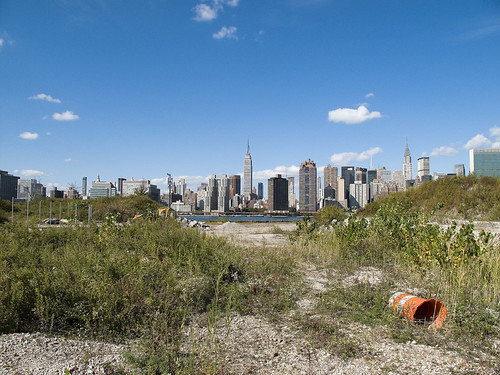
– photo by Mitch Waxman
Direct sightlines of the heroic Manhattan skyline will be offered by these new high rise buildings, and soar over the starry old coastline that has known only industrial usage since the first Europeans arrived on the archipelago we know as New York. Its value for industry has long been exhausted, and today it is a brutal waste of land.
also from nyc.gov
The proposed actions would almost double the study area’s population. However, the proposed actions’ mix of affordable and market-rate housing could serve to relieve rather than increase residential market pressure in the study area. Additionally, given the very strong trend already in place in the neighborhood, the new population at Sites A and B would not be expected to introduce or accelerate a trend toward increased market rents in the study area that might cause significant indirect residential displacement. The redevelopment of Site B would introduce new residential uses to the Long Island City industrial area south of Borden Avenue. It is possible that the introduction of this residential use could lead to some limited indirect business displacement because of increased rent pressures. However, the potential for indirect displacement resulting from increased rent pressure is limited, and would not result in significant adverse indirect displacement impacts.

– photo by Mitch Waxman
The new development, a planned community with parks and schools, will extend far from the river- nearly all the way to the Pulaski Bridge with a basketball court and green space sited for the location of the old Vernon Avenue Bridge. The shining city of Queens, and a monument to a revolutionary and aggressive group of city planners, the story of Tower Town has begun.
also from nyc.gov
The Hunter’s Point South Rezoning and Related Actions would allow Site A and Site B to be redeveloped with largely residential buildings with building components ranging in height from
40 to 400 feet. Ground floors would include local retail, lobby, and community facility uses. On Site A, a network of new streets, sidewalks, and bikeways would be developed, creating seven new city blocks from the single 30-acre parcel it is today. Center Boulevard would be continued southward onto Site A and would connect to the rest of the street network. On Site B, it is anticipated that a new publicly accessible private road and open space would roughly bisect the site. The new residential buildings would vary in height, with bases ranging in height from 40 to 70 feet and high rise elements ranging in height from 250 to 400 feet. Nine towers would be developed on Site A, and four towers would be developed on Site B. Ground floors would be occupied by local retail and other commercial uses and community facility uses. A new public school would serve the residents of the buildings and the surrounding neighborhood and create a varied and active streetscape.
In addition, a new public waterfront park would be developed along the East River and Newtown Creek frontages of Site A and a shore public walkway would be developed along the Newtown Creek frontage of Site B. An additional linear public park would also be developed on the south side of 55th Avenue between Center Boulevard and 2nd Street, and a similar public open space would be developed on the south side of the publicly accessible private road on Parcel B, creating a wide boulevard on that street. The new waterfront parks and open spaces on Sites A and B along the East River and Newtown Creek waterfronts would provide greatly increased public access to waterfront views. Wide views of the waterfront and Manhattan would be available from locations throughout the park.
Overall, the proposed actions would change the character of Sites A and B from a commercial and industrial neighborhood to a residential neighborhood. This new residential neighborhood would incorporate retail and park uses that would attract visitors. On both Site A and Site B, pedestrian activity and vehicular activity would increase substantially over existing conditions.
– photo by Mitch Waxman
Tower Town is impossible to argue against, this real estate- former home to rail and ferry docks, and 19th century barge based casinos, and printing plants, and refineries, and power plants- is a blight on the city, and an uncomfortable reminder of that earlier time when brick strewn lots were not remarkable but common.
An economic boom in construction and real estate sales will come, when it is built. A new tax base of luxury and glamour will come to western Queens, and a wildfire of enhanced valuation will spur growth throughout surrounding riverine communities- further enhancing the economy and strengthening their own tax base- Dutch Kills first, then Astoria, and Greenpoint.
Tower Town at Hunters Point South, Atlantic Yards in Brooklyn, Flushing Commons, Willets Point, the Kosciuszko Bridge replacement.
All at once.
from “Air Quality In Queens County” at synapse-energy.com
In the interest of protecting the environment and public health of Northwest Queens, the Natural Resource Defense Council (NRDC) and the Citizens Helping Organize for a Klean Environment (CHOKE) participated in the New York State Article X permitting process for several new power plants proposed in Northwest Queens. One of their objectives was to have a study conducted to analyze the contributors to air pollution in Northwest Queens and to identify possible strategies for improving air quality and reducing risks to public health. As part of the Article X permitting process for its 250 MW Ravenswood Combined Cycle project, KeySpan committed to funding such a study as a community benefit. CHOKE and NRDC contracted with Synapse to conduct this study. The conclusions and recommendations are those of the authors but do not necessarily reflect the position of KeySpan.
One of the reasons that Queens County was chosen for this study is that it is home to many sources of air pollution. In the northwest corner of the county there currently are four large power plants, which together house 46 electric generating units. The county also contains an extensive transportation network that includes the Long Island Expressway, the Brooklyn Queens Expressway, the Grand Central Parkway, two highway bridges, a tunnel to Manhattan, and two airports, along with over 400 miles of arterial and local roads. Queens also has several large industries, and some 2.2 million residents, leading to significant economic activity which contributes to air quality problems.

– photo by Mitch Waxman
A small and insignificant scuttling thing who some might describe as a man, your humble narrator has spent a good deal of time wandering about the lonely industrial frontages of Hunters Point and expended some effort into learning its past. My opinion of this project is meaningless, it is a gathering thunderhead, and Manhattan is coming to Queens. There is just one thing that has been glossed over in mainstream reports about this place…
…this waterfront property…
from a Newtown Pentacle post of 6/7/2009
In 1697, a Dutch sea captain named Peter Praa bought the Bogardus properties and set up farming. He died in 1740, and the land was left to his granddaughter Anne Bennet. Her son, Jacob Diks, inherited next and he passed the land to his daughter- Anna Hunter. In 1817, Hunter, who had three sons, left the land to her children under the proviso that it be sold and the moneys divided evenly between them. This is why the “Mispat” became known as “Hunter’s Point”.

– photo by Mitch Waxman
For the water that promoters of this plan mention is the East River, not the water that has defined it throughout all recorded time.
from a Newtown Pentacle post of 2/28/10:
3.8 miles long, its mouth is directly opposite the Bellevue Psychiatric Hospital in Manhattan, and defines the currently undefended border between North Brooklyn and Western Queens. Estimates state that some 14 million gallons of combined sewage, storm runoff, and industrial waste provide the only flow of water into the Creek. It’s waters are opaque, and in the height of summer turn an unnatural shade of green.
The soft bottom of the waterway is 15-20 feet below the surface of the water, and the hard bottom is occluded by a gelatinous sediment known as “Black Mayonnaise”. Composed of petroleum residues, coal tar, PCB’s, and human excrement- it lies 15 feet thick on the bed. The oxygen content of the water drops precipitously as soon as one leaves the East River. The first of the drawbridges which cross it- known as the Pulaski Bridge, is the borderline beyond which immersion in this water is worthy of full HAZMAT gear and first responders institute biological decontamination procedures for anyone who finds themselves in it.
As I’ve mentioned in the past… the chemicals Putrescine (an organic chemical compound NH2(CH2)4NH2 (1,4-diaminobutane or butanediamine) and Cadaverine (a toxic diamine with the formula NH2(CH2)5NH2)which are produced by the rotting and putrefaction of animal flesh are abundantly found in the Newtown Creek under industrial aliases like Acrylonitrile and are prominent members on the EPA’s list of Volatile Organic Compounds– or VOC’s..
Who can guess, what it is, that may be buried down there?

– photo by Mitch Waxman
Tower Town, you see, will be built along the Creek as well…
…the Newtown Creek…
from epa.gov
“Newtown Creek is one of the most grossly-contaminated waterways in the country,” said Acting Regional Administrator George Pavlou. “By listing the creek, EPA can focus on doing the extensive sampling needed to figure out the best way to address the contamination and see the work through.”
EPA responded to requests by members of Congress to evaluate specific sites along the creek by publishing a September 2007 report that contained a review of past work and recommendations regarding future work at Newtown Creek. The state of New York referred the site to EPA due to the complex nature of the contamination along the creek.
Newtown Creek is part of the core area of the New York-New Jersey Harbor Estuary, which has been designated by EPA as an “estuary of national significance.” Despite the ongoing pollution problems, some residents currently use the creek for recreational purposes such as kayaking, while others catch fish for consumption out of it. Various sediment and surface water samples have been taken along the creek and reveal the presence of pesticides, metals, PCBs, and volatile organic compounds (VOCs), which are potentially harmful contaminants that can easily evaporate into the air.
In the mid -1800s, the area adjacent to the 3.8-mile Newtown Creek was one of the busiest hubs of industrial activity in New York City. More than 50 industrial facilities were located along its banks, including oil refineries, petrochemical plants, fertilizer and glue factories, sawmills, and lumber and coal yards. The creek was crowded with commercial vessels, including large boats bringing in raw materials and fuel and taking out oil, chemicals and metals. In addition to the industrial pollution that resulted from all of this activity, the city began dumping raw sewage directly into the water in 1856. During World War II, the creek was one of the busiest ports in the nation. Some factories and facilities still operate along it, and various adjacent contaminated sites have contributed to its contamination. Today, as a result of its industrial history, including countless spills, Newtown Creek is badly polluted.


