Posts Tagged ‘Mount Washington’
Cola Street
Tuesday

– photo by Mitch Waxman
Circumstance recently found your humble narrator on Pittsburgh’s Cola Street, where one of the City’s more eye catching residences (302 Cola Street, well described in this post from brooklineconnection.com) is found. Colloquially referred to as ‘the colors house,’ #302 is an eye catcher which you can’t help but notice while transiting through the central part of Pittsburgh.
I couldn’t help myself from activating the car’s hazard lights and then waving the camera around for a bit. What a view.

– photo by Mitch Waxman
The enigmatic #302 is pictured above, but I didn’t want to dwell on it overly as one of its residents was busy doing spring cleaning and I didn’t want to violate their privacy. Apparently, the architect of the building is the owner and this build was a dream home for the family.
I’ll tell you this, it’s impossible not to notice the #302 from anywhere in Pittsburgh that you’ve got a view of the Monongahela River and Mount Washington. In a sea of green, brown, and gray it’s an eye catcher.

– photo by Mitch Waxman
It took a bit of hunting in the archives to find this shot, from a 2023 walk on the PJ McArdle roadway, a local road cantilevered against the face of Mount Washington on a diagonal. That little grouping of homes is Cola Street, and the ‘colors house’ is seen on the left.
Back tomorrow with something different.
“follow” me on Twitter- @newtownpentacle
Buy a book!
“In the Shadows at Newtown Creek,” an 88 page softcover 8.5×11 magazine format photo book by Mitch Waxman, is now on sale at blurb.com for $30.
Down
Thursday

– photo by Mitch Waxman
A humble narrator, after walking across the Fort Pitt bridge – as descirbed yesterday – used a free transfer from the T light rail to one of the inclines and soon found himself standing atop Mount Washington and looking down. This is one heck of a prominence, I would mention.
Also as mentioned, I was just letting this particular walk play itself out and went in whatever direction whimsy indicated as correct. As always, camera in hand and the filthy black raincoat flapping noisily in the wind.
A schmuck with a camera, that’s me.

– photo by Mitch Waxman
Mount Washington is pretty steep, even when you’re just navigating the sidewalks. As has become my habit here in Pittsburgh, I was heading downhill. The homes on the left side of the shot all seem to have terraces and huge picture windows on the cliff side of their buildings. Lucky stiffs, the people who live here have the best views in the entire city – front row, as it were.
Also as mentioned, we’ve been experiencing serious symptoms of winter here in recent weeks. This was the first day with a modicum of sunlight in several weeks, and it was warm enough out that the snow and ice had melted away.

– photo by Mitch Waxman
The bridge I had walked over the river on, Fort Pitt, is the one on the left side of the shot above, and the one in the background is Fort Duquesne Bridge (overflying the Allegheny River). This shot was gathered as I began my descent back to the level I normally dwell in.
I was walking ‘double time’ here, since it was downhill and the scuttling thereby became less ‘muscular’ than previously.

– photo by Mitch Waxman
One navigated to the P.J. McArdle roadway, which is diagonally trussed across the face of Mount Washington. It carries two lanes of vehicle traffic that head up and down the landform, and offers a somewhat ‘in need of repairs’ combine of bike and pedestrian path as well – pictured above.
At least you’re separated from vehicle traffic by waist high concrete barriers for most of it…
The civil engineering side of Pittsburgh is absolutely incredible. There seems to be no geologic obstacle that the people who built this place didn’t figure out a novel way to go through, under, or above. Wow.

– photo by Mitch Waxman
You just have to marvel at it sometimes. After that tree stump, you’ve got a drop off of about 800 or so feet which is set along a 70-80 degree cliff face, that is also heavily wooded. If you fell from here, you’d splatter like a ripe melon. As my Sicilian neighbors, back in the old neighborhood in Brooklyn, would say: “Marone.”
That’s just about when I spotted it… the horror.

– photo by Mitch Waxman
Can it be? Has the Queens Cobbler followed me to Pittsburgh, continuing their horrific pursuits? The mind shakes, the soul quivers, the body… well, nothing really happened on that front, but… can it be?
More tomorrow.
“follow” me on Twitter- @newtownpentacle
Buy a book!
“In the Shadows at Newtown Creek,” an 88 page softcover 8.5×11 magazine format photo book by Mitch Waxman, is now on sale at blurb.com for $30.
High over Pittsburgh
Monday
– photo by Mitch Waxman
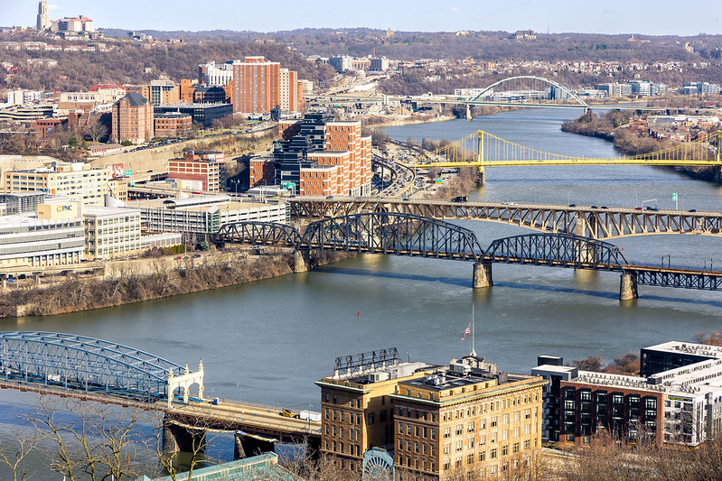
Last week, an unusually warm February day found a humble narrator marching around Grandview Avenue on Mount Washington here in Pittsburgh. This street sits on a ridge overlooking Downtown Pittsburgh and the Monongahela River, and it’s bookended by the two inclines – Allegheny and Duquesne. The views from up top are fairly killer, and it should be mentioned that I’ve been here up before. There are overlook platforms, and a sort of linear park which is well used by the public, along Grandview Avenue.
The bridges in the photo above are the Fort Pitt and Fort Duquesne Bridges, both of which were recently walked over and described.
– photo by Mitch Waxman
One is – as always – fascinated by the massing shapes and parabola of the access ramps leading to and from the bridges. The water is the Monongahela River, and this is nearby the titular end of the 130 mile long waterway where it combines with the Allegheny River and the combination transmogrifies into the Ohio River.
Wanderings over the last couple of months have seen me stitching around, exploring. One was feeling the need to come back to square and reconnoiter from above.
– photo by Mitch Waxman
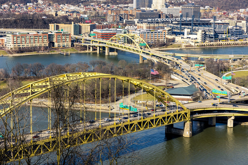
Looking up the Monongahela River, in the foreground is the Smithfield Street Bridge and the P&LERR building. Next up is the Panhandle Bridge which carries the T light rail into Downtown. Behind that is the Liberty Bridge, and the yellow one is the South Tenth Street Bridge. In the distance, you can see the Birmingham Bridge.
All along the waterfront are ‘rail to trail’ public spaces. Between Birmingham Bridge and South Tenth Street on the north side of the river is the Eliza Furnace Trail, for instance, with the Hot Metal trail found in the south side of the water.

– photo by Mitch Waxman
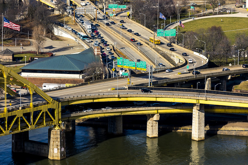
The T is seen crossing the Panhandle Bridge in the one above. I’m planning on putting some time and spending some shoe leather on this section of the world this week, so stay tuned for that one.
I’m also planning on heading further out, specifically returning to Clairton and the trailhead of the Montour Trail found directly across the street from the sense shattering US Steel mill found in that community. I’m also planning on walking another section of the Great Allegheny Passage trail which should provide great views of USS’s Mon Valley Works in Braddock from across the river.

– photo by Mitch Waxman
This one looks back along the steep slope of Mount Washington, where the trees are still very much in their winter time hibernation mode.
Since the start of the year, there’s been a couple of very high profile crimes which resulted in the shooting death of two Police Officers in separate incidents, here in the greater Pittsburgh area, and thereby the flags have been flying at half mast throughout the City.
– photo by Mitch Waxman
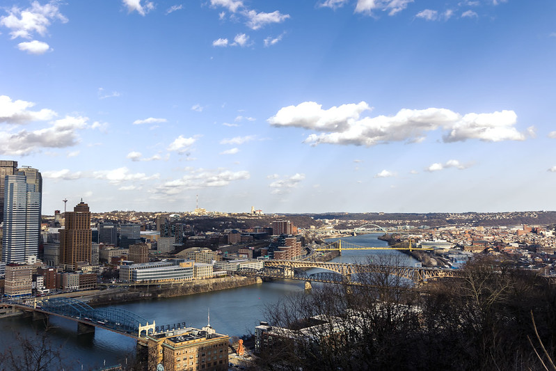
One spent a couple of hours marching back and forth on Grandview Avenue, during the late afternoon. The day was coming to an end, and I wanted to do a few tripod shots, but desired to capture a less common point of view. One headed back to the Mobile Oppression Platform (my pet name for the Toyota) which had been parked at a metered spot midway twixt the two inclines, and headed towards my next destination.
The good news is that I’m finally getting comfortable with having a car be a part of the equation. Compared to having to drag ass back to HQ after walking around NYC and getting on the Subway to discover MTA is having yet another meltdown and “you can’t get there from here” it’s a real pleasure to have some personal agency in terms of getting from A to B.
Back tomorrow with what I saw and recorded.
“follow” me on Twitter- @newtownpentacle
Buy a book!
“In the Shadows at Newtown Creek,” an 88 page softcover 8.5×11 magazine format photo book by Mitch Waxman, is now on sale at blurb.com for $30.
embodying that
Wednesday

– photo by Mitch Waxman
One was desirous of “getting busy” with the camera after several days of catch as catch can shooting out a car window. Luckily, my pal Max and I found ourselves on Mount Washington’s Grandview Avenue just as the burning thermonuclear eye of God itself was descending behind… I guess it’s Ohio out here? That’s the “iconic” view of the dead bang center of the Pittsburgh Metro above.
My whole world is about to get rocked. Imagine… the world beyond New Jersey. I’m going into the west, like the colonial Dutch, or one of Tolkien’s elves.

– photo by Mitch Waxman
I set up the tripod for these, and got fancy with how I was shooting them. This one looks up the Allegheny River from the prominence of Mount Washington. Can’t wait to start exploring this area in earnest and finding less common points of view, but for now – this’ll do.
The “shmear” of light in the midst of the Allegheny River is a tour boat operated by the Gateway Clipper outfit. This was a longish exposure.

– photo by Mitch Waxman
The one above looks up along the Ohio River. Pittsburgh is where the convergence of the Monongahela and Allegheny Rivers form into the headwaters of the Ohio. So much to learn…
That entire “zone” in the field of view of the shot above is – so far – “terra incognito” for me.

– photo by Mitch Waxman
The highways in this area are wild. High speed roads with cloverleaf overpasses and ramps as far as the eye can see.
Such an interesting place this is.

– photo by Mitch Waxman
I felt the need to zoom in on those highways, and study the massing shapes that they form. My perception of the “structure of things” in this area seem to be like that of a pearl necklace – with the high speed roads being the string, and the residential and commercial/industrial developments the pearls. That’s my first impression, of course, and I’m likely just trying to categorize and put something “in a box” based on limited observation, which is something I tend to do.
Give me a couple of years to figure things out, and learn the history of why things are where they are.

– photo by Mitch Waxman
After the burning thermonuclear eye of God itself disappeared, it got “proper dark.” Cracked out one last shot of the iconic view, and my pal Max and I headed off to dinner and then the AirBNB we were staying at. These shots were collected on the 31st of August, a Wednesday.
The 1st of September plan involved my pal Max heading off on his own, and for me to do a proper photowalk with the camera on my own.
More tomorrow.
“follow” me on Twitter- @newtownpentacle
Buy a book!
“In the Shadows at Newtown Creek,” an 88 page softcover 8.5×11 magazine format photo book by Mitch Waxman, is now on sale at blurb.com for $30.


