Posts Tagged ‘New York City’
Gods Gift to Pain

Please click through to Flickr and the larger incarnations of the above shot- it’s composed of 7 photos stitched together. Thats 7 fifteen megapixel shots and its HUGE – photo by Mitch Waxman
That extinction of hope called the Newtown Creek enjoys a series of canalized industrial waterways which act as tributaries to its main course. In the past we have visited Dutch Kills, Whale Creek, Maspeth Creek… today, it’s time for a visit to the vicious end of it all.
note: This post violates a number of the rules followed by this, your Newtown Pentacle, regarding rail tracks and probable trespass of private property… yet my hypocrisy knows no bounds. Realize, however, that I was with learned company- individuals overly familiar with this area, its mores, and the rail schedules. Do not come here, especially by yourself- for reasons later explained in this very post!
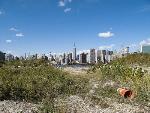
Welcome to the poison heartlands of New York City, where foul ichors flow freely, and English Kills bubbles in the afternoon sun.
from wikipedia
Newtown Creek is a 3.5 mi (6 km) estuary that forms part of the border between the boroughs of Brooklyn and Queens, in New York City, New York, United States. It derives its name from New Town (Nieuwe Stad), which was the name for the Dutch and British settlement in what is now Elmhurst, Queens. Channelization made it one of the most heavily used bodies of water in the Port of New York and New Jersey and thus one of the most polluted industrial sites in America, containing years of discarded toxins, an estimated 30 million gallons of spilled oil, and raw sewage from New York City’s sewer system. Newtown Creek was proposed as a potential Superfund site in September 2009.

– photo by Mitch Waxman
This is as bad as it gets, one of the few places along the Creek where exposure to the water is life threatening in the short term.
Sure, if you fall off the Grand Avenue Bridge, you’re going to experience broad spectrum antibiotics administered intravenously over the course of a week or two in the hospital- but this stuff is pure dragon blood.
Nauseous miasmas were luckily carried away by stiff breezes, but several times- your humble narrator felt one of his spells coming on.
Up until the latter part of the 20th Century, industries along the creek had free reign over the disposal of unwanted byproducts. With little-to-no government regulation or knowledge of impacts on human health and the environment, it made business sense to pollute the creek. The legacy of this history today is a 17 million gallon underground oil spill caused by Standard Oil’s progeny companies—7 million gallons more than the Exxon Valdez spill in 1989, copper contamination of the Phelps Dodge superfund site, bubbling from the creek bed in the English Kill reach due to increases of hydrogen sulfide and a lack of dissolved oxygen, and creekbeds coated with of old tires, car frames, seats and loose paper. Nearly the entire creek had the sheen and smell of petroleum, with the bed and banks slicked black.
There is no natural freshwater flow into the creek as the historic tributaries were covered over. Flow exclusively consists of contaminated stormwater runoff, carrying trash from numerous bridges, unsewered and wholly paved streets and industrial sites, waste transfer stations, and combined sewer overflows (CSOs) from the city’s sewer system. Moreover, severely toxic groundwater seeps through the bed and banks of the creek. Every year Newtown Creek receives 14,000 million gallons of combined sewage overflow, a mixture of rainwater runoff, raw domestic sewage, and industrial wastewater that overwhelms treatment plants every time it rains. There are also discharges from numerous permitted and unpermitted pollution sources. The creek is mostly stagnant, meaning all the pollutants that have entered the creek over the past two centuries have never left. The creek is also home to a federal Superfund site, several State Superfund sites and numerous brownfields that have not yet secured the attention of regulators.
All is not lost, however. Recently, life is returning to the creek. You can find blue crabs at the mouth, fish swim in its waters, and waterfowl are prevalent. Wetland plants are taking over the abandoned bulkheads and sediment piles and school children are growing oysters, which serve as natural water filters. The Newtown Creek Alliance is actively fighting to help life return to the creek by decreasing pollution and increasing the wetlands along the creek.

– photo by Mitch Waxman
The sickly vegetation, everything, was pulsing with “the colour”. Neither black nor white nor gray, but somehow “shiny”, this alien colour – like something out of space- permeates and identifies the creeklands. Nothing moved, but seemed instead to sway against the wind instead of with it.
In 1655, Director Stuyvesant being absent on an expedition against the Swedes on the Delaware, a horde of armed Indians landed at New Amsterdam, and began to break into houses for plunder. Driven back by the soldiers and armed citizens, they fell upon the unprotected Dutch farmers in the vicinity, many of whom were slain and others taken into captivity. The troubles experienced from the savages were now so alarming as to require the residents of Mespat Kills to concentrate for mutual safety. They, therefore, formed a village on “Smith’s Island,” at the English Kills. The Hon. Nicasius De Sille, who had a patent for the island, had the direction of the new settlement, and called it Aernhem after his native place.

– photo by Mitch Waxman
Dead things were observed in the filth, amongst other unidentifiable shapes and eyeless tubiforms that slithered and flopped and listened from the littoral mud. A vague sense of being watched affected my guides and I, and the loneliness of our location created a sense of certain misgivings which was both real and profound. Nevertheless, I continued my incessant photography, trying to make the best of limited access.
from The Eastern District of Brooklyn By Eugene L. Armbruster, via google books
BEYOND THE NEWTOWN CREEK
In the olden times the lands on both sides of Newtown Creek were most intimately connected. County lines were unknown, the creeks were dividing lines between the several plantations, for the reason that lands near a creek were taken up in preference to others, and the creeks were used in place of roads to transport the produce of the farms to the river, and thus it was made possible to reach the fort on Manhattan Island.
The territory along the Newtown Creek, as far as “Old Calvary Cemetery” and along the East River to a point about where the river is now crossed by the Queensboro bridge and following the line of the bridge past the plaza, was known as Dutch Kills. On the other side of Old Calvary was a settlement of men from New England and, therefore, named English Kills. The Dutch Kills and the English Kills, as well as the rest of the out-plantations along the East River, were settlements politically independent of each other and subject only to the Director-General and Council at Manhattan Island, but became some time later parts of the town of Newtown.

– photo by Mitch Waxman
This place, the very end of English Kills in East Williamsburgh, is non navigable and well beyond the containment boom that is observable from the Metropolitan Avenue Bridge. It hosts a rather large CSO (combined sewer outlet), and is crossed by a rail bridge which connects the massive Waste Management operation to infinite Brooklyn on one side and Queens on the other. The wooden structures which are so pleasingly posed, in their relict decay, are the remains of a former rail bridge which served the same purpose as the modern bridge.
The desk chair above is anybody’s guess.
from habitatmap.org
Combined Sewer Outfall – Newtown Creek 015
- Address Johnson Ave., Brooklyn, NY
- Neighborhood Newtown Creek
- Owner/Occupant NYC DEP
- Location Details Combined Sewer Overflow Outfall NC-015:
- discharges 344.4M gallons per year into English Kills
- Tier 2 outfall
- Ranked 20 out of over 400 in terms of volume
- located at Johnson Ave

– photo by Mitch Waxman
The shores were littered with death and disposal, and I spotted this sad little duck perched out on one of the rail structures. It didn’t seem to be moving very much, and its posture suggested sickness.
The City of New York has plans for this area. Check out page 29 of this PDF
DEP proposes to construct a 9 million gallon CSO storage facility to improve water quality by reducing the CSO discharged into the English Kills during rain storms when the CSO exceeds the capacity of the combined sewers. When this occurs, the CSO would be bypassed to the storage facility. At the end of the rain event the CSO would flow by gravity or be pumped back to the sewer system to be conveyed to the Newtown Creek Water Pollution Control Plant (WPCP) for treatment. This system was recommended by the Newtown Creek Water Quality Facility Planning Project (WQFP), a study that was part of the Citywide Combined Sewer Overflow abatement program.

– photo by Mitch Waxman
Here’s a close up of the duck, which is what I was shooting when my companions and I heard a series of voices and shuffling from the overgrown border of one of the warehouses that abuts the English Kills. Haste was made for a more advantageous position, as we were downhill and the water was at our backs. Strange gutterals were heard emanating from somewhere back in the forbidden brush, a sound almost reminiscent of a dog or bear attempting to speak as a man might- an imitation of speech rather than true use of language.
from epa.gov
Various sediment and surface water samples have been taken along the creek. Pesticides, metals, PCBs, and volatile organic compounds (VOCs), which are potentially harmful contaminants that can easily evaporate into the air, have been detected at the creek.
In the early 1990s, New York State declared that Newtown Creek was not meeting water quality standards under the Clean Water Act. Since then, a number of government sponsored cleanups of the creek have taken place. The New York City Department of Environmental Protection has sampled sediment and surface water at a number of locations along the creek since 1980. In 2009, EPA will further sample the sediment throughout the length of Newtown Creek and its tributaries. The samples will be analyzed for a wide range of industrial contaminants. EPA will use the data collected to define the nature of the environmental problems associated with Newtown Creek as a whole.

– photo by Mitch Waxman
2 men, whose macabre appearance and bizarre style of dress took me aback, emerged from down this trail. Something odd was happening back there, and it was decided that discretion was the best part of valor, and we prepared to exit. Allowing the two men to gain some distance from us (I did not photograph them, out of cowardice) I swung my camera back toward the water and the Waste Management fenceline just as music began to play somewhere back in this wood of suspicion and horror.
from wikipedia
Waste Management, Inc. (NYSE: WM) is a waste management, comprehensive waste, and environmental services company in North America. The company is headquartered in Suite 4000 at the First City Tower in Downtown Houston, Texas, in the United States.
The company’s network includes 367 collection operations, 355 transfer stations, 273 active landfill disposal sites, 16 waste-to-energy plants, 134 recycling plants, 111 beneficial-use landfill gas projects and 6 independent power production plants. Waste Management offers environmental services to nearly 20 million residential, industrial, municipal and commercial customers in the United States, Canada, and Puerto Rico. With 21,000 collection and transfer vehicles, the company has the largest trucking fleet in the waste industry. Together with its competitor Republic Services, Inc, the two handle more than half of all garbage collection in the United States.

– photo by Mitch Waxman
I shot this photo figuring it to be the end of this post, but that’s when I noticed it…
from wikipedia
The eastern half of East Williamsburg, roughly bounded by the Newtown Creek East and by the BQE and Flushing Avenue on the North and South, is mostly zoned for industry with some residential housing mixed among the warehouses and factories. The section is currently referred to by the city as the East Williamsburg Industrial Park (EWIP), or formally the East Williamsburg In-Place Industrial Park (EWIPIP)[8]. The western boundary runs approximately along Kinsgland Ave, then Morgan Avenue and then just East of Bushwick Avenue.
The EWIP is one of eight In-Place Industrial Parks in New York City and is managed by the East Williamsburg Valley Industrial Development Corporation (EWVIDCO), a company founded in 1982 with the goal of revitalizing East Williamsburg by attracting new businesses, providing business assistance to existing firms and grow overall job opportunities in the neighborhood
Historically, this neighboorhood was not part of the Village of Williamsburgh. In the late 1800s the region east of Smith Street (now Humboldt Street), west of the Newtown Creek, south of Meeker Avenue (now the BQE service road)), and north of Metropolitan Avenue was the 18th ward of the City of Brooklyn[10]. The north part of the EWIP is served by the Greenpoint Post Office and is considered by some to be part of Greenpoint. The portion of the EWIP to the South of Metropolitan Avenue was historically part of Bushwick and is still referred by many as being in Bushwick.

– photo by Mitch Waxman
I really have no idea what this is about, and I have read every crackpot theory that has ever been concocted. It very well could just be “ironic” hipster graffiti. I really don’t know, but it’s here at the end of English Kills, where at least two VERY odd characters are camped out. The things I noticed about these two fellows, you see, was this…
Two skinny white guys, late 40’s- early 50’s. Gray hair, both of them. They walked kind of stiff, and they had the colour on them. They lived back there, was my impression. A lot of “down on their luck” people live in these kinds of places- that’s not odd. What was odd- every item of clothing they were wearing still had price tags on them, and their shoes weren’t placed on their feet correctly- one of them had the left foot in the right shoe and so on. It was as if they weren’t used to wearing the clothing of men- or at least the men of this era.
from wikipedia
While it is generally accepted that some homeless people in large cities do indeed make use of accessible, abandoned underground structures for shelter, urban legends persist that make stronger assertions. These include claims that ‘mole people’ have formed small, ordered societies similar to tribes, numbering up to hundreds living underground year-round. It has also been suggested that they have developed their own cultural traits and even have electricity by illegal hook-up. The subject has attracted some attention from sociologists but is a highly controversial subject due to a lack of evidence.
Jennifer Toth’s 1993 book The Mole People: Life In The Tunnels Beneath New York City, [1] written while she was an intern at the Los Angeles Times, is allegedly a true account of travels in the tunnels and interviews with tunnel dwellers. The book helped canonize the image of the mole people as an ordered society living literally under people’s feet, reminiscent of the Morlocks of science fiction writer H.G. Wells.

– photo by Mitch Waxman
As the sign at English Kills says, the one with the little pitchfork in the lower left hand corner:
“In Gods Blessed Darkness Rambo Harnesses Light as Gods Gift to Pain”.
Bigskybrooklyn got some shots of the place during the defoliated winter, which shows a shack back there- check them out.
from nyc.gov
New York City has an estimated 3,306 unsheltered individuals according to HOPE 2008-a ratio of 1 unsheltered homeless individual to 2,485* of the general city population. San Francisco has a 1 in 269 ratio; followed by Seattle with 1 in 295; Miami-Dade County with 1 in 1,741; and Chicago with 1 in 1,798.
There were an estimated 1,263 unsheltered individuals in Manhattan; 279 in the Bronx; 336 in Brooklyn; 135 in Queens; and 152 in Staten Island for a total of 2,165 on the surface (meaning streets and parks). There were 1,141 unsheltered individuals in the subways. Additionally, the Single Adult Shelter Census showed a decline by 19 percent from 8,687 in 2005 to 6,998 in 2008.
enchanting metamorphoses

– photo by Mitch Waxman
Recent announcements have heralded the formal beginnings of the process which will transmogrify the ancient Hunters Point section of Long Island City irrevocably. The support of overt interests of the Manhattan political elite have been made in public, and the financial and real estate folks are in line behind the project.
Behold, the future home of an estimated 11,000 people, imagine Tower Town.
from nyc.gov
More than 5,000 new apartments are anticipated to be constructed in the primary neighborhood character study area by 2017, including completion of the residential development at Queens West and many other mid-size residential buildings throughout the immediate area. Almost 11,000 new residents are expected in the primary study area as a result of this new construction activity.
As the primary study area (and the secondary study area, discussed below) becomes more densely developed, traffic and pedestrian volumes will increase noticeably from the current levels. Intersections throughout the area will be more congested in the morning, midday, and evening peak hours. The intersections that currently experience some congestion on Vernon Boulevard will be noticeably more congested, with some levels of service D and even LOS F, indicating high to unacceptable delays. In addition, other intersections along Vernon Boulevard in the primary study area will also have moderate to high congestion in the peak hours. On the east-west avenues in the area near the project sites (i.e., 48th, 49th, 50th, and 51st Avenues) traffic volumes are expected to increase slightly.
Pedestrian volumes will also increase in the future without the proposed actions, but sidewalks, corners, and crosswalks will generally continue to operate at acceptable levels. The crosswalk across Vernon Boulevard on the north side of 50th Avenue will, however, become noticeably congested during the morning peak hour, as people cross to enter the subway station there. This crosswalk will operate at LOS E, as will the subway stair closest to the corner (Stair S8). Buses serving the primary study area will also be noticeably more crowded.

– photo by Mitch Waxman
Direct sightlines of the heroic Manhattan skyline will be offered by these new high rise buildings, and soar over the starry old coastline that has known only industrial usage since the first Europeans arrived on the archipelago we know as New York. Its value for industry has long been exhausted, and today it is a brutal waste of land.
also from nyc.gov
The proposed actions would almost double the study area’s population. However, the proposed actions’ mix of affordable and market-rate housing could serve to relieve rather than increase residential market pressure in the study area. Additionally, given the very strong trend already in place in the neighborhood, the new population at Sites A and B would not be expected to introduce or accelerate a trend toward increased market rents in the study area that might cause significant indirect residential displacement. The redevelopment of Site B would introduce new residential uses to the Long Island City industrial area south of Borden Avenue. It is possible that the introduction of this residential use could lead to some limited indirect business displacement because of increased rent pressures. However, the potential for indirect displacement resulting from increased rent pressure is limited, and would not result in significant adverse indirect displacement impacts.

– photo by Mitch Waxman
The new development, a planned community with parks and schools, will extend far from the river- nearly all the way to the Pulaski Bridge with a basketball court and green space sited for the location of the old Vernon Avenue Bridge. The shining city of Queens, and a monument to a revolutionary and aggressive group of city planners, the story of Tower Town has begun.
also from nyc.gov
The Hunter’s Point South Rezoning and Related Actions would allow Site A and Site B to be redeveloped with largely residential buildings with building components ranging in height from
40 to 400 feet. Ground floors would include local retail, lobby, and community facility uses. On Site A, a network of new streets, sidewalks, and bikeways would be developed, creating seven new city blocks from the single 30-acre parcel it is today. Center Boulevard would be continued southward onto Site A and would connect to the rest of the street network. On Site B, it is anticipated that a new publicly accessible private road and open space would roughly bisect the site. The new residential buildings would vary in height, with bases ranging in height from 40 to 70 feet and high rise elements ranging in height from 250 to 400 feet. Nine towers would be developed on Site A, and four towers would be developed on Site B. Ground floors would be occupied by local retail and other commercial uses and community facility uses. A new public school would serve the residents of the buildings and the surrounding neighborhood and create a varied and active streetscape.
In addition, a new public waterfront park would be developed along the East River and Newtown Creek frontages of Site A and a shore public walkway would be developed along the Newtown Creek frontage of Site B. An additional linear public park would also be developed on the south side of 55th Avenue between Center Boulevard and 2nd Street, and a similar public open space would be developed on the south side of the publicly accessible private road on Parcel B, creating a wide boulevard on that street. The new waterfront parks and open spaces on Sites A and B along the East River and Newtown Creek waterfronts would provide greatly increased public access to waterfront views. Wide views of the waterfront and Manhattan would be available from locations throughout the park.
Overall, the proposed actions would change the character of Sites A and B from a commercial and industrial neighborhood to a residential neighborhood. This new residential neighborhood would incorporate retail and park uses that would attract visitors. On both Site A and Site B, pedestrian activity and vehicular activity would increase substantially over existing conditions.
– photo by Mitch Waxman
Tower Town is impossible to argue against, this real estate- former home to rail and ferry docks, and 19th century barge based casinos, and printing plants, and refineries, and power plants- is a blight on the city, and an uncomfortable reminder of that earlier time when brick strewn lots were not remarkable but common.
An economic boom in construction and real estate sales will come, when it is built. A new tax base of luxury and glamour will come to western Queens, and a wildfire of enhanced valuation will spur growth throughout surrounding riverine communities- further enhancing the economy and strengthening their own tax base- Dutch Kills first, then Astoria, and Greenpoint.
Tower Town at Hunters Point South, Atlantic Yards in Brooklyn, Flushing Commons, Willets Point, the Kosciuszko Bridge replacement.
All at once.
from “Air Quality In Queens County” at synapse-energy.com
In the interest of protecting the environment and public health of Northwest Queens, the Natural Resource Defense Council (NRDC) and the Citizens Helping Organize for a Klean Environment (CHOKE) participated in the New York State Article X permitting process for several new power plants proposed in Northwest Queens. One of their objectives was to have a study conducted to analyze the contributors to air pollution in Northwest Queens and to identify possible strategies for improving air quality and reducing risks to public health. As part of the Article X permitting process for its 250 MW Ravenswood Combined Cycle project, KeySpan committed to funding such a study as a community benefit. CHOKE and NRDC contracted with Synapse to conduct this study. The conclusions and recommendations are those of the authors but do not necessarily reflect the position of KeySpan.
One of the reasons that Queens County was chosen for this study is that it is home to many sources of air pollution. In the northwest corner of the county there currently are four large power plants, which together house 46 electric generating units. The county also contains an extensive transportation network that includes the Long Island Expressway, the Brooklyn Queens Expressway, the Grand Central Parkway, two highway bridges, a tunnel to Manhattan, and two airports, along with over 400 miles of arterial and local roads. Queens also has several large industries, and some 2.2 million residents, leading to significant economic activity which contributes to air quality problems.

– photo by Mitch Waxman
A small and insignificant scuttling thing who some might describe as a man, your humble narrator has spent a good deal of time wandering about the lonely industrial frontages of Hunters Point and expended some effort into learning its past. My opinion of this project is meaningless, it is a gathering thunderhead, and Manhattan is coming to Queens. There is just one thing that has been glossed over in mainstream reports about this place…
…this waterfront property…
from a Newtown Pentacle post of 6/7/2009
In 1697, a Dutch sea captain named Peter Praa bought the Bogardus properties and set up farming. He died in 1740, and the land was left to his granddaughter Anne Bennet. Her son, Jacob Diks, inherited next and he passed the land to his daughter- Anna Hunter. In 1817, Hunter, who had three sons, left the land to her children under the proviso that it be sold and the moneys divided evenly between them. This is why the “Mispat” became known as “Hunter’s Point”.

– photo by Mitch Waxman
For the water that promoters of this plan mention is the East River, not the water that has defined it throughout all recorded time.
from a Newtown Pentacle post of 2/28/10:
3.8 miles long, its mouth is directly opposite the Bellevue Psychiatric Hospital in Manhattan, and defines the currently undefended border between North Brooklyn and Western Queens. Estimates state that some 14 million gallons of combined sewage, storm runoff, and industrial waste provide the only flow of water into the Creek. It’s waters are opaque, and in the height of summer turn an unnatural shade of green.
The soft bottom of the waterway is 15-20 feet below the surface of the water, and the hard bottom is occluded by a gelatinous sediment known as “Black Mayonnaise”. Composed of petroleum residues, coal tar, PCB’s, and human excrement- it lies 15 feet thick on the bed. The oxygen content of the water drops precipitously as soon as one leaves the East River. The first of the drawbridges which cross it- known as the Pulaski Bridge, is the borderline beyond which immersion in this water is worthy of full HAZMAT gear and first responders institute biological decontamination procedures for anyone who finds themselves in it.
As I’ve mentioned in the past… the chemicals Putrescine (an organic chemical compound NH2(CH2)4NH2 (1,4-diaminobutane or butanediamine) and Cadaverine (a toxic diamine with the formula NH2(CH2)5NH2)which are produced by the rotting and putrefaction of animal flesh are abundantly found in the Newtown Creek under industrial aliases like Acrylonitrile and are prominent members on the EPA’s list of Volatile Organic Compounds– or VOC’s..
Who can guess, what it is, that may be buried down there?

– photo by Mitch Waxman
Tower Town, you see, will be built along the Creek as well…
…the Newtown Creek…
from epa.gov
“Newtown Creek is one of the most grossly-contaminated waterways in the country,” said Acting Regional Administrator George Pavlou. “By listing the creek, EPA can focus on doing the extensive sampling needed to figure out the best way to address the contamination and see the work through.”
EPA responded to requests by members of Congress to evaluate specific sites along the creek by publishing a September 2007 report that contained a review of past work and recommendations regarding future work at Newtown Creek. The state of New York referred the site to EPA due to the complex nature of the contamination along the creek.
Newtown Creek is part of the core area of the New York-New Jersey Harbor Estuary, which has been designated by EPA as an “estuary of national significance.” Despite the ongoing pollution problems, some residents currently use the creek for recreational purposes such as kayaking, while others catch fish for consumption out of it. Various sediment and surface water samples have been taken along the creek and reveal the presence of pesticides, metals, PCBs, and volatile organic compounds (VOCs), which are potentially harmful contaminants that can easily evaporate into the air.
In the mid -1800s, the area adjacent to the 3.8-mile Newtown Creek was one of the busiest hubs of industrial activity in New York City. More than 50 industrial facilities were located along its banks, including oil refineries, petrochemical plants, fertilizer and glue factories, sawmills, and lumber and coal yards. The creek was crowded with commercial vessels, including large boats bringing in raw materials and fuel and taking out oil, chemicals and metals. In addition to the industrial pollution that resulted from all of this activity, the city began dumping raw sewage directly into the water in 1856. During World War II, the creek was one of the busiest ports in the nation. Some factories and facilities still operate along it, and various adjacent contaminated sites have contributed to its contamination. Today, as a result of its industrial history, including countless spills, Newtown Creek is badly polluted.
exhalted beyond thought

– photo by Mitch Waxman
Police methods are varied, and ingenious.
The NYPD Harbor patrol, staffed by fierce and dedicated mariners, has become quite modern of late. Recently noticed, but in their use for some time, was this Defender class boat patrolling the malign waters of the 21st century. The military variant of this watercraft carries an esoteric catalog of weapons and electronics, but the civilian police version shares only a love for speed and adept maneuvering with it’s Coast Guard cousins, and is not equipped with the high caliber machine gun on its prow.
from safeboats.com
The Defender class comes standard with full cabin to protect the crew from weather and an independent forced air diesel heater, both of which provide the crew with the maximum amount of comfort and minimal fatigue. The Defender has the direct benefit of years of evolutionary USCG Non Standard boat history to maximize its operational availability. Just one sea trial will prove that the Defender Class is unmatched in performance, work ability, fit, finish and quality.

– photo by Mitch Waxman
Vigilant, notice that the officer noticed me taking his picture, which will be apparent if you click through to the larger incarnations of the image found at Flickr. The boat appeared to slice through waves, and it’s general appearance was that of a predator, silvery quick and able to strike at any time it chose. Comic book metaphors ring out, and if outfitted with large wing shaped hydrofoils and a certain insignia, this could very well be the Batboat of the late 1970’s come to life.
from wikipedia
The importance of the container shipping industry is equally matched by its vulnerabilities to terrorist attack. The U.S. maritime system consists of over 300 sea and river ports with more than 3,700 cargo and passenger terminals. The United States and global economies depend on commercial shipping as the most reliable, cost efficient method of transporting goods, with U.S. ports handling approximately 20% of the maritime trade worldwide. The volume of trade throughout the U.S. and the world creates a desirable target for terrorist attack. An attack on any aspect of the maritime system, mainly major ports, can severely hamper trade and potentially affect the global economy by billions of dollars. The security of ports and their deficiencies are numerous and leave our ports vulnerable to terrorist attack. The vulnerabilities of our ports are many, leading to potential security breaches in almost all aspects of the container shipping industry. With the sheer volume of maritime traffic, there is serious concern of cargo/passenger ship hijackings and pirate attack, as well as accountability of the millions of shipping containers transported worldwide. Given the overwhelming number of ships and containers, there are many areas of concern regarding the security of U.S. ports.

– photo by Mitch Waxman
The Harbor Unit sped off, and as it did, I noticed the quick moving harbor pilot launch America nearby. Luckily, I was fairly close to America earlier in the trip, and got a couple of OK shots of a very capable boat. Incidentally, I’ve recently been exposed to a maritime truism that helps to distinguish when to call a water craft “boat” or “ship”. A “ship” can carry and launch a boat, not the other way around.
from uscg.mil
Developed in a direct response to the need for additional Homeland Security assets in the wake of the September 11th terrorist attacks, the Defender Class boats were procured under an emergency acquisition authority. With a contract for up to 700 standard response boats, the Defender Class acquisition is one of the largest boat buys of its type in the world. The 100 boat Defender A Class (RB-HS) fleet began arriving at units in MAY 2002 and continued through AUG 2003. After several configuration changes, most notably a longer cabin and shock mitigating rear seats, the Defender B Class (RB-S) boats were born. This fleet was first delivered to the field in OCT 2003, and there are currently 357 RB-S boats in operation.
The 457 Defender Class boats currently in operation are assigned to the Coast Guards Maritime Safety and Security Teams (MSST), Maritime Security Response Team (MSRT), Marine Safety Units (MSU), and Small Boat Stations throughout the Coast Guard. With an overall length of 25 feet, two 225 horsepower outboard engines, unique turning radius, and gun mounts boat forward and aft, the Defender Class boats are the ultimate waterborne assets for conducting fast and high speed maneuvering tactics in a small deployable package. This is evidenced in the fact that several Defender Class boats are already in operation by other Homeland Security Department agencies as well as foreign military services for their homeland security missions.

– photo by Mitch Waxman
This is the Sandy Hook Pilots Launch Boat “America”. Like her namesake, she’s a tough cookie that can move very quickly, but works way too hard.
from state.nj.us
All pilot vessels are maintained to a high standard, and are equipped with state of the art electronic navigation and communications equipment. All motor boats are equipped with rescue equipment, including a “Life Sling” and davit for man overboard retrieval operations. Pilot boats must operate under severe weather and sea conditions. The hull material of the pilot boats is audio-gauged regularly, and steel/aluminum plating is serviced and/or renewed when required. In general, Planned Maintenance (“PM”) procedures and Service Life Extension Program (“SLEP”) work have prolonged the in-service usage of floating equipment used in the State pilotage system, in many cases well beyond its originally intended design life.
The newest addition to the fleet, the Yankee, a 53 foot aluminum, twin screw pilot launch is stationed at the Sandy Hook pilot base in Staten Island. It is used as part of a fleet of four similar launches at the entrance of the port, and sometimes as a shuttle craft from the base to/from sea.
The fleet of four similar launches – America, Wanderer, Phantom, and Yankee allow a maintenance schedule to exist to address the substantial wear and tear on the boats throughout the year. One boat is always at sea – two others ready to go – one under maintenance.

– photo by Mitch Waxman
Tumultuous, storm prone, and crowded- NY Harbor is an estuarine environment of cross currents and drowned hazards. The archipelago itself must be protected at all costs, lest an out of control cargo ship or barge stray too close to a bridge or waterfront condominium. Experts on the intricate interplay of aquatic course and geographic knowledge, the Sandy Hook Pilots remain redoubtable.
from sandyhookpilots.com
The history of the Sandy Hook Pilots begins in 1694 when the population of New York City was under 3,000. In those days, the harbors of the Northeast were the commercial arteries of the New World. It soon became apparent that the aid to vessels entering and departing the port was necessary, and the Colonial Assembly commissioned a small group of local seamen to assist the ship masters as pilots. This port would eventually become one of the greatest commercial centers of the world.
Double-crested Cormorant, I presume?

– photo by Mitch Waxman
A common sight on the East River and other NY waterways are the diving antics of Cormorants. Breeding colonies of them can be found at several locations- notably U Thant and South Brother Islands. Your humble narrator, amongst other inadequacies, is no expert on ornithology but a bit of research has led me to believe that this is a juvenile Double Crested Cormorant.
from wikipedia
The Double-crested Cormorant (Phalacrocorax auritus) is a member of the cormorant family of seabirds. It occurs along inland waterways as well as in coastal areas, and is widely distributed across North America, from the Aleutian Islands in Alaska down to Florida and Mexico. Measuring 70–90 cm (28–35 in) in length, it is an all-black bird which gains a small double crest of black and white feathers in breeding season. It has a bare patch of orange-yellow facial skin. Five subspecies are recognized.
The Double-crested Cormorant is found near rivers, lakes and along the coastline. It mainly eats fish and hunts by swimming and diving. Its feathers, like those of all cormorants, are not waterproof and it must spend time drying them out after spending time in the water. Once threatened by use of DDT, the numbers of this bird have increased markedly in recent years.

– photo by Mitch Waxman
A diver, the Cormorant feeds on invertebrates like crabs, or vertebrates like fish, and frogs. It swallows its prey head first, after flipping the unfortunate critter into the air. It is said that there is a specie of cormorant which is trained by both Chinese and Japanese fishermen, who affix a metal ring about the captive bird’s neck to discourage swallowing, to accomplish their industry. Apparently, this is a global phenomena.
from heraldryclipart.com
In England, according to Willoughby, they were hoodwinked in the manner of the “Falcons”, ’til they were let off to fish, and a leather thong was tied round the lower part of their necks, preventing them from swallowing the fish. Whitlock tells us “that he had a cast of them manned like Hawks, which would come to hand.” He took much pleasure in them, and relates that the best he had was one presented to him by Mr Wood, Master of the Cormorants to Charles I. (Thomas Bewick’s British Birds-1826). The Cormorants have been used as symbols of nobility, indulgence, and in more modern times a totem for fishermen and a bountiful catch.

– photo by Mitch Waxman
When the Cormorant goes into one of it’s dives, it might go as deep as 25 feet and be underwater for as long as a minute. This particular specimen was diving at Hells Gate, on the East River. One marvels at the idea of training a Cormorant to carry some sort of low light camera to the shattered bottom of Hells Gate, with its current swept carpet of wrecked ships dating back to Dutch times.
from web1.audubon.org
The Double-crested Cormorant is the most numerous and widespread North American cormorant. This large, dark waterbird is the only cormorant that occurs in large numbers inland, near fresh water, as well as on the coast. Cormorants (from the Latin for “sea crow”) are often seen floating low in the water, neck and bill raised, or perching upright near water to dry their outstretched wings.
strange prayers

– photo by Mitch Waxman
For the first post on this curious altar- “City of Marble and Beryl”, in Astoria’s St. Michael’s Cemetery – click here
For the second post on this curious altar- “Effulgent Valleys“, in Astoria’s St. Michael’s Cemetery – click here
for a link to a google map, showing the location as recorded by GPS, click here
As the moon waxes to full, anticipation has found a home in the heart of your humble narrator, for the ritual site in St. Michael’s beckons. These shots are from May 28, 2010, one day after the full moon- which is referred to as the “hare’s moon” by antiquarians and occultists alike.
As is usual, the photographs are “forensic in nature”, and reveal the scene exactly as found and in situ, and nothing was manipulated or even touched.
from wikipedia
It is traditional to assign special names to each full moon of the year, although the rule for determining which name will be assigned has changed over time (e.g., the blue moon). An ancient method of assigning names is based upon seasons and quarters of the year. For instance, the Egg Moon (the full moon before Easter) would be the first moon after March 21, and the Lenten Moon would be the last moon on or before March 21. Modern practice, however, is to assign the traditional names based on the Gregorian calendar month in which the full moon falls. This method frequently results in the same name as the older method would, and is far more convenient to use.
The following table gives the traditional English names for each month’s full moon, the names given by Algonquian peoples in the northern and eastern United States, other common names, and Hindu and Sinhala names.[9] Note that purnima or pornima is Sanskrit for full moon, which has also become the Malay word for full moon purnama. Full moon days are sacred according to Buddhist tradition and called Poya in Sinhala, the dominant language of the Buddhist majority of Sri Lanka.

– photo by Mitch Waxman
The big question, of course, is “how are the folks who are working this ritual site getting in?”. St. Michael’s is quite secure, surrounded by corporate office parks and highways and locked tight behind stout fences. Well, not so stout, as a little exploration of the border fences showed several apertures and obvious breaches. I guess if someone wants to, they’re going to get in.
from wikipedia
The monthly cycle of the moon, in contrast to the annual cycle of the sun’s path, has been implicitly linked to women’s menstrual cycles by many cultures, as evident in the links between the words for menstruation and for moon in many resultant languages. Many of the most well-known mythologies feature female lunar deities, such as the Greek goddesses Selene and Phoebe and their Olympian successor Artemis, their Roman equivalents Luna and Diana, Isis of the Egyptians, or the Thracian Bendis. These cultures also almost invariably featured a male Sun god.
Male lunar gods are also frequent, such as Nanna or Sin of the Mesopotamians, Mani of the Germanic tribes, the Japanese god Tsukuyomi, Rahko of Finns and Tecciztecatl of the Aztecs. These cultures usually featured female Sun goddesses.
The bull was lunar in Mesopotamia (its horns representing the crescent). See Bull (mythology) and compare Hubal. In the Hellenistic-Roman rites of Mithras, the bull is prominent, with astral significance, but with no explicit connection to the moon.
Also of significance is that many ancient pagan religions and societies are orientated chronologically by the Moon as opposed to the sun. One common example is Hinduism in which the word Chandra means Moon and has religious significance particularly during the Hindu festival Karwa-Chouth.
The moon is also worshipped in witchcraft, both in its modern form, and in Medieval times, for example, in the cult of Madonna Oriente.

– photo by Mitch Waxman
This time around, the feathers scattered around were black, and completed rather than shredded. The quills were also still attached.
from wikipedia
Madonna Oriente or Signora Oriente (Lady of the East), also known as La Signora del Gioco (The Lady of the Game), are names of an alleged religious figure, as described by two Italian women who were executed by the Inquisition in 1390 as witches.
The story which they are reported to have told is an elaborate and fantastical tale of occult religious rituals practised at the houses of wealthy individuals in Milan, Italy, where a woman known as the Madonna Oriente, possibly regarded as a goddess by her followers, performed magical acts such as the resurrection of slaughtered animals.
The two women, Sibilla Zanni and Pierina de’ Bugatis, were brought before the Inquisition first in 1384, and with their story apparently dismissed as fantasy, were sentenced only to minor penance. When they were investigated again in 1390, however, they were charged with consorting with the Devil, condemned, and executed.
While there is no evidence that the organized group described by the women actually existed, their testimonies are remarkably similar to those of several other groups in Italy and greater Europe, such as the followers of Richella and ‘the wise Sibillia’ in 15th century Northern Italy, the Benandanti of 16th and 17th century Northern Italy, the Armiers of the Pyrenees, the Romanian Căluşari, Livonian werewolves, Dalmatian kresniki, Hungarian táltos and Caucasian burkudzauta.

– photo by Mitch Waxman
The last batch of feathers observed were white, and suggested plucking. These were large and dark in color. I shot off the camera flash on the above shot, in the hope that certain ornithological enthusiasts known to be Newtown Pentacle readers might hazard an attempt at classification.
from wikipedia
The pregnancy of Coatlicue, the maternal Earth deity, made her other children embarrassed, including her oldest daughter, Coyolxauhqui. As she swept the temple, a few hummingbird feathers fell into her bosom. Coatlicue’s fetus, Huitzilopochtli, sprang from her womb in full war armor and killed Coyolxauhqui, along with her 400 brothers and sisters. He cut off her limbs, then tossed her head into the sky where it became the moon, so that his mother would be comforted in seeing her daughter in the sky every night.

– photo by Mitch Waxman
The main ritual focal remains the same, but candles and offerings have been altered from previous months. The candles are red and purple, and there are two cigars.
from wikipedia
Moon magic is the belief that working rituals at the time of different phases of the moon can bring about physical or psychological change or transformation. These rituals have historically occurred on or around the full moon and to a lesser extent the new moon. Such practices are common amongst adherents of neopagan and witchcraft systems such as Wicca. Witches in Greek and Roman literature, particularly those from Thessaly, were regularly accused of “drawing down the moon” by use of a magic spell. The trick serves to demonstrate their powers (Virgil Eclogues 8.69), to perform a love spell (Suetonius Tiberius 1.8.21) or to extract a magical juice from the moon (Apuleius Metamorphoses 1.3.1). These beliefs would seem to be consistent with many other cultures traditions, for instance; casting of the i ching is often done during the full moon’s apex.

– photo by Mitch Waxman
One cigar is approximately in the same position as the last one was, on April 30th.
this link from wikipedia actually refers to Santeria, which is not what I think we’re seeing here, but the spirit of it is correct
“The colonial period from the standpoint of African slaves may be defined as a time of perseverance. Their world quickly changed. Tribal kings and families, politicians, business and community leaders all were enslaved in a foreign region of the world. Religious leaders, their descendants, and the faithful, were now slaves. Colonial laws criminalize their religion. They were forced to become baptized and worship a god their ancestors had not known who was surrounded by a pantheon of saints. The early concerns during this period seem to indicate a need for individual survival under harsh plantation conditions. A sense of hope was sustaining the internal essence of what today is called Santería, a misnomer for the indigenous religion of the Lukumi people of Nigeria.
“In the heart of their homeland, they had a complex political and social order. They were a sedentary hoe farming cultural group with specialized labor. Their religion based on the worship of nature was renamed and documented by their masters. Santería, a pejorative term that characterizes deviant Catholic forms of worshiping saints, has become a common name for the religion. The term santero(a) is used to describe a priest or priestess replacing the traditional term Olorisha as an extension of the deities. The orishas became known as the saints in image of the Catholic pantheon.” (Ernesto Pichardo, CLBA, Santería in Contemporary Cuba: The individual life and condition of the priesthood)
As mentioned, in order to preserve their authentic ancestral and traditional beliefs, the Lukumi people had no choice but to disguise their orishas as Catholic saints. When the Roman Catholic slave owners observed Africans celebrating a Saint’s Day, they were generally unaware that the slaves were actually worshiping their sacred orishas. In Cuba today, the terms “saint” and “orisha” are sometimes used interchangeably.

– photo by Mitch Waxman
The second was inserted into the “Gran Poder” red candle.
from wikipedia
A classic Quimbanda ritual, called a trabalho, consists of several parts: a motive, dedication to a spirit, a marginal location, the metal or clay (earthy) material, an alcoholic drink, scent, and food (usually a peppered flour-palm oil mixture, sometimes called miamiami). An example of a trabalho is as follows:
Trabalho 1: ” A work of great force, under the protection of [Exu] Tranca Ruas das Almas (Block-Streets-of-the-Souls), to eliminate an enemy. “
- Go to a crossroads of Exu on a Monday or Friday near midnight, if possible in the company of a member of the opposite sex;
- greet Ogum with a bottle of light beer, a white or red candle, and a lighted cigar;
- greet Exu Sir Block-Streets-of-the-Souls by opening seven bottles of rum (cachaga) in the form of a circle, lighting seven red and black candles, and offering seven cigars;
- put inside a vase (alguidar) and mix the following: manioc flour (farinha da mesa), palm oil (azeitede-dendd), and peppers;
- put on the ground in the middle of the circle the name of the person whom one wishes to hurt, and, using a knife, stab this with violence, asking Exu to attend to one’s request.”
Depending on the purpose of the ritual, aspects of the trabalho will change. For instance, if one desires to seek justice from Exu they will use white candles, rum and a written request. Therefore, certain colors denote different motives in a ritual: white symbolizing an honest and justice-bound motive and red and black representing an aggressive and illicit motive. Other rituals substitute the harsh or spicy smell of cigars for the sweet smell of carnations, thus symbolizing the transformation between harming and helping rituals. Likewise, rituals involving female spirits (Pomba Giras) are less aggressive in their performance. A trabalho to obtain a woman is as follows:
Trabalho 7: “to obtain a woman. “
On a Monday or Friday night, go to a female crossroads (T-shaped rather than plus-shaped) and greet Pomba Gira by pouring a little rum, ” or better yet, champagne or anisette (aniz)”;
- place two pieces of cloth (pano) on the ground, one red and the other black, and on top of this put five or seven red roses in the shape of a horseshoe;
- fill a cup of good quality with champagne or aniz;
- put the name of the desired person in the cup or in the middle of the horseshoe;
- sing a ponto (song) and thank Pomba Gira.

– photo by Mitch Waxman
The purple candle had melted out, its wax incorporating into the loam.

– photo by Mitch Waxman
On the other side of the hill, flies were buzzing about this tumbled stone. There seemed to be some kind of carbonized “stuff” on it, almost a greasy smear of ash.
Crimes typically associated with ritual violence include: trespassing, vandalism, church desecration, theft, graffiti, arson, extortion, suicide, kidnapping, ritual abuse, animal sacrifice, and ritual murder. Trespassing related to ritualistic crime usually involves persons entering private areas such as woods, barns, and abandoned buildings for the purpose of having an isolated place to worship. Since most occult theologies are nature based, rituals are frequently held outdoors and altars are often constructed of natural elements. Vandalism most often associated with occult crime includes cemetery and church desecration. The most common types of cemetery desecration attributed to occult groups are digging up graves, grave robbing, and tampering with human corpses or skeletons. This is frequently motivated by religious beliefs that require human bones to fulfill specific rituals. Church desecration frequently includes destroying Bibles, urinating and defecating on holy objects and furniture, tearing crucifixes off walls, and destroying rosaries and crucifixes. It is important to note that the motivations behind such vandalism can also be attributed to hate crimes. Thefts from Christian churches, Jewish synagogues, hospitals, morgues, medical schools, and funeral homes are often linked with ritual violence. Items that are most often taken include cadavers, skeletal remains, blood, and religious artifacts that are considered sacred: crucifixes, communion wafers, wine, chalices, and so on. Frequent motivations for these thefts are that particular groups require actual holy artifacts or human organs, bones, and the like for their rituals.

– photo by Mitch Waxman
The material on its surface was vegetable in nature, but it was stuck to something whose adhesive qualities were strong enough to resist strong breezes and attract a number of largish black and green flies.
from nypost.com
Two of Queens’ largest parks are hotbeds for animal sacrifices, according to park rangers and advocates.
Longtime Parks Department ranger Joe Puleo told The Post that killing animals for ritualistic reasons in the city is widespread, but that Forest Park and Highland Park are the most common locations.
Perpetrators of the outlawed act are rarely busted because they perform their bloody rituals in the dead of night, and the two parks no longer have 24-hour patrols due to budget cuts.
“They are never caught, because they are careful, and they never do it during the day. They do it at night when no one is around,” Puleo said.

– photo by Mitch Waxman
Lords and Ladies of Newtown, there is a hidden cult at work amongst you, amongst the moon shadowed tomb legions of Astoria.


