Posts Tagged ‘Pennsylvania’
Snow, rain, snow
Monday
– photo by Mitch Waxman
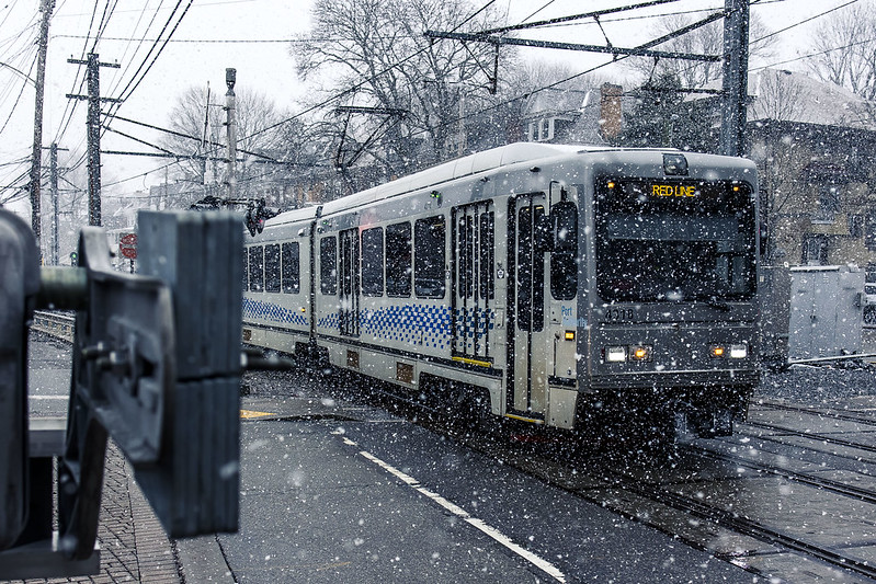
The best way to describe the previous week’s weather here in Pittsburgh is simply “last Tuesday was the day it didn’t rain or snow.” Saying that, a humble narrator was busy with mundanities so it wasn’t too much of a deal. One thing I can report to all of you back in Fun City is that I drove over to a local variant of the Department of Motor Vehicles, dubbed as the Pennsylvania Department of Transportation or “PennDOT Driver’s License Center” to transfer my New York State Driver’s License over to a Pennsylvania one in accordance with local statutes. Based on years of experience with NYS’s best analogue of a Soviet toilet paper distributorship, I figured my DMV or PennDOT experience would be miserable and frustrating.
45 minutes later I was walking to the Mobile Oppression Platform with a freshly printed Pennsylvania driver’s license in my wallet. Just had to fill out a few forms, pay a $36.75 fee, and done. The people working there were nice, helpful, and the process clear.
Y’know, when you’ve been drinking dirty water your whole life and somebody hands you a glass of crystal clear earth juice instead…
– photo by Mitch Waxman
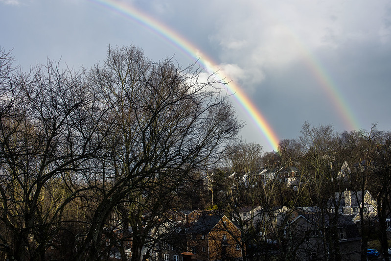
One hung around HQ during the inclement weather, mostly. A friend from New York was in town on Monday last and I got to spend a bit of time with a familiar face, which was nice. One day, after a particularly heavy wave of precipitation blasted though, the double rainbow pictured above was observed over Dormont, where HQ is now found.
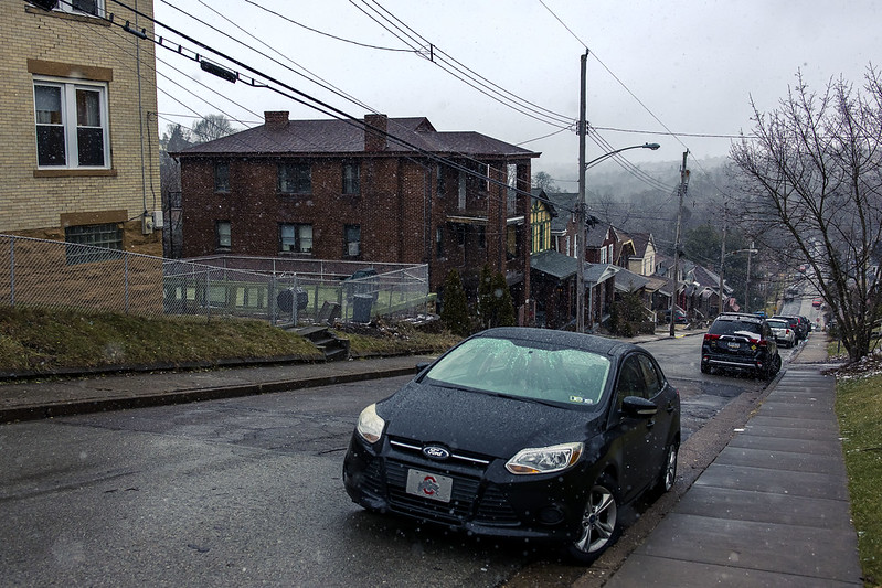
Today’s post breaks format a bit, with a three photo post. Tomorrow, we go back to the usual vulgarity with six shots. As mentioned, the weather has been… well… not fierce, but I’m still not at all used to driving out here on these crazy serpentine roadways with their steep hills and especially so when it’s icy. Take an inch of snow, pour a few hours of rain on it, then drop the temperature below freezing – that’s how you get me to stay home and not drive around.
– photo by Mitch Waxman
Pittsburgh is actually deficient at this moment, in terms of its annual averages, for snowfall but it has been fairly chilly. It is, after all, January. As you’re reading this, one is likely behind the wheel of the MOP, heading towards the bureaucratic entity that handles car registration and license plate issuance in Pennsylvania. As soon as that bit of business is handled, the entire “escape from New York City” process will have wound down and can be declared accomplished. There’s still a few things to do, notably rebuilding my office workstation which died a few years ago at the start of Covid. I’ve been working off of a fairly underpowered laptop the last couple of years, which has been sufficient but just so.
Tomorrow, I’m taking you along with me on another scouting mission, this one along the Allegheny River. Remember how I said I was “kvelling” to get a look at one of the several lock and dam locations operated by the United States Army Corps of Engineers? Well…
“follow” me on Twitter- @newtownpentacle
Buy a book!
“In the Shadows at Newtown Creek,” an 88 page softcover 8.5×11 magazine format photo book by Mitch Waxman, is now on sale at blurb.com for $30.
Investigating the GAP, part three
Friday

– photo by Mitch Waxman
The Mon Valley Works – Edgar Thomson Plant. That’s what the U.S. Steel outfit calls this steel mill, parts of which date back to 1875 and Andrew Carnegie. It’s where the United States’ first Bessemer Converter was installed, and is a cornerstone of our American story.
Having never witnessed this sort of thing in person before, the Mon Valley Works absolutely blows my mind. Wow. I’ve seen Battleships, and Air Craft Carriers, and mega massive sewer plants, and power generating stations, and petroleum refineries, and waste transfer stations, and port infrastructure – but I’ve never seen anything like this before. Blown.

– photo by Mitch Waxman
I had carried all the gear I use with me onto the Great Allegheny Passage trail, and got busy with the tripod and everything else as soon as a decent point of view of the Mon Valley Works appeared. Next time I visit the GAP, I’m planning on entering the trail from the Duquesne side to explore what you can see from that set of angles.
I’m also going to return to this position for early morning and late afternoon light when it warms up a bit, but I fear that spring and summer will create problems for me due to the vegetation being clad with leaves.
– photo by Mitch Waxman
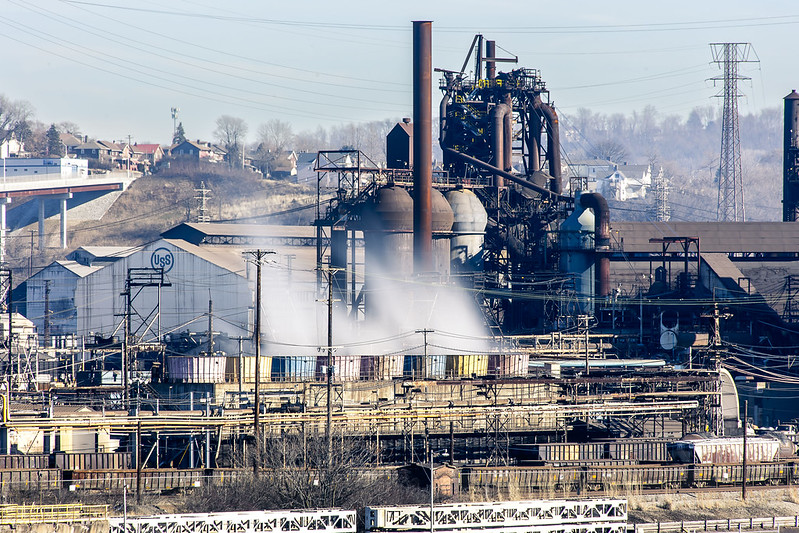
Even across the Monongahela River, and pretty distant, the Mon Valley Works are loud. Massive fans are at work for the heat exchangers, and the furnaces also are beaming out vibration and sound. The plant is also pumping out a terrific amount of sulfur dioxide, as it runs off coke and coal, so there’s a smell of rotten eggs which is omnipresent in the air.
I’m told that air quality in the Pittsburgh area can be awful, largely because of these coal fired heavy industries. So much so that there’s a website which tracks the plumes of pollutants that the three big steel mills pump into the atmosphere. Prevailing wind and economic geography decide who gets to breathe the stuff in. These steel mills, however, form and produce the building blocks for other industrial sectors, and always have. Somebody always pays the price for “progress.” It’s something to remind yourself about as you consume new manufactured products in the manner of a raging wildfire.
– photo by Mitch Waxman
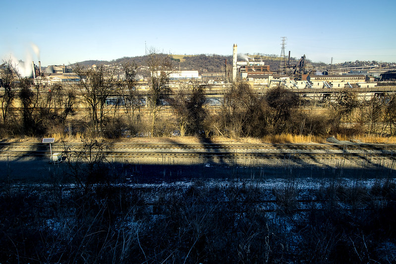
On the side of the Monongahela River that the GAP trail follows, you’re a pretty decent distance away from the shoreline. I did a wide shot to illustrate that, and to pass on the advice that if you want to get shots of the plant, bring a zoom lens with a not insignificant range.
As mentioned, those trees are going to block out the view during the warmer months. This was my turnaround point for this walk, as I’d have about another 4 miles to walk to get back to the Mobile Oppression Platform (my nickname for the car) which was parked at the Homestead Pump House. How did I come up with “Mobile Oppression Platform”? First, I owe a debt to the writers of the Futurama cartoon, secondly… have you ever talked to the bicycle people in Queens? Ever heard a car described as a two ton murder machine? I have, and took inspiration from the bellicose posturing they offered. If “two wheels good, four wheels bad” is your motto, I figured I’d give my car a name to piss you off. I’m a Dick like that.
– photo by Mitch Waxman
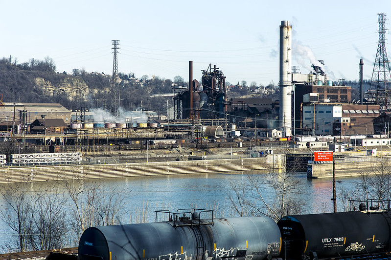
There’s so many things I want to get close up to in the shot above, including the Army Corps of Engineers lock and dam at the right side of the shot. After a disastrous flood in the 1930’s, the USACE installed a series of locks and dams on the rivers leading to Pittsburgh to control the waters. There are multiple USACE lock and dam facilities in the Pittsburgh area which I’m “kvelling” to get closer to.
I packed up my more esoteric gear after this one, reverted back to handheld shooting mode, and started retracing my steps back to the Mobile Oppression Platform in Homestead and my ride back to HQ.

– photo by Mitch Waxman
On my way, I cracked out a few more shots, and was passing by the defunct Carrie Furnace just as the light became a bit kinder. As mentioned in the first of these posts, it was fantastic to walk a fairly long distance again. It’s been a couple of months, what with the move and the setting up of housekeeping and all that, since I’ve had the chance to just scuttle about and see these sort of things.
Next week, something different at this – your Newtown Pentacle.
“follow” me on Twitter- @newtownpentacle
Buy a book!
“In the Shadows at Newtown Creek,” an 88 page softcover 8.5×11 magazine format photo book by Mitch Waxman, is now on sale at blurb.com for $30.
Investigating the GAP, part one
Wednesday
– photo by Mitch Waxman
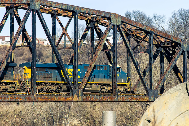
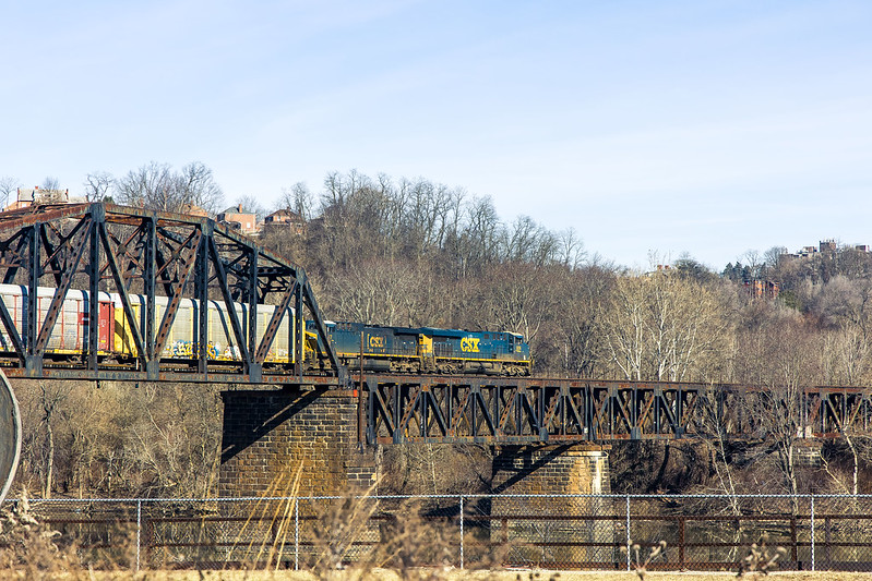
Last week, I showed you what the historic Homestead Pump House site on the Monongahela River looked like when bathed in thick fog. Lament was offered regarding the lack of a freight train transiting over the Pinkerton’s Landing or “Pemickey” Rail Bridge.
The Homestead Pump House is one of the trail heads for The Great Allegheny Passage or “GAP” rail to trail system. 150 miles in length, the rail to trail pathway follows several incorporated rights of way once operated by the B&O Railroad, Lake Erie Railroad, Union Railroad, and the Western Maryland Railway. You could theoretically walk or ride a bike to Washington D.C. on this path, which is paved in asphalt or crushed limestone – depending on where you are – and graded in accordance with the rail standard of one foot of elevation for every hundred feet.
Pictured above, this time around my dreams of a train moving over the bridge came true as a CSX freight train appeared and I was able to get a few shots of its transit across the rail bridge.
– photo by Mitch Waxman
The Homestead site has a parking lot, one which leads to the actual trail after a short walk on a sidewalk. I did all the remote scouting that was warranted, using Google maps and a few other tools as well as watching a YouTube video offered by some bloke who rode the trail on a bike. One still hasn’t purchased a shuttle craft bike which will accompany me in the cargo area of the Mobile Oppression Platform (that’s the nickname I’ve assigned to my Toyota), and be deployed for hyper local transport.
I don’t really keep track of how many miles I walk. Sometimes, after a walk I’ll check my phone to see how many steps it perceived me as taking on an excursion. If there’s any accuracy to that data, I walked on the trail about 4 miles in and 4 miles back. It was an extremely easy walk, thanks to the pavement and the easy grading in elevation. There were even installed park benches for taking a break along the route, but one of my rules involves not sitting down when you’re out. Keep moving until you’re back where you started.
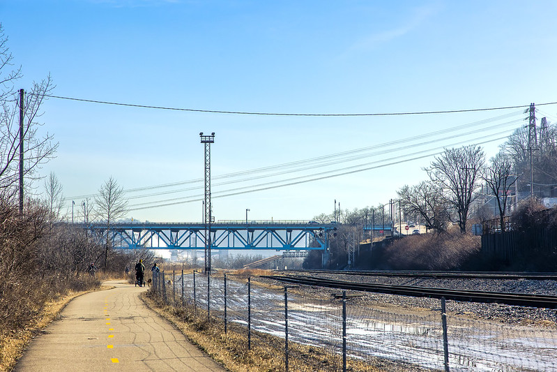
– photo by Mitch Waxman
Active rail tracks are visible for the entire section of the GAP I visited. Defunct gas and rail infrastructure was noticed on the water facing shoreline for a good chunk of this distance, and there was a high volume road at the top of a shallow ridge overlooking the whole shebang. The municipality of Homestead was where I entered the trail, and there were markers here and there letting you know what town you were walking through.
That’s how I learned there’s a place called Munhall in Pennsylvania, those signs. There were actually a fair number of people using the trail for running and bike riding for a weekday afternoon in January. A good proportion of the bike riders were wearing the “outfit” – the helmet with the rear view mirror on it and a polyester bike shirt, stretchy shorts, and those special bicycle shoes. Like I said – the outfit. Most of the bikes were road racers, but I spotted a couple of pedal assist electric ones too.
– photo by Mitch Waxman
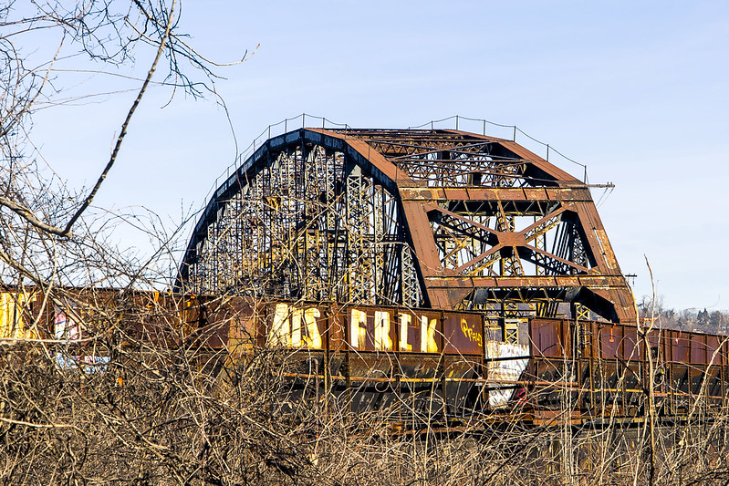
That’s the Carrie Furnace Hot Metal Bridge pictured above, I believe. Before you ask – of course I looked, and yes you can, and no it’s probably not ok but there doesn’t seem to be anybody watching, so of course, but no, not this time around. Next time, maybe.
I continued along the GAP trail, scuttling along at a leisurely pace.
– photo by Mitch Waxman
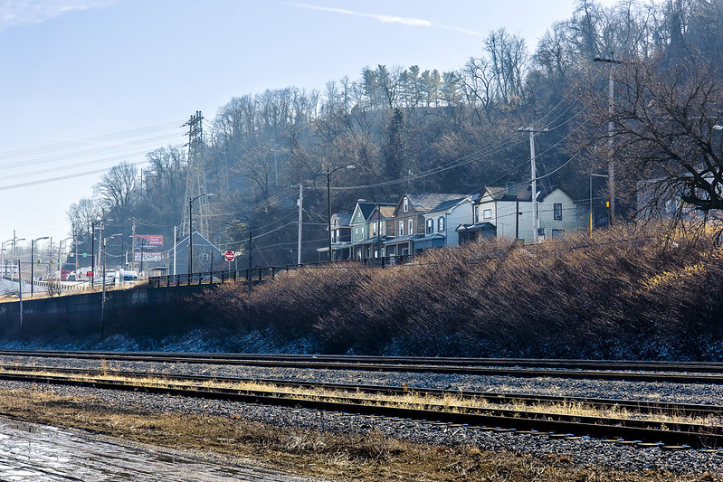
Once you’re a fair bit into the GAP trail, you’re completely separated from the surrounding town and of course – there’s no automobile traffic zipping along at high speeds to worry about.
On a personal note – it’s been a very long time since I’ve had the time to take a very long walk like this one. It felt very good to stretch the legs, kick the heels, and point the toes. Ultimately, this was another scouting expedition. It was mid afternoon, and the light was a ghastly thing to handle. For the ultimate destination I had in mind, this scouting revealed it as an early morning or sunset sort of deal. It’s also a winter thing, as the foliage must obscure all of the cool stuff you can see from this path during the warmer months when the trees are clad.

– photo by Mitch Waxman
The GAP follows under the Rankin Bridge spanning the Monongahela River. The 1951 bridge has a fairly convoluted history, and it once was used to carry Trolley traffic as well as motor vehicular flow, apparently. There’s a few very nice points of view in this section of the trail that I’m going to return to in the future. For this trip, my main interest was in getting close to the Mon Valley works, and I still had a few miles to walk to get there.
More tomorrow, from the GAP.
“follow” me on Twitter- @newtownpentacle
Buy a book!
“In the Shadows at Newtown Creek,” an 88 page softcover 8.5×11 magazine format photo book by Mitch Waxman, is now on sale at blurb.com for $30.
an Allegheny interval
Tuesday

– photo by Mitch Waxman
One had a couple of hours to kill recently, and decided to do a proper photowalk on the north side of downtown Pittsburgh. This area which I was in, I’m told, was an independent municipality in Allegheny County called Allegheny City until 1907, when it was annexed by another municipality. Pictured above is Downtown Pittsburgh, which is the neighboring city that did the annexation.
The waterfront in this area is part of the Three Rivers Heritage Trail, which is a post industrial accommodation open to the public for exercise and recreation. Lots of joggers and bicyclists are moving about, and right behind me while I was shooting these there was some kid trying to figure out to ride his skateboard. This is right about where the Allegheny River feeds into the Ohio River.

– photo by Mitch Waxman
Looking along the Allegheny River, past the Fort Duquesne steel bowstring bridge and towards the “three sisters” suspension bridges. Last week, frequent commenter and wise aleck George the Atheist asked in a comment why there are so many different types of bridges here in Pittsburgh. I don’t have a definitive answer but I’ve got a few theories. First is that these bridges were largely installed over a 75-100 year period and that technologies and materials change over time. The second, and this one fits in with my somewhat conspiratorial point of view, is that Pittsburgh was the home of the American Bridge Company.
My theory is that American Bridge Company, as organized by JP Morgan, used Pittsburgh’s waterfront as a showroom for its national and international customers. Notably, American Bridge Company was one of the principal contractors used for most of NYC’s “lesser” bridges including the Pulaski Bridge spanning my beloved Newtown Creek. They also worked, and still work, on the major bridges too.

– photo by Mitch Waxman
One decided to shed the tripod and filter setup, and just shoot shots instead for the remaining time I’d be out. Scouting, that’s what I’m doing. What I want to be doing is shooting long exposure and loving photographs of Pittsburgh and its wonders, but it kind of bogs me down and keeps me from discovering new things and points of view. I still need to wander about and find these points of view before I get fancy… that’s what my inner narrative naggingly reminds.
I packed up the gear, and set my heels a clicking for a proper photowalk, thereby. I followed the Three Rivers Heritage trail, heading off along one of the Ohio River legs of the path.

– photo by Mitch Waxman
That’s the West End Bridge, which I showed you from above last week. Pittsburgh has been dealing with an explosion of unhoused folks camping out in tents and makeshift dwellings along the waterfront in recent years. Political outrage about this has caused the City to send in the cops and sanitation crews to clear out the dwellings and to try and convince the unhoused folks to literally come in from the cold and take a bed at a homeless shelter. This went about as well as it does in any American City, as the section of the trails in the Downtown area which the TV News people filmed the Government types “cleaning up” remains depopulated, but the zones which didn’t receive the media attention still host people living in dire circumstance. The Ohio River frontage is one of those zones.
I should mention that use of the word “explosion” in the Pittsburgh context indicates that there were a couple of hundred down on their luck street and or traveling people living rough in tents and make shift huts – at most. This made the TV news, in heavy rotation.

– photo by Mitch Waxman
I approached the great cathedral and spiritual center of Pittsburgh, and the most important thing in this region of the country. This structure, which occupies the thoughts, prayers, and minds of all Pittsburgh and its surrounding counties is a sports ball arena that is home to the Steelers football team. Formerly called Heinz Field, naming rights for the stadium were recently acquired by an outfit called Acrisure. Across the street from the stadium is the Carnegie Science Center, an interactive museum largely designed for kids. In between the two is a parking lot which costs $6 for all day parking, and it’s where I left the Mobile Oppression Platform while I was out walking around and shooting.
It was starting to get dark, and since I don’t know the “lay of the land” quite yet, I decided that I would be happier and quite a bit safer in the car. It’s not that things are dangerous hereabouts, but I’m ignorant of what a good neighborhood versus a bad one looks like. Additionally, there was a nearby industrial zone I wanted to take a look at which was definitively “car country” rather than being pedestrian friendly.

– photo by Mitch Waxman
One of those industrial zone spots which I wanted to take a look at involved the Western State Penitentiary, a now shuttered prison found in the former Allegheny City and along the Ohio River. Word has it that opportunity to visit and photograph parts of this facility might materialize during the spring or summer, notably as part of a citywide event called Doors Open Pittsburgh. Doors Open’s operation is reminiscent to me of Open House NY, whom I worked with for several years on walking and boat tours of Newtown Creek.
More tomorrow, from the Paris of Appalachia, at your Newtown Pentacle.
“follow” me on Twitter- @newtownpentacle
Buy a book!
“In the Shadows at Newtown Creek,” an 88 page softcover 8.5×11 magazine format photo book by Mitch Waxman, is now on sale at blurb.com for $30.
Monongahela, men will call thee
Monday

– photo by Mitch Waxman
One thing I’ve learned about living in Pittsburgh in these first weeks of doing so is that you need to pick your battles, as far as the weather goes. Blue skies and bright sun have been a fairly rare commodity so far, so when the forecast called for those conditions on the 9th of January, I hopped behind the wheel of the Mobile Oppression Platform and set off for several points of interest which had caught my attention along the Monongahela River.
First stop was Clairton, found about 13 miles (as the crow flies) from Downtown Pittsburgh. There’s a “rail to trail” opportunity to be found there which is part of the Montour Trail. What drew me here was U.S. Steel’s Clairton Coke Works, pictured above. I ran into a cop who seemed to be “cribbing” in the parking lot of the Montour Trail, and started a conversation with him about me being a photographer who is new to the area and who wanted to get the skinny on what’s considered ok or not as far as local law enforcement’s point of view is concerned. Best to ask, let the cop know you’re not some freak who’s going to cause trouble, as I always opine.
After telling me to take my hands out of my pockets, the officer informed me that were I to trespass onto the Clairton property he’d have an interest in me due to Patriot Act related security concerns, but his department would otherwise have zero interest in my pursuits and then he even mentioned my First Amendment right to self expression and a lack of desire to interfere with such things. I thanked the officer, cracked out the shot above, and hopped back into the Mobile Oppression Platform and continued with the exploring.
As mentioned in the past, it’s January and the light sucks this time of the year, so I’m largely scouting at the moment.

– photo by Mitch Waxman
I drove through a quite lovely semi-rural area, heading southwards, and crossed the river. There are a series of public boat launches and parklets which are set up in a fairly welcoming fashion on this stretch which had caught my eye while I was scrutinizing Google maps’ satellite views during one of the several rain soaked intervals recently experienced. The shot above and the one below were captured at one of these bits of aforementioned public waterfront access infrastructure found in the community of Speers Borough.
The colossal rail bridge, which was staggering to observe in person, is the Speers Railroad Bridge, whereas the blue colored vehicular crossing with the arch is called the Belle Vernon Bridge.

– photo by Mitch Waxman
The boat launch in Speers Borough allowed me to securely park the Mobile Oppression Platform and head down to the water with my tripod setup to get a bit “artsy fartsy.” The Belle Vernon Bridge is a 1951 vintage span over the Monongahela which once carried trolley service in addition to automotive traffic.
While shooting, some dude was noticed walking towards me while carrying a bucket. “Here we go” thought this long time New Yorker, but as it turned out he was a lovely chap who used to work on the tugs that navigate the Monongahela delivering mineral feedstocks to the the steel mills. The bucket? He didn’t pay his water bill and needed to flush his toilet, hence the visit to a river with a bucket in hand.

– photo by Mitch Waxman
My next stop was Monessan, PA., which is the hometown of cinematic makeup artist Tom Savini. Savini has a program named after him at a business school in Monessan. The Arcelor Mittal Monessen coke plant is pictured above, as seen from a supermarket parking lot bordering the mill. It wasn’t this plant, or Tom Savini (whom I’m a huge fan of, and even have an autographed plaster casting of a human skull he created sitting on my desk), instead it was another boat launch which would offer unimpeded water views which drew me here.
One negotiated the local street grid, as it were, and found his way down to the riverfront and the small park and boat launch ramp hosted there.

– photo by Mitch Waxman
In the distance, that’s the Donora-Monessen Bridge, aka the Stan Musial Bridge, a 1972 addition to the Monongahela River. By this point, I had throughly gotten myself lost. My goals for the day started out with trying to find a few points of view to photograph the Clairton Works from, which ended up being a lot more difficult than you’d think. If there’s a bit of waterfront property anywhere near it, that land is super valuable for commercial exploitation. Get a few miles away from the plant where the valuation of the river facing properties drops and it becomes a liability to the town rather than an asset, and you might as well use the waterfront as a park instead.
I did spot a few locations which I’m going to have to return to on foot, after I figure out someplace convenient to leave the car, and during a season which is a bit less harsh as far as temperature. There’s a number of things which I need to work out, actually. Things are chaotic at the moment.

– photo by Mitch Waxman
I wish I could tell you the name of the rail bridge above, which is about equidistant between Clairton Works and another steel mill called the Irvin Works which I haven’t laid eyes on yet. My understanding is that the teal colored pipeline moving through the shot carries gas generated by the Clairton Works coking operation that will be pumped over to and used to fire the Mon Valley Works over in Braddock.
More exploratory wanderings in tomorrow’s Newtown Pentacle.
“follow” me on Twitter- @newtownpentacle
Buy a book!
“In the Shadows at Newtown Creek,” an 88 page softcover 8.5×11 magazine format photo book by Mitch Waxman, is now on sale at blurb.com for $30.


