Posts Tagged ‘Pennsylvania’
Montour Trail, part 2
Friday
– photo by Mitch Waxman
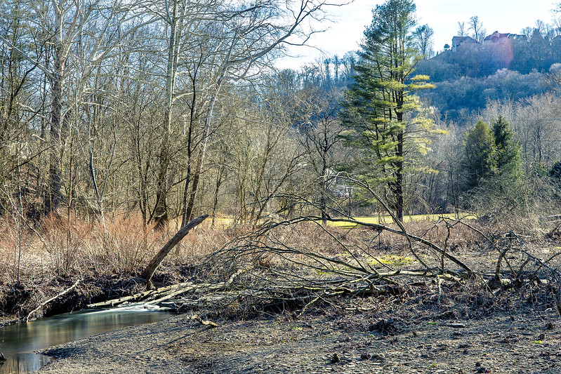
As described yesterday, one recently spent an afternoon at the head of the Montour Trail, with mile zero of the rail trail being found in the Pittsburgh suburb of Coraopolis. I scuttled from the parking lot at mile zero to about two and a half miles down the line, then turned around and headed back. Along the way, there were several interesting POV’s, so I deployed the tripod and attached a filter to my lens, and then got busy.
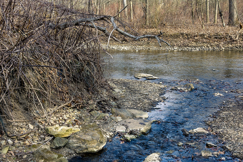
The “undistinguished” waterway seen flowing throughout today’s post is called Montour Run.
– photo by Mitch Waxman
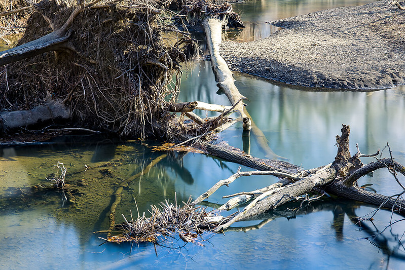
There were lots of fallen trees in the stream. I decided to affix an ND filter to the lens to slow down the light and allow the water to photograph as a mirror. There were several ‘desire paths’ which had been created by people’s feet that led off the Montour Trail and down to the banks of the waterway.
For the most part, it was seldom more than a couple/three feet deep, but the water was flowing pretty quickly. This created a lot of visual distraction, hence the desire to “mirrorize” the surface.

– photo by Mitch Waxman
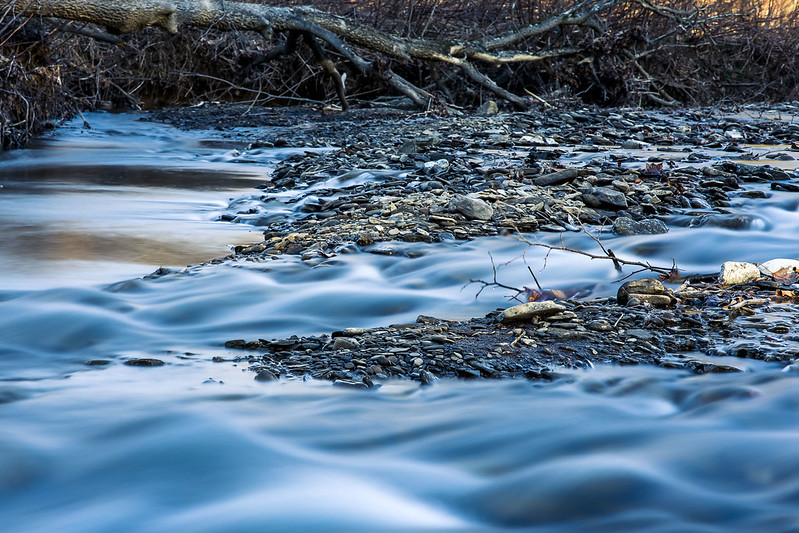
There was one area in particular which caught my attention, a basin of sorts where the water spread out nearby the overpasses of a nearby highway. For these shots, two of the legs of my tripod were actually standing in the water. I had to shimmy down a somewhat natural and quite muddy slope for these.
Worth it.
– photo by Mitch Waxman
One has been watching YouTube videos offered by bicycle riders, usually GoPro helmet cam type presentations, of Montour Trail trips. This is part of my remote scouting regime. It lets me know if there’s something specific on any one section of the trail that I might want to seek out (there are rail tunnels and bridges down the line!) and others that I’d want to avoid (the airport connector section of the Montour seems pretty horrific if you’re on foot).
Ultimately, I’m intrigued by all of this. This is EXACTLY the sort of proposal which we Newtown Creek aficionados have been proposing to the powers that be in NYC regarding the Montauk Cutoff for nearly a decade. Deaf ears, back in NYC, unless you start your sentence with “affordable housing.”
– photo by Mitch Waxman
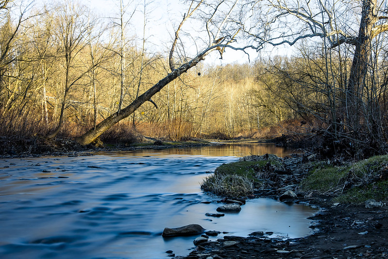
One thing I’ve discovered here in “ridge and valley” country is that the burning thermonuclear eye of god itself may be setting at the same time or later than it does back where I’m from, but because of the terrain the sunset occurs in a quicker interval than it does in a comparatively flat and oceanic terrain. Here, the orb drops behind a hill and you’re done right quick.
Saying that, there’s some serious theatrical level lighting going on during these moments.

– photo by Mitch Waxman
One looks forward to more explorations of these amazing examples of lateral thinking, regarding the post industrial utilization and conversion of private property into a public recreational space, which can be found here in Western Pennsylvania.
Back next week with something else.
“follow” me on Twitter- @newtownpentacle
Buy a book!
“In the Shadows at Newtown Creek,” an 88 page softcover 8.5×11 magazine format photo book by Mitch Waxman, is now on sale at blurb.com for $30.
Montour Trail, part 1
Thursday

– photo by Mitch Waxman
There’s a huge network of rail trails in the Pittsburgh area, something which has caught my attentions a few times. Rail Trails follow the “right of way” of some bankrupt railroad which is long gone, whereupon some combination of Governmental and community organizations converted the former trackways into public spaces and parkland. A few weeks ago, I visited a section of the Great Allegheny Passage or “GAP,” which was described here, here, and here. Additionally, visits to the Three Rivers Heritage and Hot Metal trails, as well as the Eliza Furnace Trail, are described. One is slowly becoming aware of the fairly vast network of these rail trails which snake around Pittsburgh.
Last week, I paid a visit to a suburb of Pittsburgh called Coraopolis where the Montour Trail, which follows the path of the defunct Montour Railroad, begins.
I’d visited a couple of sections of the Montour very briefly back in January, in a place called McDonald, where it intersects with another rail trail called the Panhandle. There’s also a Montour trailhead in Clairton, nearby one of the Steel Mills. Wow.

– photo by Mitch Waxman
I parked the Mobile Oppression Platform (the Toyota) at the head of the trail at a lot maintained for visitors nearby the Montour Trail’s zero mile marker. There was a Porta Potty there. One gathered the camera gear off of the back seat of the MOP and set off for a medium sized scuttle. This time around, I had two zoom lenses and a tripod with me. One lens on the camera, the other (a 70-300) in the bag. I’d say that about 75-80% were shot with my 24-105 mm lens.
Speaking of shooting, the first mile or so of the Montour Trail allows you egress between the property of two shooting ranges. For the entire first mile and a half, you’ll hear non stop rifle fire. This was excellent. There was so much gunfire going on that it sounded like a rock beat was playing. USA!

– photo by Mitch Waxman
These trails are very easy walking, and a lot of people were biking through, and most of them were sort of pleasant. The custom here is to say hello to strangers, or at least nod at them, while passing by. It’s somewhat ritualized, this friendly thing. As a lifelong New Yorker, this acknowledgment of other’s existence is weird, but when in Rome…
The surface of the trail is mostly crushed limestone but there’s patches of pavement here and there. The grading of the thing is in accordance with the railroad standard of gaining no more than one foot of elevation for every hundred feet that’s crossed horizontally, which is where that “easy walking” observation comes in. A small waterbody was running alongside the trail berm that once carried rails, called Montour Run. In places, the water looked fairly deep. Signage indicated that the run was stocked with trout. There were a bunch of informal trails leading off the Montour which people had graded with their feet. In urban design circles, these sort of corridors are called “desire paths.”
– photo by Mitch Waxman
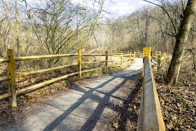
Roughly two miles from where I started, the Montour Trail intersects with a natural conservation area and a set of side trails maintained by the Hollow Oak Land Trust. One wandered into the Hollow Oak zone for about a half hour, and enjoyed the landscape. I’m definitely coming back to this one in the spring when all of those sticks have leaves on them.
A lot of shallow water was cascading about, running down out of the woods and eventually joining the Montour Run.
– photo by Mitch Waxman
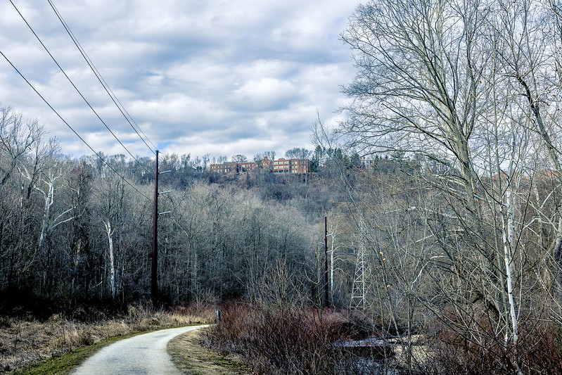
A crew of volunteers was at work when I was there, maintaining the trail and clearing brush. This was my turnaround point for the walk, as I ultimately had to back track to the zero mile point to get back to the car. The Montour Trail ultimately goes to Maryland, so it’s clearly not something I’m going to walk all in one go.
The other side trails which branch off of the Montour are going to also get some attention in the fullness of time, but as mentioned many times – one is still scouting.
– photo by Mitch Waxman
After hitting the turnaround point, roughly two and a half miles from the start, one began heading to the MOP. I had noted a few spots which were visually promising on my way to the turnaround point, and since it was now a good time of day – late afternoon – for light…
More tomorrow at this – your Newtown Pentacle.
“follow” me on Twitter- @newtownpentacle
Buy a book!
“In the Shadows at Newtown Creek,” an 88 page softcover 8.5×11 magazine format photo book by Mitch Waxman, is now on sale at blurb.com for $30.
The Hood
Wednesday
– photo by Mitch Waxman
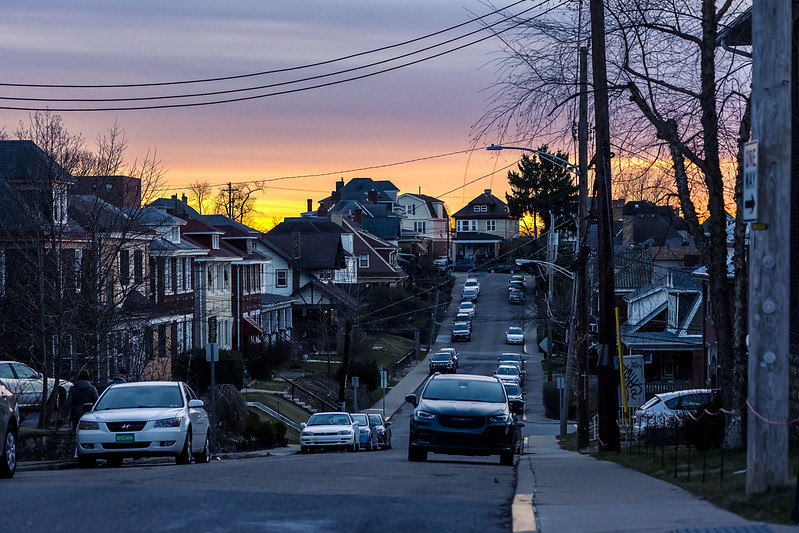
Last weekend, Our Lady of the Pentacle and myself found ourselves hanging around in the Pittsburgh suburb we landed in, which is dubbed Dormont. Given our proximity to the titular center of the City of Pittsburgh, which is about four and a half miles from here, it’s surprisingly well wooded and there’s critters all over the place. Deer, rabbits, every sort of bird you can imagine. It’s quiet and dark at night, and after midnight you can pretty much hear a pin drop. Of course, if you drop that pin, the neighborhood dog chorus is going to be forced to comment on the event.
We’ve been taking things one step at a time, and recently enjoyed a small bar crawl at several of the locals. This included what’s becoming my favorite spot – a pool hall which has a bar in it. They have Guinness on tap there, which is a bit harder to find here in Yuengling country than it was back in Irish Bar dominated Western Queens.
– photo by Mitch Waxman
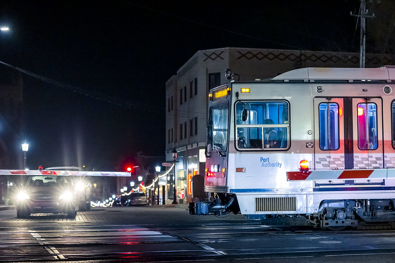
The terrain is something else, and Dormont is part of a region in Pittsburgh called the South Hills. One of the resources available here is “The T” street car line which leads directly into downtown Pittsburgh. It’s about a 20 minute ride from Dormont to downtown, and costs $2.75 for us. They use a distance based fare system for the service.
Our place is down the hill from the street which the T’s tracks are set into, and I can see the red flashing lights which signal its movement from the back deck. Thereby, I can confirm that the service is fairly frequent and you wouldn’t be waiting long for one to arrive at the station. Some of the stations are just set asides on the street, whereas others are high platform stand alone ones. The T has two sets of doors, one for the street level stops which has a set of steps, the other for the high platform ones.
– photo by Mitch Waxman
There’s a little patch of woods in a… I’m not sure it’s gulley, a hollow, or a run… but it’s a shallow valley which sometimes has water running through it right across the street from our place. It’s meant to be connected across by a wooden bridge, but I haven’t found that yet.

– photo by Mitch Waxman
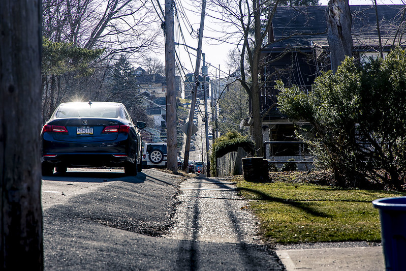
As pictured above, the terrain here is madness when you’re on foot. The locals who grew up here display super muscular legs when they’re wearing shorts. They wear shorts (with a Steelers jersey) if the temperature is anything above 40. I’ve had people ask why I’m dressed for Antarctic clime when it’s literally freezing out and I have a winter coat on. Most of the blokes I see wear fleece sweatshirts in lieu of coats, but you do spend a lot of your time getting in and out of the car in this area so it’s a practical choice.
There are hundreds and hundreds of these municipal steps all over Pittsburgh, and it’s suburbs. As time goes by, I’m planning on exploring the somewhat hidden network of these things, and seeing what they’ll show me. I’ve been planning on taking a walk along one set that overlooks freight tracks which is tolerably nearby.
Good cardio, here in Pittsburgh.
– photo by Mitch Waxman
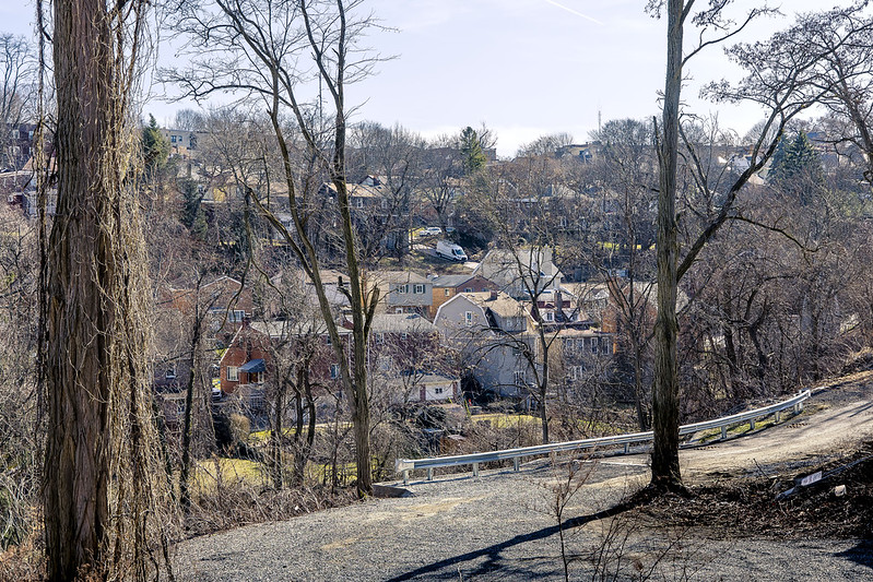
One walk we undertook was around that gully or hollow mentioned above which is literally across the street from the house and which we haven’t gotten around to exploring yet. The street I live on dead ends about a block from my front door and then supposedly transmogrifies into a path leading towards one of those steps. We regularly see transients and never do wells heading in that direction and not coming back. According to the neighbors, there’s a quite lovely rock formation hidden back there somewhere. Maybe the corpses of all this transients we see heading in the one direction too. I’ll find it, and them, when the weather is warmer.
The ridge at the top of the hill in the shot above is where the T street car line runs, on a street dubbed “Broadway Avenue.”

– photo by Mitch Waxman
There are some truly lovely homes here, huge structures with decks and yards and multi car garages and driveways. There is not a single building style, it’s disturbingly heterogeneous.
One can confirm the “sylvania” part of the state’s name at this time. Lots of woods here.
Tomorrow – a walk along the Montour “rail to trail” is coming. Prepare!
“follow” me on Twitter- @newtownpentacle
Buy a book!
“In the Shadows at Newtown Creek,” an 88 page softcover 8.5×11 magazine format photo book by Mitch Waxman, is now on sale at blurb.com for $30.
Hot Metal, 3 Rivers Heritage Trail
Tuesday

– photo by Mitch Waxman
The path which the Monongahela River enjoys is somewhat serpentine in nature, prior to the waterway’s juncture with the Allegheny River, where they mutually become the Ohio River nearby Downtown Pittsburgh. Last week, I drove the Mobile Oppression Platform (the Toyota) over to a neighborhood called the Southside Flats and parked in a lot associated with a park and the Three Rivers Heritage Trail. The MOP was left directly beneath the Birmingham Bridge, pictured above.
It’s a young bridge for this section of the world, having been opened for business in 1977. It’s another bowstring arch bridge, not unlike the Fort Penn bridge discussed last week. The fact that it’s not painted yellow indicates that it’s a state – rather than a city – bridge. My plan for the afternoon was pretty simple – I’d walk eastwards along the trail, cross the river and then walk westwards, whereupon I’d circle back to the MOP. It was overcast in Pittsburgh, with roiling clouds bolting around up in the vault, and the temperatures were comfortable and in the mid 50’s.

– photo by Mitch Waxman
This is another one of the sections of Pittsburgh where there used to be a steel mill, I’m told. The trail itself follows active freight rail tracks on the south side of the river. In tomorrow’s post, the north side of the scene will be explored, but for the first half of my walk it was all about the south side and getting to where my crossing would be found.
There’s gigantic infrastructural elements available for inspection and appreciation along the way – storm sewers, enormous concrete and iron retaining walls that keep the slopes of sedimentary soil deposits from sliding into the river. One section had steel plates holding up a wall of soils, with the steel plates bolted into place with giant lug nuts that were the size of dinner plates.

– photo by Mitch Waxman
That’s the 1887 vintage Hot Metal Bridge. During the Second World War, 15% of American steel production would travel over it on the rails. In 2000 AD, it was converted over to vehicle and pedestrian/bike usage. Its “official” name is the “Monongahela Connecting Railroad Bridge and Hot Metal Bridge.” On the path approaching it, there’s historic signage which describes the steel industry and the railroads which served it.
There’s post industrial development everywhere you look in this zone, and a few large corporate anchors are located nearby, including the clothing company American Eagle Outfitters.

– photo by Mitch Waxman
On the Hot Metal Bridge’s pedestrian path, which is completely separated from the vehicular lanes, and heading north – that’s where this shot was gathered. I didn’t have any particular goal for the afternoon other than kicking my feet about and getting some exercise, but I was able to piece together a mental map of where I was scuttling based around prior explorations – which I’ve described here – of the Monongahela Valley. Locally, it’s referred to as the Mon Valley by the politicians, but when they say that it’s usually in reference to the still quite industrial areas to the east like Clairton and Braddock.
There were just a few other people on the bridge. A bike rider or three, joggers, one or two other pedestrians. No dogs.

– photo by Mitch Waxman
This one looks back towards the south side of the river across the Hot Metal Bridge. My original plan was to circle back to the south side and the MOP using the Birmingham Bridge… but more on that tomorrow.
The north side has quite a different circumstance than the south does, with high speed roads like I-579 riding on elevated structures and an industrial and commercial zone. When you get to the north side, the Three Rivers Heritage trail is renamed as the Eliza trail to commemorate the J&L Steel mill which was located here. This bridge is also part of the Great Allegheny Passage trail.

– photo by Mitch Waxman
On the north side, I turned westwards. The neighborhoods around this intersectional area are Oakland and the Hill District. The terrain here is difficult due to its verticality, and I can tell you that it’s a real challenge to climb these hills on foot. Luckily, the path I was walking on was graded for rail, meaning one foot of elevation for every hundred feet horizontally.
Tomorrow, I find myself walking through the sort of place which most would logically go looking for my corpse, if I’d gone missing.
“follow” me on Twitter- @newtownpentacle
Buy a book!
“In the Shadows at Newtown Creek,” an 88 page softcover 8.5×11 magazine format photo book by Mitch Waxman, is now on sale at blurb.com for $30.
Highland Park Resovoir
Wednesday

– photo by Mitch Waxman
That’s the 117 million gallon ‘Reservoir One’ pictured above, at Pittsburgh’s Highland Park. The region’s water and sewer people style themselves as pgH20, and they’re the Pittsburgh equivalent of NYC’s Department of Environmental Protection – or DEP – whom long time readers have endured multitudinous descriptions delineating both the infamy and charm of that organization here at Newtown Pentacle.
For you New Yorkers – the DEP is annually budgeted at $1.6 billion, and is committed to spend some $24.3 billion on capital improvements to their system on top of that, just in the next decade. Pay attention to this “black box,” somebody.
The reservoir, here in a suburb of Pittsburgh, is surrounded first by a walkway and then by a large park which also incorporates the city zoo and aquarium. The enveloping neighborhood is, I’m told, also called Highland Park and boy oh boy is this a pretty town, with gorgeous housing stock surrounding the park. This is literally just up the hill from the location on the Allegheny River which started up yesterday’s post about Lock and Dam 2. Of course, when I say “just up the hill” in Pittsburgh, we’re talking Mayan pyramid up. The reservoir is at an elevation of 1,030 feet above sea level, and the lock and dam I visited was at an elevation of 721 feet, so that would be about 25-30 building stories differentially.

– photo by Mitch Waxman
There were all sorts of humans milling about, in their impermanence, so to remove any sign of life from these shots I set myself up for long exposures and got all artsy fartsy. That’s how you get those long mirror surface reflections, with long exposures of at least 20-30 seconds. Also, unless one of the humans stands stock still like a statue they disappear.
As opined yesterday, one remote scouts using Google maps’ satellite views to look for interesting things and locales which might be within reach of a humble narrator. In this case, it was a “what the hell is that” followed by “hey, there’s a parking lot.” Now that I’m a car guy, having a safe and legal spot to park the Mobile Oppression Platform has become part of my deal. Luckily, Pittsburgh doesn’t pretend that bike lanes can fix the universe nor do they opine that cars are the reason that housing is unaffordable. Instead, there’s places to park your car which adjoin safe and maintained trails for recreation and exercise.
Distributed load multi modal transportation network is the term you’re looking for. So’s acknowledging that people have kids, or mobility issues, and that public infrastructure like parks HAS GOT TO BE ACCESSIBLE BY PEOPLE WHO AREN’T NECESSARILY ABLE TO WALK OR RIDE A BIKE. You need to have places to bring and park vehicles. There is no one size fits all answer to anything when you’re discussing access to a public place.
Sorry, still scarred from being the Transportation Chair of a Community Board in Queens.

– photo by Mitch Waxman
One spent about a half hour at the reservoir, pulling shots from various angles. The locals were wandering about on bikes and on foot, and I even spotted a couple of other blokes tugging their cameras about, but they were preparing to do some sort of portrait shoot with a video component from the look of their gear. We chatted briefly, Sony shooters.
A humble narrator has long used little strips of gaff tape to cover up the bright white Canon logos on my camera, ever since I had to retouch the reflection out of the eyes of somebody I was taking a picture of. Also, the evil people are clever, and also have google on their phones and can thereby figure out what your gear is worth and if you’re worth robbing. Why not camouflage that Canon or Nikon logo?

– photo by Mitch Waxman
There were several signs forbidding certain things on the walkway – litter, smoking, dogs – all of which were prosaic cautions given this reservoir is full of what’s going to be used as drinking water. Where HQ is found in Dormont, the water system has been privatized and is controlled by a corporate entity called “American Water” which is apparently a fairly large corporation that I never heard of before moving here.
Pennsylvania politics flips hard “Red” or hard “Blue” during the various election cycles. Currently it’s in a blue phase. The reds ok’d fracking and a bunch of other ugly stuff, whereas the blues… man… this sort of thing really sounds like the last days of the Roman republic doesn’t it? If memory serves, for them it was Blues and Greens.

– photo by Mitch Waxman
Luckily, I’ve managed to avoid having just about any political conversation at all so far. Let’s face it, it’s only a matter of time until I blunder into some sort of situation where I find myself in a “political room” but I really want to stay the hell out of all that until I have to. I’ve had enough of that for a while. You should see the look on the Pennsylvanian’s faces when I mention that my Congress member used to be AOC, back in Astoria.
At any rate… Highland Park in Pittsburgh…

– photo by Mitch Waxman
On my way back to the MOP, I cracked out this shot of the Highland Park’s formal entrance with its columnar accoutrements.
In yesterday’s post about Lock and Dam 2, I mentioned that a diversion of about an hour occurred in between my circling of the river infrastructure. Highland Park reservoir was where that diversion occurred.
Tomorrow, more from the corridors of the Allegheny River.
“follow” me on Twitter- @newtownpentacle
Buy a book!
“In the Shadows at Newtown Creek,” an 88 page softcover 8.5×11 magazine format photo book by Mitch Waxman, is now on sale at blurb.com for $30.


