Archive for the ‘Queens’ Category
these realms

– photo by Mitch Waxman
Occasion called for me to meet up with Our Lady of the Pentacle deep in the far eastern (from the perspective of Astoria, at least) neighborhood of Flushing over the last weekend. The obviate path would demand navigating and enduring the exquisite ironies visited upon the hapless weekend customer of the MTA here in western Queens, and though my patience was thin- my wallet is thinner so a cab was out of the question and… it was a really nice day.
Hence, I walked… and walked… and walked… from Astoria to Flushing.
The master, Kevin Walsh over at Forgotten-NY offered a “slice” of Roosevelt Avenue in 2008

– photo by Mitch Waxman
This isn’t one of the “deep history” or “occluded past” kind of posts by the way- it’s more a series of surface observations made on a very long walk.
Roosevelt Avenue is a very, very interesting place and not just because of the elevated subway tracks which dominate its experience. Roosevelt starts off at the East River in Brooklyn as “Greenpoint Avenue” and transforms into “Roosevelt” as it hurtles over Queens Blvd and ultimately ending at Northern Blvd. way out in Flushing.
My route out of Astoria followed Broadway southeasterly toward Jackson Heights, and then East on Roosevelt.
The inestimable and inexhaustable Mr. Walsh of Forgotten-NY presented a post detailing the Woodside to Greenpoint side of things, which be accessed here

– photo by Mitch Waxman
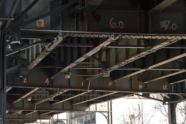
Aforementioned, the elevated tracks of the 7 line really do make you understand why Manhattan tore down its elevated tracks as soon as it was feasible. Loud, the structure is a shadowy and dripping mess, providing a home to what must be entire nations of pigeons. Sidewalk and crosswalk intersections resemble the mad excesses of certain Abstract Expressionist painters popular during the 20th century, and the vast structure dominates and demands an oppressive pall over the street.
The Woodside section of Roosevelt Avenue was given a short and sweet “once-over” a while back in this May of 2010 posting, at this, your Newtown Pentacle.
Additionally, the Flushing River just beyond Roosevelt Avenue was explored from the water in this November 2009 posting, and intriguing municipal machinery was observed along Roosevelt Avenue at Flushing’s Corona Yard in this posting from February of 2010.
– photo by Mitch Waxman
Roosevelt Avenue, and a few of the neighborhoods it passes through are a subject of much conversation amongst area wags. The whole stretch is home to such a vast agglutination of nationalities and ethnicities, representing what seems like a statistical sampling of every variation which the planetary human infestation might take, that it’s hard to say exactly who lives here.
In the section between Woodside and Flushing though, a LOT of people speak Spanish.

– photo by Mitch Waxman
There’s a lot of controversy surrounding these neighborhoods, with long time Queens residents pointing accusing fingers and offering dire prophecies for the future of the borough based on the presumed moral and legal failings of this new population. The spanish speaking community has exploded in the last decade along Roosevelt Avenue, growing by an astounding estimation of 450% since the last Census. That number, of course, is the official one. There is probably a larger number of people extant, but hazy immigration patterns and reticent newcomers leery of government officials contribute to a less than full accounting.
I can tell you from observation, however, that the economic doldrums affecting other commercial streets (like Steinway Street in Astoria, for instance) in the so called “more affluent” sections of Queens does not seem to be affecting this area.

– photo by Mitch Waxman
Perhaps its because the folks who live here will do just about anything they can to make a few bucks, often working multiple shifts, starting work at a lumber yard in the morning and busing a table in a restaurant at night for instance. A buddy of mine lives around here who came to New York from Ecuador, allows himself only 4 hours of sleep a day at the dormitory like and quite illegal rooming house which serves as his address in Corona. He’s sending money back home when he can, and trying to save what he has left over to do “something” with when opportunity presents itself to him.
I’m not going to gloss over the crime and gang life that is here, it’s just that I don’t know too much about it, and thankfully haven’t had any experience with that side of these neighborhoods.

– photo by Mitch Waxman
The newer buildings you see along Roosevelt Avenue are slapdash affairs, and would seem to fit the term “Queenscrap” coined by our friends over at the blog of the same name. The charming early 20th century detached 2 and 3 story homes which were familiar to multiple generations of…
What is the term for Queens natives anyway? Is it “Queensites” or “Queensipolitans” or “Queensicans” or something? If you’re from Brooklyn or Manhattan it’s “ites”, but what about Queens?
At any rate, the newer structures have one governing principle, and it’s that form follows function. The function seems to be a desire to use every square inch of the property lot and build to maximum height allowable by zoning regulations (and often beyond all law). In a lot where one or possibly two families historically declared their address, there can be as many as 10 or 12 today.

– photo by Mitch Waxman
The effect that this huge surge in population has had on area institutions like schools and hospitals has been profound. The usual problems arising from urban life are compounded by the fact that these are a “working class” group of people- often the so called “working poor”, who suffer from a well known and commented upon series of cultural “Gotcha’s” as it is- many amplified by speaking a different language and differing expectations for the future than those born to the culture they’ve joined.
The largely “middle class” (and often college trained) population of surrounding neighborhoods sneer at the Roosevelt Avenue corridor as being populated by illegal immigrants, call everyone here the “Mexicans“; the males of which are all gangsters- and accusing their women as scheming to spawn “anchor babies” in order to guarantee citizenship in “El Norte” and then allowing their lawless spawn to run wild in the streets. It’s blatant, more than a little racist, and I hear it all the time- even from sources you wouldn’t expect. One neighbor recently opined that “mexicans shit in the street”.
And that’s crap, Lords and Ladies. I’m tired of hearing it, frankly, and that’s what this post is really about.

– photo by Mitch Waxman
In no uncertain terms, understand this- what the “Lower East Side” and “Five Points” were to the Irish, Italians, Germans, and Jews 125 years ago is what Roosevelt Avenue is to this “immigrant wave”. As you’re reading this, a future President of the United States is eating Churros in her baby carriage somewhere on Roosevelt Avenue around 100th street. A Supreme Court Justice is kicking a ball around with a future incarnation of Al Capone in some dusty lot near Linden Park. Roosevelt Avenue is where America is being retooled, and you can safely watch it happening from the sidewalk, while the cowboys and arabs draw down on each other in the cool dusty air of some faraway land.
For reasons I can’t really attribute, the necessity of saying this out loud and in public is important to me.

– photo by Mitch Waxman
Running late, it was decided that to save a few steps and cut through Flushing Meadow Corona Park instead of continuing down Roosevelt Avenue, and I was forced to make a right turn instead of my usual left. Some interesting sights were had, which will be discussed and presented in some future (and less grandstandlingly Progressive!) posting of this- your Newtown Pentacle.
vapour soaked
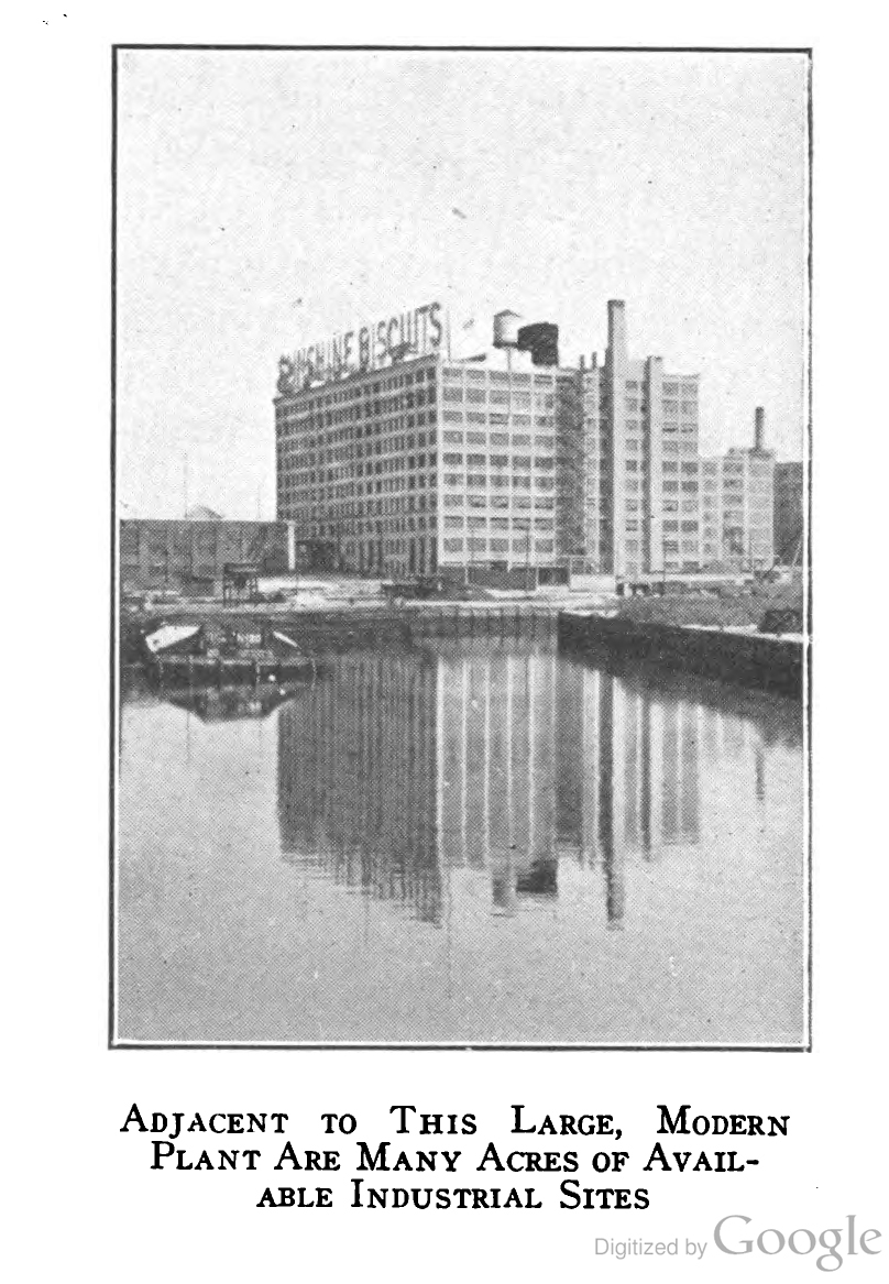
– photo from “The Newtown Creek industrial district of New York City By Merchants’ Association of New York. Industrial Bureau, 1921”, courtesy Google Books
My weird obsession with recreating very old photographs once again turns toward Dutch Kills, this time it’s looking to the end of the Degnon Terminal barge turning basin toward LaGuardia Community College’s building C- which was the former Sunshine Biscuits or Loose Wiles Bakery.
The shot above was captured in 1921 or thereabouts, and the ones below from 2011.

– photo by Mitch Waxman
An interesting parallell to this shot is the one presented at the end of the “Hunters Point Avenue Bridge Centennial, Dec. 11” posting from December 3rd in 2009, which presents the inverse viewpoint of today’s.
That shot was obtained from a 7th floor window of the building, on the wall with the red detailing, 3rd window from the left some four score and ten years or approximately 24,855 days later than the original and focused on the spot where these were shot.

– photo by Mitch Waxman
This is the uncropped version, showing Dutch Kills just around sunset, on February 17th, 2011 from the deck of the Hunters Point Avenue Bridge.
of stout body
Ok, just one more frozen Calvary post… and apologies for the sparse presentations this week, a dear friend of the Pentacle has been hospitalized and I’ve been spending a good amount of time visiting with and attempting to take some of the load off of the immediate family. Such is the price of true fealty and companionship, this duty to “be there” when the good times stop. I’m no “good time charlie”, after all.

– photo by Mitch Waxman
These shots are from the same walk through the ice at Calvary Cemetery discussed during a couple of last week’s transmissions . On the lookout for animal tracks (I’ll find that damned Coyote), I discovered these curious prints etching back and forth through the crusty ice and deep snow.
from wikipedia
In 1847, faced with cholera epidemics and a shortage of burial grounds in Manhattan, the New York State Legislature passed the Rural Cemetery Act authorizing nonprofit corporations to operate commercial cemeteries. Old St. Patrick’s Cathedral trustees had purchased land in Maspeth in 1846, and this land was used to develop Calvary Cemetery. The first burial in Calvary Cemetery was in 1848 and by 1852 there were 50 burials a day, half of them the Irish poor under seven years of age.
The original division of the cemetery, now known as First Calvary or Old Calvary, was filled by 1867. The Archdiocese of New York expanded the area of the cemetery, adding more sections, and by the 1990s there were nearly 3 million burials in Calvary Cemetery.

– photo by Mitch Waxman
Childhood fantasy blossomed in my thoughts, and despite the obviousness of these being bird tracks, I entertained certain vague memories of Spring Heel Jack and other Dickensian bogeymen. Imagine if there were some monopodal mystery hopping about the place, thought an idiot in a filthy black raincoat while standing in knee deep frozen precipitants at an ancient cemetery in Queens.
from wikipedia
Spring Heeled Jack (also Springheel Jack, Spring-heel Jack, etc.) is a character from English folklore said to have existed during the Victorian era and able to jump extraordinarily high. The first claimed sighting of Spring Heeled Jack that is known occurred in 1837. Later alleged sightings were reported all over England, from London up to Sheffield and Liverpool, but they were especially prevalent in suburban London and later in the Midlands and Scotland.
Many theories have been proposed to ascertain the nature and identity of Spring Heeled Jack. The urban legend of Spring Heeled Jack gained immense popularity in its time due to the tales of his bizarre appearance and ability to make extraordinary leaps, to the point where he became the topic of several works of fiction.
Spring Heeled Jack was described by people claiming to have seen him as having a terrifying and frightful appearance, with diabolical physiognomy, clawed hands, and eyes that “resembled red balls of fire”. One report claimed that, beneath a black cloak, he wore a helmet and a tight-fitting white garment like an “oilskin”. Many stories also mention a “Devil-like” aspect. Spring Heeled Jack was said to be tall and thin, with the appearance of a gentleman, and capable of making great leaps. Several reports mention that he could breathe out blue and white flames and that he wore sharp metallic claws at his fingertips. At least two people claimed that he was able to speak comprehensible English.

– photo by Mitch Waxman
Inexpert, I clumsily followed the tracks, moving in my typically arthritic, lurching, and uneven winter scuttle. By this point, the specie which had left its mark behind was clearly avian, and quite obviously a water bird of some sort.
from wikipedia
Anatidae is the biological family that includes ducks, geese and swans. The family has a cosmopolitan distribution, occurring on all the world’s continents except Antarctica and on most of the world’s islands and island groups. These are birds that are adapted through evolution for swimming, floating on the water surface, and in some cases diving in at least shallow water. (The Magpie Goose is no longer considered to be part of the Anatidae, but is placed in its own family Anseranatidae.) The family contains around 146 species in 40 genera. They are generally herbivorous, and are monogamous breeders. A number of species undertake annual migrations. A few species have been domesticated for agriculture, and many others are hunted for food and recreation. Five species have become extinct since 1600, and many more are threatened with extinction.

– photo by Mitch Waxman
Three toes and webbed at that, this was no Spring Heeled entity… I recognized what shared my walk through Calvary that cold day… And then they appeared…
from wikipedia
6-8 living species of black geese are known. In addition, one species has been described from subfossil remains found in the Hawaiian Islands, where it became extinct in prehistoric times. Another undescribed prehistoric species from the Big Island of Hawai‘i was extremely large and flightless; it is tentatively assigned to this genus due to being very peculiar. It is fairly certain that at least another species of this genus awaits discovery on the Big Island, judging from the facts that at least one species of Branta was found on every major Hawaiian island, and that remains of such birds have not been intentionally searched for on the Big Island.

– photo by Mitch Waxman
Several Canada Geese appeared at the top of a hill, quietly picking at the ice. Copious deposits of their feces were observed as well- but not pictured as to insure against the delicate sensibilities of the Lords and Ladies of the Newtown Pentacle being offended.
from wikipedia
This species is native to North America. It breeds in Canada and the northern United States in a variety of habitats. Its nest is usually located in an elevated area near water such as streams, lakes, ponds and sometimes on a beaver lodge. Its eggs are laid in a shallow depression lined with plant material and down. The Great Lakes region maintains a very large population of Canada Geese.
By the early 20th century, over-hunting and loss of habitat in the late 19th century and early 20th century had resulted in a serious decline in the numbers of this bird in its native range. The Giant Canada Goose subspecies was believed to be extinct in the 1950s until, in 1962, a small flock was discovered wintering in Rochester, Minnesota, by Harold Hanson of the Illinois Natural History Survey. With improved game laws and habitat recreation and preservation programs, their populations have recovered in most of their range, although some local populations, especially of the subspecies occidentalis, may still be declining.
In recent years, Canada Geese populations in some areas have grown substantially, so much so that many consider them pests (for their droppings, the bacteria in their droppings, noise and confrontational behavior). This problem is partially due to the removal of natural predators and an abundance of safe, man-made bodies of water (such as on golf courses, public parks and beaches, and in planned communities).

– photo by Mitch Waxman
Often are such Geese observed here at First Calvary, even during the summer. It’s odd, alongside the maligned Newtown Creek and within the walls of New york’s ancient burying ground, that there exists a sort of nature preserve amongst the tomb legions.
from a 2009 nytimes.com report:
All commercial airplane engines are required to pass a “bird strike” test before they can be certified for use. Engine manufacturers, including CFM International, which produced the engines on the US Airways Airbus A320 involved in Thursday’s sudden landing, test the engines physically and through computer simulation.
In the physical tests, the engines are revved to full power inside a test facility and absorb various kinds of birds, from those the size of sparrows to those the size of herons, one at a time. (The birds are already dead.) The engines also ingest multiple birds meant to simulate a collision with a flock, said Matthew Perra, a spokesman for the engine manufacturer Pratt & Whitney.
To pass the test, engines must keep operating after the collision, maintaining enough power to take off, fly around the airport and land the plane safely, he said. That is because a jet with two engines has to be able to take off on 50 percent power
a ghastly plot
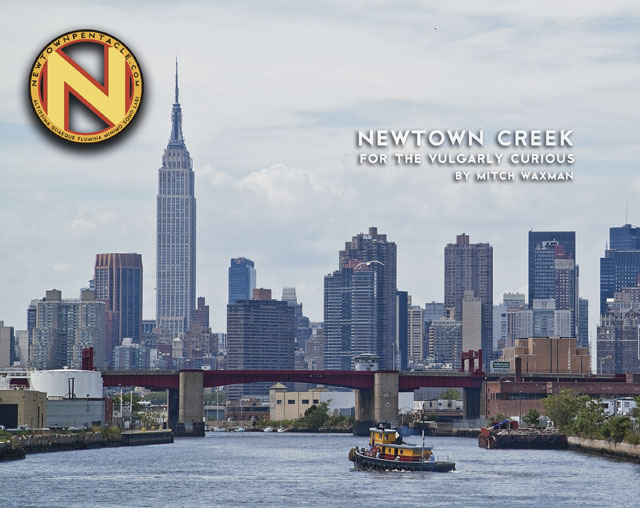
“Newtown Creek for the Vulgarly Curious” is a fully annotated 68 page, full-color journey from the mouth of Newtown Creek at the East River all the way back to the heart of darkness at English Kills, with photos and text by Mitch Waxman.
Check out the preview of the book at lulu.com, which is handling printing and order fulfillment, by clicking here.
Every book sold contributes directly to the material support and continuance of this, your Newtown Pentacle.
reticence shown

– photo by Mitch Waxman
I fear that I’ve become quite focused on Calvary Cemetery again. Recent caches of primary sources have been discovered which have all but confirmed certain hypothetical precepts, and illumined certain unimagined parameters to my studies. As yellowed maps and time blasted books have passed before my startled eyes, dawning realizations about the structure which underlies the place torment my curiosity.
Allow me to explain…

– photo by Mitch Waxman
Newtown Creek guy, that’s me- part of the history crowd from Queens- harmless.
The history part is what I’m interested in, and everything I’ve read or witnessed around the Newtown Creek indicates that while First Calvary Cemetery was incorporated in 1848- when the first recorded interment took place (more on that in a later post)– an interval of roughly 5-10 years preceded the beginning of an era which saw as many as 20 funerals conducted during a single day. Immigration patterns can explain this, of course, but the primary sources which have been consulted describe something else.

– photo by Mitch Waxman
It’s the sewers.
Two interesting leads have presented themselves, the first having led to:
The Rosary Magazine, in a report from 1908, via Google Books, offers this snippet:
On November 11, Archbishop Farley of New York dedicated a new mortuary chapel which was recently erected under the title of St. Callistus in Calvary Cemetery, Long Island. The Mass on the occasion was sung by Mgr. Lavelle and the sermon preached by Mgr. Mooney. The new structure will serve the double purpose of chapel and mausoleum. Below the chapel floor there is a crypt containing one hundred and fourteen vaults, in which hereafter will be buried the priests of the New York Archdiocese. The idea of such a building was first conceived by Archbishop Farley some four years ago. The structure is quite an imposing one, built of granite and Saracenic in its style of architecture. It is ninety-six feet long and sixty-four feet wide. The auditorium will accommodate two hundred and fifty persons. Surmounting the dome is a fine figure of the risen Christ, designed by Miss Melro Beatrice Wilson. When finished the total cost of the building will approximate $200,000. The building was designed by Raymond F. Almirall.
Here’s the cutaway architect drawing, courtesy again- Google Books:
Long time readers will remember that the Chapel has been previously profiled at this- your Newtown Pentacle- in the post “scenes familiar, and loved“.

– photo by Mitch Waxman
The catacombs beneath the Calvary Cemetery Chapel are fairly old news to long time readers, but… back to those sewers.
The second interesting nugget that I’ve turned up recently is (other than fascinating references to an excommunicated and controversial 19th century Catholic priest named McGlynn) that there seems to have been a legal issue settled by the State of New York which involved the removal of tens of thousands of tons of Calvary topsoil, and it’s eventual disposition on Catholic owned farms in Jamaica which aroused and infuriated the largely Protestant agricultural community of Newtown. This topsoil was removed “during the building of Calvary Cemetery, with its modern sewerage system”.
The building…

– photo by Mitch Waxman
I haven’t screwed the lid down on this one yet, so I’m not sharing links on this, but- the various sources I’m working on have opened up the reality that the hill of Laurels is in fact engineered ground. Discussions of enormous underground culverts and diversion channels for water, titan work forces, and a decade long struggle to turn the marshy waste land around the Newtown Creek into the well drained and immaculately landscaped structure we know today have consumed me- and driven Our Lady of the Pentacle to near madness.
Who can guess, all there is, that might be buried down there?


